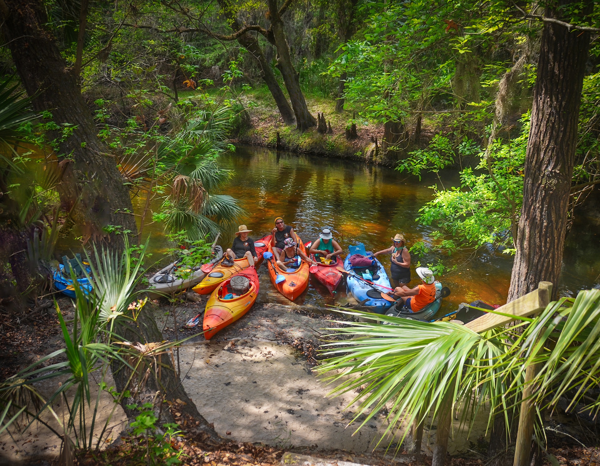
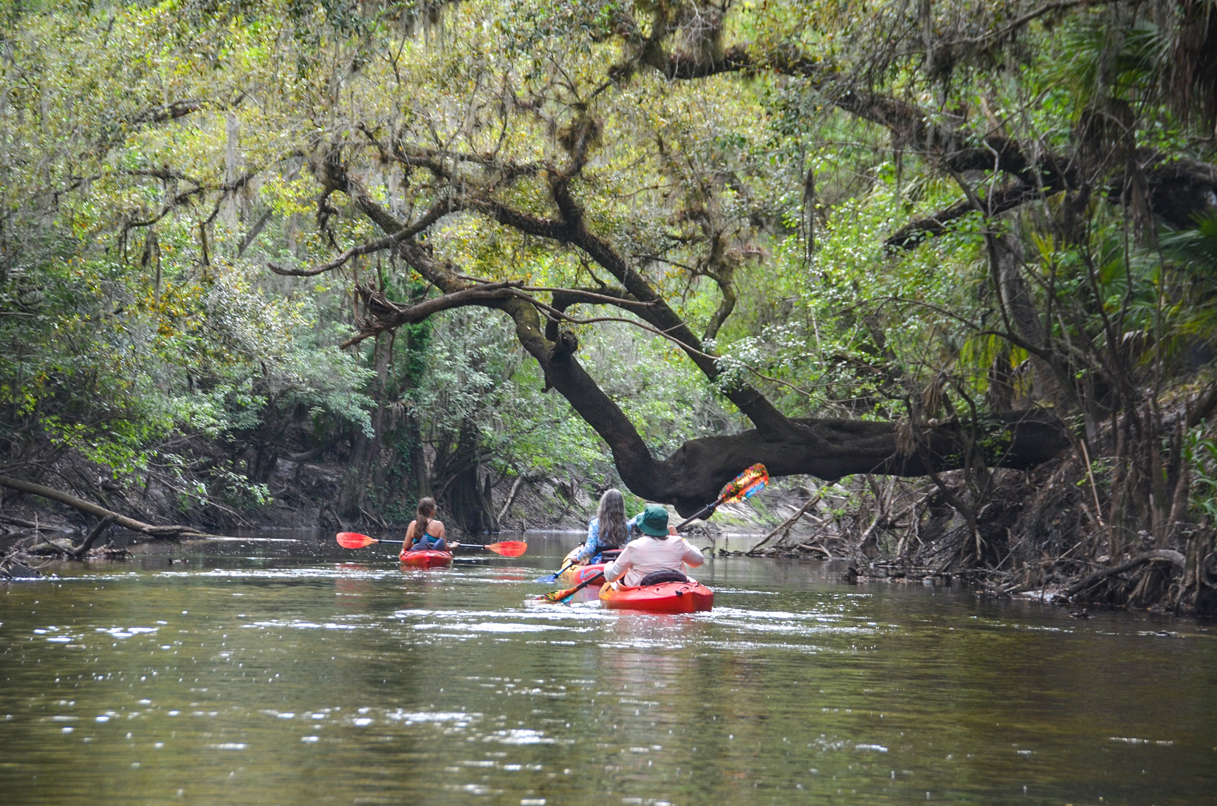
The second of three new paddle spots on this camping weekend in Hillsborough County. On this day we launched and paddled the Alafia River…what a treat it was! A narrow, winding river, with lush canopies, clear incoming streams, and numerous shoals to provide some thrills along the 10-mile route. We will certainly return to this river! …James
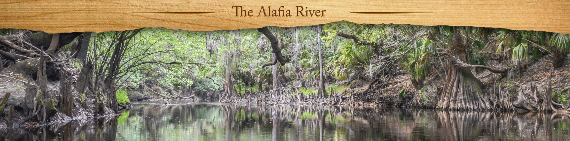
The Alafia River ( pronounced Al-uh-fi ) comprises a 10-mile State Designated Paddling Trail running between Alderman’s Ford Park and Lithia Springs Conservation Park in Hillsborough County. Once the home of the Tocobaga Indians that settled the Tampa Bay area, the river was named Alafia, ‘River of Fire‘ for the red fluorescent sparks from the algae spores and phosphate in the water.
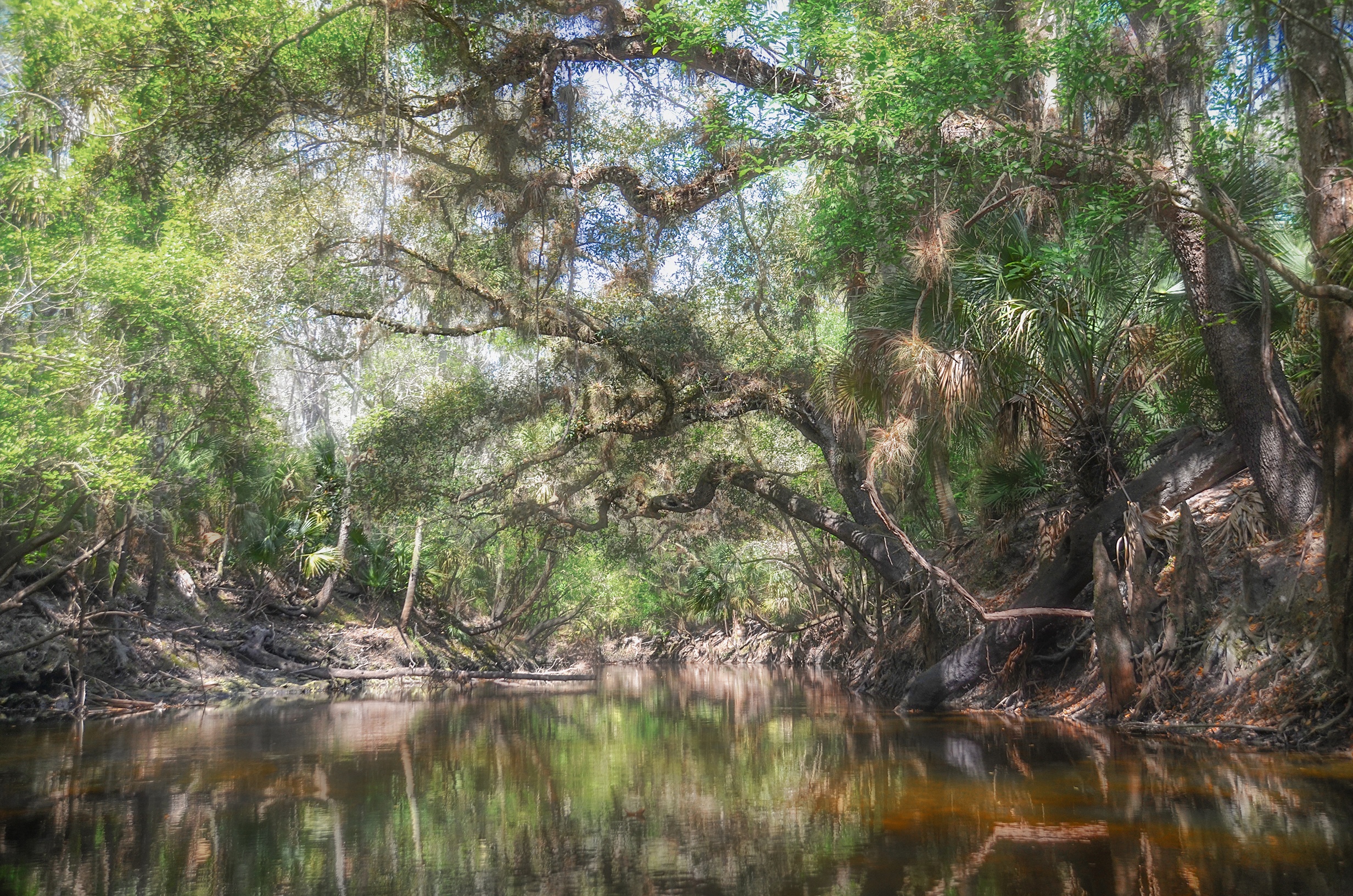
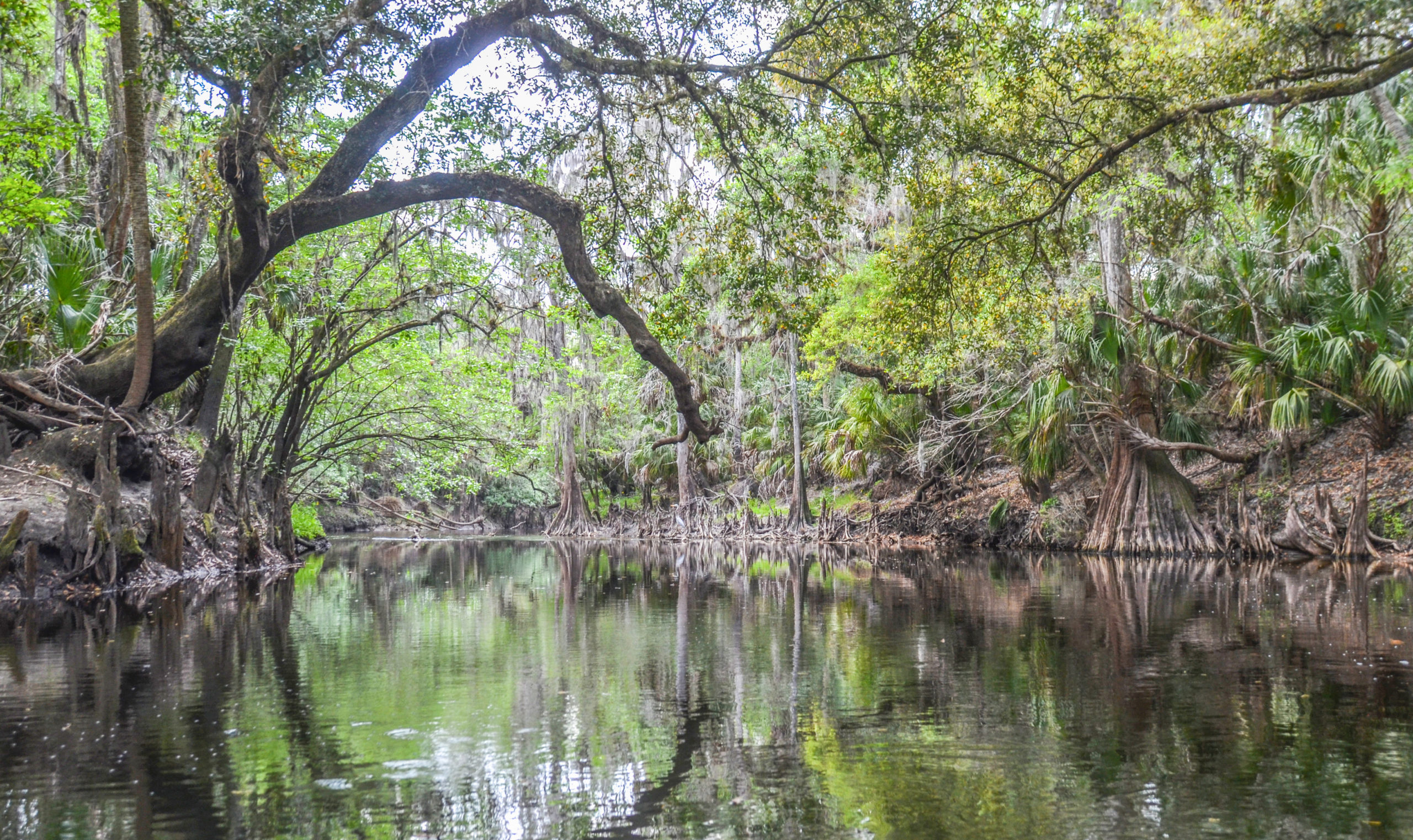
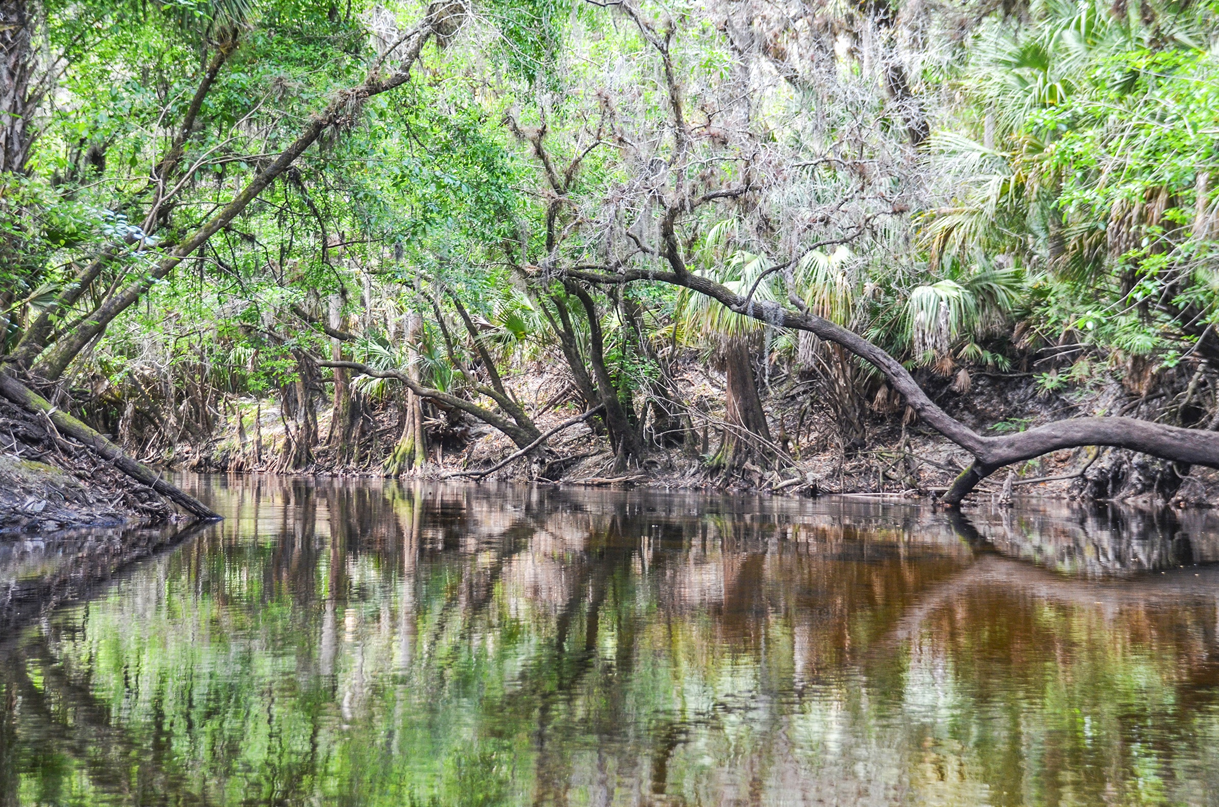
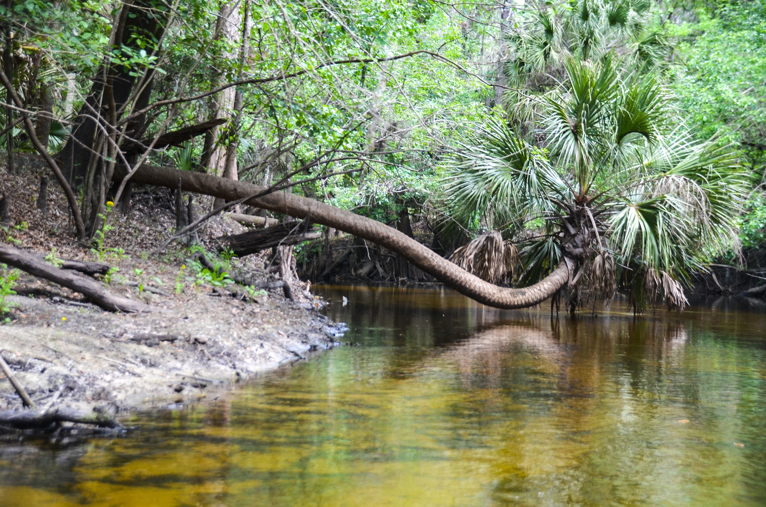
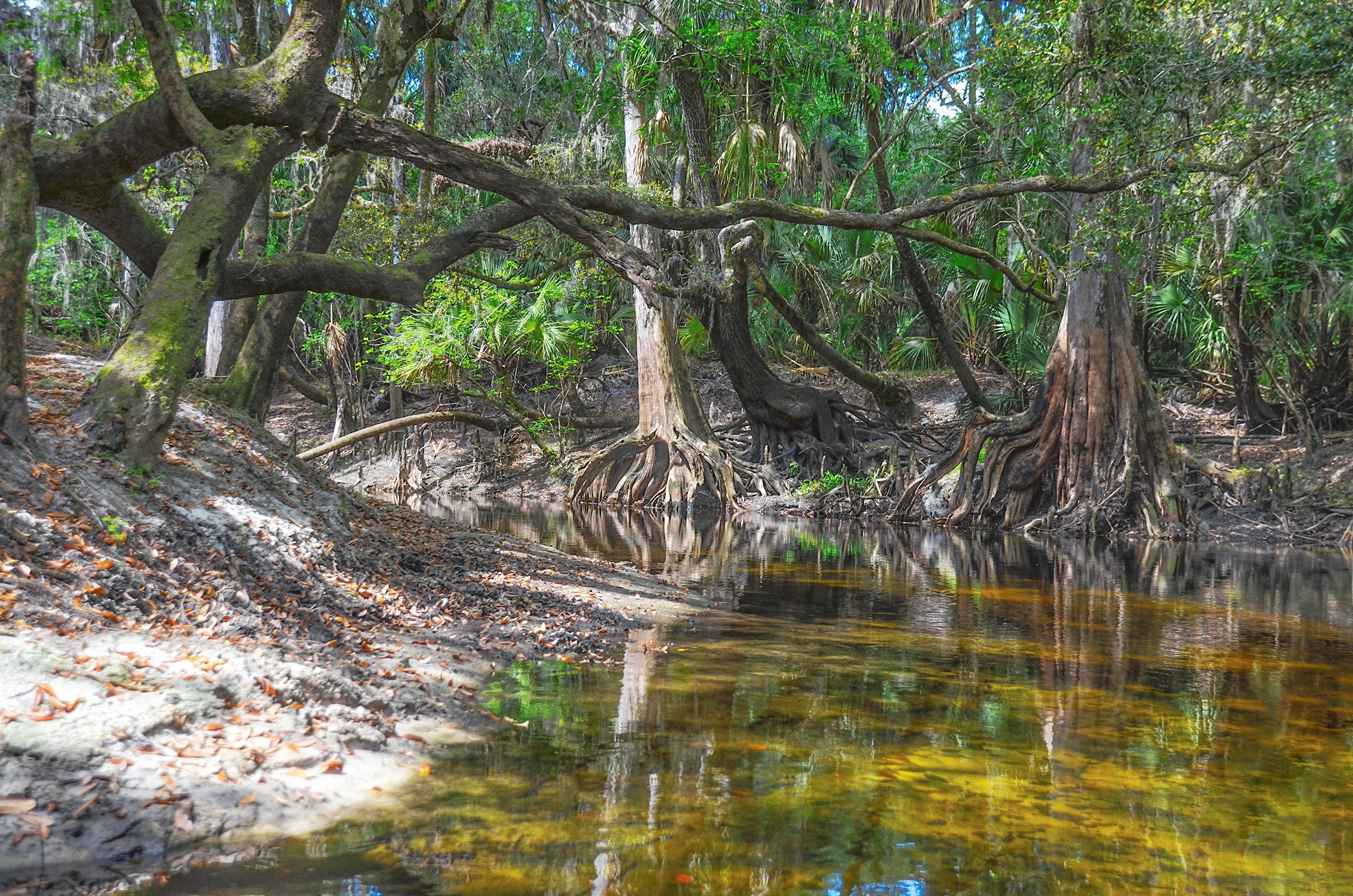
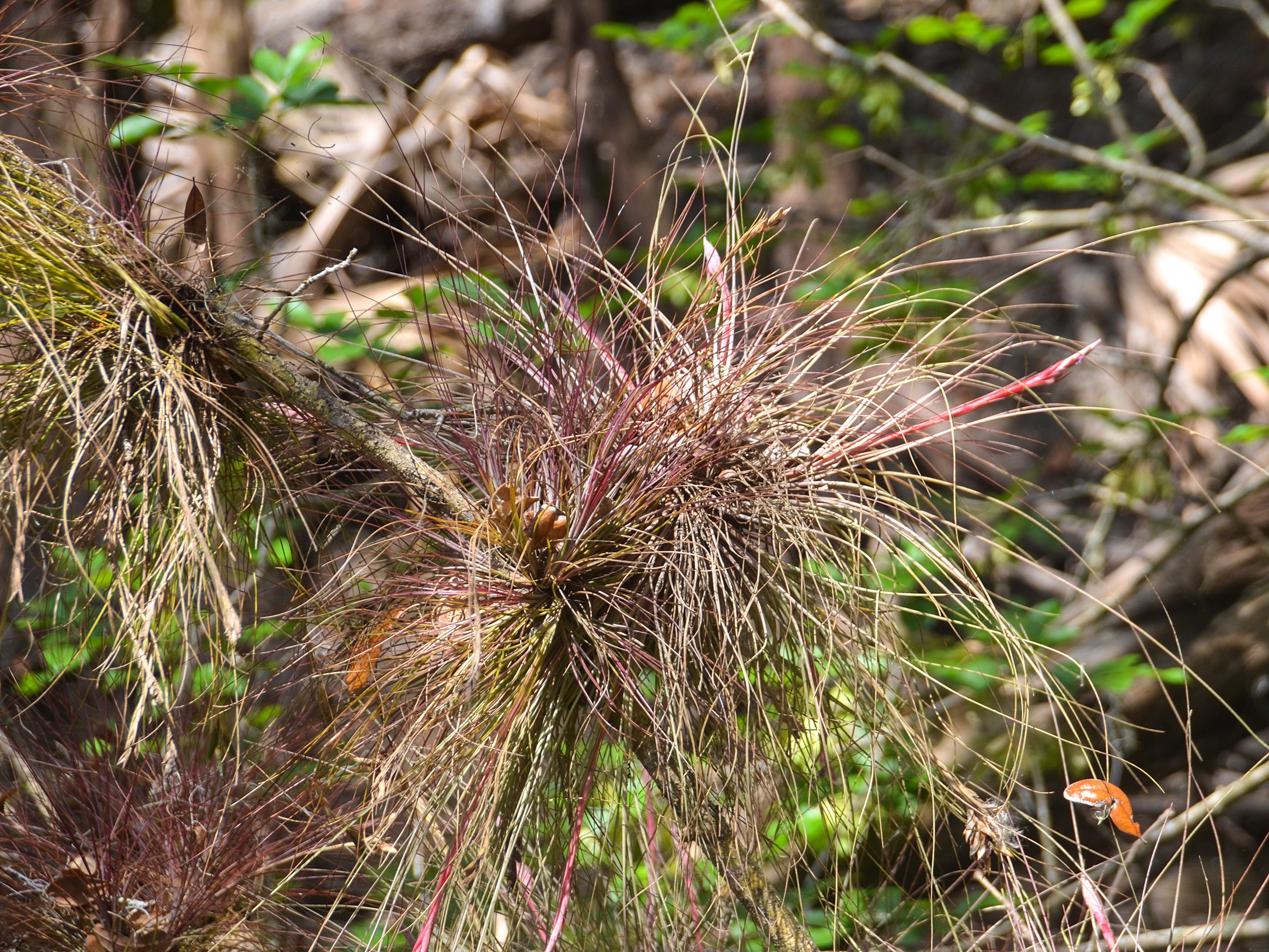
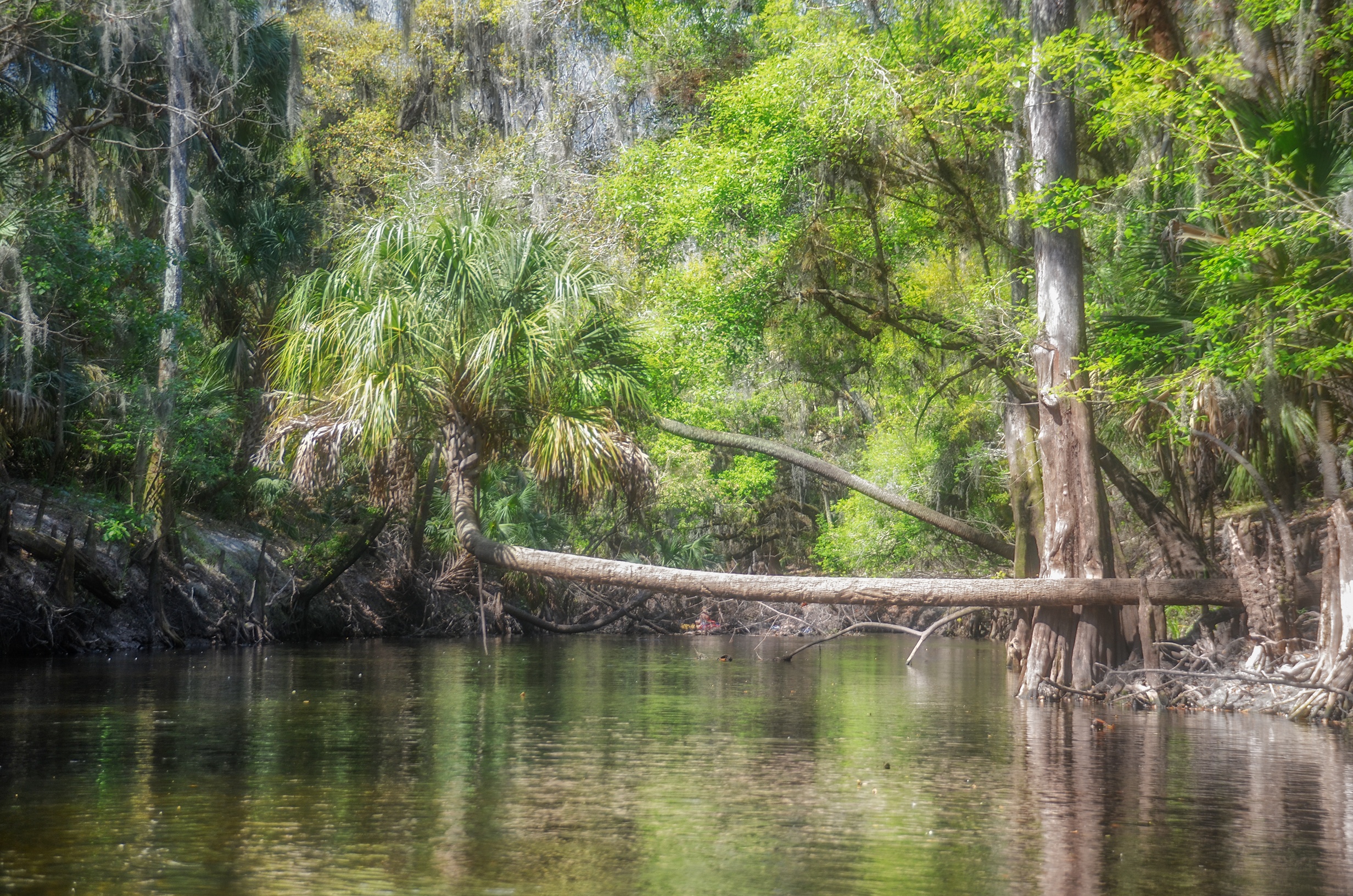
The river was once quite polluted from agriculture and phosphate mining in the area, but now runs through several conservation preserves and the vegetation and wildlife are abundant. The river is well-canopied by large Oaks, Palms, and Ash, covered with Spanish Moss and several species of air plants. In this paddle, sections of the shoreline were in bloom with yellow Butterweed blossoms.
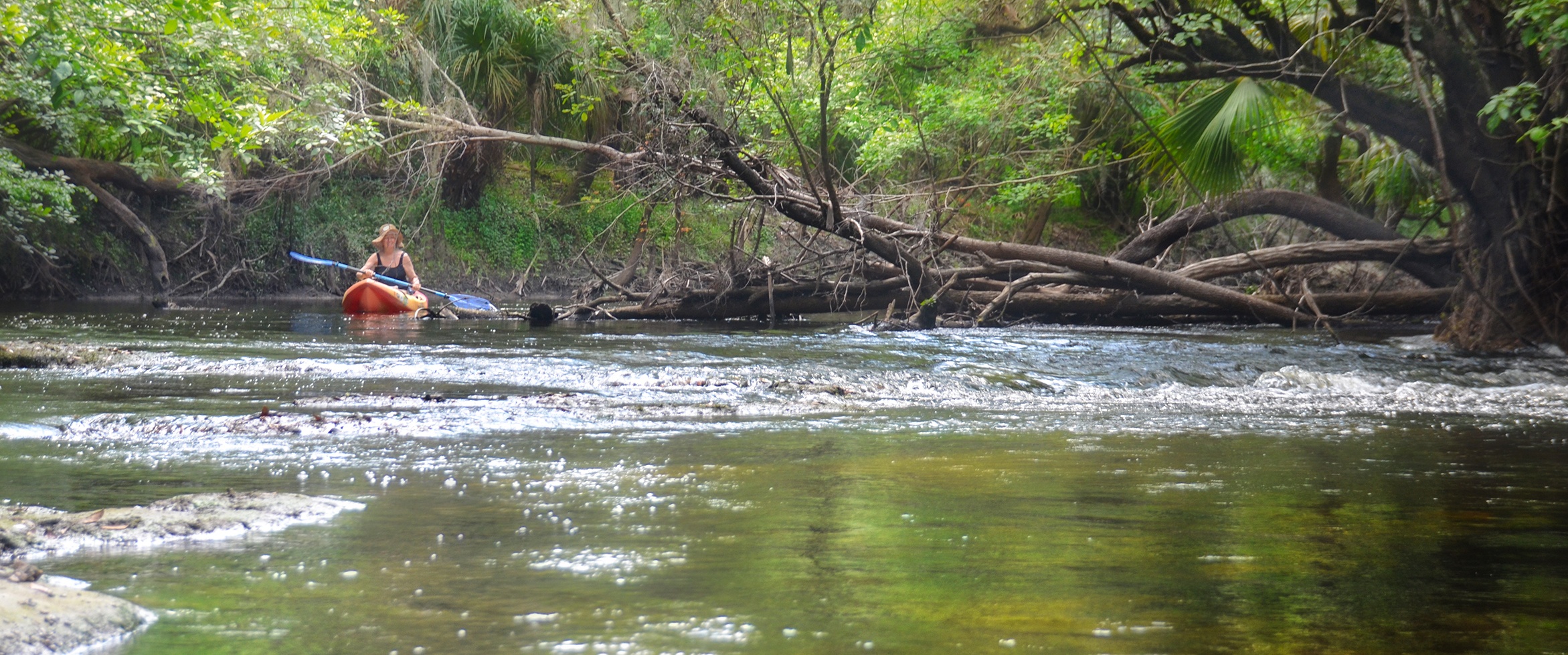
The water level was low and allowed for some fun small shoals, with lime rocks just a foot below our kayaks. In higher water, during the rainy season, I could imagine the current would demand a little more skill paddling the twist, turns, and downfall. This was a primitive paddle, in my opinion, flowing through parts of Old Florida with several small, clear streams entering along the way. This river definitely deserves a visit…simply beautiful!
![]()
 Alafia River Details:
![]() Location: The 10-mile section paddled today is located near Lithia, Fl in Hillsborough County.
Location: The 10-mile section paddled today is located near Lithia, Fl in Hillsborough County.
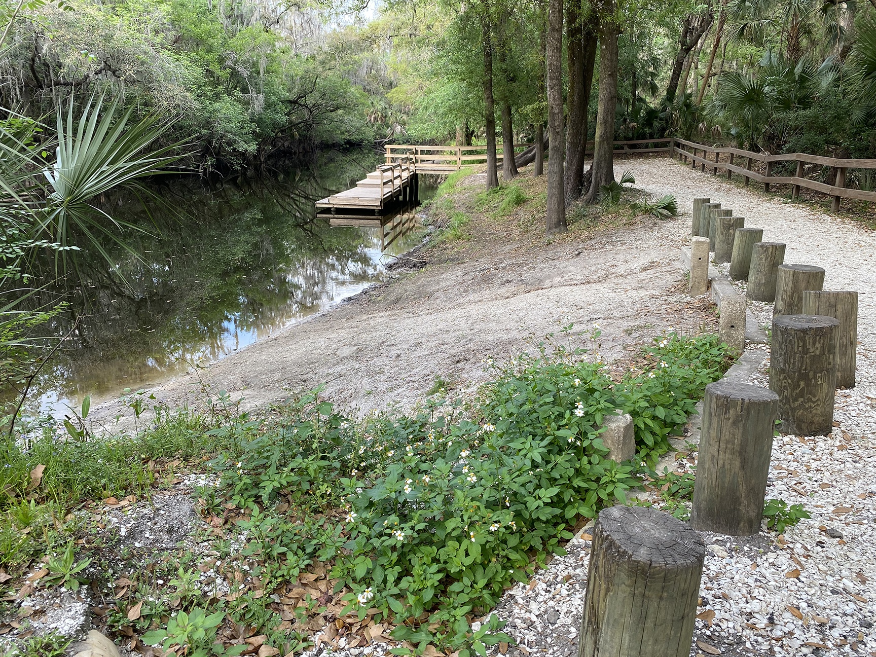
![]() Launch for this Paddle: Alderman’s Ford Park Canoe Launch, 9625 Canoe Launch Loop, Lithia, Fl. 33547 There is a fee of $2.00 per vehicle. Take Out: Lithia Springs Park, 3932 Lithia Springs Road, Lithia, FL 33547. (813) 744-5572.
Launch for this Paddle: Alderman’s Ford Park Canoe Launch, 9625 Canoe Launch Loop, Lithia, Fl. 33547 There is a fee of $2.00 per vehicle. Take Out: Lithia Springs Park, 3932 Lithia Springs Road, Lithia, FL 33547. (813) 744-5572.
![]() Paddle Distance: 10.25 miles
Paddle Distance: 10.25 miles
![]() Difficulty: Easy to moderate. It could be moderate if the water level was just a foot lower, which would require portaging, or if it was higher and the current faster, requiring maneuvering around twists, turns, and deadfall.
Difficulty: Easy to moderate. It could be moderate if the water level was just a foot lower, which would require portaging, or if it was higher and the current faster, requiring maneuvering around twists, turns, and deadfall.
![]() Average Paddle Speed: 2 -3 mph
Average Paddle Speed: 2 -3 mph
![]() Width and Depth: Today’s gauge height was 3.25′ but only 1′ over some shoals. The width averaged from 35′ to 50′ wide.
Width and Depth: Today’s gauge height was 3.25′ but only 1′ over some shoals. The width averaged from 35′ to 50′ wide.
![]() Current – Tidal: Depending on the water level and rain amounts, the flow of this river can range from 1 – 4 mph. Today it was a little over 2 mph.
Current – Tidal: Depending on the water level and rain amounts, the flow of this river can range from 1 – 4 mph. Today it was a little over 2 mph.
![]() Side Paddles: NA
Side Paddles: NA
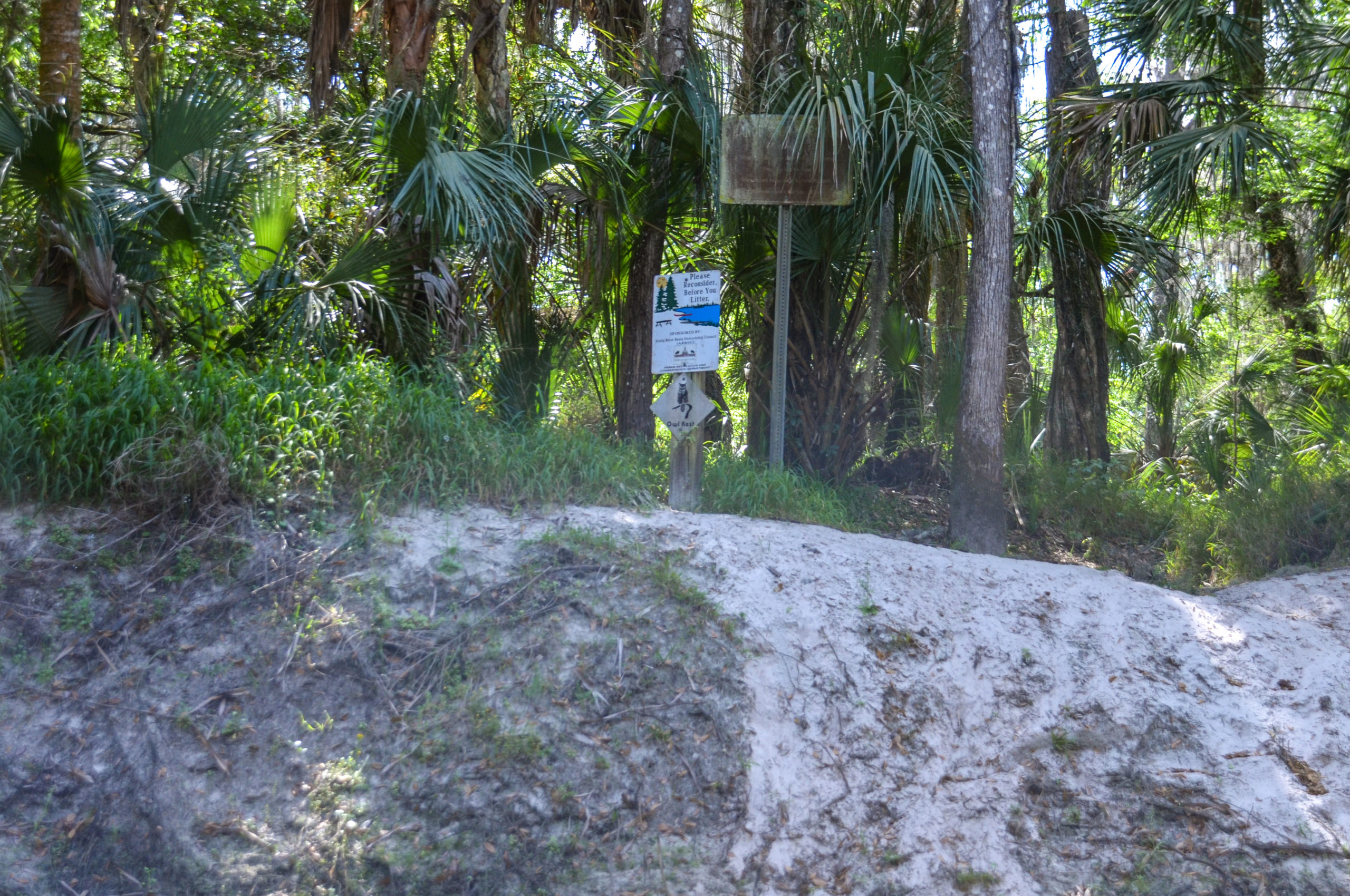
![]() Rest Areas: There were a few areas that allowed for exiting a kayak. Cougar Run, Owl Rest, and several other sandy beaches are great stopping spots.
Rest Areas: There were a few areas that allowed for exiting a kayak. Cougar Run, Owl Rest, and several other sandy beaches are great stopping spots.
![]() Important Information: Check the water levels for this river. Too low or too high is the difference between portaging the shoals or moving quickly around the twists and turns.
Important Information: Check the water levels for this river. Too low or too high is the difference between portaging the shoals or moving quickly around the twists and turns.
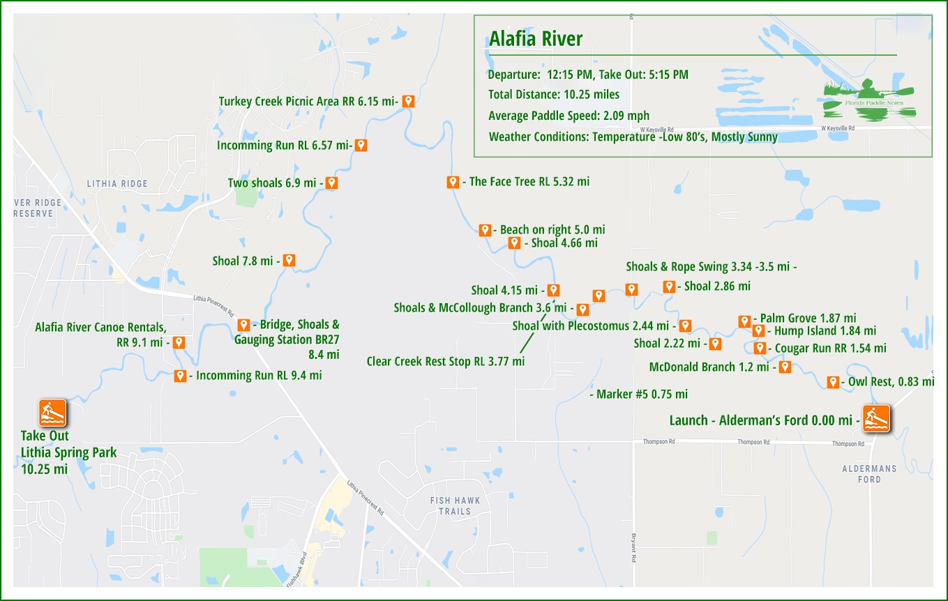
The Alafia River Paddle Map…
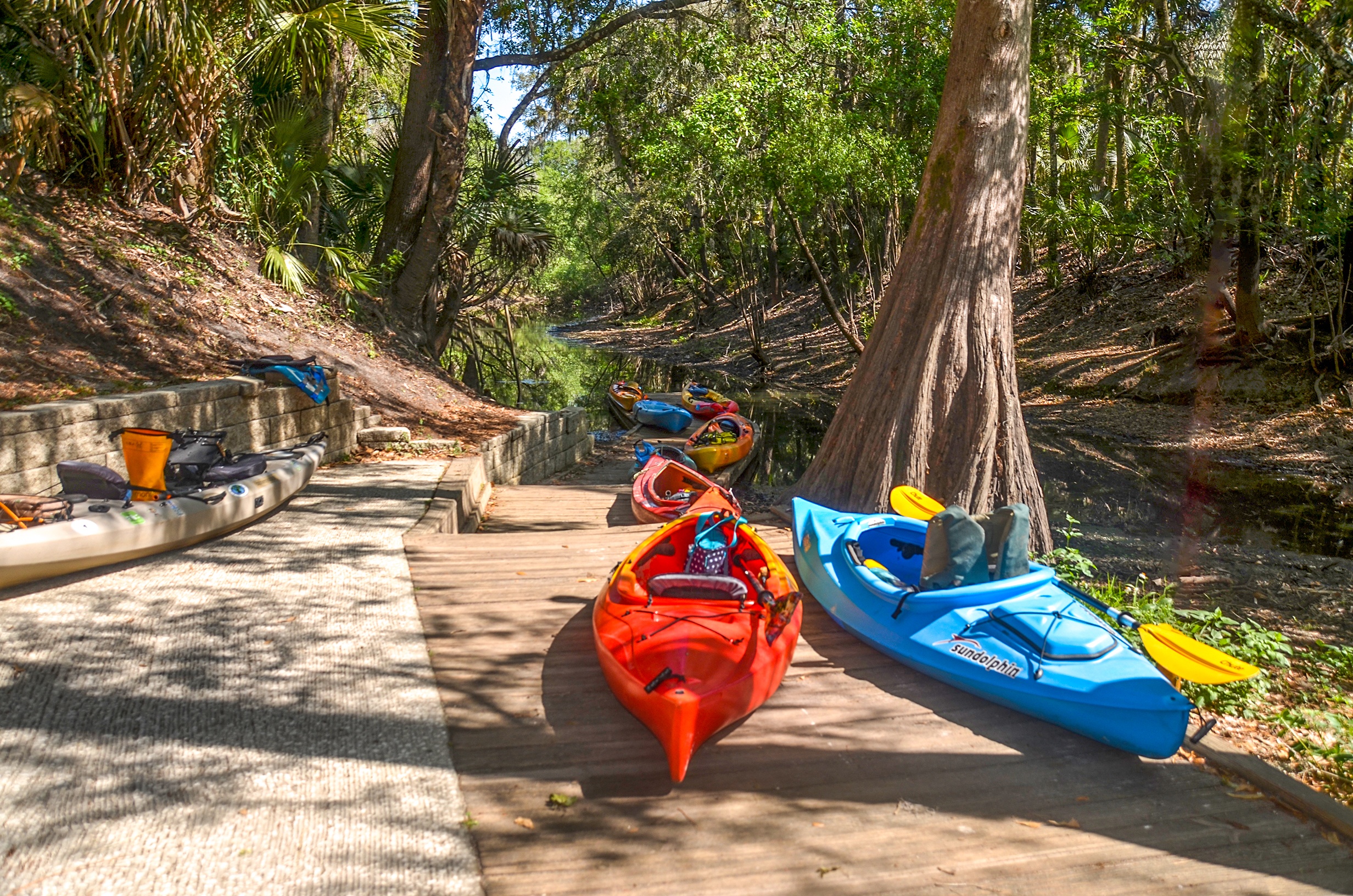
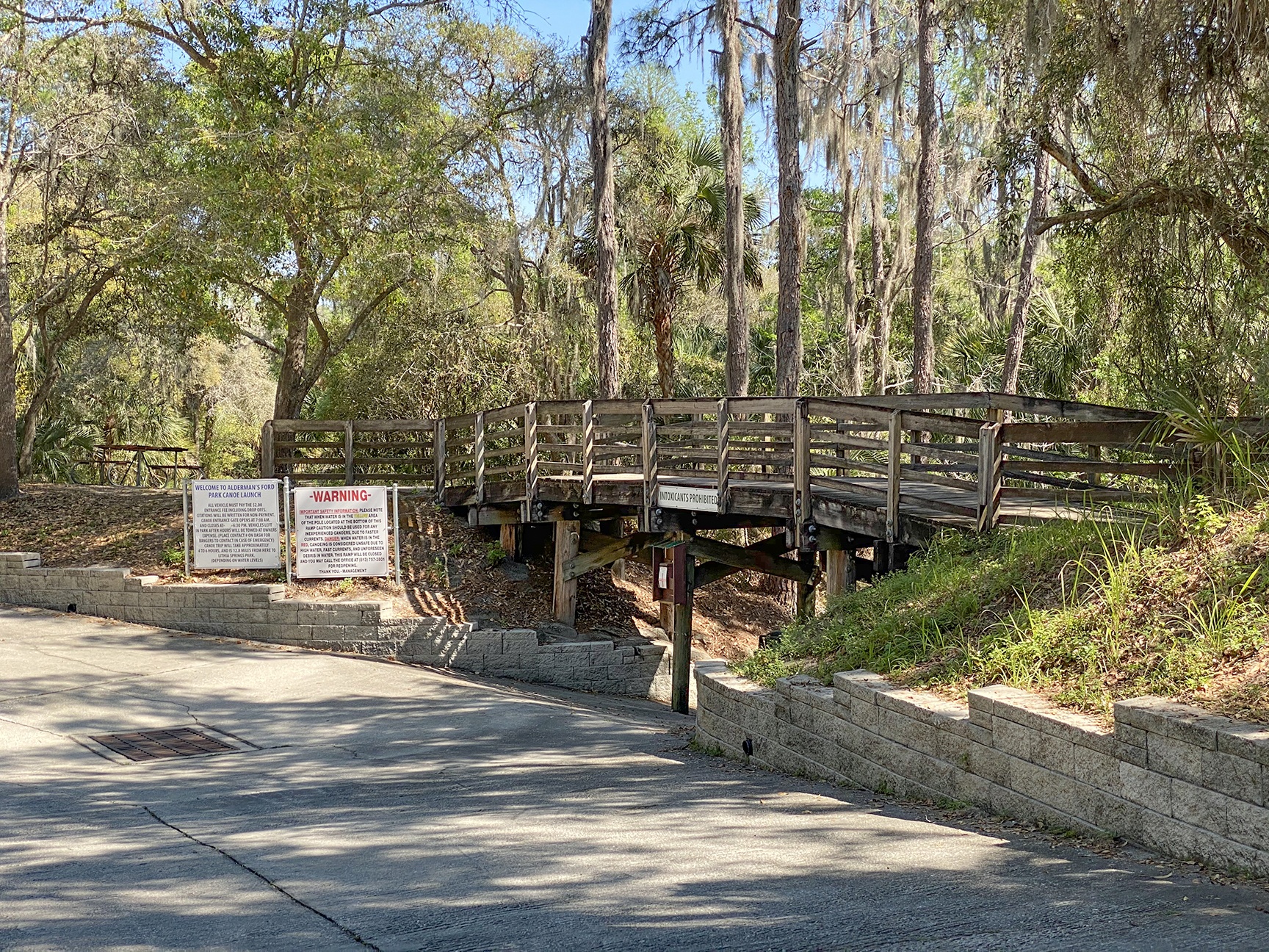
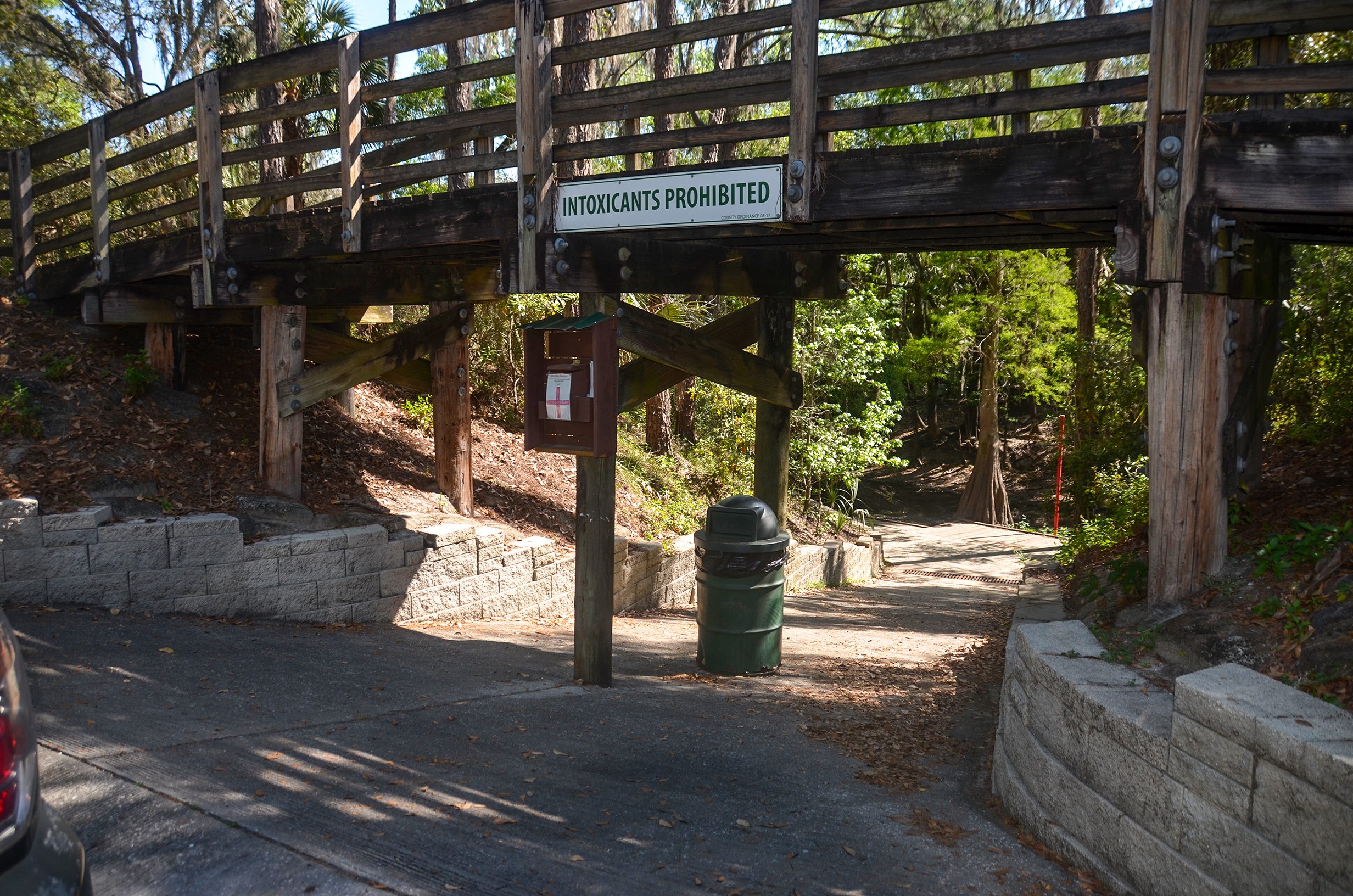
Alderman’s Ford Launch…
“In 1848, settler James Alderman built his homestead south of the Alafia River in Lithia. He fashioned a crossing by cutting down the steep banks of the river, creating Alderman’s Ford.”…an excerpt from Alderman’s Ford Conservation Park website.
The launch offers good staging facilities as well as restrooms. The concrete slope down to the launching dock is steep and the docks offer plenty of space to prepare to launch
The Alafia River…
There is a short 450′ ‘run’ from the launch to the actual river and once on the river, you are in for a treat. The water level was just over 3′ today, which provided for a pleasant flow just over 2 mph. This water level also allowed for fun paddling over the 15 shoals we encountered along the way. The water level over some of these shoals was just about 1′.
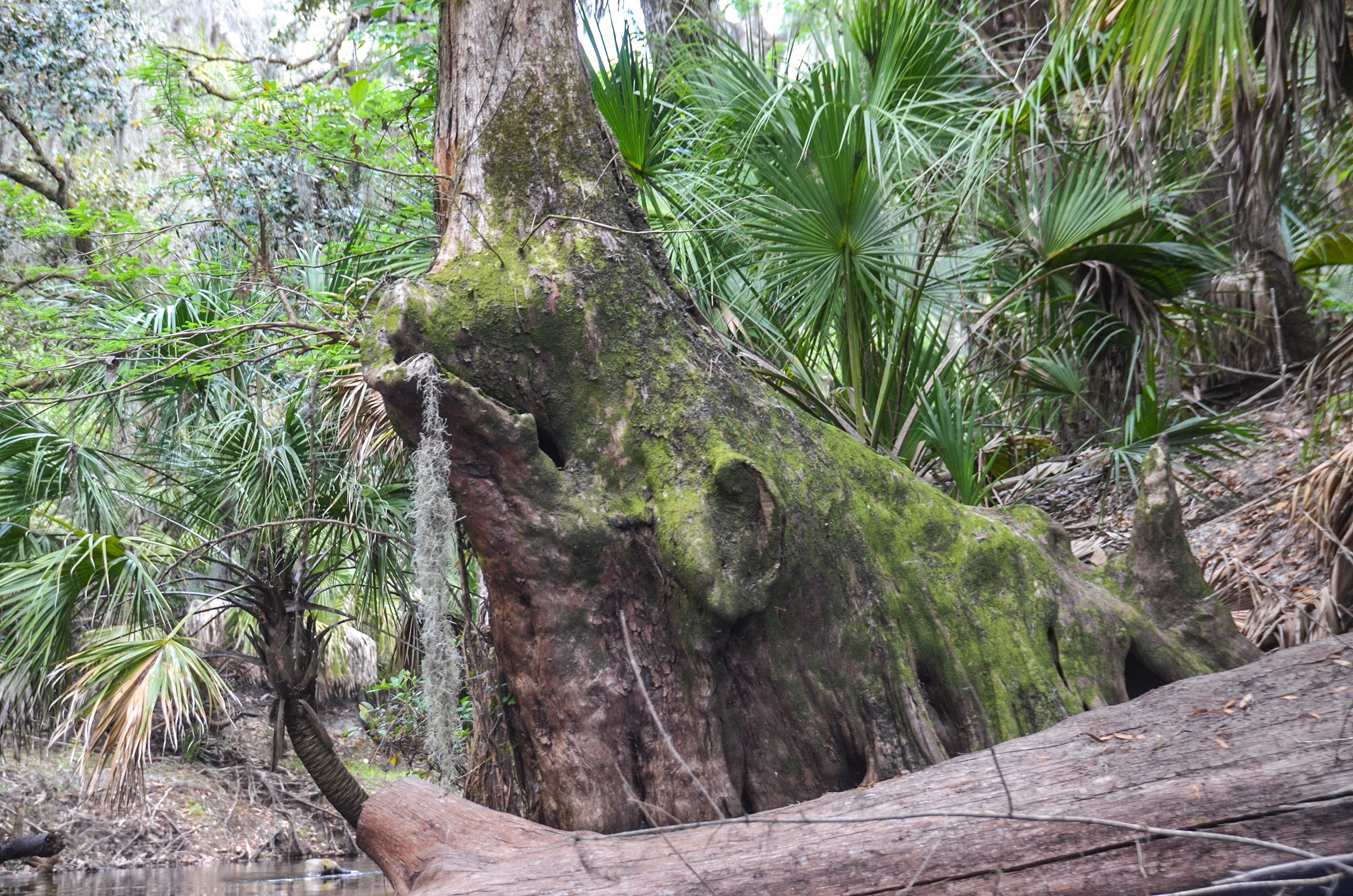
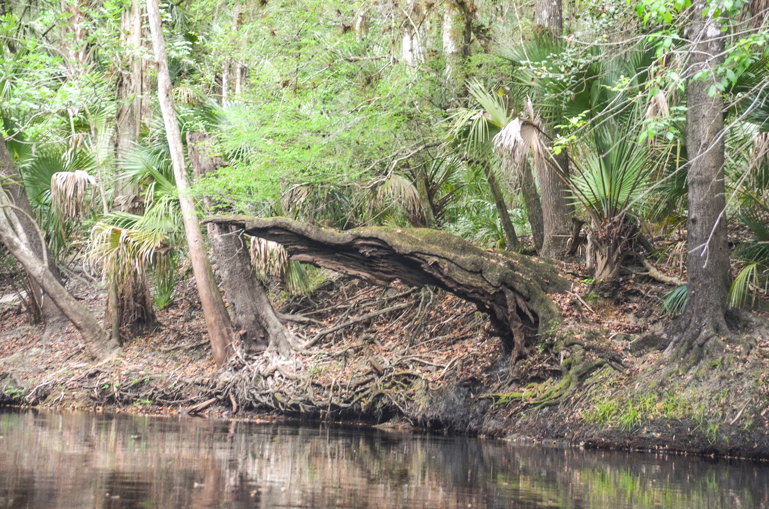
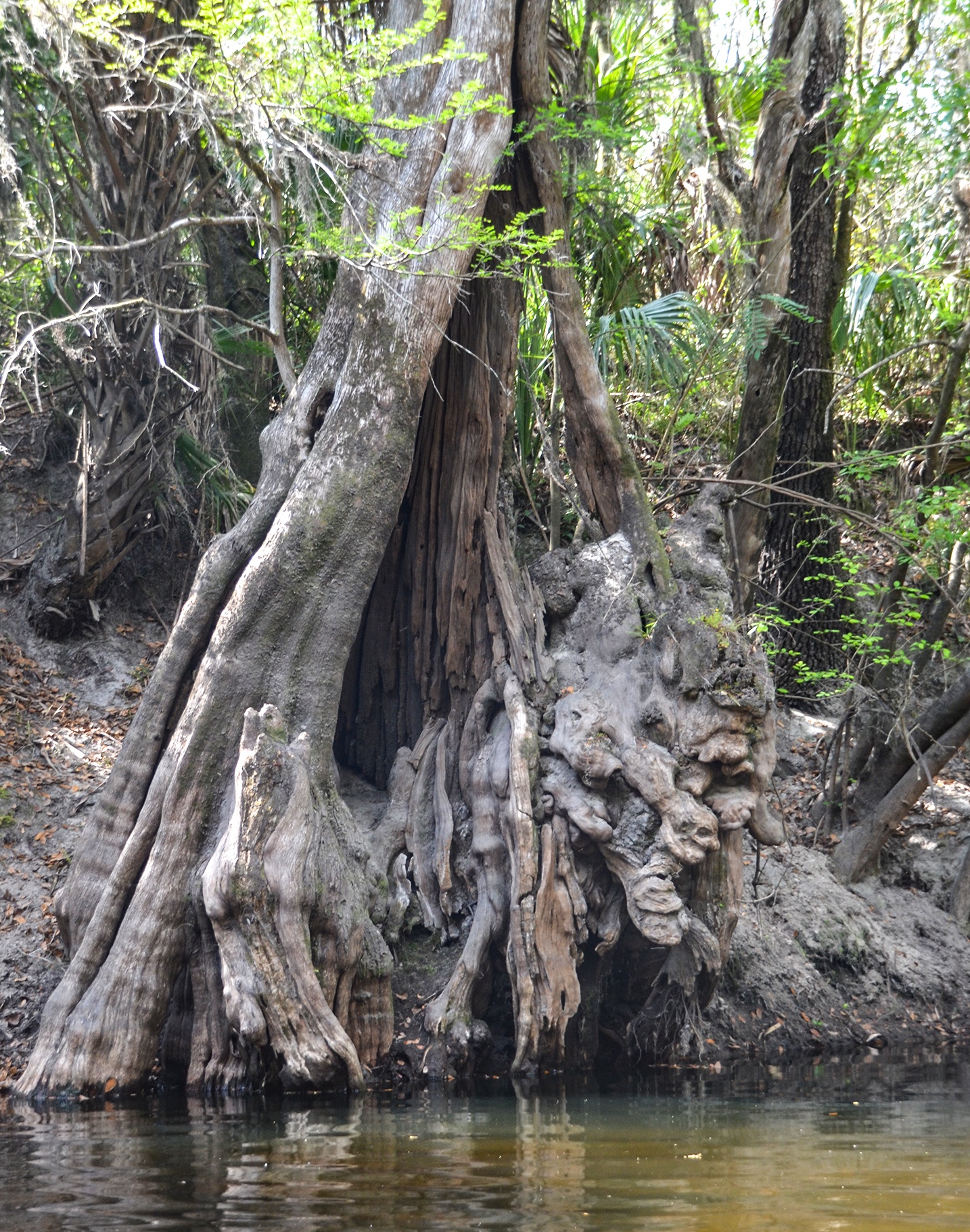
It was a warm day and the heavily canopied river provided wonderful shade and cooled down the temperature. The low water level exposed the 5′ ( average ) banks and showcased many entangled roots and cypress trees. Above us Oaks, Ash, and Palms leaned over to provide shade, the oaks being covered with Tillandsia spp, creating a fuzzy effect. The tall Cypress trees also shared the banks, with Spanish Moss hanging from the branches. The new spring growth cast a beautiful green hue everywhere. Also, very predominant all along the banks were the tall, yellow-clustered blooms of Butterweed – Packera glabella.
The Shoals…
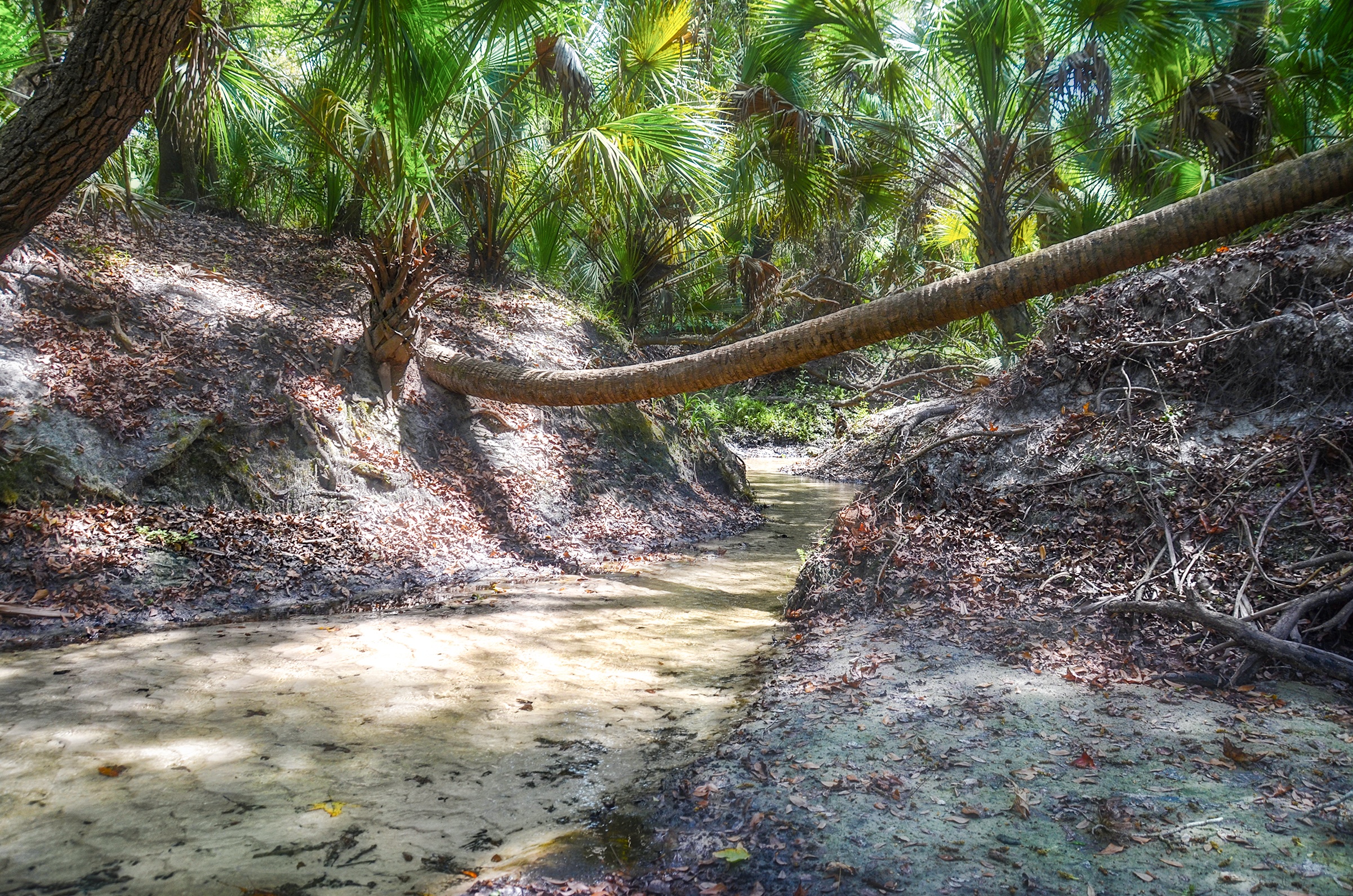
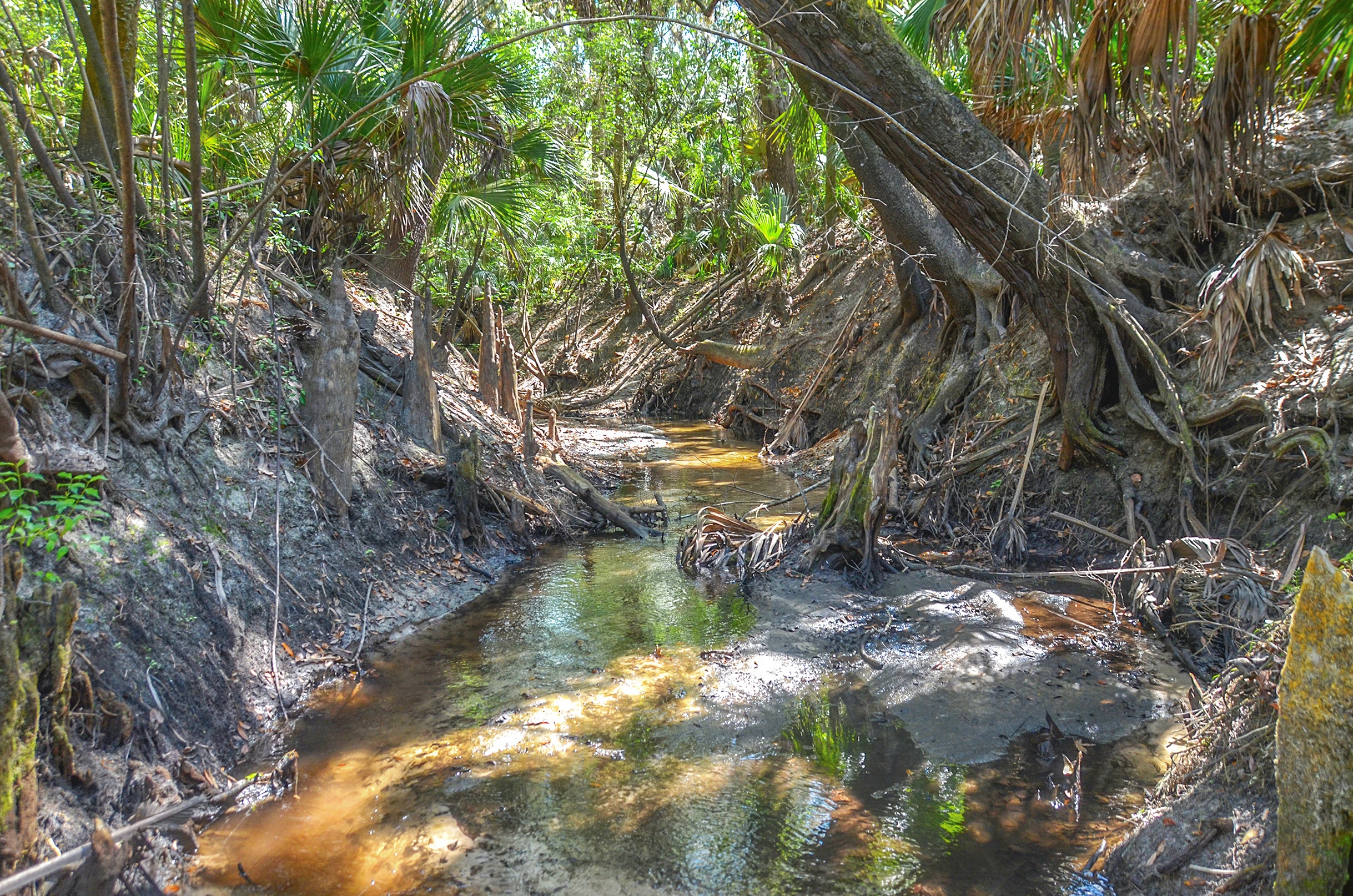
The Alafia River water is tannin colored, typical of these types of Florida rivers, yet there was quite a bit of fresh clear water, offered by several side creeks that were perfectly clear with white sandy bottoms. We explored, on foot up one of the runs for several hundred feet and determined we could be walking a long time!
What made the paddle especially fun and interesting were the 15 shoals we encountered along the way! The shoals started just after mile 2 and lasted up to mile 8 at the Lithia Pinecrest Road bridge, most in the 3 – 4-mile range. All were quick and fun and the water level was just about 1′ over the lime rock bottom below. If the water level was any lower, we would surely have been portaging over several of these.
An Excellent Paddle…
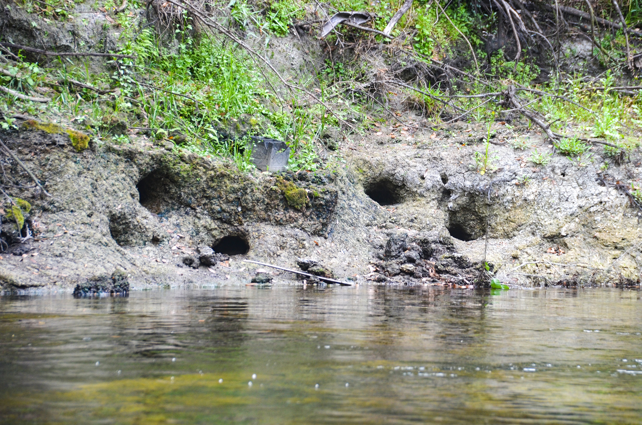
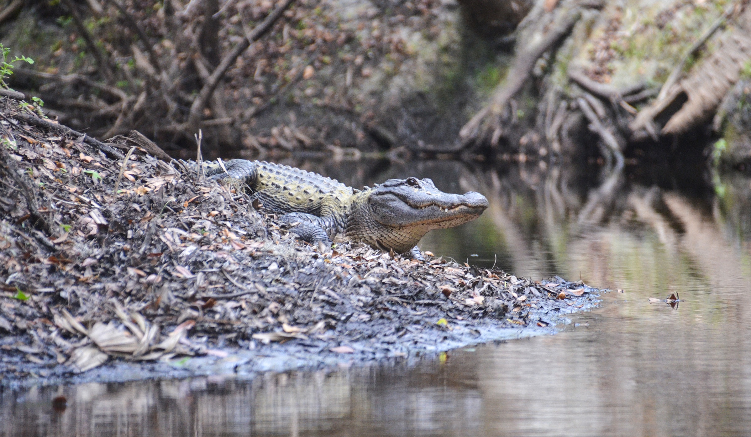
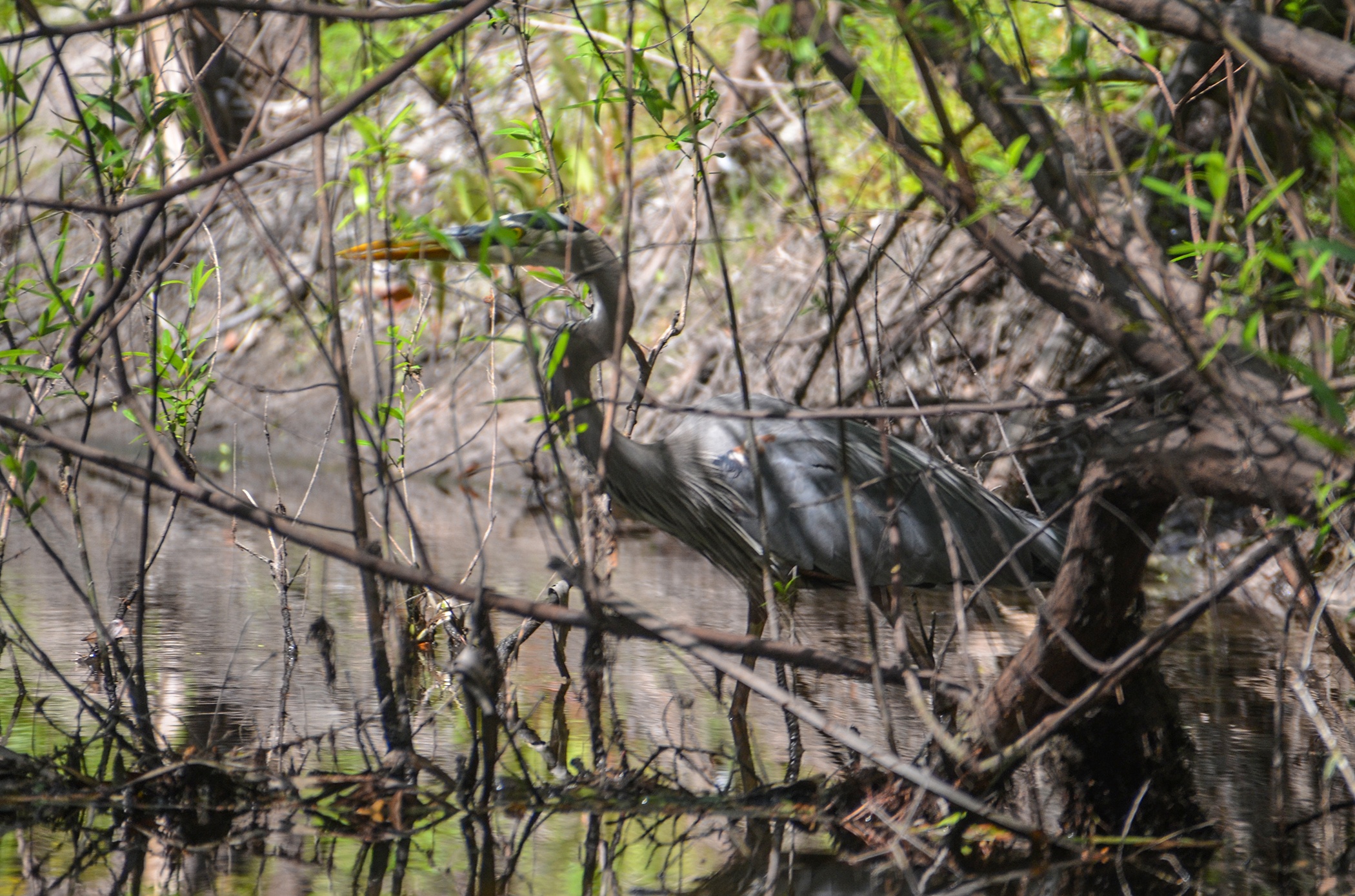
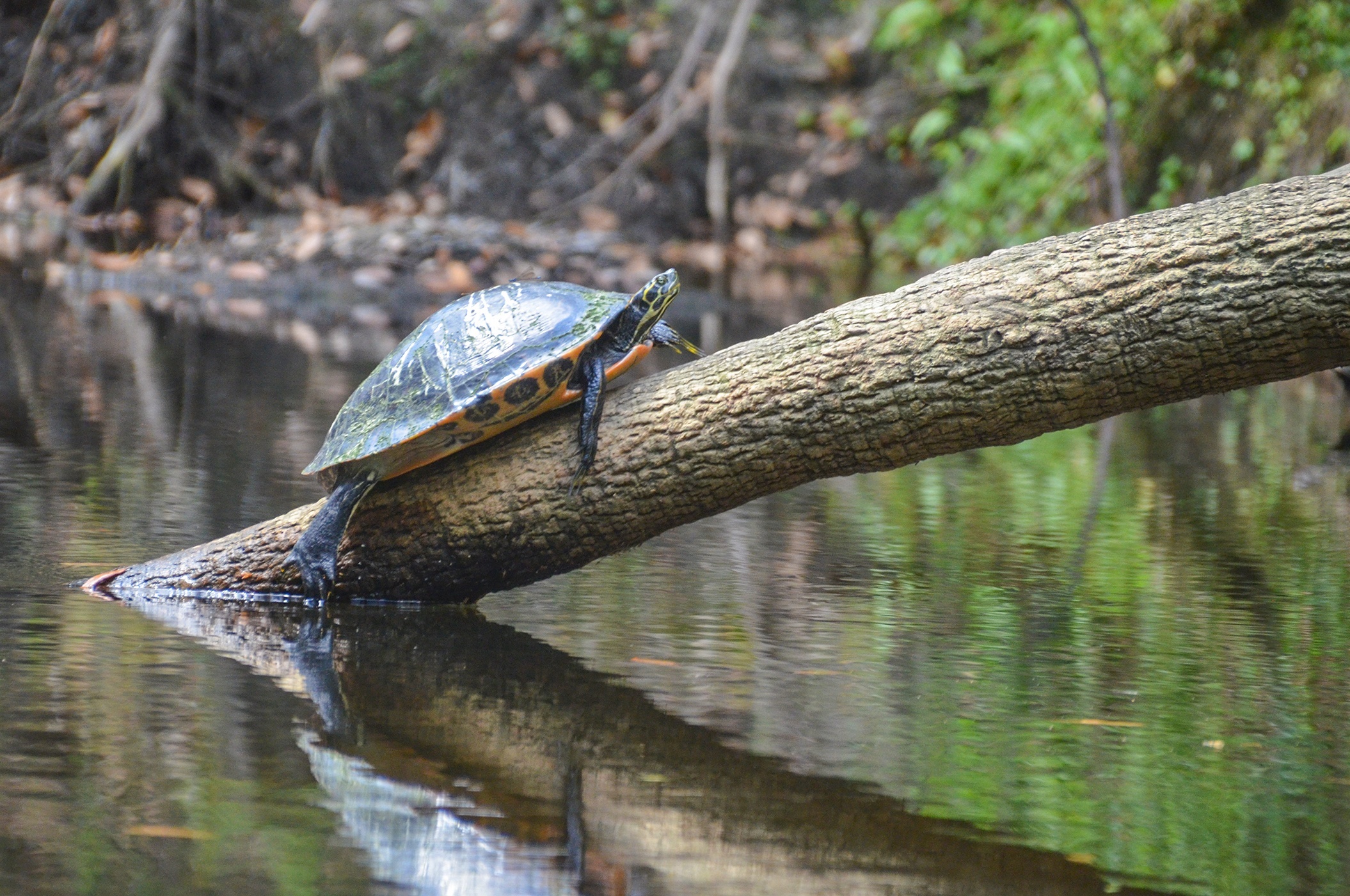
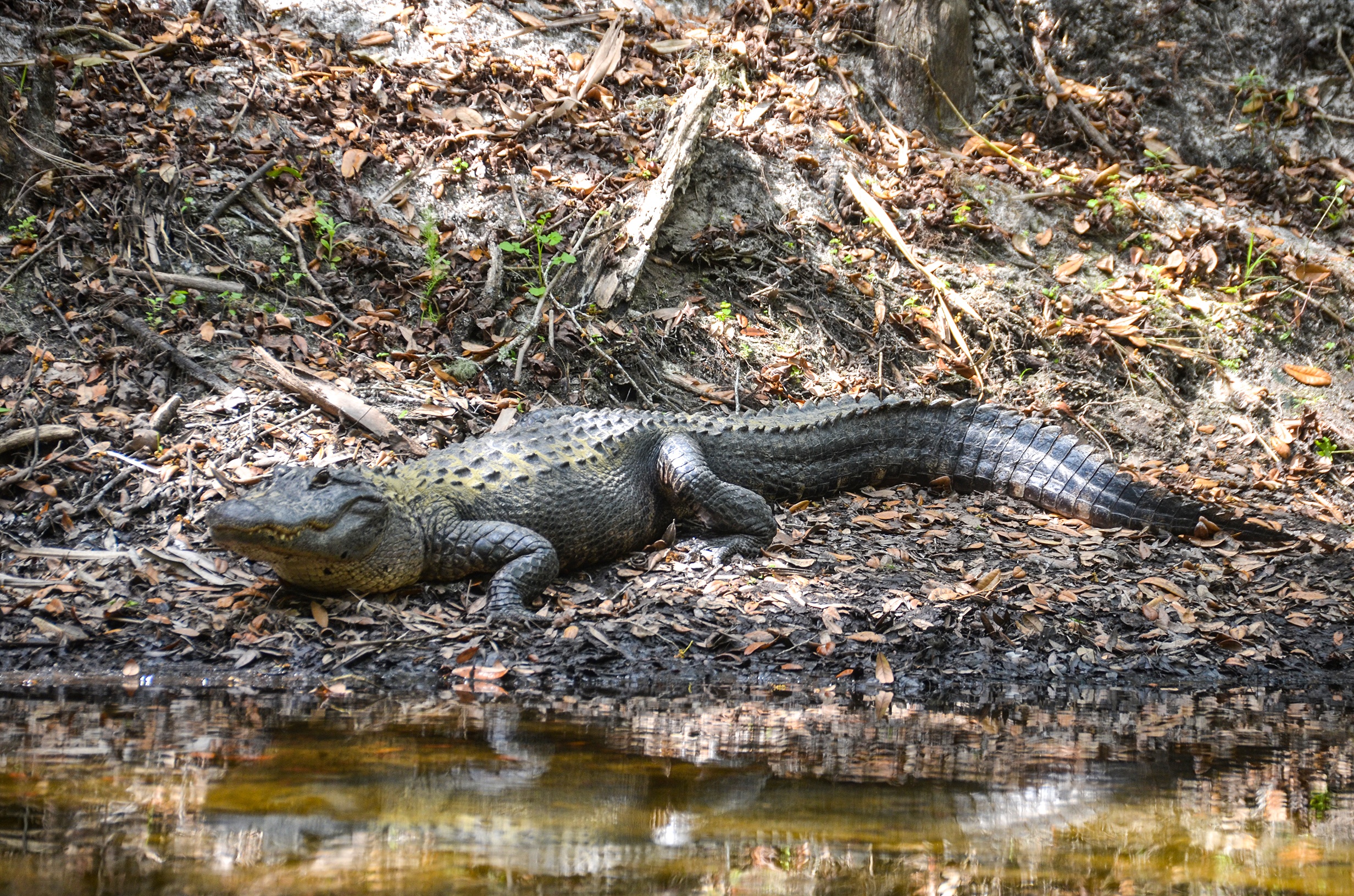
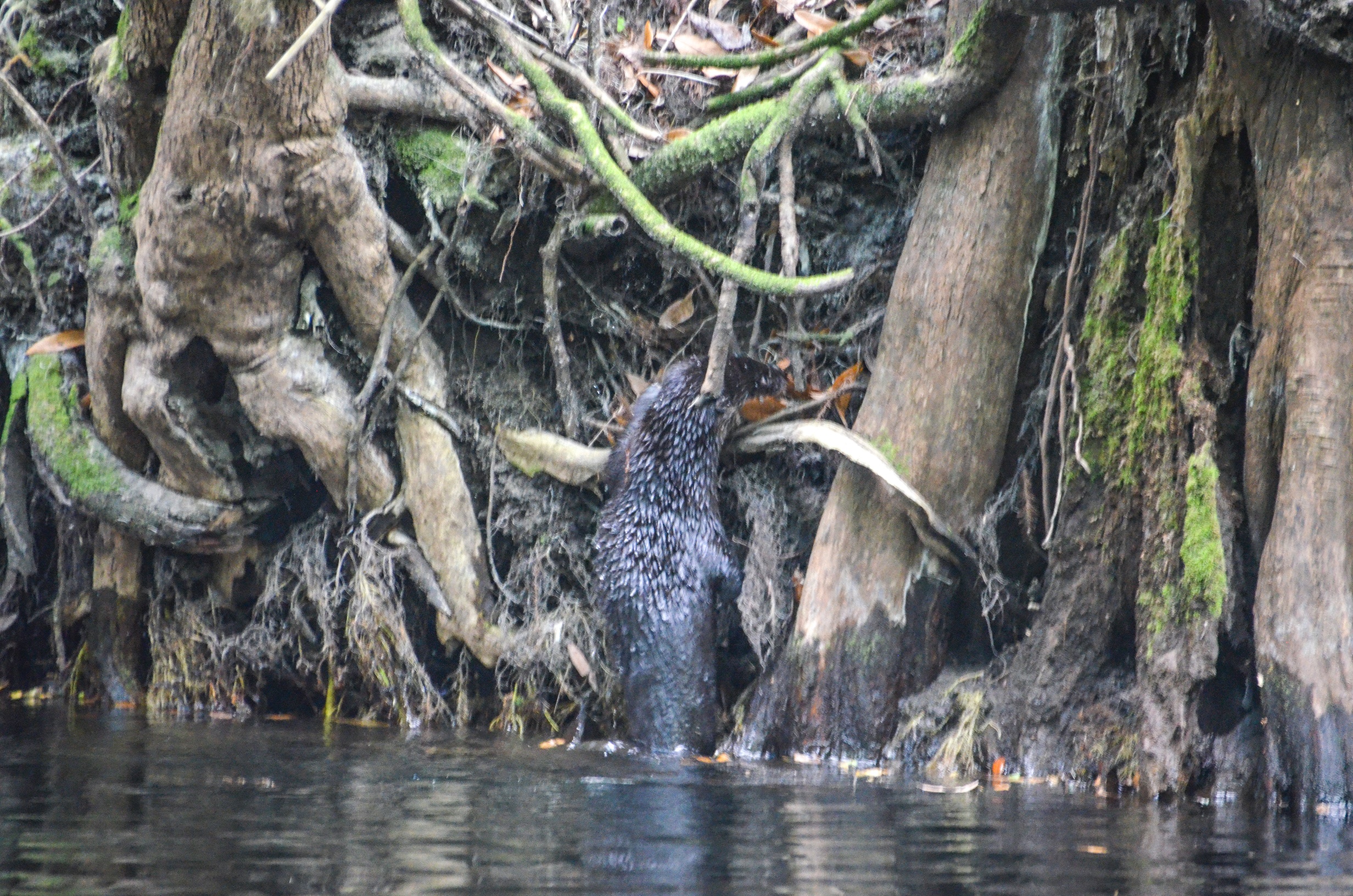
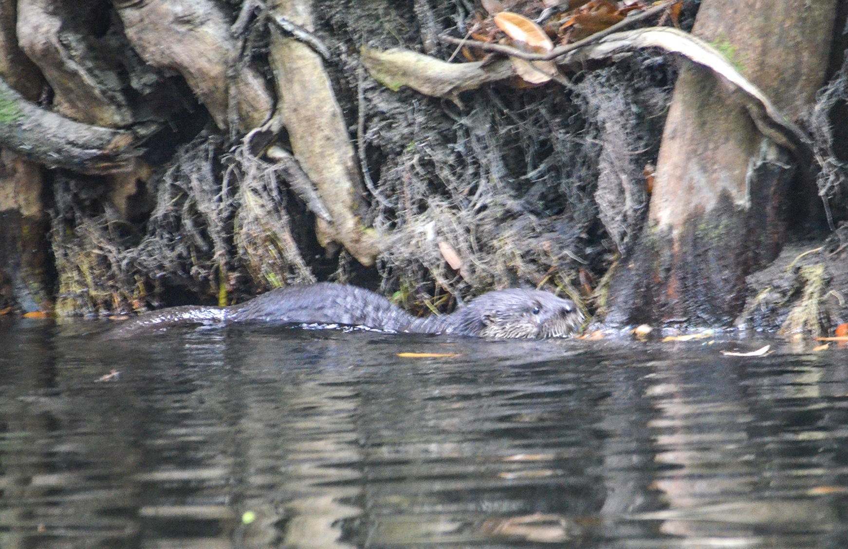
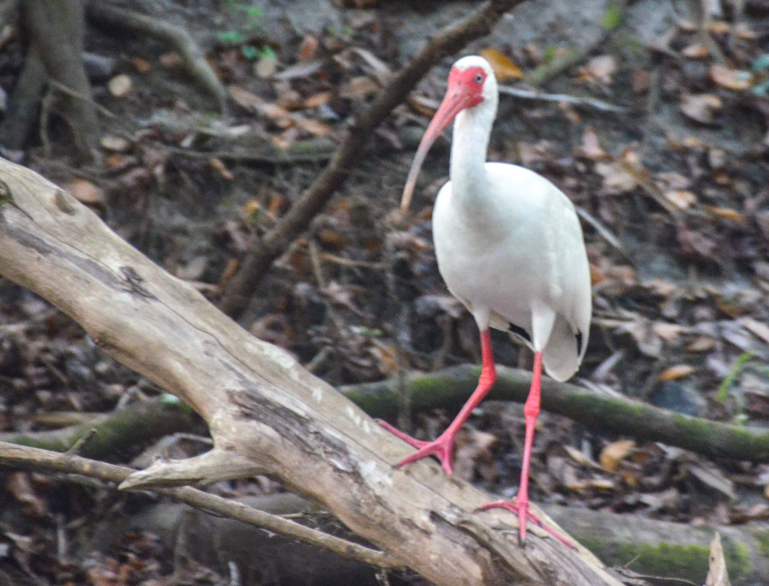
The Alafia River was and is an excellent paddle to put on your list. The flora was beautiful as was the wildlife that included the typical gators, turtles, and birds as well as an otter. Also of note, at mile 2.44, there is a fun shoal, and while paddling over the lime rock numerous Plecostomus ( algae eaters ) can be seen on the lime rock below. Along some of the exposed sandy/clay banks, Plecostomus holes are very visible.
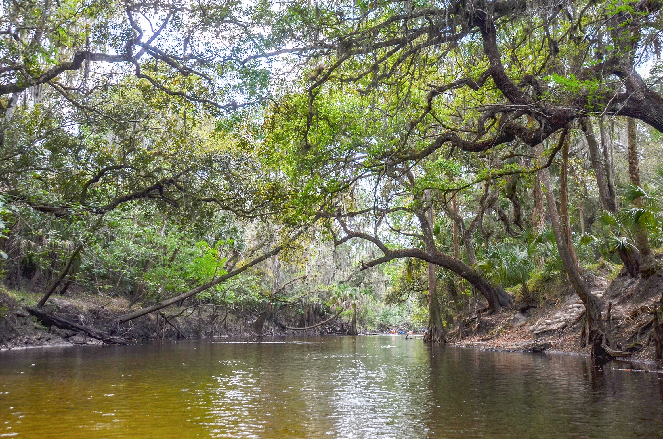
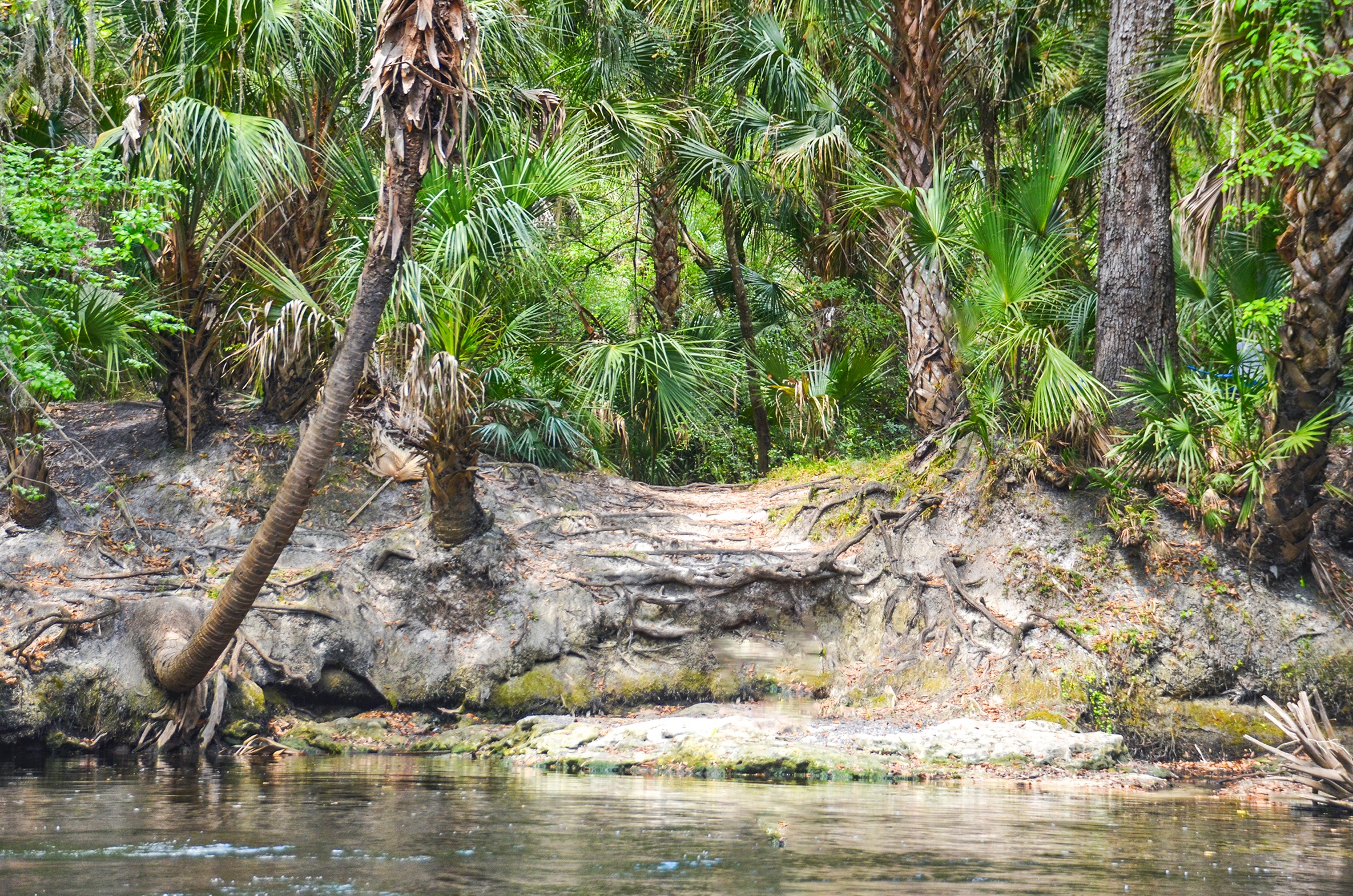
The rest stops along the way are picturesque, some with high banks, sandy beaches, and clear creeks entering the river. The Alafia River will definitely be on my bucket list to return to.

Guides, Maps & Info…
- Alafia River Topo Map ( Launch at Alderman’s Ford )…
- Alafia River Water Levels…
- Alafia River Paddle Guide…
- Alafia River State Park…
- Lithia Springs Park…
- Alderman’s Ford Park…
- Alafia River Canoe Rentals…
![]()