
Brief Overview…
Bulow Creek North. The plantation, known as Bulow Ville, goes back to the early 19th century. Charles Wilhelm Bulow grew sugarcane, indigo, cotton and rice on the 9,000 acres of land bordering the tidal creek now named Bulow Creek. Bulow died at age 44 and his son John, then 16 years old, took over the plantation, added a mill to produce sugar, molasses and rum from the sugar cane.
Due to the Second Seminole War in 1835, John Bulow was forced from Bulow Ville by the local militia, who wanted to use the sturdy stone buildings as a fortified base of operations. They were soon attacked and burned out by the Seminoles, putting an end to the plantation that had lasted only 15 years. Today stands the remains of the sugar mill and a few chimneys and wells. ( from Atlas Obscura )
Bulow Creek has one of the largest stands of Southern Live Oak along Florida’s east coast. The featured tree of the park is the Fairchild Oak, a 400 year old Southern Live Oak, one of the largest in the southern United States
Bulow Creek is a State of Florida Canoe Trail. It is a shallow, meandering waterway, originating in the wetlands of Graham Swamp, West of the Intercoastal Waterway ( Matanzas River ). Bulow Creek flows South for most of it’s 9 mile length before turning eastward and flowing into the Halifax River. Here is a Bulow Creek Paddle Guide.

Bulow Creek North Details:
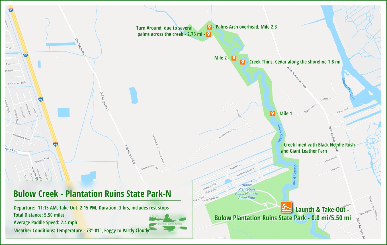
![]() Location: The north section of Bulow Creek is located 3 miles southwest of Flagler Beach.
Location: The north section of Bulow Creek is located 3 miles southwest of Flagler Beach.
![]() Launch/Take Out point: The launch is located at Bulow Plantation Ruins Historic State Park, 3501 Old Kings Road, Flagler Beach FL 32136. There is a $4.00 vehicle fee for the park. The park also rents kayaks for use, $10.00 per hour.
Launch/Take Out point: The launch is located at Bulow Plantation Ruins Historic State Park, 3501 Old Kings Road, Flagler Beach FL 32136. There is a $4.00 vehicle fee for the park. The park also rents kayaks for use, $10.00 per hour.
![]() Paddle Distance: Paddling north on Bulow Creek and back is approximately 5.5 miles. There was a group of palm down, across the creek that prevented going further.
Paddle Distance: Paddling north on Bulow Creek and back is approximately 5.5 miles. There was a group of palm down, across the creek that prevented going further.
![]() Difficulty: Easy.
Difficulty: Easy.
![]() Average Paddle Time & Paddle Speed: 3 hours with stops, paddle speed 2.5 mph.
Average Paddle Time & Paddle Speed: 3 hours with stops, paddle speed 2.5 mph.
![]() Width and Depth: Bulow Creek North is wide and open at the launch, approximately 150′ and at 2.75 miles tapers to 20′. The width and fallen trees prohibits paddling beyond 3 miles. At it’s deepest, Bulow Creek is 8′ deep at the southern end and only 1-4′ deep in this north section, depending on the tide. Due to the tide, it is necessary to watch for sandbars that might require portaging.
Width and Depth: Bulow Creek North is wide and open at the launch, approximately 150′ and at 2.75 miles tapers to 20′. The width and fallen trees prohibits paddling beyond 3 miles. At it’s deepest, Bulow Creek is 8′ deep at the southern end and only 1-4′ deep in this north section, depending on the tide. Due to the tide, it is necessary to watch for sandbars that might require portaging.
![]() Current – Tidal: Bulow Creek is definitely a tidal creek.
Current – Tidal: Bulow Creek is definitely a tidal creek.
![]() Side Paddles: There are no side paddles on this stretch of Bulow Creek.
Side Paddles: There are no side paddles on this stretch of Bulow Creek.
![]() Rest Areas: Restroom facilities at the launch, Bulow Plantation Ruins Historic State Park.
Rest Areas: Restroom facilities at the launch, Bulow Plantation Ruins Historic State Park.
![]() Important Information: Most of this paddle is in the open. Depending on the time of year, be prepared for strong breezes, exposure to sun and insects. Plan you paddle for high tide.
Important Information: Most of this paddle is in the open. Depending on the time of year, be prepared for strong breezes, exposure to sun and insects. Plan you paddle for high tide.
Bulow Creek North Paddle Map…
The Launch at Bulow Ville…
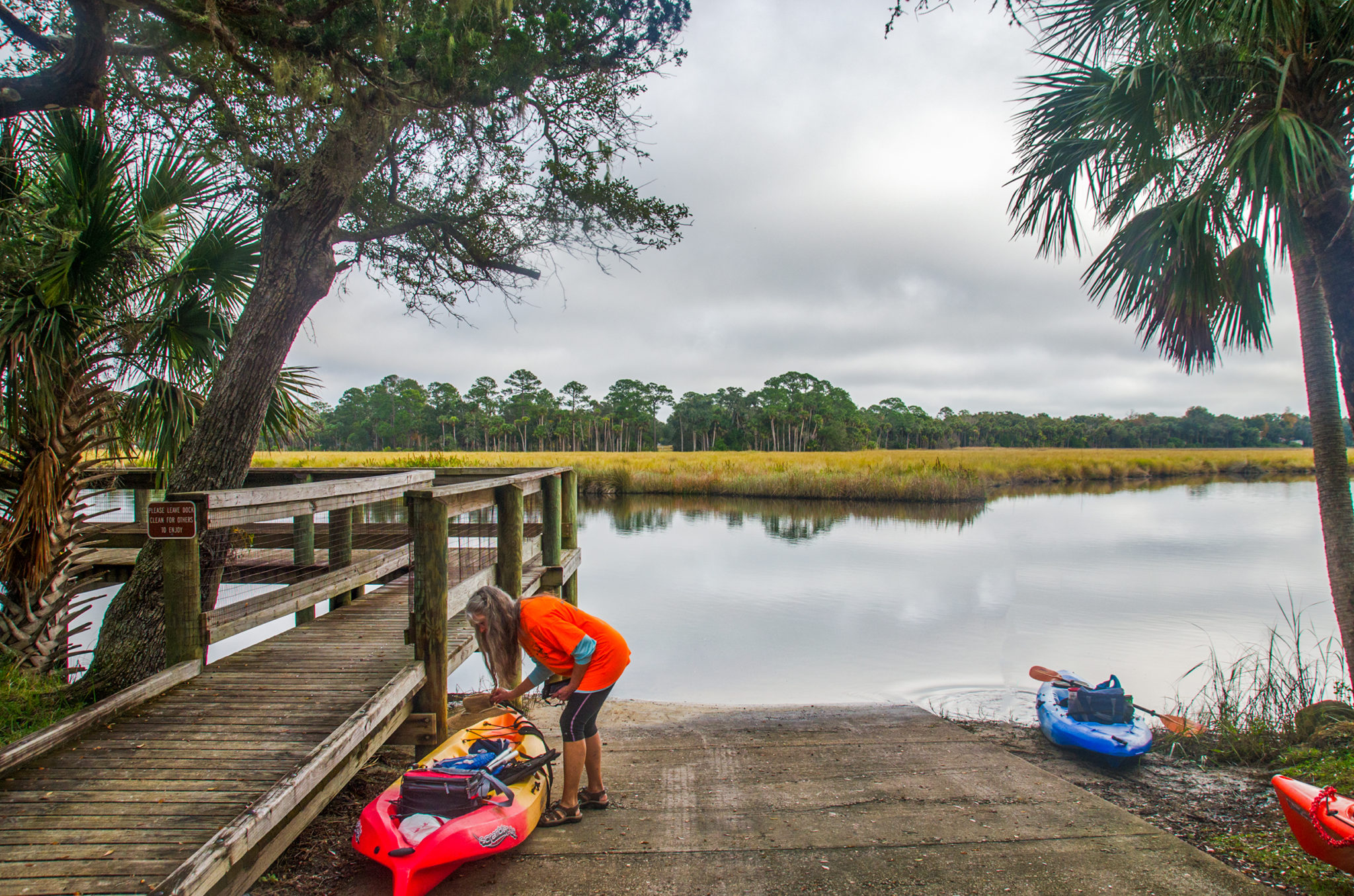
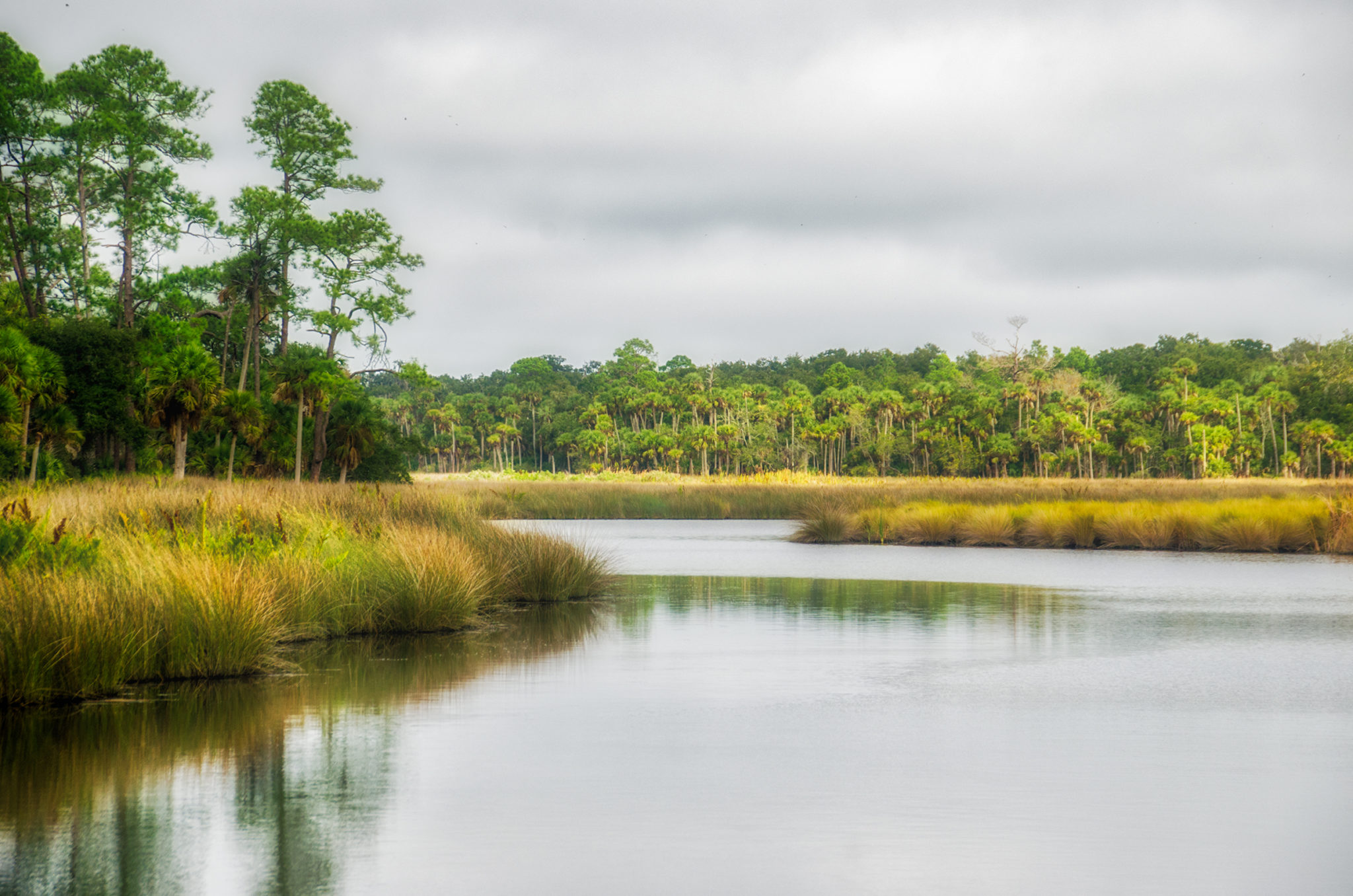
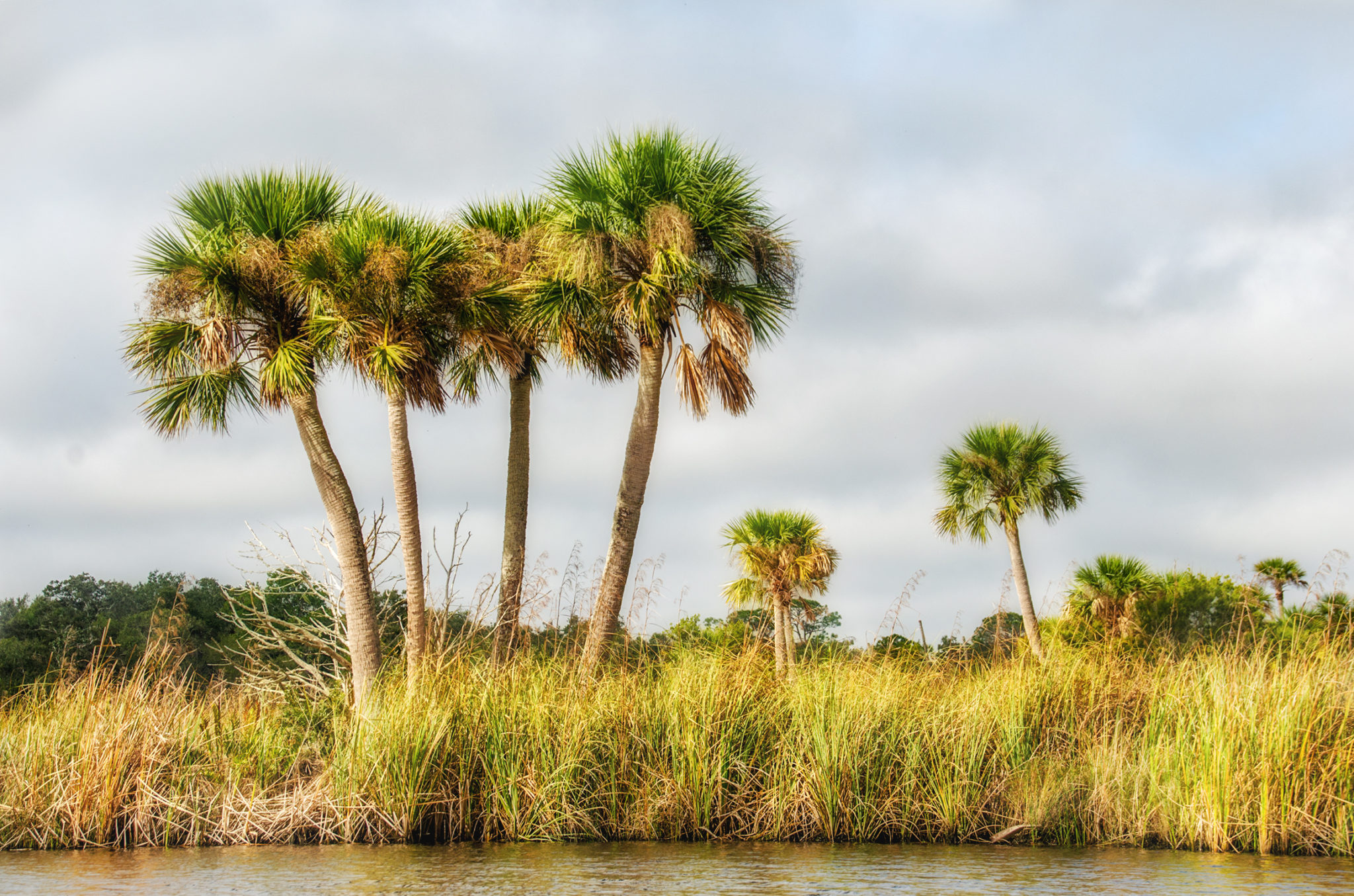
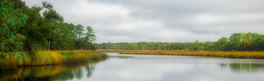
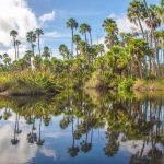
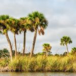
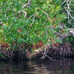
The sky was overcast, 73° and the heavy fog was now lifted for an 11:00 am departure. After entering Bulow Plantation Ruins Historic State Park, the launch is located at the end of a mile long, dirt road, through scenic, thick coastal forest. The concrete ramp is easy to use, has a loop for loading and unloading and plenty of parking. is a nice concrete ramp leading to a sandy bottom Bulow Creek. Looking East across the 150′ navigable waterway, is a scenic view of over 700′ of marsh, dominated by Needle Rush, and then a shoreline with oaks, pines and the characteristic Sabal Palmettos.
The current is mild and according to the water line on the Rush, the level is just below high tide and falling slowly…promising to be a nice day on the water. We launch and begin our 3 mile journey North through a beautiful, scenic, Florida Waterway.
Bulow Creek…
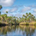
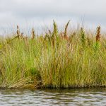
This is definitely a paddle into old Florida. The eastern side of the waterway is dominated with Needle Rush and the Palms and Pines define the shoreline. Just under a half a mile there are a series of canals that lead into a subdivision on RL. Once past these, and aside from the occasional boardwalks, stretching out through the rush, the paddle is pure Florida habitat.
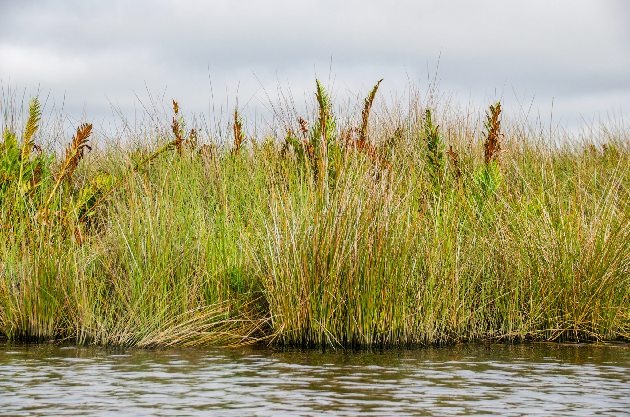
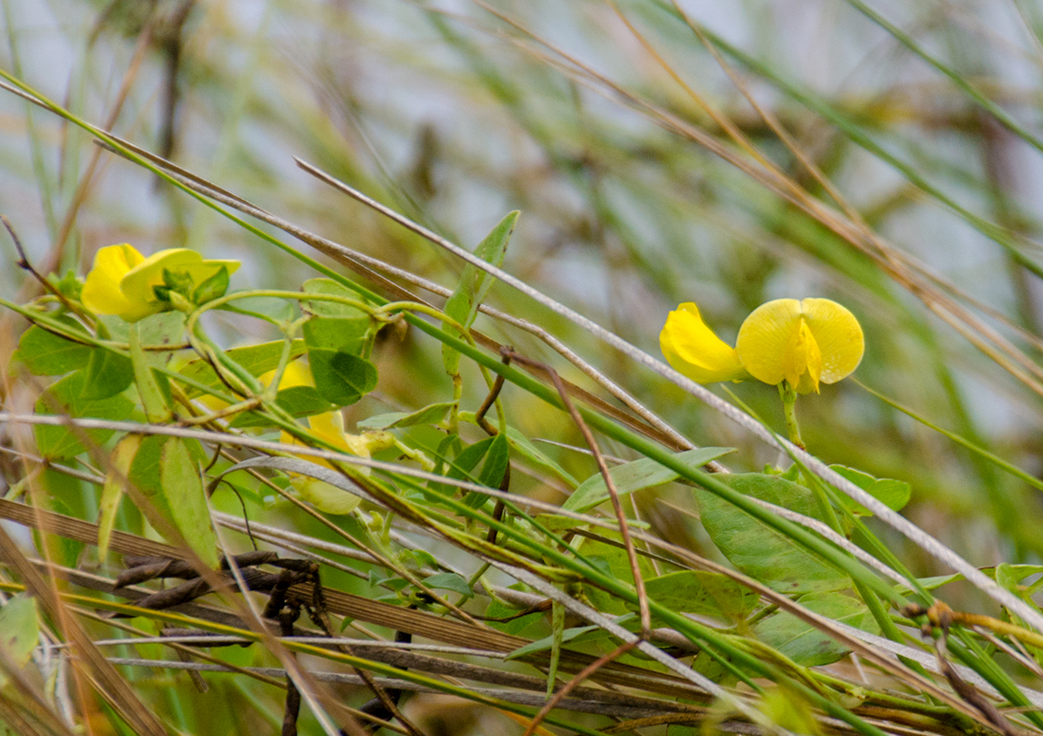
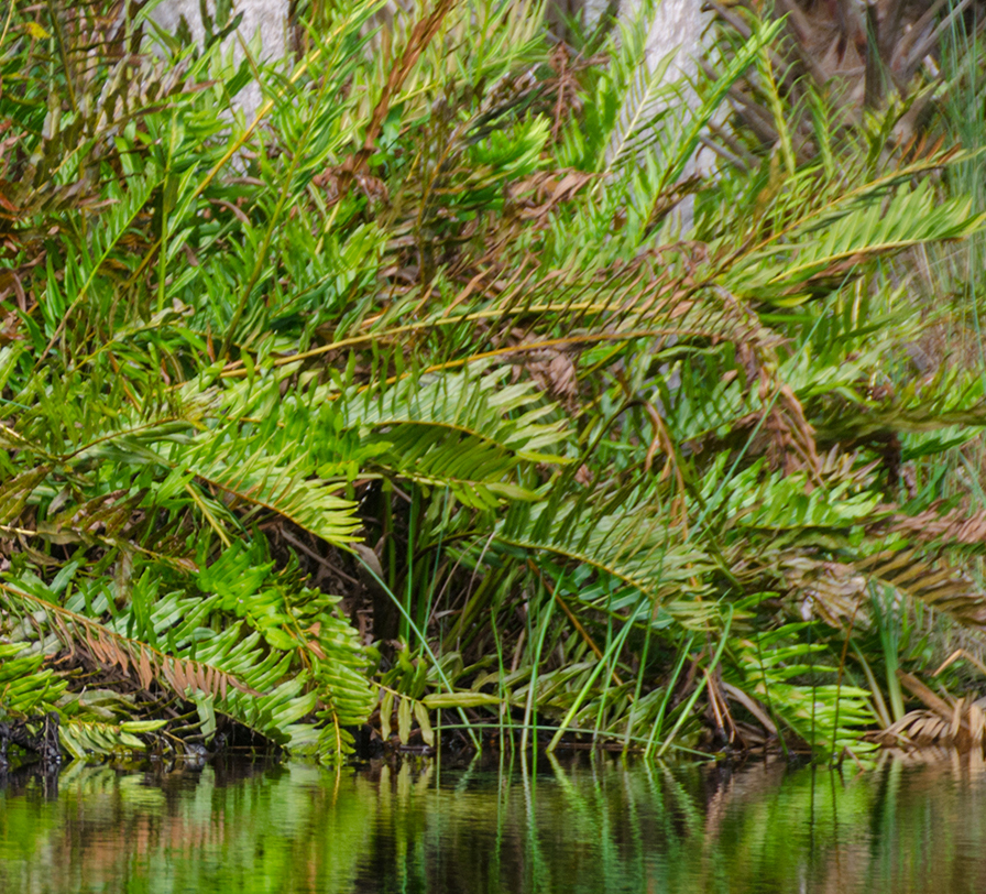
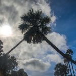
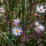
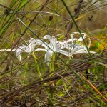
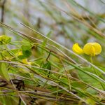
For the entire first course of this winding creek, Needle Rush create a barrier to the distant shoreline. Giant Leather Ferns rise above the rush and once into mile 2, are predominant, in thick clumps along the shoreline. As on numerous Florida rivers, asters show their colors, and are still in bloom on this trip, nestled in among the rush. Hairy Cowpea was also in full bloom, vining it’s way throughout the rush. By now the sun is breaking through and the day is warming under a beautiful blue sky.
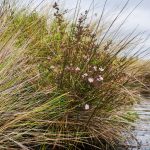
The creek begins to thin around 1.75 miles and here, the Needle Rush begin to disperse, especially along the western shoreline. By mile 2.3 the rush is largely displaced by clumps of Giant Leather Fern, patches of Sawgrass and larger mounds of Asters. The shorelines are densely populated with Sabal Palmettos, and occasional pine or oak.
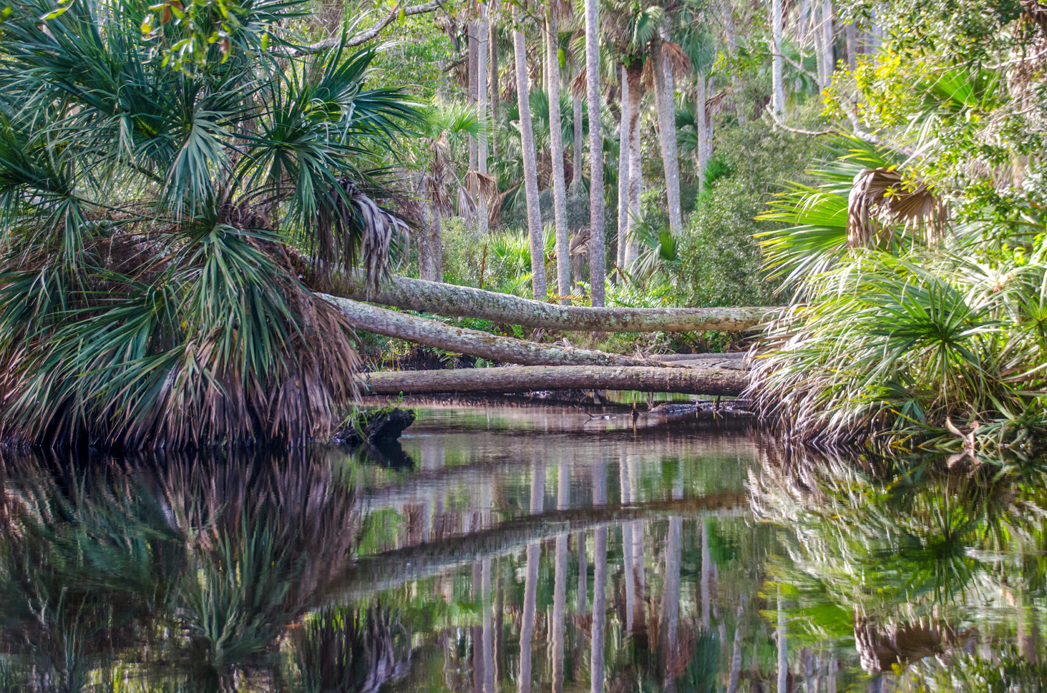
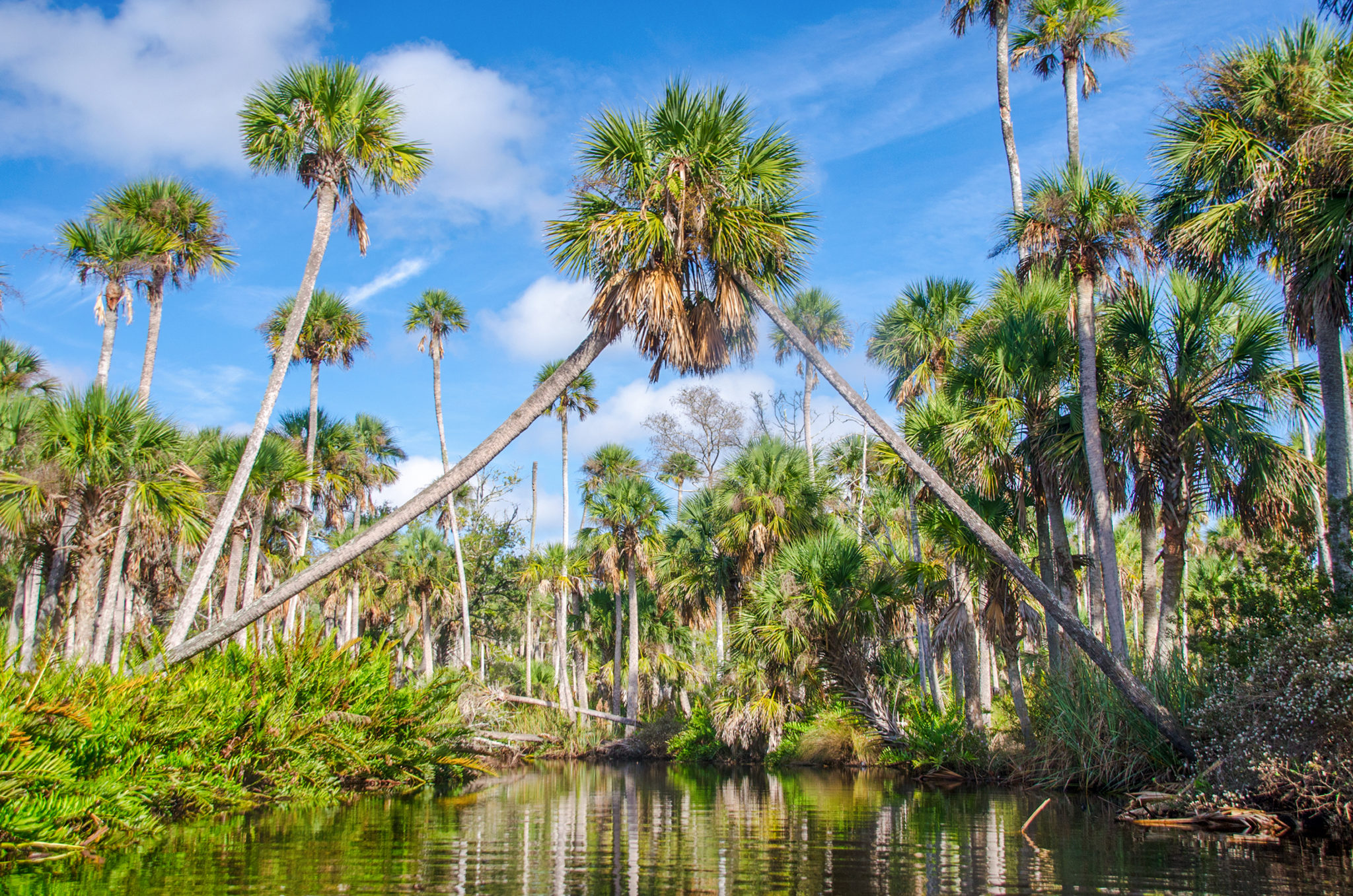
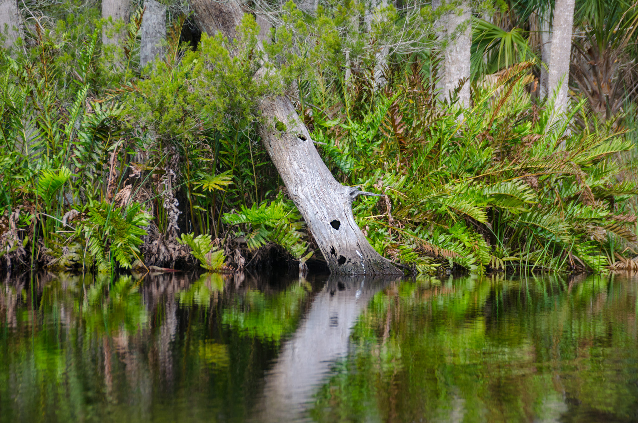
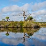
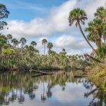
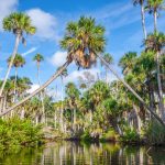
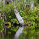
What is definitely noticeable, are the numerous dead Cypress trees. It is obvious the salinity of Bulow Creek is too much for the Cypress trees, killing them off and leaving majestic statues, ‘wldlife condos‘ along the paddle. At the 2 mile mark, southern cedar scrub and an occasional taller cedar can be seen along the shorelines. Mile marker 2.4 takes us beneath beautiful Sabal Palmetto arches and soon, with the creek getting narrower ( 20′-25′ ) several palms are completely across the waterway with no access around our under to continue or paddle. This is a wonderful paddle!
Turning around after 2.75 miles we enjoy the scenery once again on the return to the launch and thus ending another chapter in Florida Padlle Notes.
Bulow Creek Photo Gallery:
![]()