
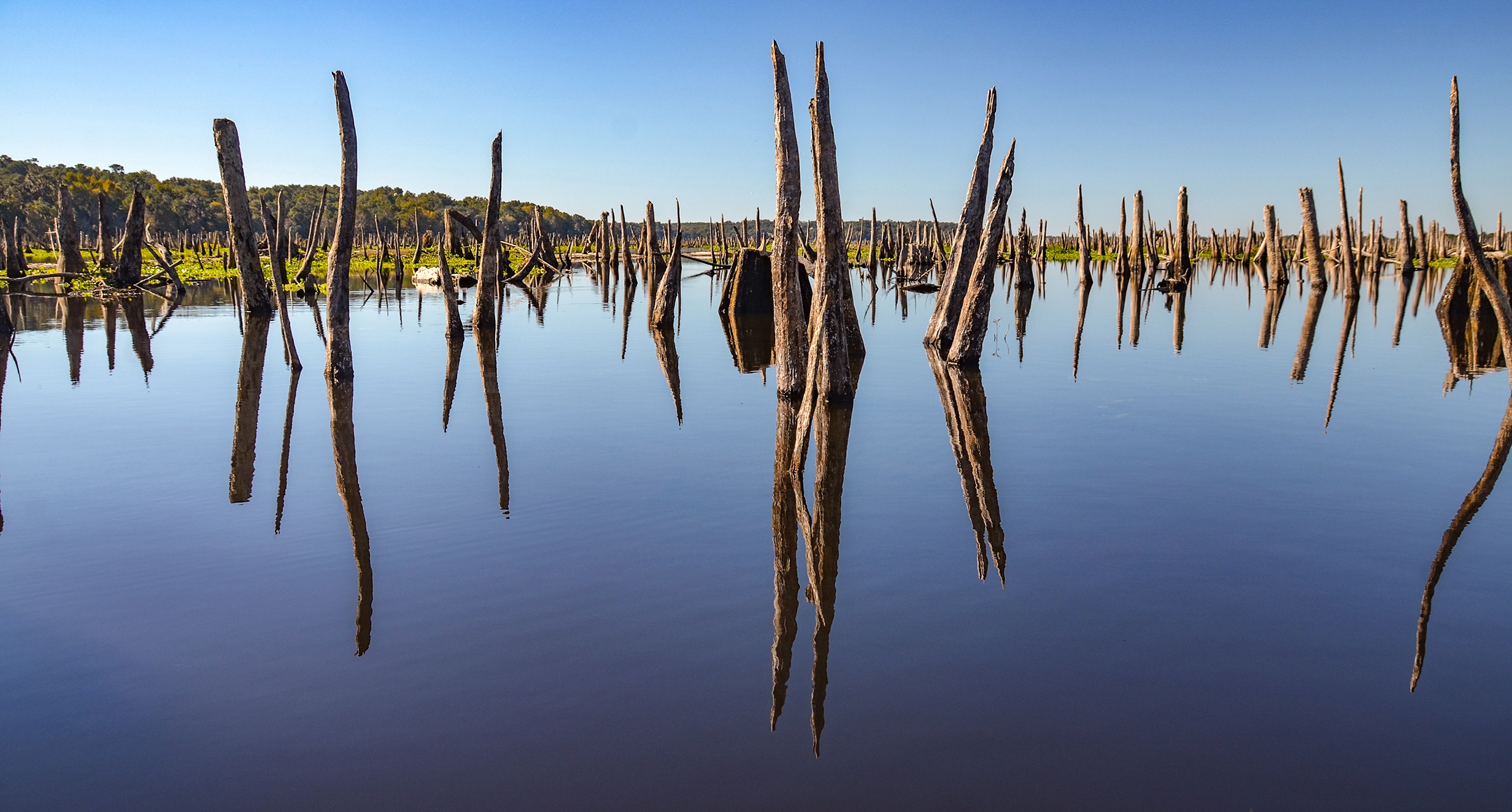
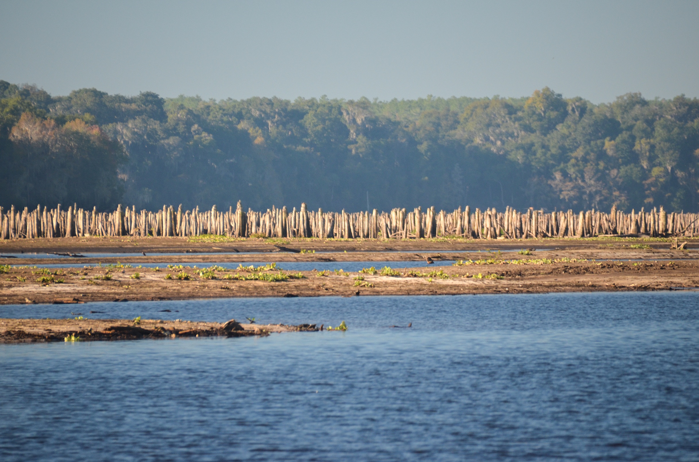
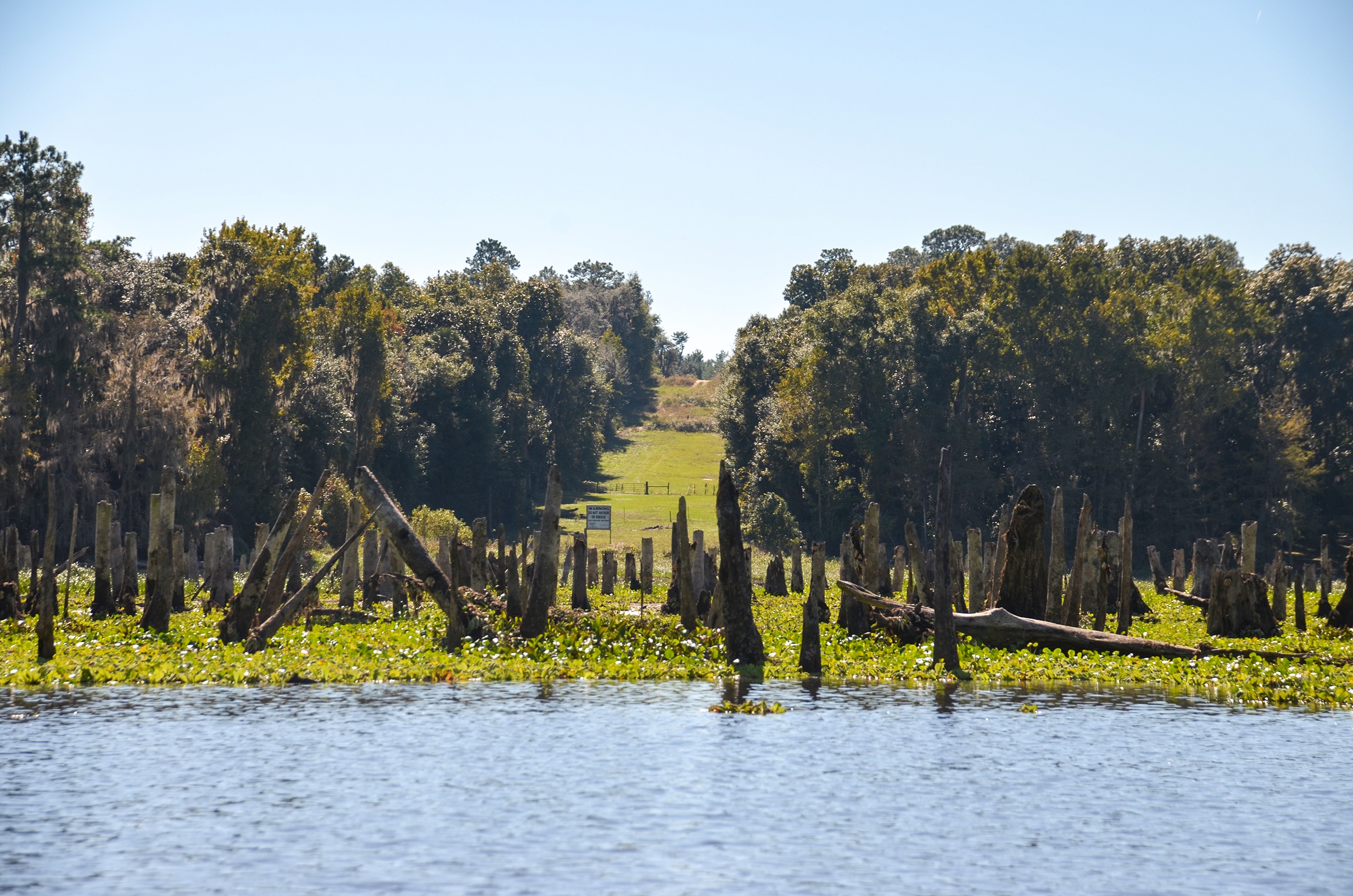
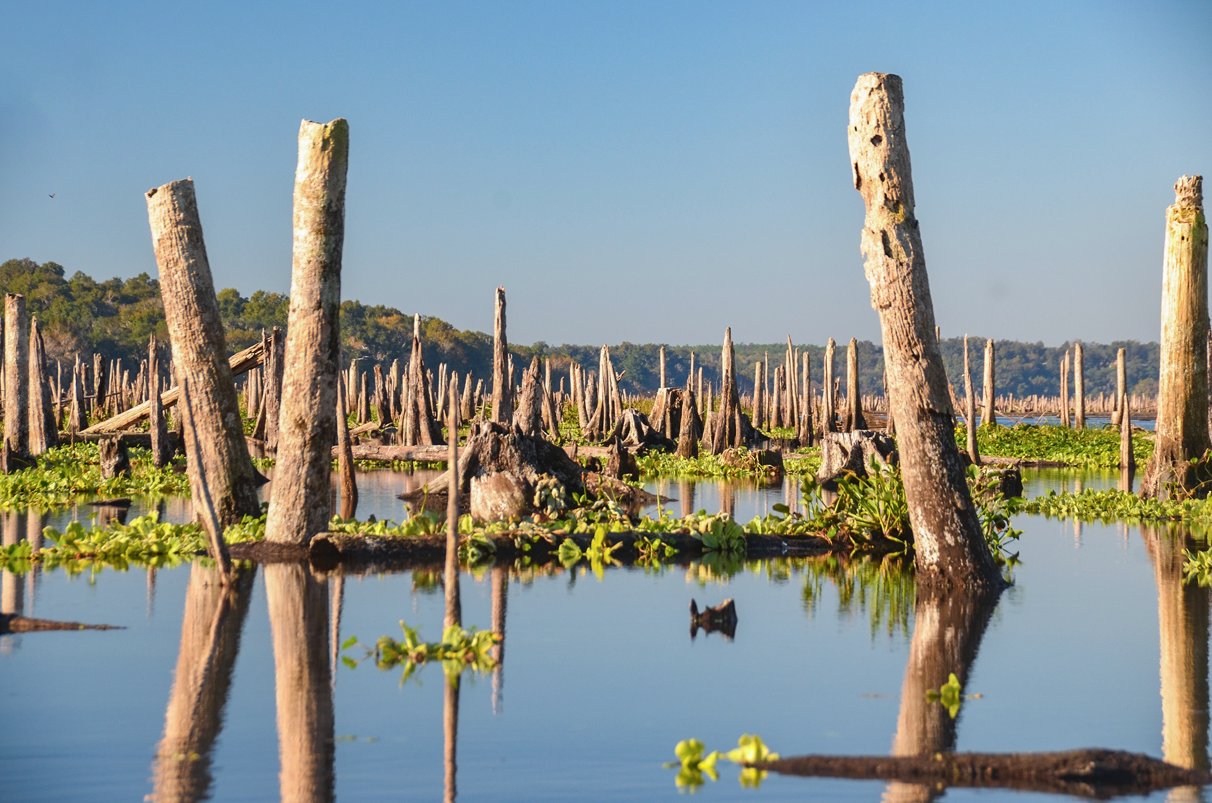
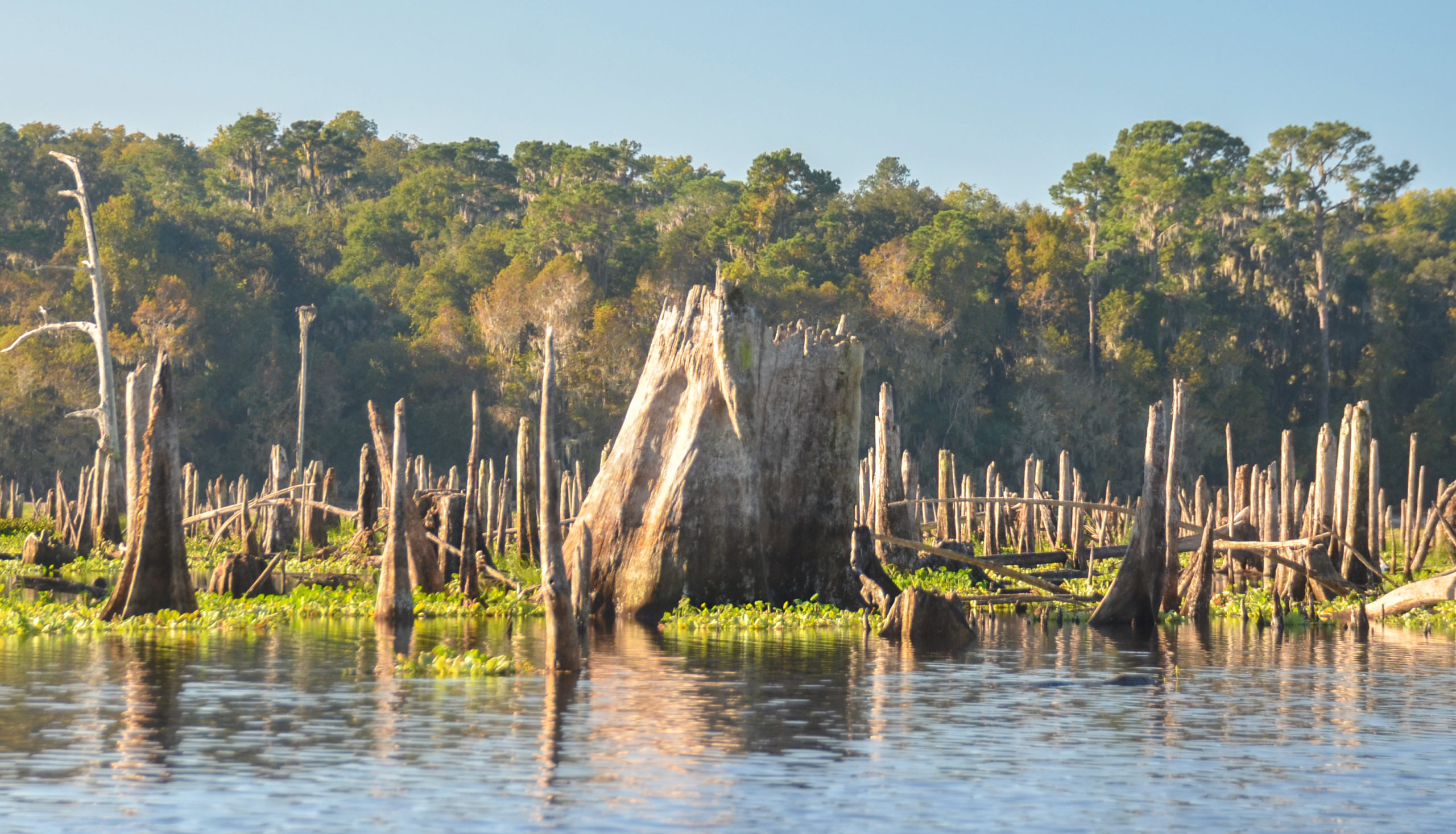
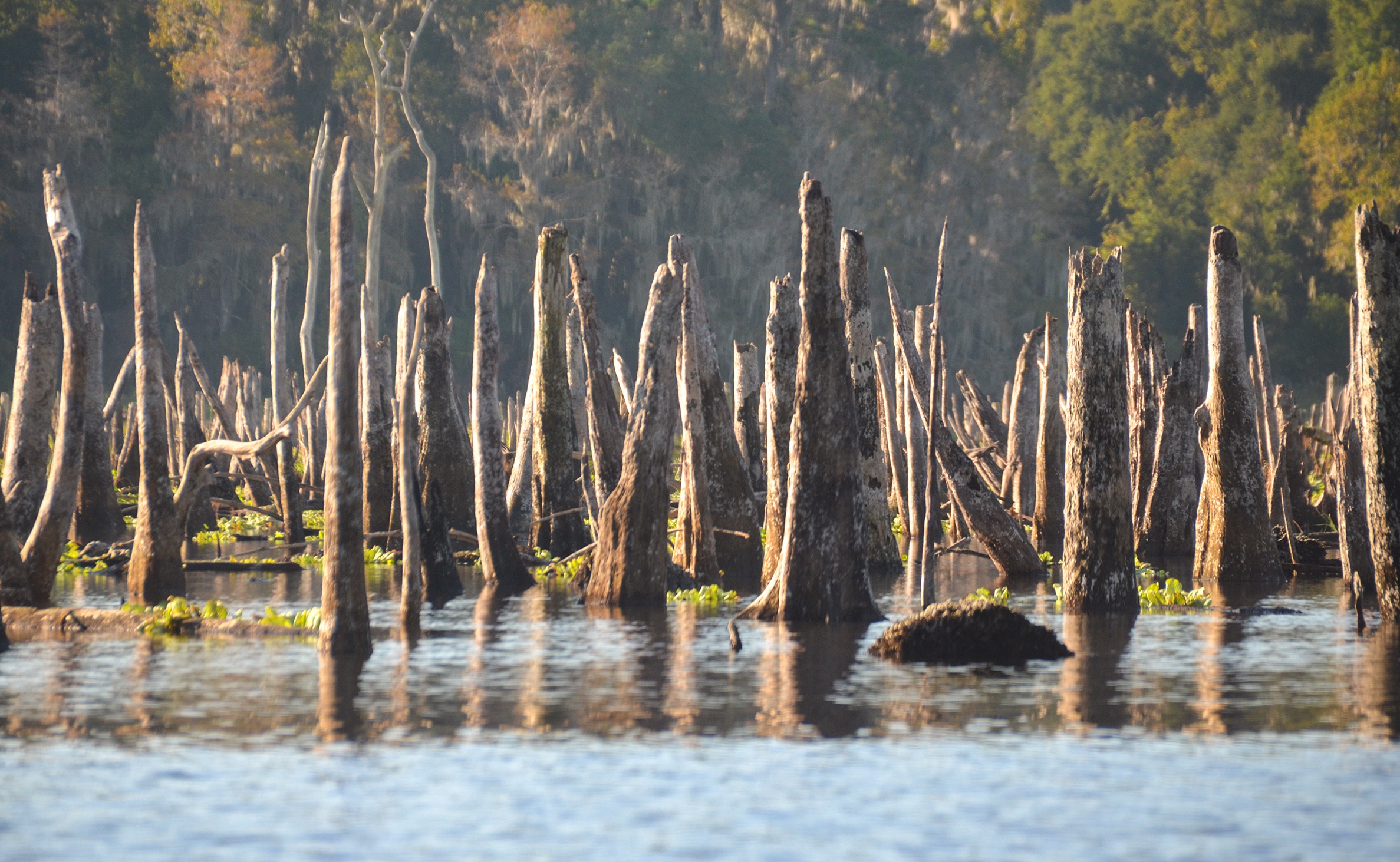
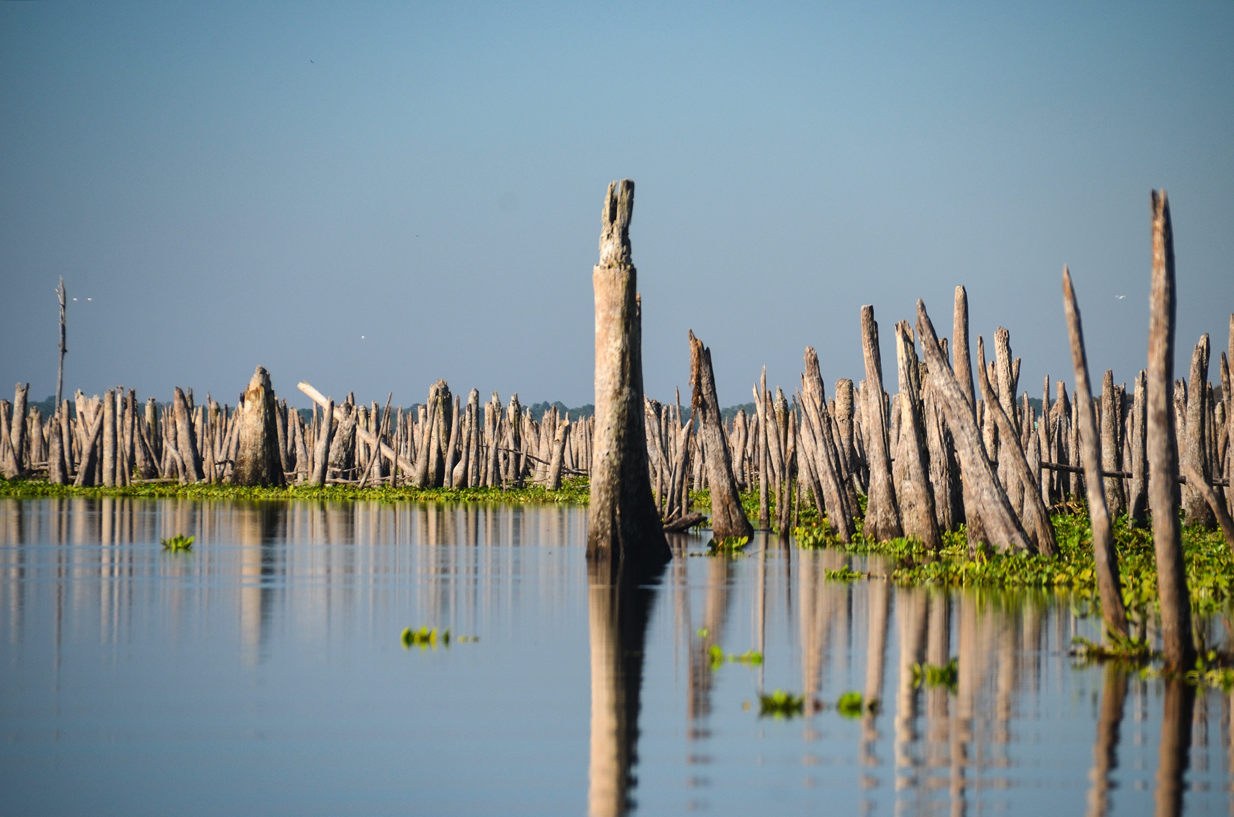
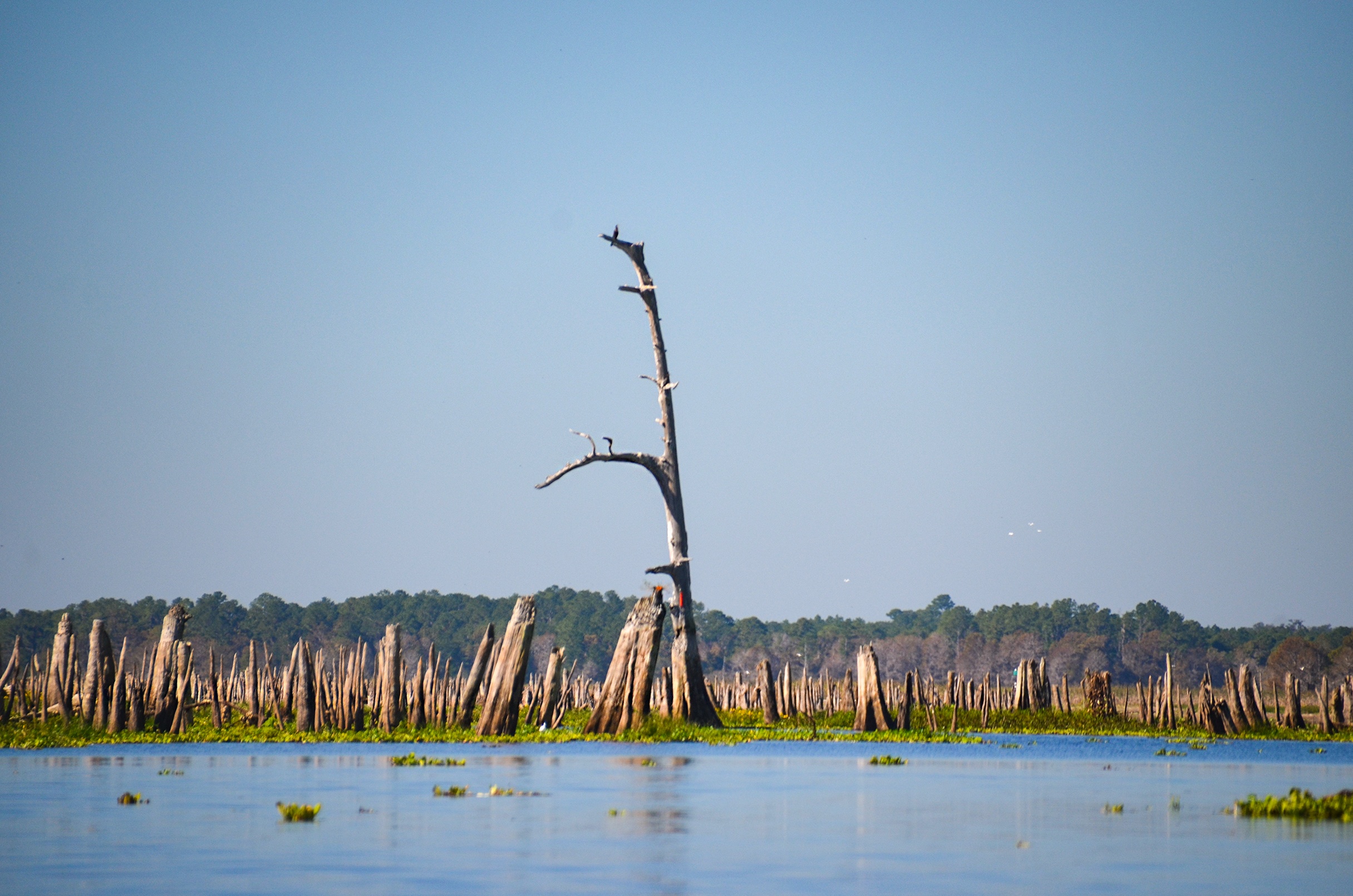
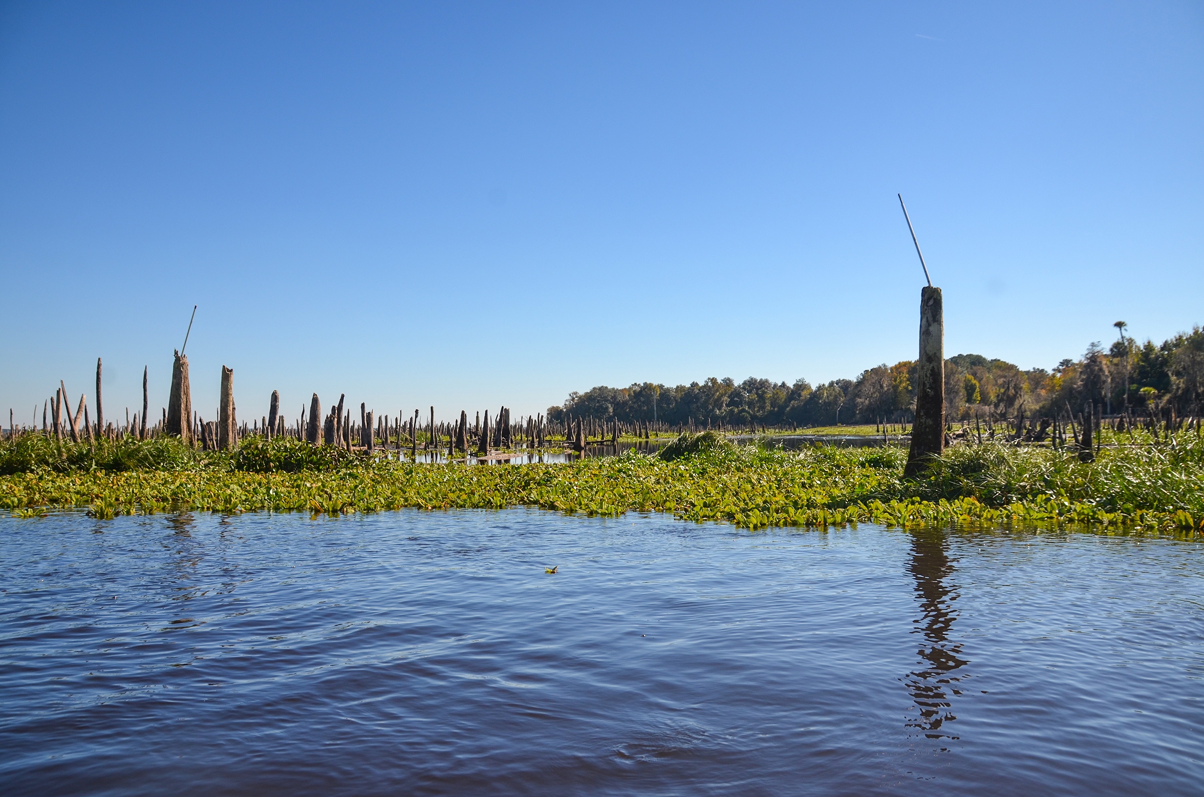
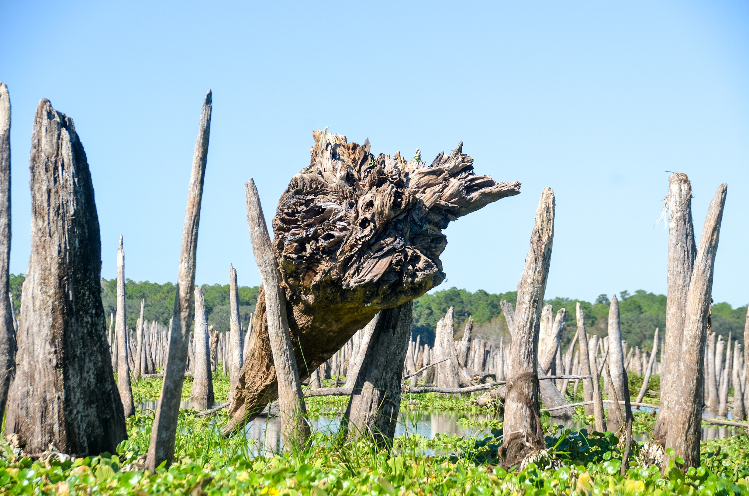
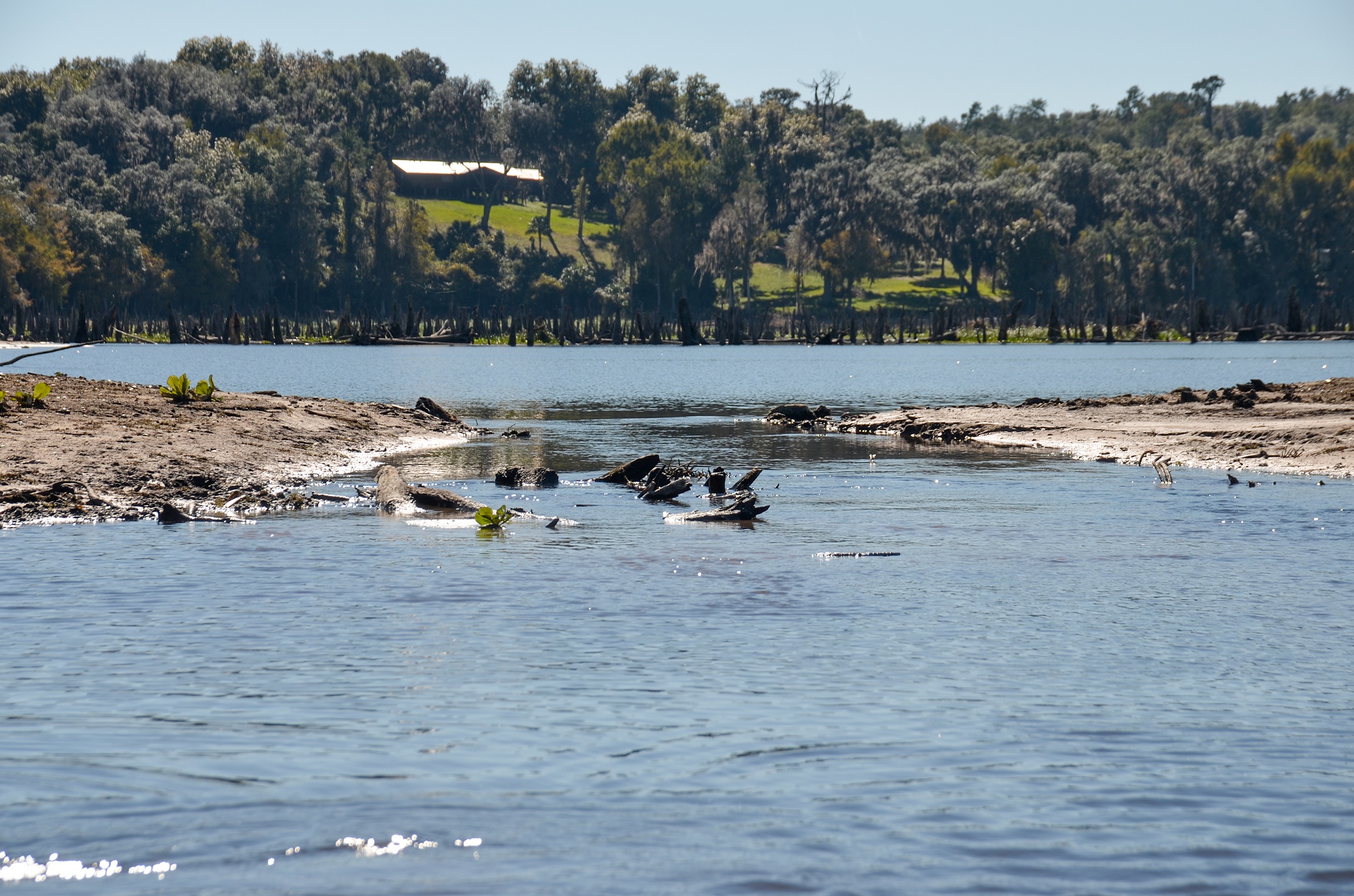
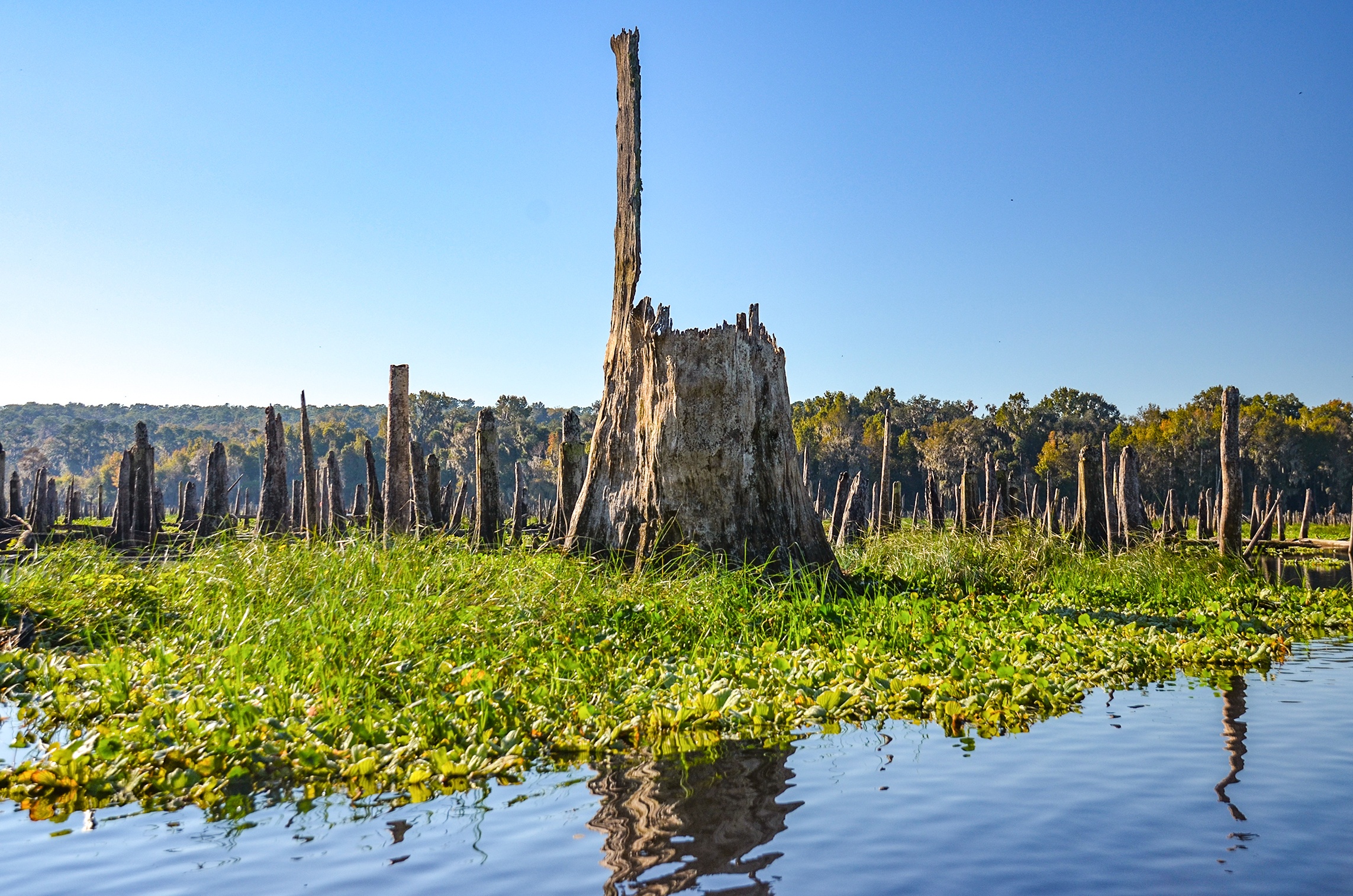
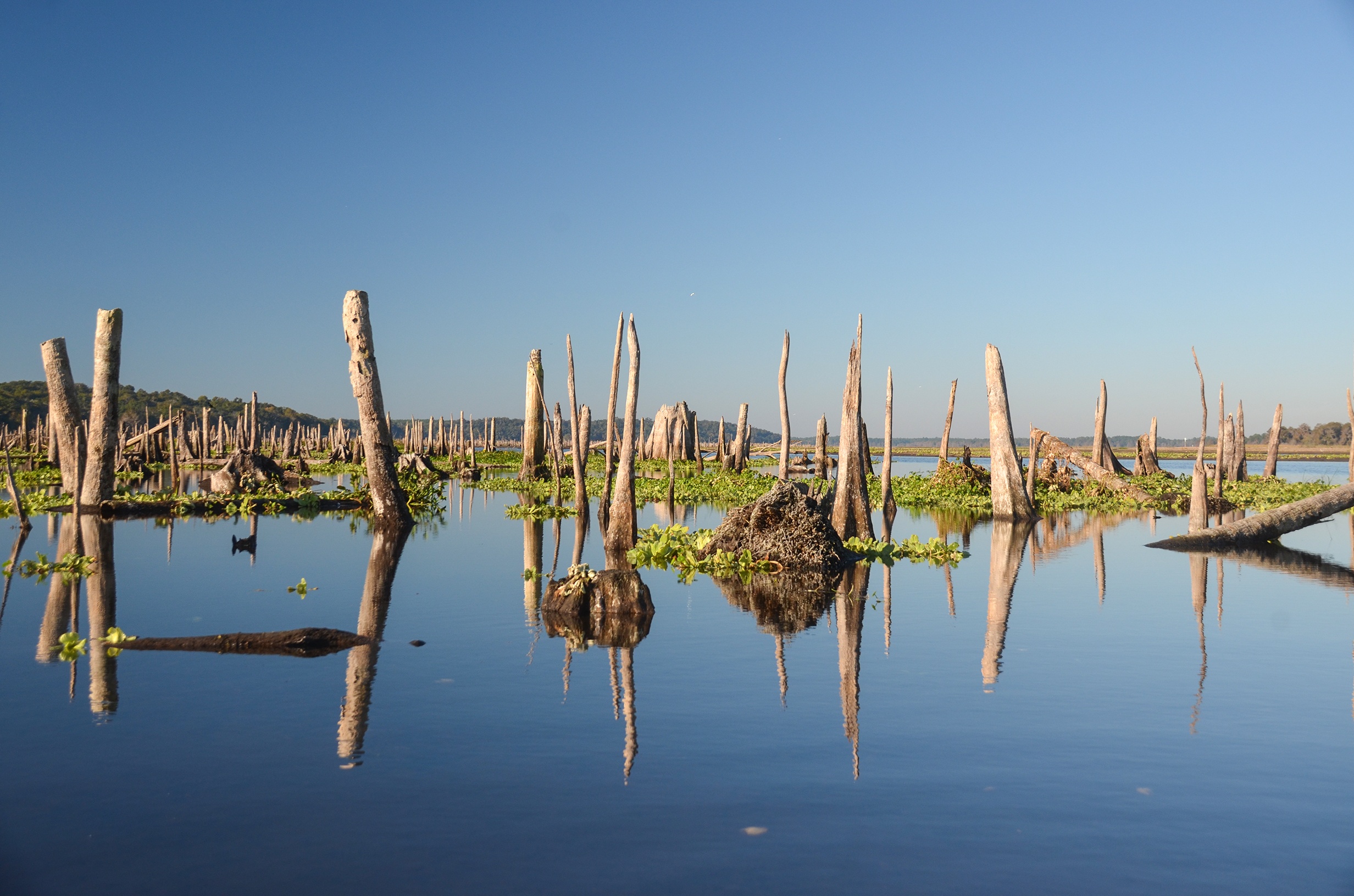
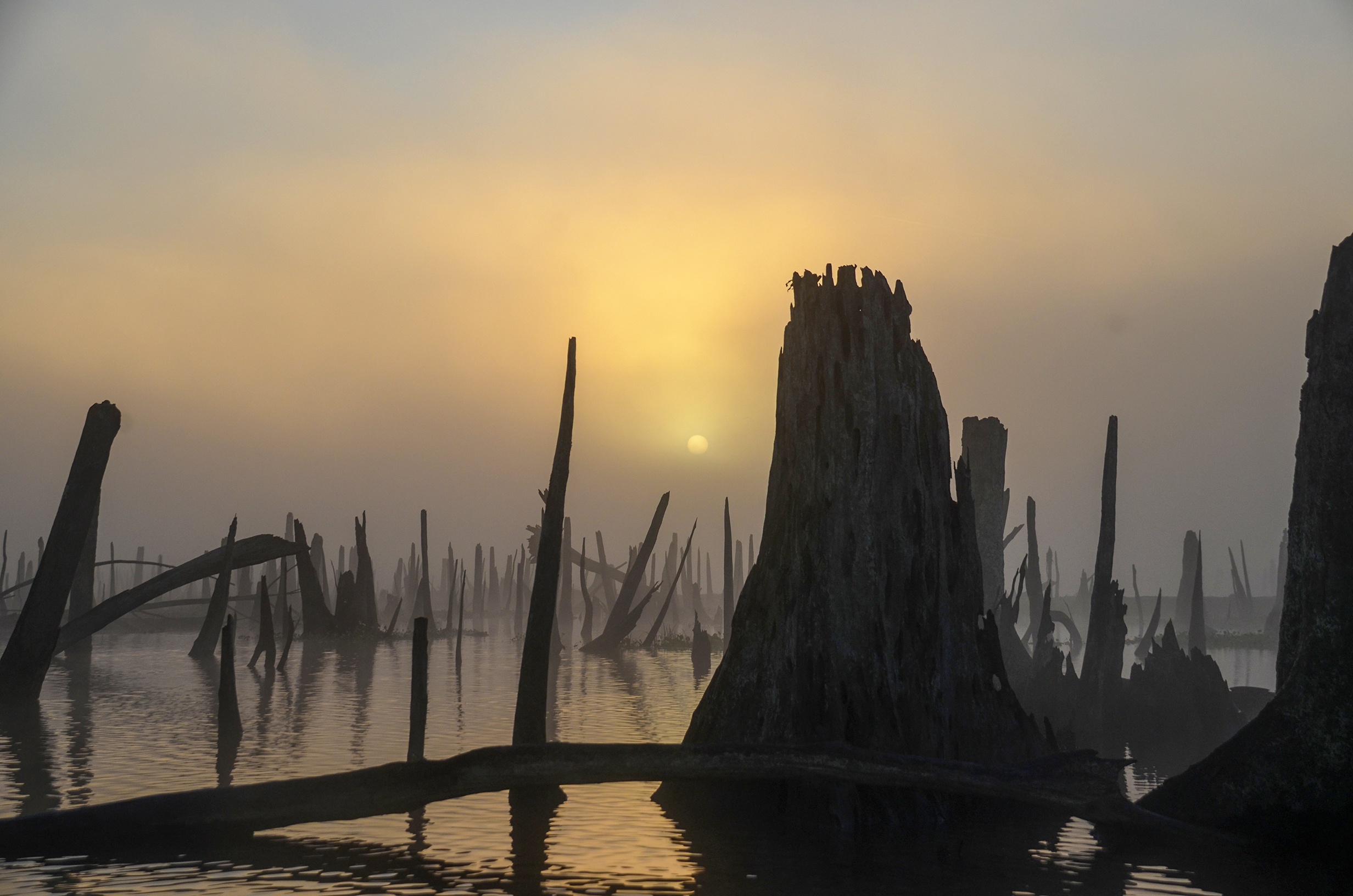
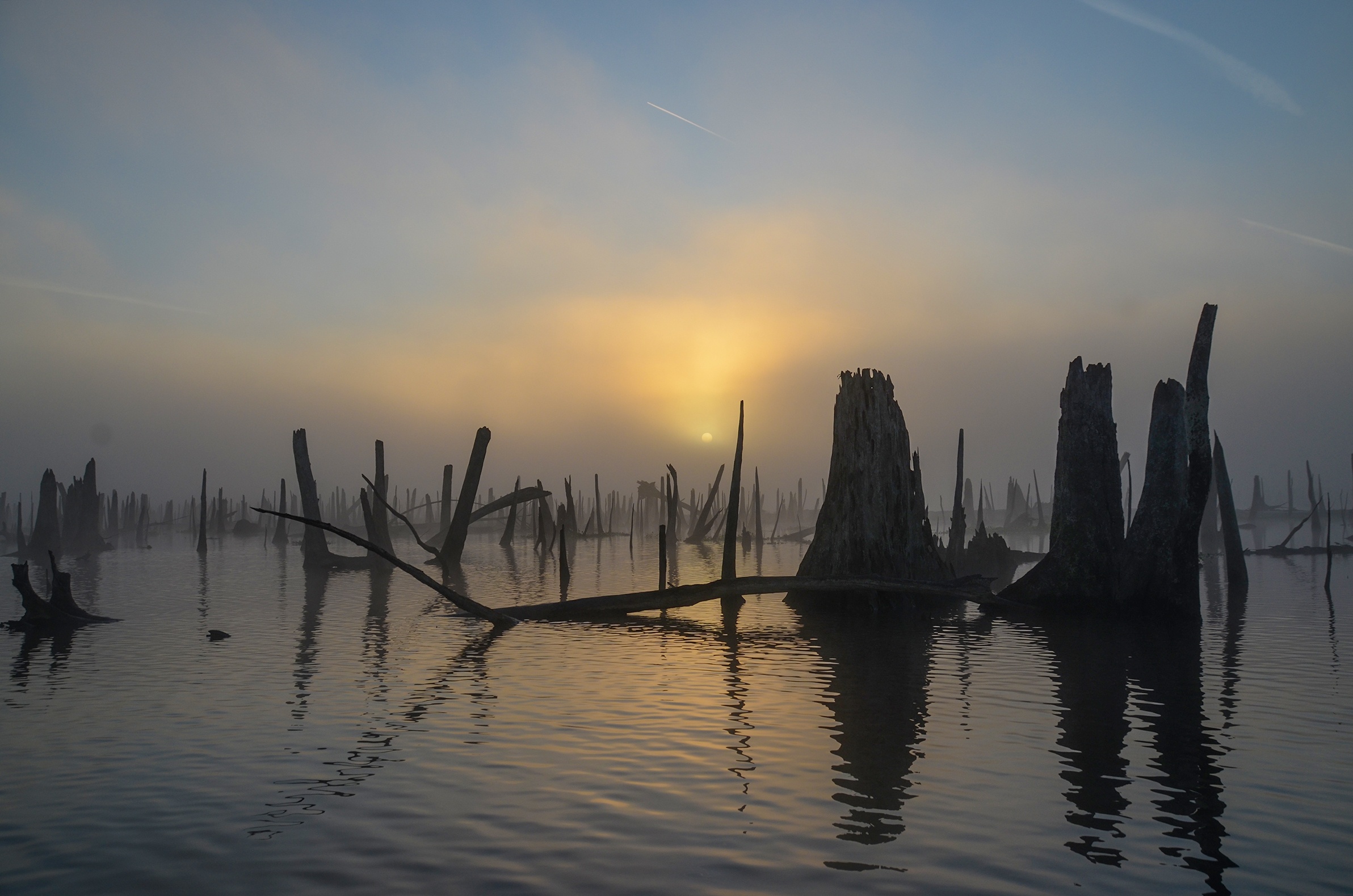
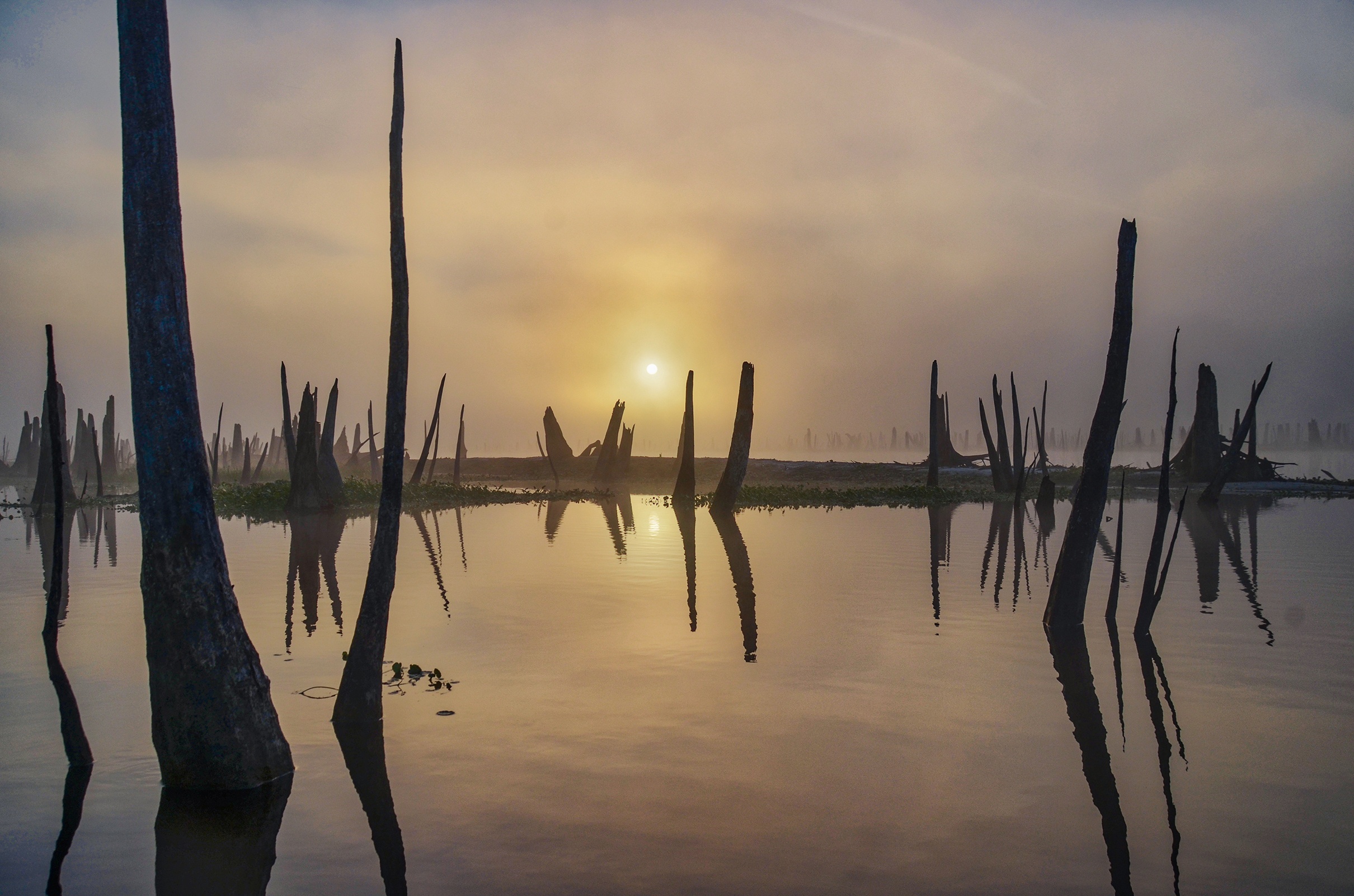
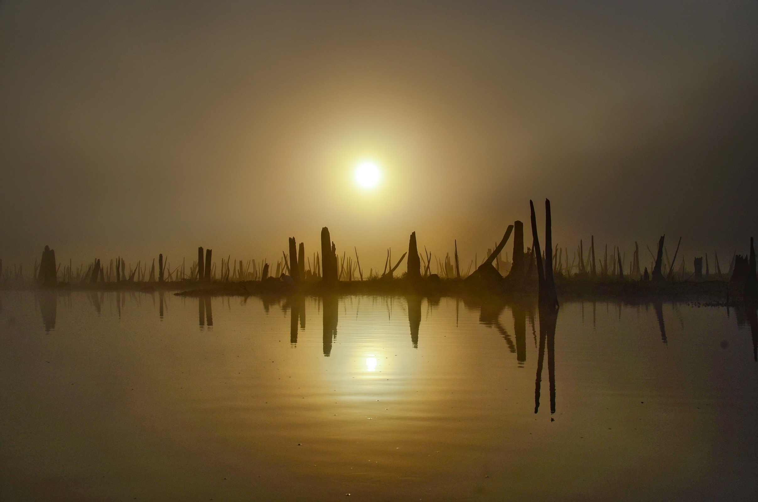
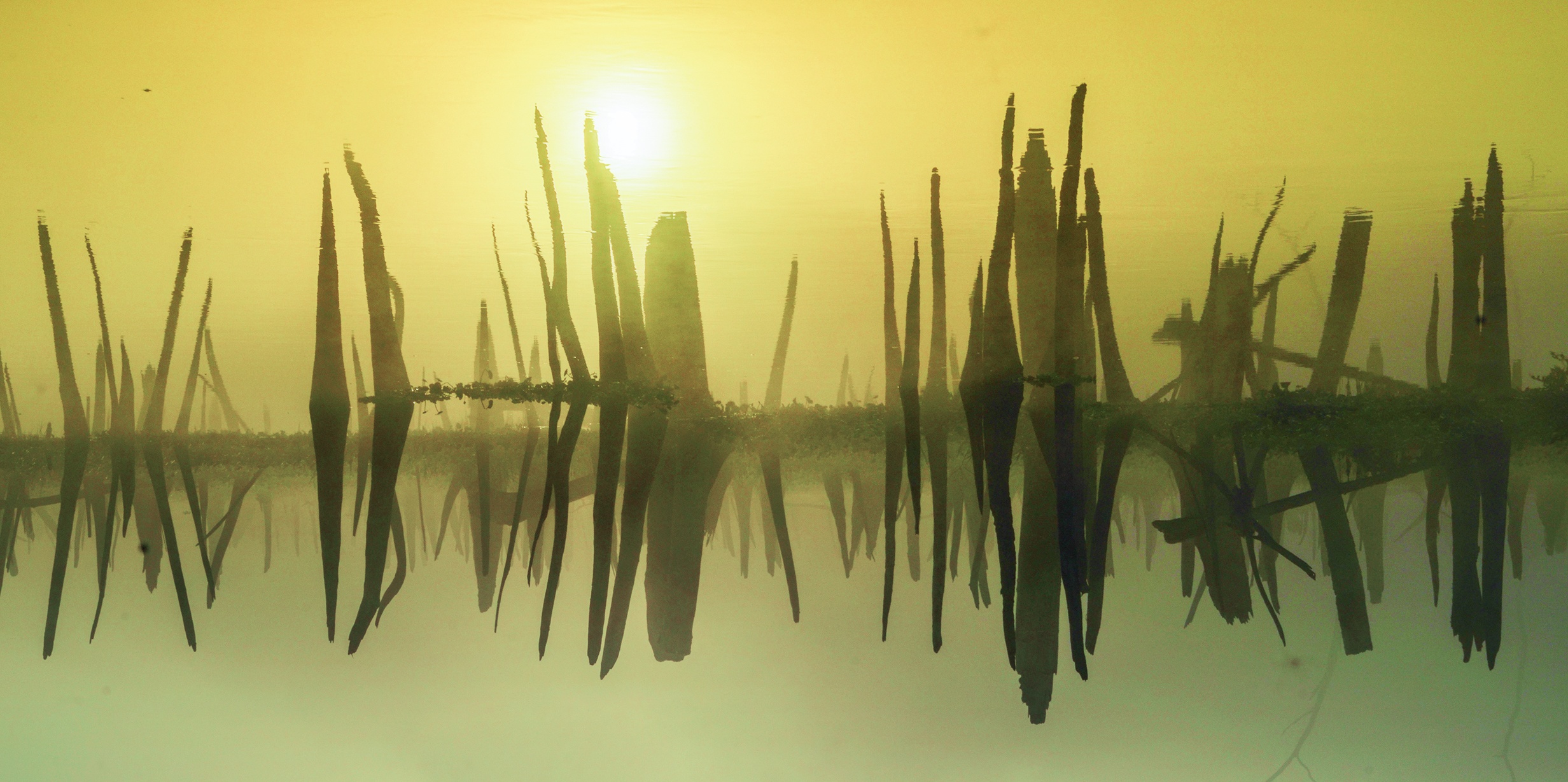
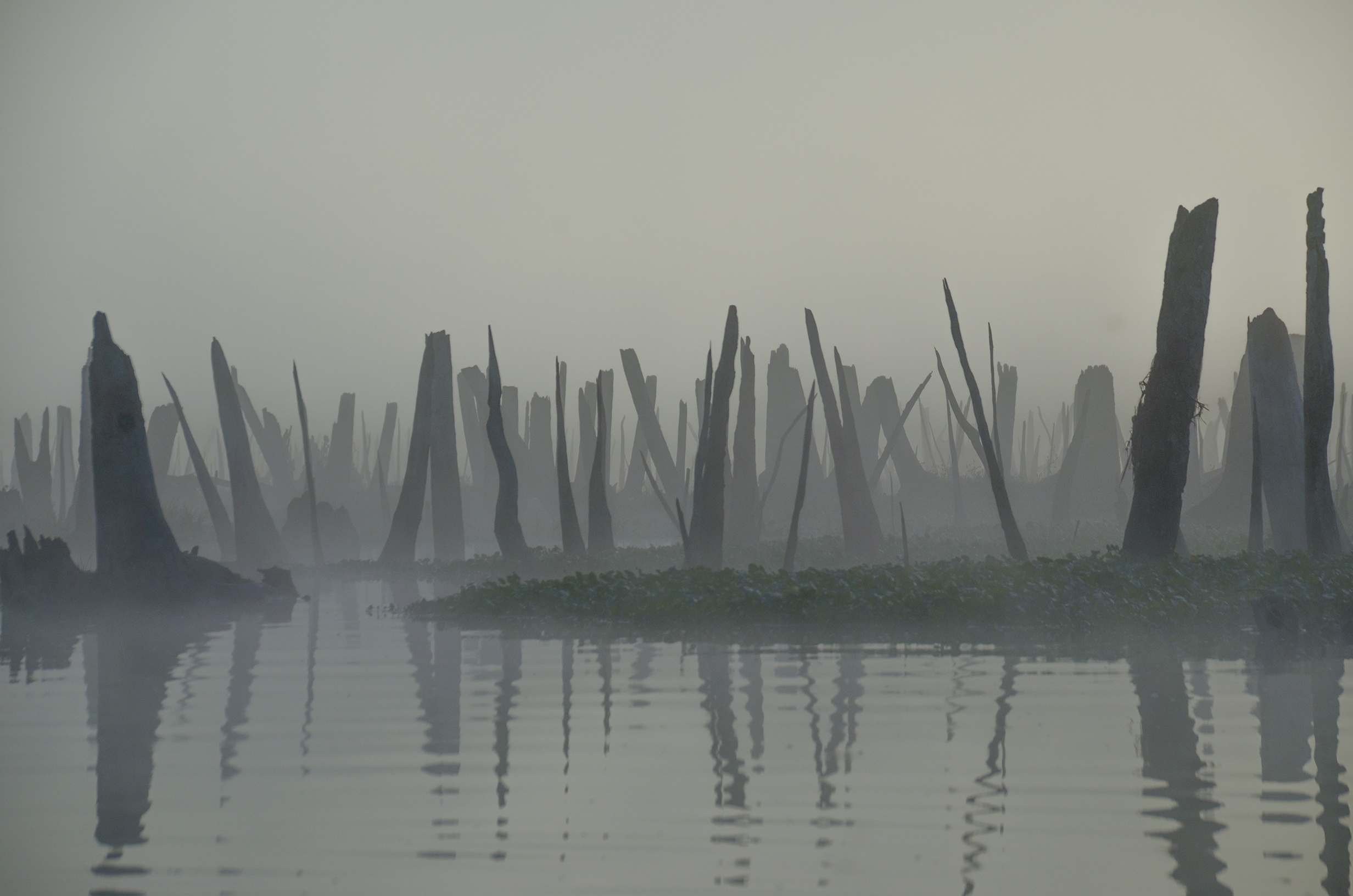
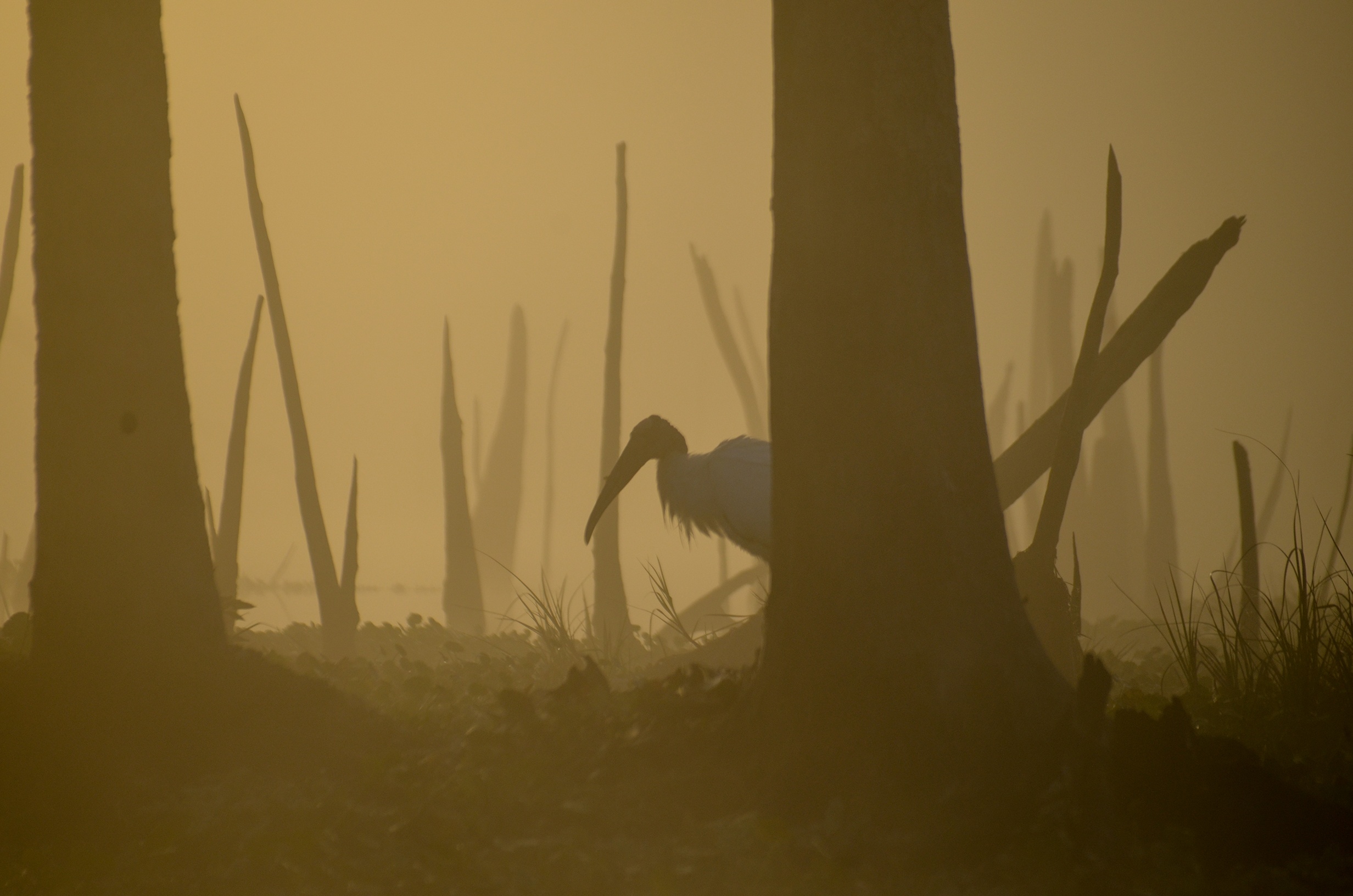
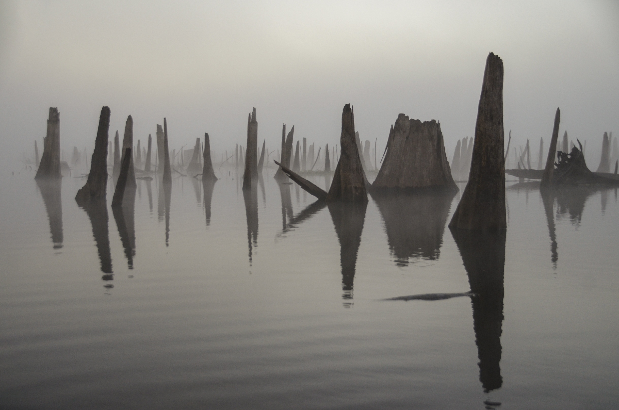
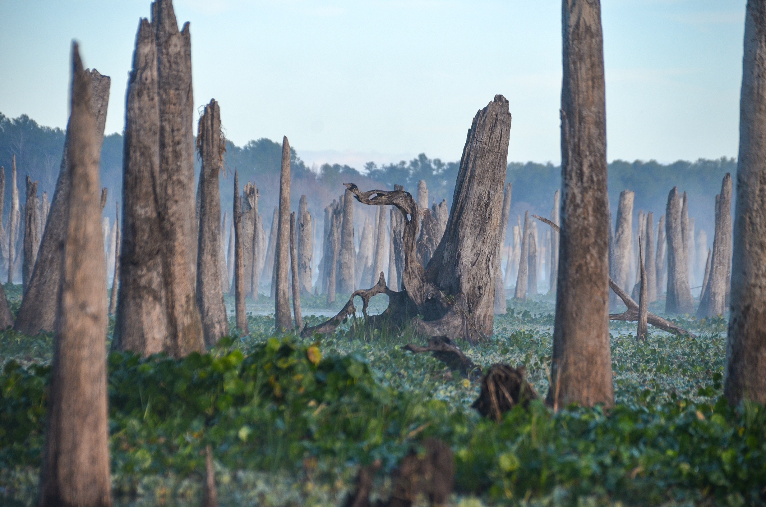
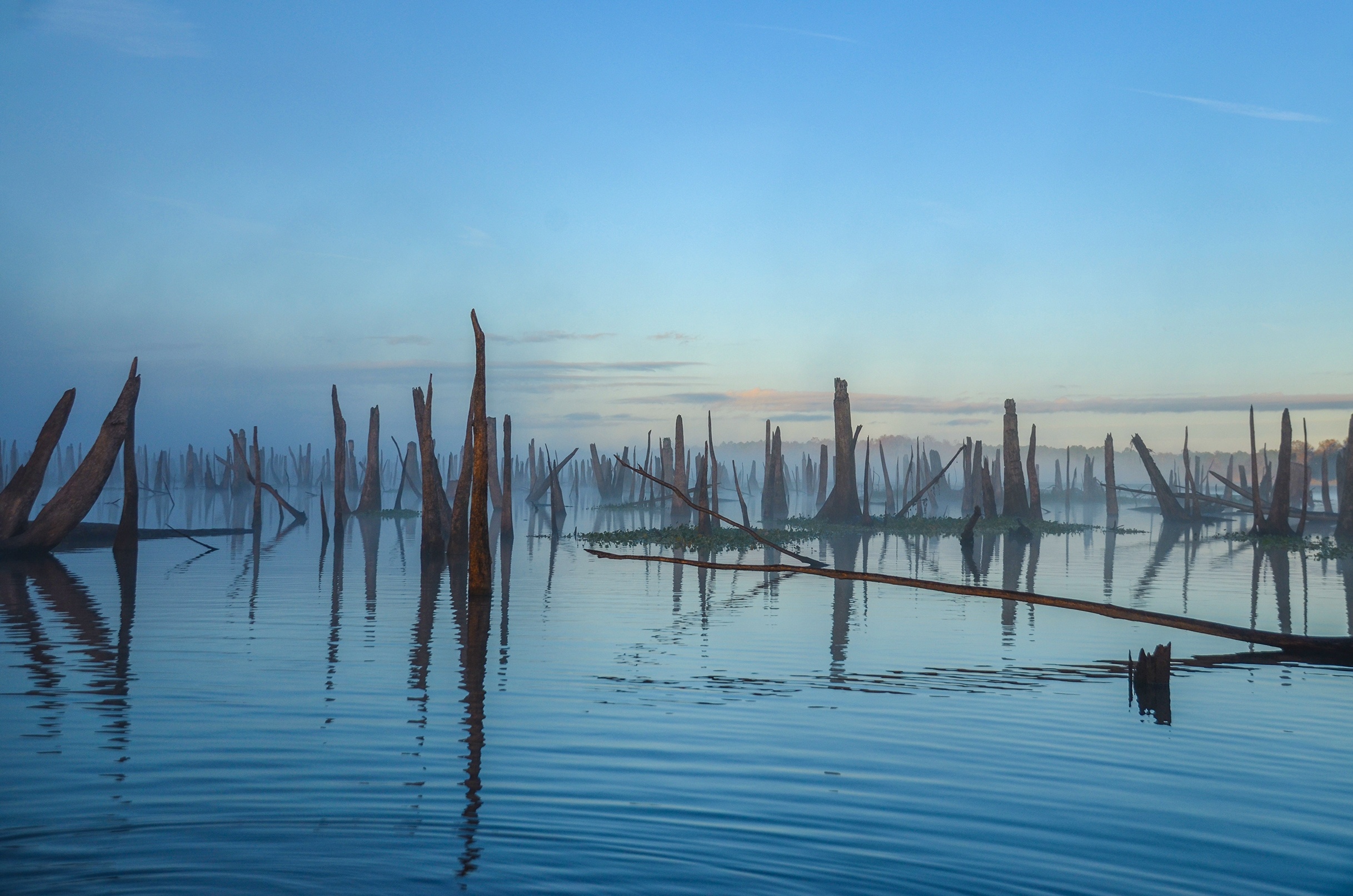
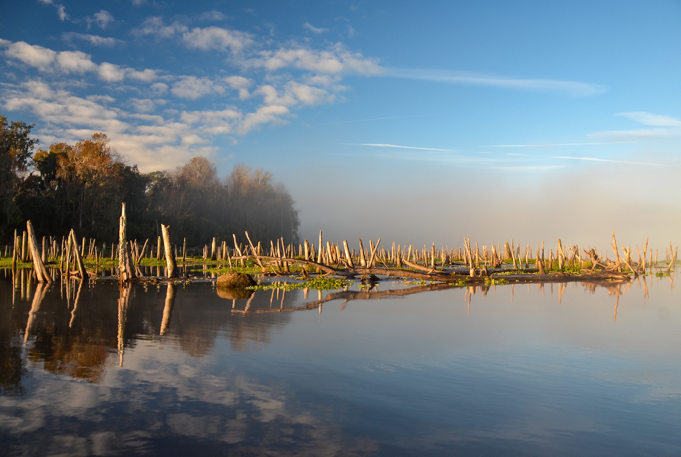
Rodman Reservoir is currently in a drawdown, where the water level goes from an average of 18′ – 20′ down to approximately 11′. The drawdown exposes the original Ocklawaha River channel along with the remains of hundreds of Cypress tree stumps that once lined the banks of the river. Several springs known as ‘hidden’ or ‘lost’ springs’ are also now revealed with the lower water level and today’s paddle takes Florida Paddle Notes to a few of these springs.
A more detailed look into today’s paddle follows below…James
![]()
Ocklawaha River Overview:
The Ocklawaha River is the principal tributary of the St. Johns River. It’s main source is Lake Griffin, part of the Harris chain of lakes in Lake County, Florida. The Ocklawaha River watershed includes parts of the Green Swamp, most of Lake County, and portions of Marion, Alachua and Putnam counties. The key tributary to the Ocklawaha is the Silver River, which originates in Silver Springs, Fl.
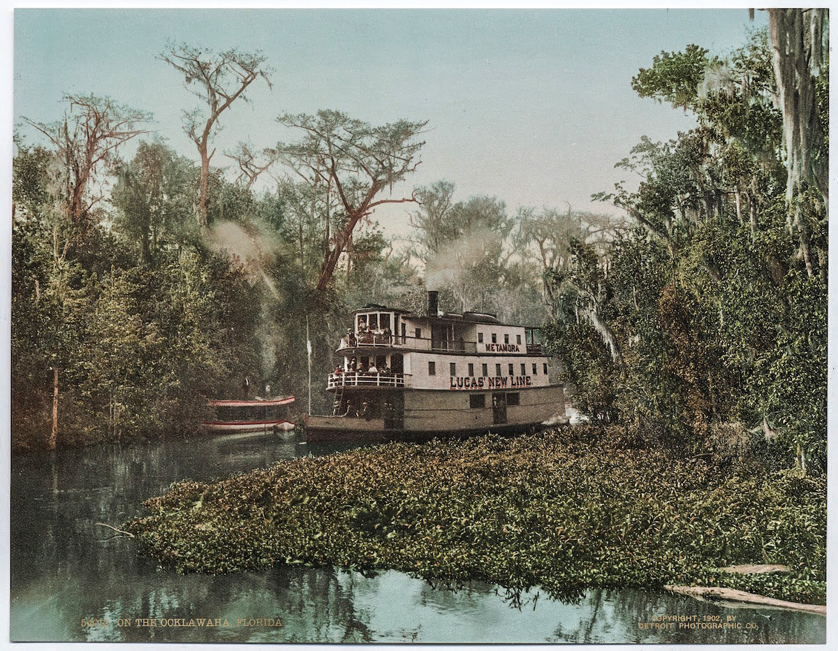
During the 1800’s and early 1900’s, steamboats populated the winding river, bringing folks from Palatka to Silver Springs. These boats were small and narrow in order to navigate the many twisting turns. The Hart Line was the most popular, as was Lucas Line as well. With the arrival of the railroad to Ocala, Florida the steamboat popularity declined. On many of today’s maps several of the landings where the steamboats picked up passengers are still listed.
In 1964, President Lyndon Johnson initiated the construction of the Cross Florida Barge Canal, a 200 mile long, 30′ deep canal that would connect the Atlantic Ocean with the Gulf of Mexico. This environmentally hazardous project was protest vehemently!
Marjorie Harris Carr, past president of Florida Defenders of the Environment played a key role in fighting against the continuing of The Florida Barge Canal and its effect passing through the Ocklawaha River.
In January of 1971 a federal judge issued an injunction that stopped construction of the canal. This was immediately followed by President Richard Nixon officially halting construction due to the environmental damage it would cause. Today the Rodman Dam, now the Kirkpatrick Dam, is a reminder of the fight that continues to this day to have the dam removed. The fight to save the Ocklawaha River has inspired many artists, poets and musicians over the years to include Will McLean, Gamble Rogers, Don Grooms and Whitey Markle.
The 74 mile Ocklawaha River is a must paddle for those interested in ‘Old Florida’. It’s history is rich as are the wildlife and surrounding forests.
Ocklawaha at Rodman Notes:
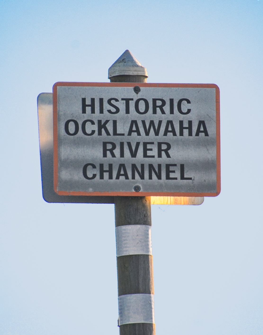
![]() Location: The ‘Lower’ Ocklawaha River is usually considered the section from the Eureka Dam on Hwy 316 East of Ft. McCoy, to its confluence with the St. Johns River. We paddled a section of the area now considered Rodman Reservoir…I refuse to call it Lake Ocklawaha!
Location: The ‘Lower’ Ocklawaha River is usually considered the section from the Eureka Dam on Hwy 316 East of Ft. McCoy, to its confluence with the St. Johns River. We paddled a section of the area now considered Rodman Reservoir…I refuse to call it Lake Ocklawaha!
![]() Launch point: The launch for this paddle is at Kenwood Recreation, however during the drawdown the launch is not in the actual boat ramp launch but at the end of Kenwood Boat Ramp Road.
Launch point: The launch for this paddle is at Kenwood Recreation, however during the drawdown the launch is not in the actual boat ramp launch but at the end of Kenwood Boat Ramp Road.
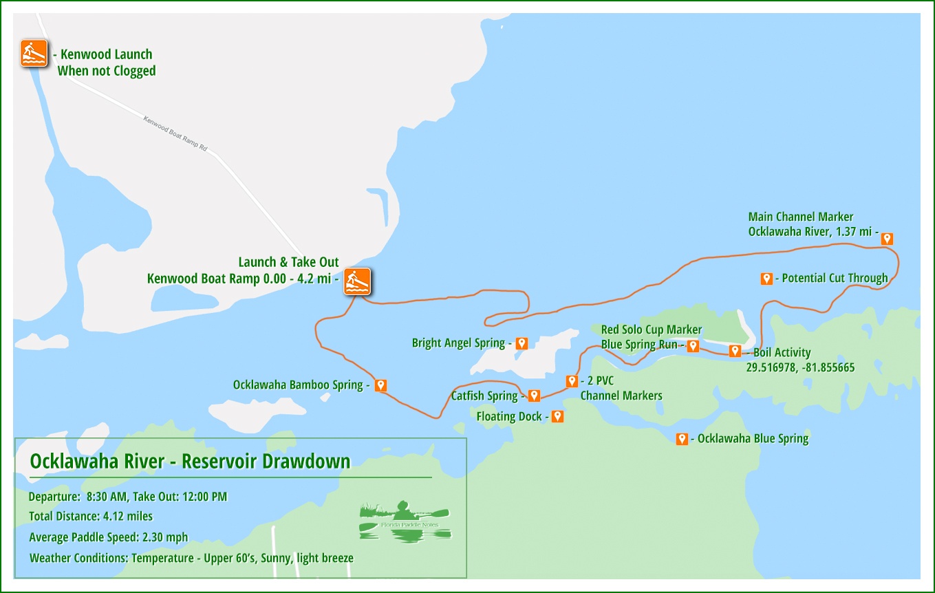
![]() Paddle Distance: We paddled 4.12 miles on the original Ocklawaha channel and also paddled 4.3 miles revisiting Cannon Springs for a total of 8.42 miles.
Paddle Distance: We paddled 4.12 miles on the original Ocklawaha channel and also paddled 4.3 miles revisiting Cannon Springs for a total of 8.42 miles.
![]() Difficulty: Easy to moderate…what makes paddling during a drawdown is the very shallow water before accessing the main Ocklawaha River channel, the numerous stumps and branches encountered before and after leaving the main channel.
Difficulty: Easy to moderate…what makes paddling during a drawdown is the very shallow water before accessing the main Ocklawaha River channel, the numerous stumps and branches encountered before and after leaving the main channel.
 Average Paddle Speed: 2.25 mph.
![]() Width and Depth: The width is deceiving due to the drawdown. There is a ‘sandbar’ barrier between the launch that has to be maneuvered before getting on or off the original Ocklawaha channel. Depth can go from 4″ to around 7′ once in the main channel. The depth is also deeper in the waterway, not considered the historic channel.
Width and Depth: The width is deceiving due to the drawdown. There is a ‘sandbar’ barrier between the launch that has to be maneuvered before getting on or off the original Ocklawaha channel. Depth can go from 4″ to around 7′ once in the main channel. The depth is also deeper in the waterway, not considered the historic channel.
![]() Current – Tidal: The current was slow in the reservoir area but definitely 3 mph on our paddle from Payne’s Landing to Cannon Spring.
Current – Tidal: The current was slow in the reservoir area but definitely 3 mph on our paddle from Payne’s Landing to Cannon Spring.
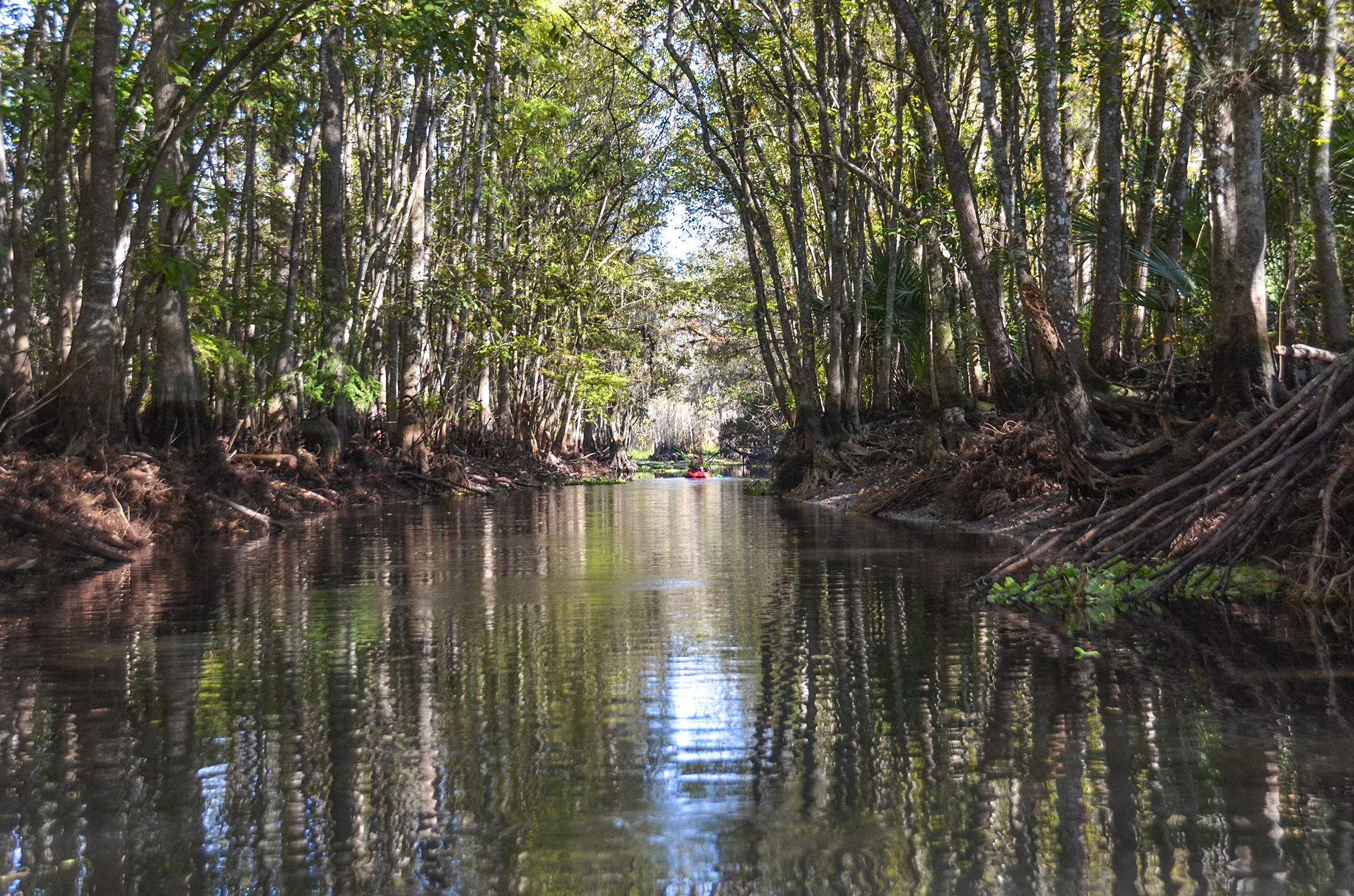
![]() Side Paddles: Cannon Spring is a must paddle during this drawdown. The canal entrance to the spring is located 2.1 miles south of Payne’s Landing and it is a 1/4 mile paddle to the spring.
Side Paddles: Cannon Spring is a must paddle during this drawdown. The canal entrance to the spring is located 2.1 miles south of Payne’s Landing and it is a 1/4 mile paddle to the spring.
![]() Rest Areas: There are several places to pull onto shore on this paddle, especially heading toward Cannon Spring…a nice landing is a Tobacco Patch Landing.
Rest Areas: There are several places to pull onto shore on this paddle, especially heading toward Cannon Spring…a nice landing is a Tobacco Patch Landing.
Ocklawaha River at Rodman Reservoir Paddle Map…
Kenwood Park Launch:
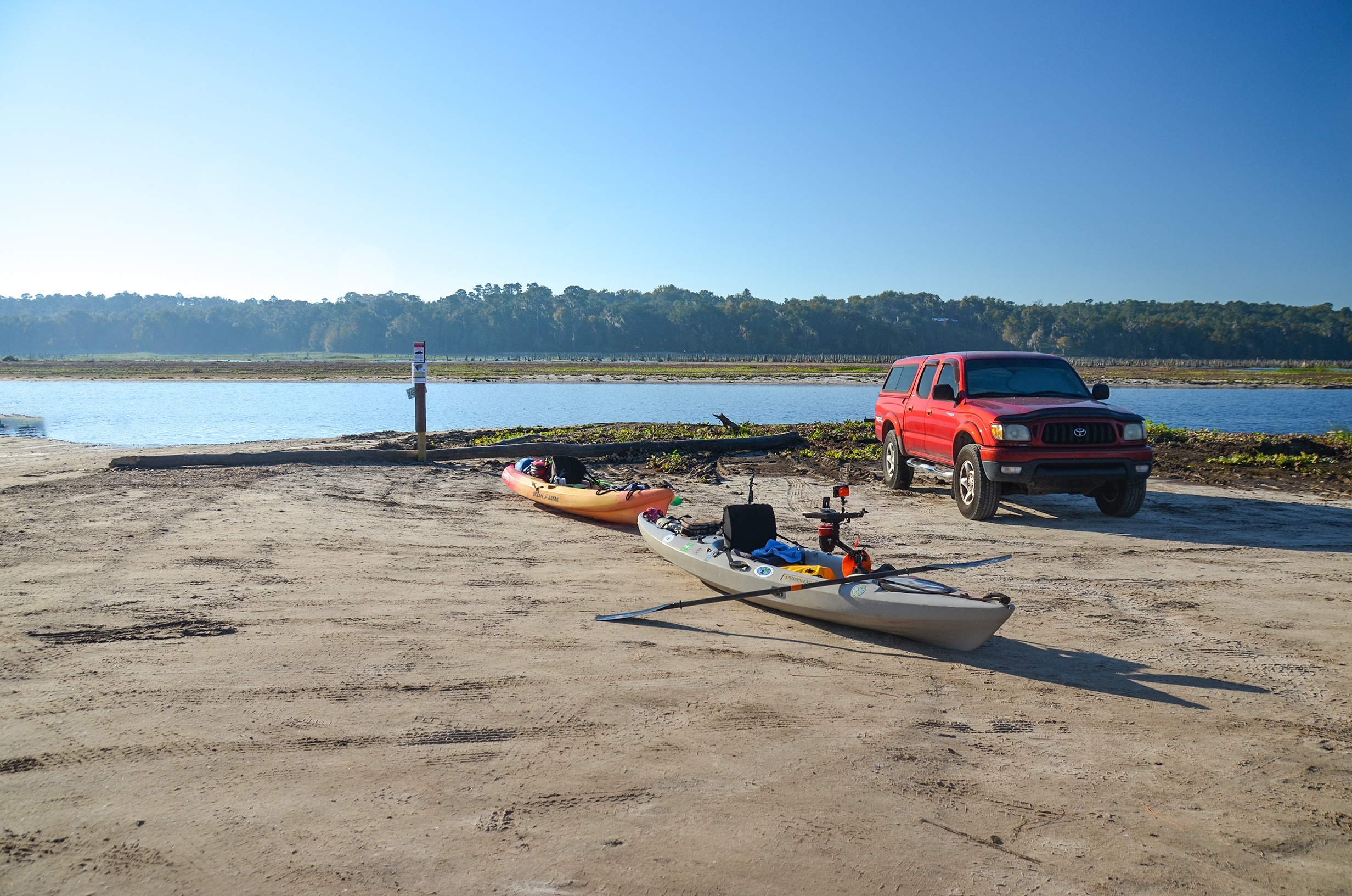
Kenwood Park has a nice launch when there is not a drawdown. Since we are in a drawdown, you need to bypass the park launch, which is often clogged, and travel South on Kenwood Boat Ramp Road leading to the northern shoreline of Rodman Reservoir. There are Port-a-Potties and ample parking with a nice ramp.
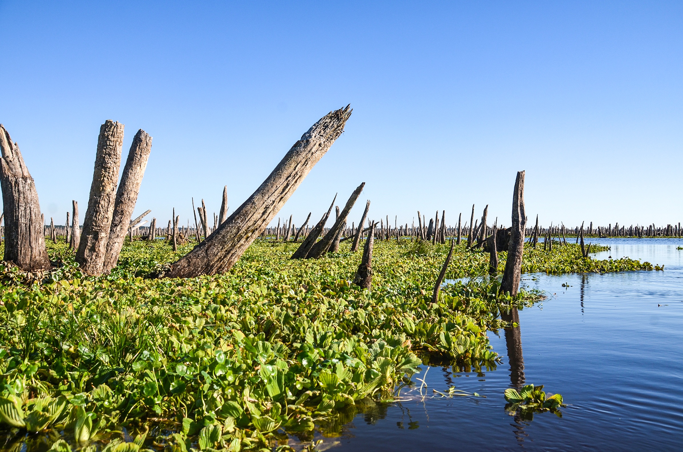
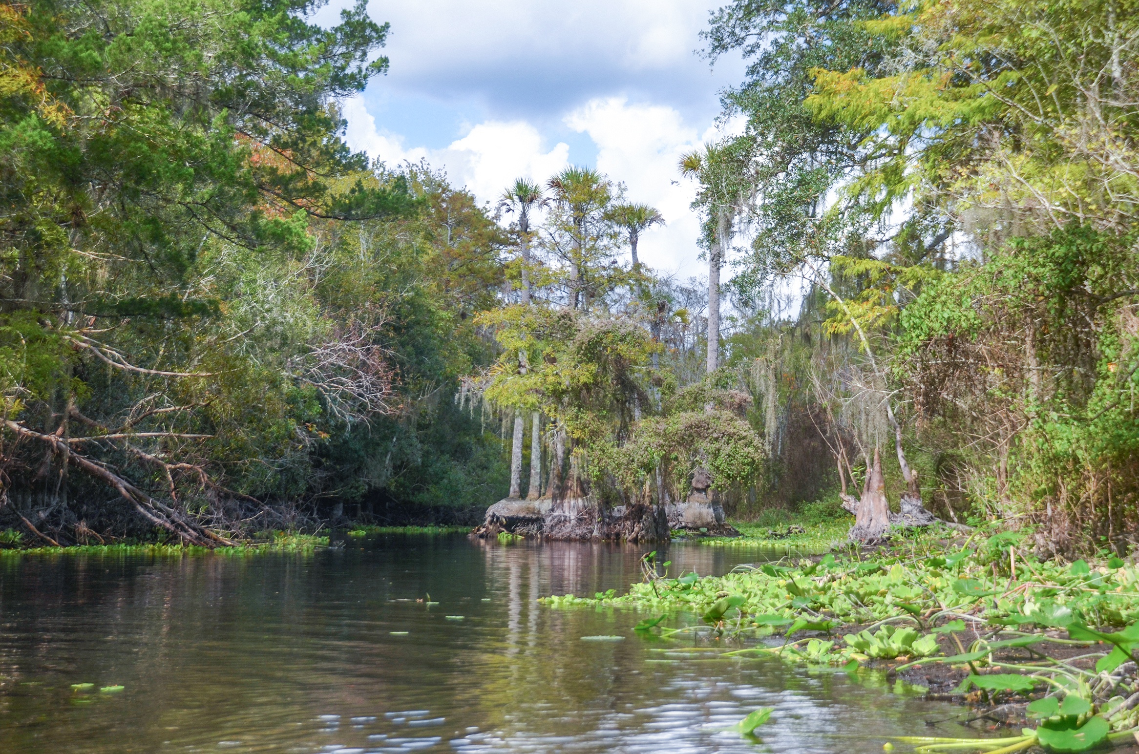
From this launch site there is an interesting visual awaiting. The original Ocklawaha River channel is out there, among hundreds of dead cypress trees! It is moving to say the least.
First option is to go West and cross the ‘sandbar’ against the current, to get into the Ocklawaha channel and paddle with the current on the Ocklawaha, or paddle East with the current, 1.37 miles, reaching the Historic original channel of the Ocklawaha River. This was the route we chose. When you reach the river there is a tall marker designating the channel and from here the adventure begins!

![]() Maneuvering the ‘Sandbars’…once launched there are sandbars present and you will need to maneuver these to eventually get to the old Ocklawaha channel. Looking at the paddle map above, you will see we paddled about a 1/4 mile to our left ( East ) and crossed over. We then paddled on the boating channel, still heading East until we reached the main river. On our way back, after leaving the river, we paddled West just a bit and crossed the sandbar through a very shallow and narrow channel right near the launch.
Maneuvering the ‘Sandbars’…once launched there are sandbars present and you will need to maneuver these to eventually get to the old Ocklawaha channel. Looking at the paddle map above, you will see we paddled about a 1/4 mile to our left ( East ) and crossed over. We then paddled on the boating channel, still heading East until we reached the main river. On our way back, after leaving the river, we paddled West just a bit and crossed the sandbar through a very shallow and narrow channel right near the launch.
The Ocklawaha Drawdown:
Unless you have paddled this section before, during a drawdown, some pre-planning is necessary to maneuver the boat lane and cross over into the river channel. As mentioned above we headed east in the boating channel and entered the Ocklawaha channel 1.37 miles from the launch. It started out a cool, clear day, with a deep blue sky and we were on the river!
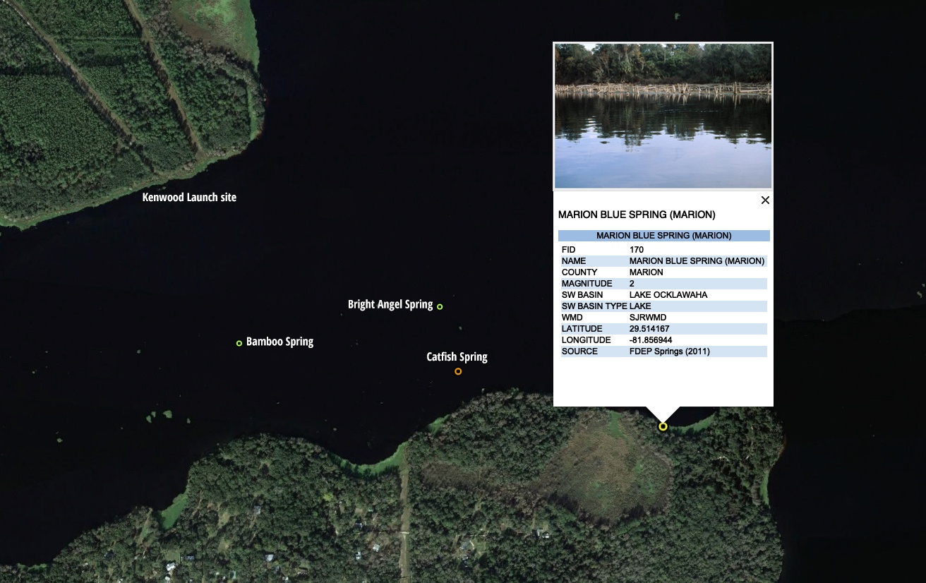
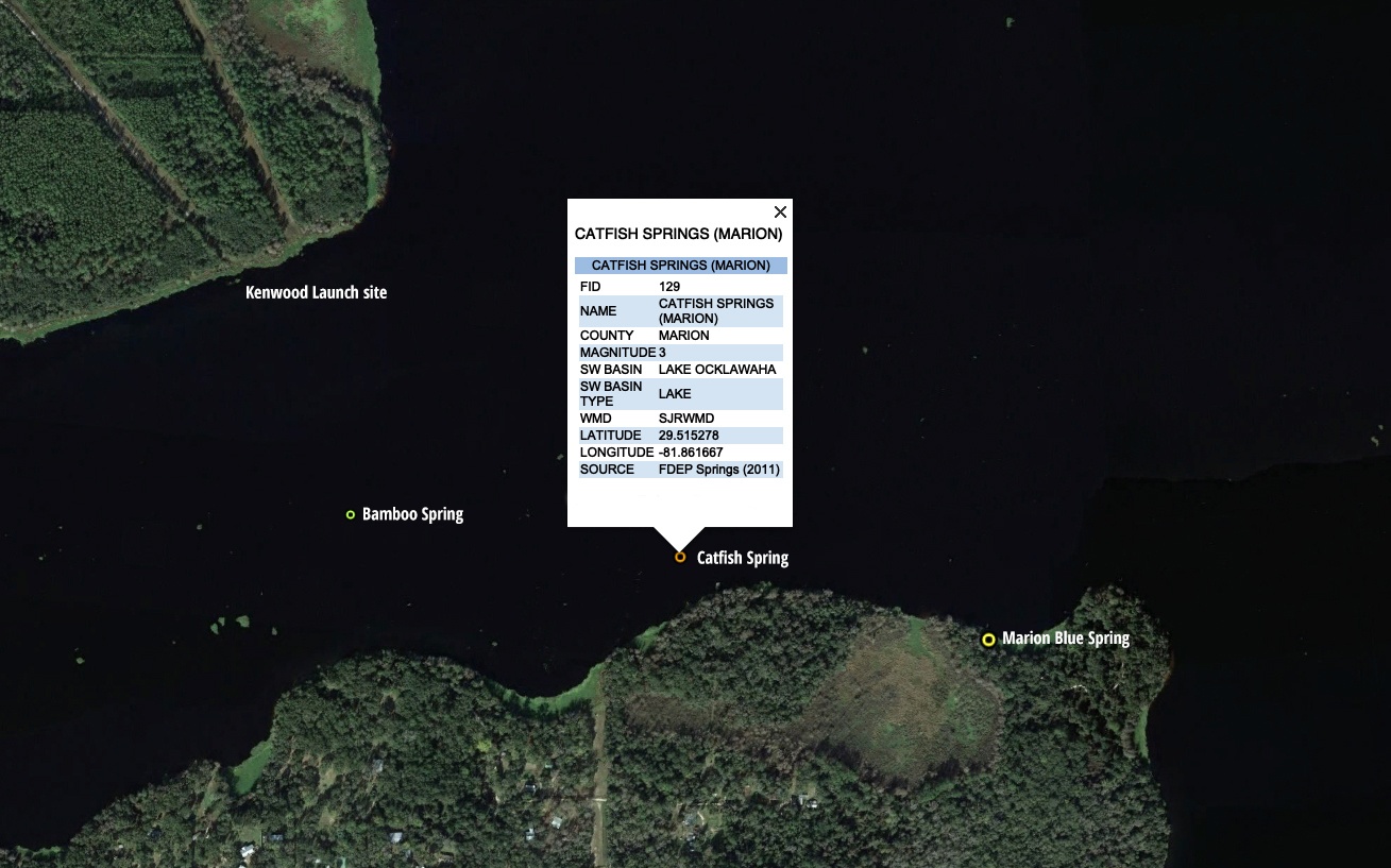
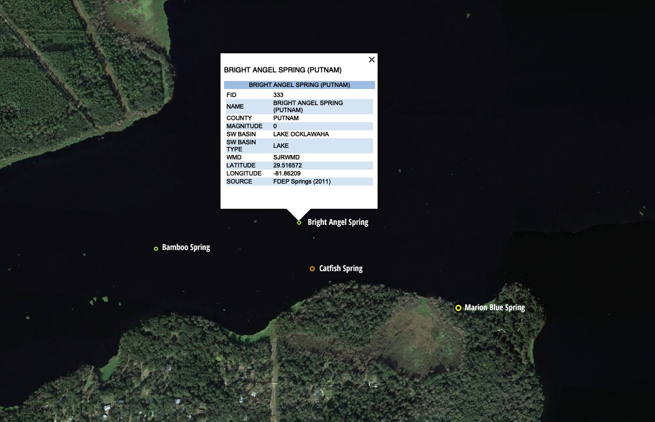
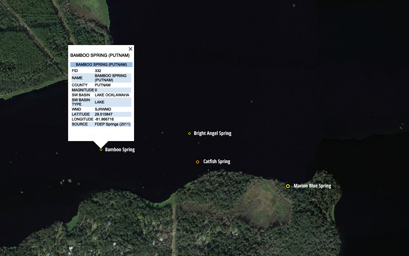
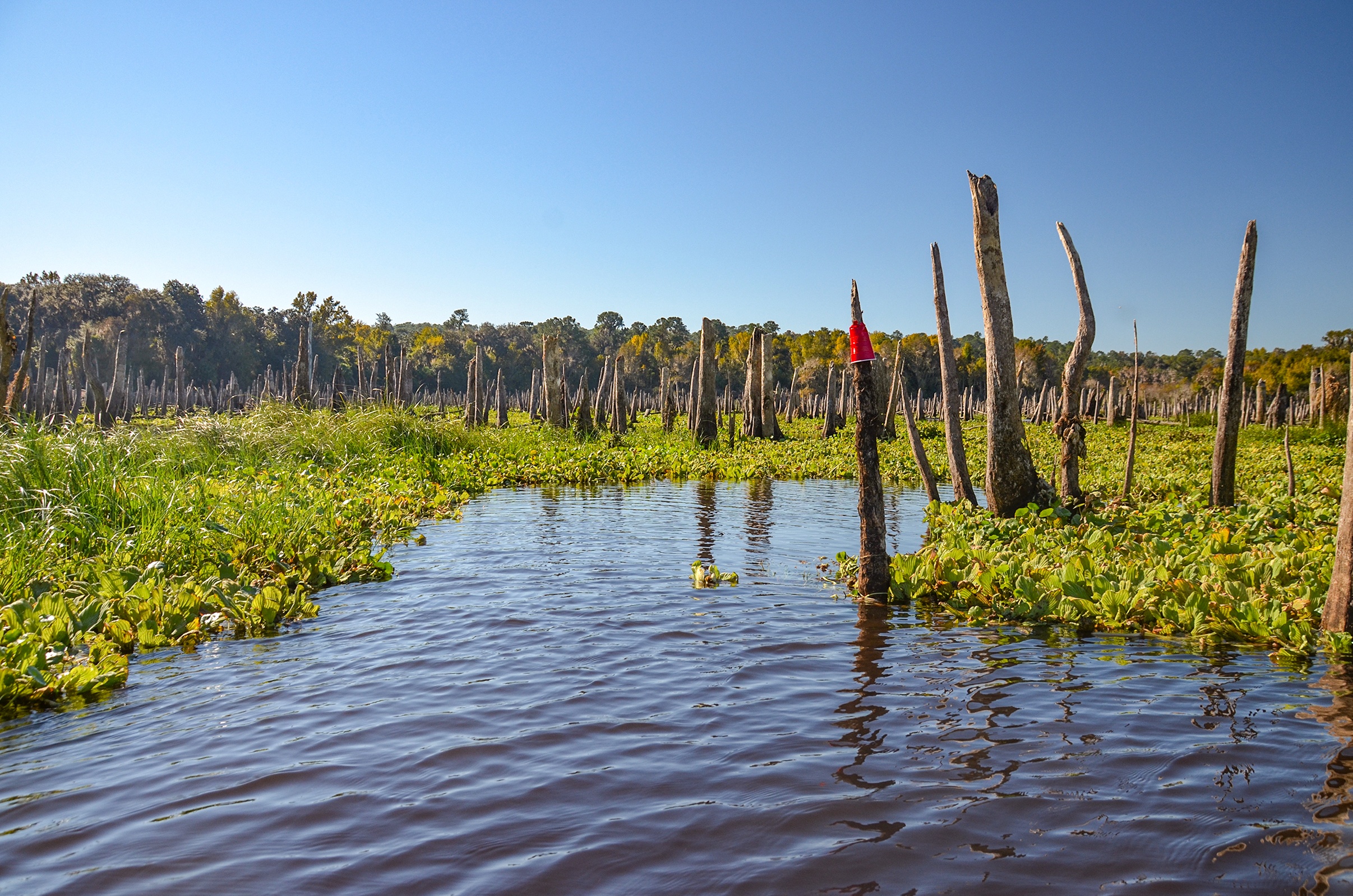
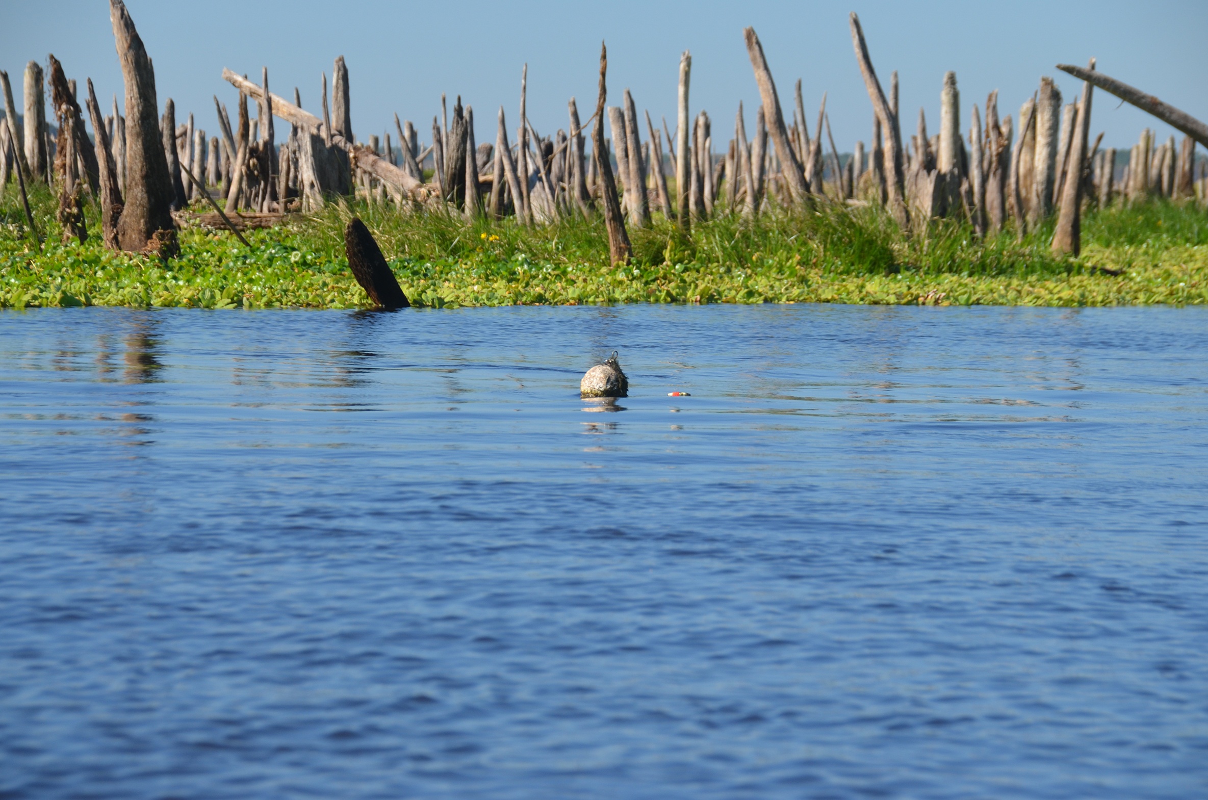
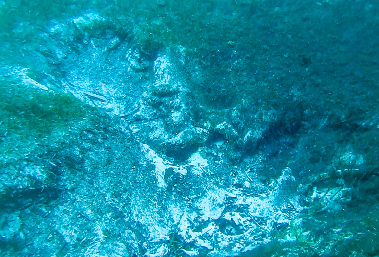
In the section that we paddled, we are in the vicinity of four springs, Marion Blue Spring, Catfish Spring, Bright Angel Spring and Bamboo Spring…( hover over to see information and location ). From accounts of others, Marion Blue Spring is still 5′ below the surface even during drawdown and today, access was quite clogged. There was a marker, a Red Solo Cup stuck on a cypress stump, that marked the location of the run to. We did notice several spots of activity along the river as we paddled toward Catfish Spring, which is marked with a crab crap float. Bright Angel Spring and Bamboo Spring eluded us despite out paddle path going right over Bamboo Spring. When trying to locate the springs, we used the far southern shore is a guide. There is a wide utility easement up the hill, that allowed be to coordinate my position in relation to the springs which I had mapped out prior to paddling.
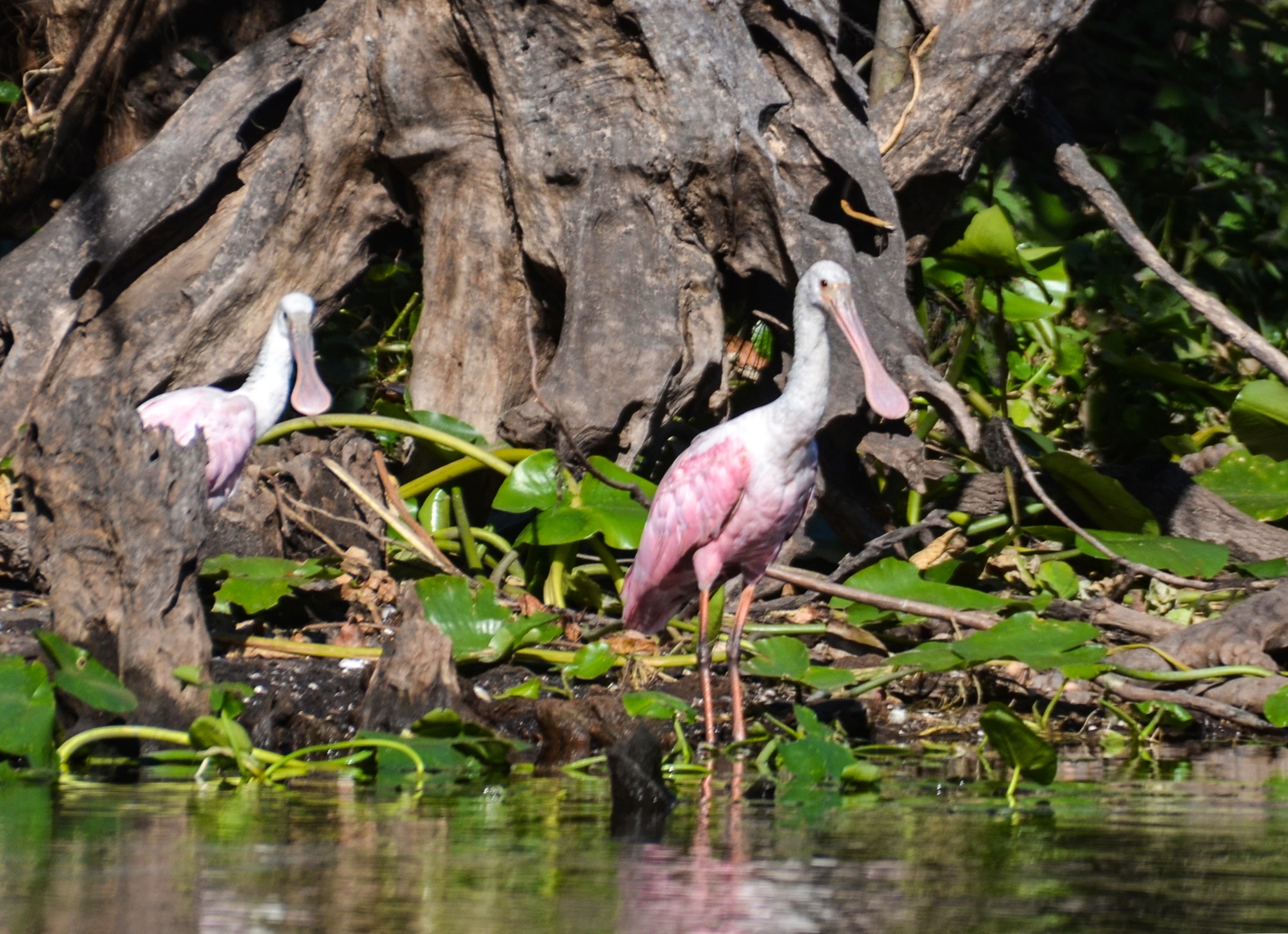
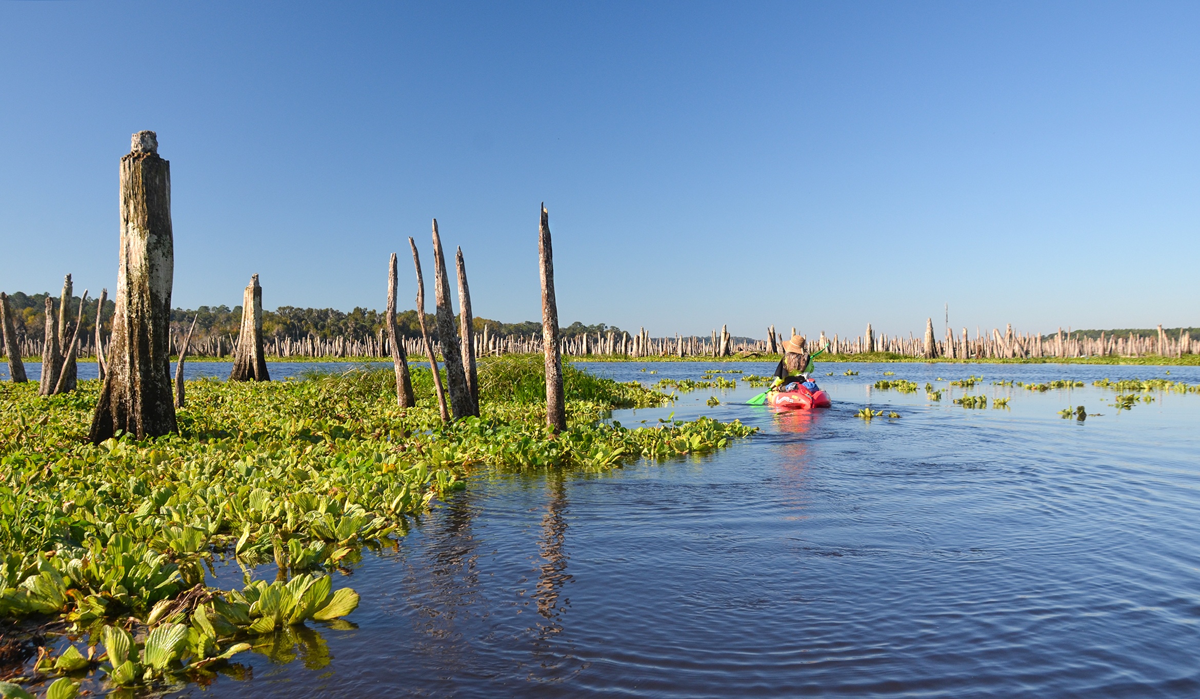
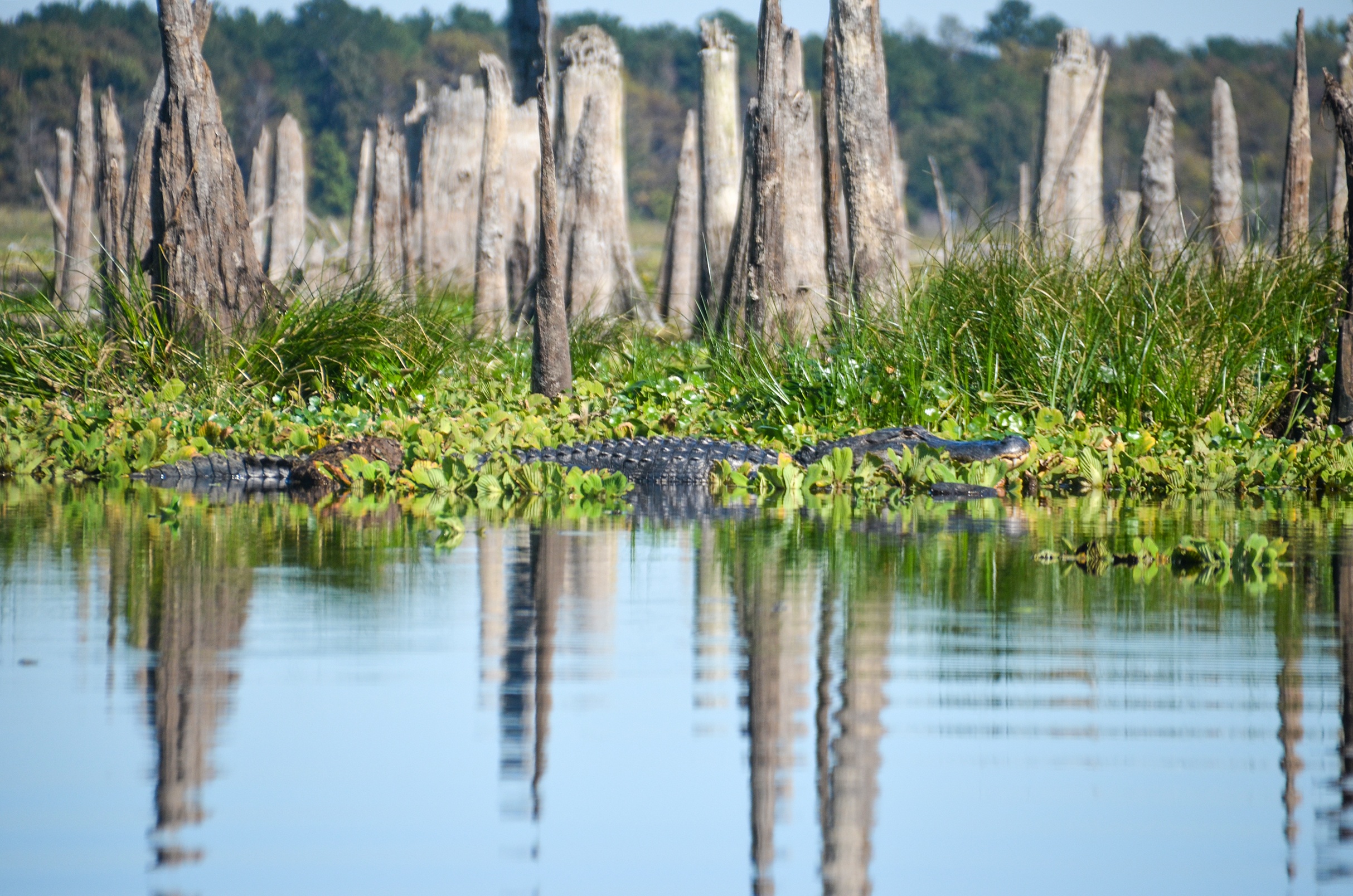
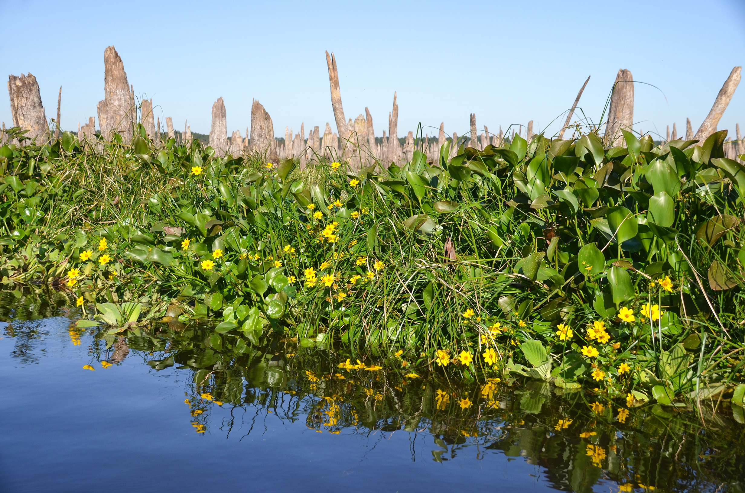
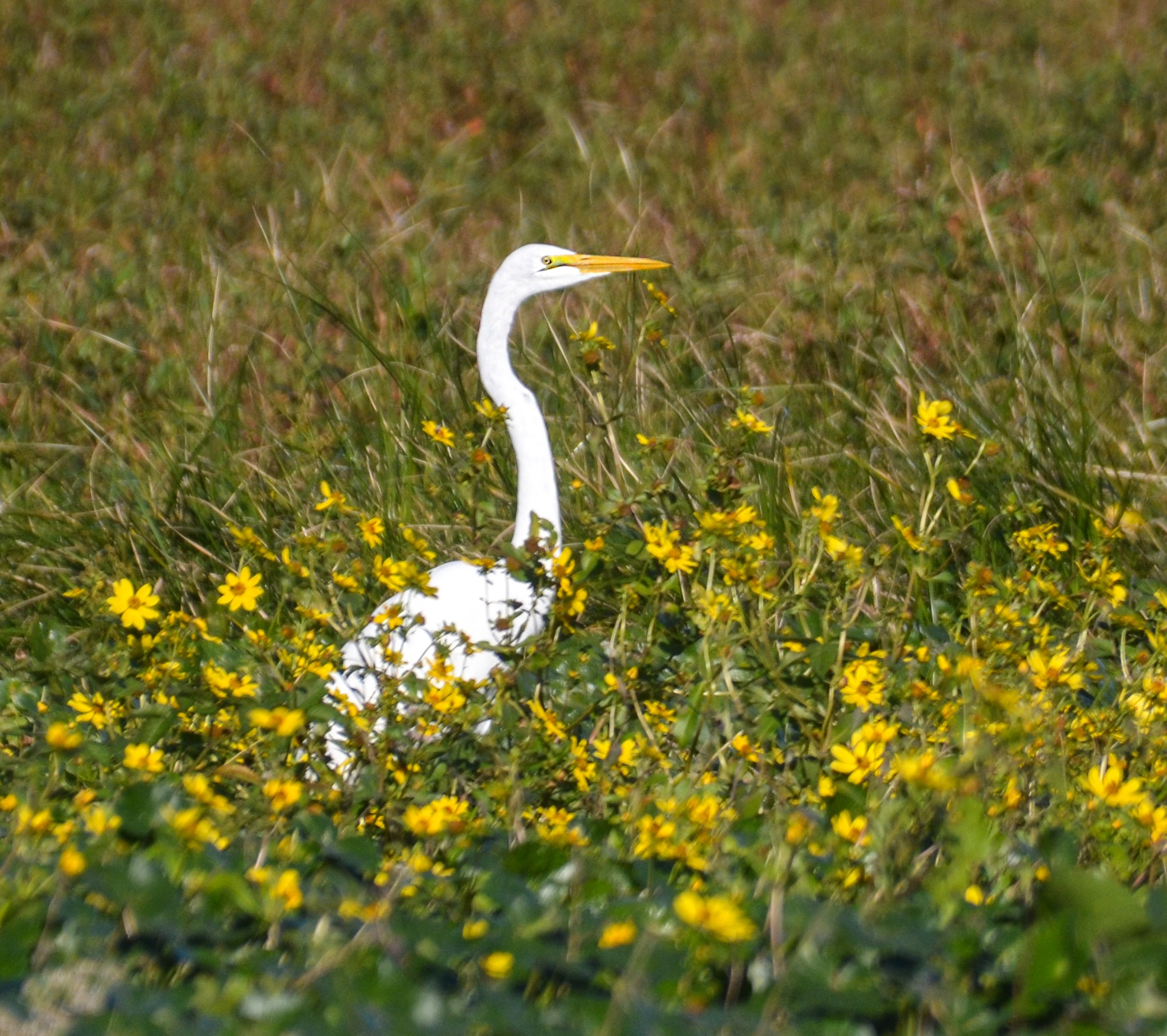
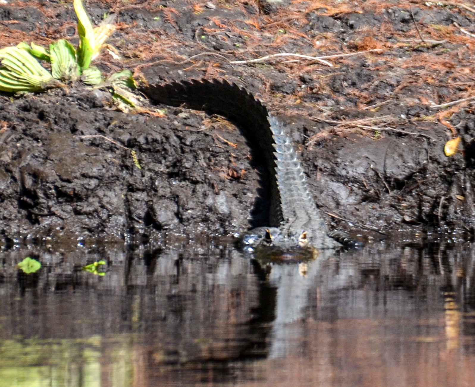
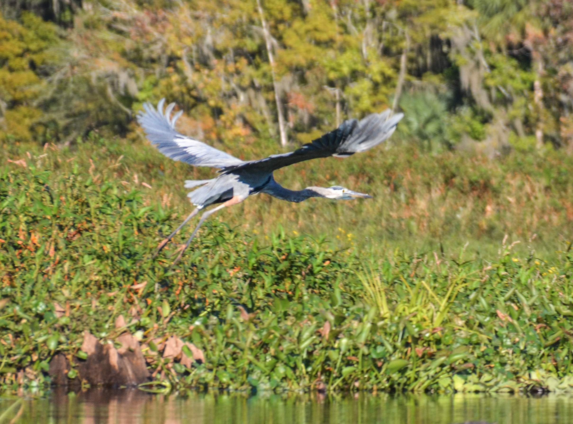
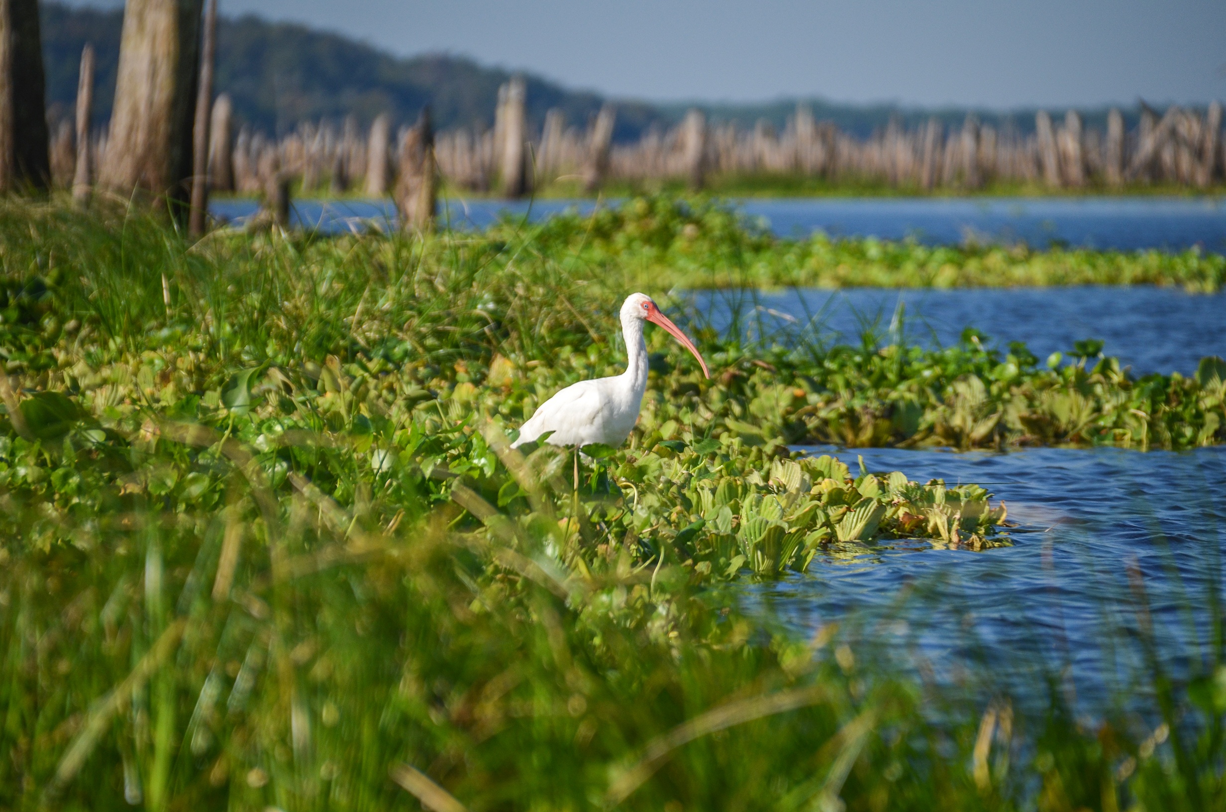
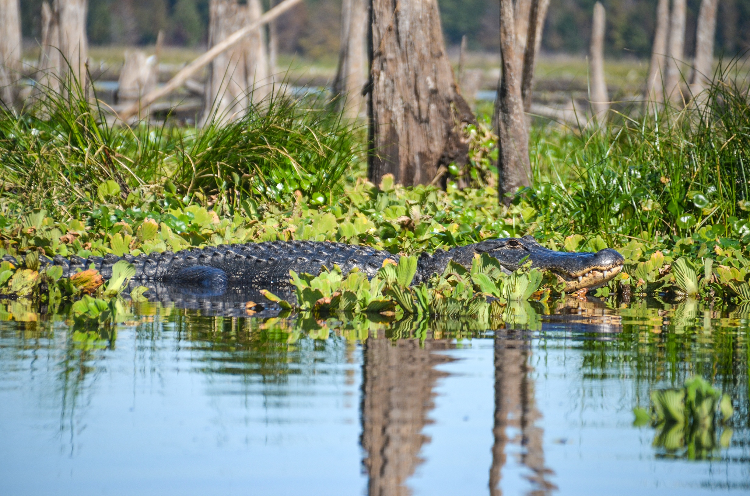
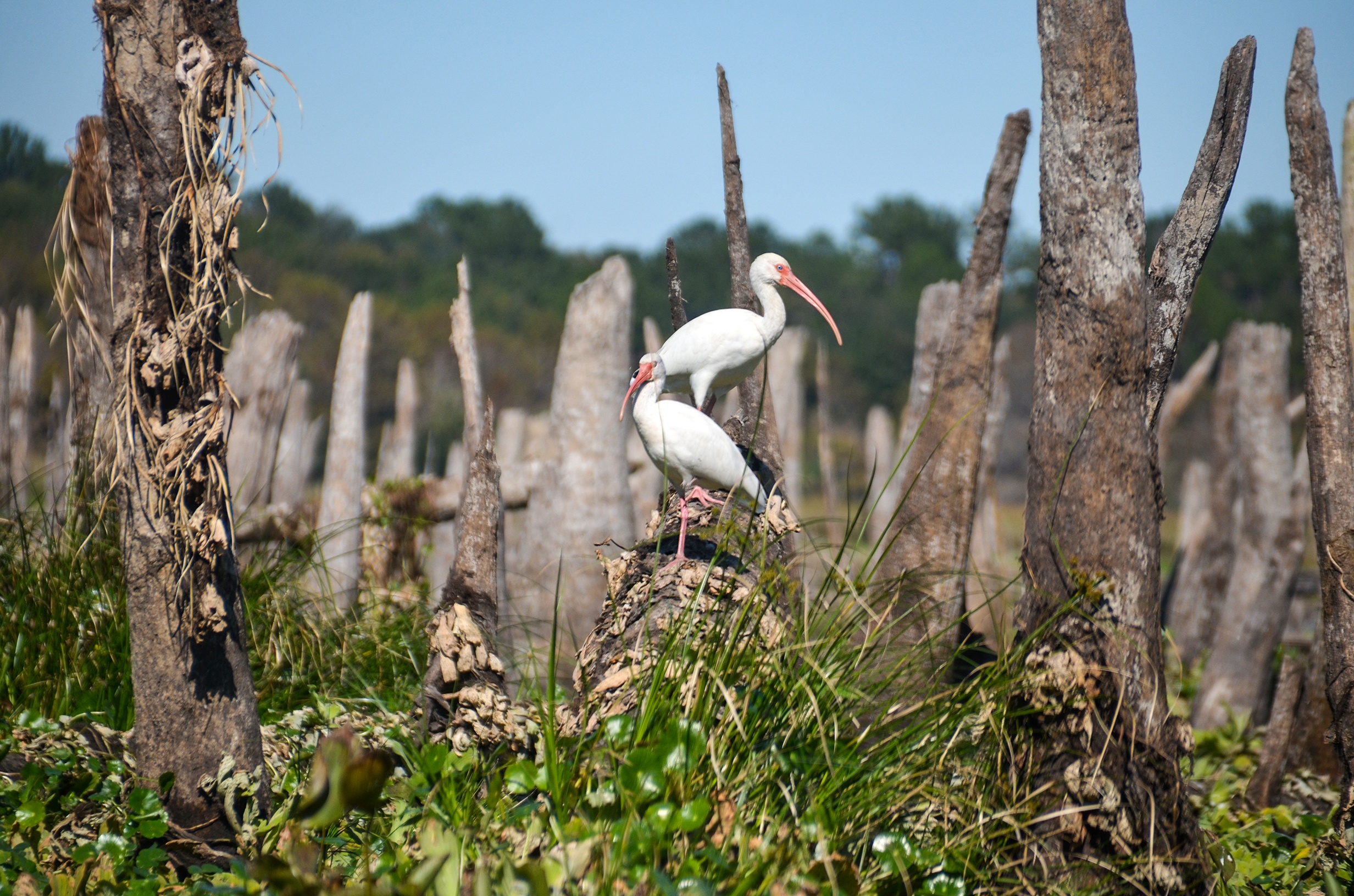
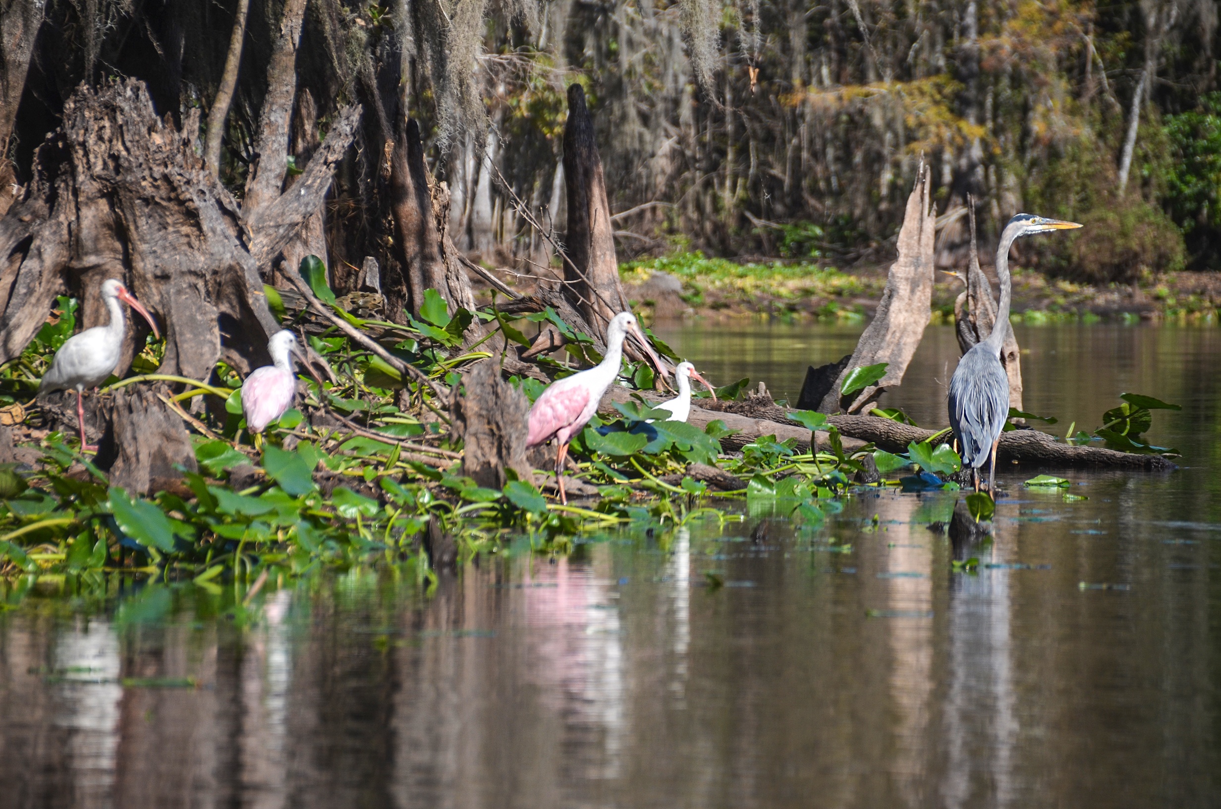
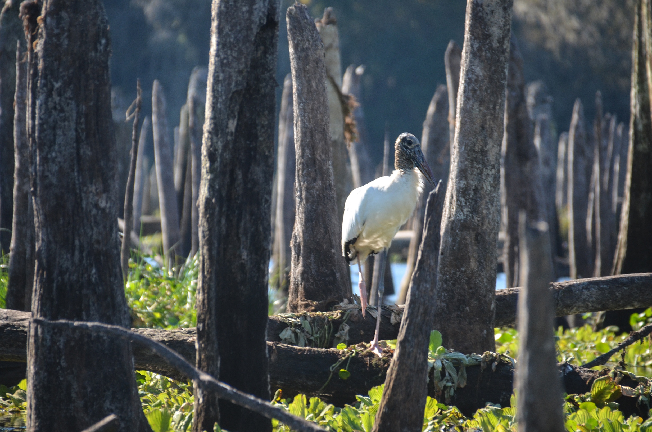
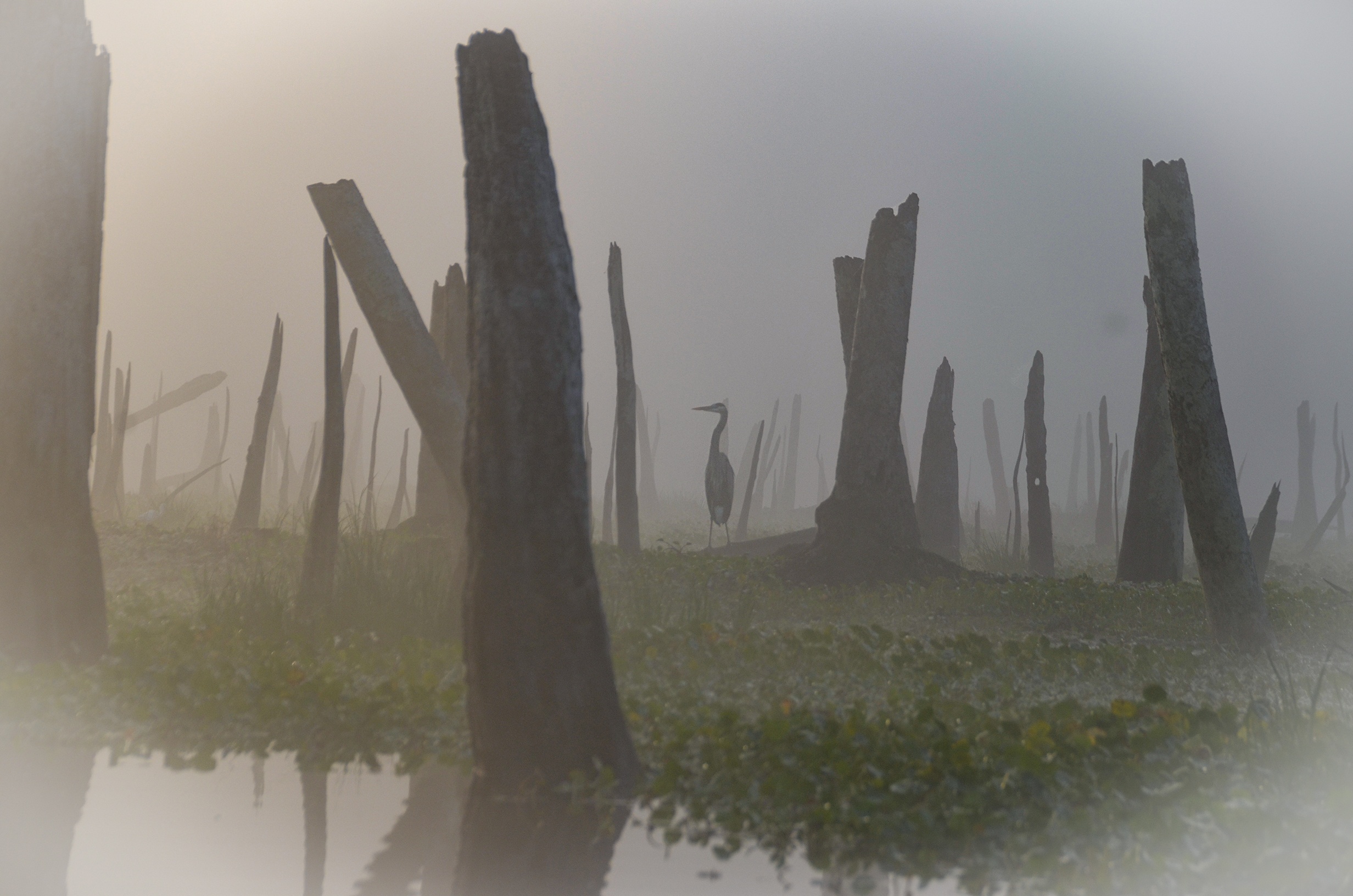
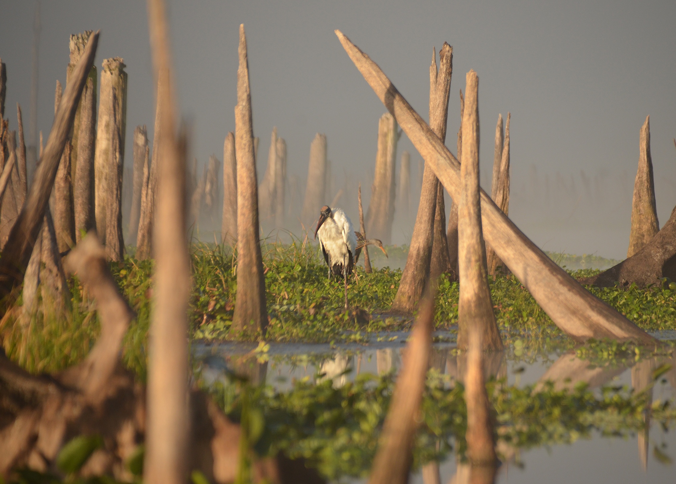
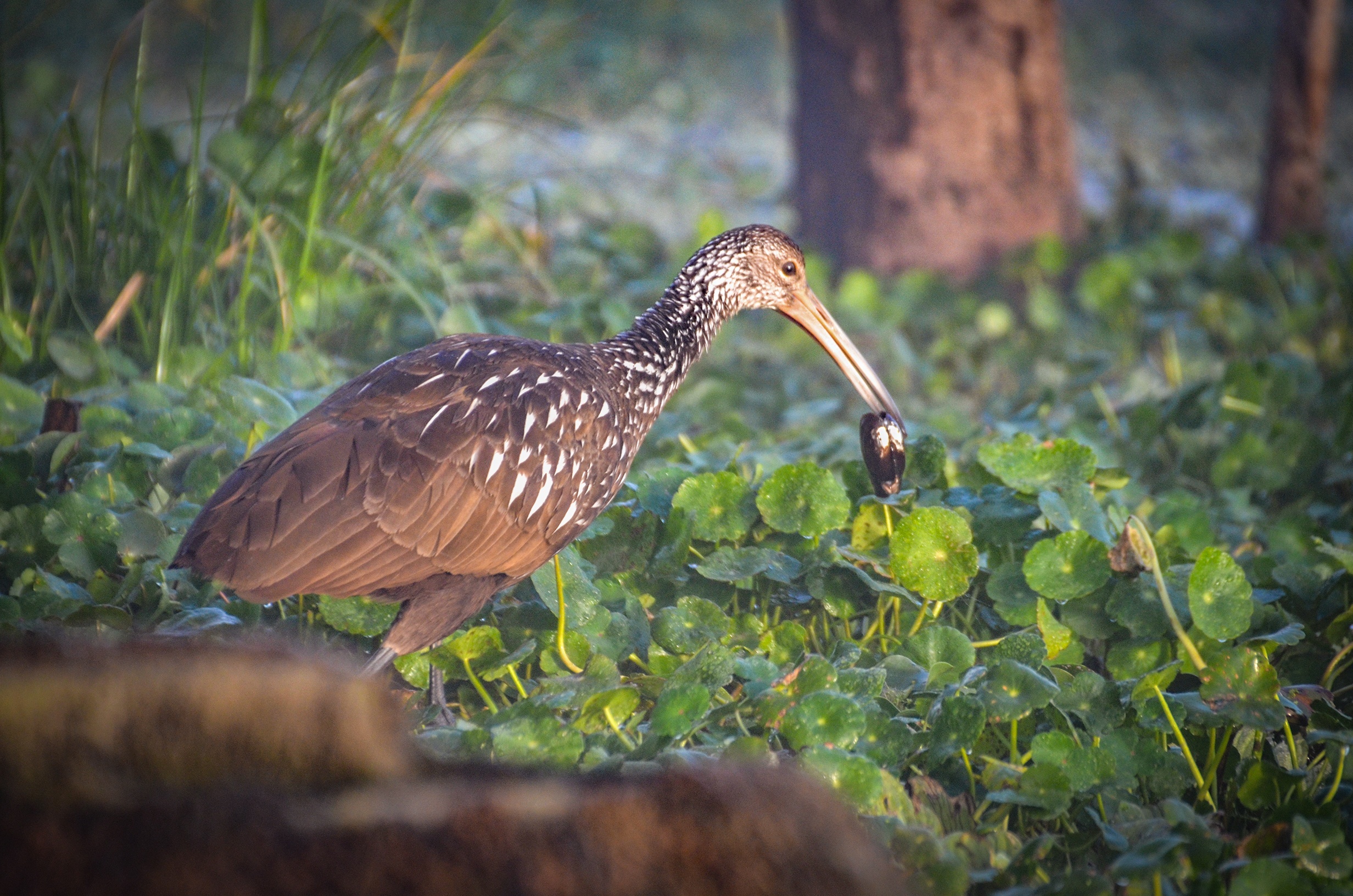
Paddling this section of the Ocklawaha River gives a sense of amazement, awe, sadness and anger. Such poor judgement or perhaps a lack of awareness in destroying such an ecosystem. Paddling among the hundreds of dead Cypress stumps leaves one in such awe of what this must of looked like before the destruction. It had to be amazingly beautiful! Yet, amidst the obvious destruction and vegetative clogs, we observe the wildflowers and wildlife present. Such a wide variety of birds that include, Eagles, Ospreys, Herons, Egrets, Ibis, Limpkins, Wood Storks and Roseatte Spoonbills. Gators were prevalent everywhere, small and large, on the banks, on the water lettuce clogs and swimming ahead of us. A must do paddle for those who have never experienced a Rodman Drawdown!


Drawdown at Sunrise:

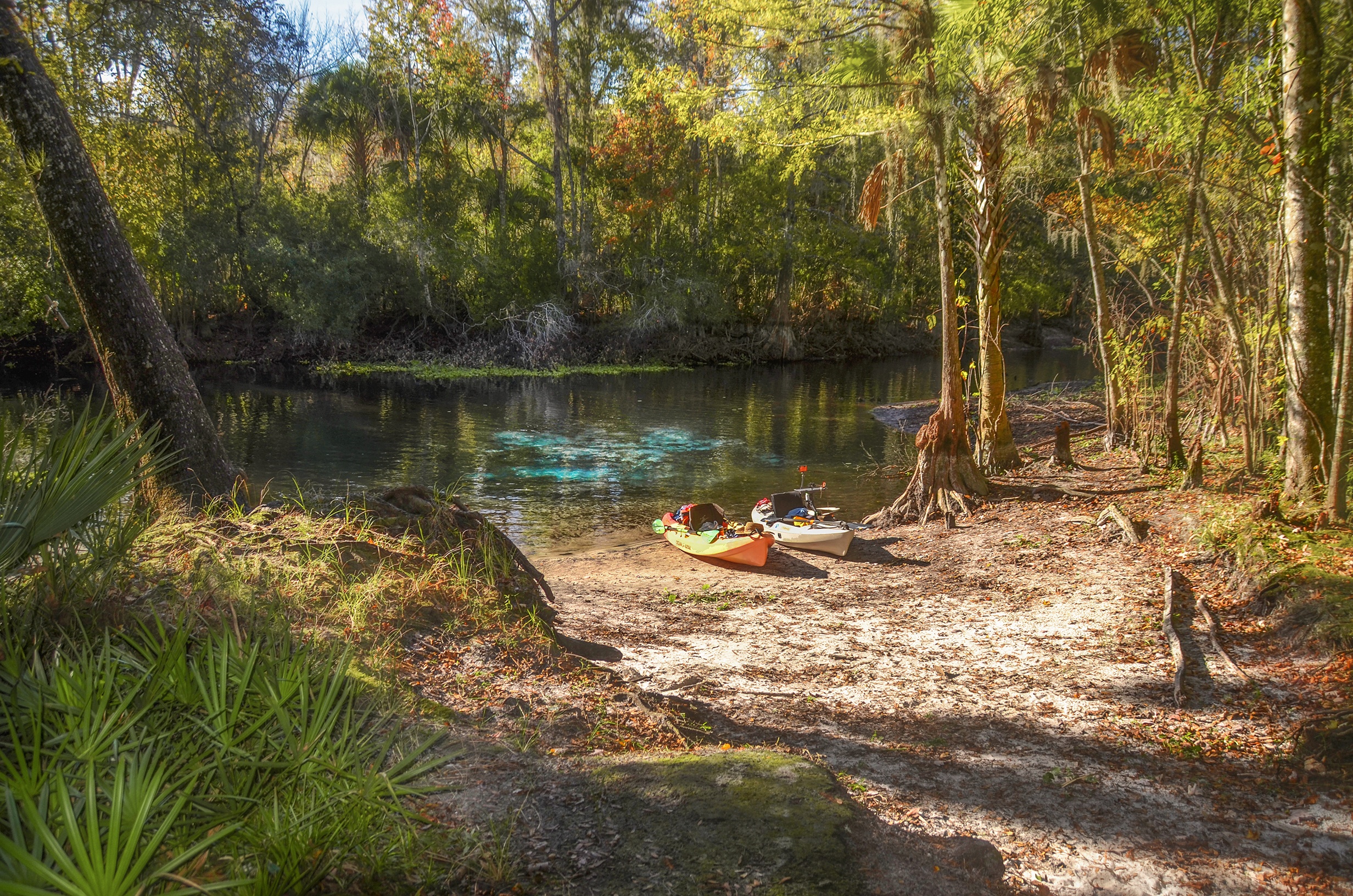
Cannon Spring:
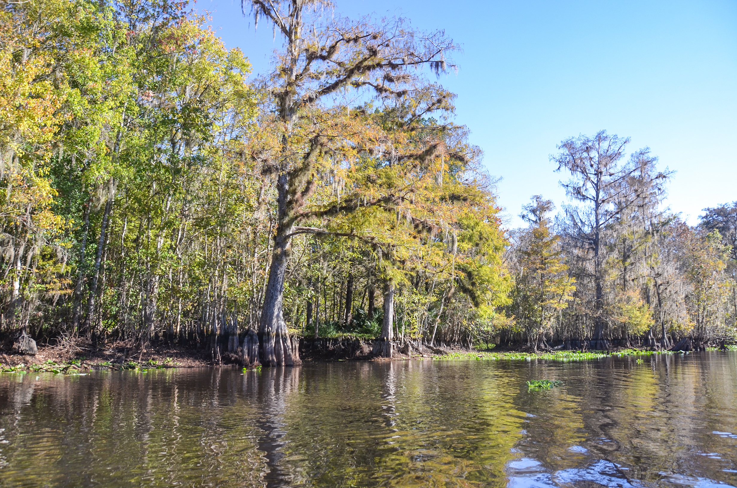
As long as we were at the river we finished up our paddle near the reservoir, drove South to Payne’s Landing. Here we launched, paddled upstream against a 3 mph current for 2.1 miles to the canal that leads to Cannon Springs Run. The canal is canopied with Tupelo trees and about 500′ long, Keeping to the right, it is another 735′ to Cannon Springs on a picturesque run. The spring is visible from the surface and a good landmark is the leaning tree on shore. This is a beautiful spring that goes unnoticed most of the time because it is usually covered with several feet of water and becomes visible during the drawdown.
Guides, Maps & Info…
- Rodman Reservoir Topo Map…
- Ocklawaha Water Level Info at Eureka…
- Florida Defenders of the Environment – Remembering the Ocklawaha…
- Ocklawaha River – Remembered-Imagined…
- North Star Charters…Capt. Karen Chadwick…
- History of The Florida Barge Canal…
- Ditch of Dreams…
- History – Treaty of Paynes Landing…
- Ocklawaha Canoe Outpost & Resort…
- The Springs of the Ocklawaha River, Florida: Rodman Dam to Eureka Dam…
- An Ocklawaha River Information Mini-Page…
- Whitey Markle on the Ocklawaha River…
- Searching for—and Finally Finding—Cannon Springs, by Whitney Sanford…
- Save Rodman Reservoir, Inc…
- Free the Ocklawaha, Info and Videos…
- Additional Ocklawaha River posts by Florida Paddle Notes…
![]()