
Brief Overview:
Rock Springs Run is located in Orange County, 5 miles northeast of Apopka, and 5 miles southeast of Sorrento, Fl. It is an 8-mile long run, forming the boundary between the 7,000 acre Wekiwa Springs State Park to the West and the 14,000 acre Rock Springs Run State Preserve to the North and East.
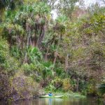
The run is a paddle into the past, through land still as it was when the Timucuan Tribes inhabited the area. Rock Springs Run flows through Sand Pine scrub, Pine Flatwoods, Swamps, Indian Mounds, Artesan Springs and hardwoods. The 8 mile run offers a diversity of plant and wildlife as it flows through one of Florida’s most densely populated Black Bear habitats.
Rock Springs Run flows into the Wekiva River, which in turn is a tributary to the St. Johns River. The Wekiva River Basin includes Wekiva Springs Run, Rock Springs Run, the Wekiva River, Blackwater Creek and Seminole Creek. These waterways comprise the first congressionally designated National Wild and Scenic River Basin in Florida, as well as being designated an Outstanding Florida Water and a Florida Designated Paddling Trail.
The Paddle Notes ~ Rock Springs Run Gallery ~ Flora and Fauna
 Run Details:
![]() Location: Rock Springs Run is located in Orange County, 5 miles northeast of Apopka, and 5 miles southeast of Sorrento, Fl.
Location: Rock Springs Run is located in Orange County, 5 miles northeast of Apopka, and 5 miles southeast of Sorrento, Fl.
![]() Launch Point: The launch is located at Kings Landing Canoe and Kayak Rental Service at 5722 Baptist Camp Rd, Apopka, FL 32712, (407) 886-0859. There are fees to launch here and are paid by Cash Only…
Launch Point: The launch is located at Kings Landing Canoe and Kayak Rental Service at 5722 Baptist Camp Rd, Apopka, FL 32712, (407) 886-0859. There are fees to launch here and are paid by Cash Only…
Single Kayak/Canoe Launch Fee: $10
Single Launch and Shuttle Return: $20
Additional rentals,fees and shuttle times are listed on their website here.
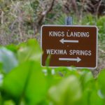
Take Out Point: The take out point is at Wekiva Island, approximately 8.5 miles downstream.
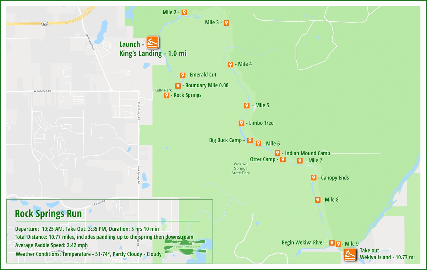
![]() Paddle Distance: Launching at Kings Landing , it is approximately 1 mile up Rock Springs Run toward the head spring. The main spring is blocked off, but this is well worth the paddle, though strenuous. Returning back to the launch area completes a 2 mile paddle before continuing on downstream for 8.5 more miles. Total distance of our paddle was 10.8 miles.
Paddle Distance: Launching at Kings Landing , it is approximately 1 mile up Rock Springs Run toward the head spring. The main spring is blocked off, but this is well worth the paddle, though strenuous. Returning back to the launch area completes a 2 mile paddle before continuing on downstream for 8.5 more miles. Total distance of our paddle was 10.8 miles.
![]() Difficulty: Easy to moderate. Paddling up to the head spring is against a strong current and can be too much for some folks, however once there and returning, the paddle is easy.
Difficulty: Easy to moderate. Paddling up to the head spring is against a strong current and can be too much for some folks, however once there and returning, the paddle is easy.
 Average Paddle Speed: 2.6 mph. This was lower due to paddling upstream against the current. There was a maximum speed recorded at 4.67 mph.
![]() Width and Depth: This winding run can be anywhere from 10′ to 75′ wide, with the actual navigable paddle portion even 10′ Aquatic plants mask the true shoreline in several sections. Depth is from 18″ to a few feet.
Width and Depth: This winding run can be anywhere from 10′ to 75′ wide, with the actual navigable paddle portion even 10′ Aquatic plants mask the true shoreline in several sections. Depth is from 18″ to a few feet.
![]() Current – Tidal: The creek flows in a southeasterly direction after the first 3 miles and depends on the flow from Rock Springs, rain run off and smaller less known springs.
Current – Tidal: The creek flows in a southeasterly direction after the first 3 miles and depends on the flow from Rock Springs, rain run off and smaller less known springs.
![]() Side Paddles: Paddling upstream to Rock Springs from the launch, could be considered a side paddle, being 1 mile up and back. This is known as Emerald Cut and is quite scenic. Close to mile 9, where the run meets the Wekiva, another ‘side’ paddle would be to paddle the 3/4 mile run up to Wekiva Springs.
Side Paddles: Paddling upstream to Rock Springs from the launch, could be considered a side paddle, being 1 mile up and back. This is known as Emerald Cut and is quite scenic. Close to mile 9, where the run meets the Wekiva, another ‘side’ paddle would be to paddle the 3/4 mile run up to Wekiva Springs.
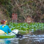
![]() Rest Areas: Restrooms available at the launch as well as the take out. Along the river, there are three campsite areas in the 5 – 6 mile areas that offer a chance to exit your kayak for a stretch.
Rest Areas: Restrooms available at the launch as well as the take out. Along the river, there are three campsite areas in the 5 – 6 mile areas that offer a chance to exit your kayak for a stretch.
The Paddle Route…
Kings Landing…
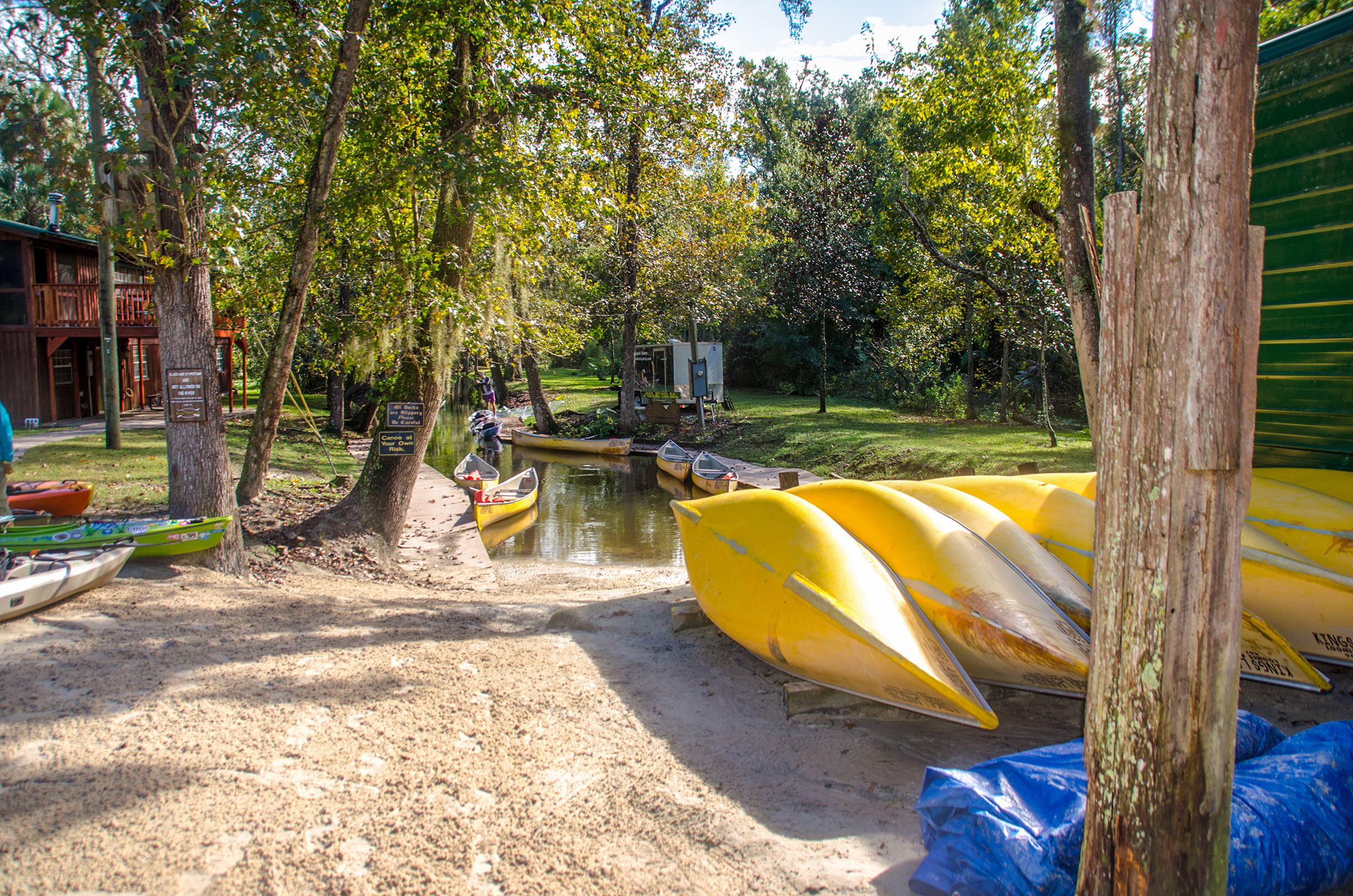
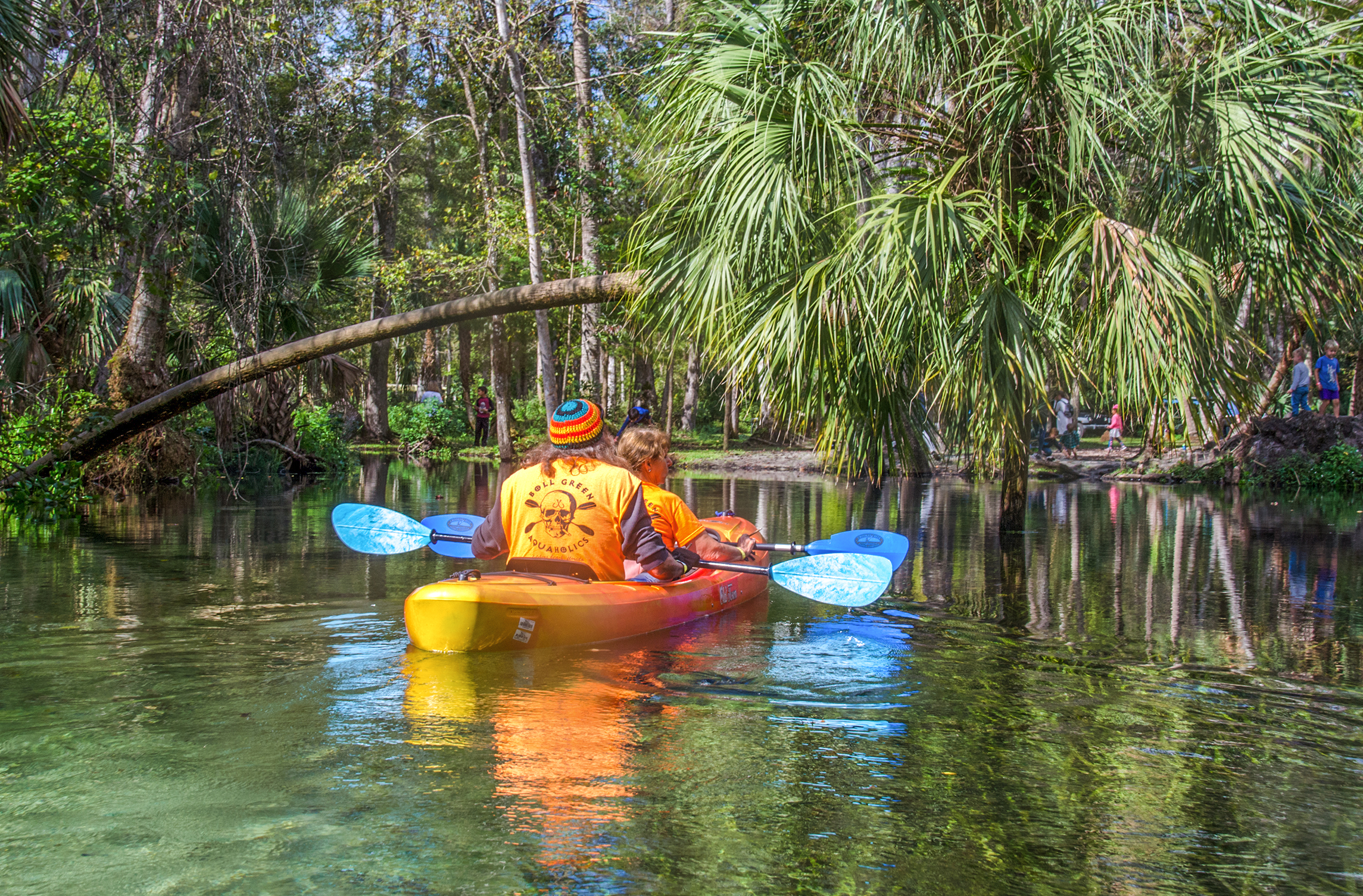
Kings Landing Canoe and Kayak Rental Service is our launching point for today’s paddle on Rock Springs Run. This is the only launch outside of Kelly Park and is located at 5722 Baptist Camp Rd, Apopka, FL 32712, (407) 886-0859.
The folks at Kings Landing are friendly and helpful and a pleasure. We use their service each time we paddle the run. There is a launch fee, shuttle fee, rentals, store and restrooms available. For prices and times see the above link.
It was a bit chilly when we left home 2 hours earlier, but by our 10:25 am launch time, the sun was out and warming up. Paddling out a narrow, 600′ canal we entered Rock Springs Run.
Against the Current to Rock Springs…
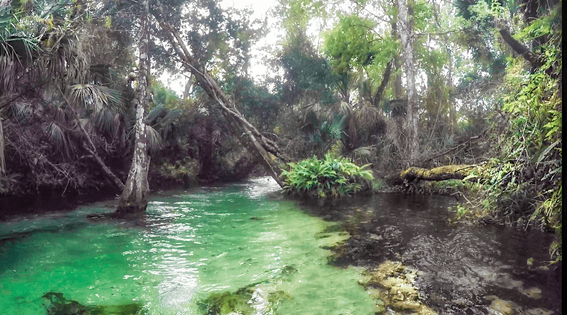
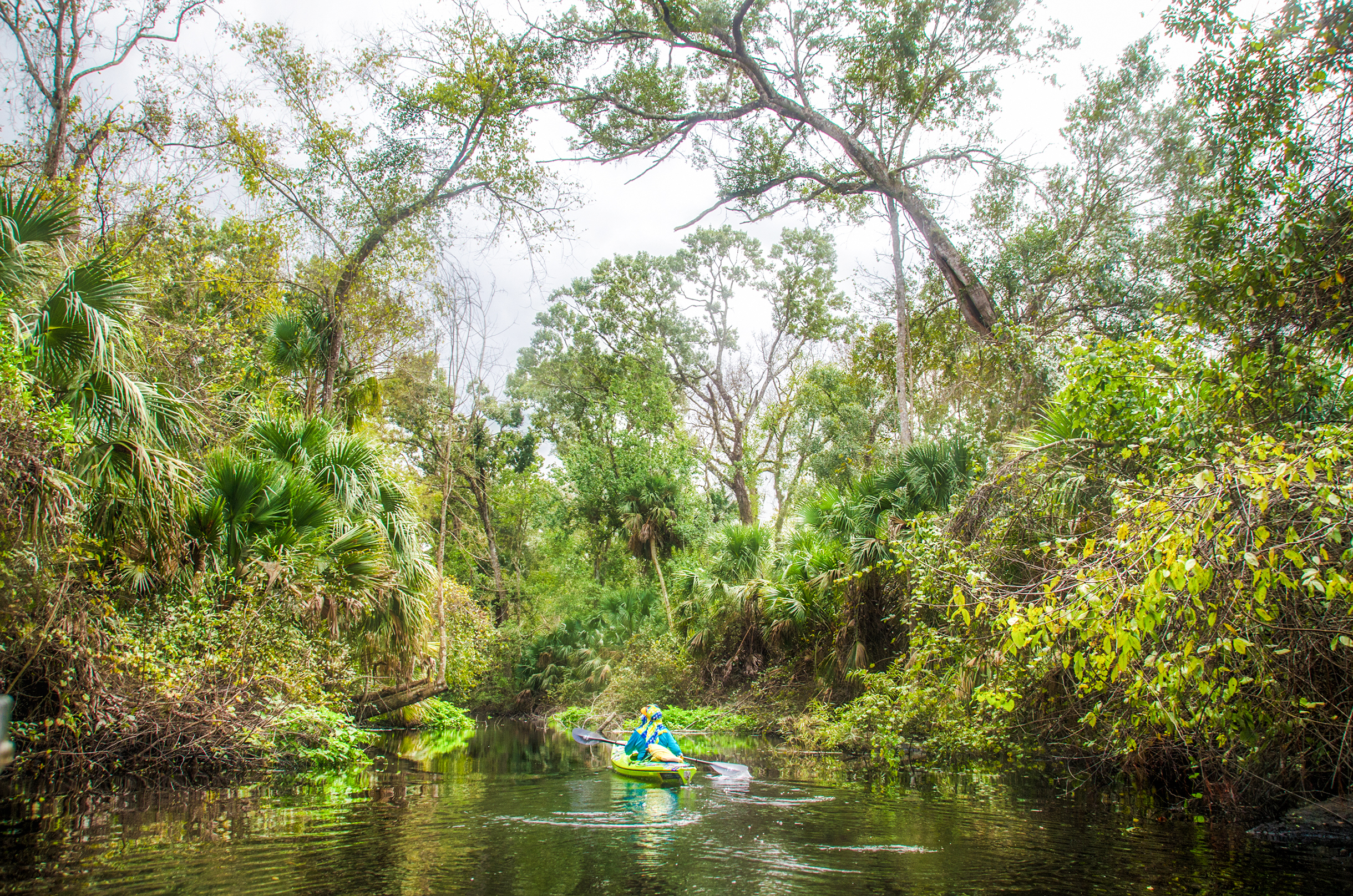
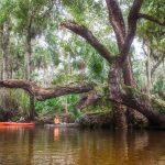
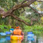
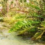
Once on Rock Springs Run there is a choice to go right and head upstream toward the headspring or turn left and follow the flow downstream to the Wekiva River. You do not want to miss going upstream. Turning right out of the canal we paddle under a picturesque Sabal Pametto leaning and arching over the water and enter the narrow, canopied run. This section is known as Emerald Cut due to the lushness of all the green foliage and it’s reflection in the water.
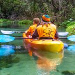
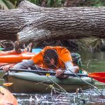
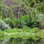
The run is swift and winding for one mile, however this is a paddle through diverse Jungle habitat and semi-open wetlands. The water is clear blue green above a sandy bottom, with a current that moderates between 3 and 5 mph. The shoreline is thick with Sabal Palmettos, Sword Ferns, Giant Leather ferns, Red Maples and a mixture of hardwoods. At times the run is less than 10′ wide and is a combination dense canopy with several fallen trees to paddle under and other times it is open wetland with the shoreline lined with invasive aquatic plants.
There is no passage to the actual headspring. About a mile upstream is a bridge/barrier that prevents paddling any further, however this one mile paddle on the Emerald Cut just may be the highlight of the trip!
Rock Springs Run…
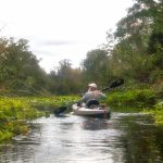
Once turned around at the headspring barrier, the paddle downstream is easy and the flow is nice, at least for a mile or two. The further downstream, the slower the flow, however it is still a pleasant and comfortable paddle.
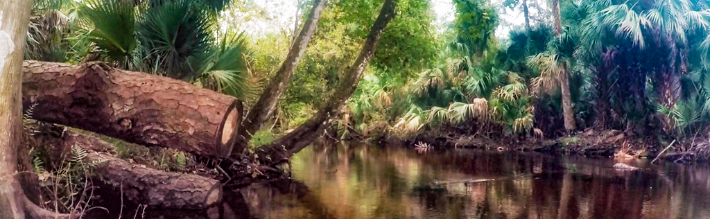
This section of the river seems to be in constant change over the years. Two things were very noticeable over past trips. Storms have downed numerous trees. There were several times it took great limbo skill to clear underneath the fallen trunks. Overhead, trees leaned across the run creating tall arches as we paddle through. The sight of so many dead trees and branches made it seem like paddling through a war zone. Here is a short clip going under the Limbo Tree.
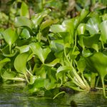
Also quite noticeable on this trip were the thick masses of aquatic plants on each side of the shoreline. Water Hyacinth, Pickerel Weed, Water Lettuce and Water Hemlock were predominant especially when the canopy ended and the run became more wide at mile 5 through 7. Approaching the 5 mile mark, the water also begins showing more signs of tannin as the flow slows down. Rather than clear, white sandy bottoms, the sand is masked with the typical tea colored tannin. Also in this stretch are 3 campsites, Big Buck, Indian Mound and Otter Camp. Good spots to take a break before continuing on…these are marked in the above Paddle Map.
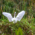
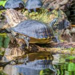
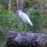
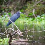
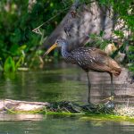
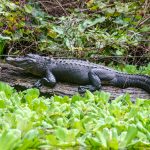
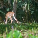
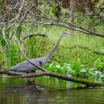
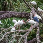
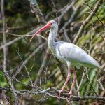
The wildlife viewed on this trip included, Herons, Alligators, Limpkins, Deer and Ibis. It was a pleasant paddle with nice weather. Out timing was great as King’s Landing shuttle was waiting when we arrived. They were very helpful, we shuttled back ending another chapter in Florida Paddle Notes.
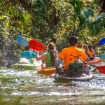
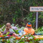
Rock Springs Run Gallery:
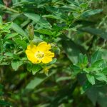
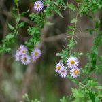
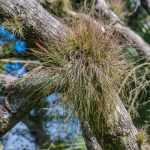
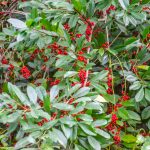
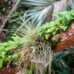
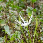
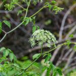
Rock Springs Flora & Fauna:
Guides, Maps & Info…
- Rock Springs Run Topo Map…
- Rock Springs Run Water Level Info…
- Rock Springs SJRWMD…
- Rock Springs Run State Reserve…
- Rock Springs Run WMA Brochure…
- Kings Landing Canoe and Kayak Rental Service…
- Walk & Paddle Blog: Kings Landing…
![]()