
We could not pass up the predicted excellent weather and so ventured out on a 12-mile section of the Withlacoochee River (S), launching just north of Hwy 40 at Spruce Public Boat Launch and paddling to Dunnellon to enjoy our reward at The Blue Gator Tiki Bar and Restaurant. Along this Florida Paddle Trail, we enjoyed temperatures in the 70s, sunny skies, an awesome breeze at our back, and a swift current! Couldn’t have been better…James
![]()
The 150 mile long Withlacoochee River originates in central Florida’s Green Swamp, east of Polk City, and empties into the Gulf of Mexico near Yankeetown in Levy County. It is considered a ‘Blackwater’ river and one of two Florida rivers that flow northward.
Springs contribute approximately 2.2 billion gallons of water per day to the Withlacoochee River. Contributing springs include the Rainbow Springs Group, Gum Springs, Fenney Spring, Citrus Blue Springs, and many smaller springs.
“Withlacoochee” probably stems from a Muskhogean dialect, which suggests that its application is comparatively recent. It is compounded of Creek we (water), thlako (big), and chee (little), or little big water. This word combination signifies little river in the Creek language, and as we-lako or wethlako may also refer to a lake, it may signify a river of lakes, or lake river. An alternate etymology holds that Withlacoochee is a Native American word meaning “crooked river”…(Wikipedia) The Withlacoochee River is designated as an Outstanding Florida Waterway.
Withlacoochee River (S) Paddle Map…
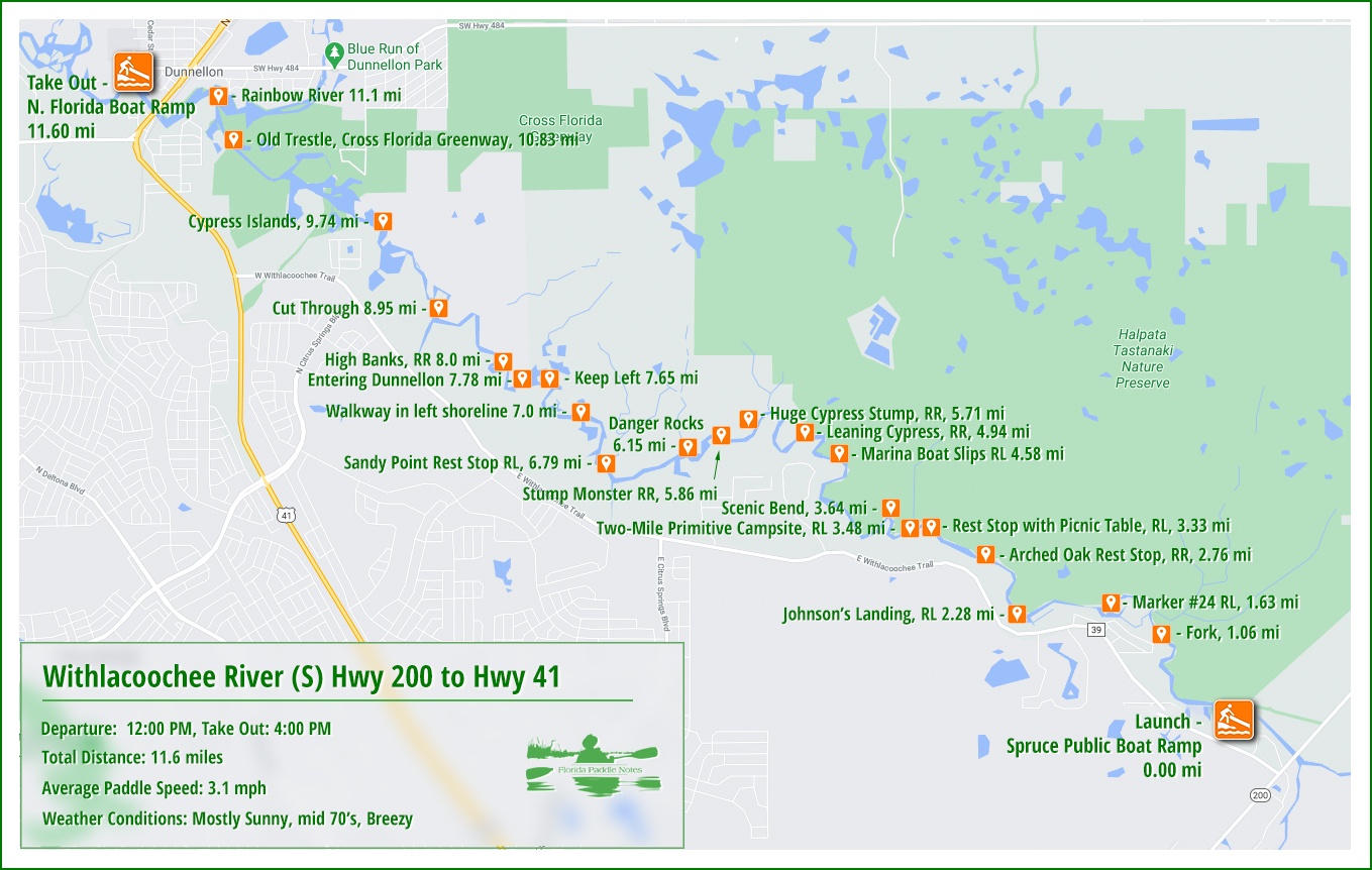
Withlacoochee River Details…
![]() Location: This 12-mile section of the Withlacoochee River is located between the cities of Dunnellon and Hernando, dividing Citrus County and Marion County.
Location: This 12-mile section of the Withlacoochee River is located between the cities of Dunnellon and Hernando, dividing Citrus County and Marion County.
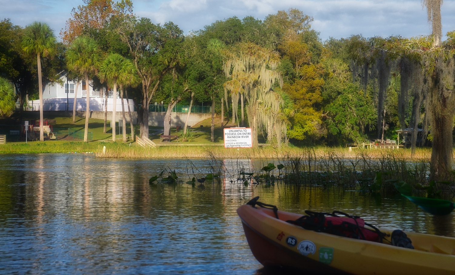
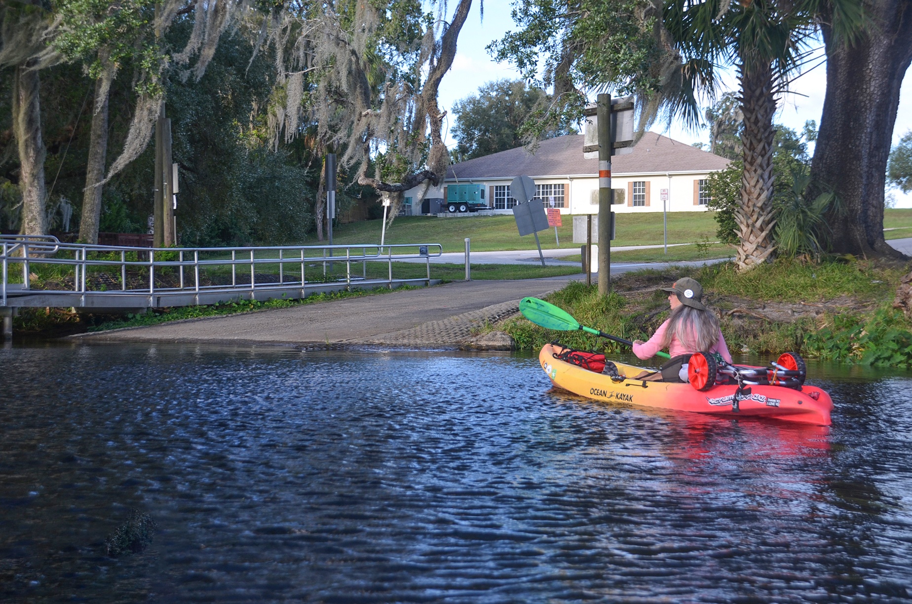
![]() Launch point and Take out: The launch for this paddle is Spruce Public Boat Launch, located at 4863 E Spruce Dr, Dunnellon, FL 34434. The take-out is the N Florida Avenue Boat Ramp, 12196 S Williams St, Dunnellon, FL 34432
Launch point and Take out: The launch for this paddle is Spruce Public Boat Launch, located at 4863 E Spruce Dr, Dunnellon, FL 34434. The take-out is the N Florida Avenue Boat Ramp, 12196 S Williams St, Dunnellon, FL 34432
![]() Paddle Distance: 11.6 miles
Paddle Distance: 11.6 miles
![]() Difficulty: Easy. The water level was high and the flow was good.
Difficulty: Easy. The water level was high and the flow was good.
 Average Paddle Speed: 3.1 mph.
![]() Width and Depth: At the launch, the is 125′ wide and increases to 200′ wide at the take-out. The water level was on the high side at 27.4′ NAVD 1988.
Width and Depth: At the launch, the is 125′ wide and increases to 200′ wide at the take-out. The water level was on the high side at 27.4′ NAVD 1988.
![]() Current – Tidal: There was a good 3 mph flow to the river today.
Current – Tidal: There was a good 3 mph flow to the river today.
![]() Side Paddles: NA
Side Paddles: NA
![]() Rest Areas: There are no bathroom facilities at the launch but all along the river there are plenty of places to stop and rest. A couple of nice places are at miles 3.33 and 6.79.
Rest Areas: There are no bathroom facilities at the launch but all along the river there are plenty of places to stop and rest. A couple of nice places are at miles 3.33 and 6.79.
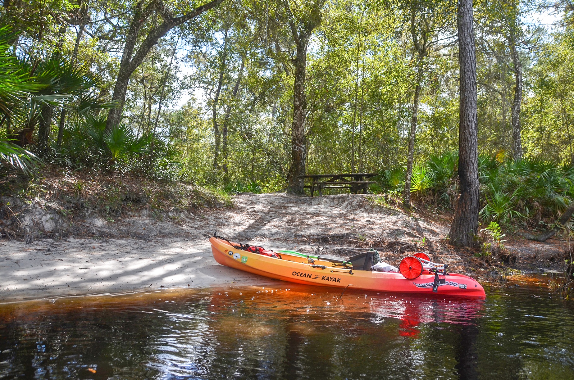
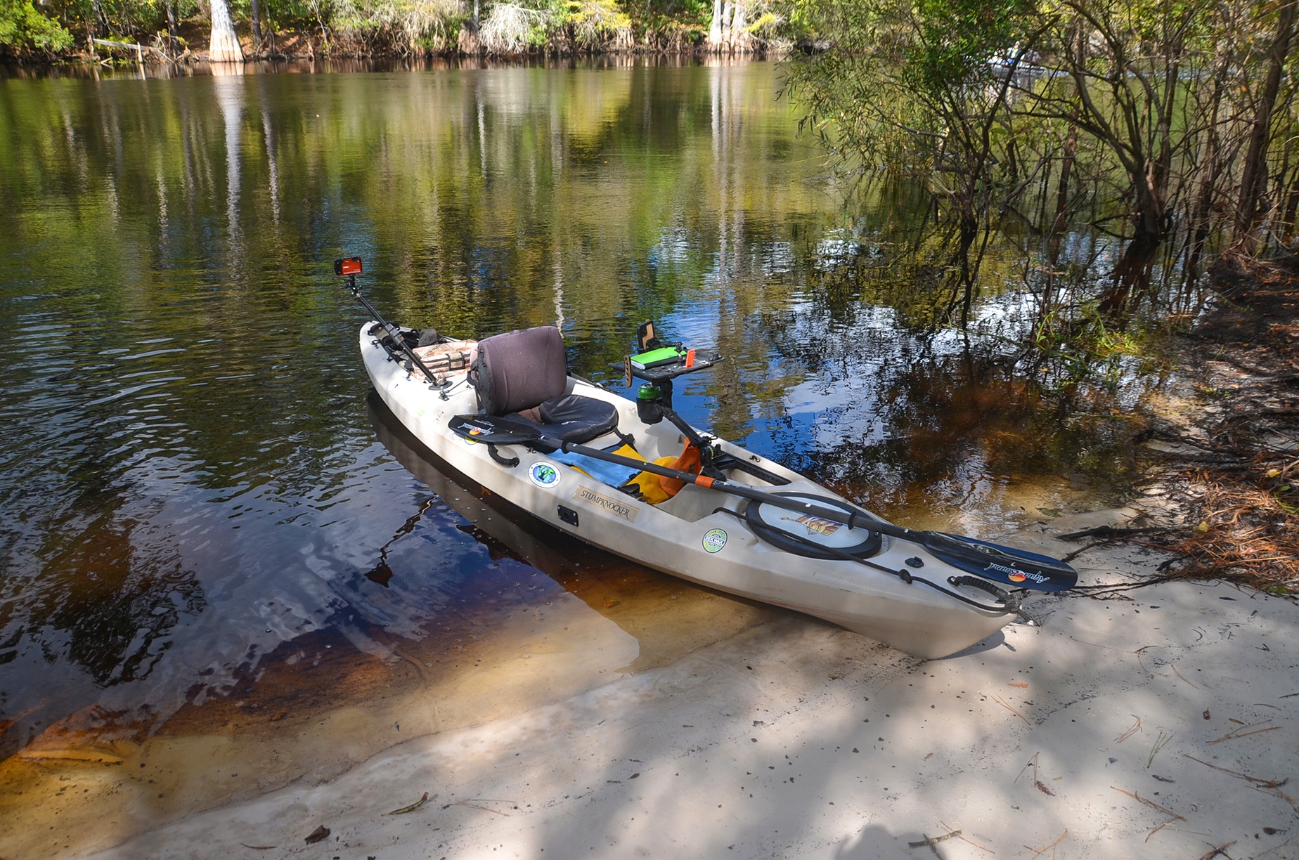
Spruce Public Boat Launch…
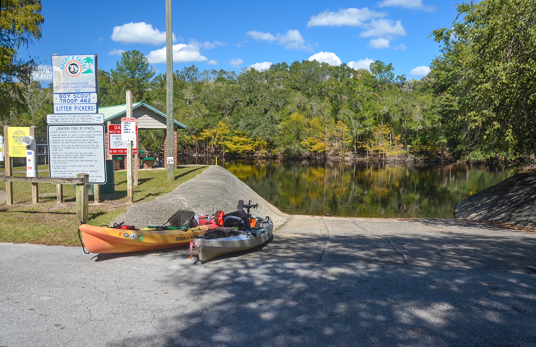
Located just over a quarter mile north of Hwy 200, the Spruce Public Boat Ramp is a nice launch point for this section of the Withlacoochee.
It is a small facility, with limited parking and no restroom facilities, but the rippled concrete launch ramp is wide and nice. There is a covered picnic table and there are no fees required.
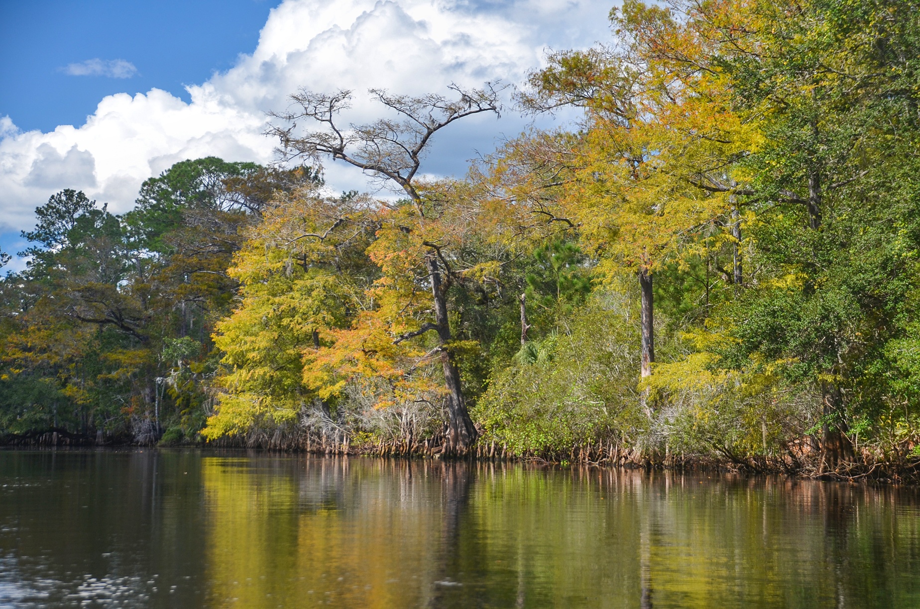
Fall on the Withlacoochee …
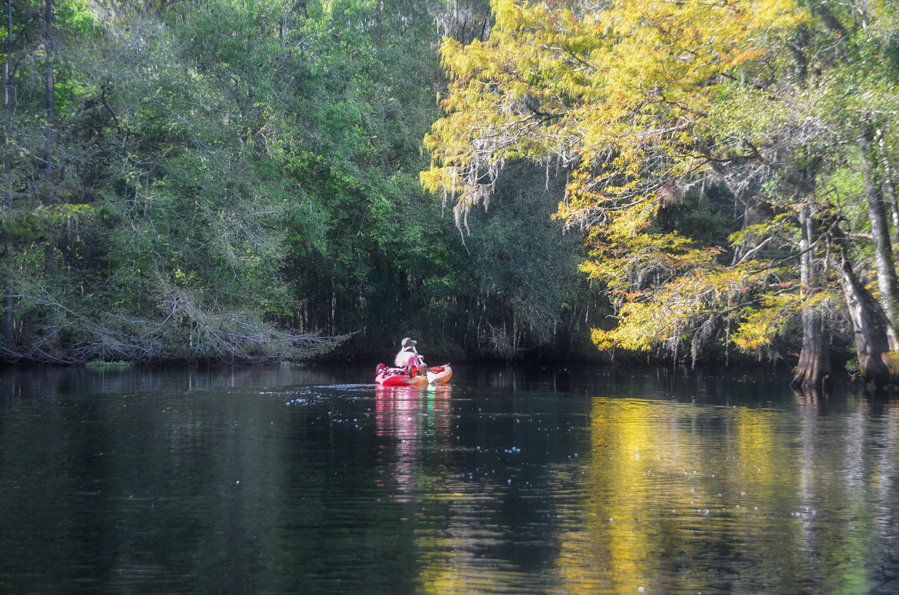
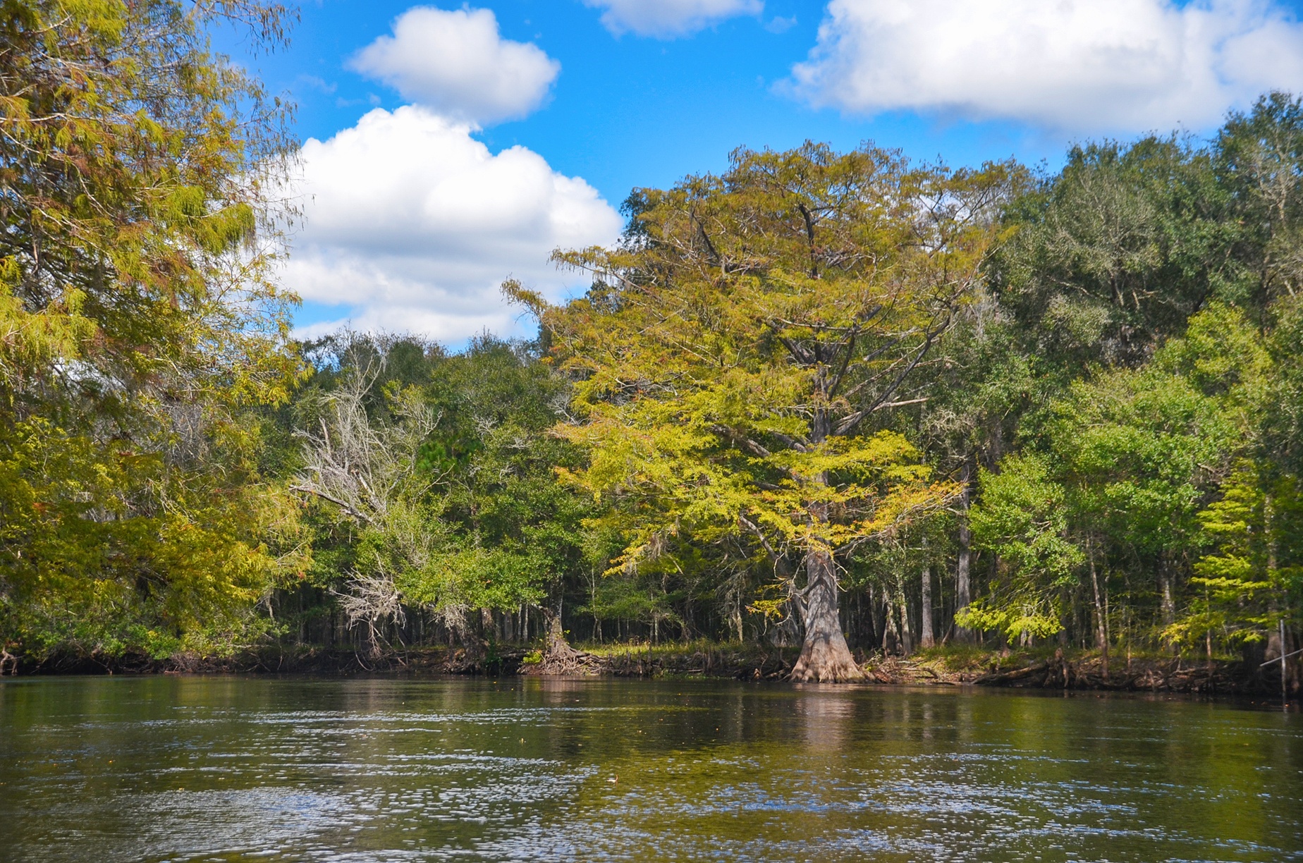
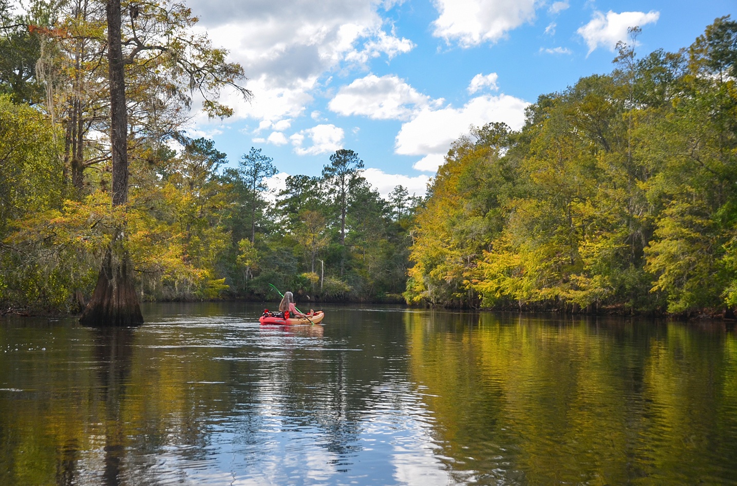
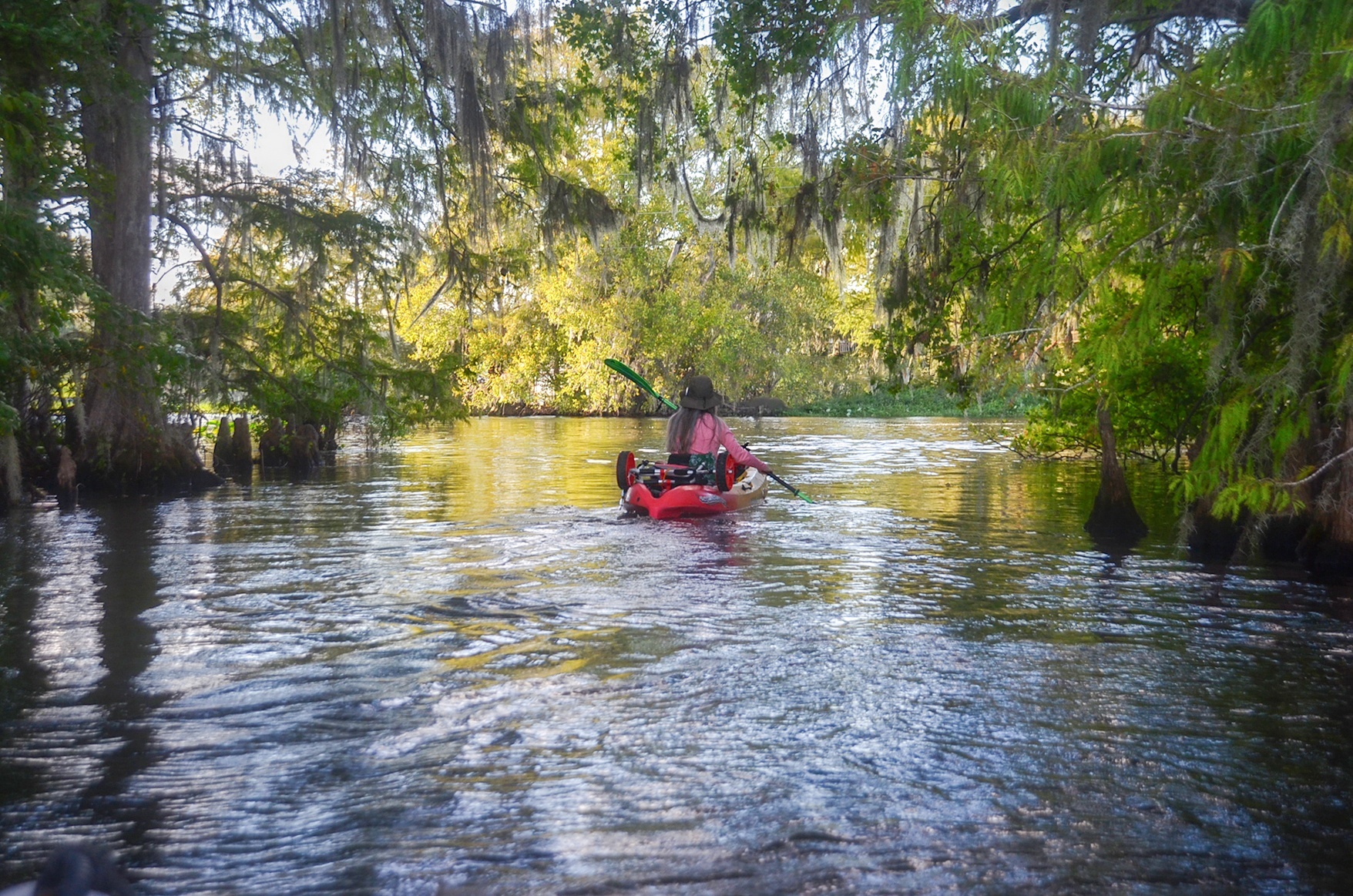
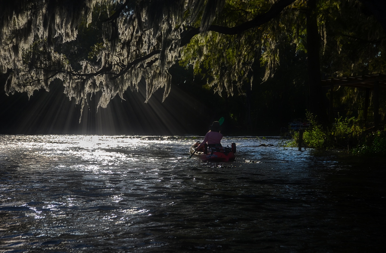
With excellent weather, a good breeze at our backs, and a very good 3 mph flow, we launched and were treated to a wonderful paddle. Fall was definitely in the air on the river, with most of the Bald Cypress showing off their golden leaves.
A good portion of this river is bordered by the Halpata Tastanaki Nature Preserve. The preserve is named after Seminole leader Hálpata Tastanaki (Chief Alligator) who, along with Osceola, Jumper, and approximately 1,000 warriors, took part in the largest battle of the Second Seminole Indian War in 1836. Included within the property is the site of the community of Stockton, established shortly after the conclusion of the Second Seminole Indian War.
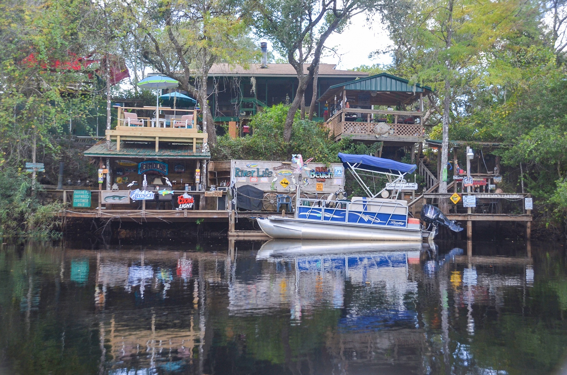
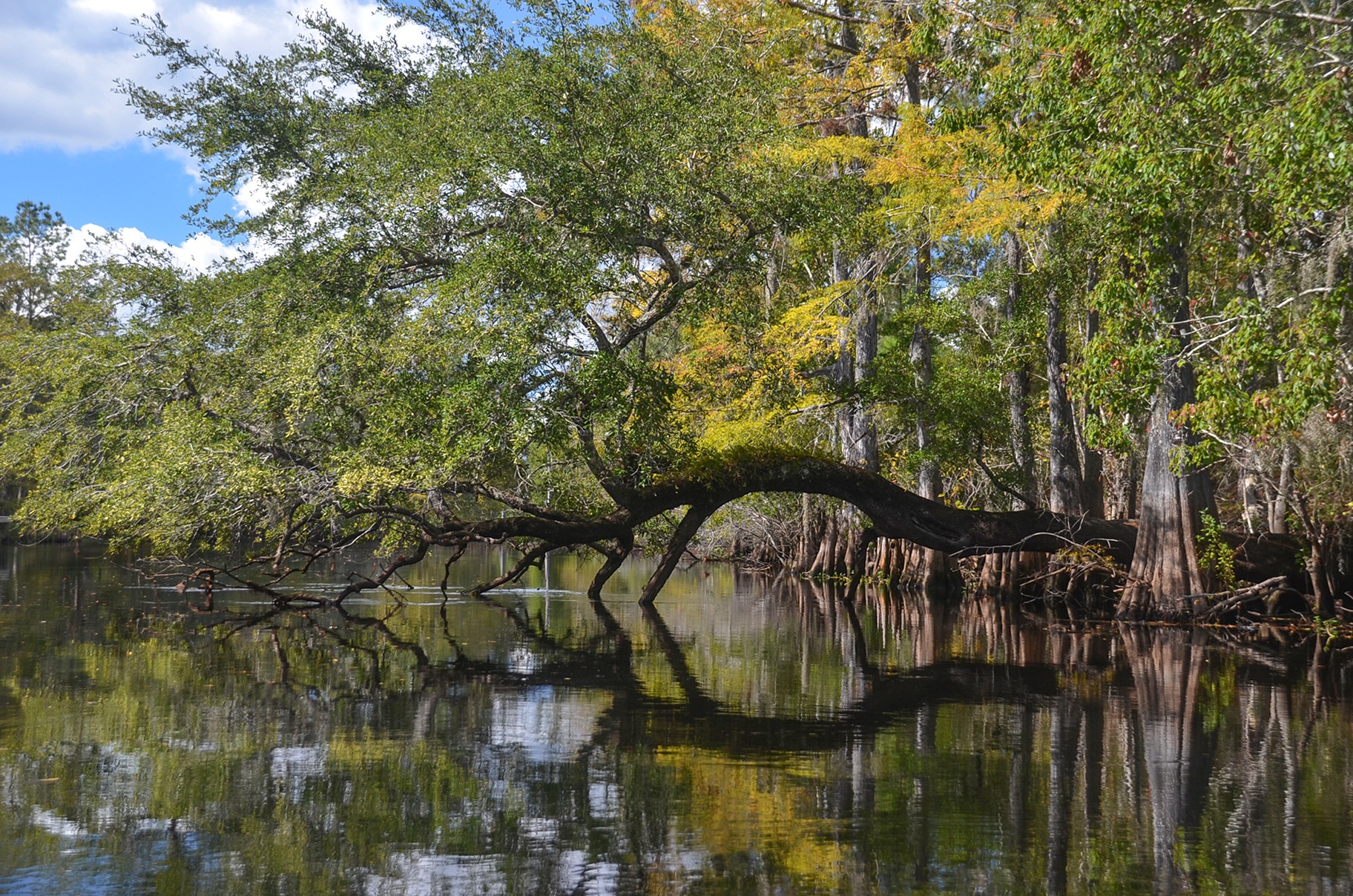
We paddled through a floodplain swamp with gorgeous, uniquely shaped Bald Cypress trees and at mile 5.7 if you look into the woods about 50′, there is a huge trunk from a fallen cypress. Also, be sure to admire Johnson’s Landing at the 2.3-mile mark. A very creatively decorated river home!
Points of Interest…
There are plenty of opportunities to stop and take a break along much of the river. At mile 3.33, on river-left is a noticeable sandy beach as well as a picnic table. We stopped here for a lite snack. The water does drop off quickly if deciding to swim. Further up the bank is a large open area with a fire pit and this is all part of a primitive campsite called Two-Mile Prairie Primitive Campsite.
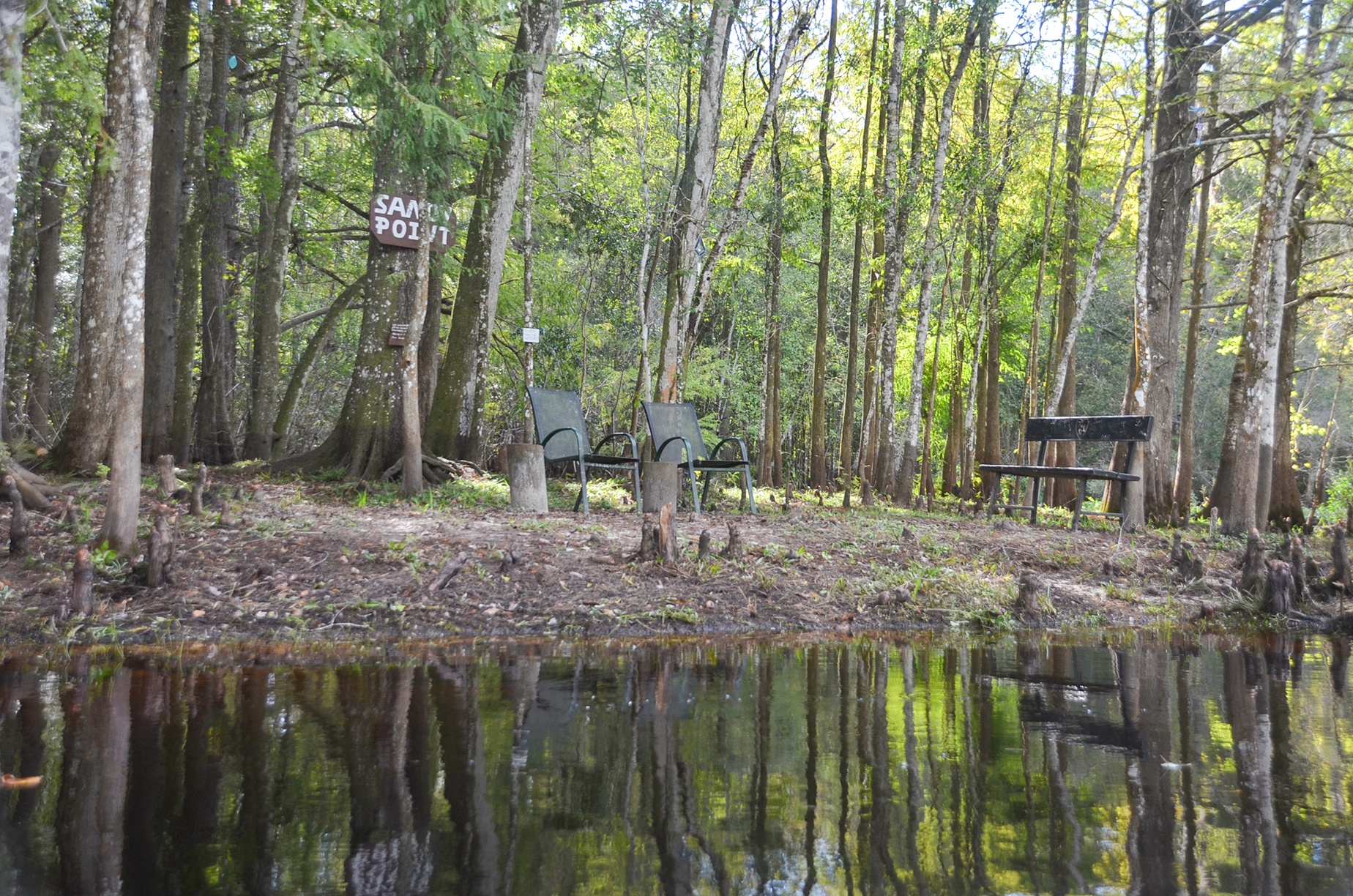
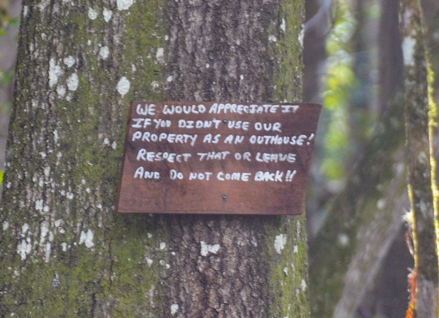
Further down the river is another interesting rest stop called Sandy Point. There are chairs to relax. It is apparently private property although it looks like the owners do not mind if you stop, however they do have a warning sign for those wanting to use the area as an open bathroom!
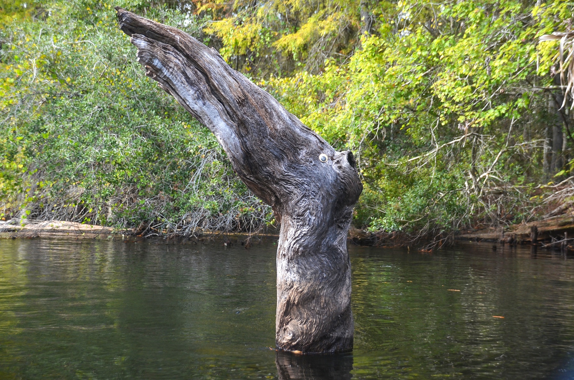
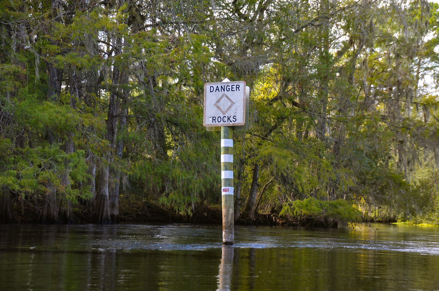
Mile 5.86 greets you with a subtle stump monster sticking out of the water and at mile 6.1 you will encounter a Danger Rocks sign. With the water level high we had no issues with shallows or rocks on this paddle.

The Final Stretch…
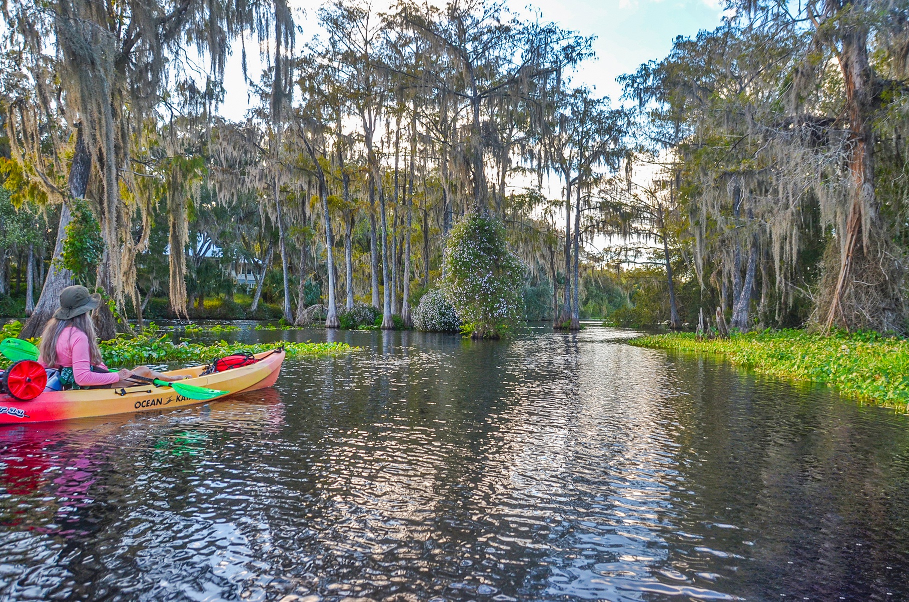
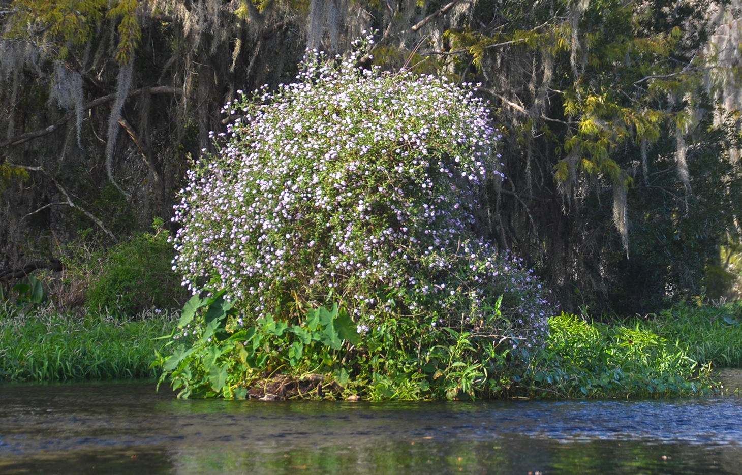
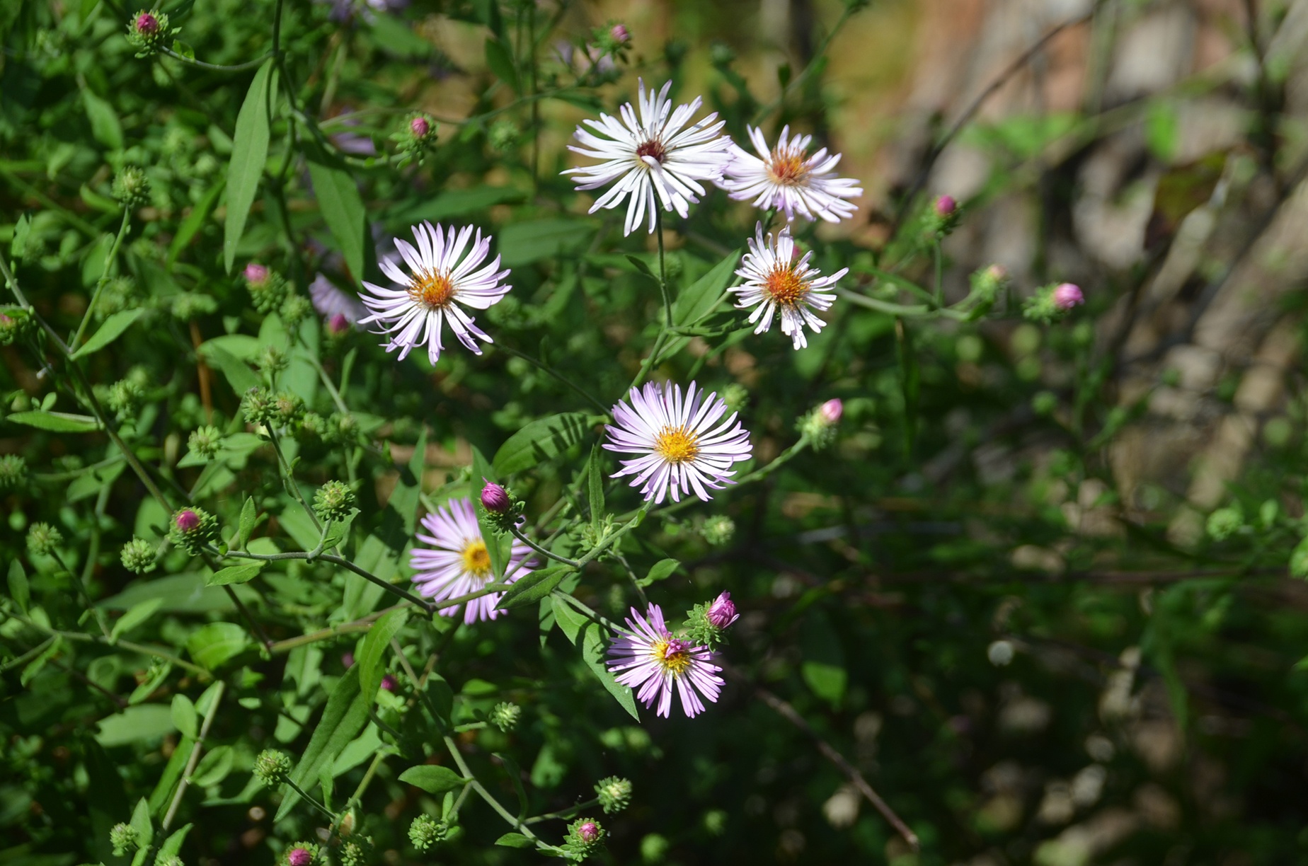
The final three miles of this paddle are an interesting maze of lakes, cut-throughs, and wonderful clumps of Climbing Asters in full bloom. The main channel becomes somewhat hidden as it winds through these small lakes and looking over our GPS paddle route found that we, unintentionally, left the main channel twice! Having some familiarity with this area and having gleaned over satellite pics of the area prior to the paddle, knew there would not be a problem.
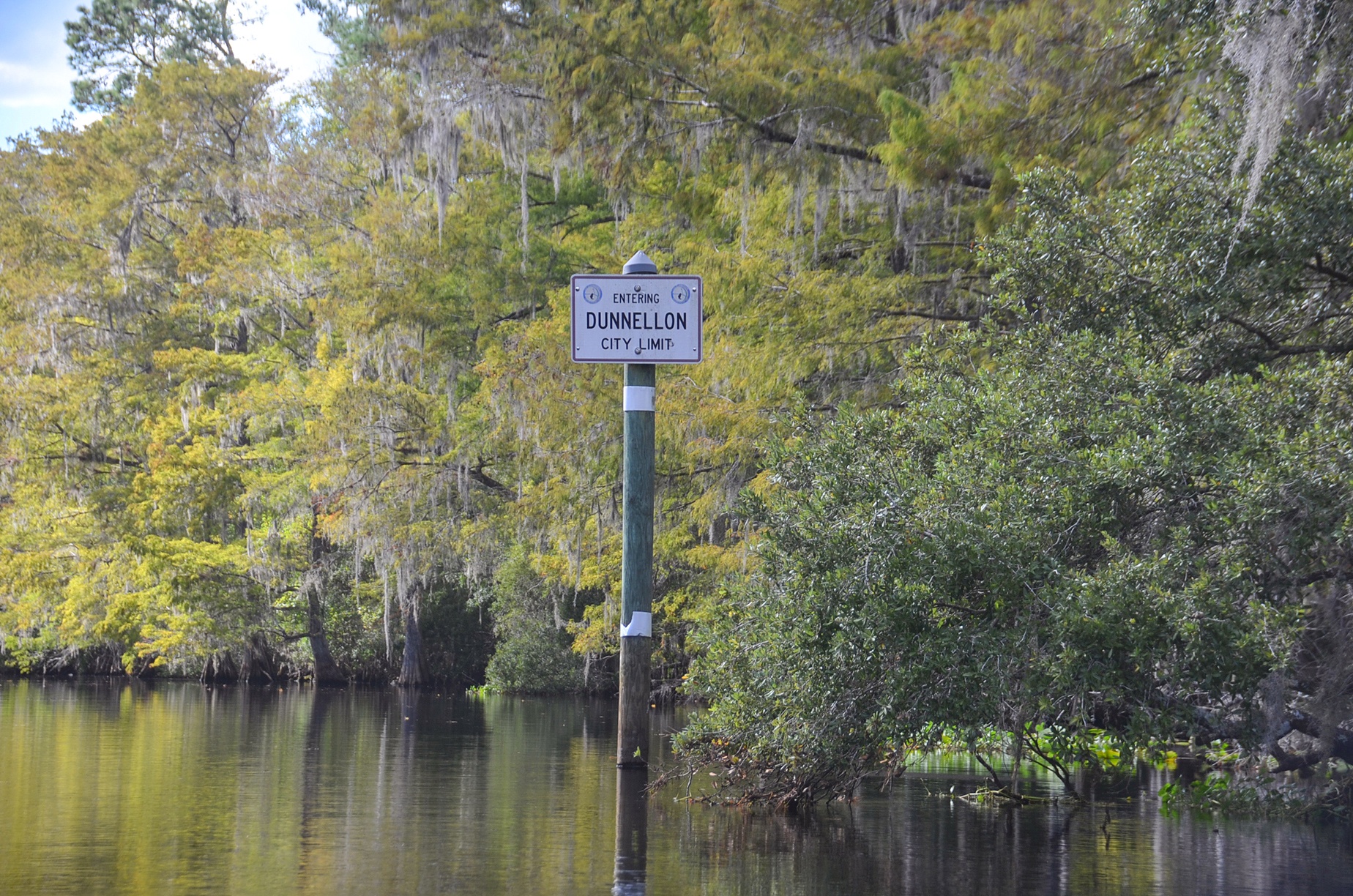
As the sun was getting lower in the sky, we reached the confluence with the Rainbow River and within a half-mile, concluded our paddle in Dunnellon. It was a great day on the water for sure! Aside from the awesome scenery, we rewarded ourselves with an early dinner of Gator Tail, Calamari, and a pitcher of cold Stumpknocker Beer at The Blue Gator Tiki Bar & Restaurant!

Guides, Maps & Info…
- Withlacoochee River Topo Map…
- Withlacoochee Paddling Trail…
- Withlacoochee River Water Resources…
- Two Mile Prairie Primitive Campsite…
- Halpata Tastanaki Nature Preserve…
- The Withlacoochee River Water Excursion…
![]()