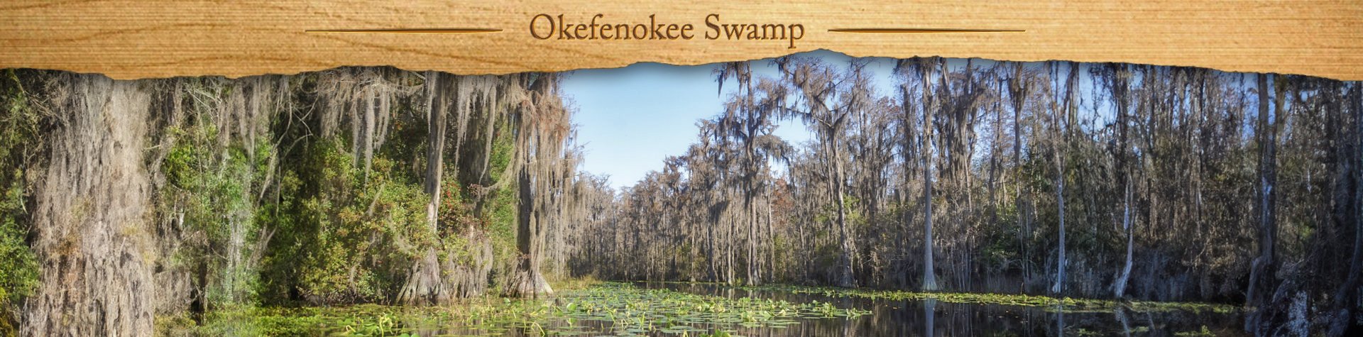
Okefenokee Swamp Overview

The Okefenokee National Wildlife Refuge is a 402,000‑acre National Wildlife Refuge located in Charlton, Ware, and Clinch Counties of Georgia, and Baker County in Florida, United States. The refuge was established in 1937 to protect a majority of the 438,000 acre Okefenokee Swamp.
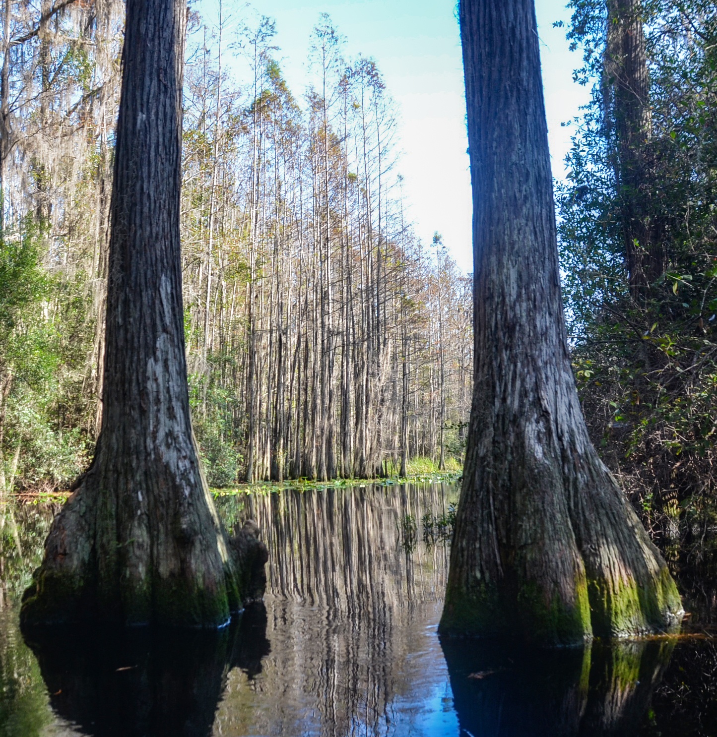
The swamp is a vast bog inside a huge, saucer-shaped depression that was once part of the ocean floor. It now lies 103 to 128 feet above mean sea level. Peat deposits, up to 15 feet thick, cover much of the swamp floor. These deposits are so unstable in spots that trees and surrounding bushes tremble by stomping the surface. The name “Okefenokee” probably came from the Hitchiti (Creek) word meaning “trembling earth” or “bubbling water.” Habitats include open wet “prairies”, cypress forests, scrub-shrub vegetation, upland islands, and open lakes.
The swamp has a rich human history including Native American settlement, explorations by Europeans, a massive drainage attempt, and intensive timber harvesting. ( Wikipedia )
![]()
Billy’s Island Overview
During the Seminole Wars of the early 19th century, a small party of Indians evaded capture by retreating into the swamp. Over time, this group grew to become a community where escaped slaves and AWOL soldiers were welcome. Their leader went by the name of “Billy Bowlegs.” It’s generally agreed that it is this Billy for which the island was named. This 4000 acre island is the second largest in the swamp and is only accessible by boat.
There is great history of Billy’s Island that involves the Lee family as squatters, The Hebards, a family of loggers and the State of Georgia, all laying claim to ownership. Interesting narratives of this history can be read here…Our Georgia History, The Okefenokee Swamp and The History of Billy’s Island in the Okefenokee Swamp
![]()
Minnie’s Lake Overview
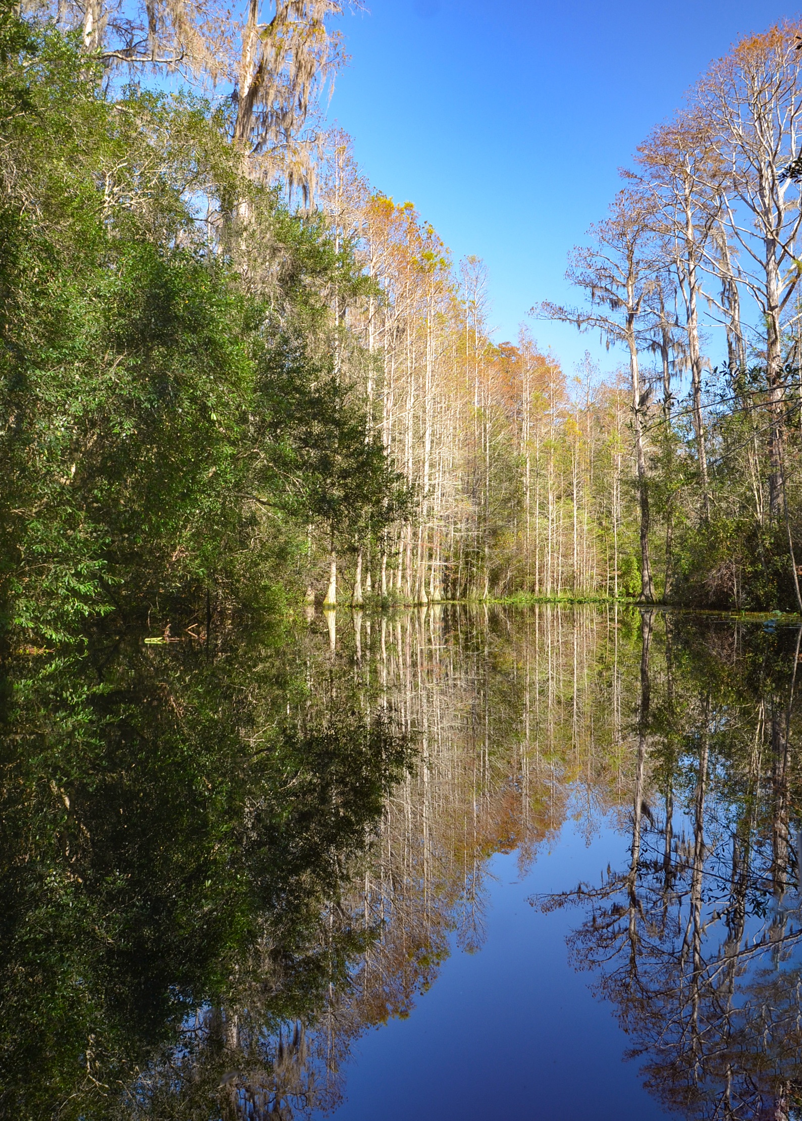
Minnie’s Lake is a popular and iconic destination within the Okefenokee National Wildlife Refuge, renowned for its haunting beauty, wildlife encounters, and photogenic cypress scenery. Situated off the Suwannee Middle Fork, it’s accessible only by water—typically via a 4-mile paddle (one-way) from Stephen C. Foster State Park. The route winds through cypress-lined channels draped with Spanish moss, leading paddlers into a remote, tranquil section of the swamp.
The lake itself is known for its open water patches framed by spatterdock and floating vegetation, providing contrast to the tighter tree tunnels along the way. It’s also a hotspot for alligator sightings, with many seen sunning on logs, stumps, and banks—especially in warmer months. Birdwatchers can often spot ibis, herons, and wood storks, while the occasional barred owl hoots from the shadows.
Minnie’s Lake is also home to a raised overnight platform—one of several maintained in the refuge—allowing for backcountry paddling and camping under the stars, surrounded by the quiet sounds of the swamp. Its combination of accessible remoteness, wildlife, and classic Okefenokee scenery makes it a must-visit stop for paddlers exploring the western side of the refuge.
Billy’s Island ~ Minnie’s Lake

Billy’s Island Details
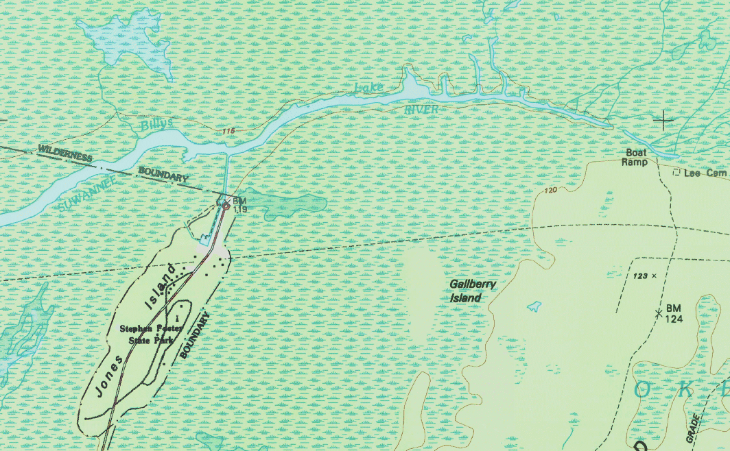
![]() Location: Billy’s Island is located in the Okefenokee Wildlife Refuge with the landing dock being at coordinates 30°49’54.11″N, 82°20’1.07″W
Location: Billy’s Island is located in the Okefenokee Wildlife Refuge with the landing dock being at coordinates 30°49’54.11″N, 82°20’1.07″W
![]() Launch Point: The launch is located at Stephen C. Foster State Park, 17515 GA-177, Fargo, GA 31631.
Launch Point: The launch is located at Stephen C. Foster State Park, 17515 GA-177, Fargo, GA 31631.
There are canoe, kayak and boat rentals available at the park. Phone # 912-637-5274
![]() Paddle Distance: The distance to Billy’s Island is 2 miles one way.
Paddle Distance: The distance to Billy’s Island is 2 miles one way.
![]() Difficulty: Easy
Difficulty: Easy
 Average Paddle Speed: 1.7 mph. This was lower due to numerous stops to view alligators and take photographs.
![]() Width and Depth: Once leaving the access canal, this portion of the river is 155′ wide and thins to 35′ wide at Billy’s Island. The average depth of the waterways in the swamp are from 2′ to 10′ deep.
Width and Depth: Once leaving the access canal, this portion of the river is 155′ wide and thins to 35′ wide at Billy’s Island. The average depth of the waterways in the swamp are from 2′ to 10′ deep.
![]() Current – Tidal: There is minimal flow to this area of water. The Okefenokee drains slowly to the Southwest forming the Suwannee River and drains to the South forming the St. Marys River.
Current – Tidal: There is minimal flow to this area of water. The Okefenokee drains slowly to the Southwest forming the Suwannee River and drains to the South forming the St. Marys River.
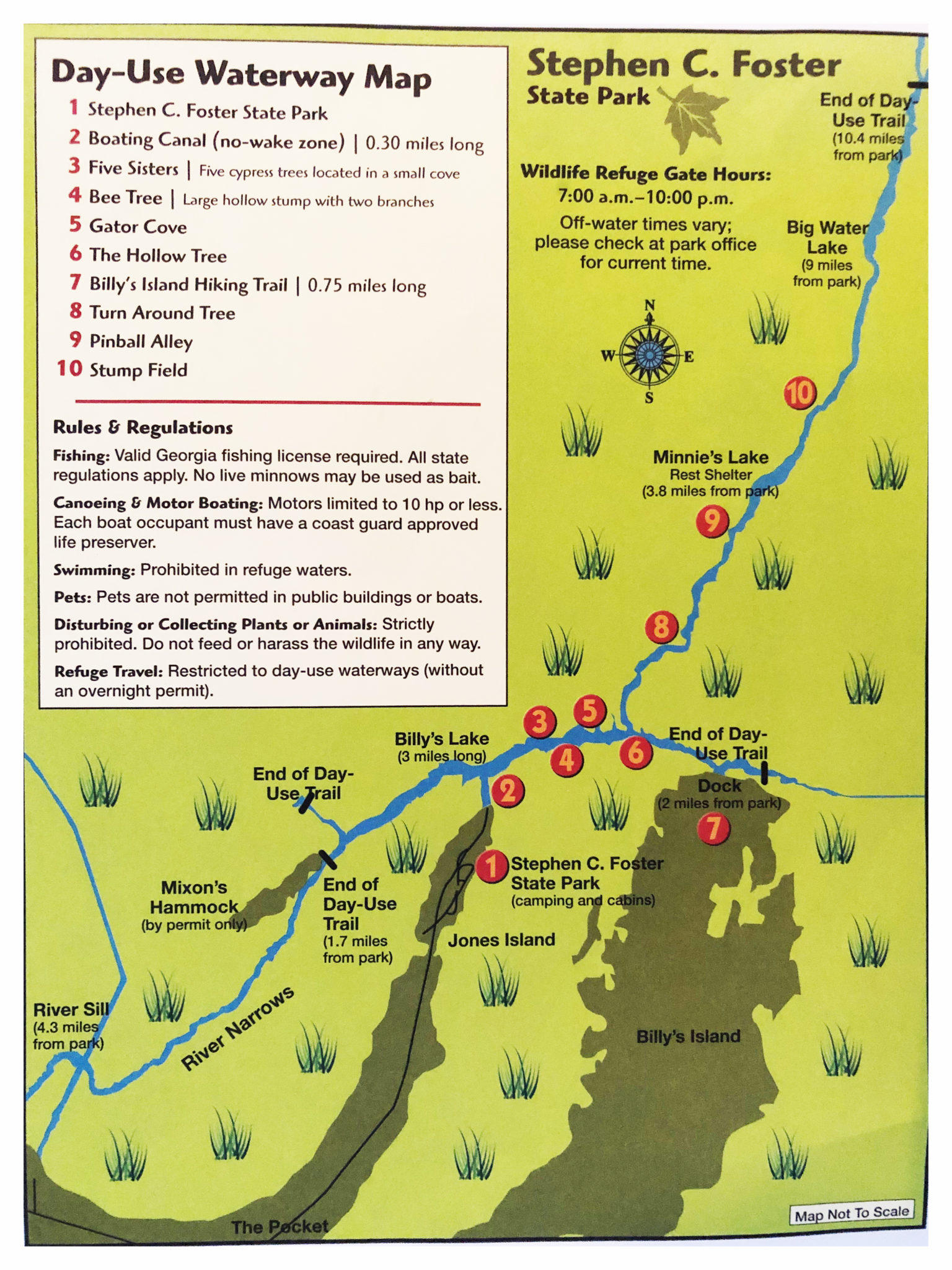
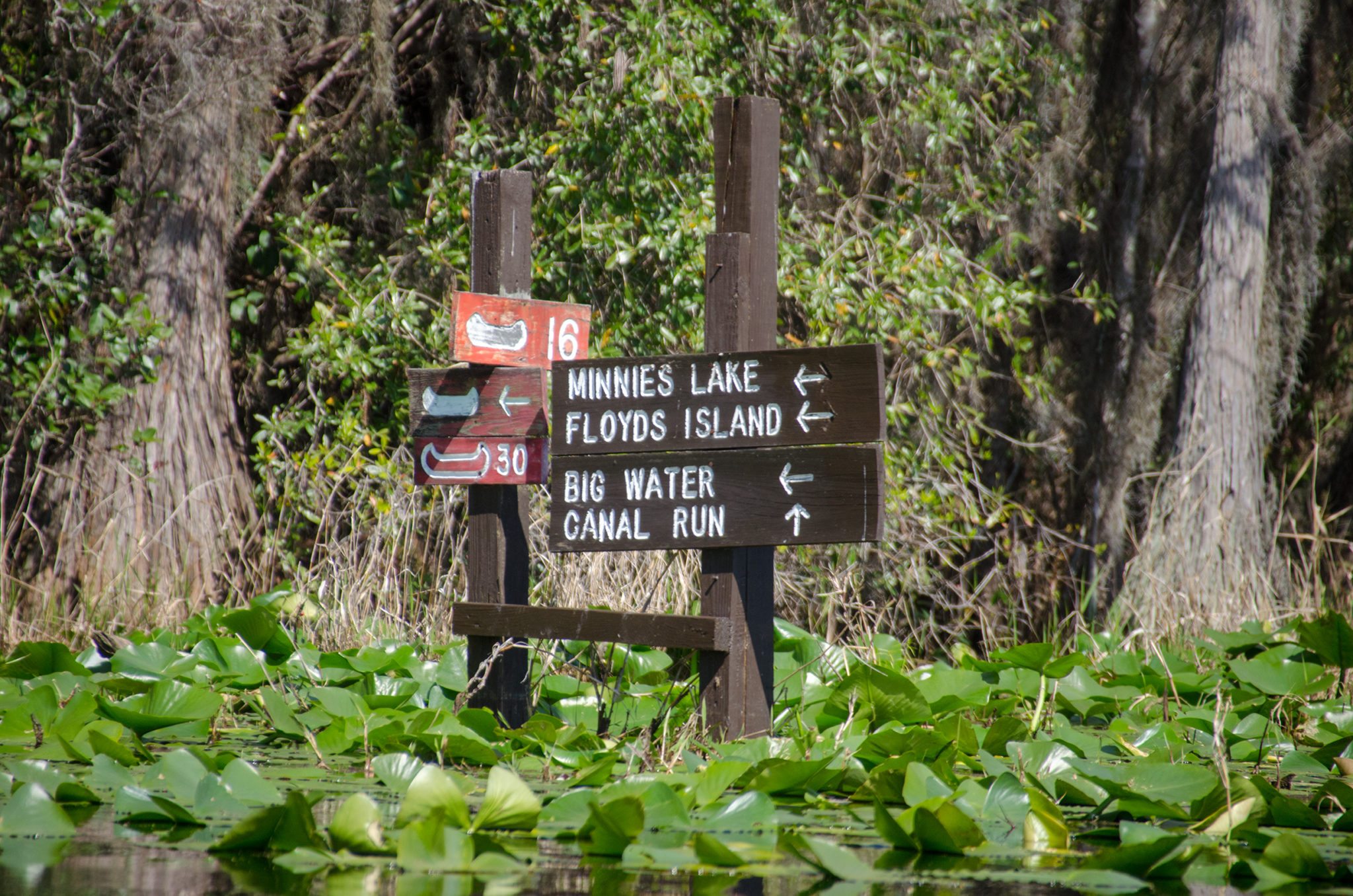
![]() Side Paddles: There are several miles of paddling trails in this area, all well marked. 4 areas are to the West after entering the river and three are to the right, which includes Billy’s Island. 1.4 miles East, after entering the river from the access canal, is the paddle trail leading North ( RR ) to Minnie’s Lake and Big Water.
Side Paddles: There are several miles of paddling trails in this area, all well marked. 4 areas are to the West after entering the river and three are to the right, which includes Billy’s Island. 1.4 miles East, after entering the river from the access canal, is the paddle trail leading North ( RR ) to Minnie’s Lake and Big Water.
![]() Rest Areas: Restrooms available at the launch. Billy’s Island does not have bathroom facilities but a great chance to rest and hike.
Rest Areas: Restrooms available at the launch. Billy’s Island does not have bathroom facilities but a great chance to rest and hike.
![]() Important Information: This would be a buggy hot paddle in the summer months. Watch out for the numerous LARGE alligators.
Important Information: This would be a buggy hot paddle in the summer months. Watch out for the numerous LARGE alligators.
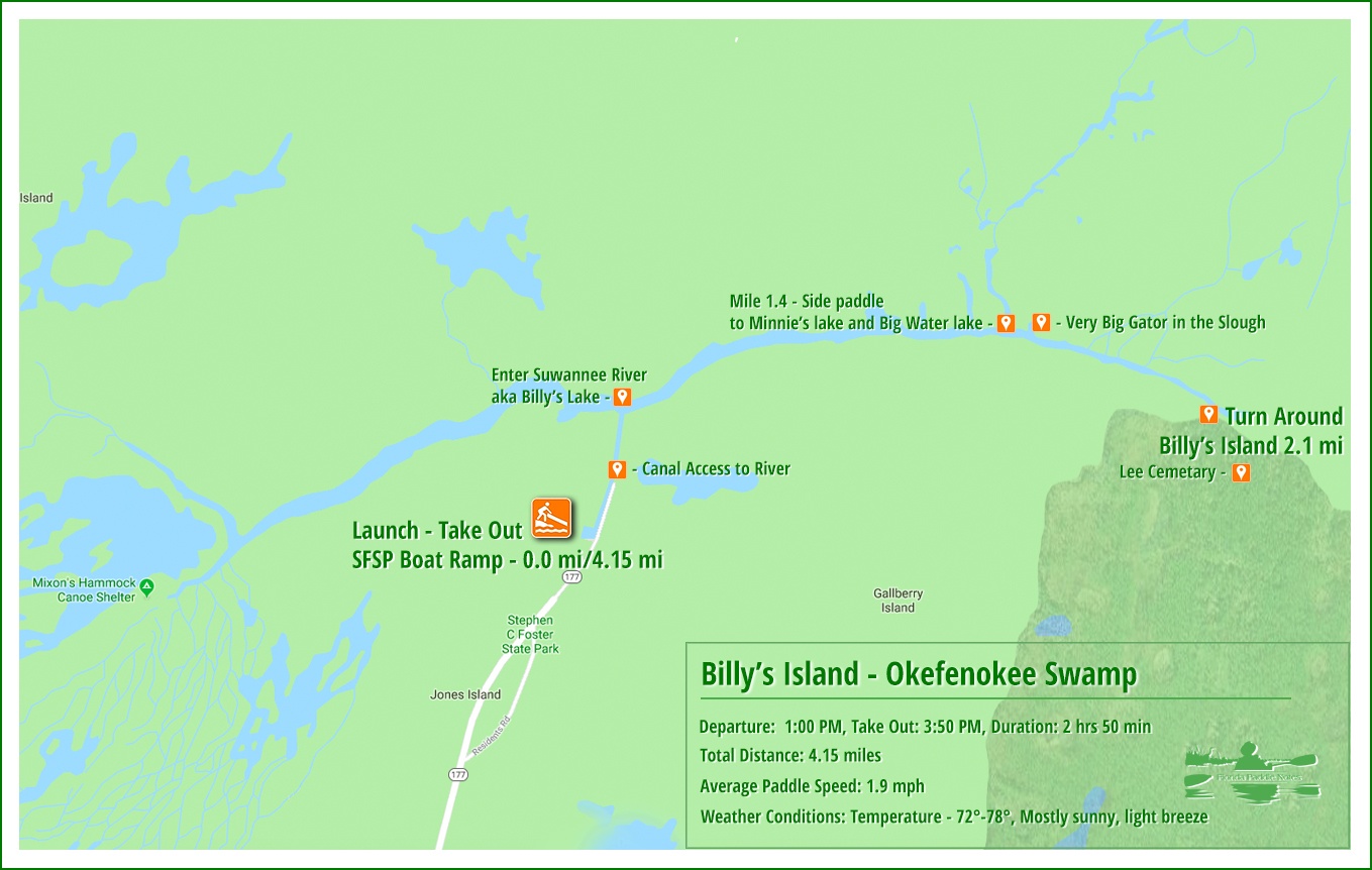
Billy’s Island Paddle Map
The Launch
The launch, located in Stephen C. Foster State Park is nice. It is a small, square marina with a good ramp and plenty of parking. There is also an area along the canal where canoes/kayak rentals are kept on a grassy slope. This area is where I launched. Keep an eye out however, as there are numerous alligators, both large and small along this very thin canal.
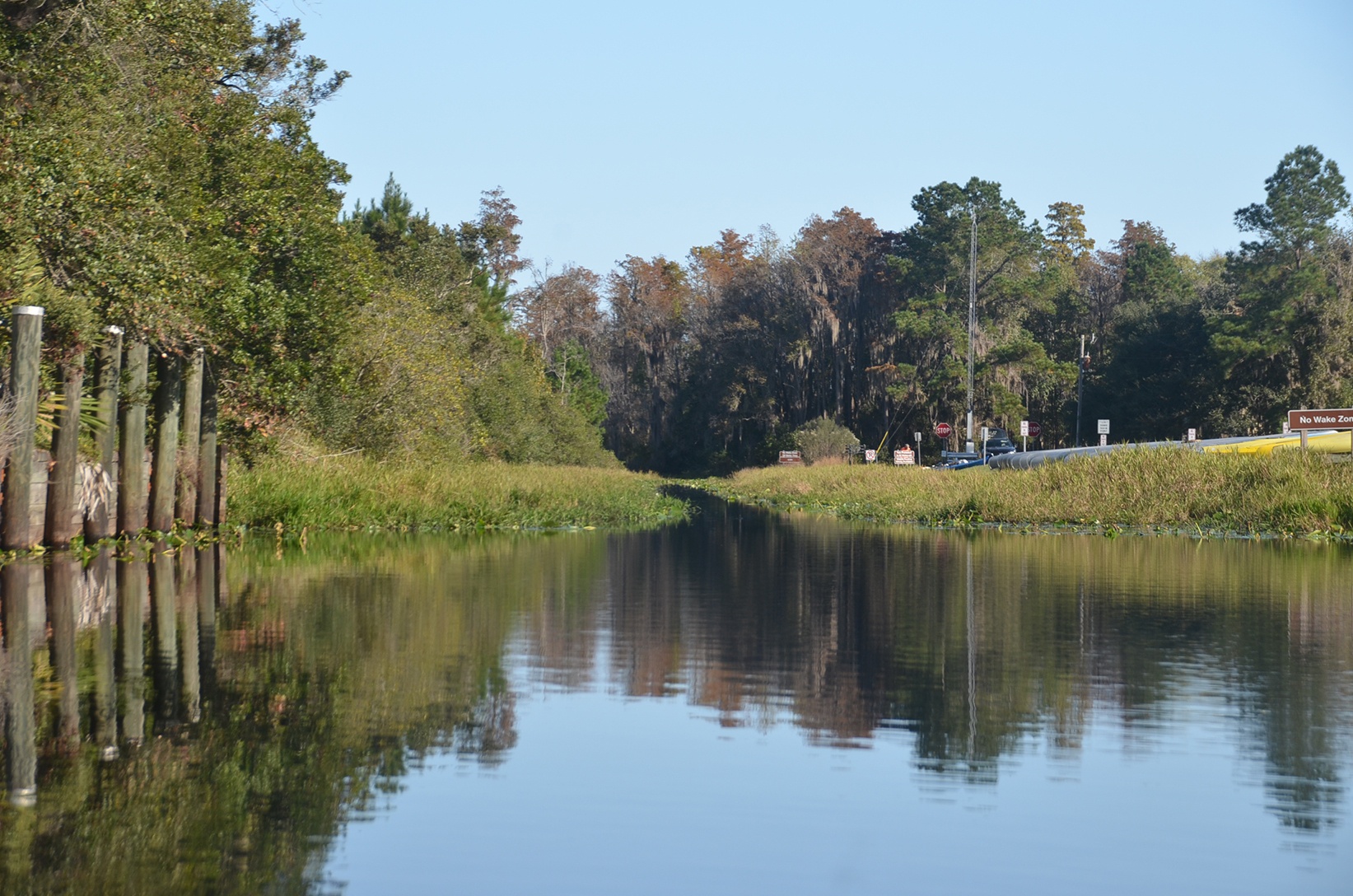
The canal itself is barely 20′ wide, shallow and lined with Spadderdock, making the passage a single file endeavor. The canal runs 1700′ before reaching Billy’s Lake ( as the state park map labels it ) also labeled on topographic maps as the Suwannee River. It is on this body of water the adventure begins!
Our paddle to Billy’s Island leads us East on Billy’s Lake. Paddling to the West would lead to several areas of interest to include the Suwanee River Sill, a low earthen dam that was built to raise the water level in the Okefenokee to reduce the numerous fires during periods of drought. That will be another paddle. On this paddle, it’s off to Billy’s Island, two miles ahead!
Billy’s Island
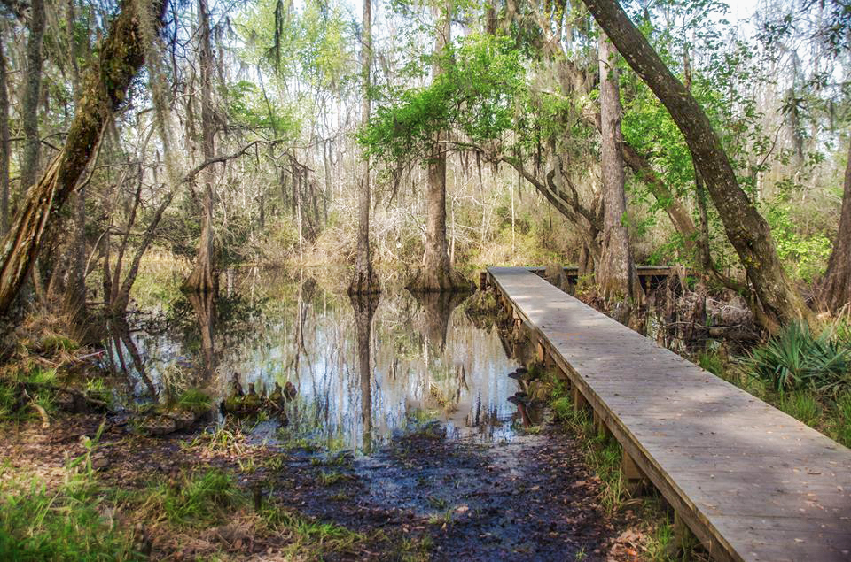
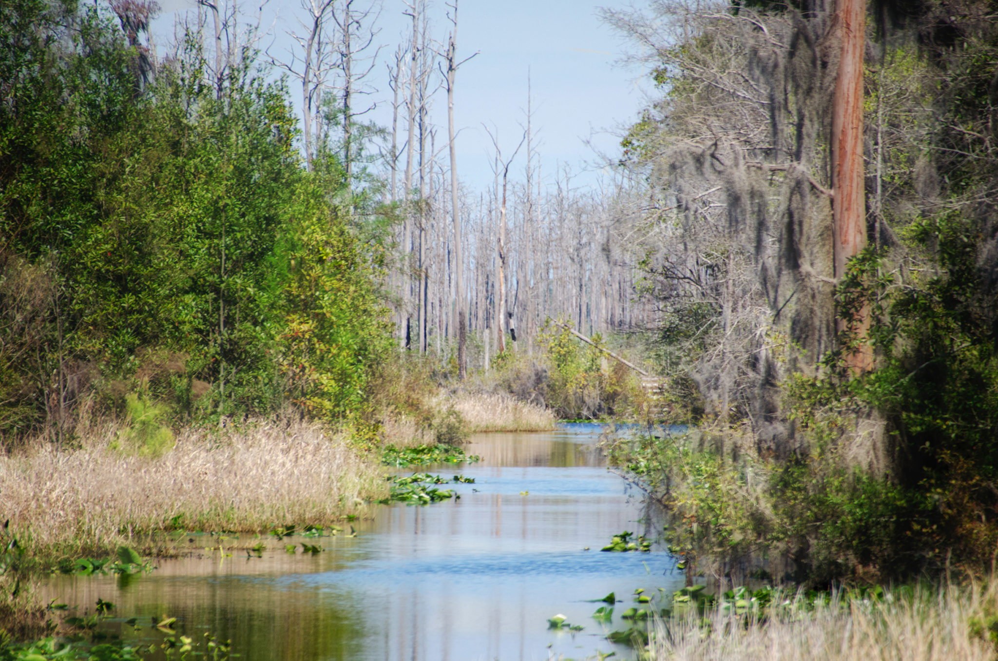
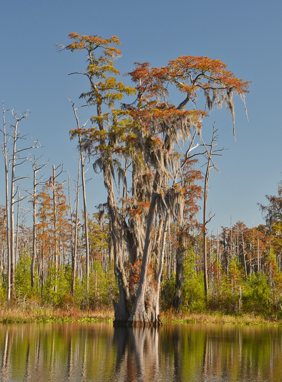
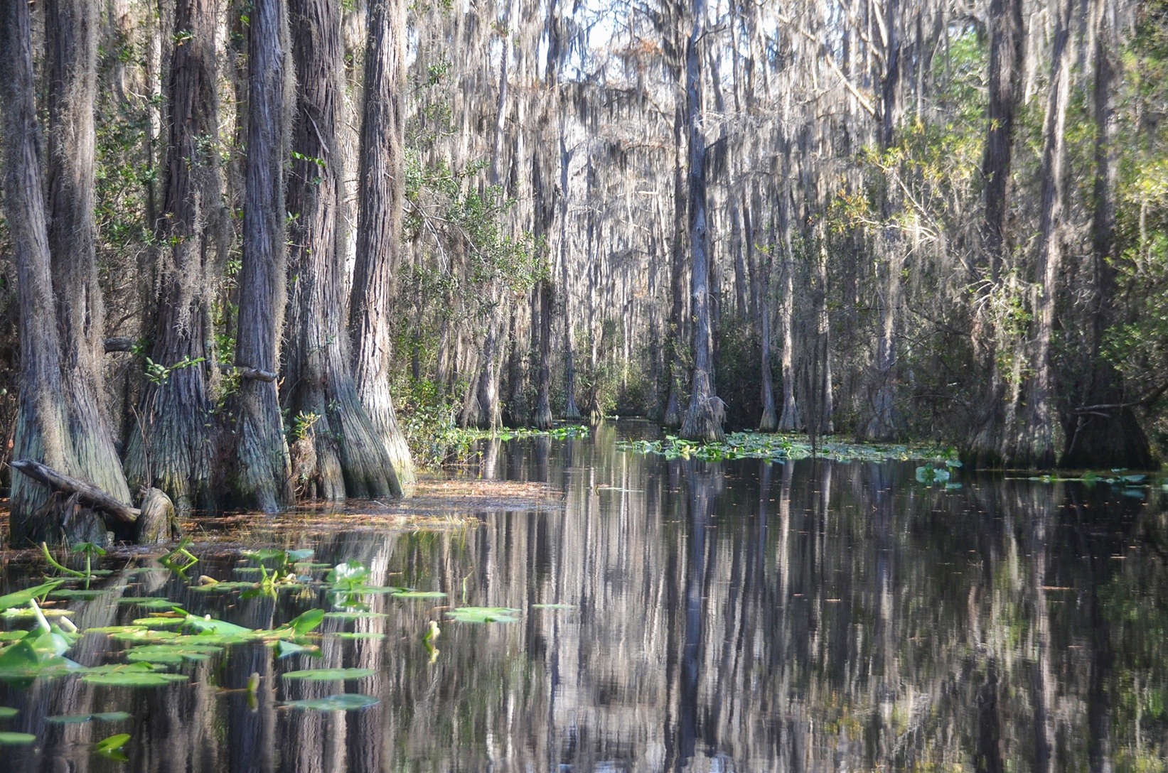
The paddle on Billy’s Lake was very pleasant, a slight breeze, 74° and mostly sunny. Except for a few smaller cypress, the leaves had yet to emerge on the older ones and we paddled along a highway of tall, barren cypress covered in Spanish Moss. Accenting the grey and brown of the cypress was the bright green of Spadderdock that lined both shorelines and a bright blue sky…beautiful.
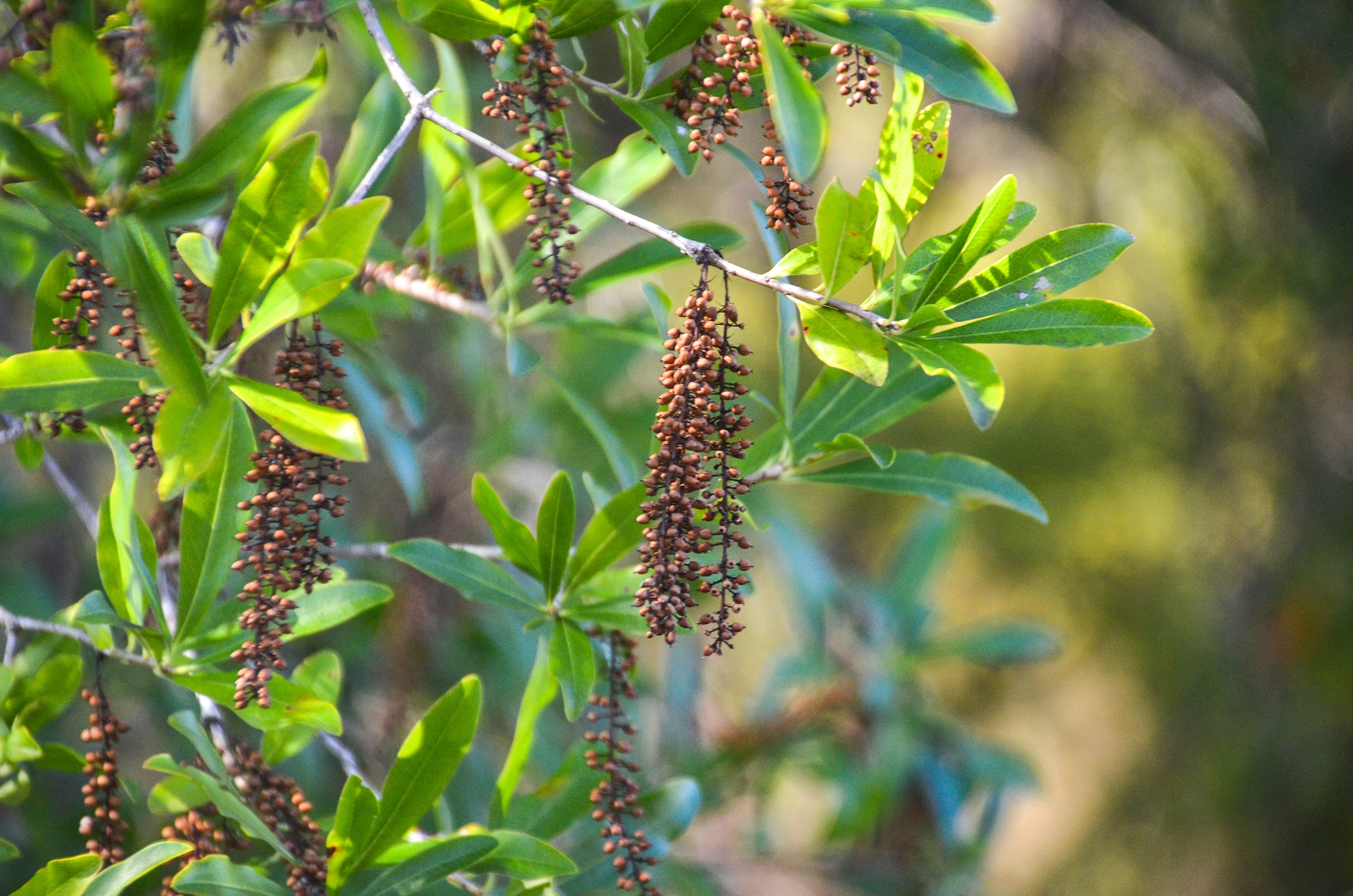
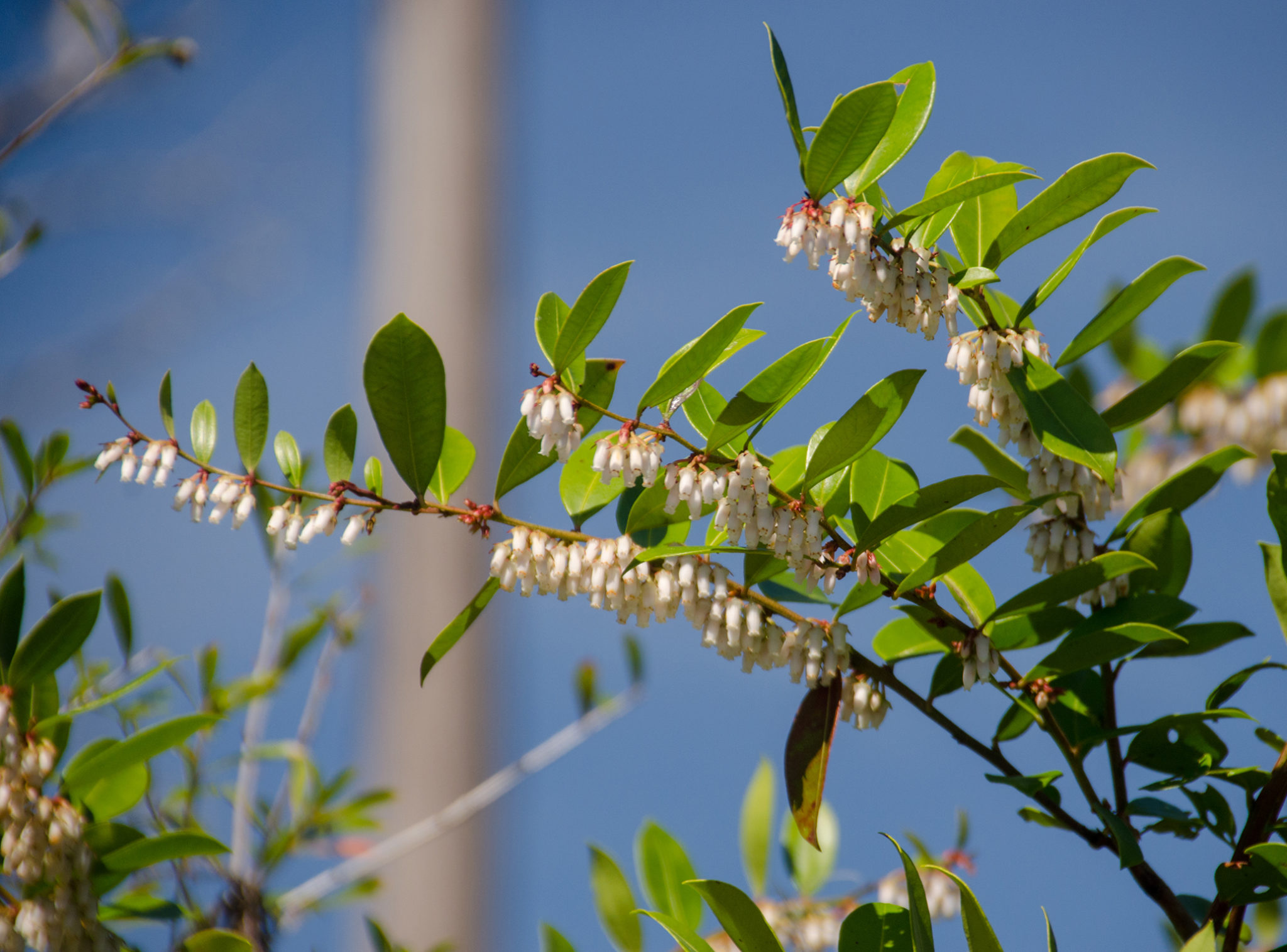
What caught my attention on this paddle was the abundance of Shining Fetterbush in full bloom, everywhere! It was so abundant I researched it and found it is the principal understory species of the Okefenokee Swamp.
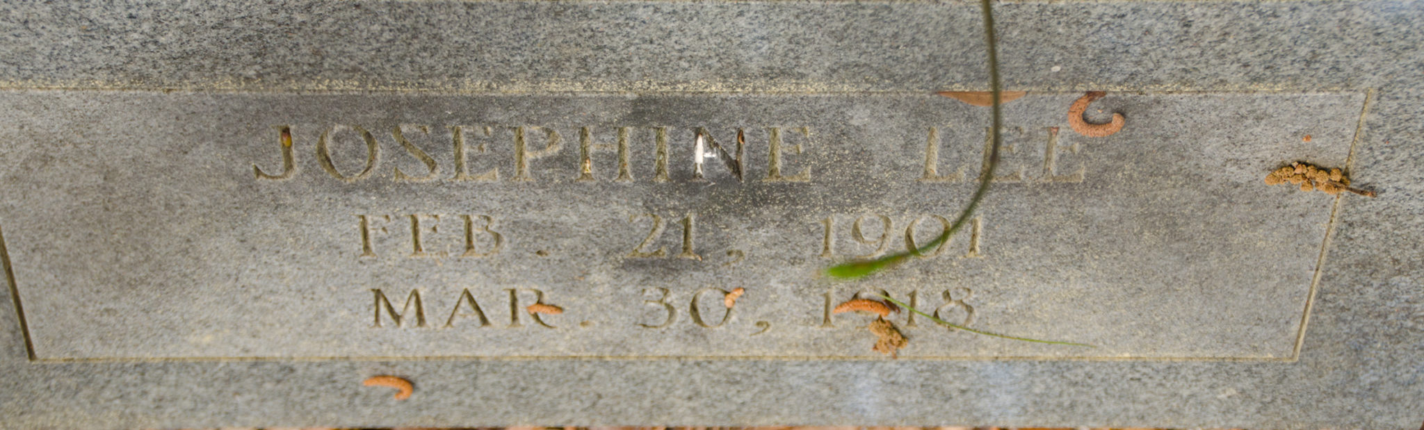
Billy’s Lake gradually thins to 35′ approaching the Island. Here, a marker sign greets us at our destination. A well constructed dock and walkway provide for easy tie up and exit from the kayak. It is well shaded and a great place to rest, have lunch and take the short walking tour that leads to the Lee Cemetary. The Lee family were early squatters on this island and have a great history here. What impressed me about Billy’s Island was the obvious size, covered with large Pines and Saw Palmetto as far as the eye can see. As is typical of the Okefenokee Swamp, there are numerous islands like this and Billy’s is the second largest.
After a nice rest and lunch, it was time to return and once again view many of the same Gators we saw on the way here. This was a pleasant paddle and I look forward to returning when the Cypress trees have leafed . There’s much more to explore here!
Billy’s Lake aka The Suwannee River

There is a large directional sign on the north side of the river as you leave the entrance canal and enter Billy’s Lake, aka The Suwannee River. My direction to Minnie’s Lake is to the right ( East ).
This is an open section of the river, lined with Cypress Trees, Holly, and Spadderdock. It is 100 – 150′ wide against a minimal current. There are a couple of points of interest along this one-mile section, noted on the State Park’s brochure…The Five Sisters, The Bee Tree, Gator Cove and The Hollow Tree. I was able to locate the Five Sisters, Gator Cove, and the Hollow Tree but no clue about the Bee Tree. Numerous, very large alligators can be viewed along each of the banks as well as, swimming across the river.
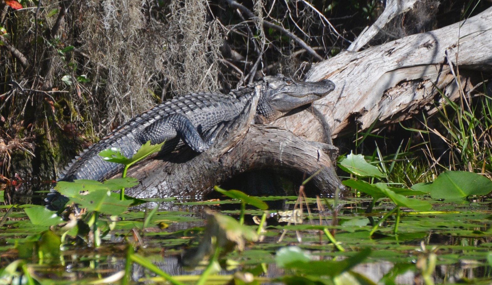
The Okefenokee Gators
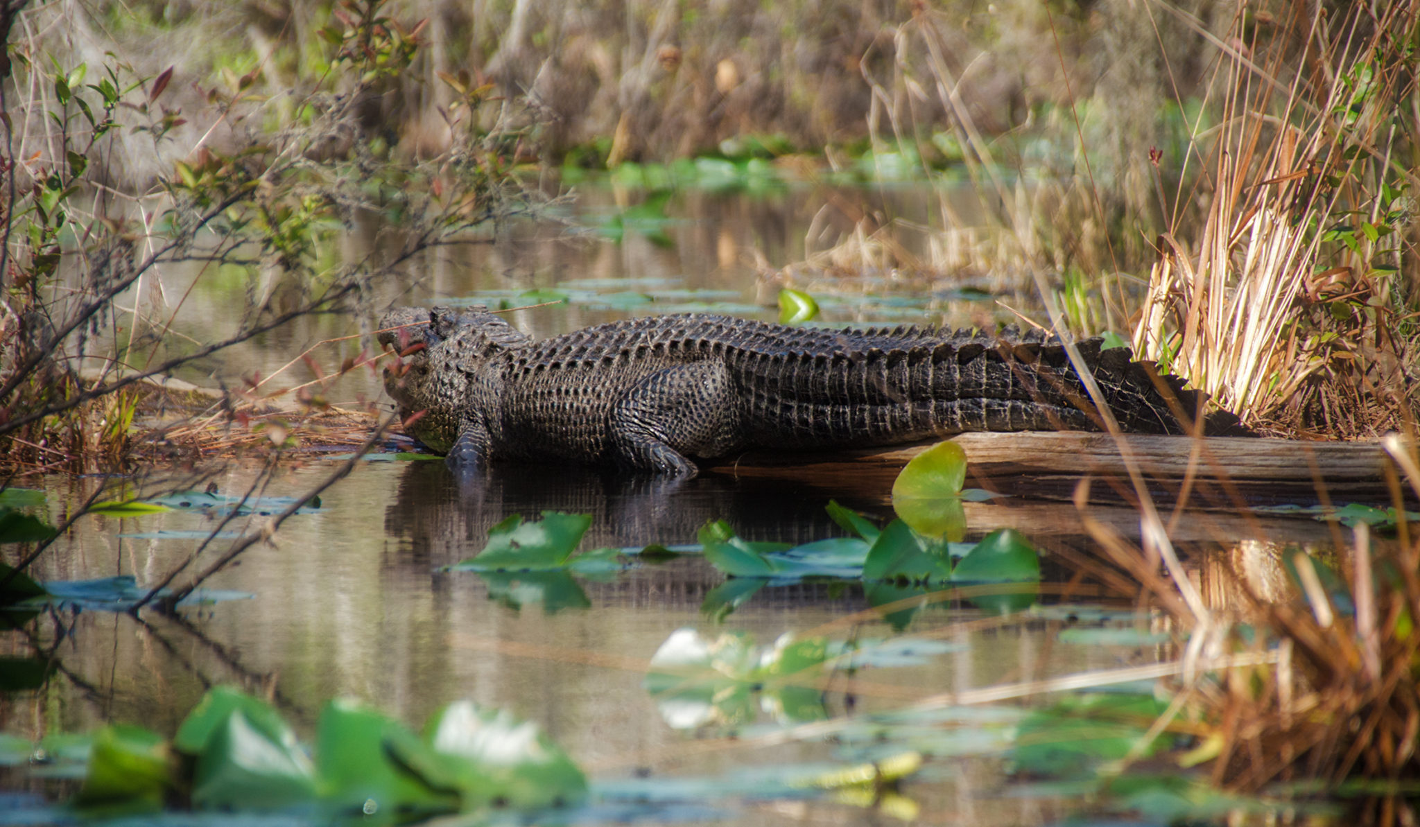
From the moment of launch, it was obvious this was Gator Country! The Okefenokee is home to an estimated 10,000-13,000 American Alligators and I saw a good share of them. What was interesting was the size of these gators…HUGE…anywhere from 10′-12′ long. According to Georgia sources that track and count the gators, 14′ gators are rare in the swamp. While most of the gators remained basking in the sun, several emerged into the tannin water as I neared. A general rule of thumb for sizing gators is to estimate the distance between the nose and eyes and convert the inches to feet to get a decent estimate of size.
Minnie’s Lake Details
![]() Location: This paddle in the Okefenokee Swamp is located in Charlton County Georgia in the middle of the Okefenokee National Wildlife Refuge about 17 miles northeast of Fargo, Ga.
Location: This paddle in the Okefenokee Swamp is located in Charlton County Georgia in the middle of the Okefenokee National Wildlife Refuge about 17 miles northeast of Fargo, Ga.
![]() Launch Point: The launch is located at Stephen C. Foster State Park, 17515 GA-177, Fargo, GA 31631.
Launch Point: The launch is located at Stephen C. Foster State Park, 17515 GA-177, Fargo, GA 31631.
There are canoe, kayak, and boat rentals available at the park. Phone # 912-637-5274, There are restroom facilities at the park and plenty of parking. There normall is a $5.00 Refuge Parking fee that is waived with a National Parks Senior Pass.
![]() Paddle Distance: The distance to Minnie’s Lake is 4 miles one way.
Paddle Distance: The distance to Minnie’s Lake is 4 miles one way.
![]() Difficulty: Easy
Difficulty: Easy
Average Paddle Speed: 2.2 mph. I did reach faster paddle speed on my return from the shelter, paddling with the flow.
![]() Width and Depth: Once leaving the access canal, this portion of the river is 155′ wide and thins to 35′ wide at Billy’s Island. Paddling north onto the middle fork to Minnie’s Lake, the width can range from 20′ to 100′ throughout the paddle. The average depth of the waterways in the swamp are from 2′ to 10′ deep.
Width and Depth: Once leaving the access canal, this portion of the river is 155′ wide and thins to 35′ wide at Billy’s Island. Paddling north onto the middle fork to Minnie’s Lake, the width can range from 20′ to 100′ throughout the paddle. The average depth of the waterways in the swamp are from 2′ to 10′ deep.
![]() Current – Tidal: There is a minimal flow to this area of water. The Okefenokee drains slowly to the Southwest forming the Suwannee River and drains to the South forming the St. Marys River.
Current – Tidal: There is a minimal flow to this area of water. The Okefenokee drains slowly to the Southwest forming the Suwannee River and drains to the South forming the St. Marys River.
![]() Side Paddles: There are several miles of paddling trails in this area, all well marked. 4 areas are to the West after entering the river and three are to the right, which includes Billy’s Island and Lake Minnie. 1.4 miles East, after entering the river from the access canal, is the paddle trail leading North ( RL ) to Minnie’s Lake and Big Water.
Side Paddles: There are several miles of paddling trails in this area, all well marked. 4 areas are to the West after entering the river and three are to the right, which includes Billy’s Island and Lake Minnie. 1.4 miles East, after entering the river from the access canal, is the paddle trail leading North ( RL ) to Minnie’s Lake and Big Water.
![]() Rest Areas: Restrooms available at the launch. There is a rest area at Minnie’s Lake along with a very clean outhouse.
Rest Areas: Restrooms available at the launch. There is a rest area at Minnie’s Lake along with a very clean outhouse.
![]() Important Information: This would be a buggy, hot paddle in the summer months. Be respectful of the numerous LARGE alligators.
Important Information: This would be a buggy, hot paddle in the summer months. Be respectful of the numerous LARGE alligators.
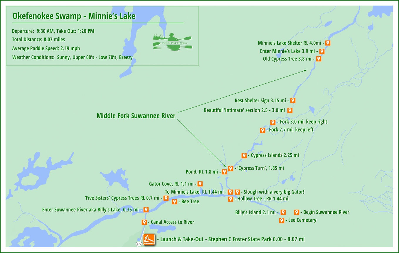
Minnie’s Lake Paddle Map
On to Minnie’s Lake
There is another directional sign on the north side of the river where I need to make a left turn and paddle north 2.5 miles to the shelter at Minnie’s Lake. This is the Middle Fork of the Suwannee River.
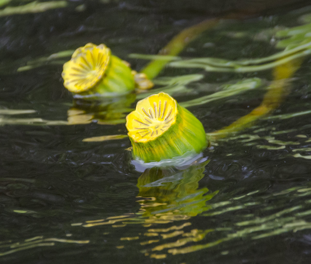
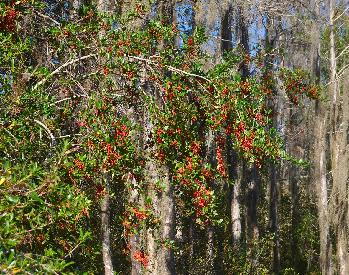
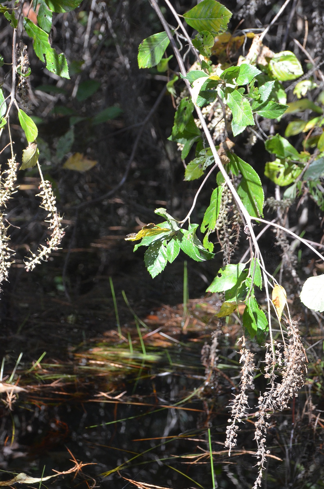
The scenery definitely changes when exiting Billy’s Lake and entering the thick, swamp jungle of the fork. This stretch is characterized by tall-reaching Cypress trees. Unlike some of the giant, weathered, sculptured specimens we see along the main Suwanne River and larger rivers, the densely populated cypress along this fork are tall, straight specimens reaching for the light. Joining the tall Cypress is a nice mix of Red Bay & Loblolly Bay. The understory is densely populated with Dahoon Holly, with bright red berries on display the entire paddle. Shining Fetterbush, Climbing Fetterbush, Swamp TiTi, Willow, Virginia Sweetspire, and Wax Myrtle were the predominant understory shrubs/trees that displayed the final results of their bloom season. Along the paddle, Golden Club can be spotted in the water along the edges.
This two-mile section up the middle fork Suwannee is very unique, scenic, and as I said in my intro, worth revisiting with a fresh flush of leaves on the Cypress. The gentle flowing fork winds around cypress trees in the mainstream opens up to tall stands of cypress and returns to a cooling, intimate, canopied swamp experience. My favorite section was mid-way up…just so cool!


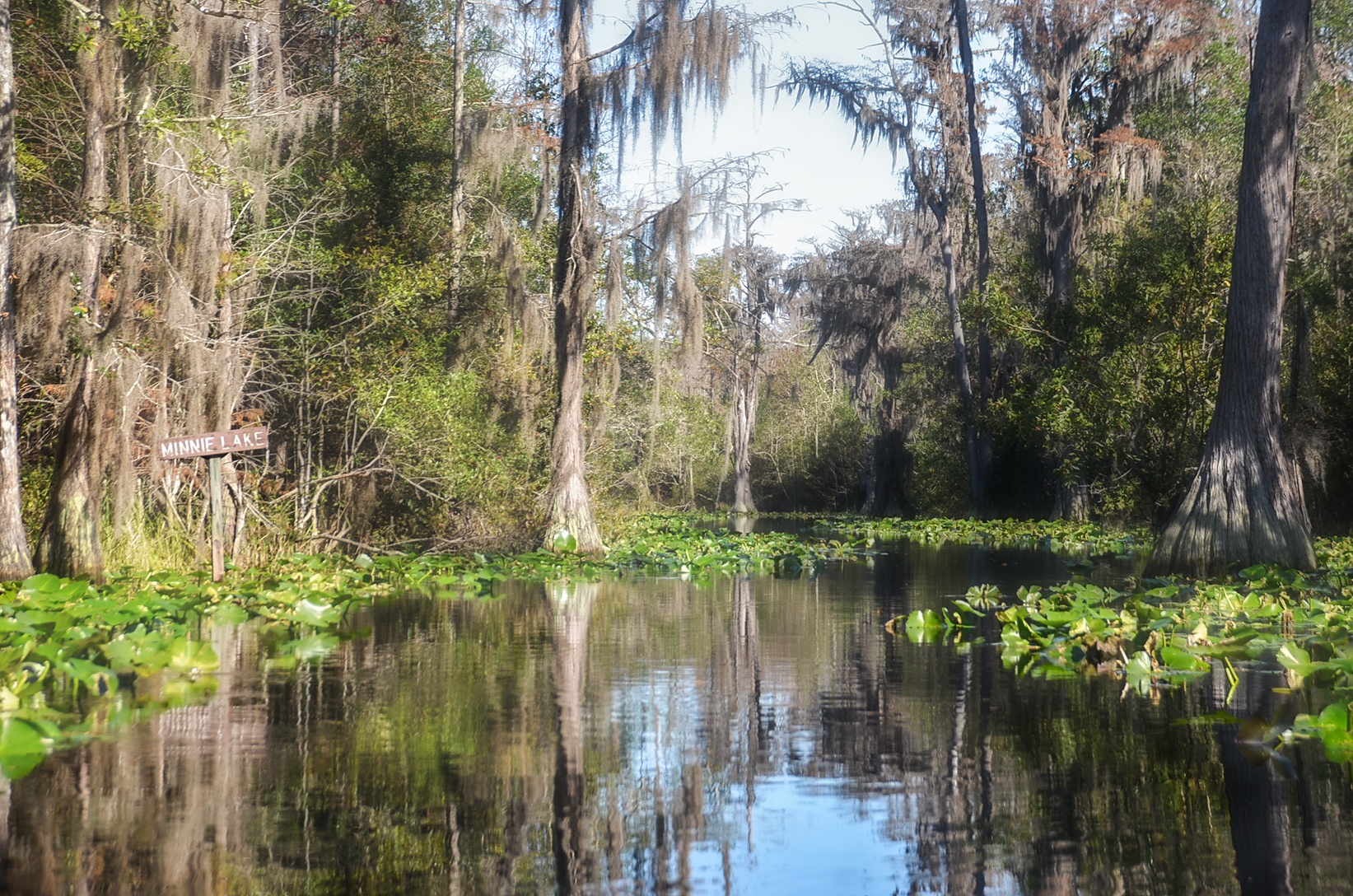
Minnie’s Lake Shelter
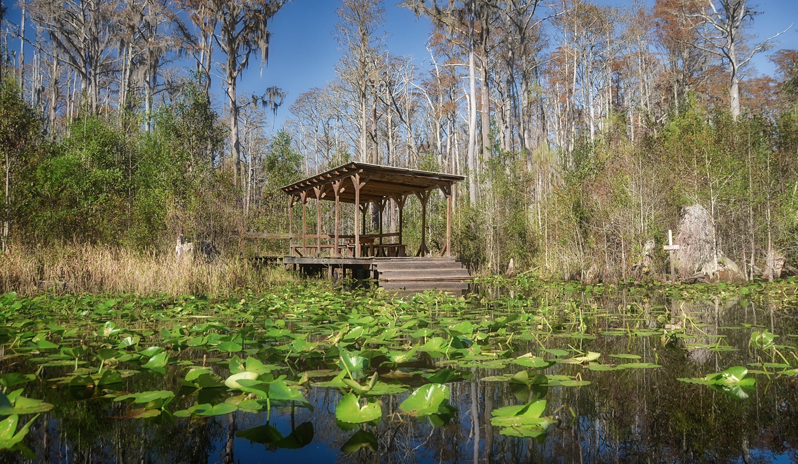
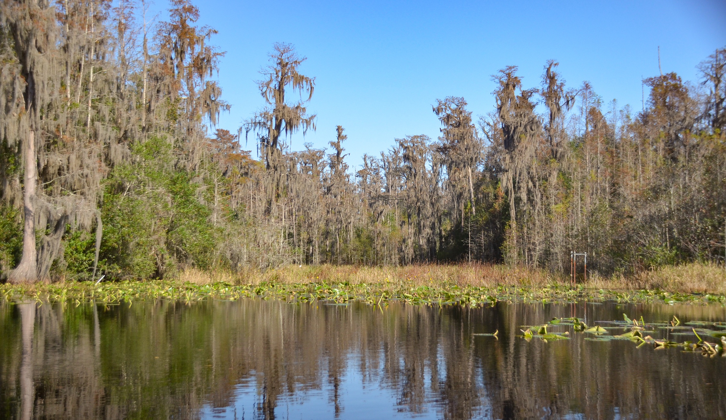
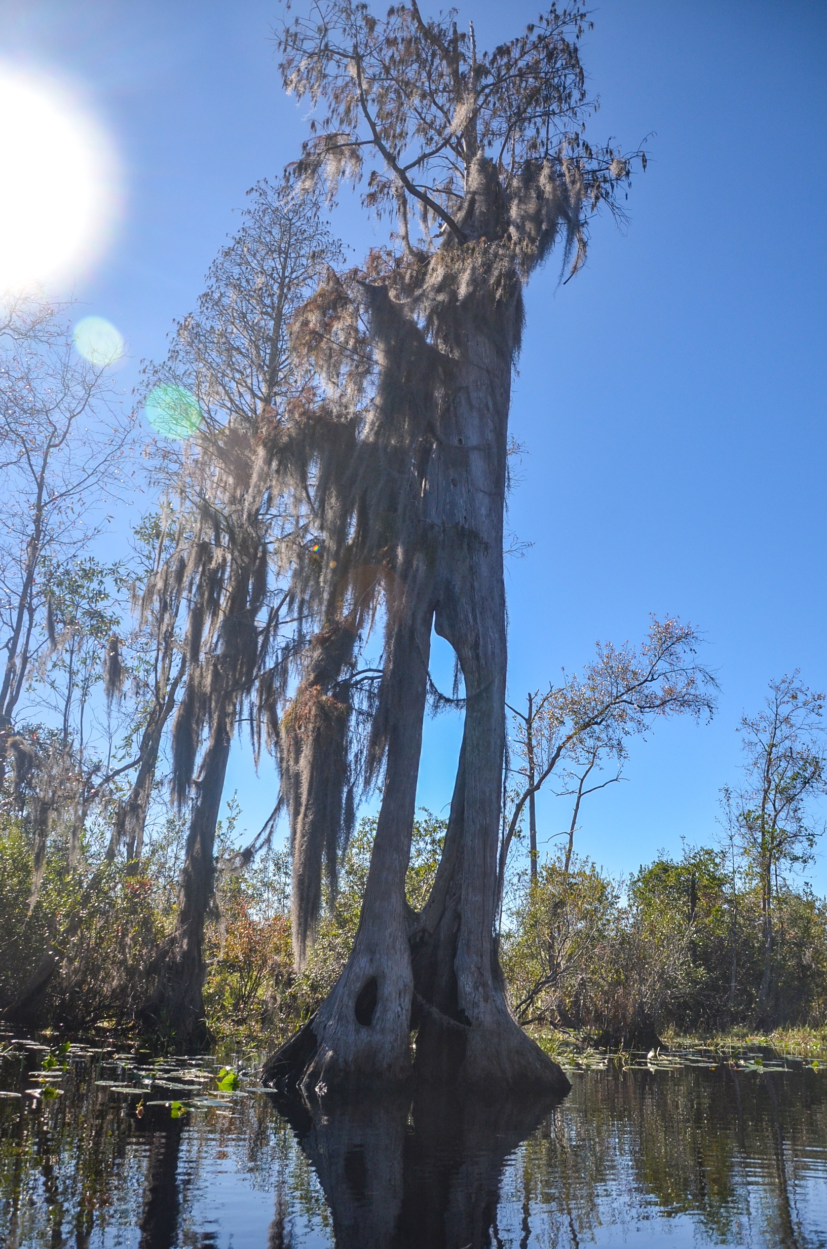
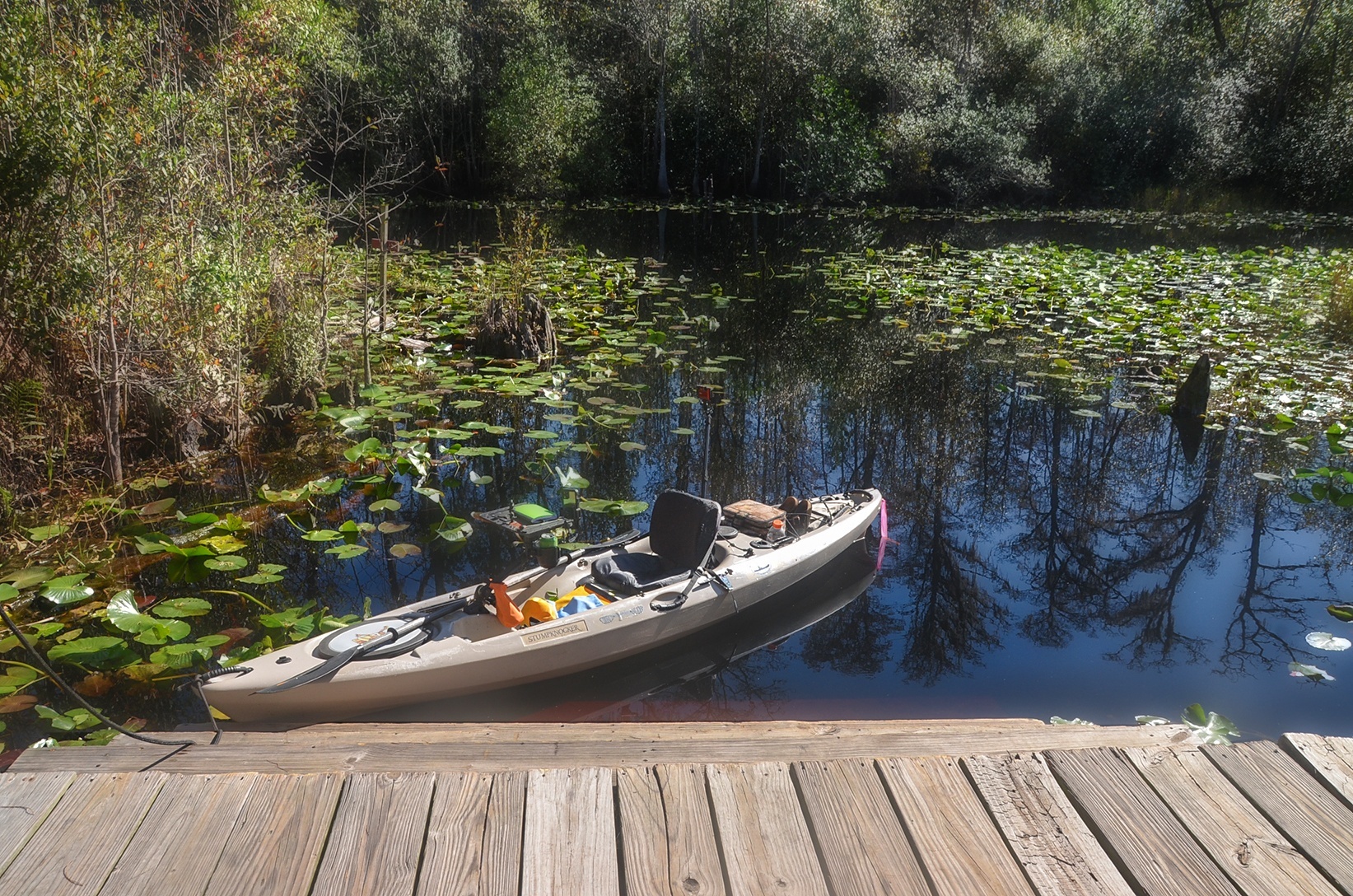
The noticeable change, after entering Minnie’s Lake is the canopy ends, the thick stands of cypress are in the distance and, now there appear the old weathered and even dead, tall Bald Cypress trees, It is quite a change. The shelter was perfect! Because of the higher water level, I was able to paddle ‘Stumpknocker’ over to the landing steps and step out of the kayak onto one of the steps the was about 8″ below the waterline. This made for very easy exiting and re-entering of the kayak. A word of caution…the submerged step is VERY slippery!
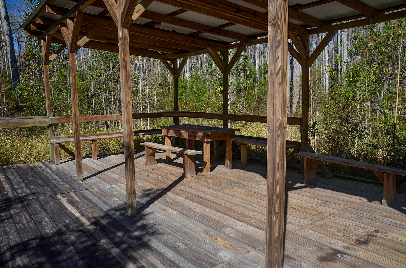
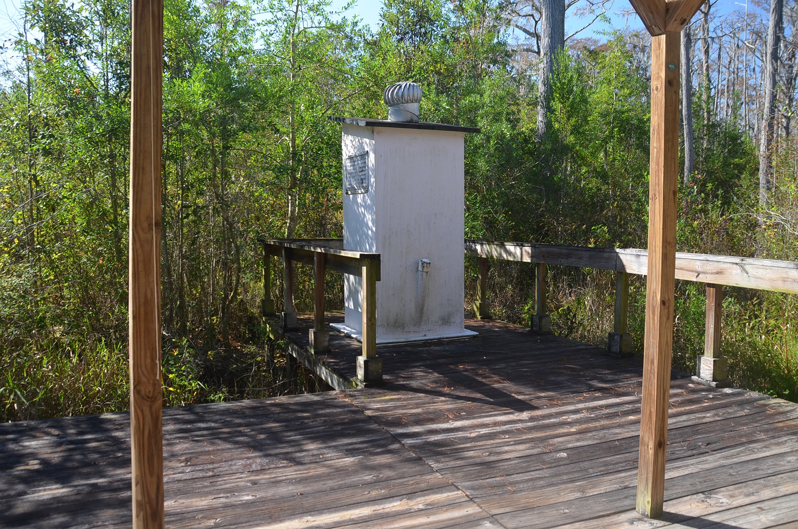
I was the only inhabitant of the shelter today, It is a nice open, wood shelter, 20′ x 30′ with a side portion 10′ x 12′ where the Outhouse is located. The outhouse was clean, with plenty of TP. Beneath the metal roof there are a couple of benches as well as a picnic table. Plenty of space to relax. The shelter is for day use only., I had lunch, jotted down a few notes, and prepared for my paddle back.
Guides, Maps & Info
- Minnie’s Lake Topo Map…
- Billy’s Island Topo Map…
- Stephen C. Foster State Park…
- Okefenokee National Wildlife Refuge…
- Okefenokee Swamp…
- Suwannee River Water Levels at Fargo…
![]()