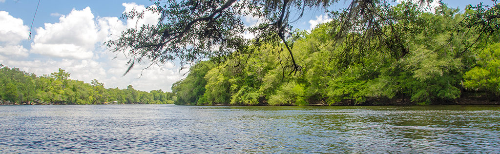
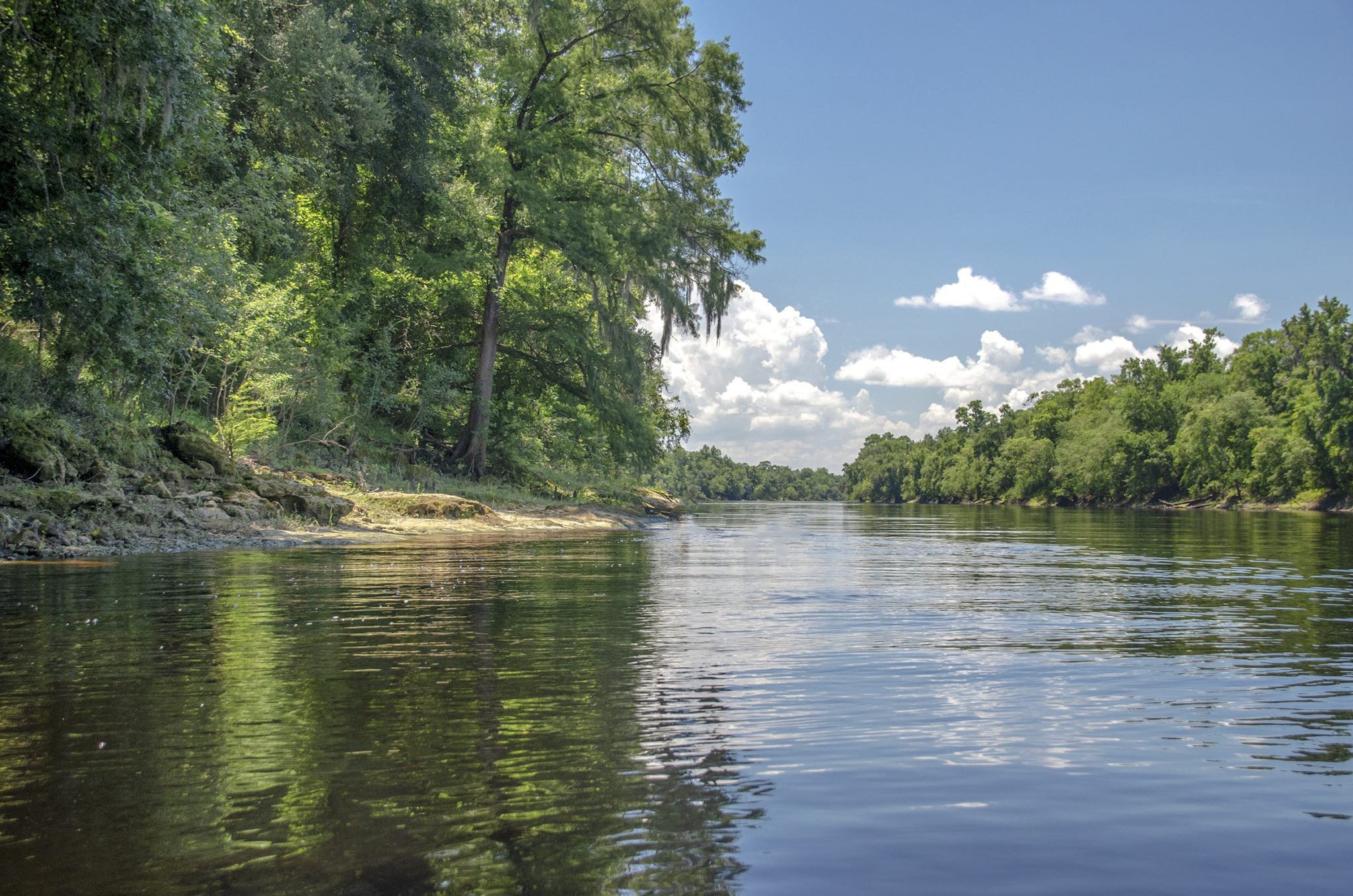
Suwannee River Overview

The Suwannee River is a federally designated wild blackwater river, flowing 246 miles from the Okefenokee Swamp in southeastern Georgia through North Florida to the Gulf of Mexico. Renowned for its dark, tannin-rich waters and natural beauty, the Suwannee is shaped by swamps, high limestone bluffs, hardwood hammocks, and coastal marshes. Along its course, the river carves through Florida’s karst landscape, creating limestone outcroppings and sinkholes that give rise to dramatic features—including Florida’s only whitewater rapids, found at Little Shoals and Big Shoals near White Springs.
The river is home to more than 60 freshwater springs, many of them first-magnitude, which feed into the Suwannee along its journey south. These springs—including Fanning, Manatee, Troy, and Ichetucknee—support crystal-clear swimming holes, rare aquatic life, and a delicate balance of freshwater ecosystems. The surrounding terrain is a mix of floodplain forests, cypress domes, and upland pine woods, making it a haven for paddlers, birders, and wildlife enthusiasts.
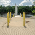
Culturally, the Suwannee is deeply tied to the American imagination. In 1851, Stephen Foster, often referred to as “America’s First Composer,” was struggling with a lyric for his ballad “Old Folks at Home.” His brother suggested “Suwannee” as a melodious river name, and though Foster never visited Florida, the song immortalized the river in American music history. Since 1935, “Old Folks at Home” has been the official state song of Florida, and its legacy is celebrated at the Stephen Foster Folk Culture Center State Park in White Springs—home to festivals, museum exhibits, and a 97-bell carillon tower that plays Foster’s melodies.
In modern times, the Suwannee River remains largely unspoiled, protected by conservation efforts and appreciated for its role in Florida’s cultural identity and natural heritage. Whether paddling its quiet stretches, exploring its rugged shoals, or listening to the notes of a song written centuries ago, the Suwannee offers a journey through both nature and nostalgia.
Rock Bluff Spring | Owens Spring to Patrician Oaks | To Manatee Spring
![]()

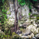
Rock Bluff Spring Details
Rock Bluff Spring is a scenic 2nd-magnitude spring located in Gilchrist County, just northwest of Bell, Florida. Once only accessible by boat via the Suwannee River, the spring became publicly accessible with the opening of the A.H. Anderson Jr. Memorial Park in late May 2019. This small but well-designed county park provides walk-in access, parking, and a short trail leading to the spring, making it a convenient stop for paddlers and spring enthusiasts alike.
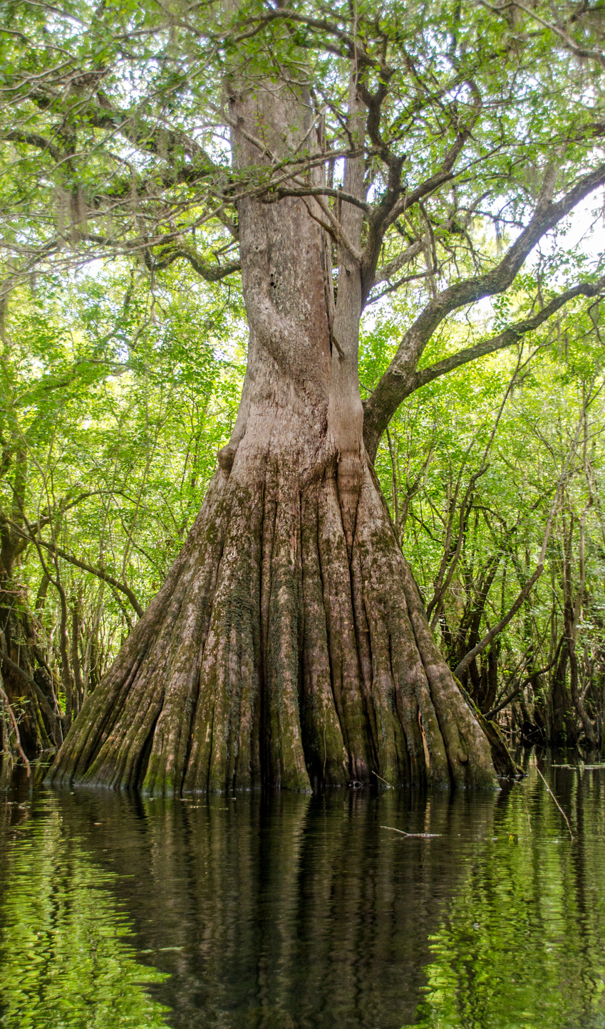
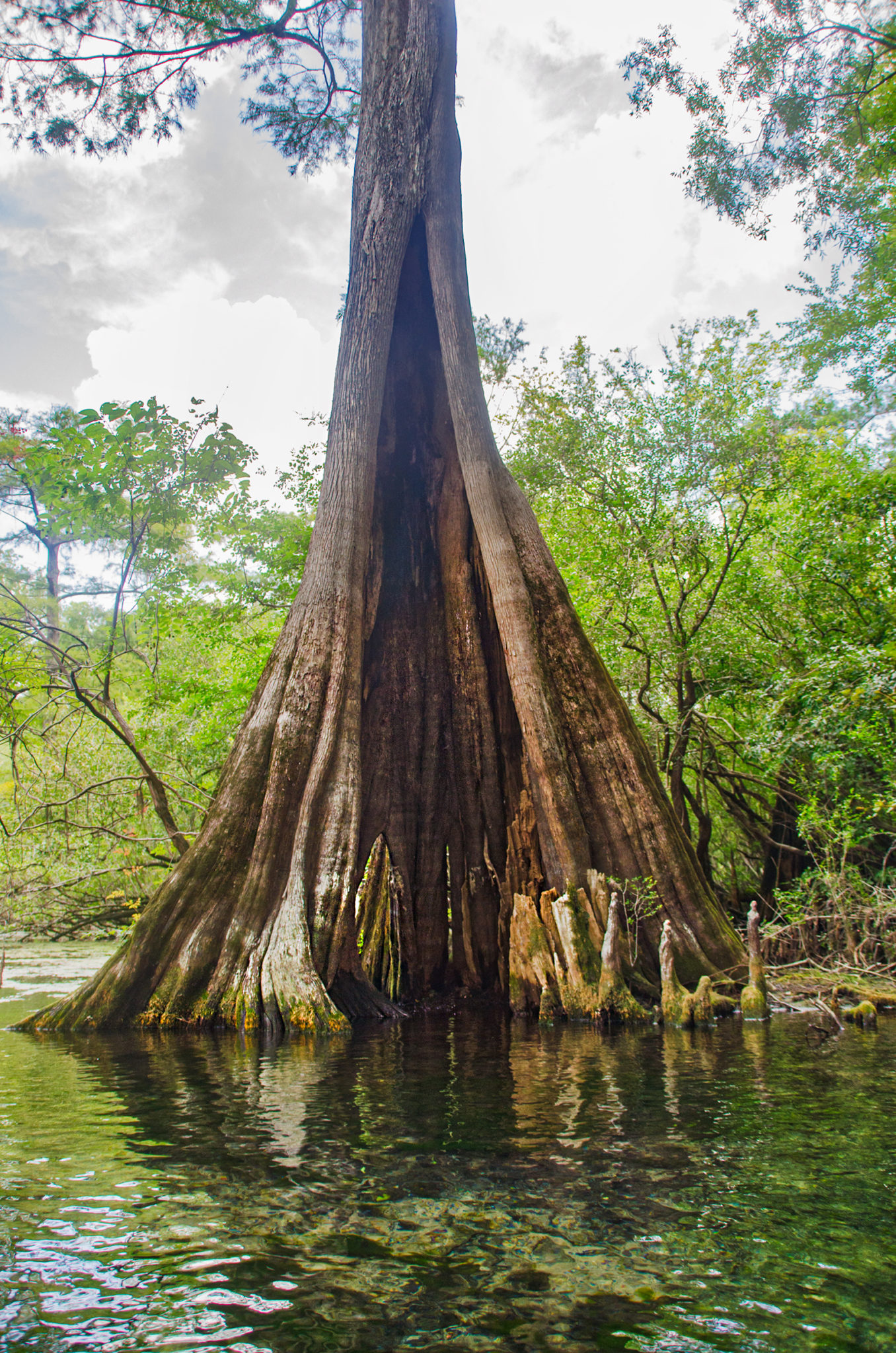
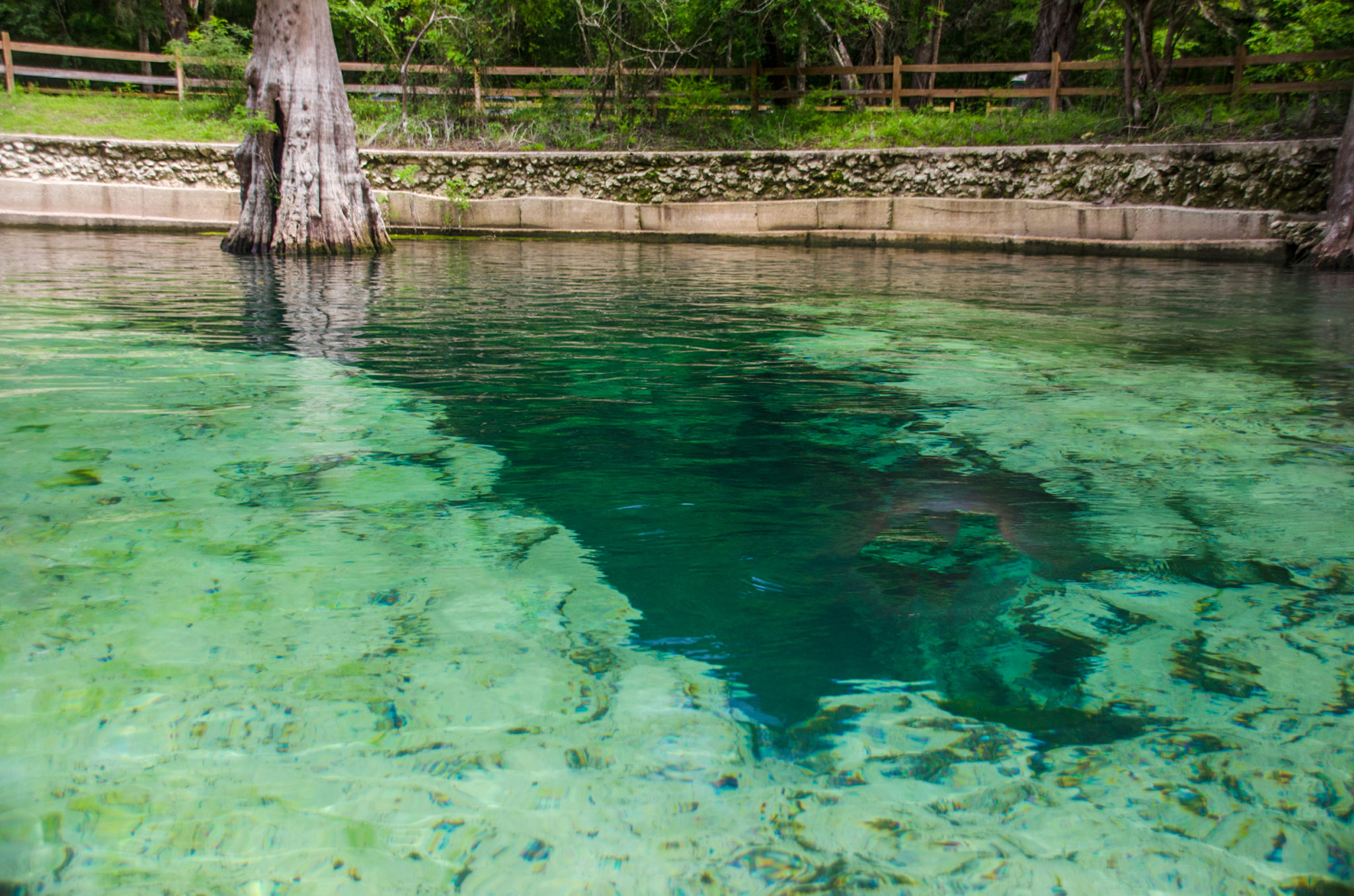
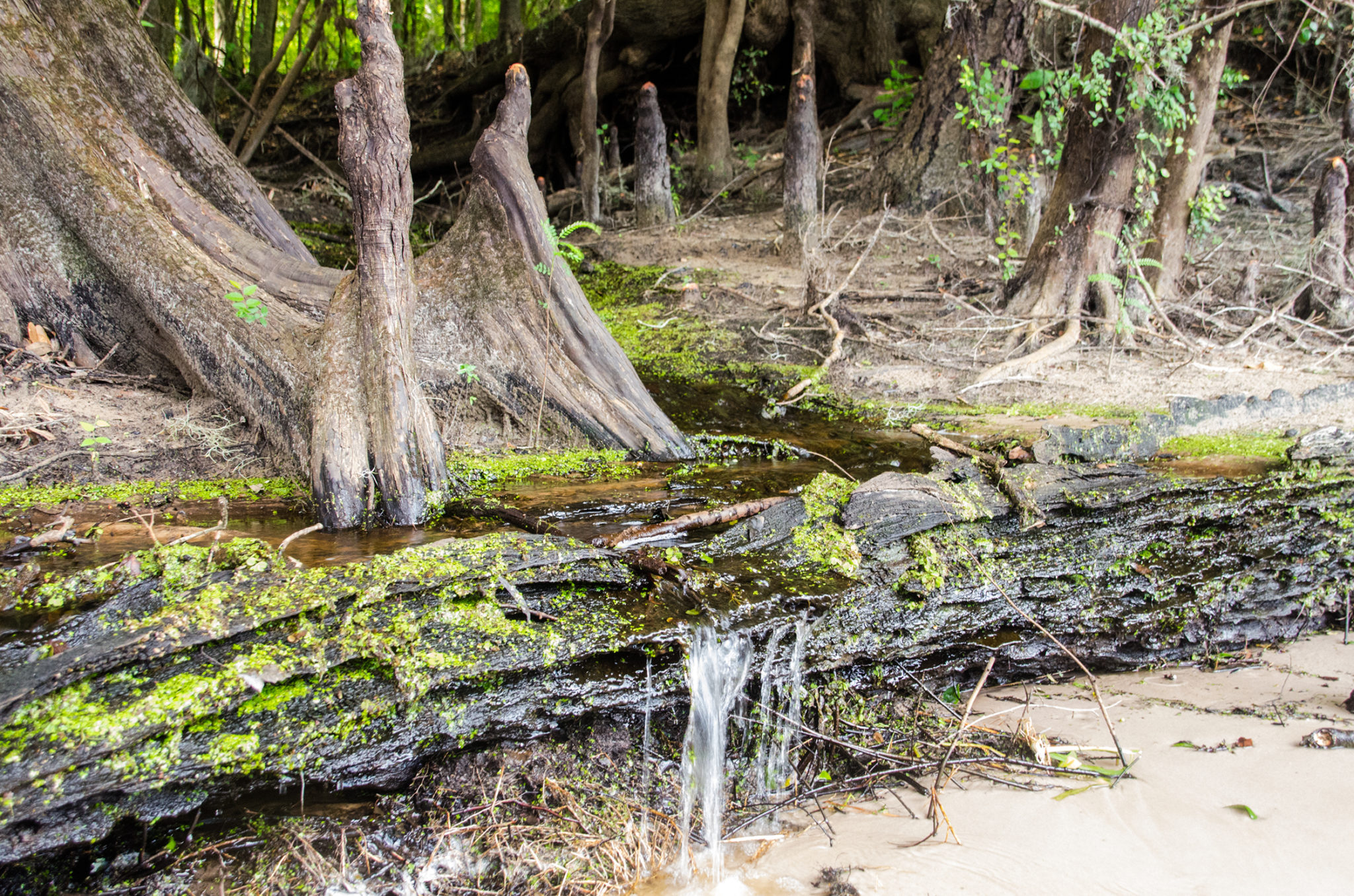
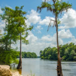
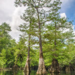
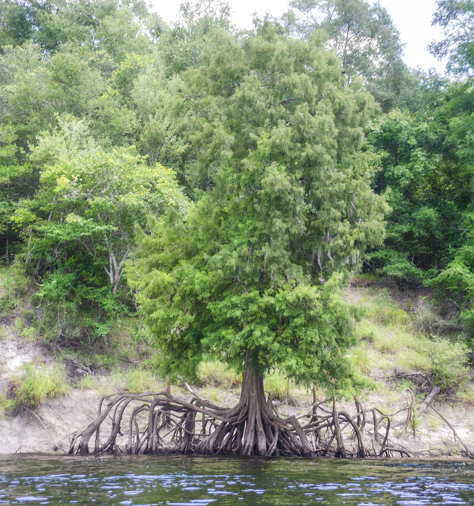
The spring itself features multiple vents that discharge clear, cool water into a wide, shallow pool. The area is framed by graceful Bald Cypress trees, their buttressed trunks creating a dramatic backdrop around the spring pool and along the run. The spring run flows just over 200 feet into the Suwannee River, bordered by larger cypress and hardwoods, adding to the natural beauty of the setting.
With its deep blue waters, sandy bottom, and rich aquatic vegetation, Rock Bluff Spring is both a visually striking and ecologically important feature of the Suwannee corridor.
![]() Location: Rock Bluff Spring is located in Gilchrist County, near Bell, Fl. It is now accessible by trail as well as boat. There is a $4.00 park fee, per car, that is self pay. The park has picnic tables and plenty of shade trees.
Location: Rock Bluff Spring is located in Gilchrist County, near Bell, Fl. It is now accessible by trail as well as boat. There is a $4.00 park fee, per car, that is self pay. The park has picnic tables and plenty of shade trees.
![]() Launch Point: The launch is located on the Suwanne River, Highway 340, 20 miles West of High Springs, Fl.
Launch Point: The launch is located on the Suwanne River, Highway 340, 20 miles West of High Springs, Fl.
Take Out Point: The take out point is at Log Landing Public Boat Ramp, NW 6th St, Bell, FL 32619
![]() Paddle Distance: From the launch on Highway 340, paddling north to Rock Bluff Spring 1/4 mi, then South to Log Landing Public Boat Ramp was a total of 5.6 miles.
Paddle Distance: From the launch on Highway 340, paddling north to Rock Bluff Spring 1/4 mi, then South to Log Landing Public Boat Ramp was a total of 5.6 miles.
![]() Difficulty: Easy.
Difficulty: Easy.
 Average Paddle Speed: 2.4 mph
![]() Width and Depth: At the launch, the Suwannee River was 260′ across and at the take out it was 300′ across. The run averages around 35′ wide. The water level on the Suwanne for this trip was 6.83′ with flood stage being 21′.
Width and Depth: At the launch, the Suwannee River was 260′ across and at the take out it was 300′ across. The run averages around 35′ wide. The water level on the Suwanne for this trip was 6.83′ with flood stage being 21′.
![]() Current – Tidal: There was a consistent flow to the Suwannee, not affected by tides.
Current – Tidal: There was a consistent flow to the Suwannee, not affected by tides.
![]() Side Paddles: The main side paddle on this trip was to Rock Bluff Spring, just under a 1/4 mile north of our launch on HWY 340, on RR.
Side Paddles: The main side paddle on this trip was to Rock Bluff Spring, just under a 1/4 mile north of our launch on HWY 340, on RR.
![]() Rest Areas: There are several areas to access the shore along this paddle with facilities at the launch ( very poor condition ), facilities at Gronto Spring.
Rest Areas: There are several areas to access the shore along this paddle with facilities at the launch ( very poor condition ), facilities at Gronto Spring.
![]() Important Information: This can be a hot paddle, bring fluids to hydrate and sunscreen. Be prepared for heavy boat traffic with little concern for kayakers!
Important Information: This can be a hot paddle, bring fluids to hydrate and sunscreen. Be prepared for heavy boat traffic with little concern for kayakers!
Rock Bluff Paddle Map
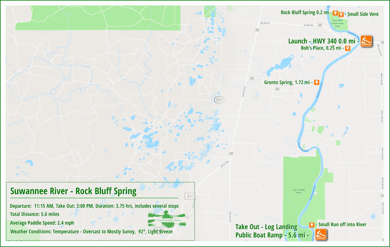
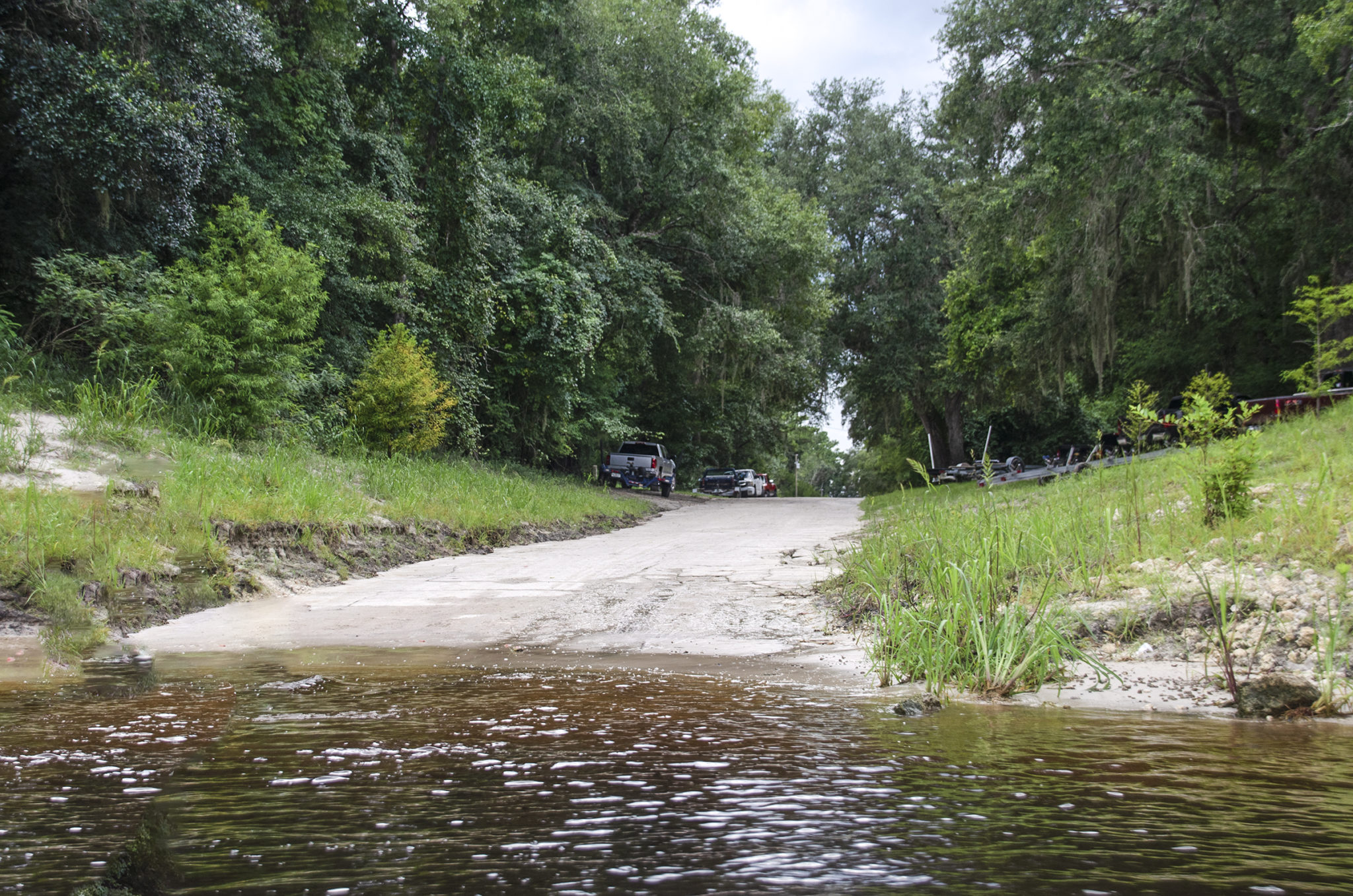
Highway 340 Launch ( Rock Bluff Landing )
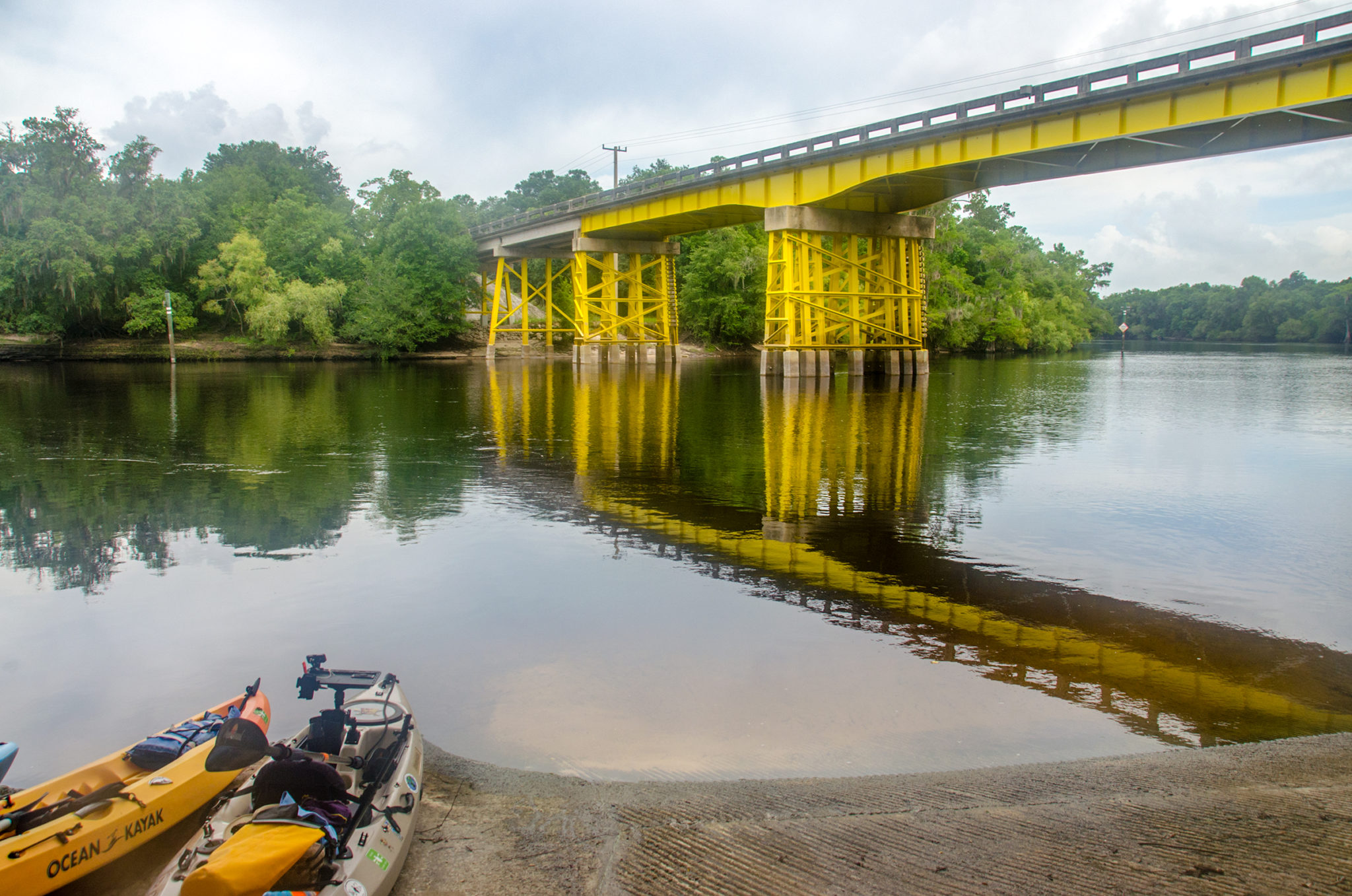
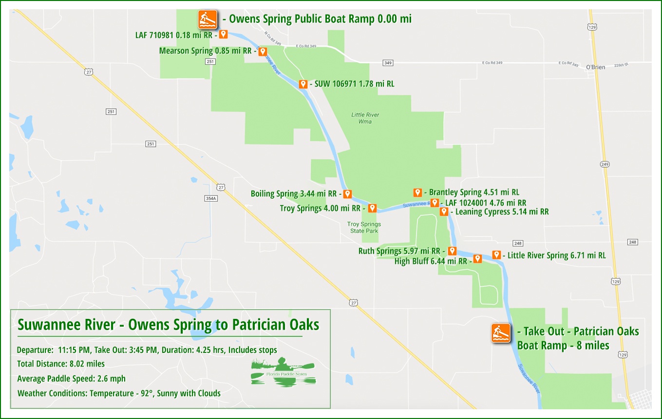
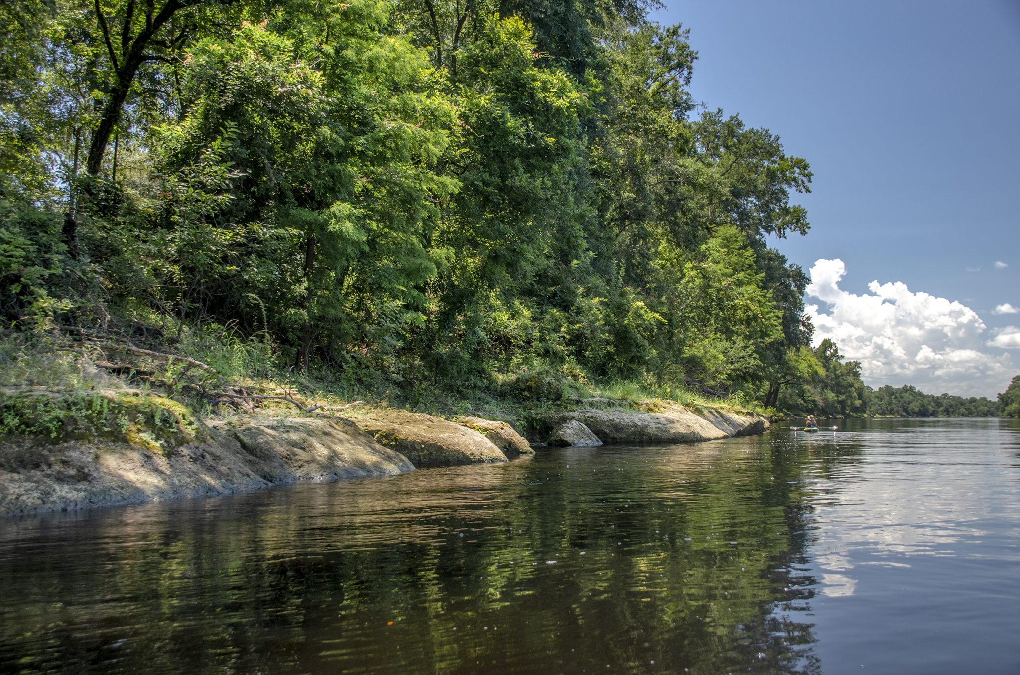
The day started out overcast at the launch but soon developed into a partly cloudy, mostly sunny day. The launch is located on the southeast side of the river. It is a long ramp, textured concrete and today somewhat busy. There is ample parking. Kayaks can be staged on either side of the ramp. The restroom facility at this place was quite gross and unmaintained…be forewarned!
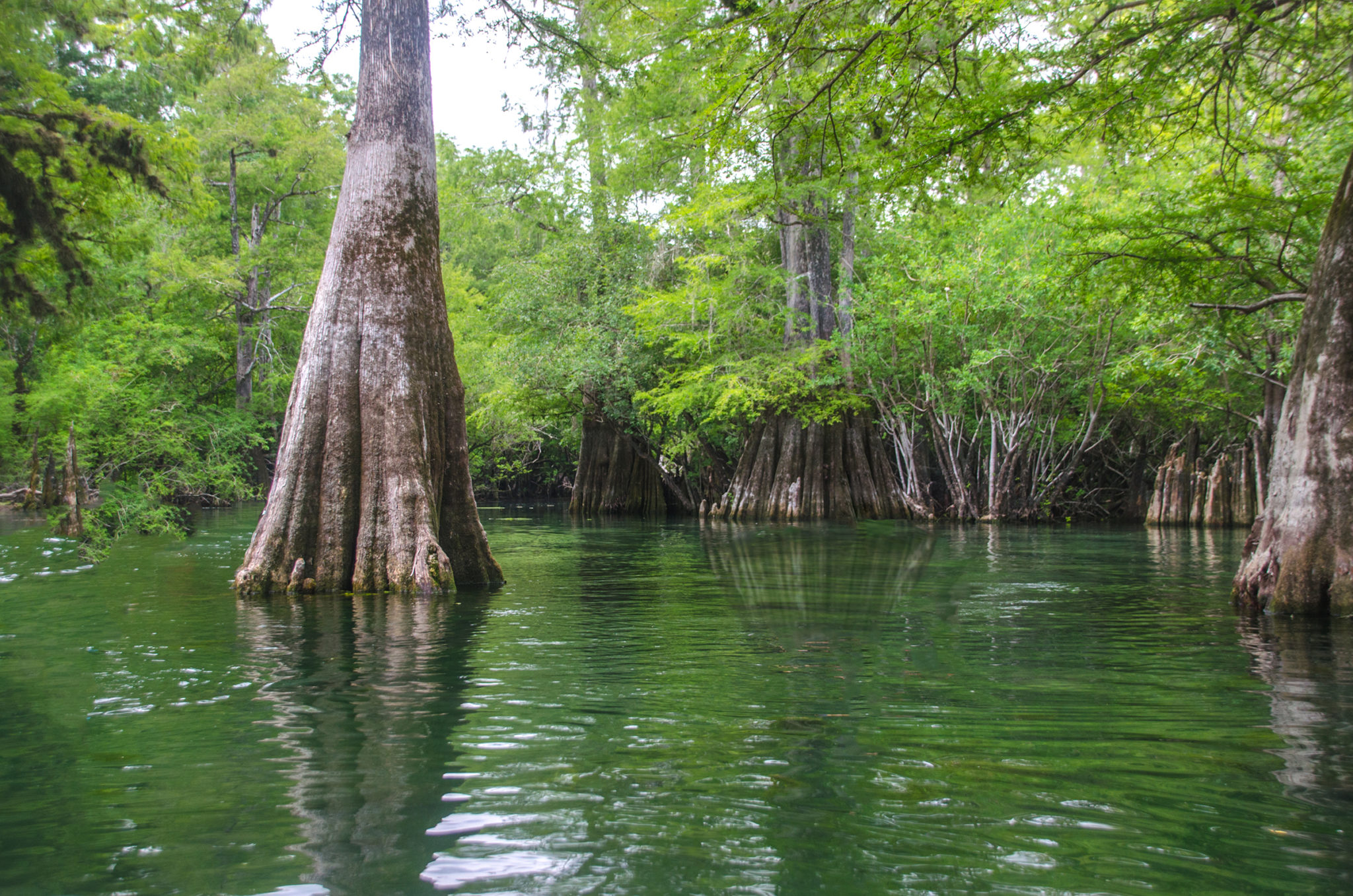
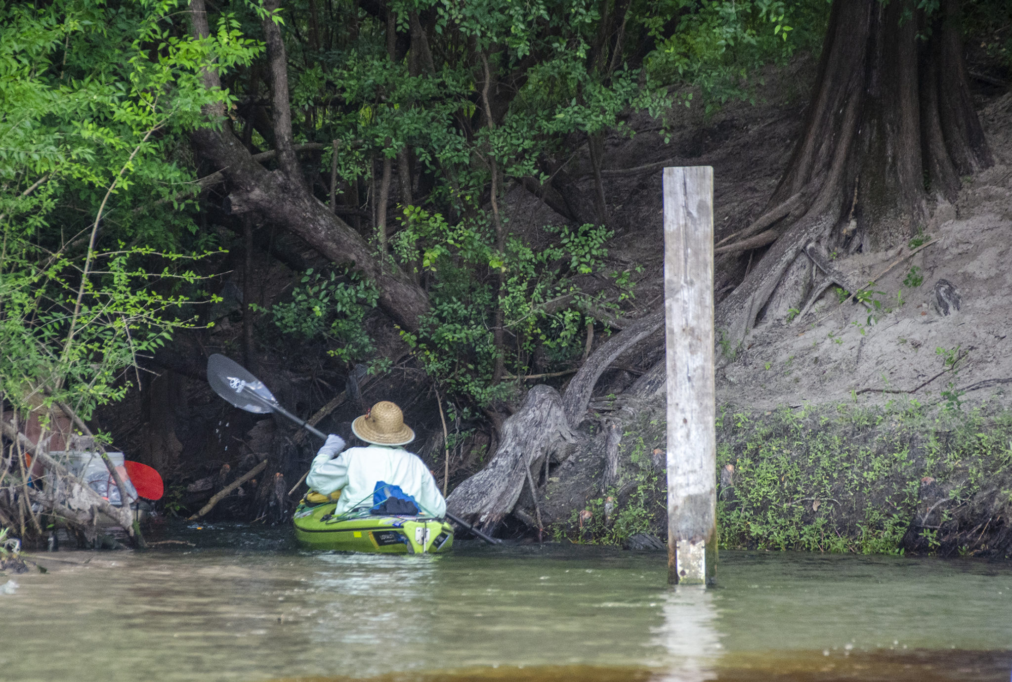
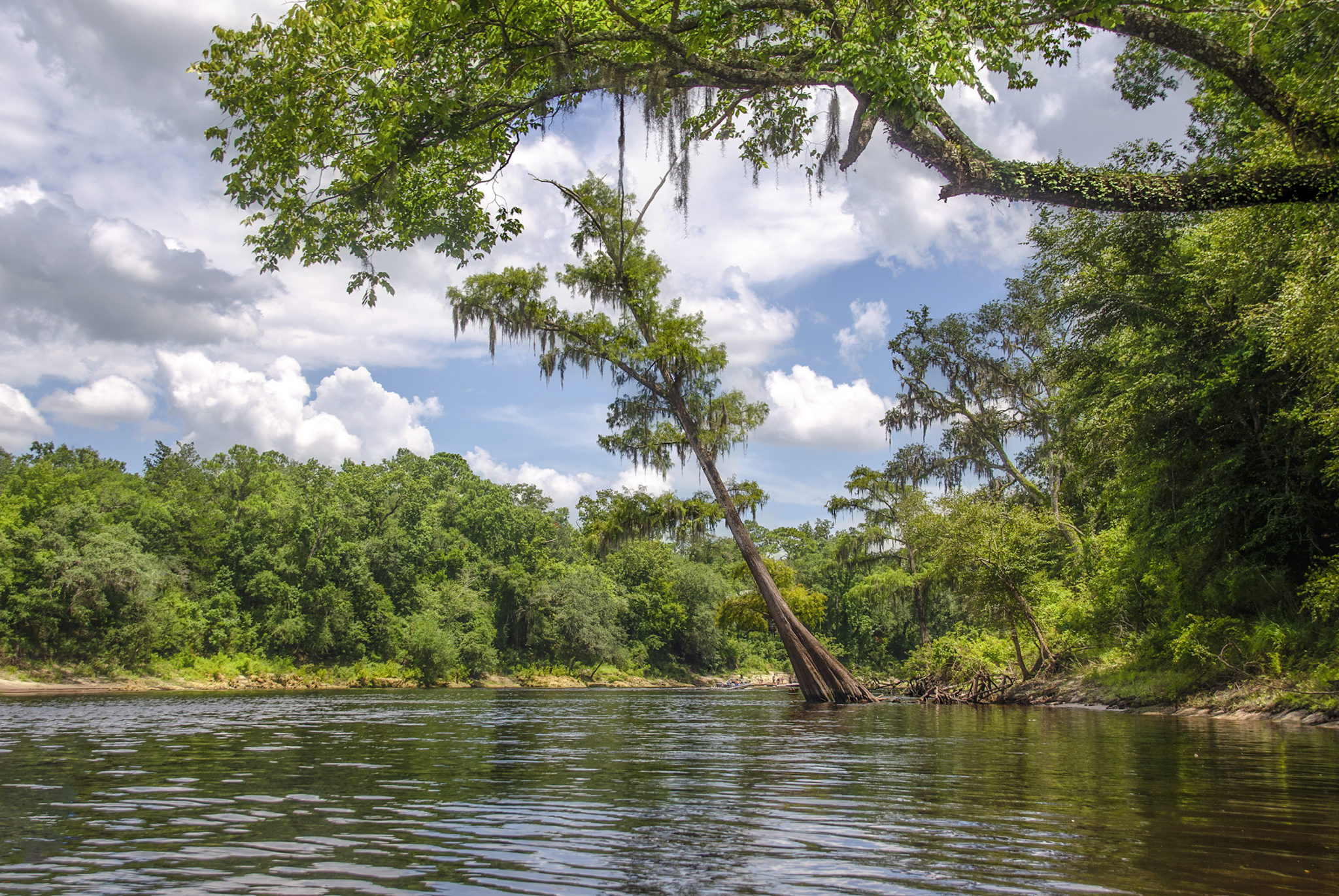
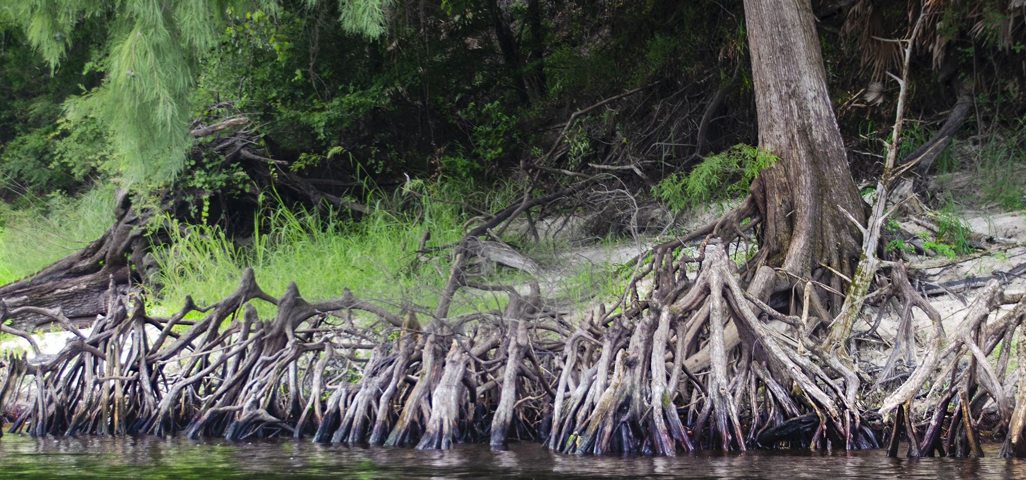
From the launch, it is just under a 1/4 mile north, on RR to the entrance to Rock Bluff Spring Run. The run is not much more than 30′ wide but it is absolutely gorgeous, lined with beautiful tall Bald Cypress with oversized trunks at their base in the water.
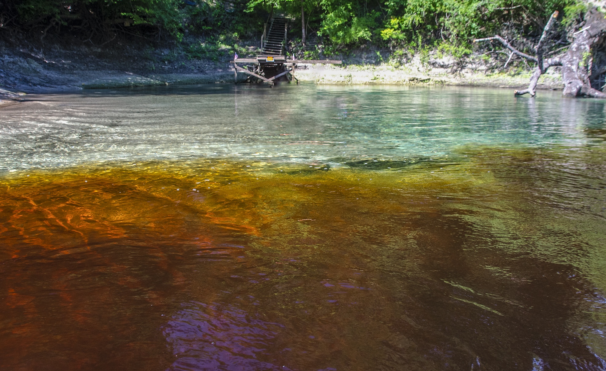
Rock Bluff Spring
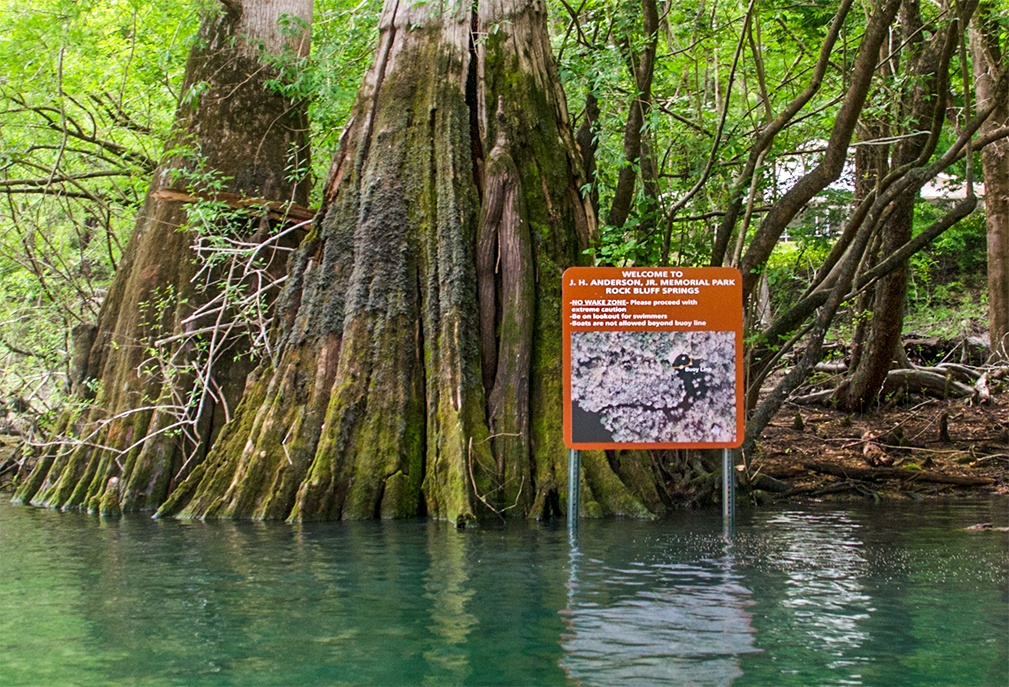
The run is a 700′ long, by 30′ wide run. Paddling eastward, then turning north, past beautiful giant Cypress we come into Rock Bluff Spring. This is now part of A. H. Anderson Jr. Memorial Park. What catches your eye, paddling into the main spring, are the unique Cypress trees that are scattered throughout the spring. Very secluded, very scenic!
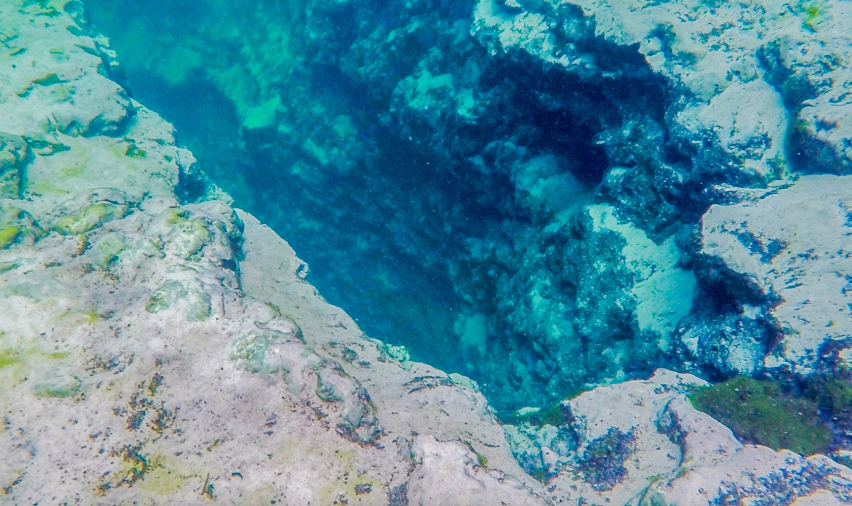
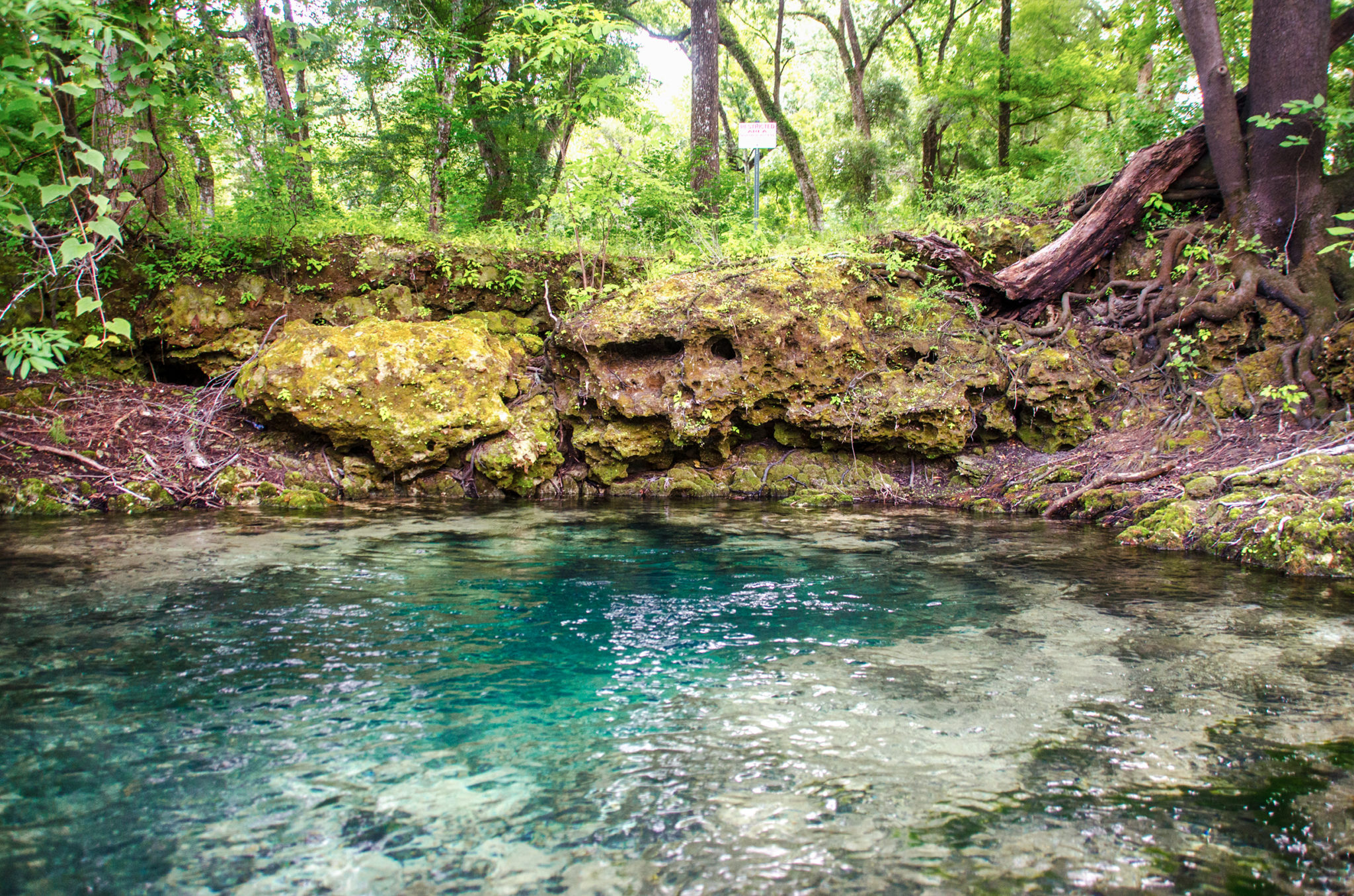
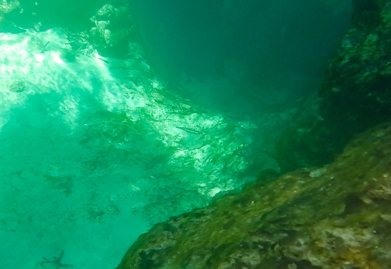
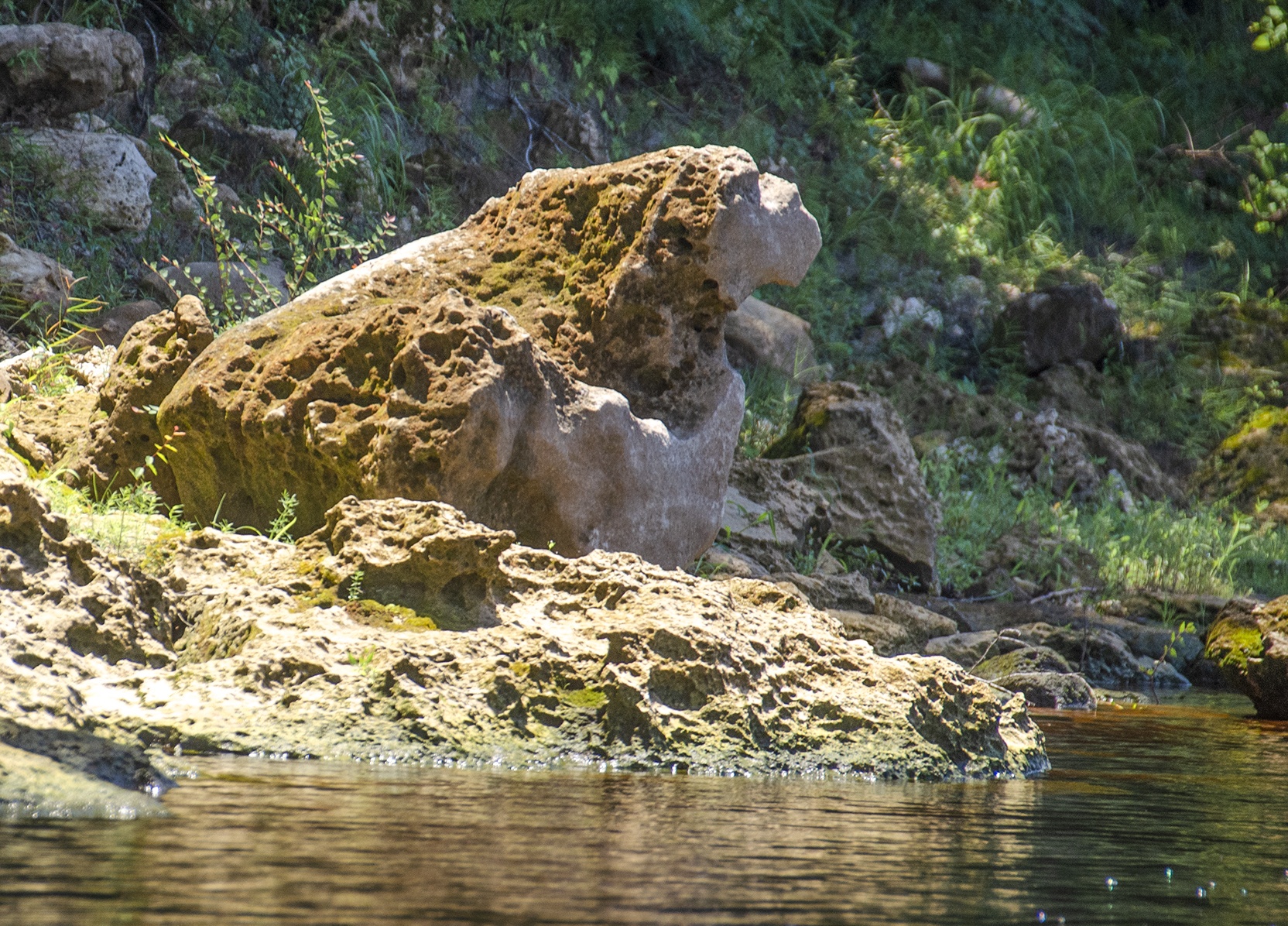
The spring itself is quite interesting. The main spring is a cavity 40′ long, from 2′ to 6′ wide and about 30′ deep. There is a side vent with a noticeable flow just a few feet south of the main vent and also a third vent almost 100′ southeast of the main vent in a small alcove, lined with limerock and protected by a large hollow trunked Cypress.
The run, as well as the spring ,had a lot of algae on this day. Also the clay along the bottom is easily disturbed creating a cloudy appearance when there is too much activity. Still it is quite a unique setting and warrants a return visit!


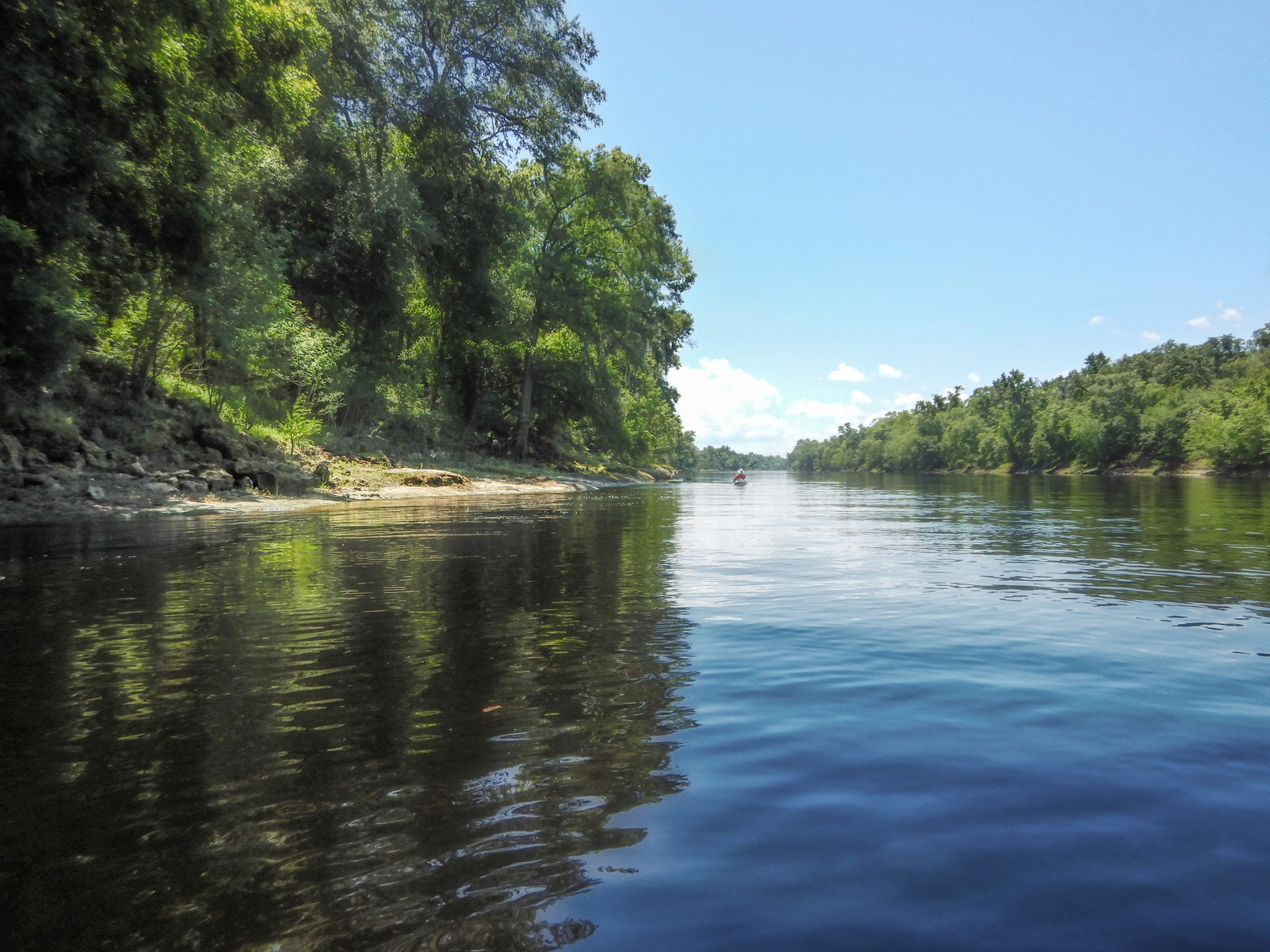
Way Down Upon the Suwannee River
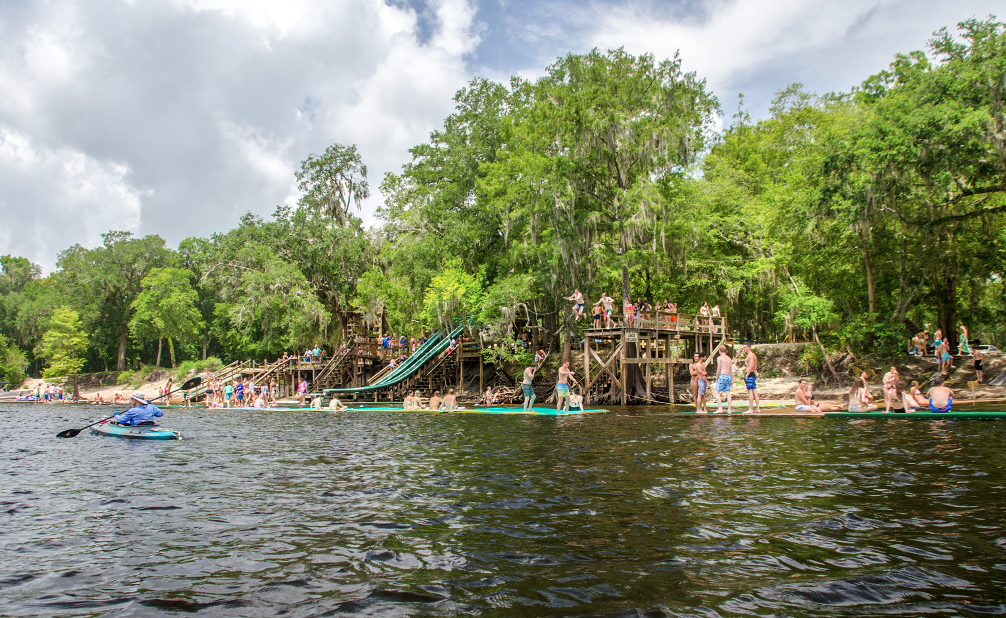
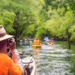
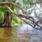
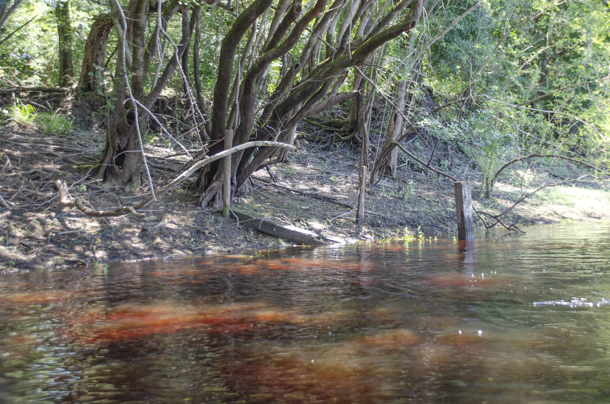
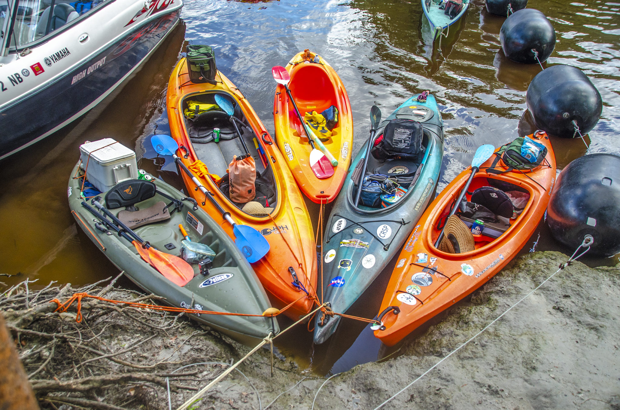
Leaving Rock Bluff Spring, we entered the Suwannee River and paddled South toward our take out at Log Landing Public Boat Ramp. It was a warm, sunny Saturday in June and the river was full of activity. Just 1/4 mile south of the launch site on RR we encountered the popular Bob’s River Place. This is one active swimming hole! Privately owned, Bob’s River Place offers rope swings, Water Slides, Log Roll, Waterfalls, Floating Rafts with Paddles, Karaoke, Splash Pads, Jumping Platform, Floating Walkways, Floating Square Docks (for playing “King of the Dock”), Water/Dry Volleyball, Tubing Trail for Tubing down the River, Water Hammocks, 50 Picnic Tables and Grills. Admission is $10.00. We paddled by a lot of folks having a great time.
At mile marker 1.72, it was a rest stop at Gornto Spring. The spring itself was a bit cloudy, however we beached where the spring enters the Suwannee River. Here the cool spring water mixes with the warm tannin water of the Suwannee creating the perfect rest stop.
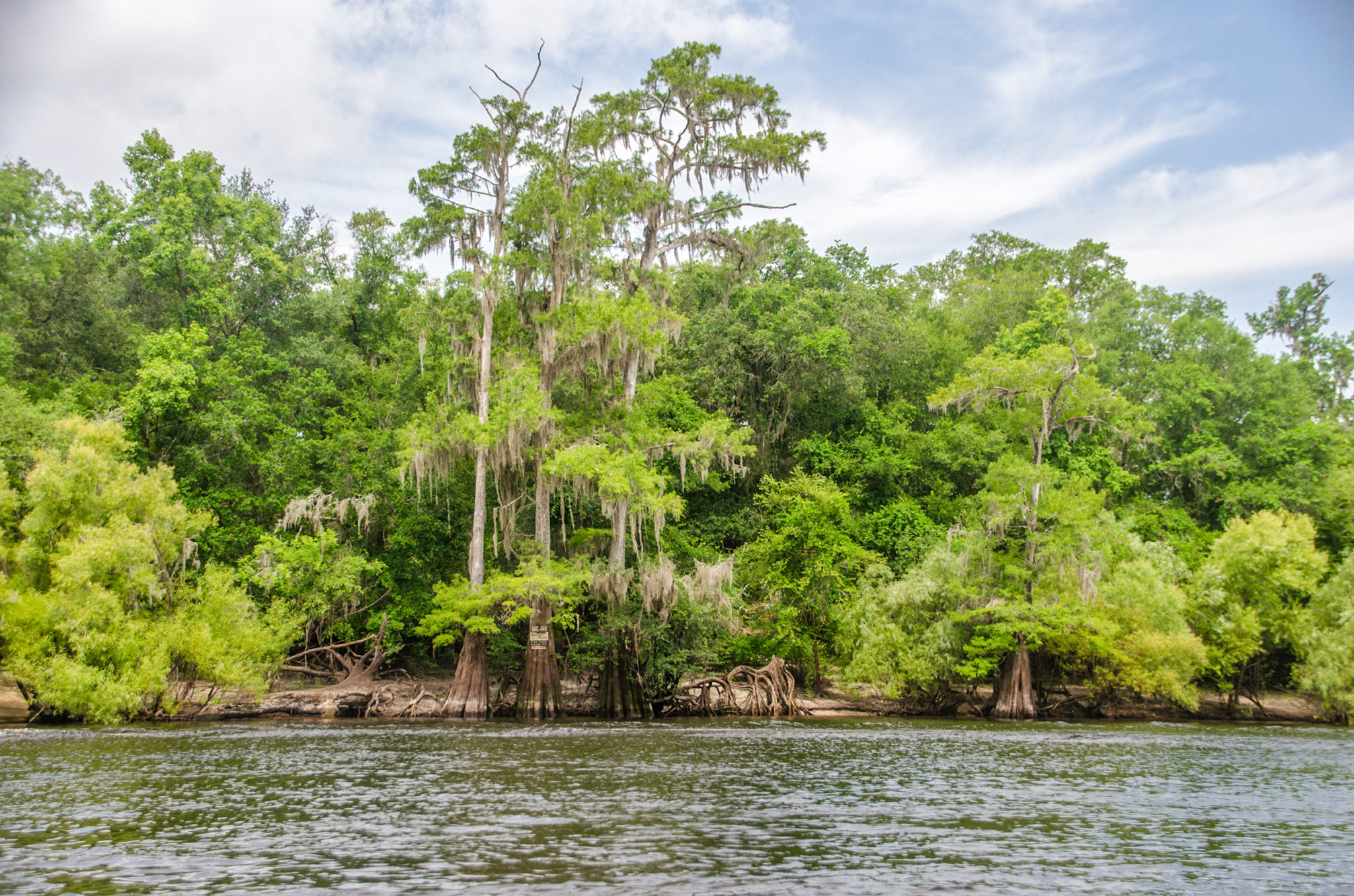
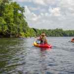
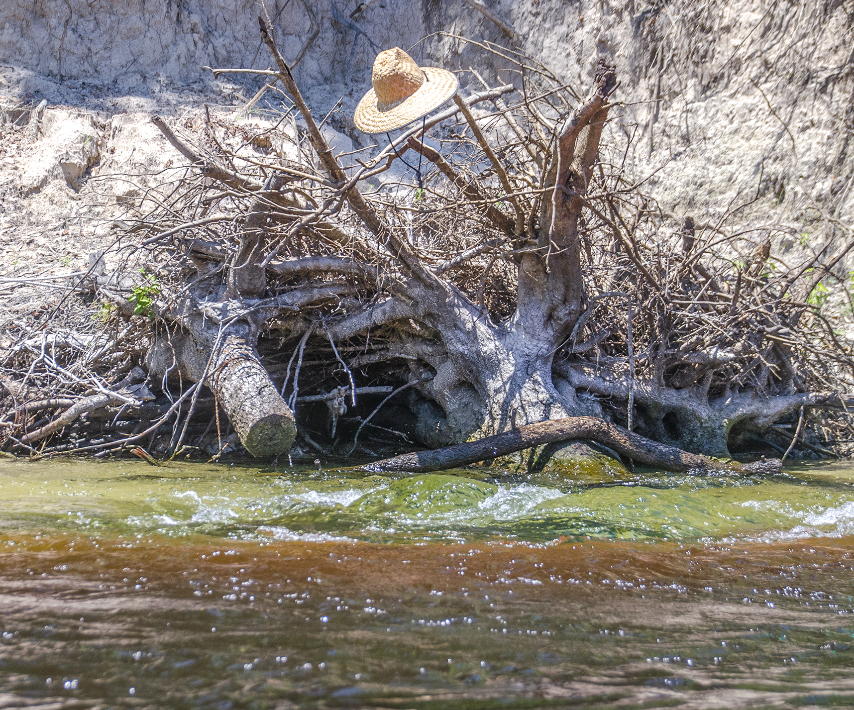
We continued our paddle uneventfully further down river. The river was active with Jet Skis, Pontoon Boats, Speedboats, and Pleasure boats of all kinds…all at full throttle, creating small waves for our paddling pleasure! At mile marker 4.75 on RL is a small tributary ( I am being generous ) creating a gentle flow over logs and around cypress knees as it enters the Suwannee. A brief stop here and it was on to the take out, a quick 1/2 mile down river. Log Landing Public Boat Ramp is a well constructed ramp and suited for heavy boat traffic. Plenty of parking.
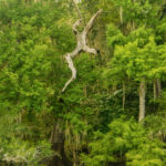
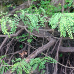
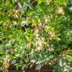
Wildlife was limited on this paddle except for the numerous, huge, sturgeon jumping as we paddled. The shoreline was a combination of Willows, Swamp Locust, Ash, Button Bush, Cypress and Oaks.
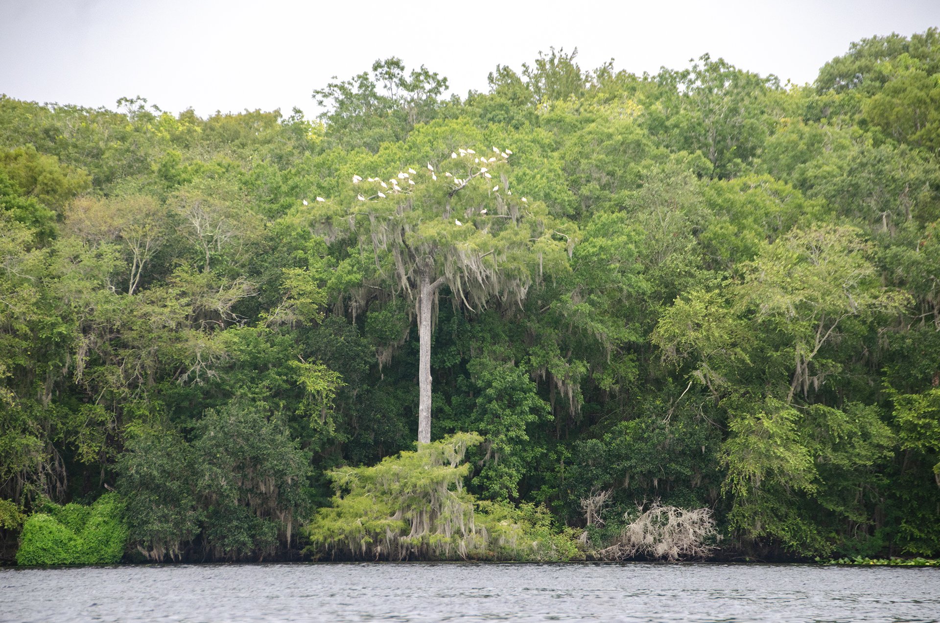
Suwannee/Rock Bluff Spring Flora & Fauna


Owens Spring to Patrician Oak Details
![]() Location: This section of the Suwannee River begins almost halfway between the cities of Mayo and Branford, flowing generally southeast toward Branford.
Location: This section of the Suwannee River begins almost halfway between the cities of Mayo and Branford, flowing generally southeast toward Branford.
![]() Launch Point: The launch is located at the Owen Springs Public Boat Ramp, County Road 251 (off Highway 27), Mayo, 32060
Launch Point: The launch is located at the Owen Springs Public Boat Ramp, County Road 251 (off Highway 27), Mayo, 32060
Take Out: The take-out point for this paddle is at Patrician Oaks Public Boat Ramp, Patrician Oaks Road (off NE Lantana Road), Branford, 32008.
![]() Paddle Distance: Approximately 8 miles which includes a side paddle up Ruth Spring run to Ruth Spring.
Paddle Distance: Approximately 8 miles which includes a side paddle up Ruth Spring run to Ruth Spring.
![]() Difficulty: Easy. Today there was a nice current allowing for an easy, relaxing paddle.
Difficulty: Easy. Today there was a nice current allowing for an easy, relaxing paddle.
 Average Paddle Speed: 2.6 mph.
![]() Width and Depth: The Suwannee River is averages 300′ wide in this section. Depth for today’s paddle was 10.5′ with flood stage at 25′ for this section.
Width and Depth: The Suwannee River is averages 300′ wide in this section. Depth for today’s paddle was 10.5′ with flood stage at 25′ for this section.
![]() Current – Tidal: Gentle flow, not tidal.
Current – Tidal: Gentle flow, not tidal.
![]() Side Paddles: A side paddle was taken to Ruth Springs, located at the 6 mile mark, on RR. The run is 650′ to the spring.
Side Paddles: A side paddle was taken to Ruth Springs, located at the 6 mile mark, on RR. The run is 650′ to the spring.
![]() Rest Areas: There are plenty of areas for rest stops, many are nice sandy ‘beach’ areas.
Rest Areas: There are plenty of areas for rest stops, many are nice sandy ‘beach’ areas.
![]() Important Information: Keep an eye out for busy boat traffic as well as numerous jumping Sturgeons!
Important Information: Keep an eye out for busy boat traffic as well as numerous jumping Sturgeons!
Owens Spring Paddle Map
Owen Springs Public Boat Ramp
The Owen Springs Boat Ramp is a typical long ramp to account for the potential rise of water on the Suwannee River. There are no bathroom facilities but plenty of woods if needed. Ample non-paved parking. This is a nice concrete ramp supported by Sport Fish Restoration and Lafayette County.
We launched under a blue sunny sky with scattered white clouds and warm temperatures, looking forward to cooling off in the coming springs.
Mearson Spring

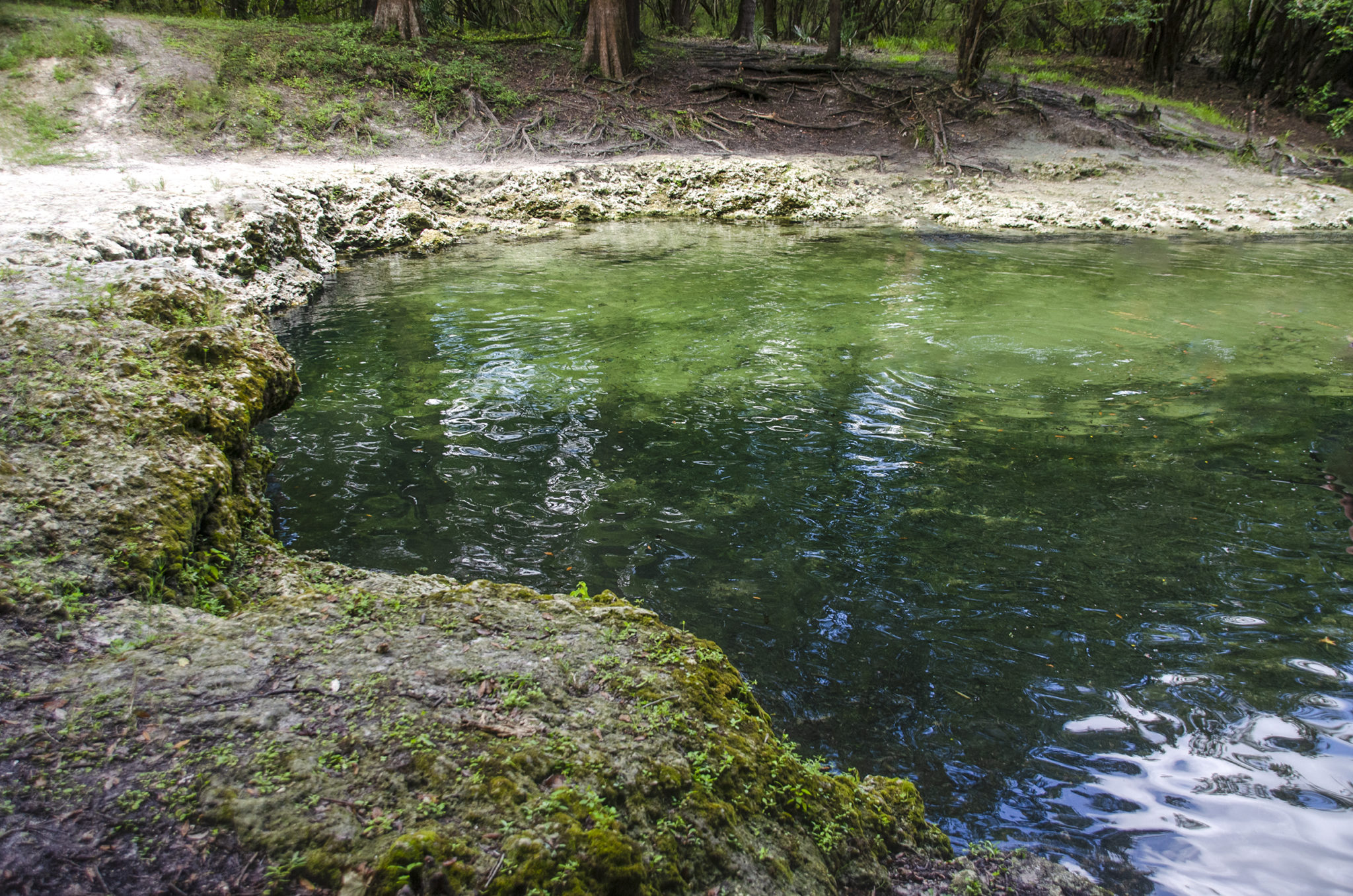
Immediately after launching from Owens Spring Boat Ramp, there is a small spring on RR at mile 0.18. This is a small 4th magnitude, un-named spring, LAF 71098, 30.0451° N, -83.033864° W. Due to the small size of the spring and the water level, this was not visible.
Further along at mile 0.85, RR however, is a beautiful gem of a spring, Mearson Spring, 30.041343°, -83.025028°. It is surrounded by private property, which is posted, however it is accessible from plenty of shallow water leading from the river, then dropping off at a steep ledge. This 2nd magnitude spring with several powerful boils below the ledge, is awesome. The vents produce a very strong boil and the greens and blues are vivid. The spring pool is framed by small steep banks. There was not a sole there as we rested and explored the spring.

Boiling Spring
At mile 1.74 from the launch, there is another un-named spring on RL. As with LAF 71098, this this 4th magnitude spring, SUW106971, 30.032682° N, -83.013506° W, was not visible due to the water level, however there posts in place that apparently marked the location matching the coordinates.
Mile 3.44 on RR offered a wonderful surprise! Boiling Spring. According to Suwannee River Water Management’s Facebook page, this unique spring has quite different personalities depending on the water level. They write…“The spring can bubble 6-12 inches high! The spring is located on the Suwannee River about 8 miles north of Branford. During low river levels, it flows over a limestone shelf into the river.”
On this particular day it was a visible, intense boil, just bubbling away with a definite force.
Troy Spring
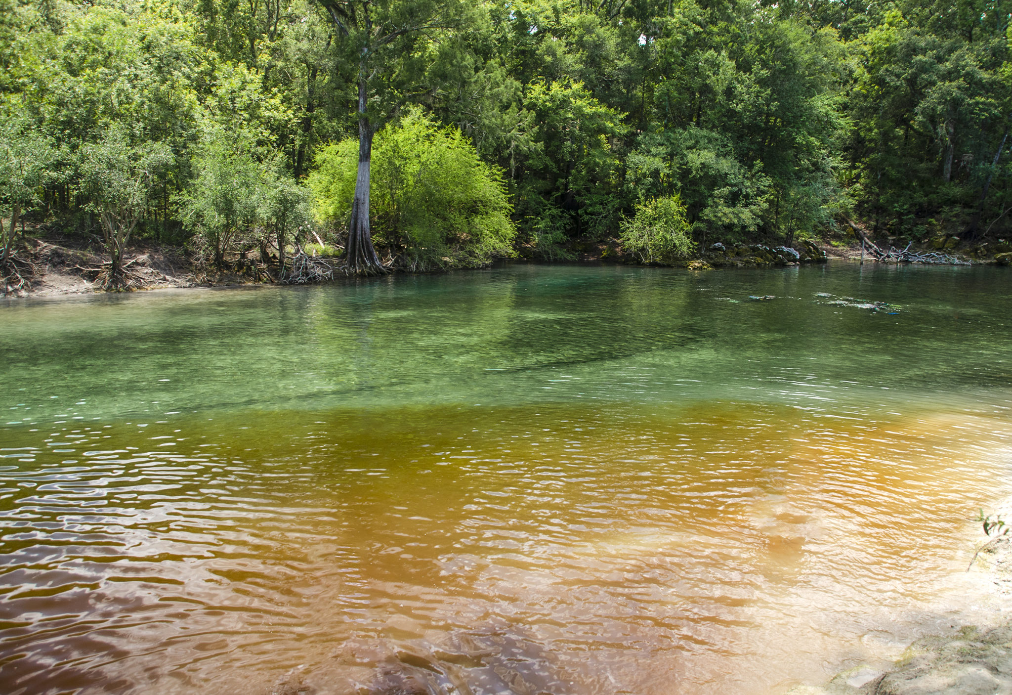
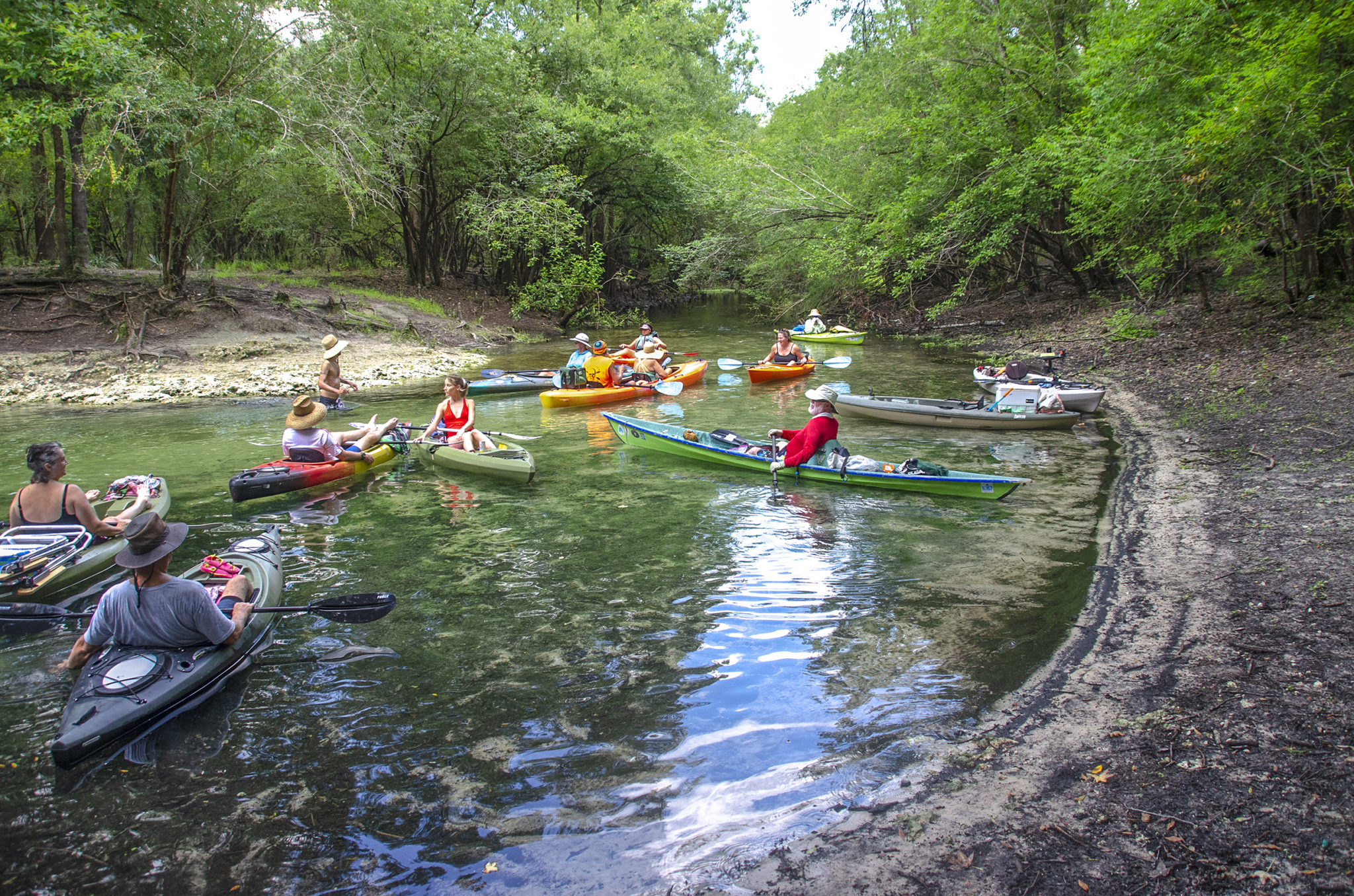
Next stop, Troy Spring! This 1st magnitude spring is a popular watering hole and this hot Saturday afternoon was no exception. Plenty of boaters were moored to the large floats that prevents entry to the spring by boat. Many were anchored along the shoreline. There were numerous folks in the spring as well a scuba divers. We tied our kayaks together along the barrier and entered the spring for a refreshing swim.
The water was clear and a clean separation of spring water and tannin from the Suwannee. The bottom, as well as the banks, were clay and made for some precarious walking. Also there are the keel timbers and ribs of the Confederate steamship ‘Madison’, sunk to keep it from falling into Union hands! We stayed just long enough to cool off and decided to move further down river to enjoy our lunch.
Ruth Spring
Lunch was spent on a sandy beach area in the vicinity of two springs 4.7 miles down river, both of which we did not see; Brantley Spring on RL, 30.008283°, -82.986518°, and LAF1024001, RR, 30.007517°, -82.982251°
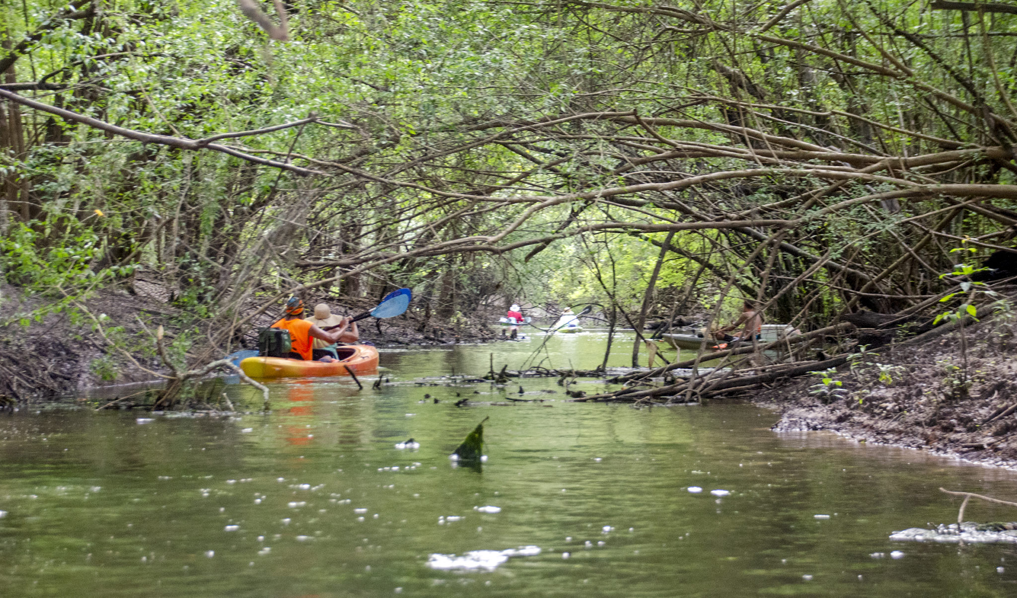
What we almost missed was Ruth Spring! At mile 6 on RR is the entrance to Ruth Spring. This run is marked with a large pole with a water gauge on it and presents itself as a dark tunnel into the shore. The run had a dense canopy of willows, elms and other brush and was shallow. It was tricky to paddle with a long paddle and some used half a paddle to maneuver.
Once inside we were greeted by a few paddlers already at the spring. The spring was was nice, secluded and had a canopy of oaks, gums and cypress.
The Final Stretch
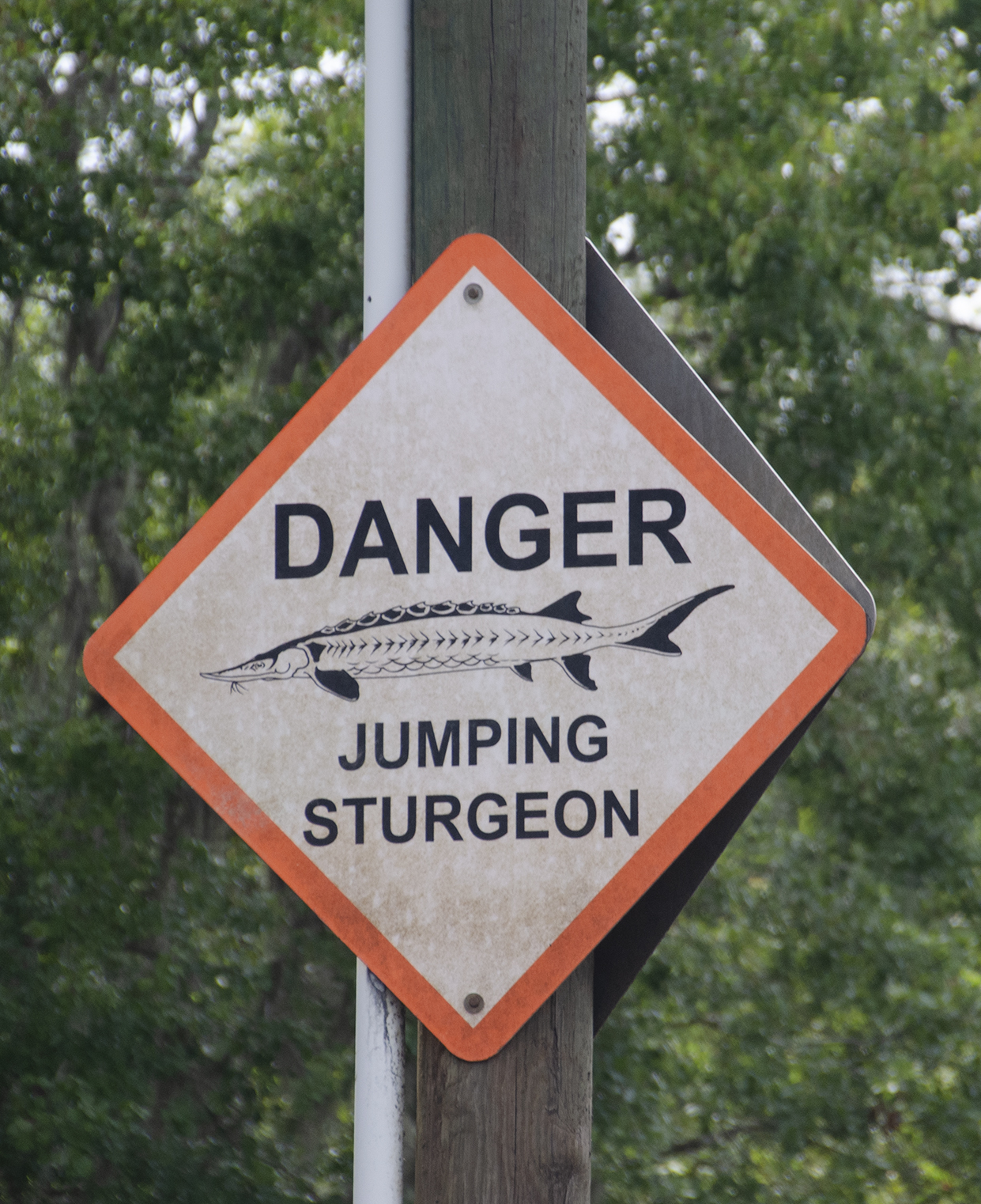
The final stretch after Ruth Spring took us past Little River Spring, on RL, mile 6.7. On this warm Saturday afternoon, it was quite crowded and we just paddled on by, deciding to visit it on a weekday in the fall. This area also has several warning signs for jumping Sturgeon. Already we had counted 7 along our paddle and apparently this section was such that required warning signs. The type of sturgeon in the Suwannee River are known for leaping and can grow up to 8 feet long and weigh 200 pounds, according to the National Oceanic and Atmospheric Administration. In July 2015, 5 year old Tanya Faye Rippy was the first recorded death by a Sturgeon on the Suwannee River.
We finally reached our destination at 8 miles, Patrician Oaks Public Boat Ramp just before the darkened sky opened up with heavy rain. A great chapter in Florida Paddle Notes!
NOTE: See other Florida Paddle Notes entries for The Suwannee River: Suwannee River – Rock Bluff Spring
Suwannee River Gallery 2

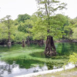
Manatee Springs Overview
Manatee Springs State Park, situated 6 miles west of Chiefland on SR 320, off US 19, is a Florida State Park featuring a first magnitude spring called Manatee Spring. It directly flows into the Suwannee River via a quarter mile spring run. The park encompasses swamps, hardwood wetlands along the Suwannee, sinkhole ponds, and a cave 90 feet below ground that connects to the popular diving spot called the catfish hotel.
Manatee Springs boasts a history dating back over 9,000 years, with its earliest inhabitants being the Timucuan Indians. The park’s picnic area once served as a Timucuan Indian village, chosen for its strategic Suwannee river location providing transportation and fresh water access. The cultural landscape shifted with the arrival of the Spaniards in the 1500s.
In 1774, William Bartram visited and named it “Manate Springs” after encountering a manatee carcass on the shoreline. During the Seminole Wars (1835-1842), a significant attack led by Major General Andrew Jackson altered the region’s dynamics. Settlers and farmers later utilized the springs for various activities. On January 23, 1968, Manatee Springs became Florida’s first state park with excavations revealing a richly populated Indian village with artifacts suggesting travel to the Gulf of Mexico. ( excerpts from Wikipedia )
![]()
Suwannee River and Manatee Springs Details

![]() Location: This section of the Suwannee River begins about 5 miles southwest of Fanning Springs and 7.5 miles Northwest of Chiefland.
Location: This section of the Suwannee River begins about 5 miles southwest of Fanning Springs and 7.5 miles Northwest of Chiefland.
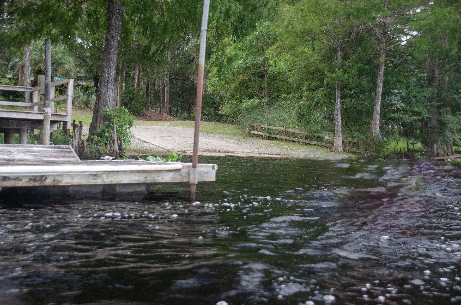
![]() Launch Point: is at Manatee Springs Boat Ramp, 11670 NW 130th St, Chiefland, FL 32626. There is also a soft kayak launch. No fees or restrooms, ample parking.
Launch Point: is at Manatee Springs Boat Ramp, 11670 NW 130th St, Chiefland, FL 32626. There is also a soft kayak launch. No fees or restrooms, ample parking.
Take Out: The take-out point is at Camp Azalea Boat Ramp, NW 128th Court, Chiefland Florida 32626, 5 miles south of the launch. Both on the east side of the River. No fees or restrooms, limited parking.
![]() Paddle Distance: Approximately 5 miles which includes a side paddle up Manatee Spring Run.
Paddle Distance: Approximately 5 miles which includes a side paddle up Manatee Spring Run.
![]() Difficulty: Easy. Today there was a nice current allowing for an easy, relaxing paddle. Can be hot on a summer afternoon.
Difficulty: Easy. Today there was a nice current allowing for an easy, relaxing paddle. Can be hot on a summer afternoon.
Average Paddle Speed: 2.2 mph.
![]() Width and Depth: The Suwannee River is averages 500′ – 525′ wide in this section. Depth for today’s paddle was 3.73′ with flood stage at 7′ for this section.
Width and Depth: The Suwannee River is averages 500′ – 525′ wide in this section. Depth for today’s paddle was 3.73′ with flood stage at 7′ for this section.
![]() Current – Tidal: Gentle flow, not tidal.
Current – Tidal: Gentle flow, not tidal.
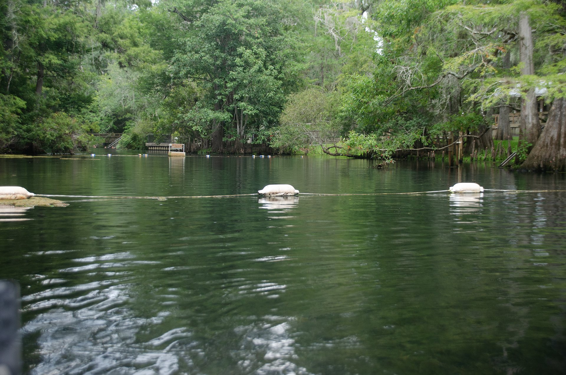
![]() Side Paddles: A side paddle was taken to Manatee Springs, located at the 2.75 mile mark, on RL. The run is 1/4 mile to the spring, however it is roped odd several hundred feet before reaching the spring.
Side Paddles: A side paddle was taken to Manatee Springs, located at the 2.75 mile mark, on RL. The run is 1/4 mile to the spring, however it is roped odd several hundred feet before reaching the spring.
![]() Rest Areas: There are a couple of rest stops along river left, main one at Ushers Boat Ramp.
Rest Areas: There are a couple of rest stops along river left, main one at Ushers Boat Ramp.
![]() Important Information: Keep an eye out on the weather as well as numerous jumping Sturgeons!
Important Information: Keep an eye out on the weather as well as numerous jumping Sturgeons!
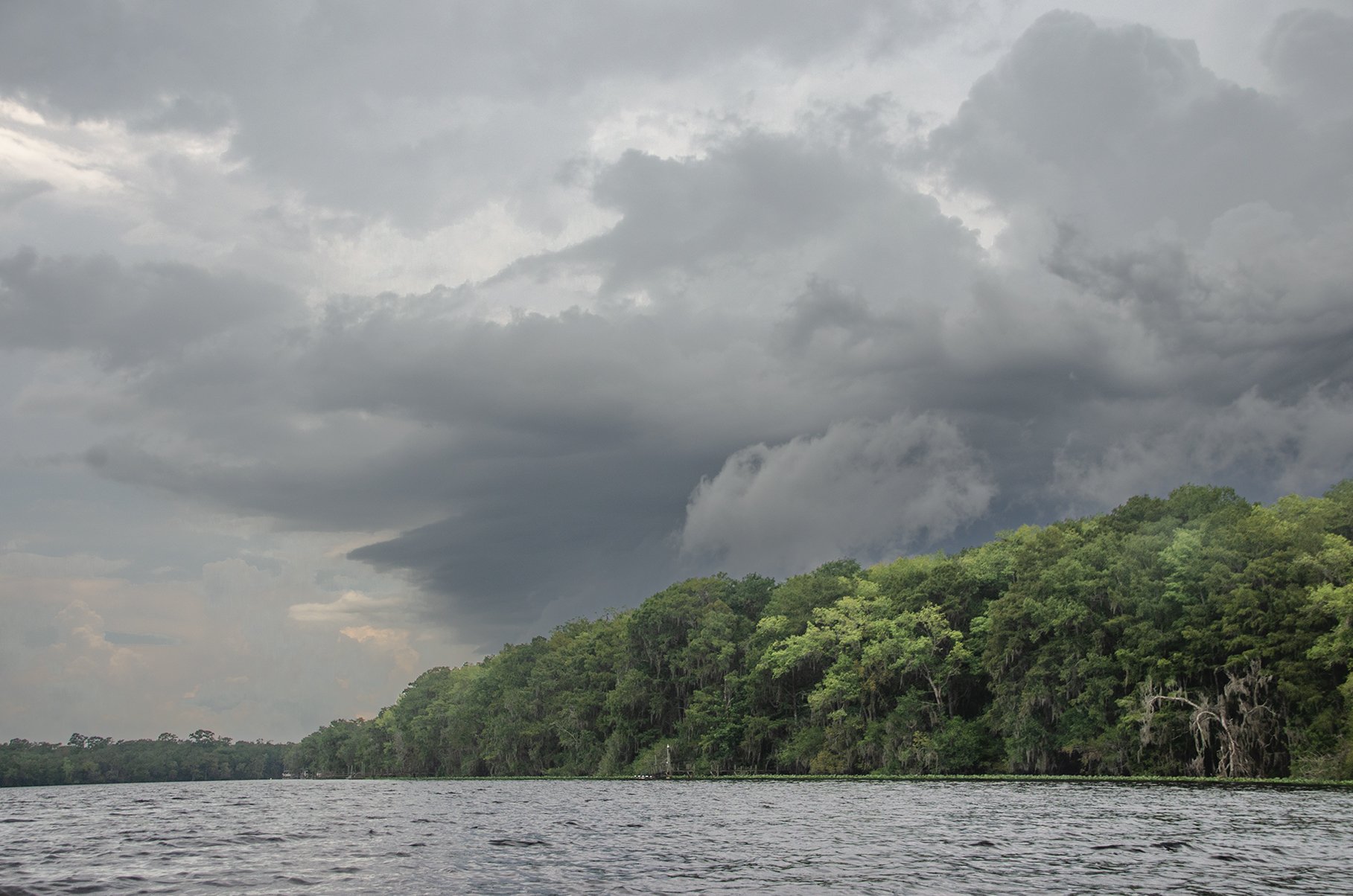
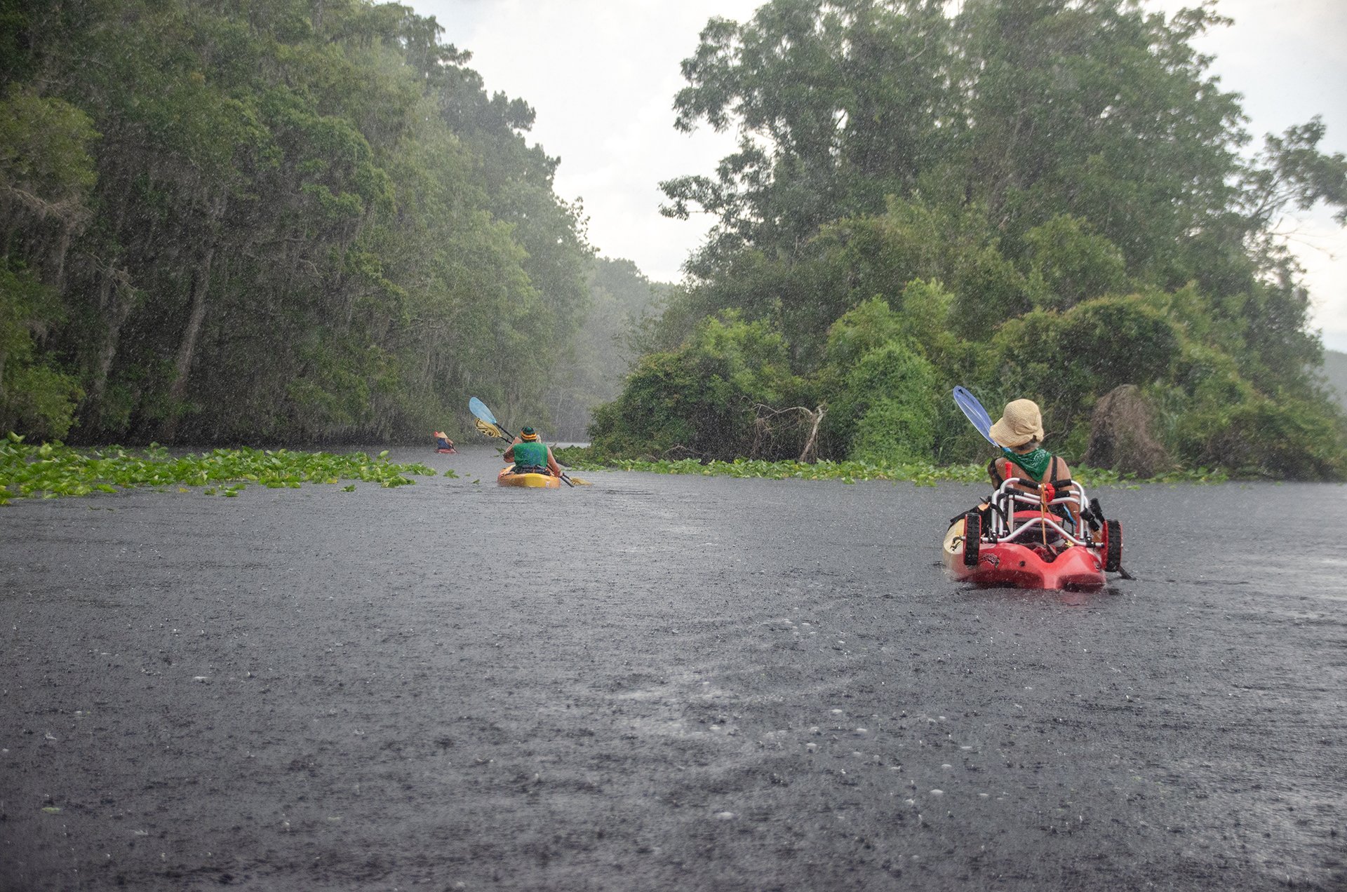
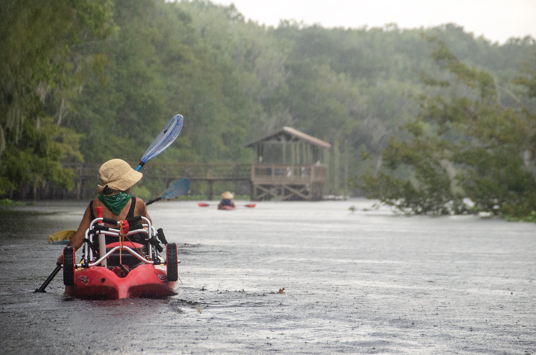
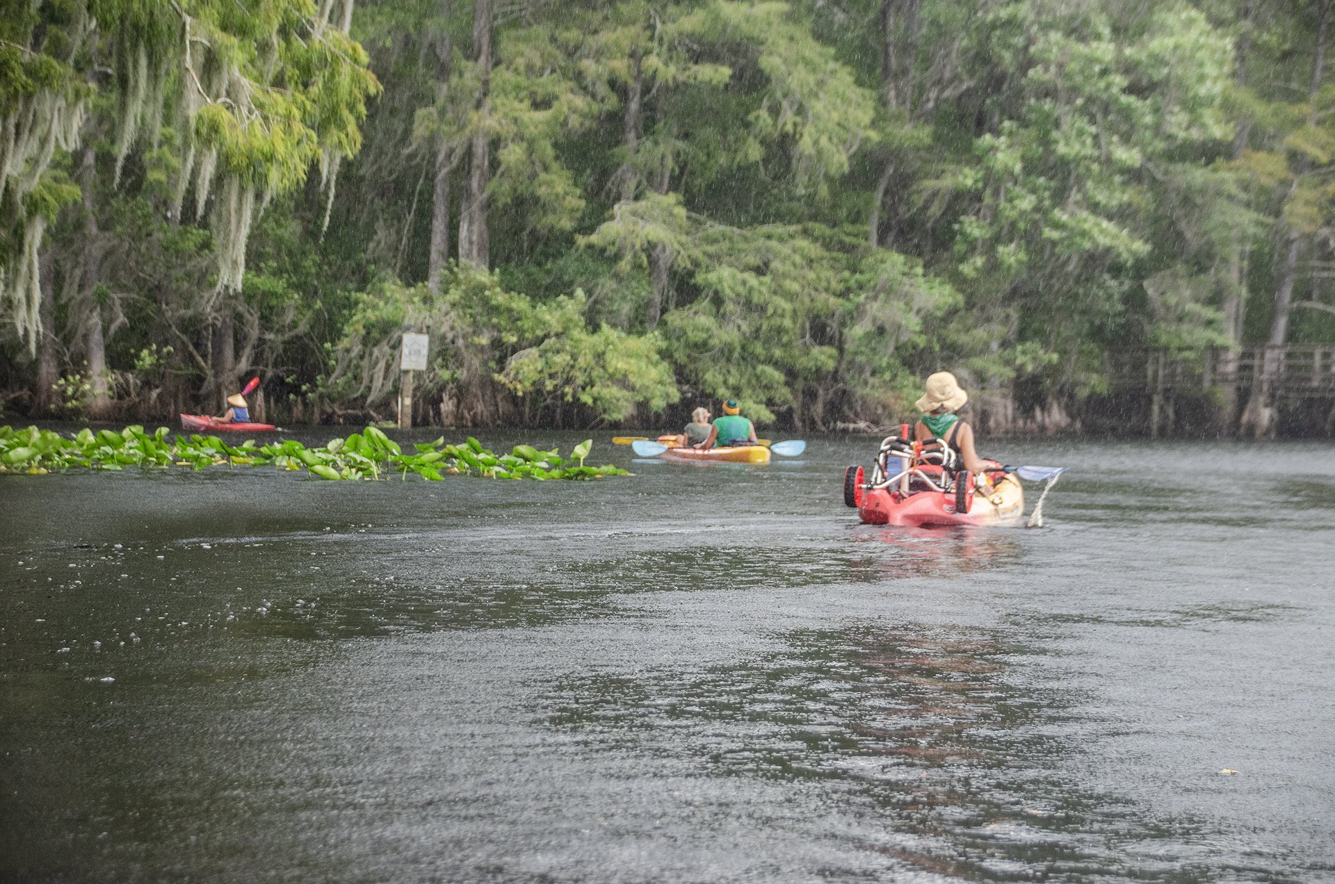
A Beautiful Morning

Upon arriving at the river it was a very warm, sunny day. We used the ‘soft launch’ just south of the actual ramp, cooled off in the tannic water and headed out. Not a mile into the paddle the skies clouded up, thunder and distant lighting and then the sky opened up, refreshing us with cool rain. It was actually pleasant
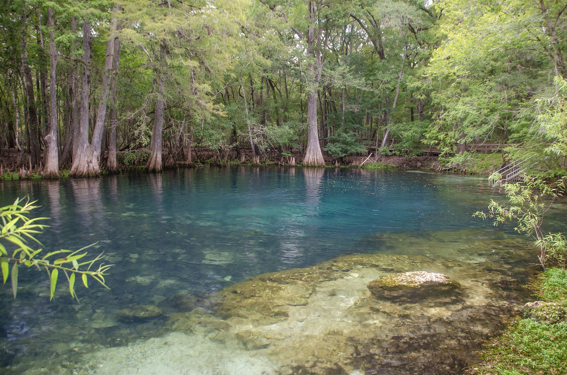
Manatee Springs

Manatee Spring was a treat in August. Though the rain was letting up a few went in for a swim. The Spring, is located in the State Park. There is a long boardwalk the length of the run, very good stairs and walkways entering the spring and restroom facilities.
Swimming and Scuba available. Fee was $6.00 per car load, we were not charged coming in from the river.
Suwannee River/Manatee Springs Gallery
Guides, Maps & Info
- Middle Suwannee River Springs Restoration Plan, (pdf)…
- Suwannee River Wilderness Paddling Guide, (pdf)…
- Florida Spring Classification System and Spring Glossary, (pdf)…
- Suwannee River Water Management District, Boating and Canoeing…
- Suwannee River Wilderness State Trail (pdf)…
- Real Time Water Levels…
- Manatee Springs State Park…
- Suwannee River Water Levels…
- Suwannee River State Park…
- History of the Suwannee River...
![]()