Bear Creek Overview

Bear Creek is a distributary of the Ocklawaha River. It originates as a small 35′ wide creek, 1/4 mile East of the HWY 19 bridge, 19 miles North of Salt Springs. The creek basically flows 4.25 miles Southeast on its winding way to the St Johns River.
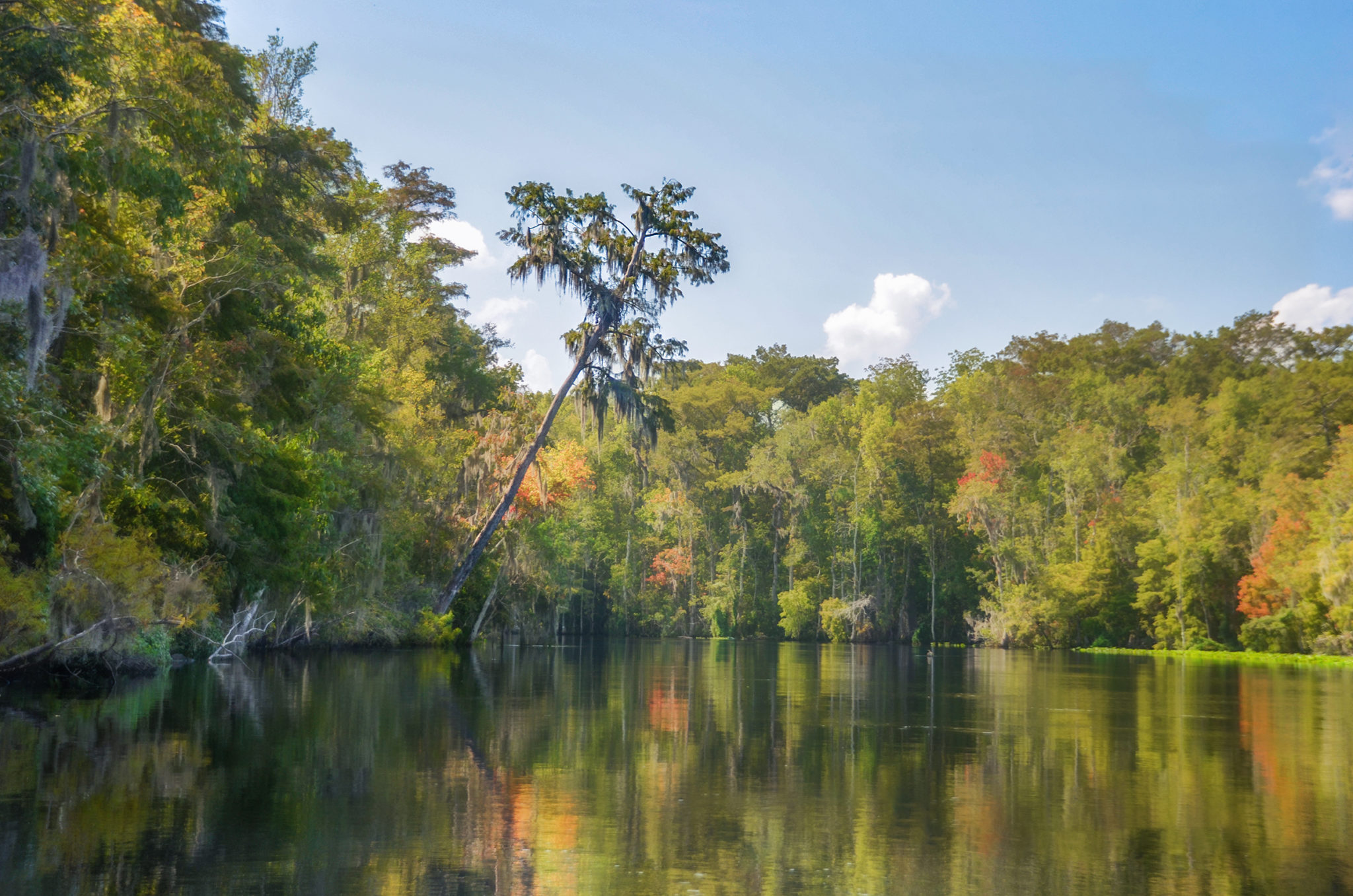
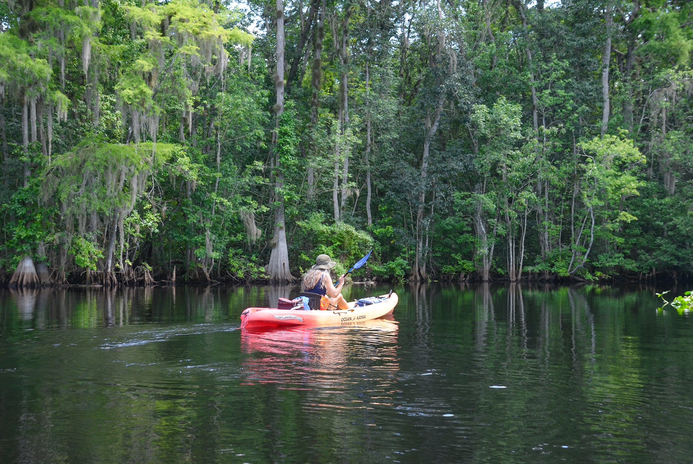
The creek parallels the Ocklawaha River on the South, along the north border of Little Lake George Wilderness. At 0.75 miles Bear Creek passes north of 8PU644 Bear Creek Indian Mound. At its source, the creek is approximately 35′ across and widening to 75′ by the time it meets the Ocklawaha at mile 2.5. Here, Bear Creek continues on its own as a 30′ canopied stream until it reaches the St Johns River at 100′ wide. The flow is slow and gentle.
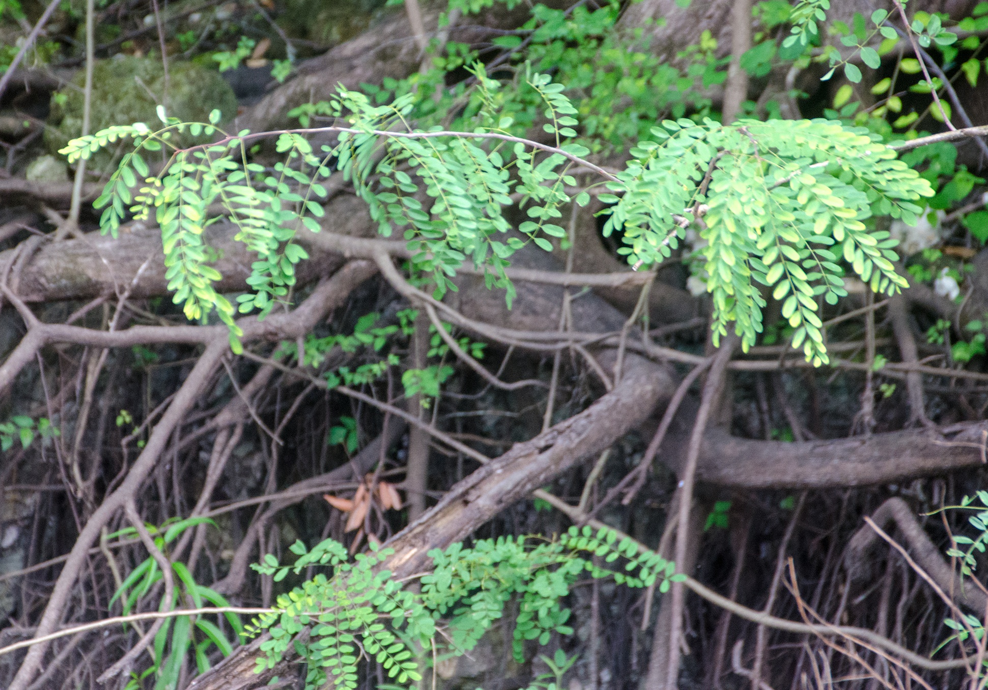
Bear Creek is a wonderful paddle through a typical Bottomland Hardwood Forest. Often flooded, bottomland forests are characterized with Cypress, Gum, Ash, and Maple among others. The trunks are usually fluted and often form a tangled canopy overhead. The shoreline is loosely defined with the typical ‘Swamp Smell’, which are gases produced by decaying bacteria and vegetation. Bear Creek is known for it’s diversity of Flora and Fauna.
Bear Creek – St Johns River Loop | Bear Creek – Ocklawaha River Loop

Bear Creek – St. Johns River Details
![]() Location: Bear Creek originates as a small 35′ wide creek, 1/4 mile East of the HWY 19 bridge, 19 miles North of Salt Springs, Putnam County, Fl.
Location: Bear Creek originates as a small 35′ wide creek, 1/4 mile East of the HWY 19 bridge, 19 miles North of Salt Springs, Putnam County, Fl.
![]() Launch Point: Bryant’s Wharf on Palmetto Street in Welaka.
Launch Point: Bryant’s Wharf on Palmetto Street in Welaka.
![]() Paddle Distance: Round trip for this paddle was 6.25 miles
Paddle Distance: Round trip for this paddle was 6.25 miles
![]() Difficulty: Easy. Wind can be a factor on the St. Johns River.
Difficulty: Easy. Wind can be a factor on the St. Johns River.
 Average Paddle Speed: 1.85 mph. Probably slower today due to photography and observations.
![]() Width and Depth:
Width and Depth:
- St. Johns River 1/4 mile wide, 40′ deep in main channel
- Bear Creek, 25′ – 80′ wide, depth variable from a few feet to over 6′
- Ocklawaha River 130 – 150′ wide, variable depth 8’+
![]() Current – Tidal: Gentle current
Current – Tidal: Gentle current
![]() Side Paddles: This trip does have a side paddle. Once on the Ocklawaha, 3/4 mile down river on RL is a tributary to the river.
Side Paddles: This trip does have a side paddle. Once on the Ocklawaha, 3/4 mile down river on RL is a tributary to the river.
![]() Rest Areas: There are no rest areas along this loop.
Rest Areas: There are no rest areas along this loop.
![]() Important Information: Watch for the downfall on Bear Creek. Winds may be an issue on the St; Johns River, sun, and heat along the Ocklawaha.
Important Information: Watch for the downfall on Bear Creek. Winds may be an issue on the St; Johns River, sun, and heat along the Ocklawaha.
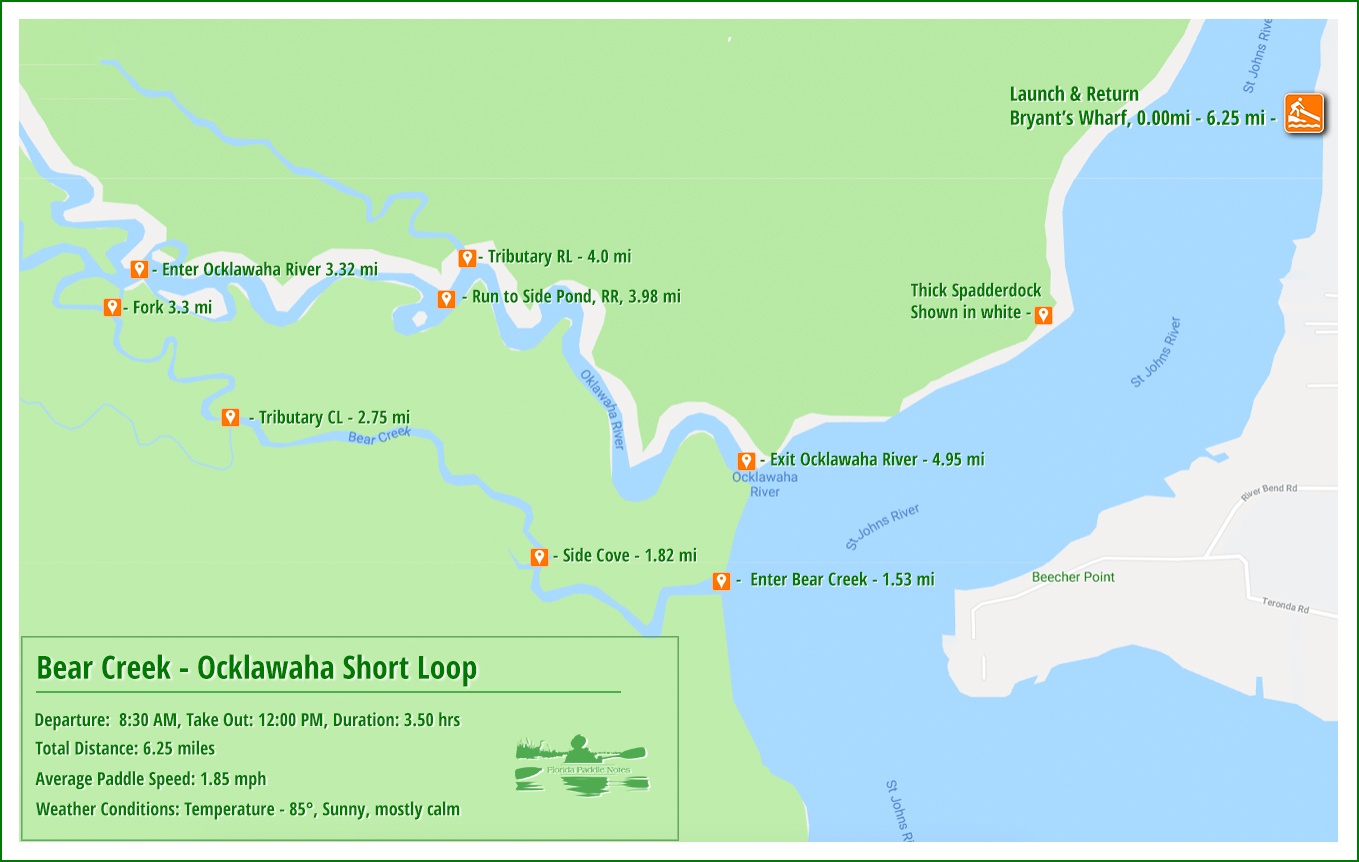
Bear Creek Paddle Map
Bryant’s Wharf Launch
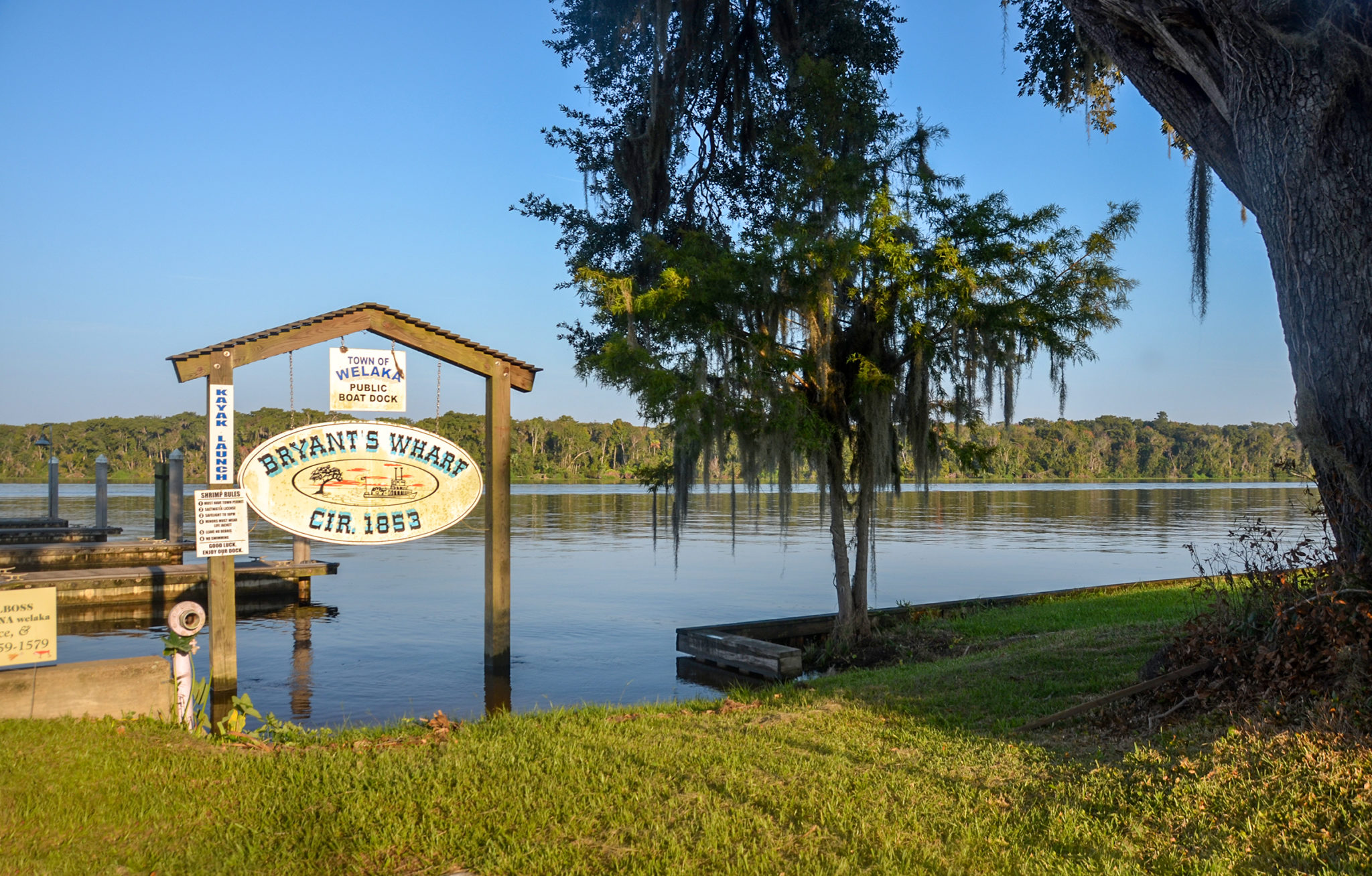
The launch site is a small grassy area at Bryant’s Wharf on Palmetto Street in Welaka. The wharf has a history dating back to 1855 when Colonel James Bryant bought Old Miguel Crosby Spanish Land Grant. Following the Civil War, Welaka survived in the seafood business on the St Johns River. According to a brief history, posted at Bryant’s Wharf, Football Hall of Fame quarterback Johnny Unitas owned Welaka Seafood in the late 1900s.
There is adequate parking at Bryant’s Wharf as well as a dock and restroom facilities.
St. Johns River
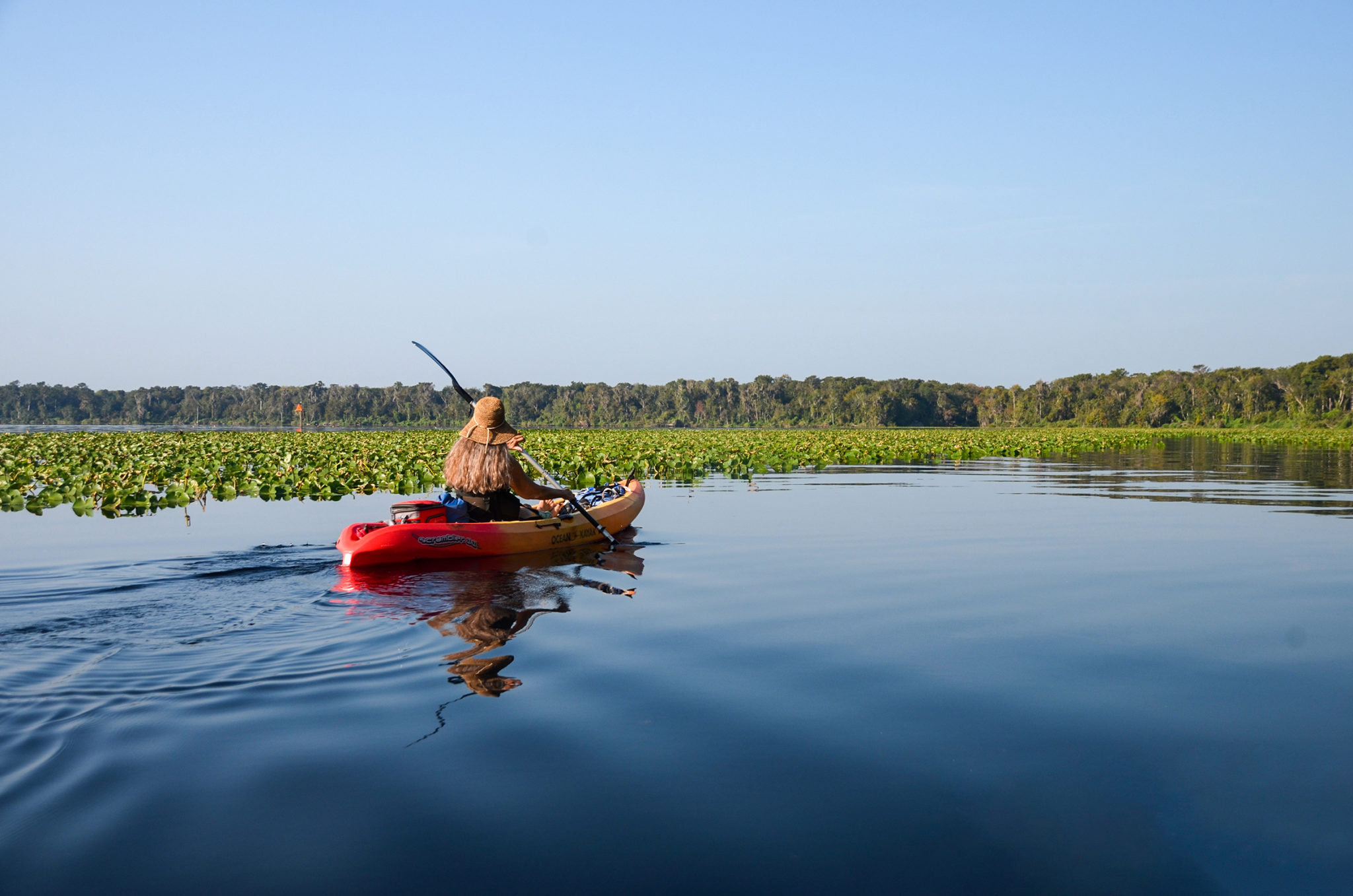
The St Johns River is 1/4 mile across from our launch and we proceed to cross the river. This morning it is warm, 84°, sunny and calm. There is no boat traffic or wind on the St Johns River which is a blessing and makes the crossing quite pleasant.
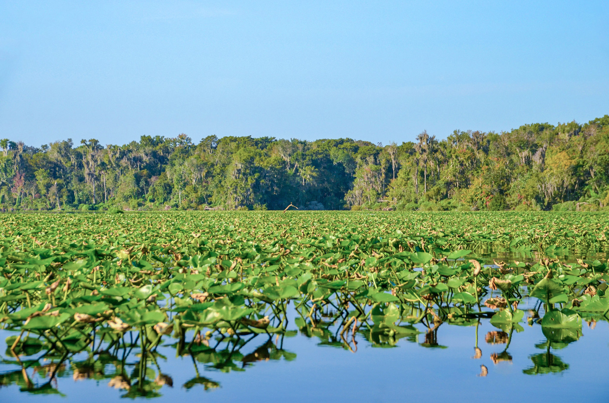
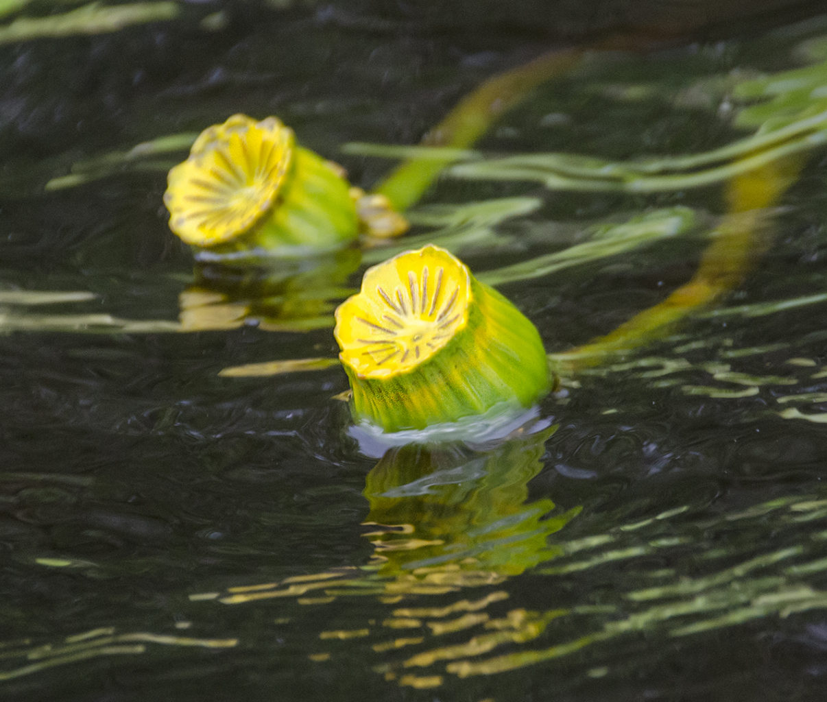
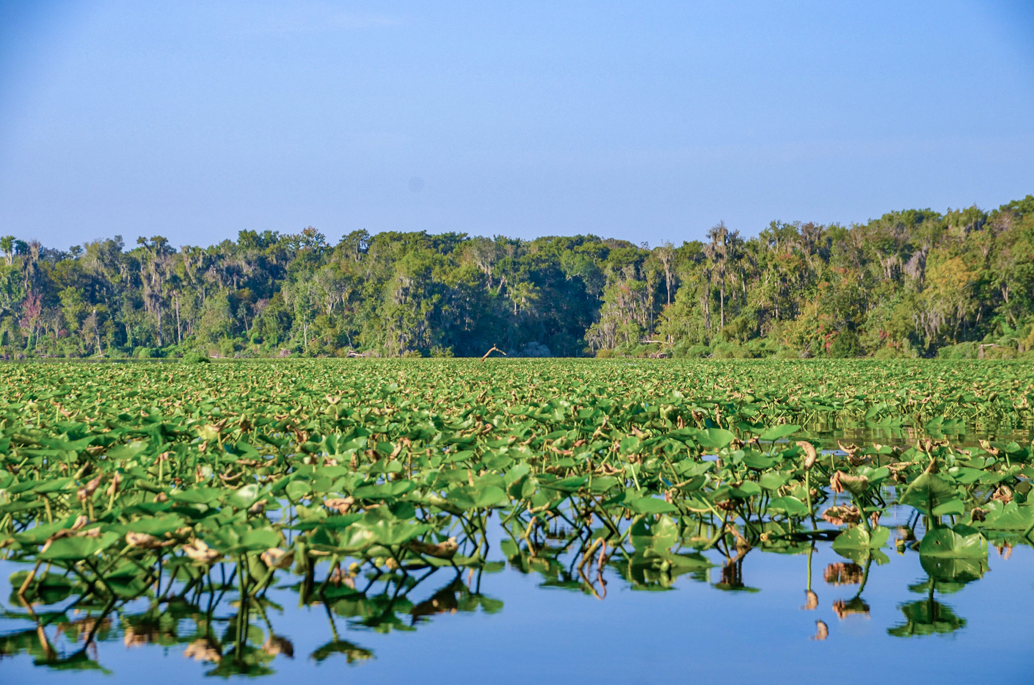
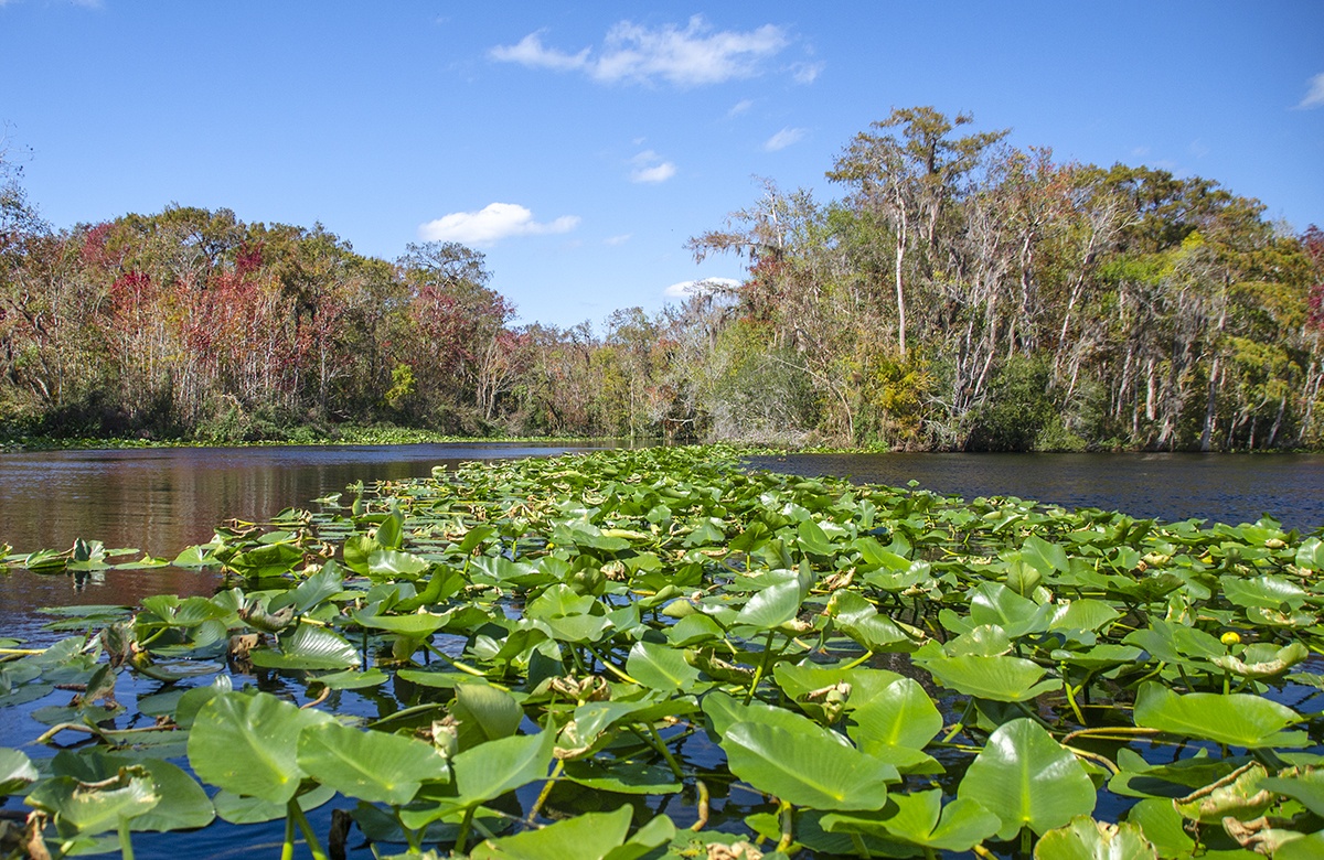
The western shoreline of the St. John’s is characterized by wide masses of Spadderdock that average 100′ – 200′ feet wide. We paddle through a small passage through the Spadderdock, along the shoreline past the Ocklawaha River, to the entrance to Bear Creek.
Bear Creek
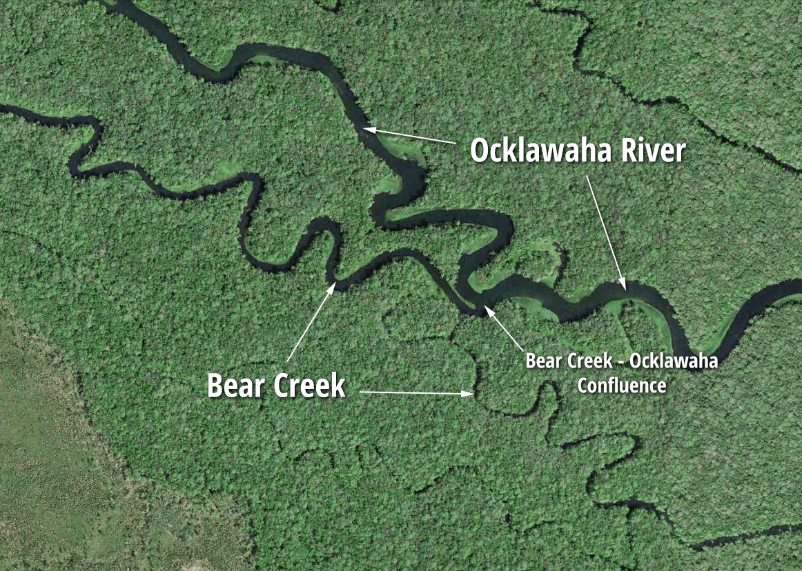
The mouth of Bear Creek can be seen from a distance across the sea of Spadderdock on the St. Johns River, 1.5 miles into our paddle…location map. A good landmark is the St Johns River Marker #52 near the mouth of the Ocklawaha River. From the Ocklawaha, Bear Creek is just under 1000′ to the South.
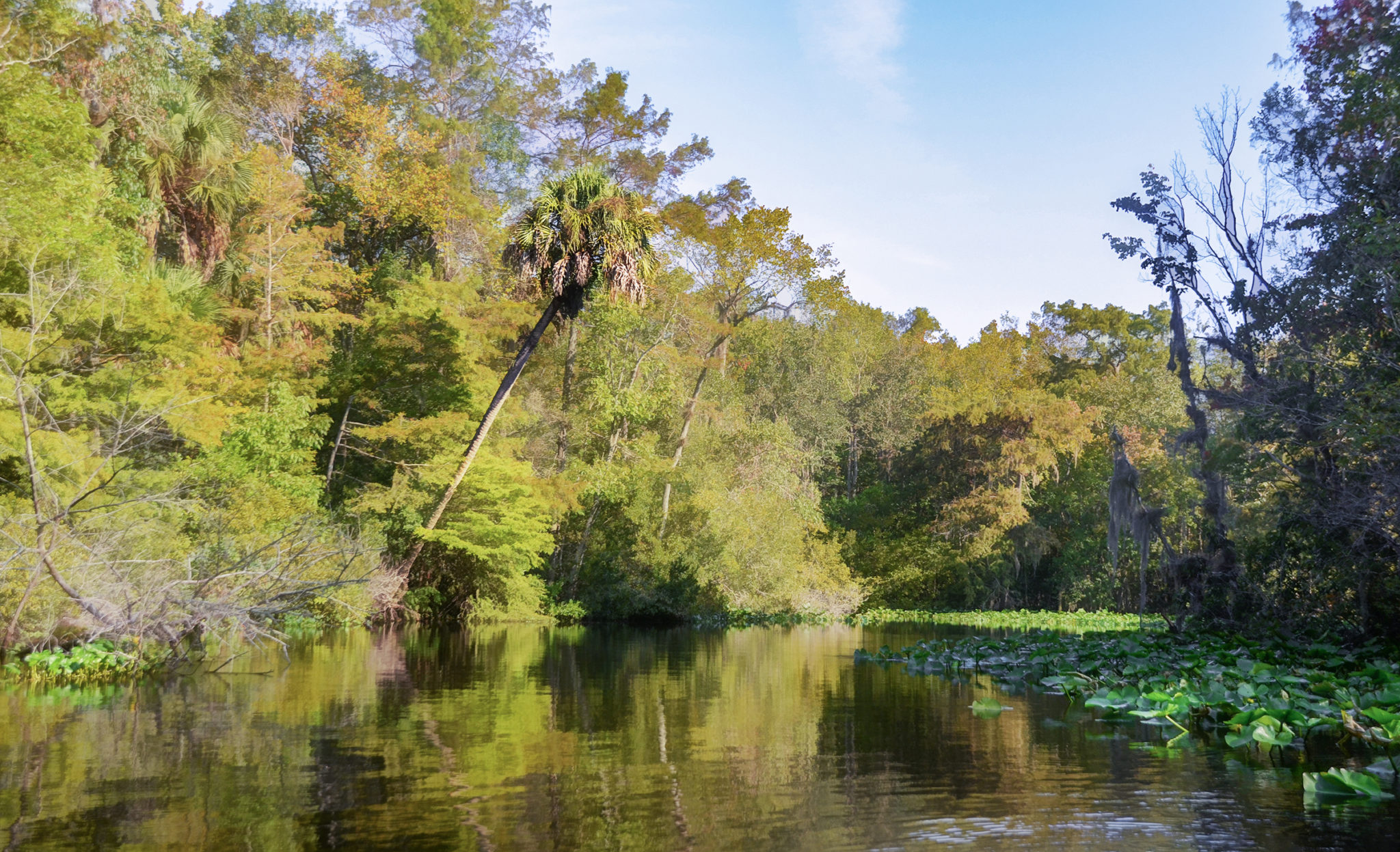
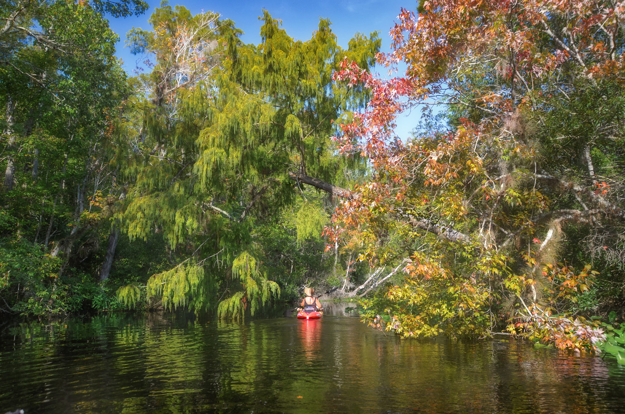
Bear Creek is just over 100′ wide as it enters the St Johns River. The flow is gentle and there is no problem paddling against the current. The water level is noticeably high, with the lower branches of many Cypress and palms below the waterline. There were several new trees downed since our last visit, but none obstructed our paddle under their canopy. The air was still and the familiar smell of the swamp was in the air as we paddled the 1.75 miles up to where Bear Creek brushes the Ocklawaha River.
Flora and Fauna
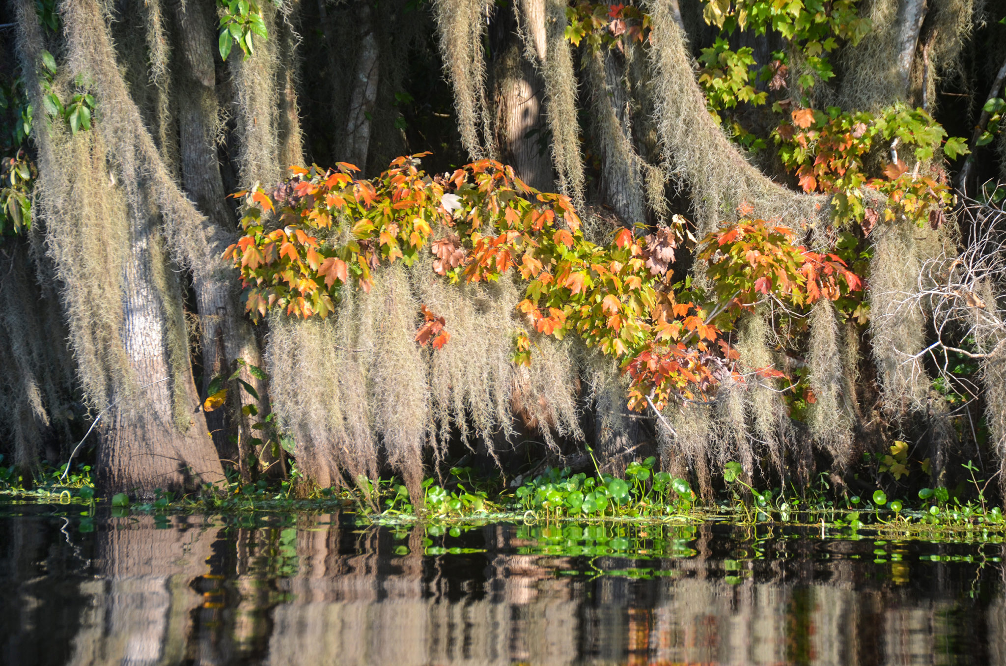
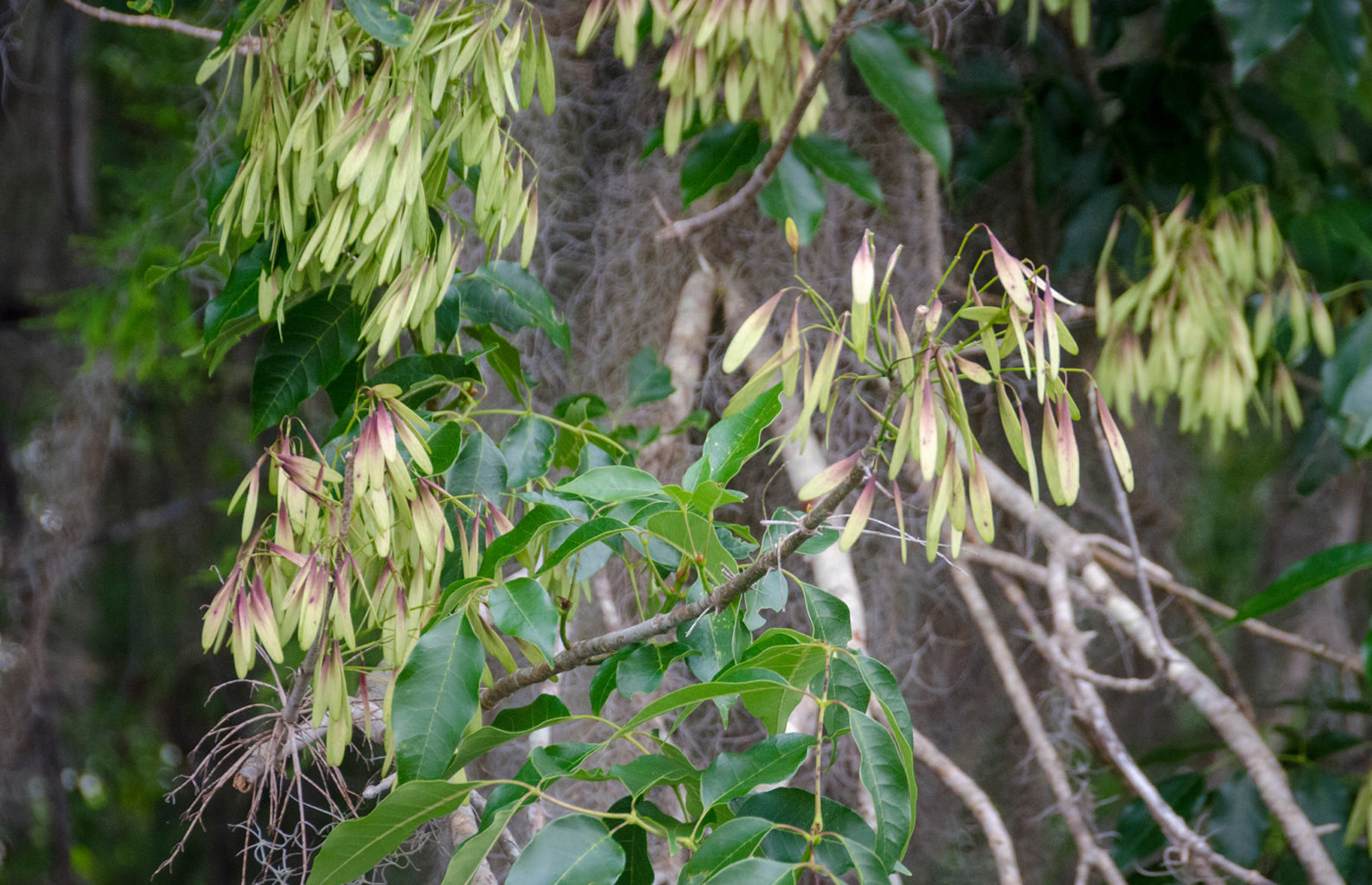
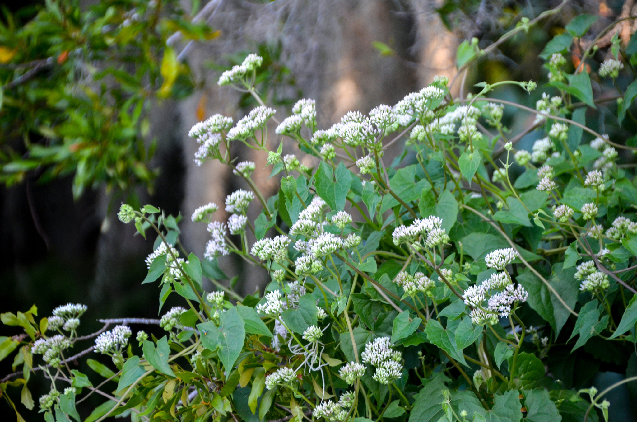
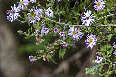
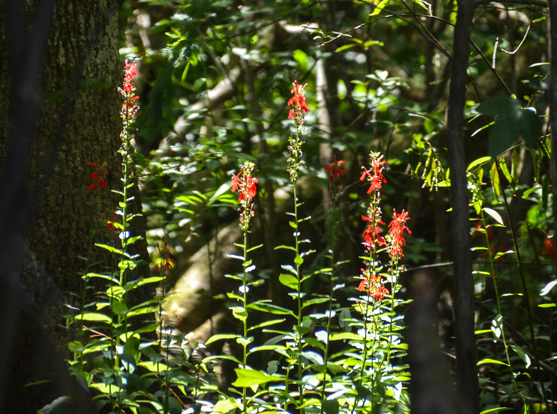
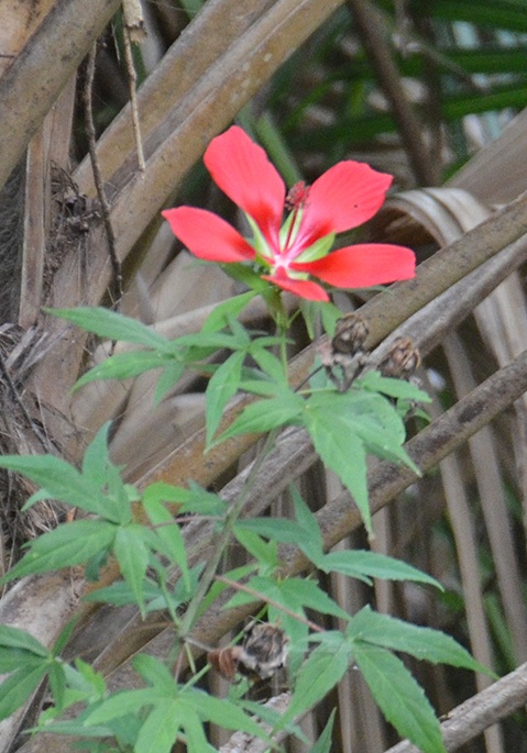
Red Maples made for great color accents with their bright red and orange leaves on a background of green from the Bald Cypress. Carolina Ash still had numerous seed pods remaining on them and many Cypress trees displayed their male catkins like tinsel on a Christmas Tree. Climbing Hempvine was in full bloom the entire length of Bear Creek and Swamp Dogwood displayed numerous berries along the way. The Creek was a diversity of trees and shrubs to include, Wax Myrtle, Carolina Ash, Swamp Tupelo, Red Maple, Sweet Gum, Bald Cypress, Water Locust, and Swamp Dogwood.
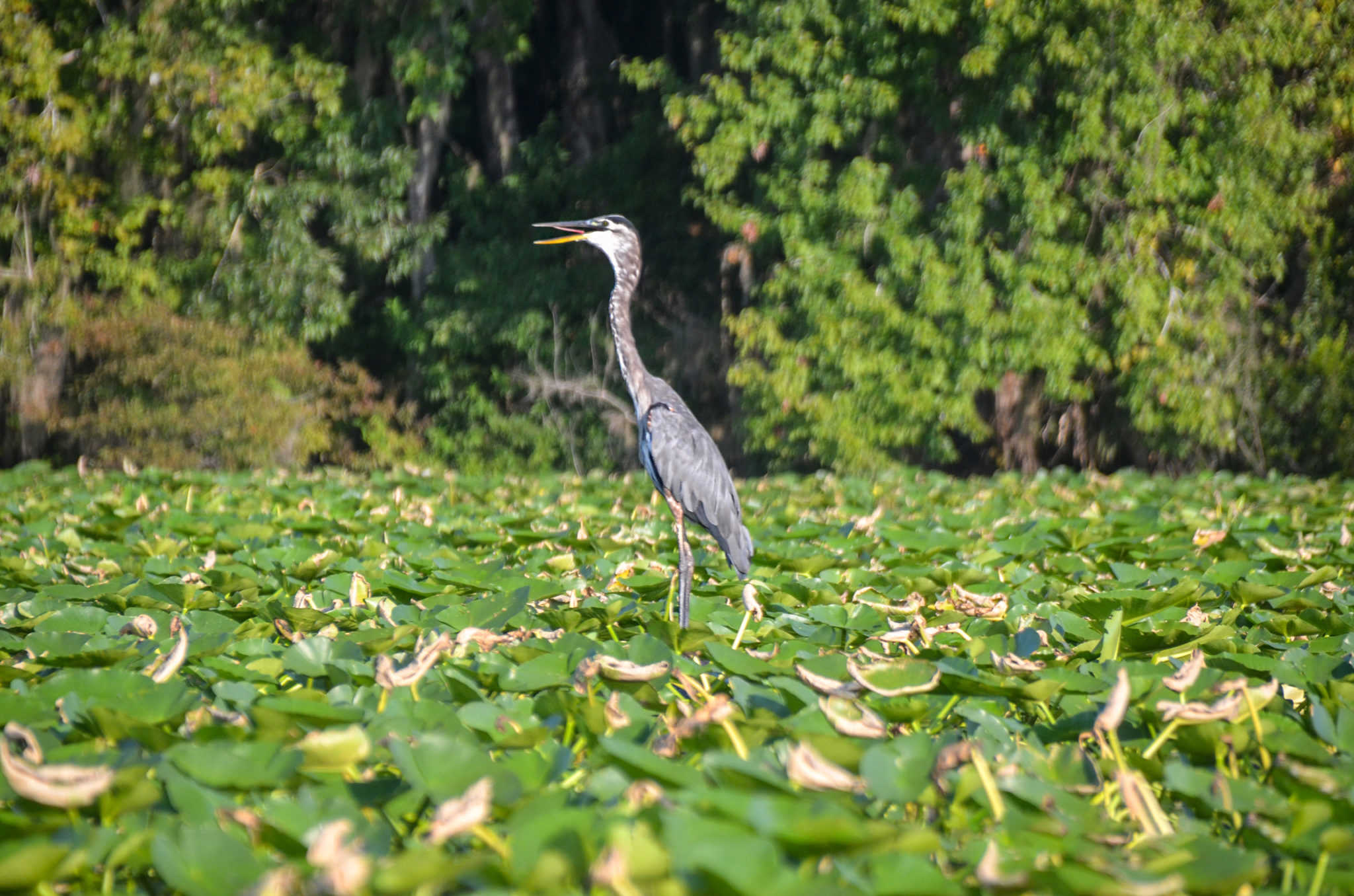
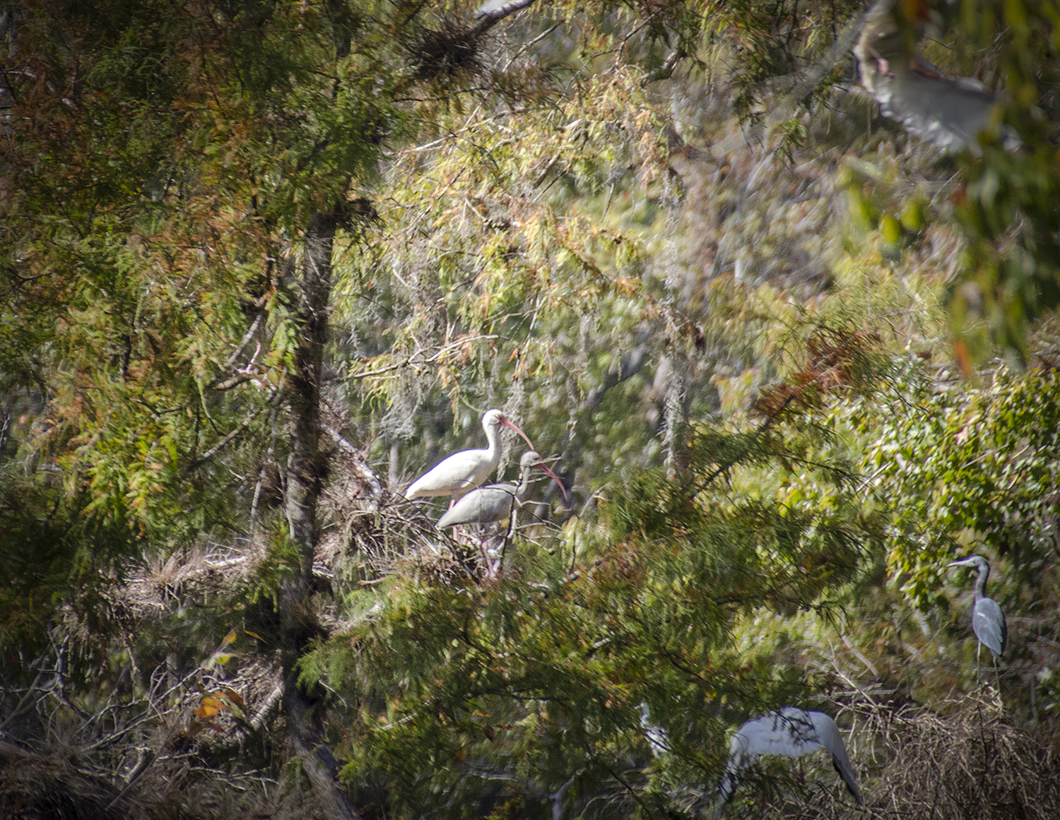
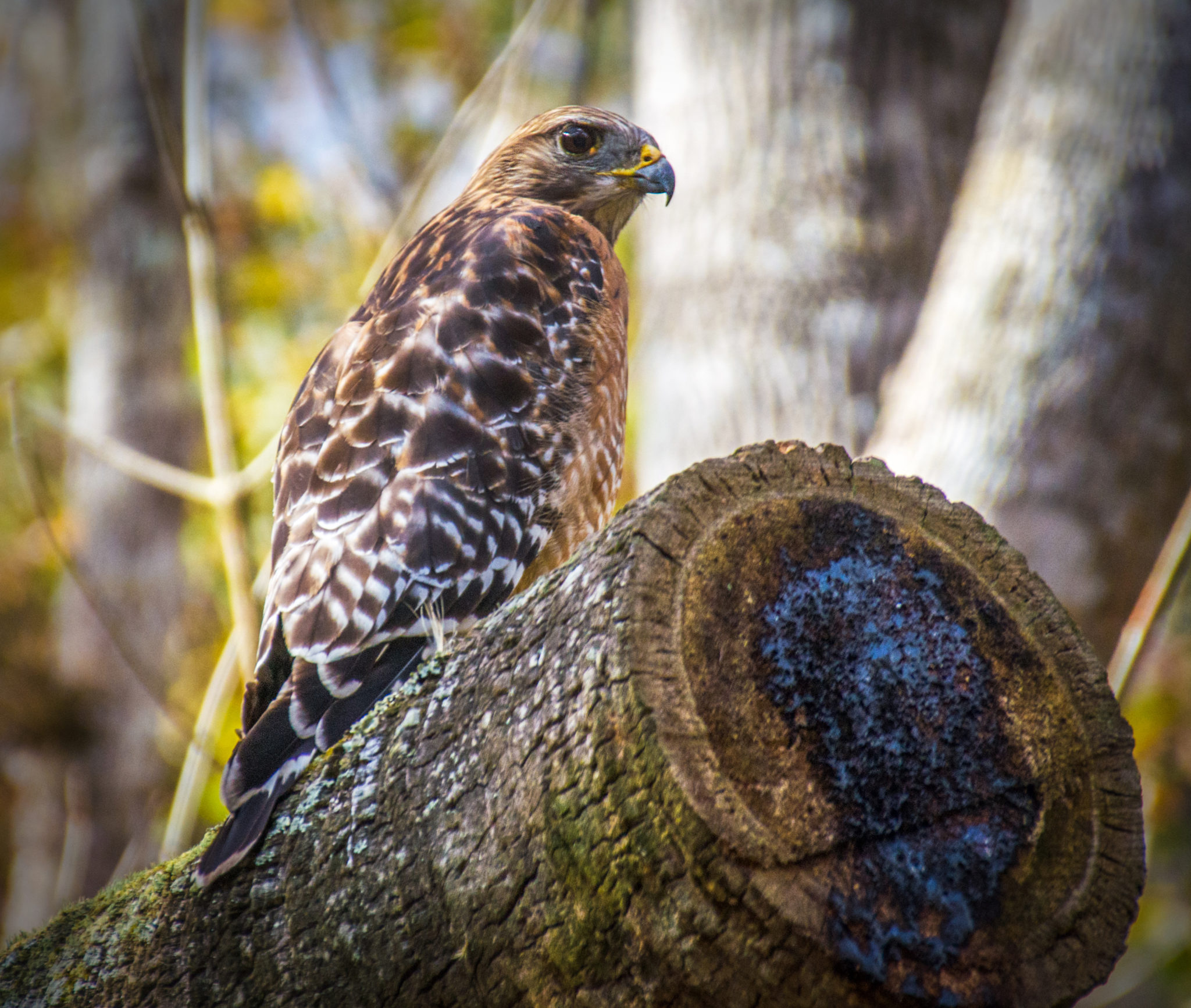
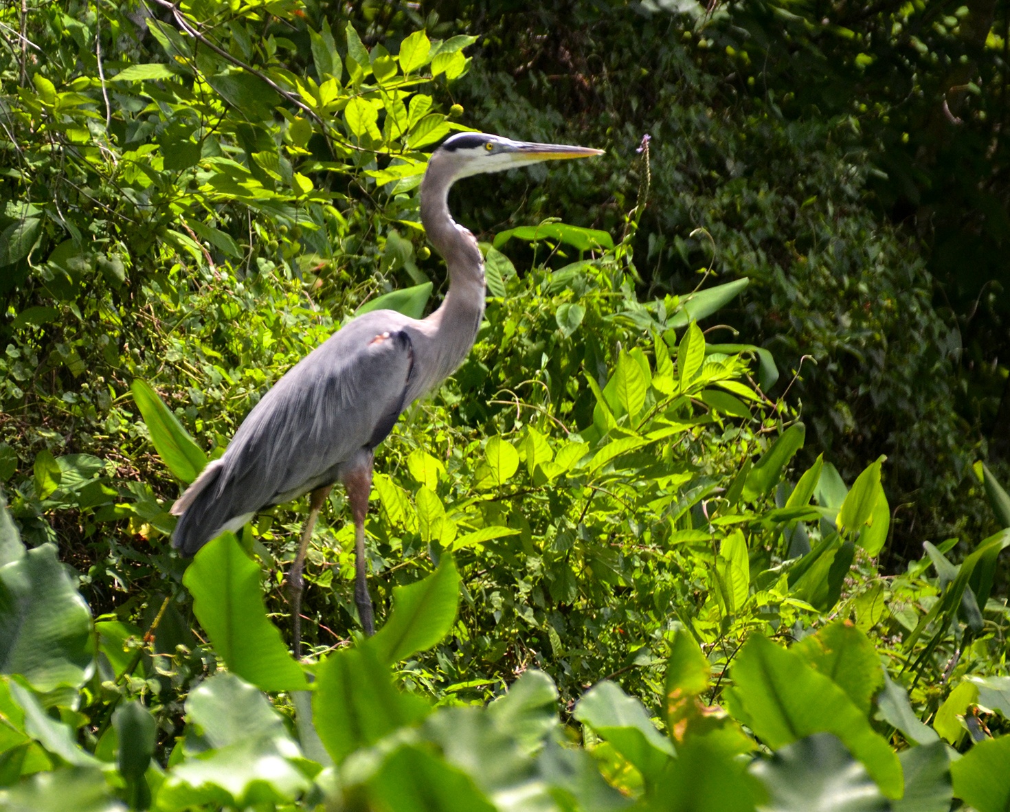
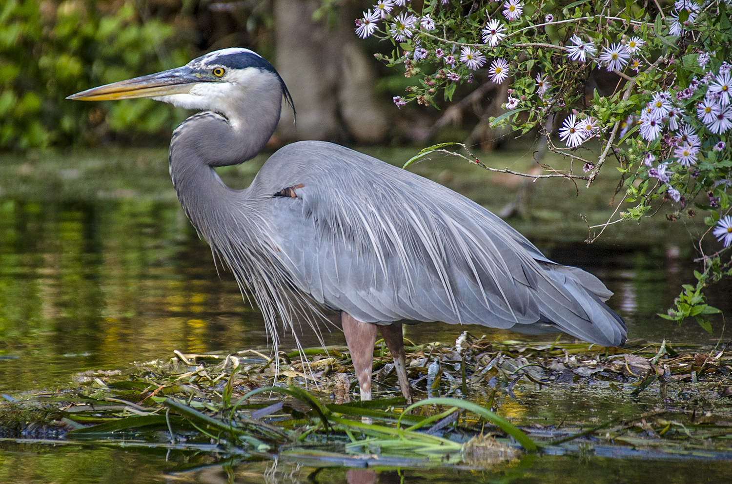
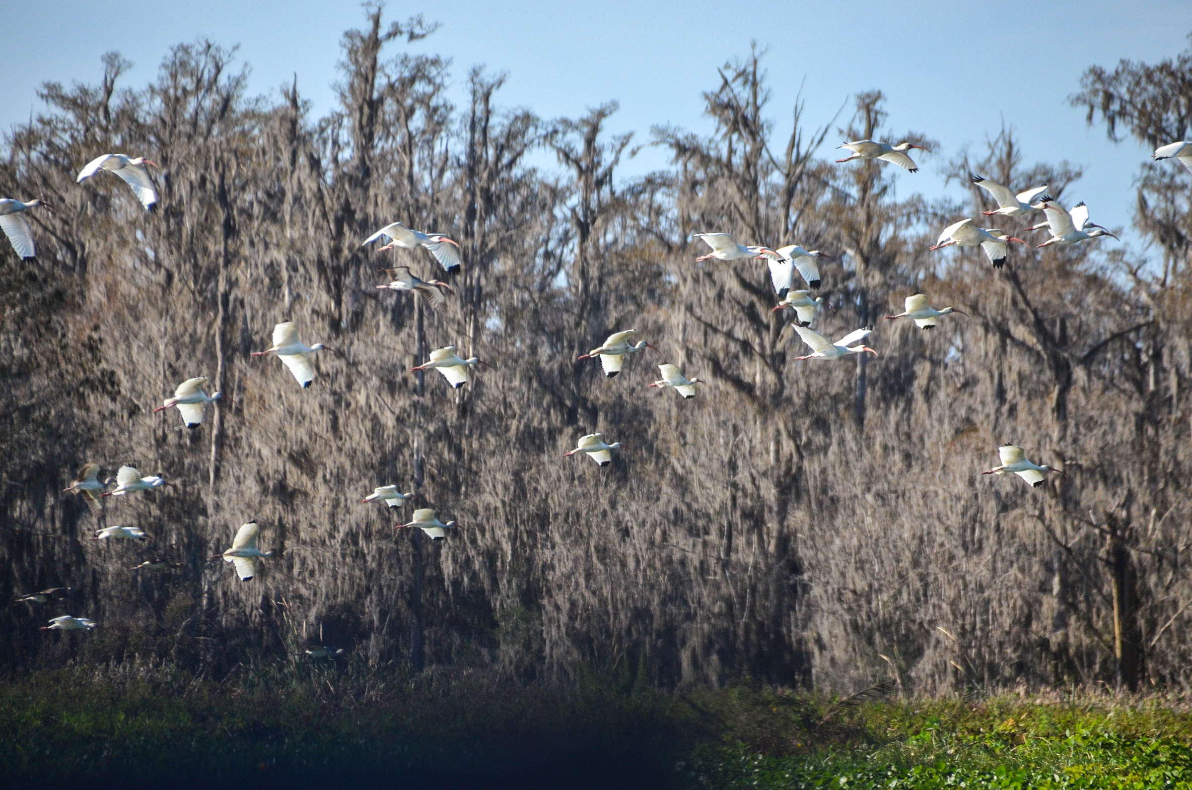
What was noticeable was the absence of birds, which normally, are abundant along Bear Creek. I included photos of Ibis and a Red-Shouldered Hawk from a past paddle, however, today, a couple of Anhingas and a Great Heron was all that we saw.

Ocklawaha River
1.75 miles up Bear Creek is a junction. It is here that Bear Creek, flowing from the West, actually flows into the Ocklawaha River. It is also here, that the small creek we just paddled up emerges from the Ocklawaha and is named Bear Creek. See Graphic… There is a 175′ distance between this smaller Bear Creek to the confluence of the larger Bear Creek and the Ocklawaha. Paddling through this opening brings us into the much wider and open Ocklawaha River. Here the river is 150′ wide with 50′ of this width matted with Spadderdock around every turn.
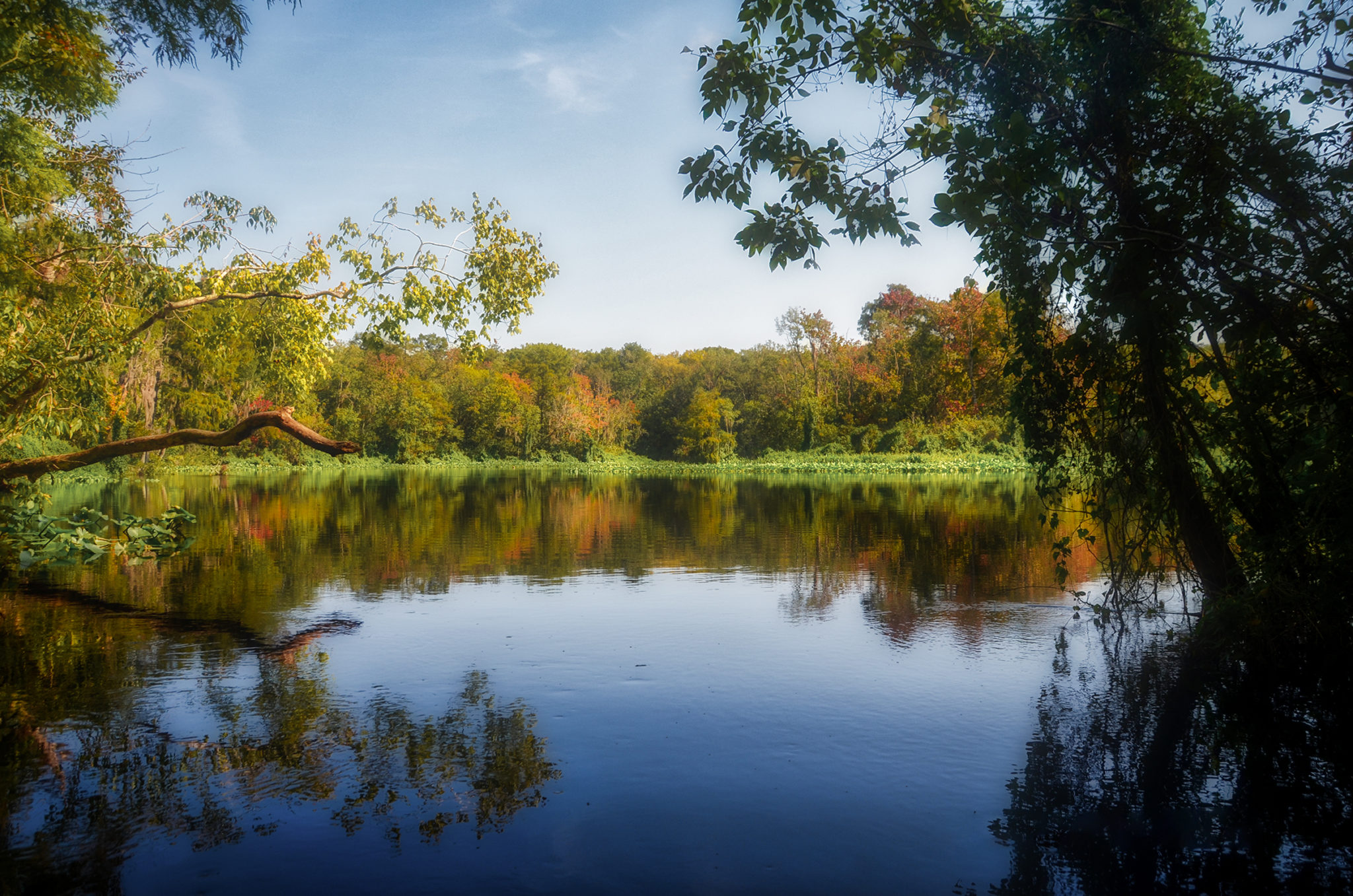
The river is beautiful, gently flowing, and like Bear Creek is accented with the bright leaves of the Red Maples. The paddle is effortless and surprisingly there is no boat traffic at all. It is much warmer now and we paddle 1.75 miles down the river to the St. Johns River. From there, back to our launch at Bryant’s Wharf, Welaka. Definitely an enjoyable 6+ mile paddle!
Bear Creek St Johns Gallery


Bear Creek – Ocklawaha Details
![]() Location: Bear Creek originates as a small 35′ wide creek, 1/4 mile East of the HWY 19 bridge, 19 miles North of Salt Springs, Putnam County, Fl.
Location: Bear Creek originates as a small 35′ wide creek, 1/4 mile East of the HWY 19 bridge, 19 miles North of Salt Springs, Putnam County, Fl.
![]() Launch Point: Johnson Field Boat Ramp on Hwy 19.
Launch Point: Johnson Field Boat Ramp on Hwy 19.
![]() Paddle Distance: Round trip for this paddle was 6.35 miles
Paddle Distance: Round trip for this paddle was 6.35 miles
![]() Difficulty: Easy. Could be difficult if trees are downed on Bear Creek
Difficulty: Easy. Could be difficult if trees are downed on Bear Creek
Average Paddle Speed: 2.0 mph.
![]() Width and Depth:
Width and Depth:
- St. Johns River 1/4 mile wide, 40′ deep in the main channel
- Bear Creek, 25′ – 80′ wide, depth variable from a few feet to over 6′
- Ocklawaha River 130 – 150′ wide, variable depth 8’+
![]() Current – Tidal: Gentle current
Current – Tidal: Gentle current
![]() Side Paddles: This trip does have two side paddles. Once on the Ocklawaha, 1.0 mile downstream on RL is Boyd Creek and at 2.6 miles, also on RL is Turpentine Creek.
Side Paddles: This trip does have two side paddles. Once on the Ocklawaha, 1.0 mile downstream on RL is Boyd Creek and at 2.6 miles, also on RL is Turpentine Creek.
![]() Rest Areas: There are no rest areas along this loop.
Rest Areas: There are no rest areas along this loop.
![]() Important Information: Watch for downfall on Bear Creek. Be prepared for the sun and heat.
Important Information: Watch for downfall on Bear Creek. Be prepared for the sun and heat.
Bear Creek Ocklawaha Loop Paddle Map
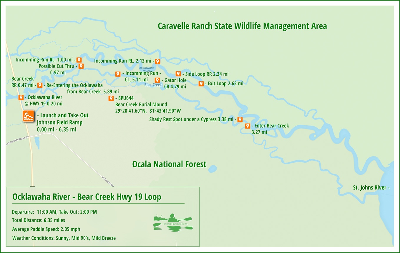
Johnson Field Boat Launch
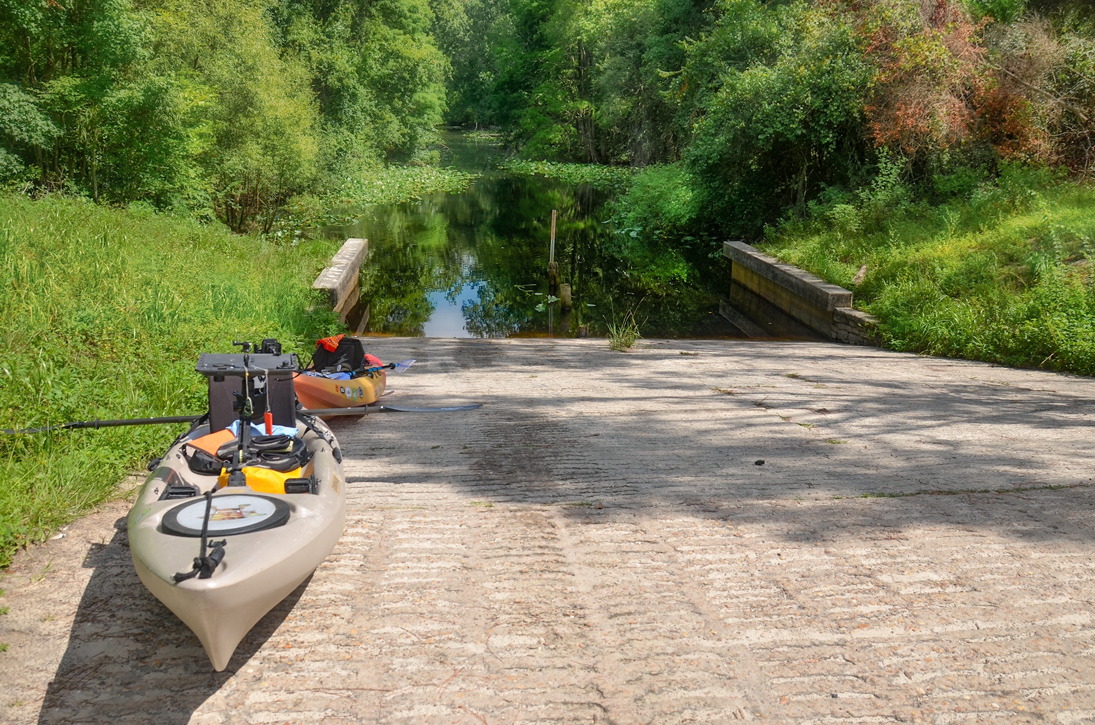
The launch site is on the southeast side of the Hwy 19 bridge that crosses the Ocklawaha River. It is a long, concrete, wide, and a bit steep, but in good condition. There is plenty of parking, nothing paved, and no facilities, no fees.
We expected to see many more vehicles/trailers today but there was only one other. At the launch, it is just under a 1/4 mile, along the bridge to the Ocklawaha River.
The Ocklawaha River
The Ocklawaha River at the Hwy 19 bridge is about 135′ wide as we head eastward. Mats of Spadderdock form large scattered clumps along each side. It is a hot day, there is no boat traffic and flow is gentle.
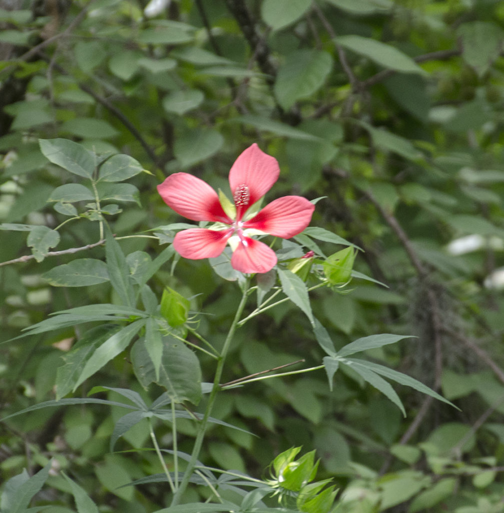
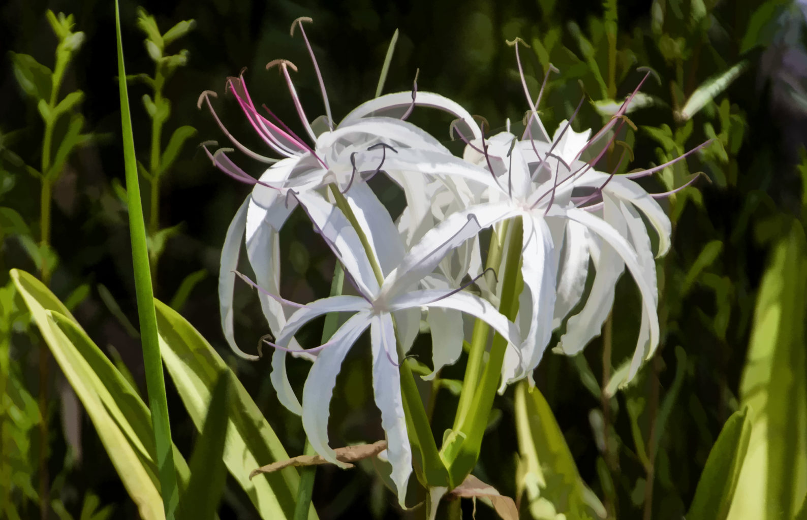
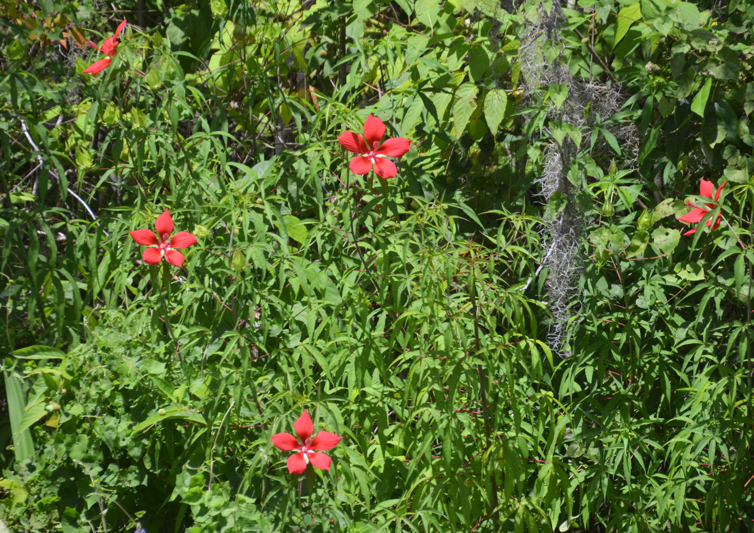
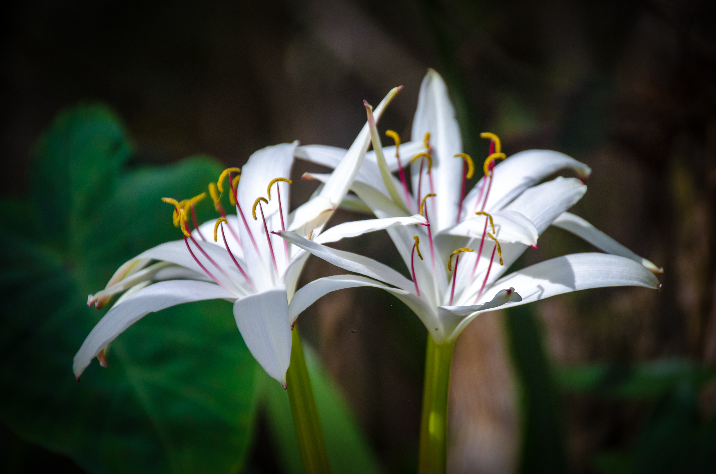
The Scarlet Rose Mallow and the white Swamp Lily, provide splashes of color along our way, while an occasional Blue Heron and Ibis fly along the shore. The river is quiet today. We pass the entrance of Bear Creek 1/2 mile into the paddle and note that this is where we will be coming out on our return trip.
At mile 0.95 I note a passage through the trees to Bear Creek on RR and just past this is the incoming Boyd Creek at 1.0 mile, RL. There is not another ‘marker’ until mile 2.2 RL, Turpentine Creek. Beyond that a short loop on RR and soon we are at our crossover destination, Bear Creek.
Bear Creek
3.4 miles down the Ocklawaha, we come to our crossover point onto Bear Creek. The creek is slightly less wide at this point but it too is open, no canopy. At this point, we are hot and ready for lunch. As soon as we enter the creek, there is a large Bald Cypress on the right, providing plenty of shade and it proved to be a very good rest spot to chill for a while.
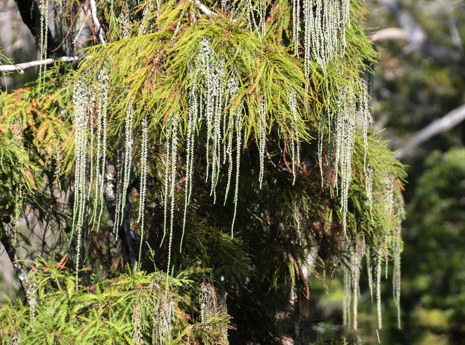
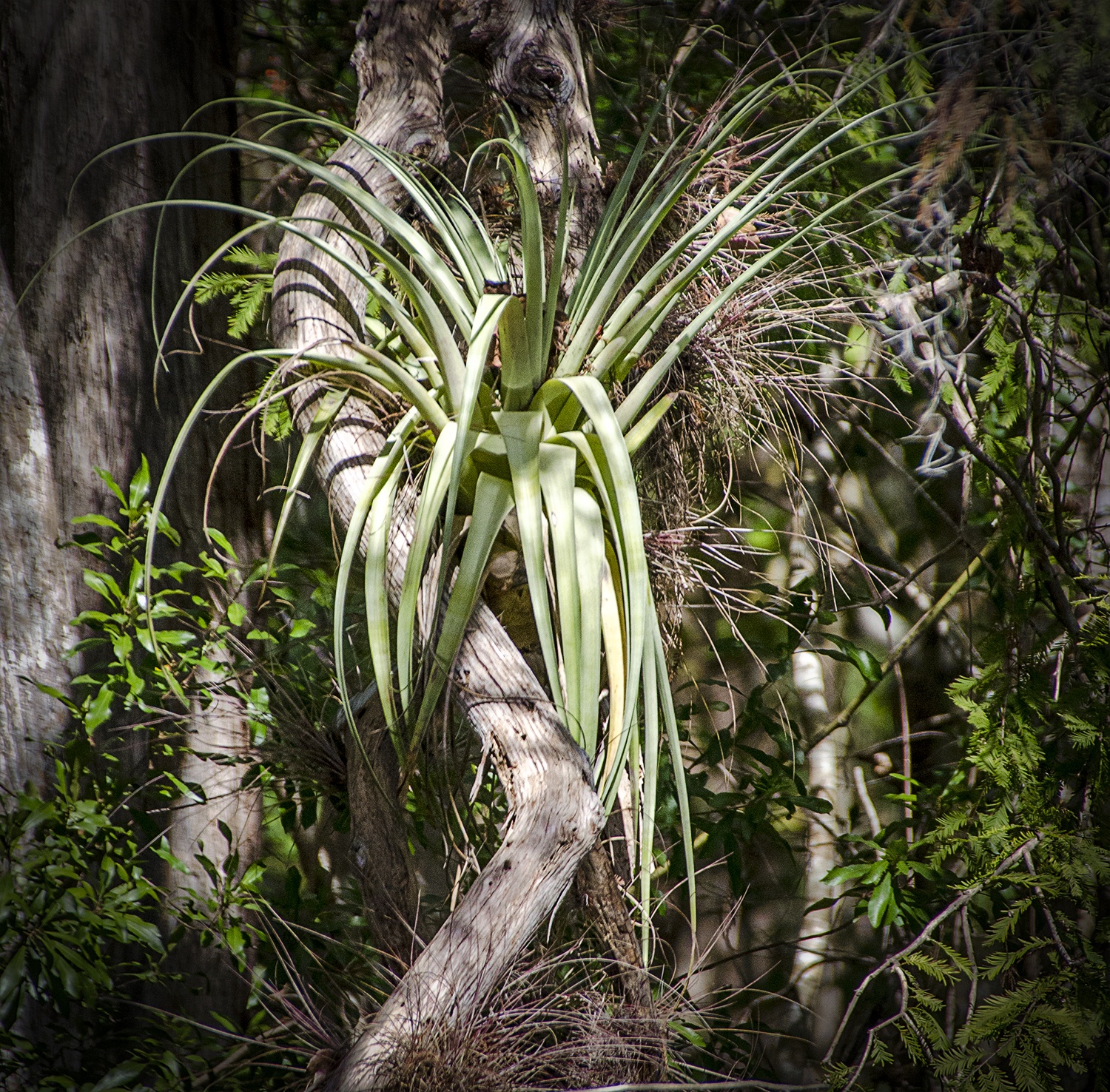
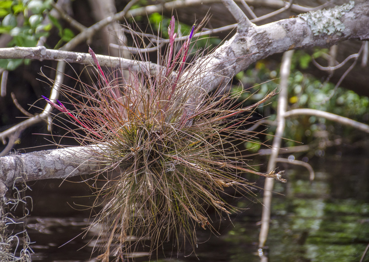
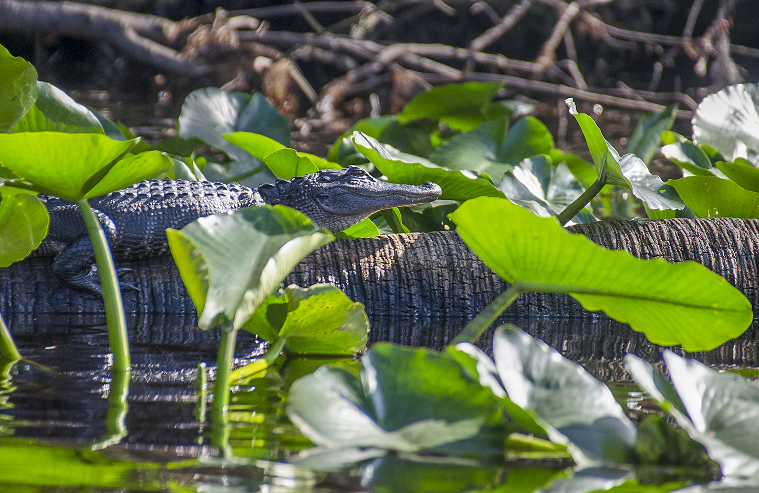
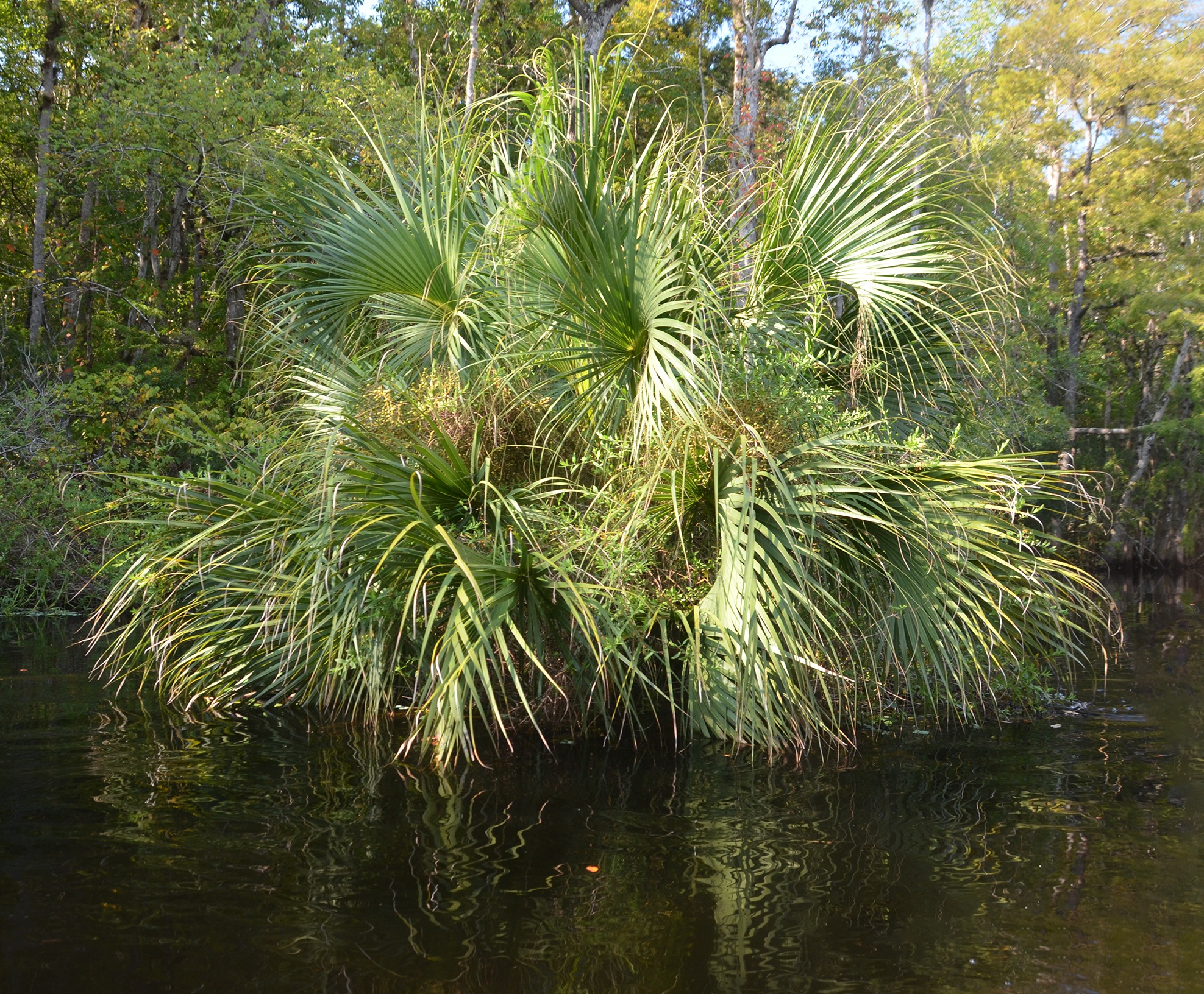
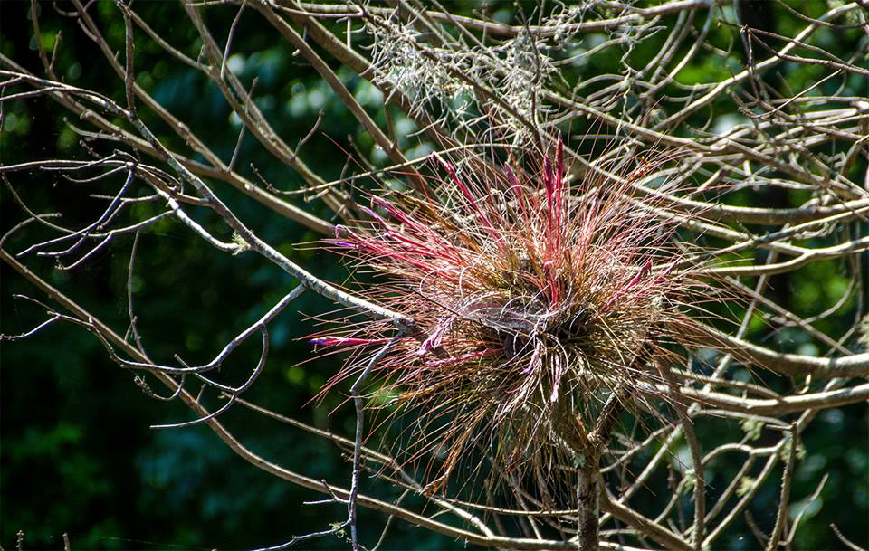
One noticeable thing on Bear Creek was the numerous gators, We did not see one gator on a log or bank ( as there are no banks, but we did see them crossing the creek ahead of us, silently watching us as we approached and disappearing under the water. As we approached mile 4.8 of our journey, a large gator bellowed as we approached and I marked the spot on the map. Definitely a ‘Gator Hole‘ and we did not investigate. I do not recall any birds on the creek, something it is known for and it was probably just too hot for them. Still, there were plenty of Scarlet Mallows in bloom as well as Swamp Lilies and the numerous Bartram’s Airplants in so many trees.
Guides, Maps & Info…
- Rodman Reservoir Topo Map…
- Ocklawaha Water Level Info at Eureka…
- Florida Defenders of the Environment – Remembering the Ocklawaha…
- Ocklawaha River – Remembered-Imagined…
- North Star Charters…Capt. Karen Chadwick…
- History of The Florida Barge Canal…
- Ditch of Dreams…
- History – Treaty of Paynes Landing…
- Ocklawaha Canoe Outpost & Resort…
- The Springs of the Ocklawaha River, Florida: Rodman Dam to Eureka Dam…
- An Ocklawaha River Information Mini-Page…
- Whitey Markle on the Ocklawaha River…
- Searching for—and Finally Finding—Cannon Springs, by Whitney Sanford…
- Save Rodman Reservoir, Inc…
- Free the Ocklawaha, Info and Videos…
- Additional Ocklawaha River posts by Florida Paddle Notes…
![]()