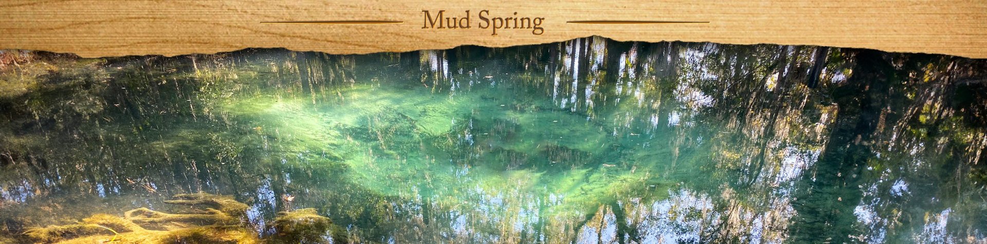
Mud Spring Overview

Mud Spring, nestled within the Welaka State Forest in North Central Florida, is a tranquil 4th-magnitude spring surrounded by a lush canopy of palms and palmettos. The spring forms an oval-shaped pool approximately 85 by 65 feet, with an average depth of about 4 feet. A gentle boil bubbles up at its center, keeping the crystal-clear water in motion and revealing underwater vegetation like sagittaria and coontail.
Despite its name, Mud Spring is anything but murky. The name likely comes from its light-colored muddy bottom, which can temporarily cloud the water when stirred—offering a rare example where the name reflects a subtle but real feature. The spring discharges around 14,000 gallons of water per hour, feeding a short, scenic spring run that flows southeast for just under half a mile. This run becomes Mud Creek, which winds through the forest for about a 1/2 mile before entering Mud Creek Cove, part of Little Lake George and ultimately the St. Johns River.
Quiet, scenic, and easily accessible by a loop trail, Mud Spring is a hidden gem—ideal for a refreshing dip, a shaded picnic, or a peaceful stop along a forest hike. For those who love Florida’s springs but seek something less traveled, Mud Spring offers a naturally beautiful, serene alternative.
![]()

Mud Spring Details
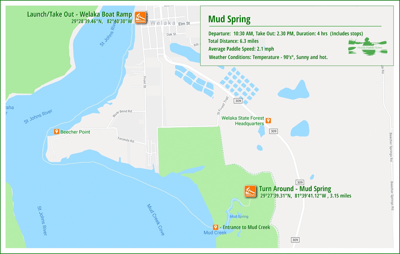
![]() Location: Mud Spring is located in the Welaka State Forest, 1.5 miles south of Welaka Fl. The coordinates are 29°27’39.31″N, 81°39’41.12″W.
Location: Mud Spring is located in the Welaka State Forest, 1.5 miles south of Welaka Fl. The coordinates are 29°27’39.31″N, 81°39’41.12″W.
![]() Launch point: The launch for this paddle is at the Bryant’s Wharf Boat Dock, located at the end of Palmetto St. in Welaka, Fl. 29°28’45.88″N, 81°40’29.88″W This is also the return take-out point.
Launch point: The launch for this paddle is at the Bryant’s Wharf Boat Dock, located at the end of Palmetto St. in Welaka, Fl. 29°28’45.88″N, 81°40’29.88″W This is also the return take-out point.
![]() Paddle Distance: One way to Mud Spring is 3.15 miles
Paddle Distance: One way to Mud Spring is 3.15 miles
![]() Difficulty: Easy. Can be a bit tiring if you have to fight the wind on the St Johns River.
Difficulty: Easy. Can be a bit tiring if you have to fight the wind on the St Johns River.
 Average Paddle Time: 2.1 mph.
![]() Width and Depth: This is an open expanse on the St John River, which is 1/4 mile across at the launch site. Mud Creek starts out at 300′ wide and quickly tapers to 50′ at the spring.
Width and Depth: This is an open expanse on the St John River, which is 1/4 mile across at the launch site. Mud Creek starts out at 300′ wide and quickly tapers to 50′ at the spring.
![]() Current – Tidal: The current along the St Johns River is below 1 mph as it is called a lazy river, dropping only 30′ in its entire length of 310 miles! The flow out of Mud Spring is minimal.
Current – Tidal: The current along the St Johns River is below 1 mph as it is called a lazy river, dropping only 30′ in its entire length of 310 miles! The flow out of Mud Spring is minimal.
![]() Side Paddles: Not applicable
Side Paddles: Not applicable
![]() Rest Areas: There are restroom facilities at Mud Spring.
Rest Areas: There are restroom facilities at Mud Spring.
Mud Spring Paddle Map
Bryant’s Wharf launch
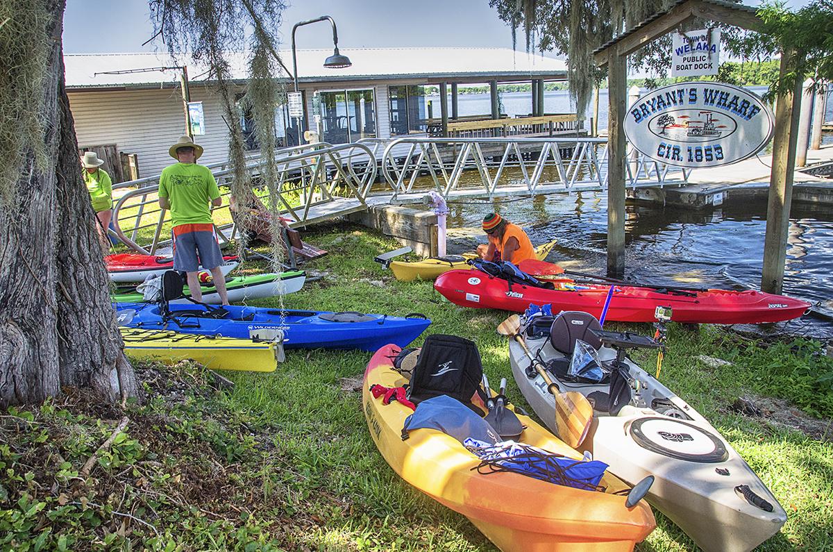
We arrived around 10:00 am at Bryant’s Wharf Boat Dock at the end of Palmetto St. In Welaka.. The kayaks were staged on the grass to the right of the public boat dock and that is where we also launched. There is a larger boat ramp 1 street south on Elm and is used for the larger boats with trailers.
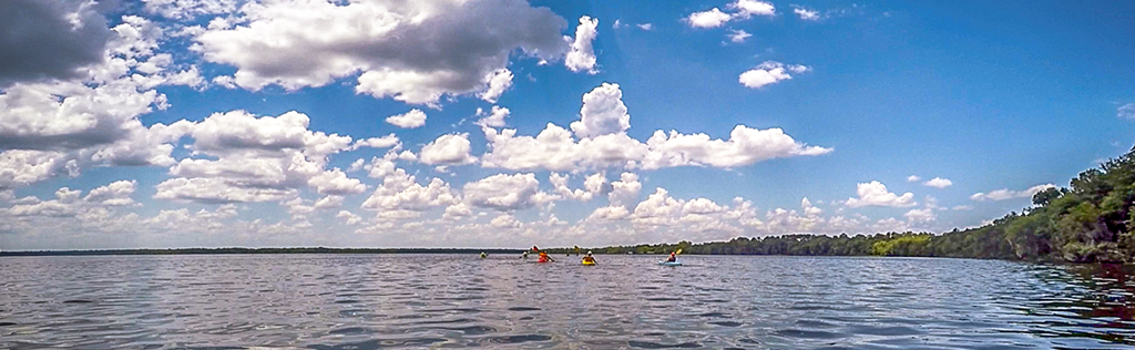
It was a beautiful, sunny morning and we had a pretty good size group from Putnam Blueways and Trails. We all had our water blasters for cooling off later when the temperature starts to rise…and it did! BY 10.30 am we were all the the water and heading out following the eastern shoreline of the St Johns River.
St. Johns River
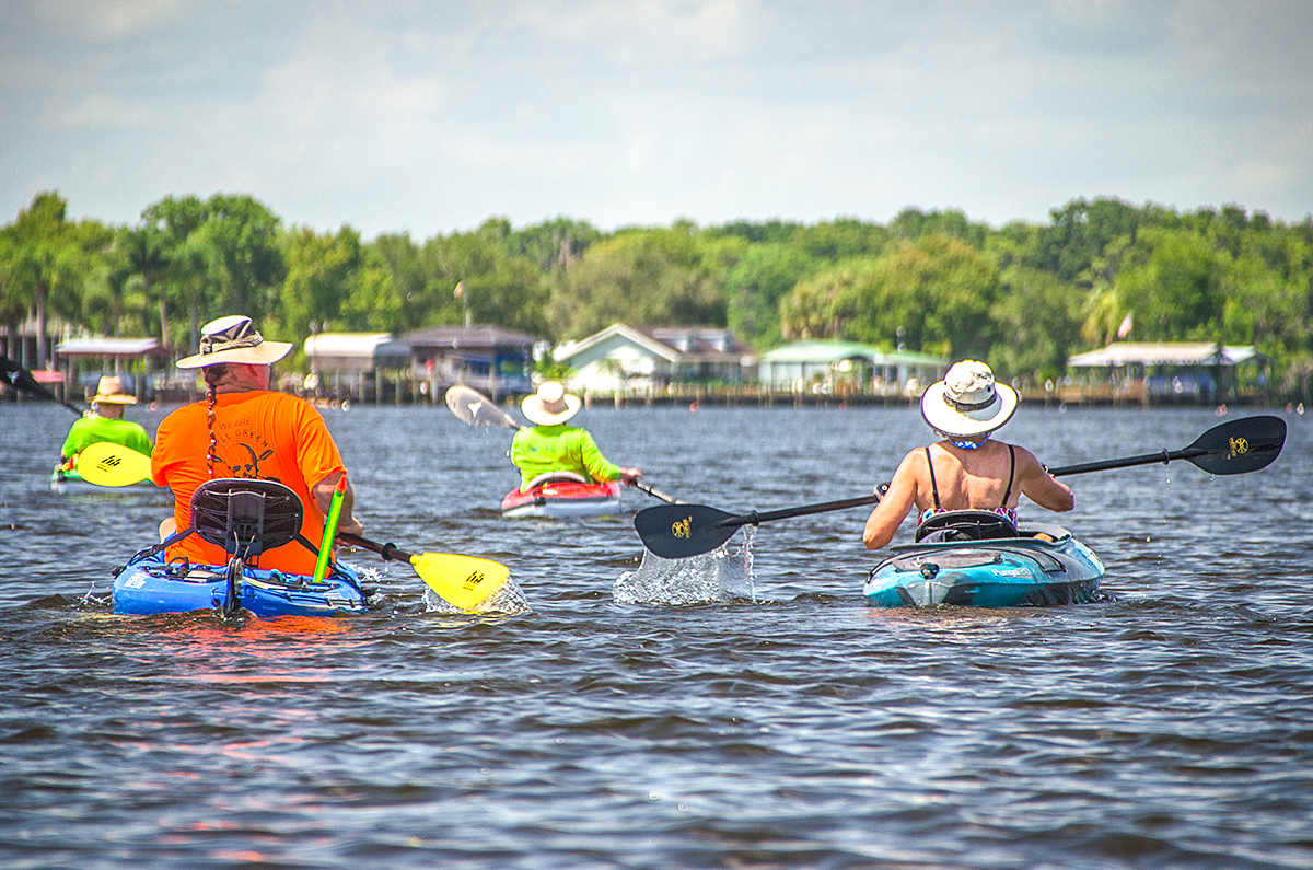
The St Johns River is about a 1/4 mile across at the launch on Palmetto St. It was a basically calm day on the river with not much head wind to deal with, which is always a welcomed treat when on that river.
The paddle takes us in a southwesterly direction about a mile to Beecher’s Point. Across the river from this point is where the Ocklawaha River flows into the St Johns River as well as Bear Creek. Rounding this bend in the river, we paddle southeasterly for a little of 1 1/4 miles across Mud Creek Cove to the entrance of Mud Creek, 29°27’28.30″N, 81°39’54.43″W.
Mud Creek and Mud Spring
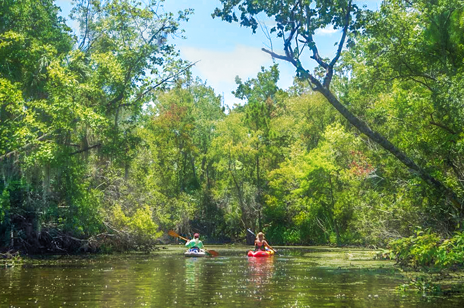
By the time we reached the entrance to Mud Creek we were hot and looking forward to getting to the spring. The creek’s entrance is is about 300′ wide but tapers quickly to about 50′.
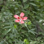
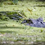
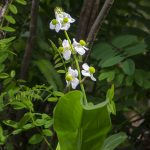
It is just less than a half mile up Mud Creek to the Mud Spring. There is minimal flow coming from the spring and the creek is often clogged with Duckweed. Along this short stretch we saw several Egrets, Scarlet Rose Mallow, Broadleaf Arrowroot and a small alligator with eyes just emerging from the thick Duckweed.
Having arrived at the docking area near the spring, we managed to tie up 11 kayaks and walk over to the spring. It was quite refreshing and for the most part clear. We enjoyed a short stay, cooled off, ate some lunch and headed back to the launch. It was a hot day, so the spring was a welcome refresher and another chapter of Florida Paddle Notes.
Mud Spring Gallery


Guides, Maps & Info
![]()