St. Marys River Overview

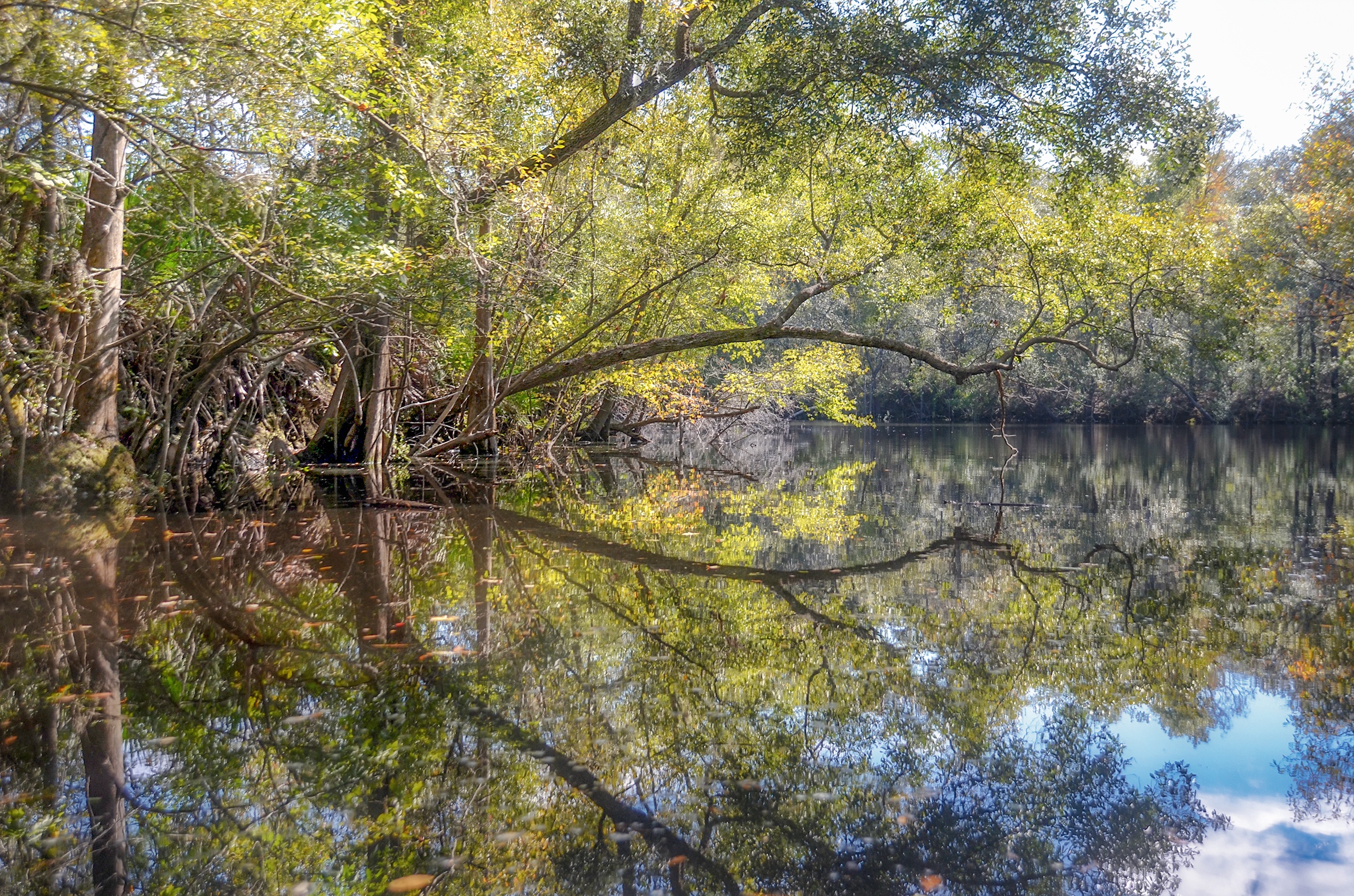
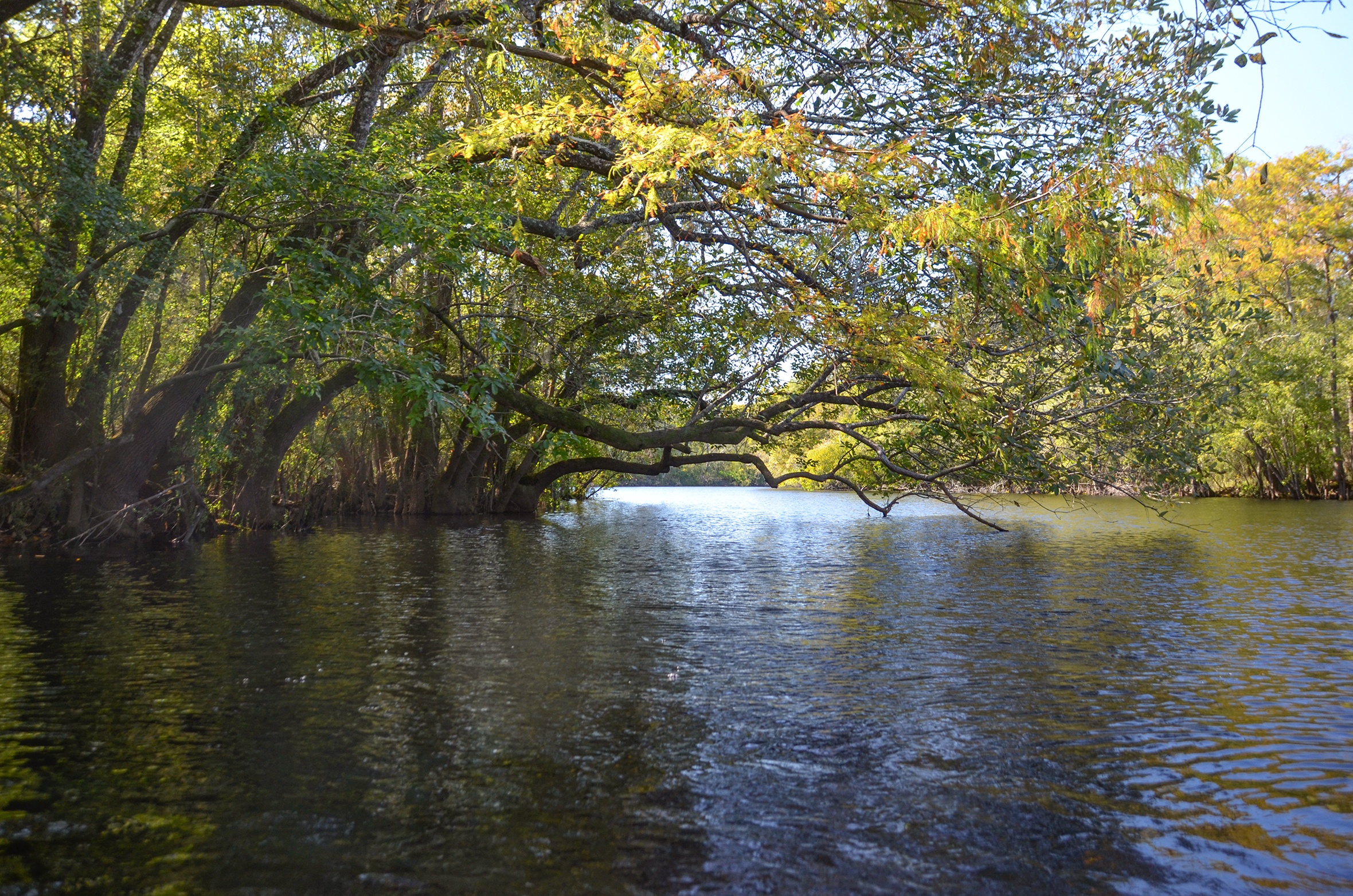
The St. Marys River is a winding blackwater river that forms the natural border between southeastern Georgia and northeastern Florida. Originating deep within the Okefenokee Swamp, the river flows for approximately 130 miles, eventually emptying into the Atlantic Ocean near Cumberland Island, Georgia. Its tea-colored waters, tinted by tannins from decaying vegetation, snake through cypress swamps, pine flatwoods, and coastal marshes, creating a diverse and vibrant ecological corridor.
Over 13,000 years ago, the St. Marys River Basin was inhabited by early Native American cultures, later becoming home to the Timucua, a complex and far-reaching tribal group known for their village networks and mound-building traditions. Archaeological evidence shows that these early inhabitants used the river for food, travel, and ceremonial life. By the 1500s, Spanish explorers had made contact, followed by British settlers and missionaries in the 1600s and 1700s. The river soon became a key route for exploration, trade, and colonization, threading through shifting boundaries of empires and nations.
In the 1800s, the St. Marys evolved into a vital artery for the timber industry, as massive pine forests were harvested and floated downstream to be milled or shipped to port. Riverboats and barges became a familiar sight, and small settlements grew around landings and ferry points. Fishing, trapping, and turpentining also flourished along its banks, forming the lifeblood of rural river communities.
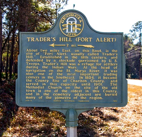
Trader’s Hill, just south of Folkston, Georgia, is a launch point steeped in history. Originally known as Fort Alert, it served as a Native American trading post and later became the Charlton County seat before that honor shifted to Folkston. Today it offers a quiet gateway to paddlers and history lovers alike, where whispers of the past linger in the breeze off the water.
One of the St. Marys’ notable tributaries is Spanish Creek, named after “Spanish John,” a local Seminole Indian known for his ties to the area. The creek meanders through moss-draped hammocks before meeting the main river, adding both fresh flow and historical character to this richly storied waterway.
![]()

St. Mary’s River Details
![]() Location: The St. Mary’s River is located in southeastern, Ga and northeaster Florida. The section we paddled is located 2.5 miles south of Folkston, Ga.
Location: The St. Mary’s River is located in southeastern, Ga and northeaster Florida. The section we paddled is located 2.5 miles south of Folkston, Ga.
![]() Launch point: The launch for this paddle is Trader’s Hill Boat Ramp…30°46’59.2″N 82°01’27.1″W, Folkston, GA 31537
Launch point: The launch for this paddle is Trader’s Hill Boat Ramp…30°46’59.2″N 82°01’27.1″W, Folkston, GA 31537
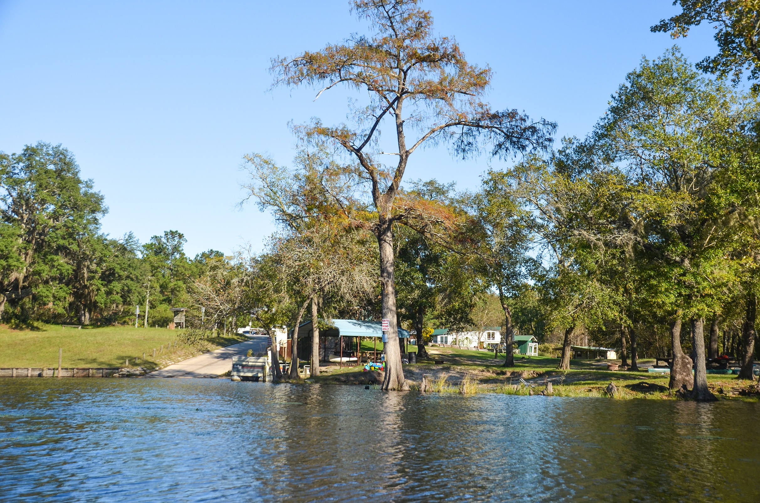
Take Out point: The take out for this paddle is at St. Mary’s Fish Camp 29506 Scotts Landing Rd, Hilliard, FL 32046.
![]() Paddle Distance: 6.34 miles, includes paddles into Spanish Creek and Holly Creek
Paddle Distance: 6.34 miles, includes paddles into Spanish Creek and Holly Creek
![]() Difficulty: Easy…today there was very little boat traffic, the river had no obstacles and a very gentle flow.
Difficulty: Easy…today there was very little boat traffic, the river had no obstacles and a very gentle flow.
 Average Paddle Speed: 2.11 mph, affected by side paddles.
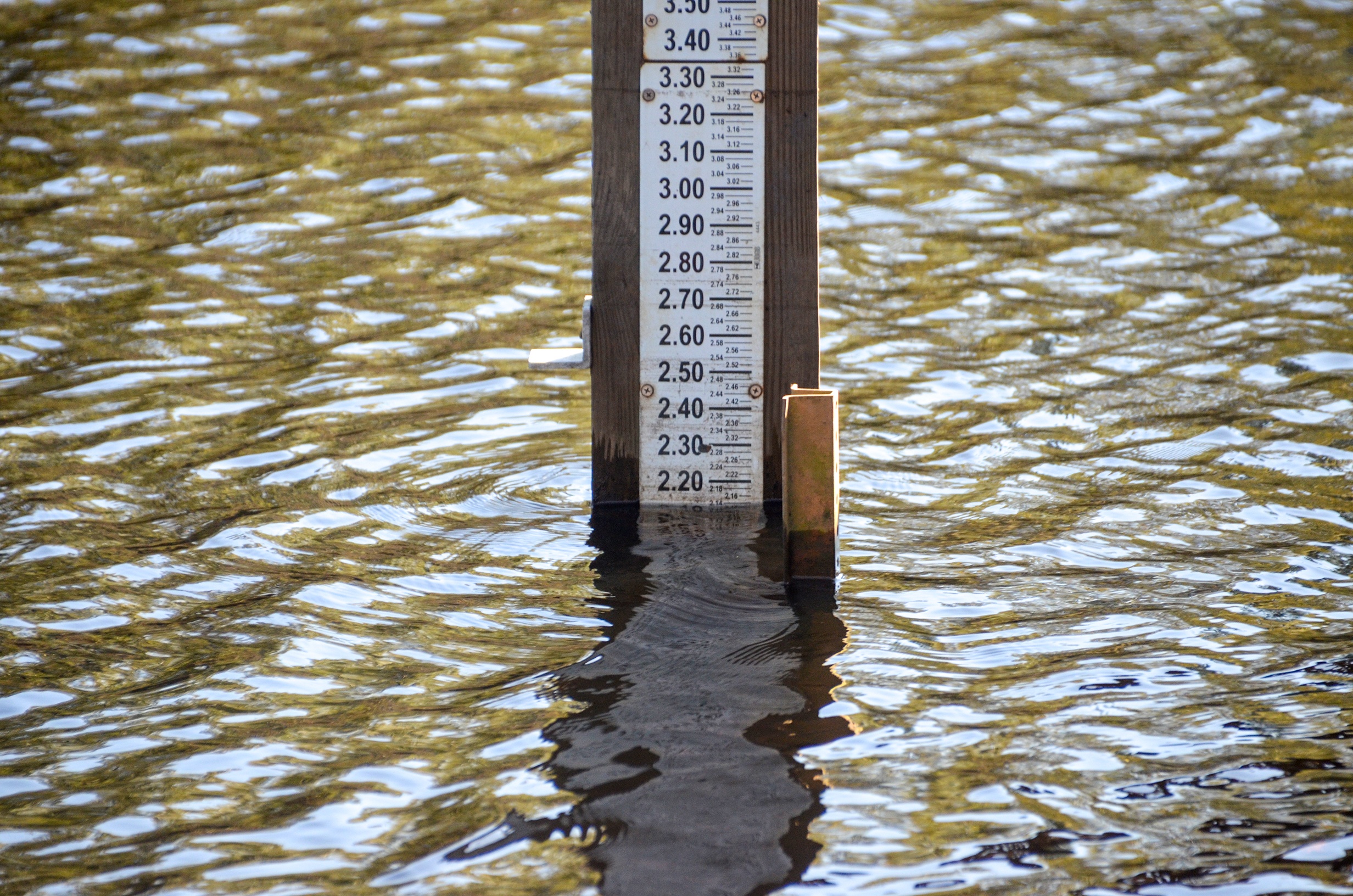
![]() Width and Depth: The width of the St Mary’s River was pretty consistent from launch to take out, from 175′ to 200′ with an open canopy. Flood stage is 12′ and today’s gauge showed a level of 2.15′
Width and Depth: The width of the St Mary’s River was pretty consistent from launch to take out, from 175′ to 200′ with an open canopy. Flood stage is 12′ and today’s gauge showed a level of 2.15′
![]() Current – Tidal: The current was low moving and we weren’t far enough on the eastern portion of the river to be affected by tidal brackish waters.
Current – Tidal: The current was low moving and we weren’t far enough on the eastern portion of the river to be affected by tidal brackish waters.
![]() Side Paddles: Our main side paddle was Spanish Creek. The creek was on RL, 1 mile into our paddle. We explored the 35′ wide creek for 0.3 mi, then returned. It looks like this can be paddled for 3/4 mile or so before becoming too obstructed. The creek was scenic, we passed a nice camp site. The down side is the creek is polluted and affected by water treatment runoff from the town of Folkston.
Side Paddles: Our main side paddle was Spanish Creek. The creek was on RL, 1 mile into our paddle. We explored the 35′ wide creek for 0.3 mi, then returned. It looks like this can be paddled for 3/4 mile or so before becoming too obstructed. The creek was scenic, we passed a nice camp site. The down side is the creek is polluted and affected by water treatment runoff from the town of Folkston.
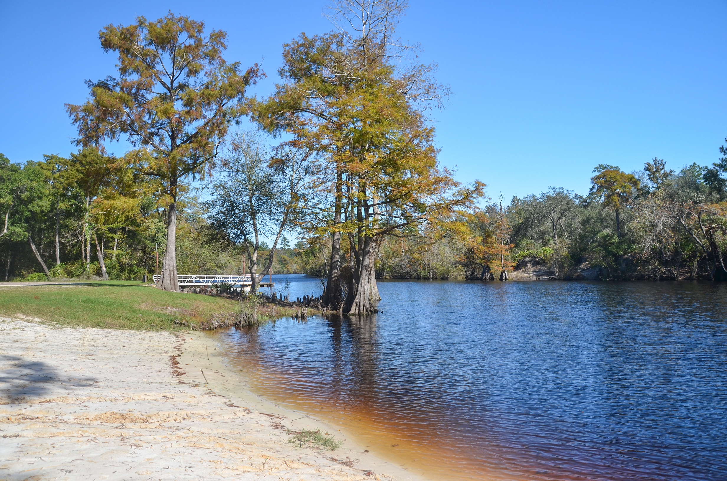
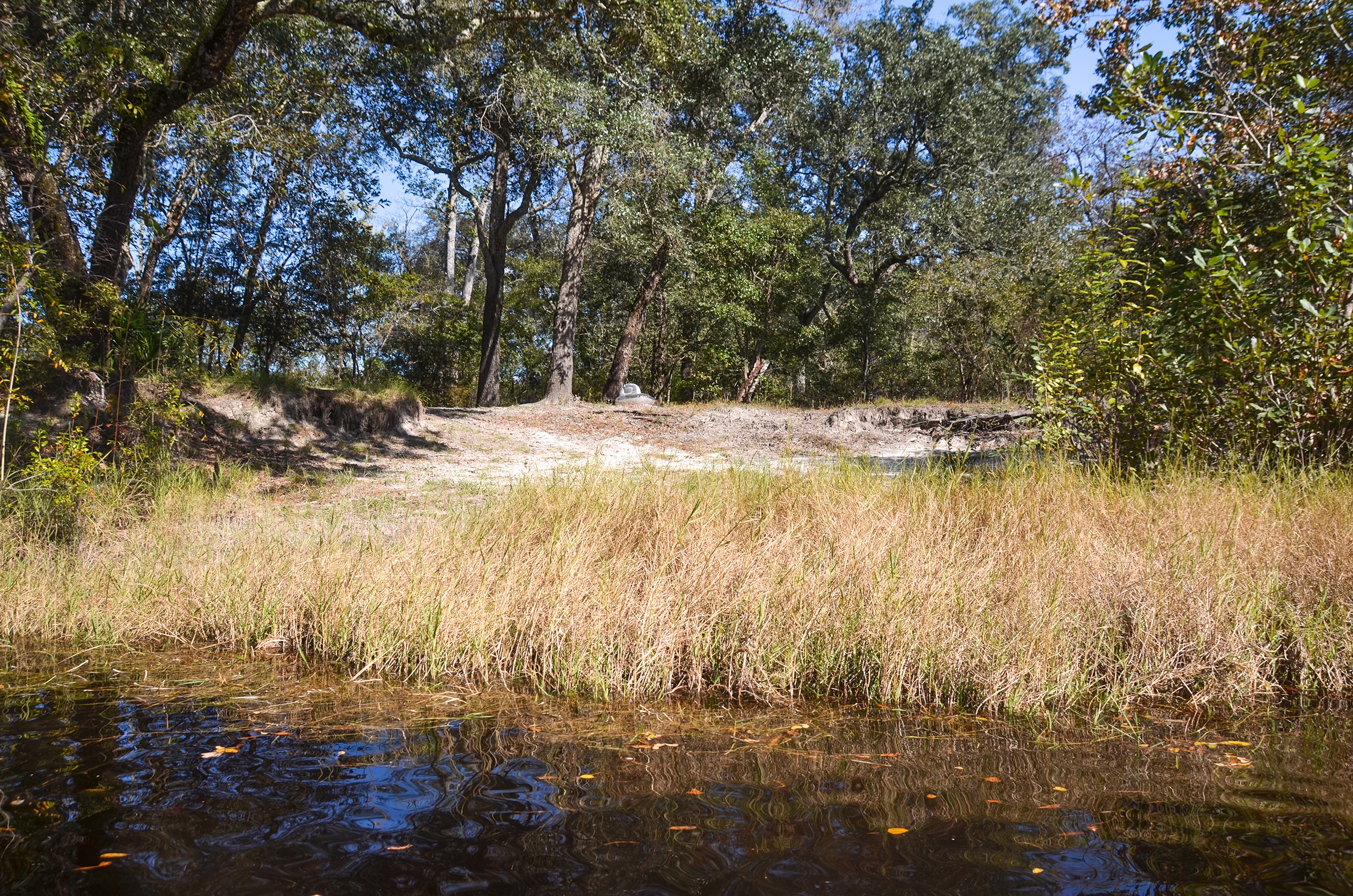
![]() Rest Areas: There our facilities at the campground launch and a couple of sandy beaches and camp sites within the first 2 miles of the paddle, a good break site ( no facilities ) at the Black River Boat Ramp, mile 3.57, RL.
Rest Areas: There our facilities at the campground launch and a couple of sandy beaches and camp sites within the first 2 miles of the paddle, a good break site ( no facilities ) at the Black River Boat Ramp, mile 3.57, RL.
St. Mary’s River Paddle Map
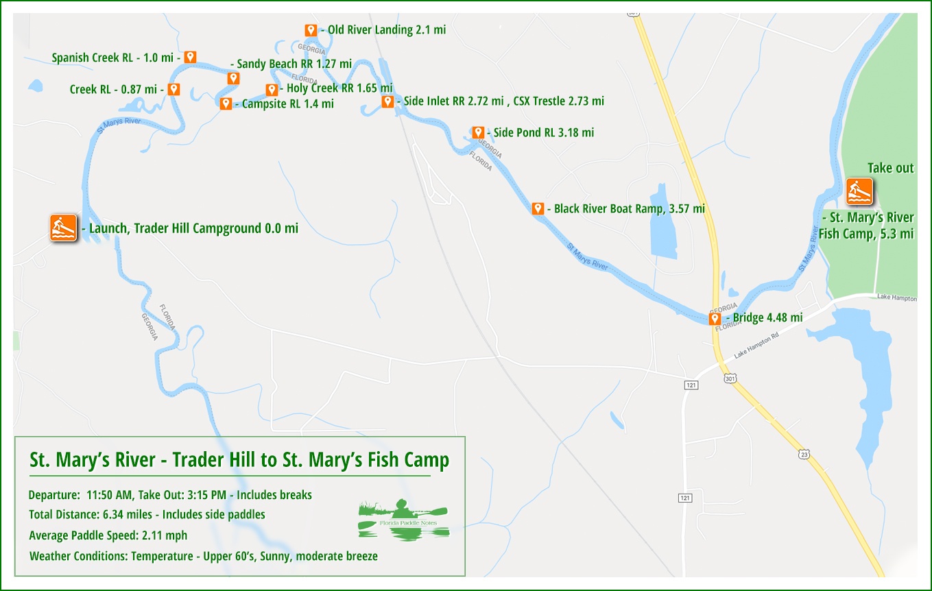
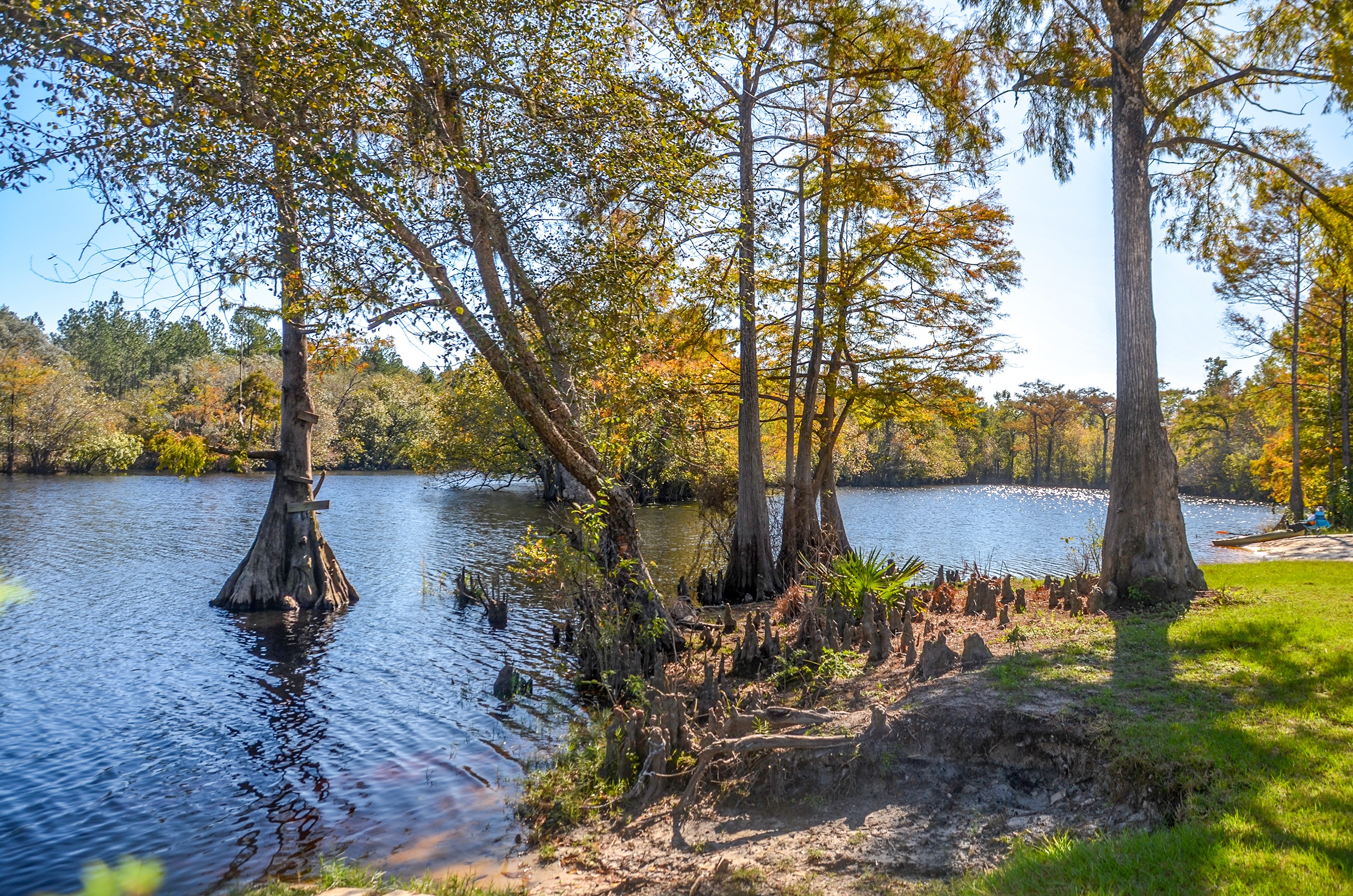
Trader’s Hill Launch
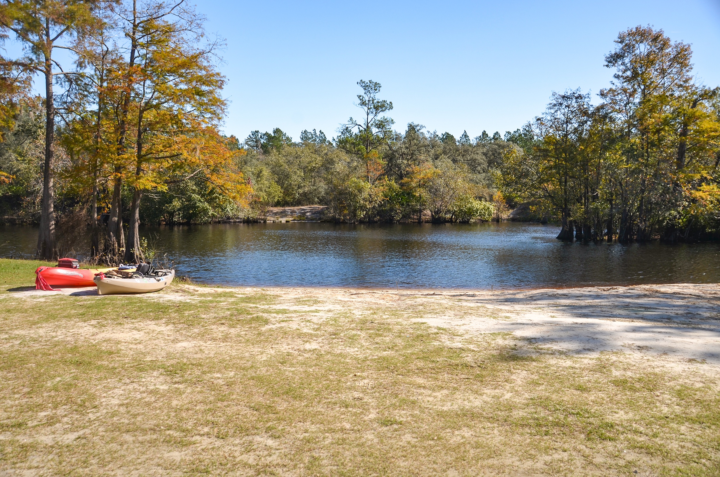
Trader’s Hill Boat Launch is an excellent staging area. There is a wide soft launch as well as an accompanying concrete boat ramp with small dock. There is plenty of parking and restroom facilities available at the campground up the hill.
Our destination was downstream ( to the left ) and we had beautiful Fall weather in the upper 60°’s and sunny skies!
Spanish Creek
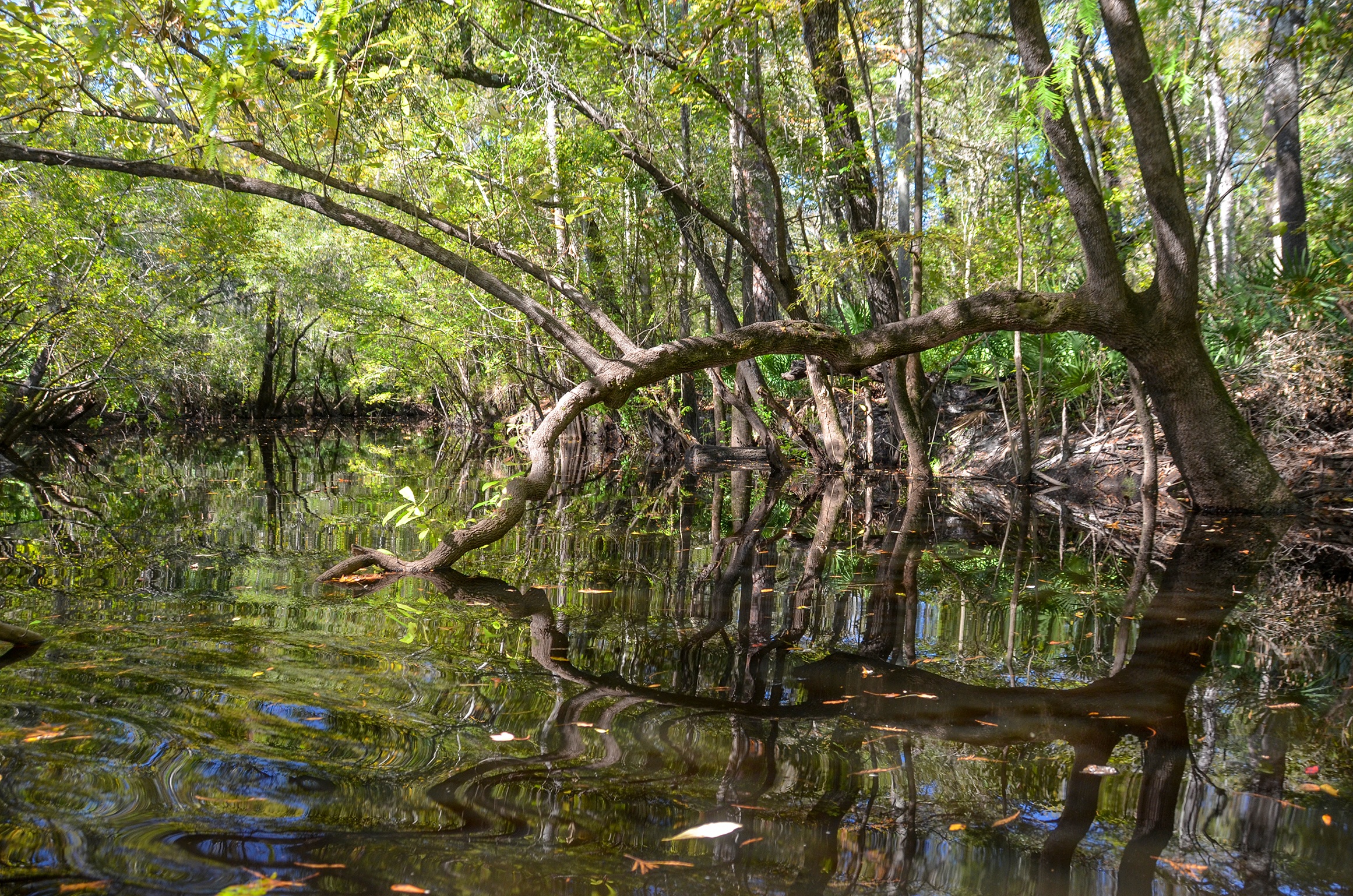
One mile from our launch, on RL is the mouth of Spanish Creek, one of the tributaries to the St. Mary’s River.
Spanish Creek originates in Little Okefeenokee Swamp near Mack’s Island, about 15 miles to the NNW of where it flows into the St. Mary’s River. The creek is a 35′ narrow creek, heavily canopied with Tupelo trees. We came across a nice camp spot a 1/4 mile up creek on the right, paddled just a little further before returning to the river.
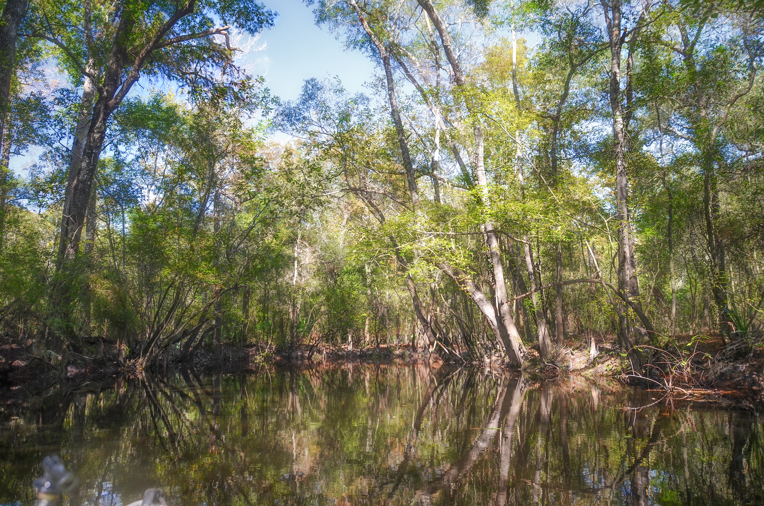
The St. Mary’s River
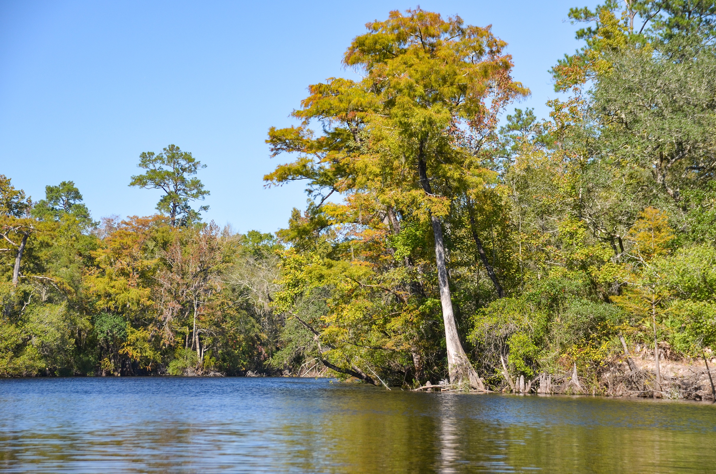
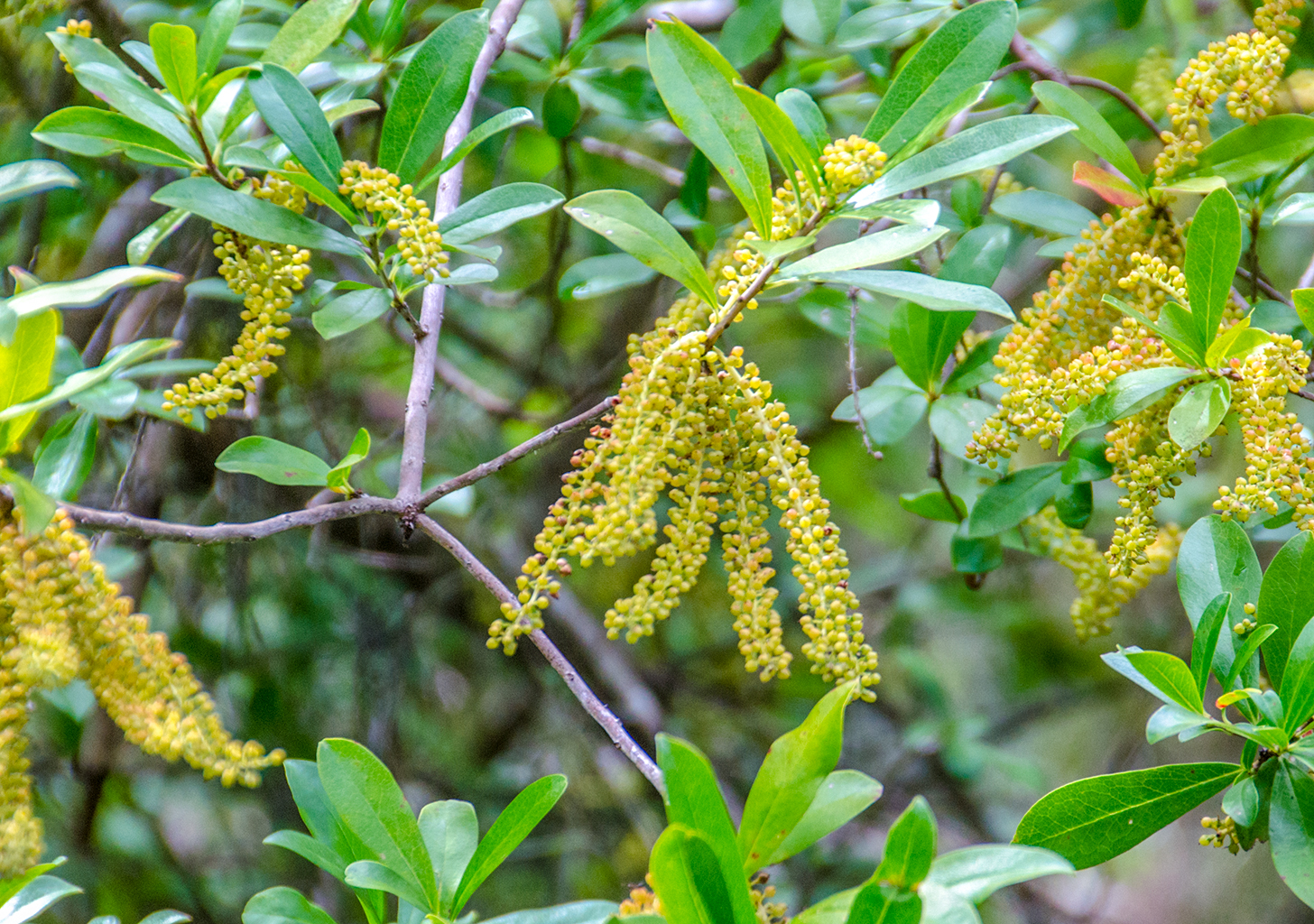
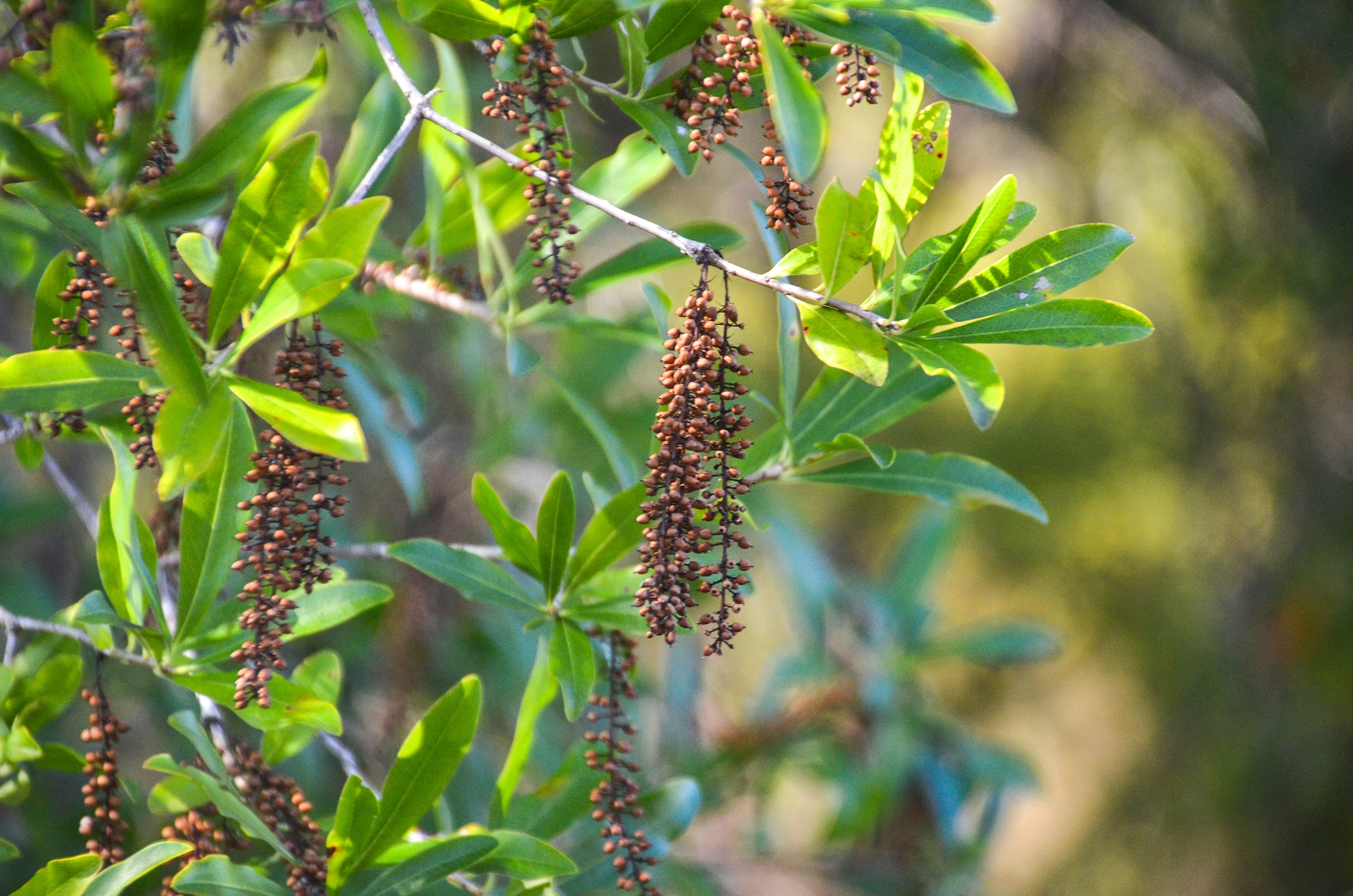
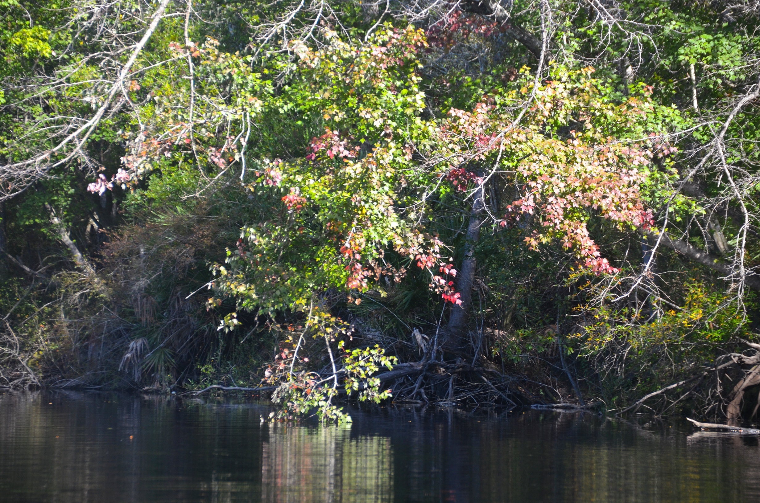
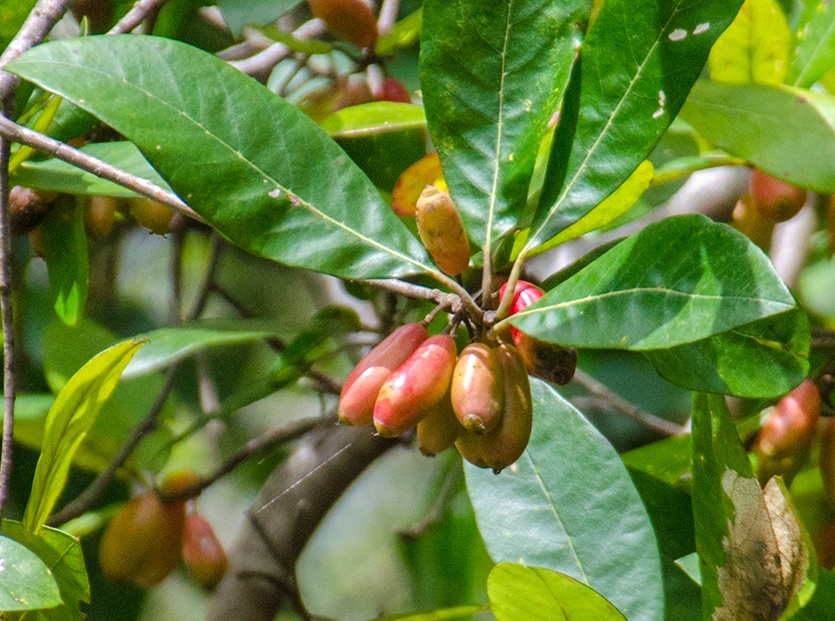
The river is the border between southeastern Georgia and northeastern Florida. Fall colors were just starting to show, especially on the Red maples and Cypress. There were numerous Titi trees as well as Tupelo. The fruits of the Ogechee Tupelo were seen in abundance at our stop at Black Water Boat Ramp.
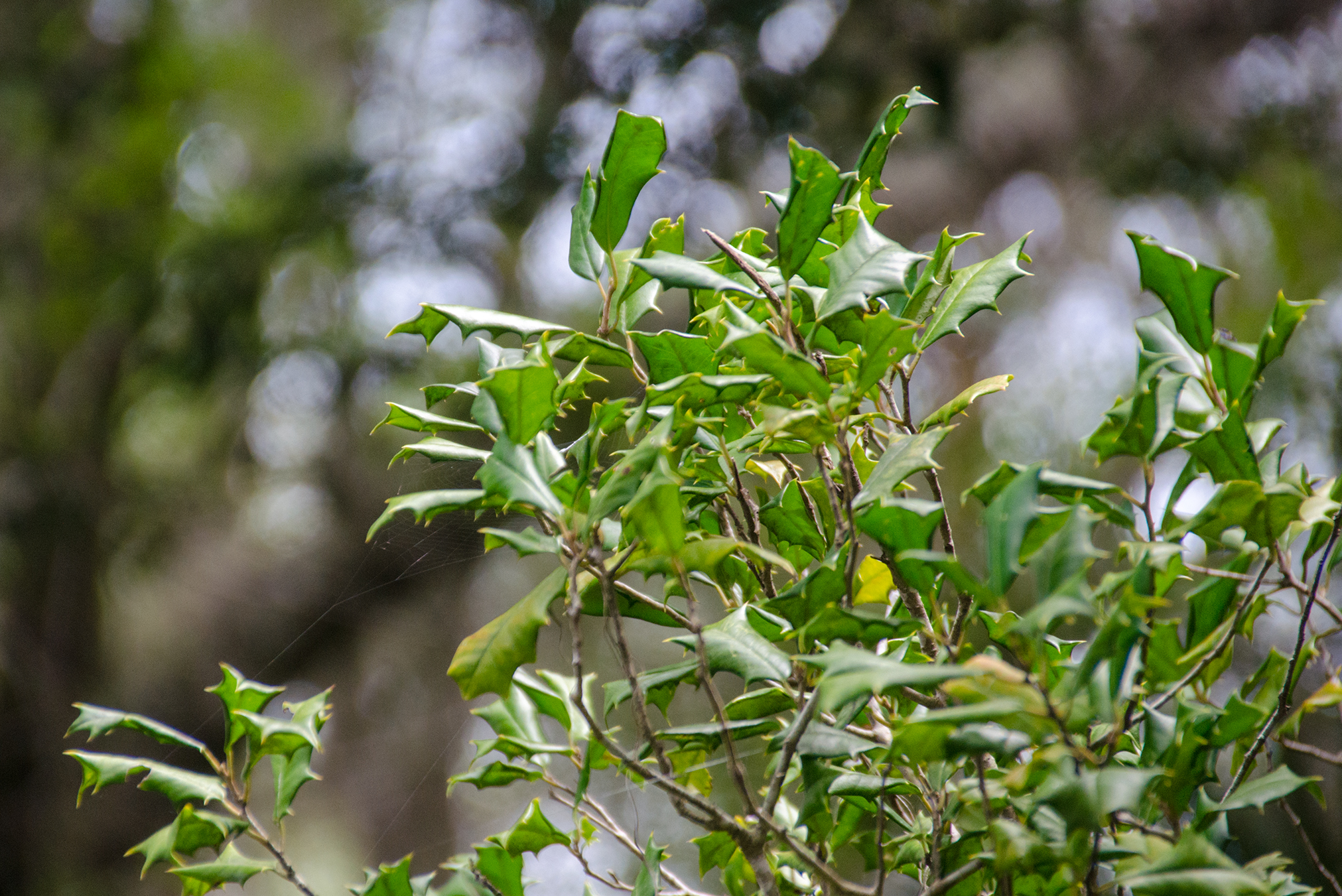
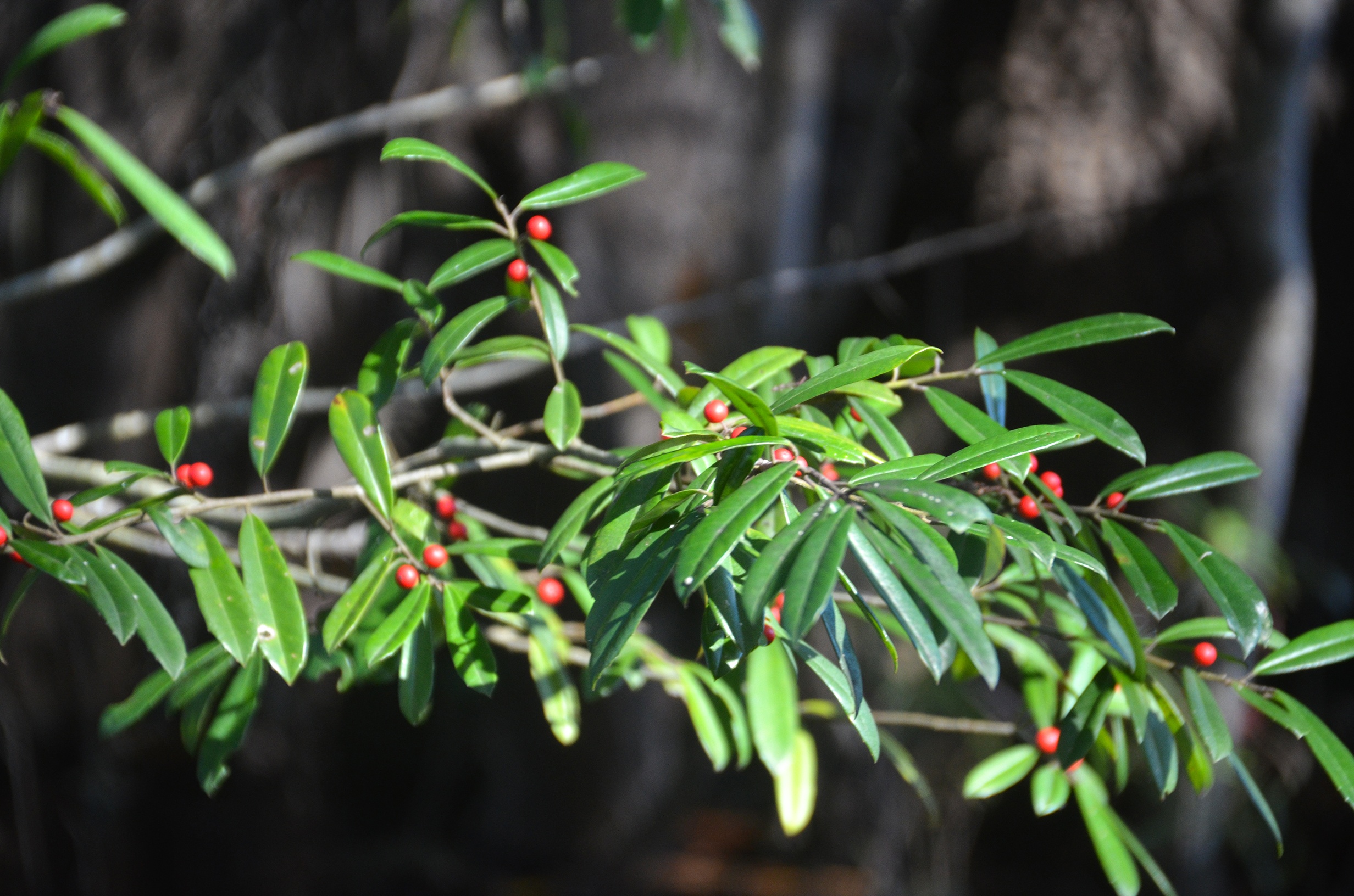
Along our paddle we decided to venture into another very small side creek at mile 1.6 mi RR. We only got 350′ into the creek before having to return back to the river. The interesting thing about this creek was it was lined with numerous American Holly trees, more than I have ever seen in one stand!
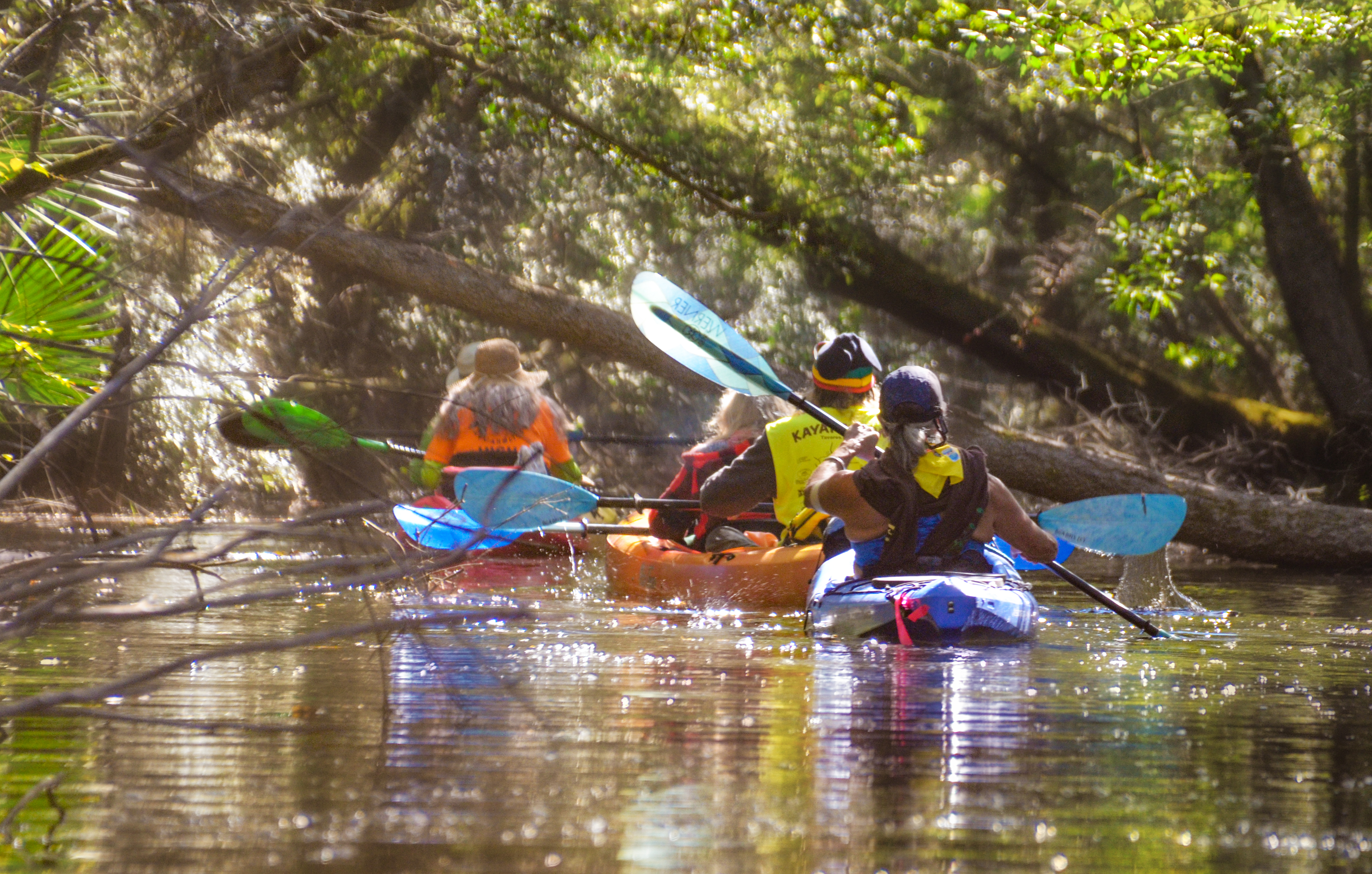
The paddle was easy and noticeably absent of much wildlife except for three Herons and a Turtle. We stopped 2/3 way into the paddle for a break at the Black Water Boat Ramp, then continuing our journey to the take out at St. Mary’s Fish Camp. Overall, not a lot to write home about but it was a beautiful day on another of Florida’s waterways.


Guides, Maps & Info…
- Folkston/St. Marys Topo Map…
- Fort Alert Marker…
- USGS Report – Spanish Creek…
- Spanish Creek Name…
- Timucua Tribe…
![]()