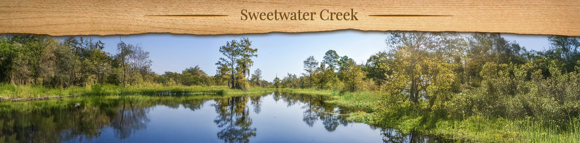
Sweetwater Creek Overview

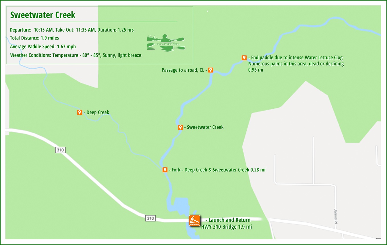
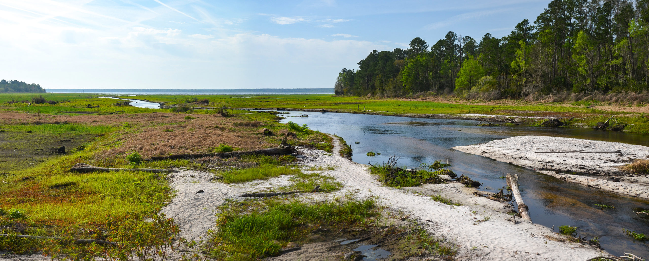
Sweetwater Creek is located about 6.5 miles southeast of Interlachen, near Highway 310. Originating in swampland north of the Ocklawaha River, the creek flows into the Rodman Reservoir and is navigable for approximately 3 miles, depending on water levels and aquatic vegetation such as water lettuce, which can clog the channel. During Rodman Reservoir drawdowns, like the one in early 2020, low water levels expose tree stumps and create a gentle current, improving paddling conditions. Access is available from a small gravel path on the southeast corner of the Highway 310 bridge. Deep Creek, a smaller tributary, joins Sweetwater about a quarter mile from the launch but is often blocked by vegetation.
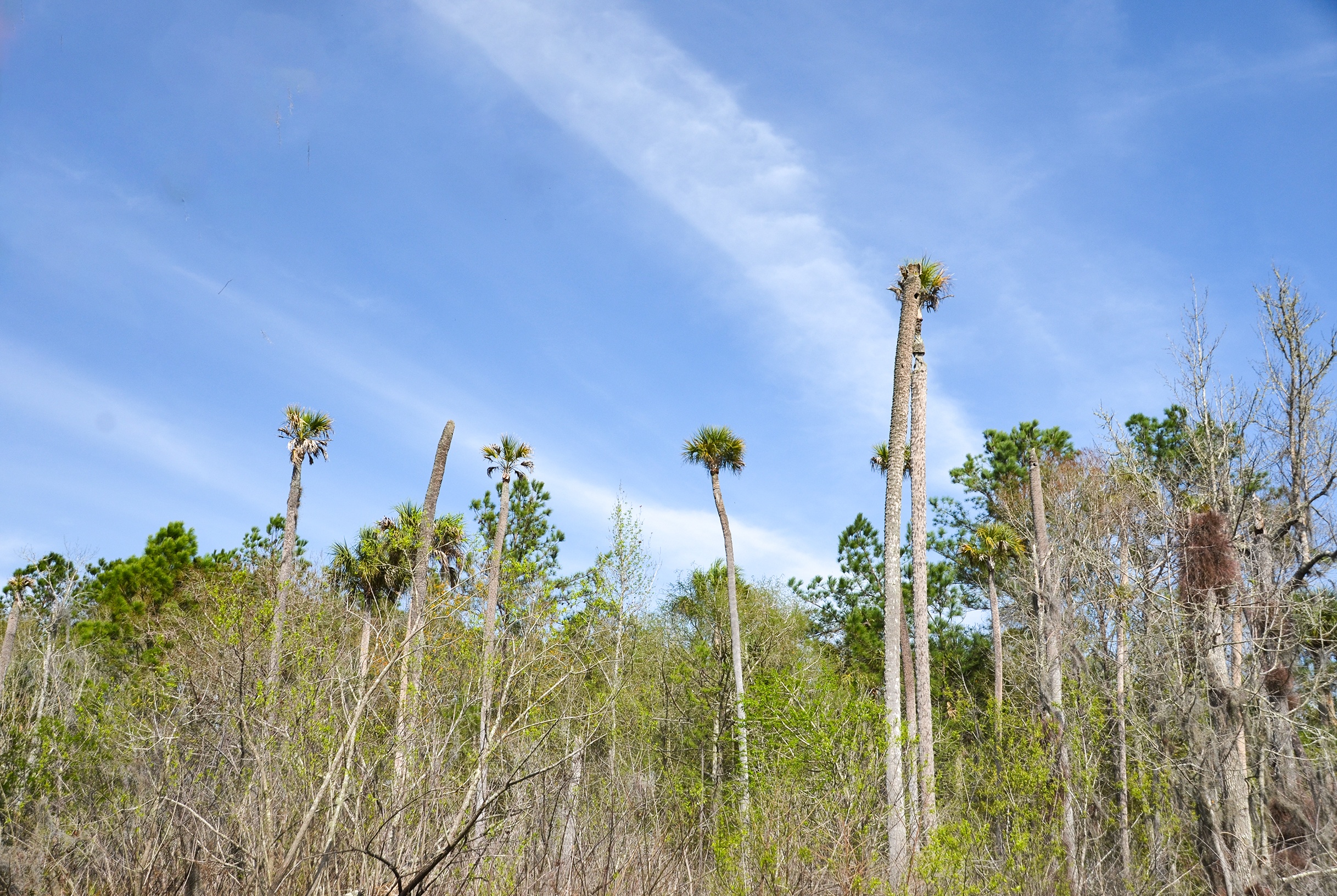
The banks of the creek are lined with pines, oaks, gums, and ash, though many trees are stressed or dying due to reservoir flooding. Paddlers may encounter obstacles such as submerged logs, thick aquatic growth, and large alligators. The bridge clearance is low—about 2 feet—posing a challenge during high water. Wildlife in the area includes alligators, turtles, wading birds, and, occasionally, manatees. While Sweetwater Creek offers a quiet, wild paddling experience, the impact of the reservoir has altered the ecosystem, leaving behind a raw and sometimes somber landscape. Checking current water levels and vegetation conditions is essential before planning a trip.
![]()

Sweetwater Creek Details
![]() Location: Sweetwater Creek is located in Putnam County, Fl, 6.5 miles southeast of Interlachen, Fl.
Location: Sweetwater Creek is located in Putnam County, Fl, 6.5 miles southeast of Interlachen, Fl.
![]() Launch Point for this Paddle: A small bridge on HWY 310. Launch area is on the SE corner of the bridge.
Launch Point for this Paddle: A small bridge on HWY 310. Launch area is on the SE corner of the bridge.
![]() Paddle Distance: Potentially 3 miles…this day, due to water lettuce clogs, 1 mile ( one way )
Paddle Distance: Potentially 3 miles…this day, due to water lettuce clogs, 1 mile ( one way )
![]() Difficulty: Easy…unless you want to maneuver the water lettuce clogs.
Difficulty: Easy…unless you want to maneuver the water lettuce clogs.
![]() Average Paddle Speed: 1.8 mph
Average Paddle Speed: 1.8 mph
![]() Width and Depth: The width averaged between 25′ and 70′. The depth was at least 6′
Width and Depth: The width averaged between 25′ and 70′. The depth was at least 6′
![]() Current – Tidal: NA, except during Rodman Dam draw down.
Current – Tidal: NA, except during Rodman Dam draw down.
![]() Side Paddles: A quarter mile up from the launch is a fork, very unnoticeable. Deep Creek enters Sweetwater Creek here, however, Deep Creek was totally clogged with aquatic vegetation.
Side Paddles: A quarter mile up from the launch is a fork, very unnoticeable. Deep Creek enters Sweetwater Creek here, however, Deep Creek was totally clogged with aquatic vegetation.
![]() Rest Areas: There are no restrooms or rest stops.
Rest Areas: There are no restrooms or rest stops.
![]() Important Information: Be prepared for numerous water lettuce clogs after the 3/4 mile mark.
Important Information: Be prepared for numerous water lettuce clogs after the 3/4 mile mark.
Sweetwater Creek Paddle Map
The Launch
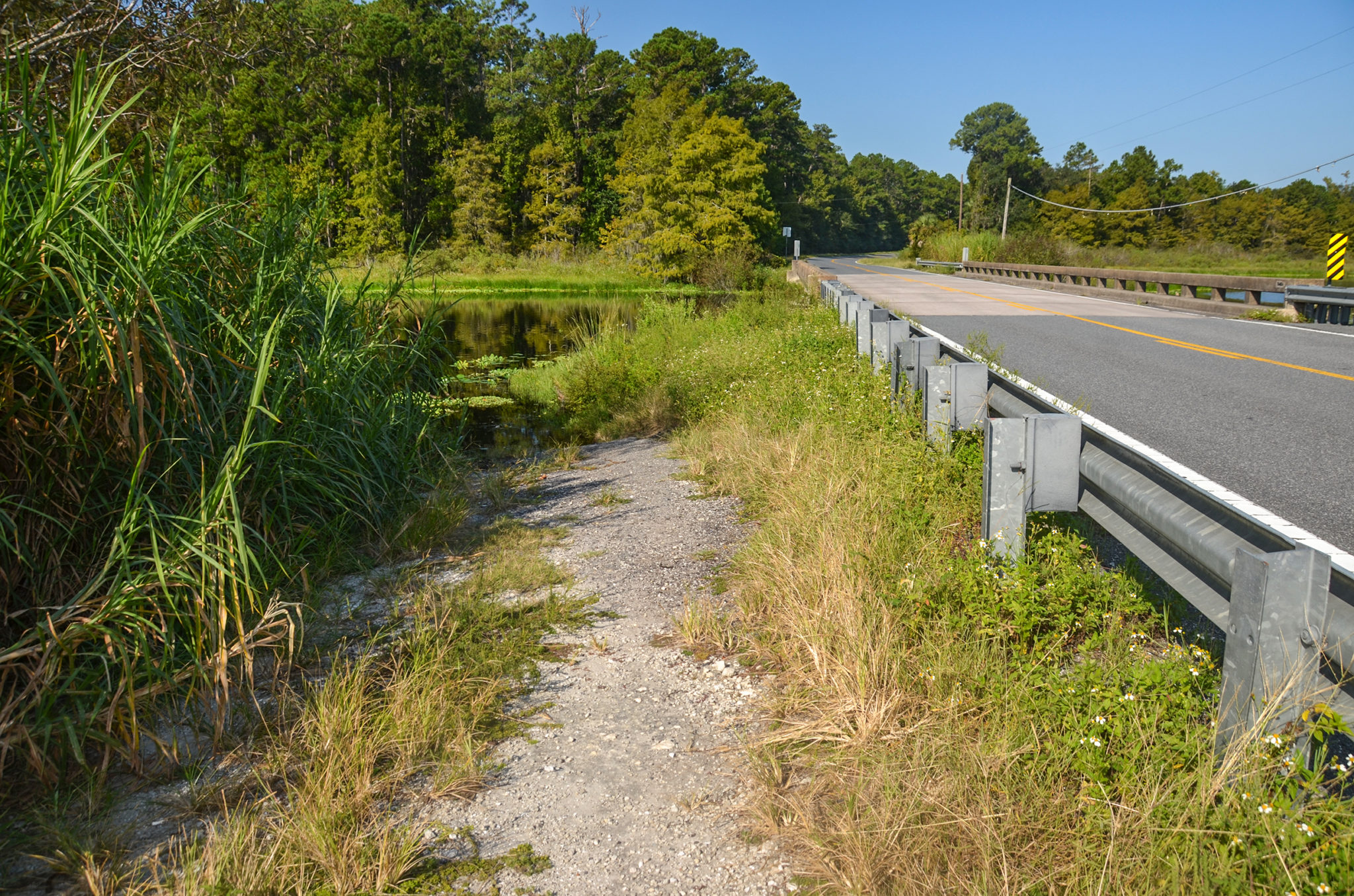
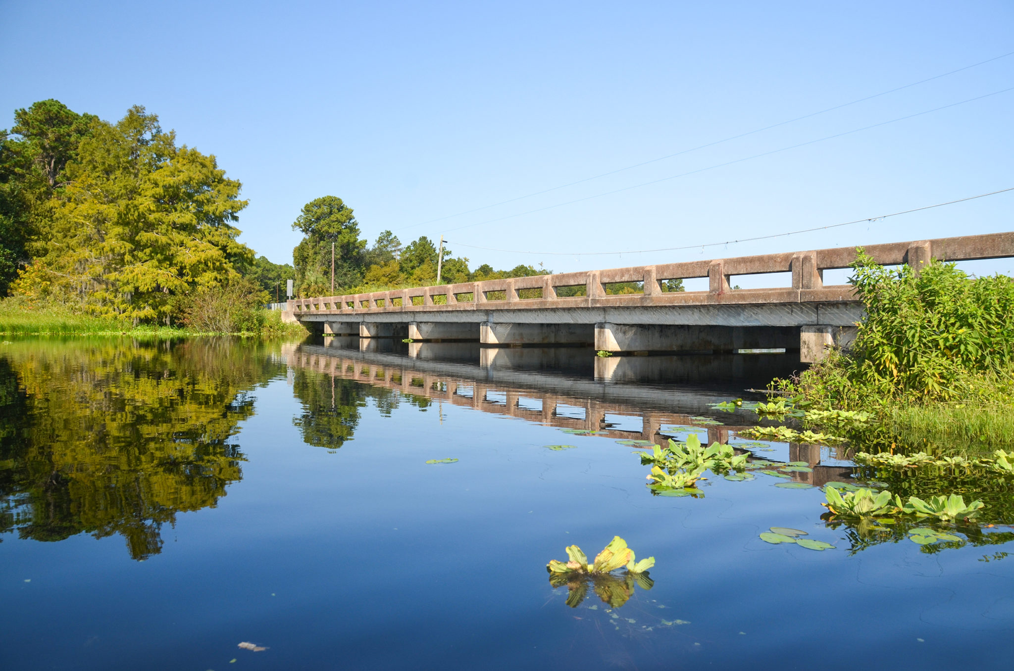
The launch is rural. Just a narrow path of gravel and grass on the southeast corner of the Highway 310 bridge. It is a tricky feat paddling under the bridge as the water level is just about 2′ below the bridge…time to get prone!
Sweetwater Creek
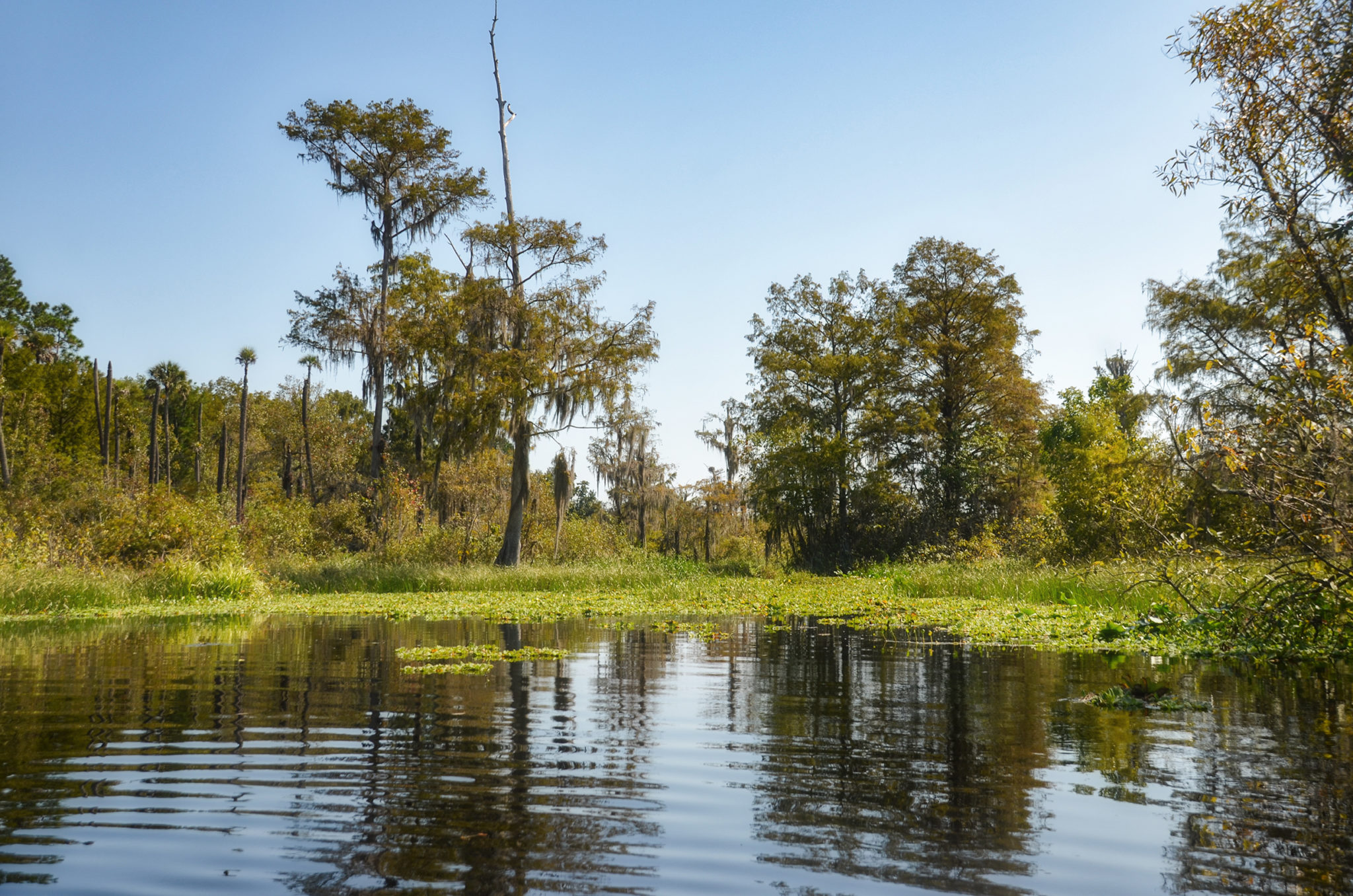
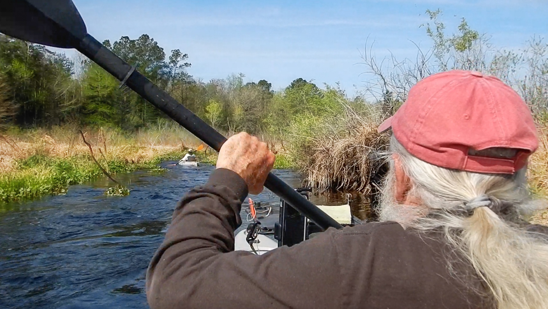
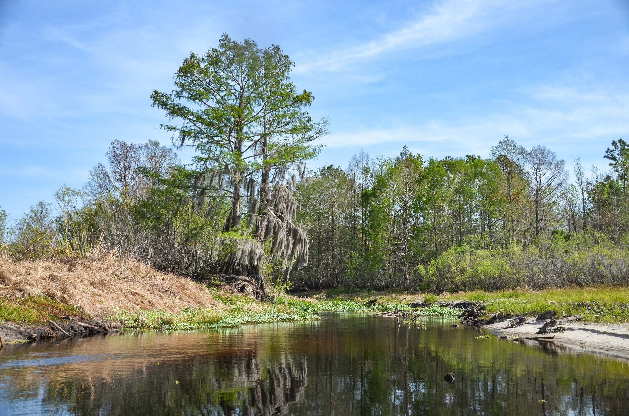
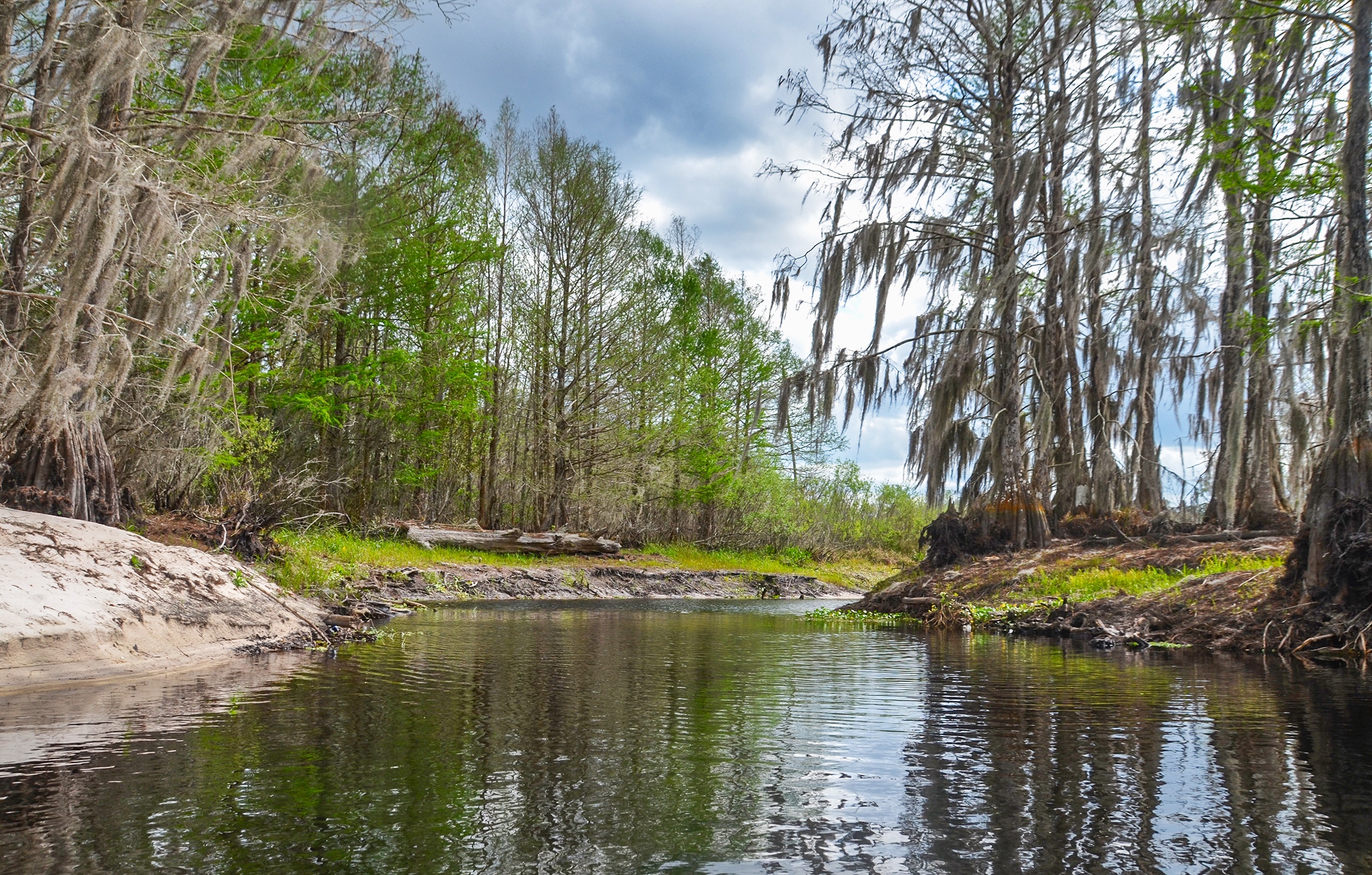
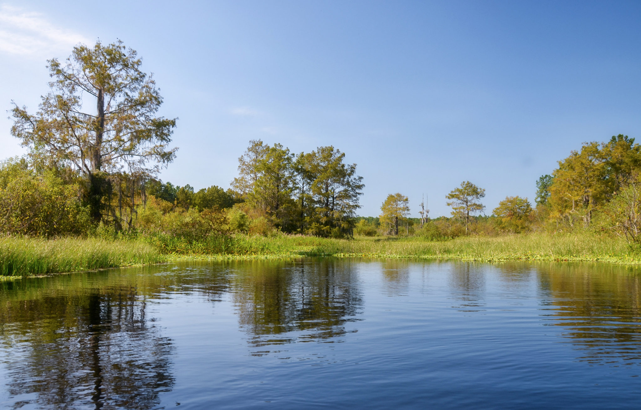
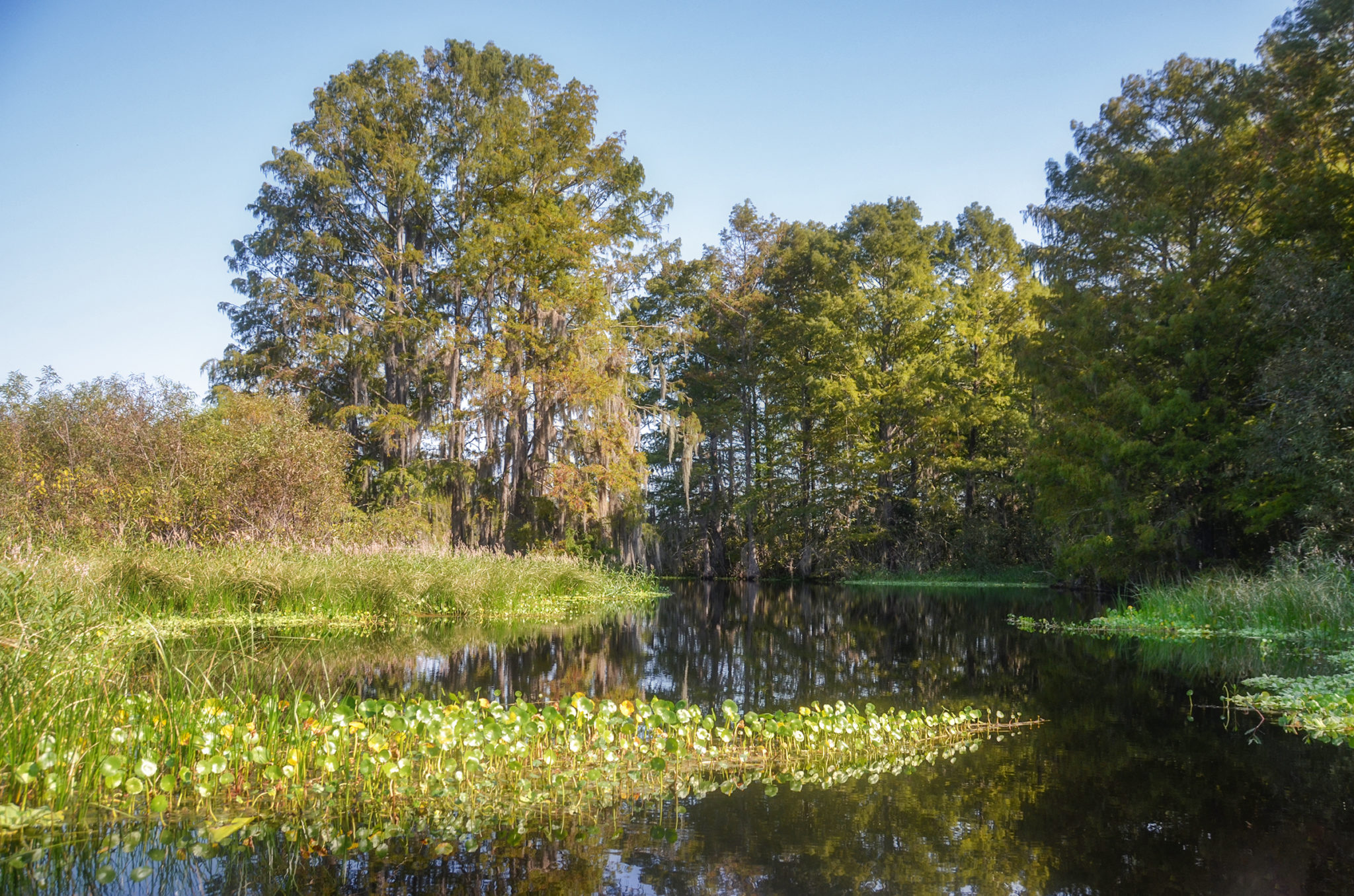
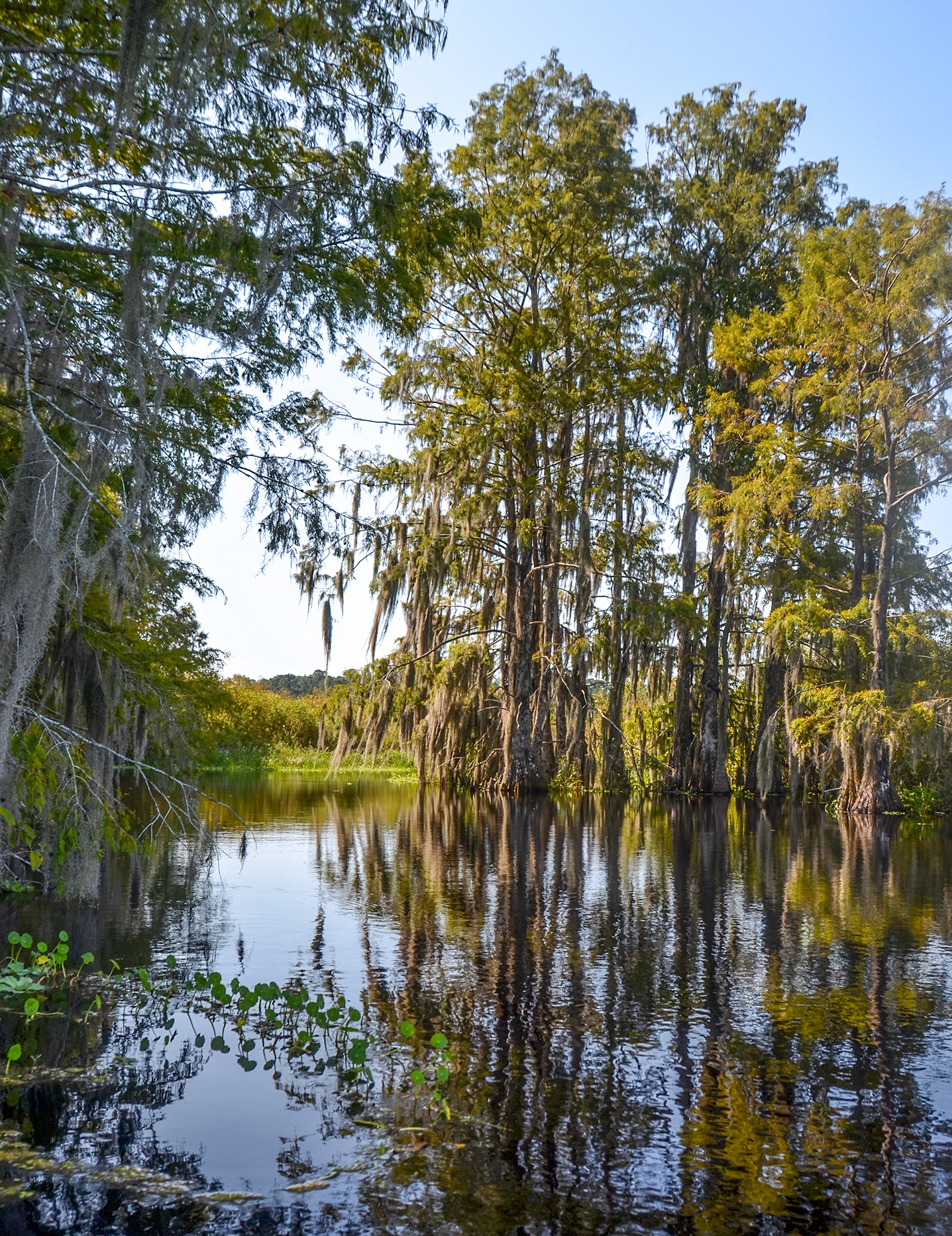
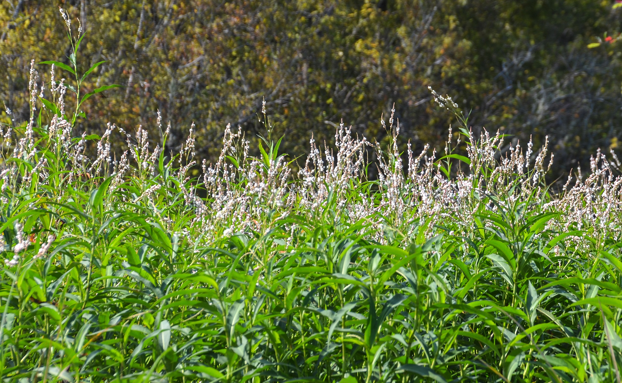
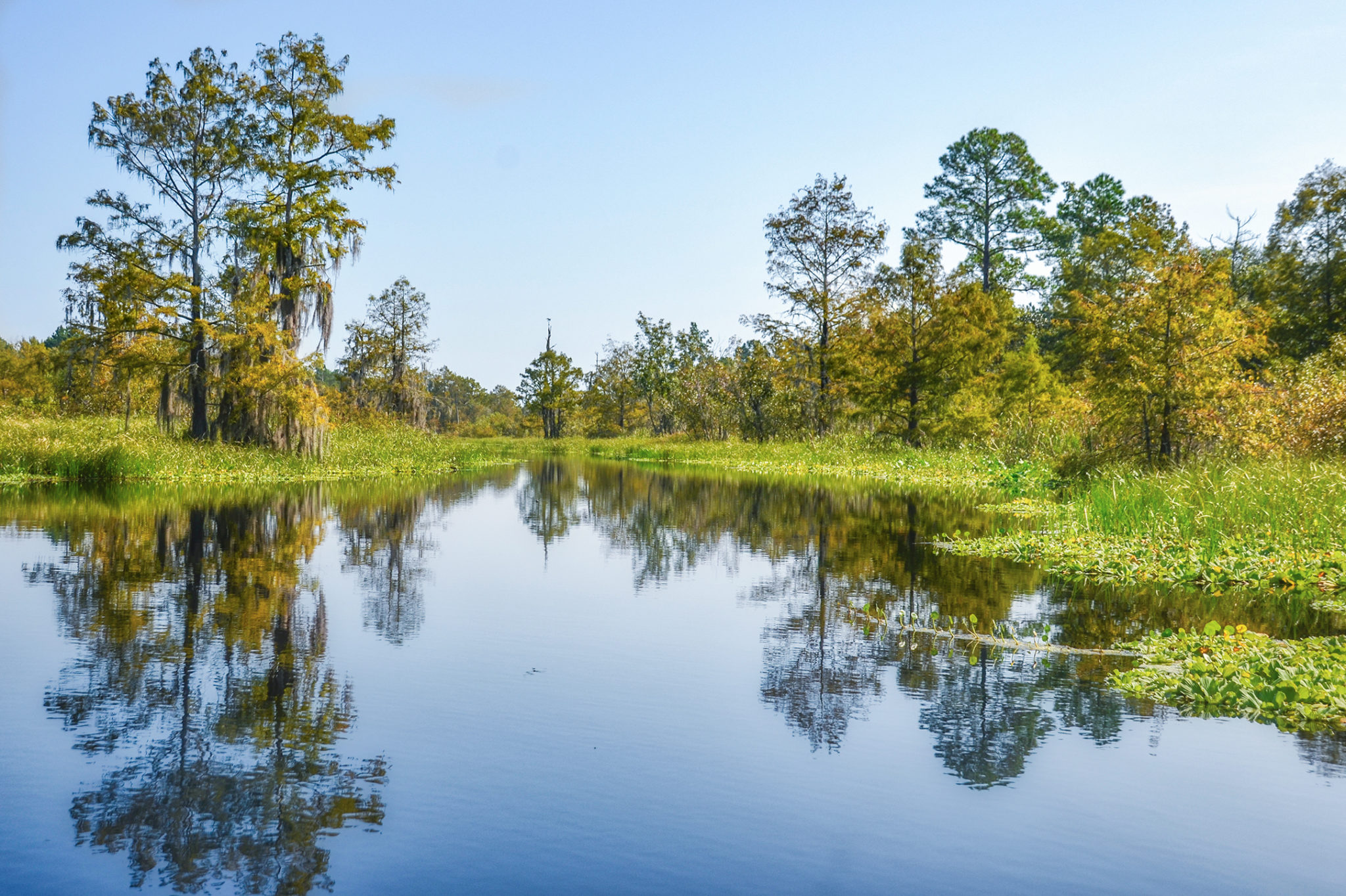
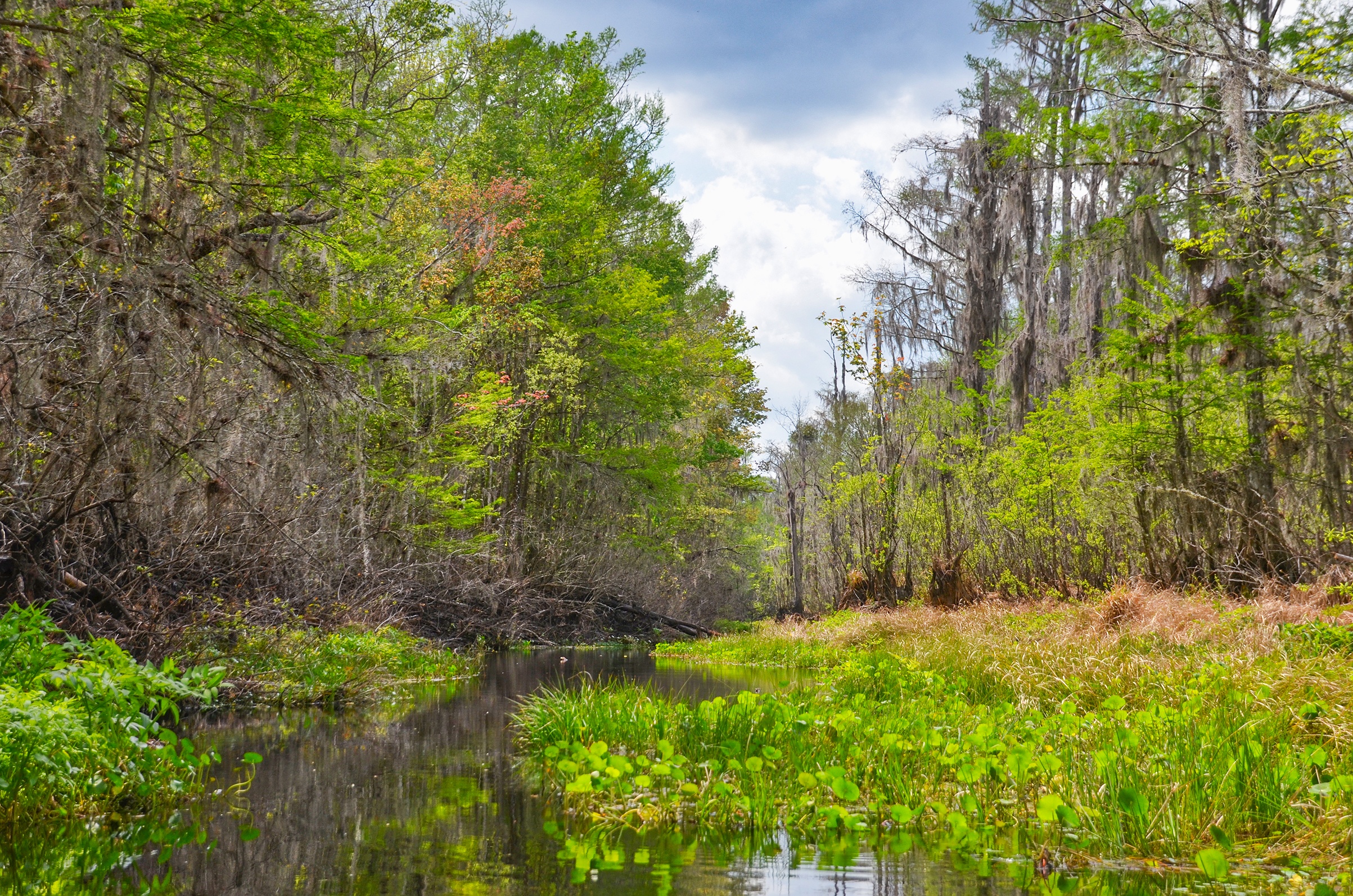
Sweetwater Creek was a beautiful paddle into swampland bordered to the north by Pines, Oaks, Gums and Ash. 1/4 mile into the paddle is the fork where the smaller Deep Creek enters Sweetwater from the northwest. Because Deep Creek was completely clogged it was hard to see however there is a tall, dead tree that adequately marks this intersection.
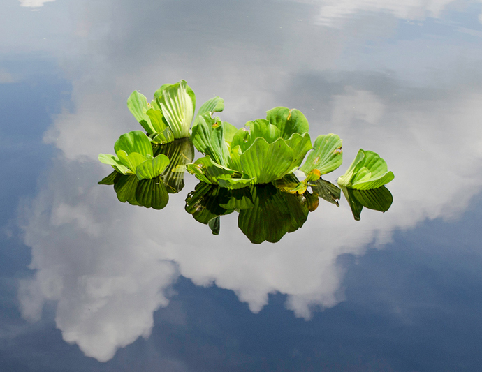
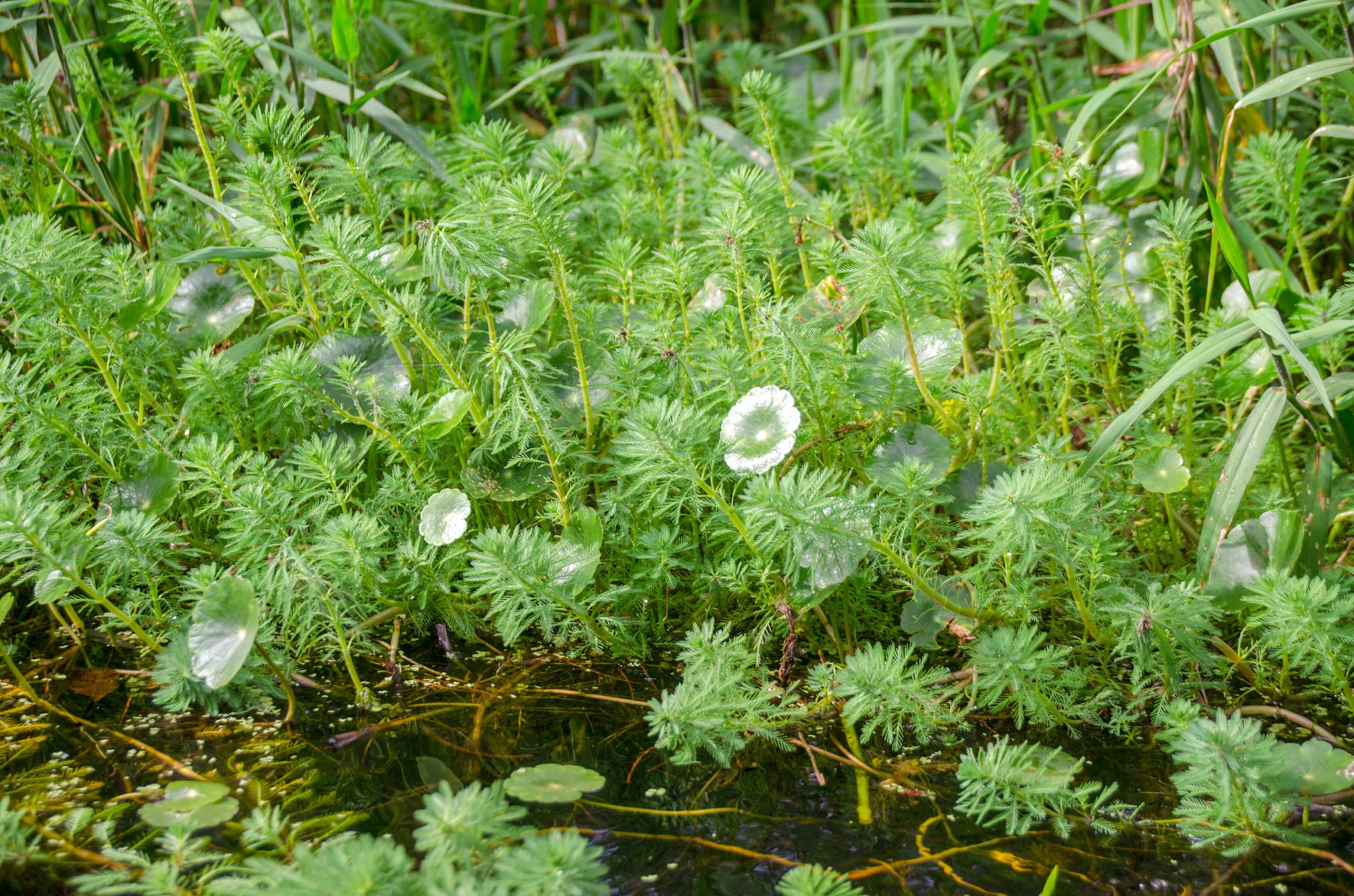
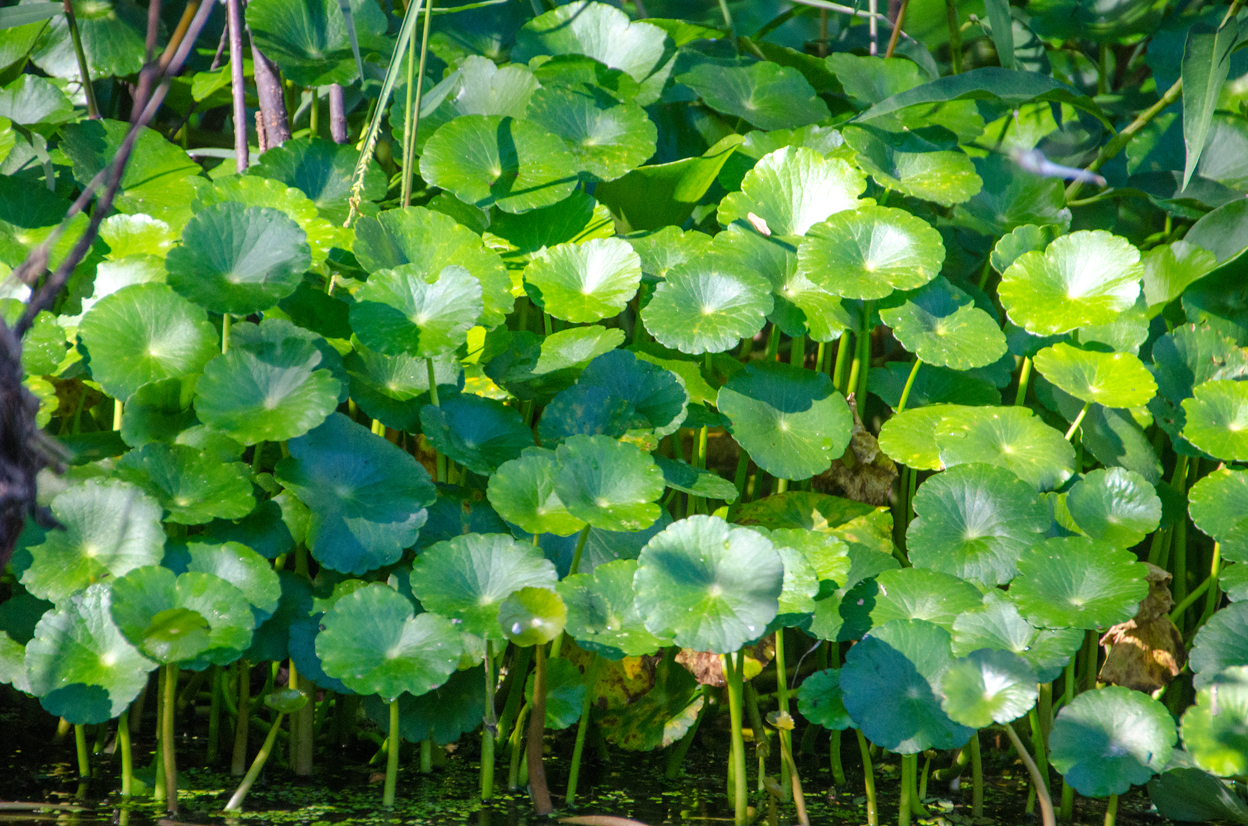
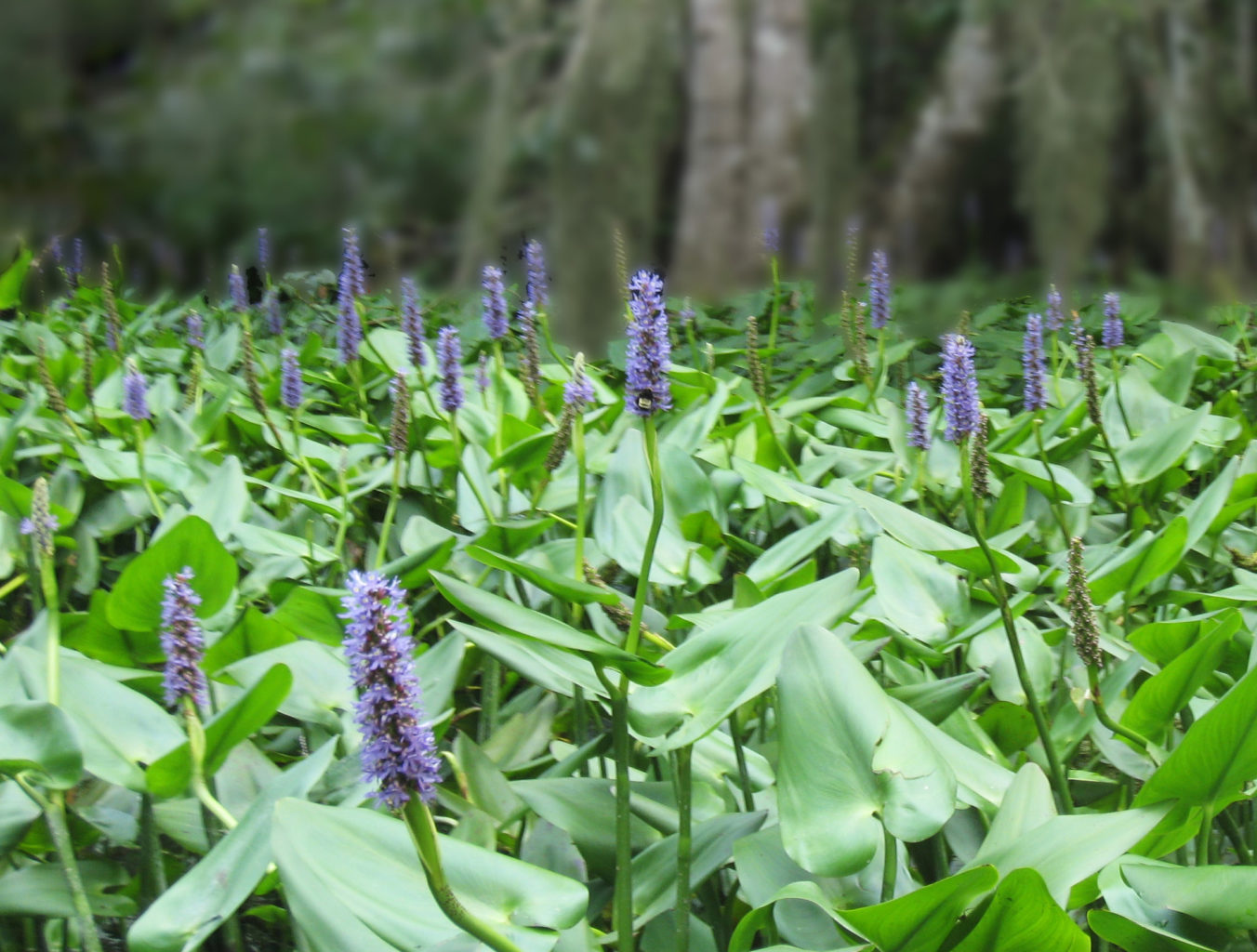
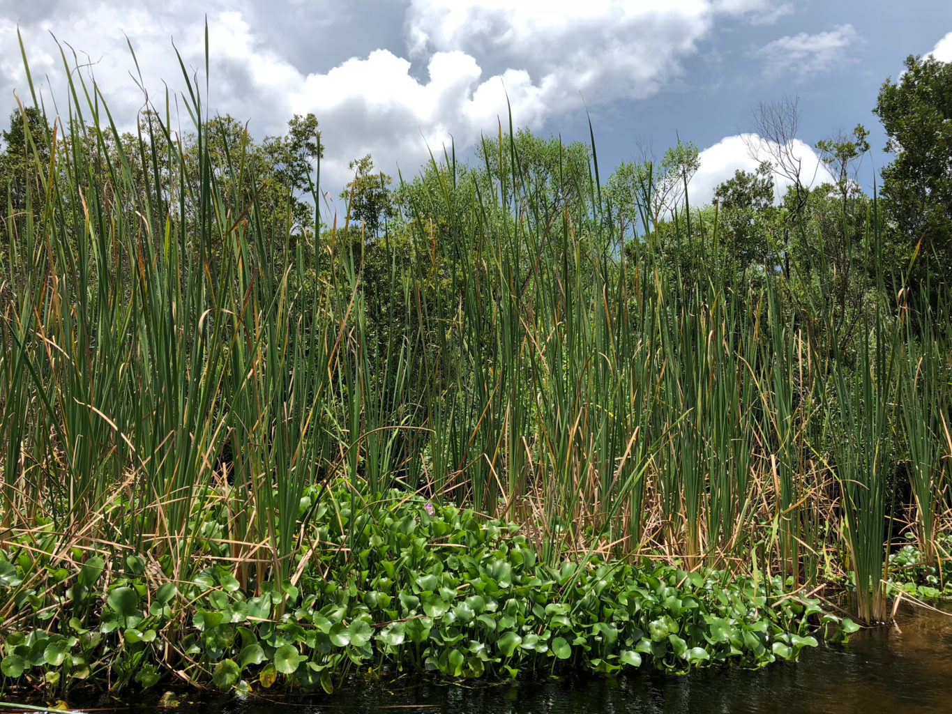
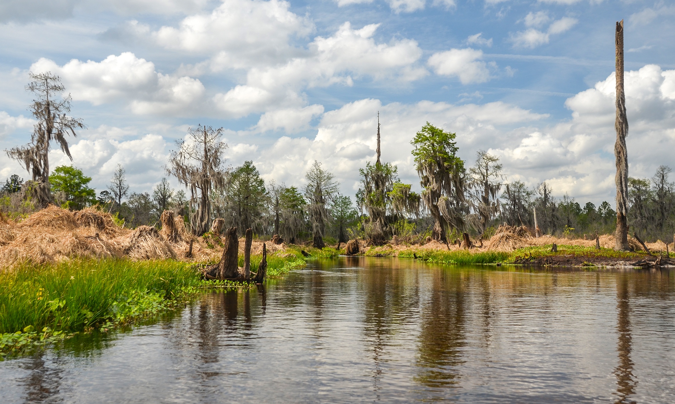
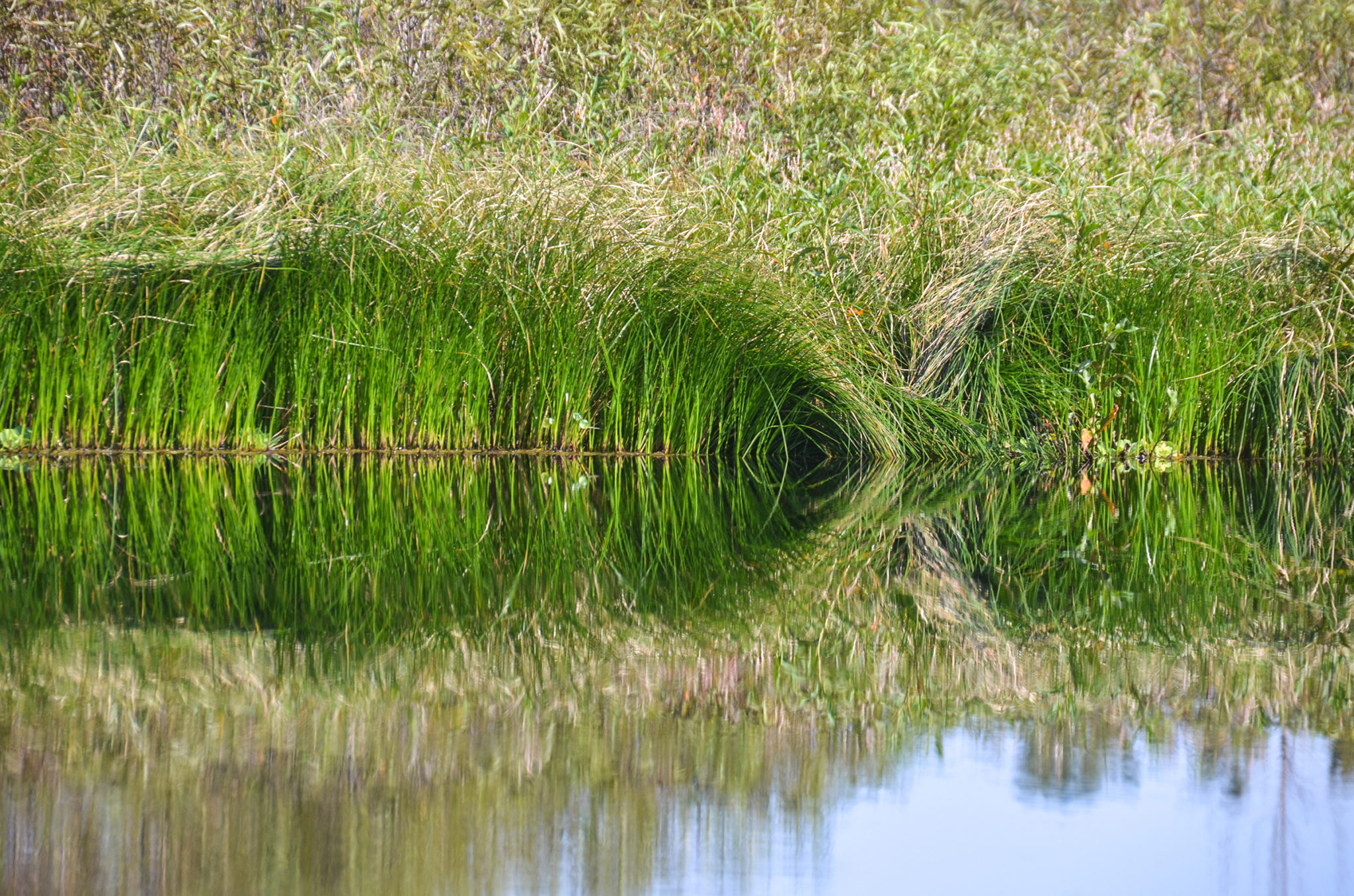
For the most part it was about 50′ wide with Cypress trees, Willow and Swamp Dogwood as the predominant foliage. Lake Sedge and Smart Weed lined the paddle trail accented by Water Lettuce, Hydrilla, Dollarweed, Pickerel Weed and Cattails. It was sad to see so many ‘drowning’ trees and shrubs in this area due to the reservoir!
We only had to maneuver through two clogs of Water Lettuce, less than 10′ thick until we reached the 1 mile mark, where the Water Lettuce completely clogged the creek for as far as we could see. Disappointed, but prepared for anything, we turned back and made an attempt to paddle up Deep Creek however it was totally blocked with aquatic vegetation.
As we were prepared for anything, it was nice to paddle a beautiful swamp for at least a mile and we are told to try again after the Rodman Drawdown in January 2020, which kills much of the Water Lettuce we encountered.
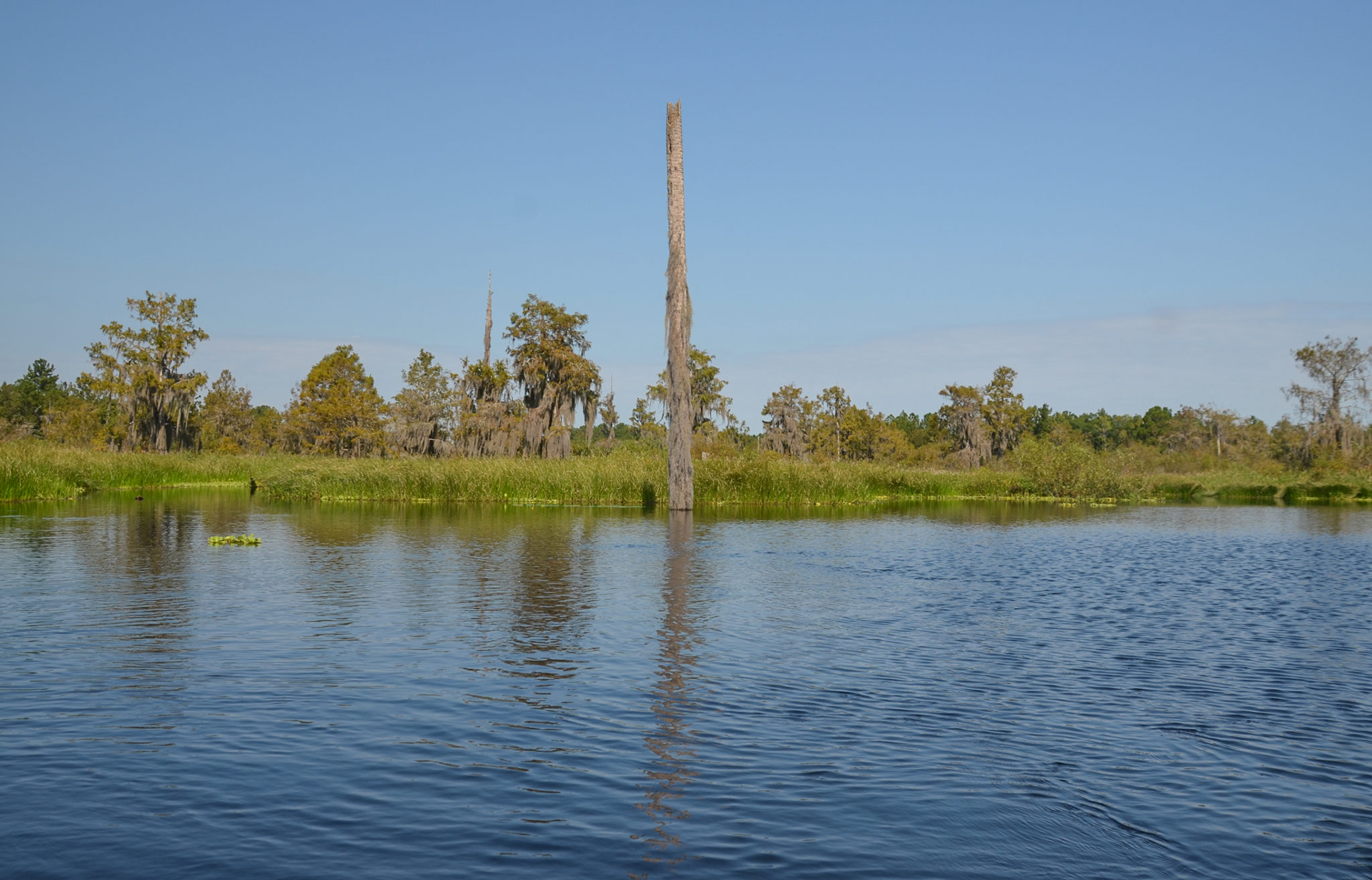
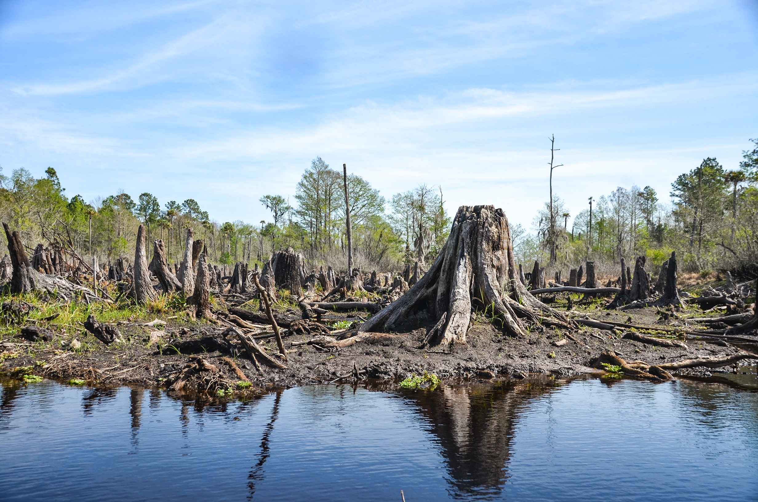
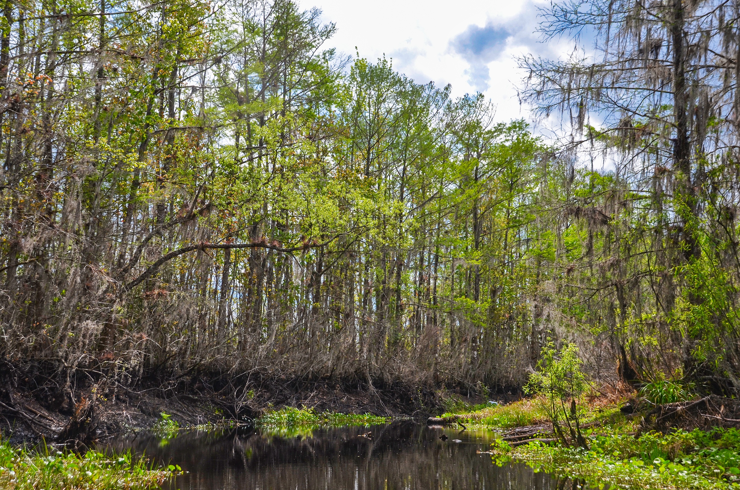
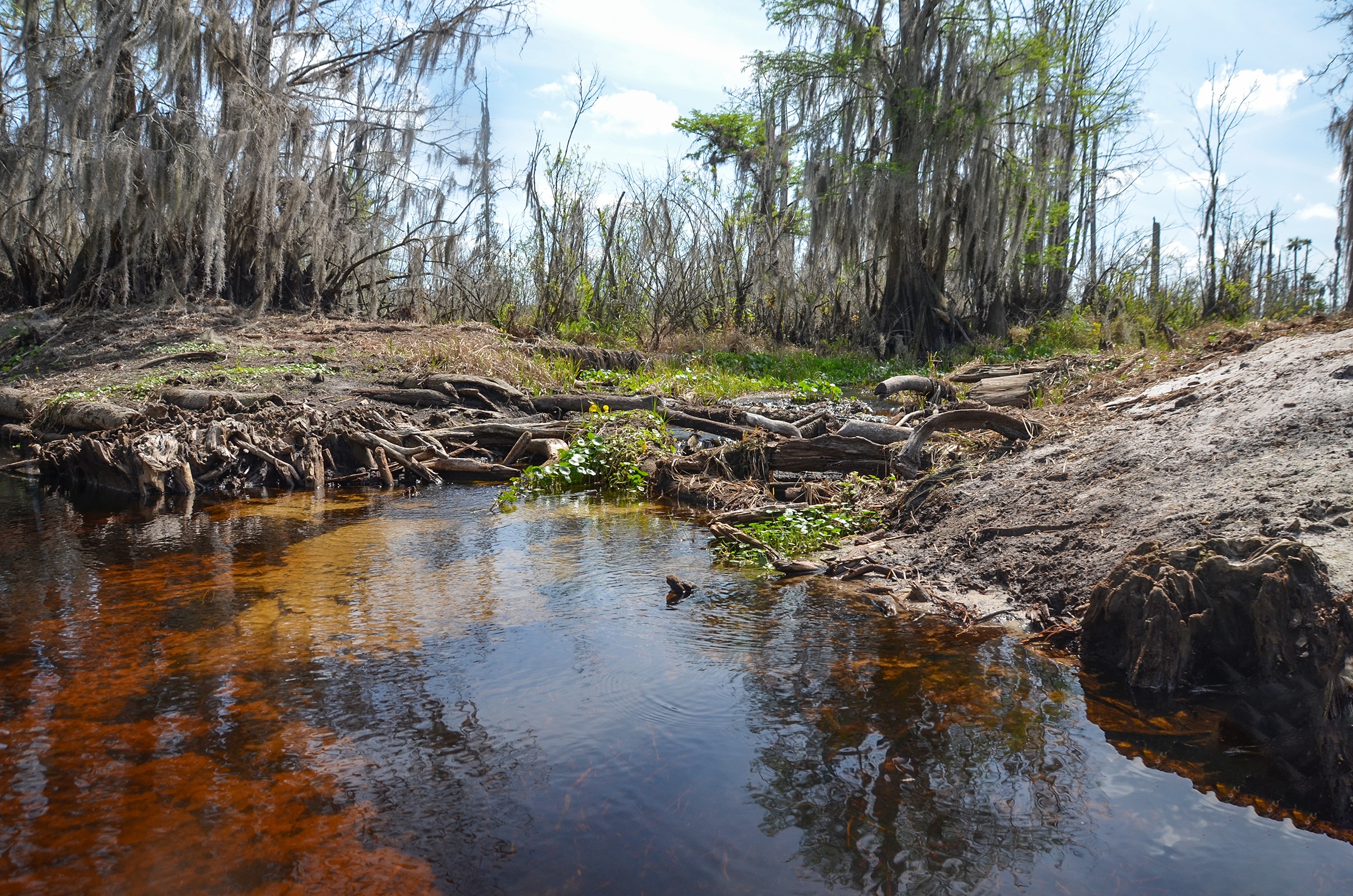
Sweetwater Creek during the Rodman Drawdown
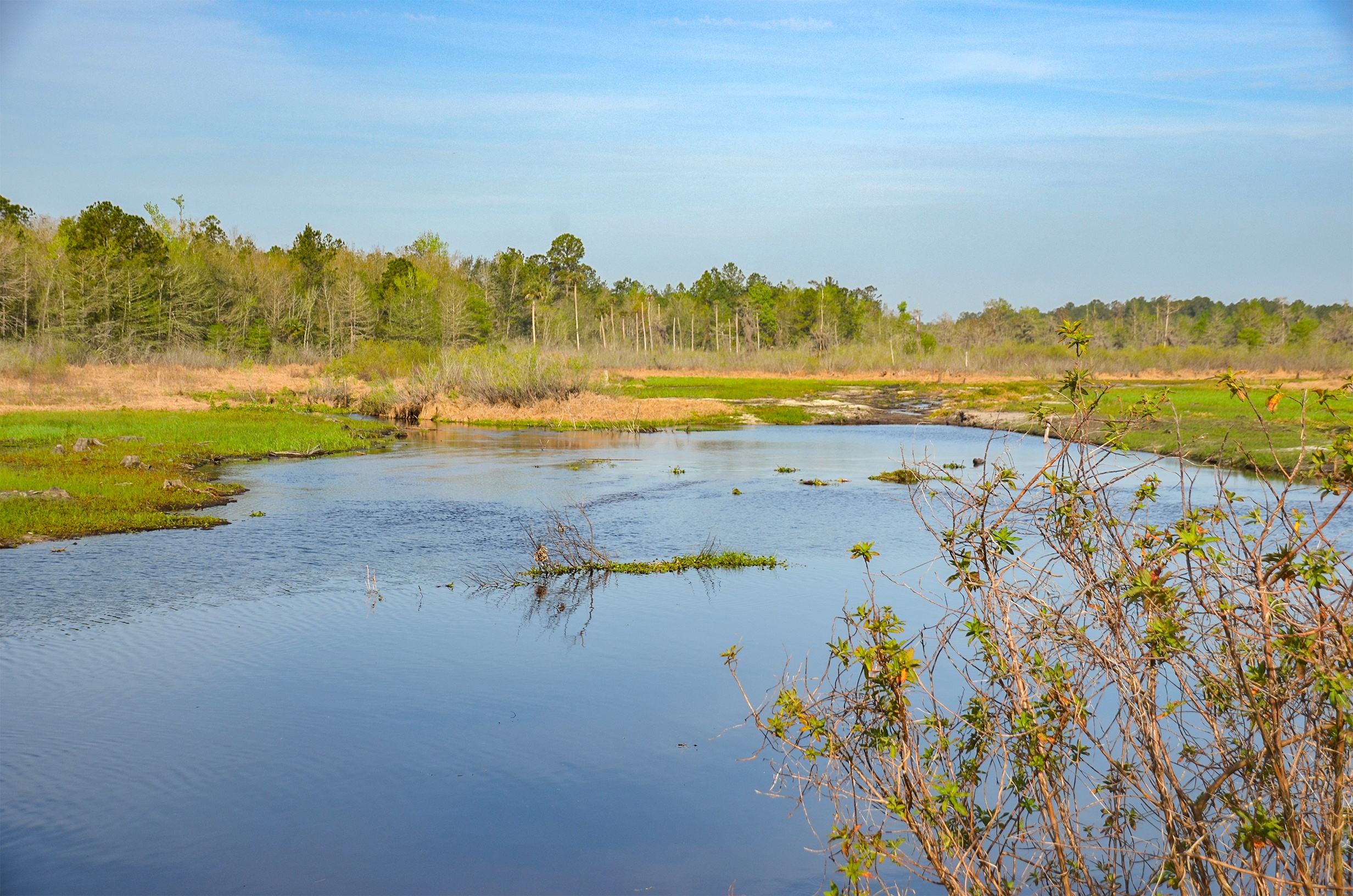
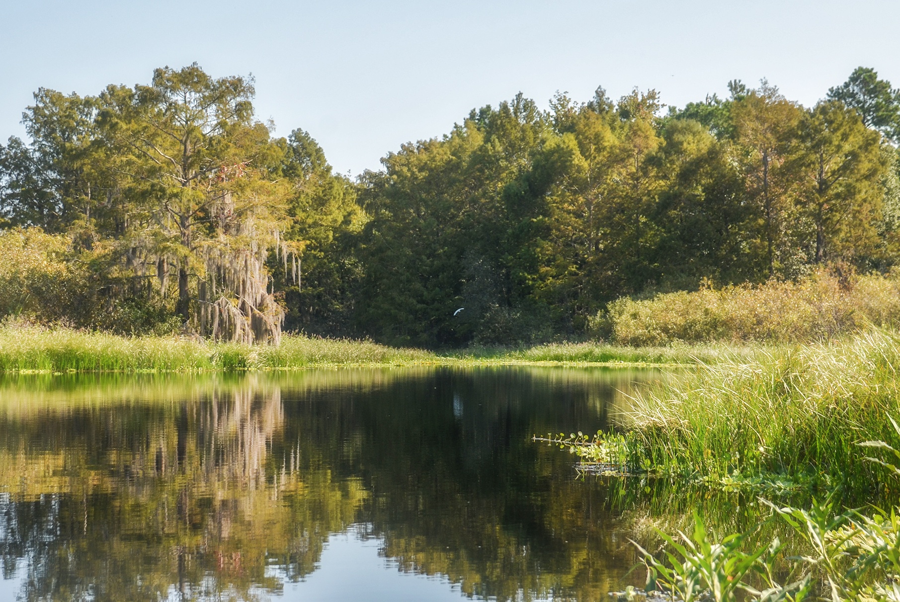
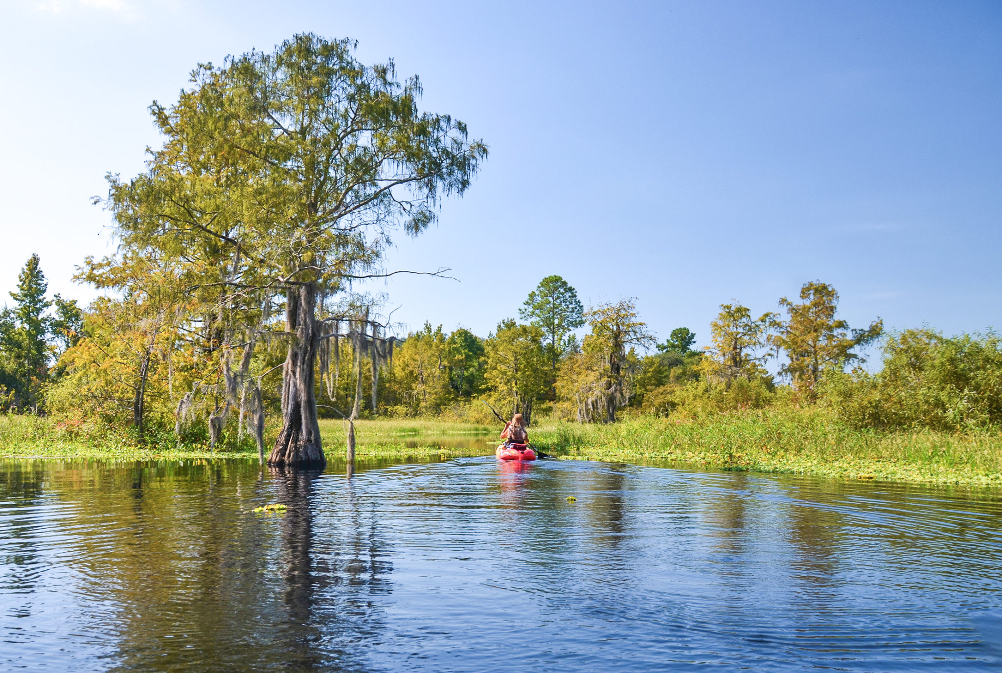
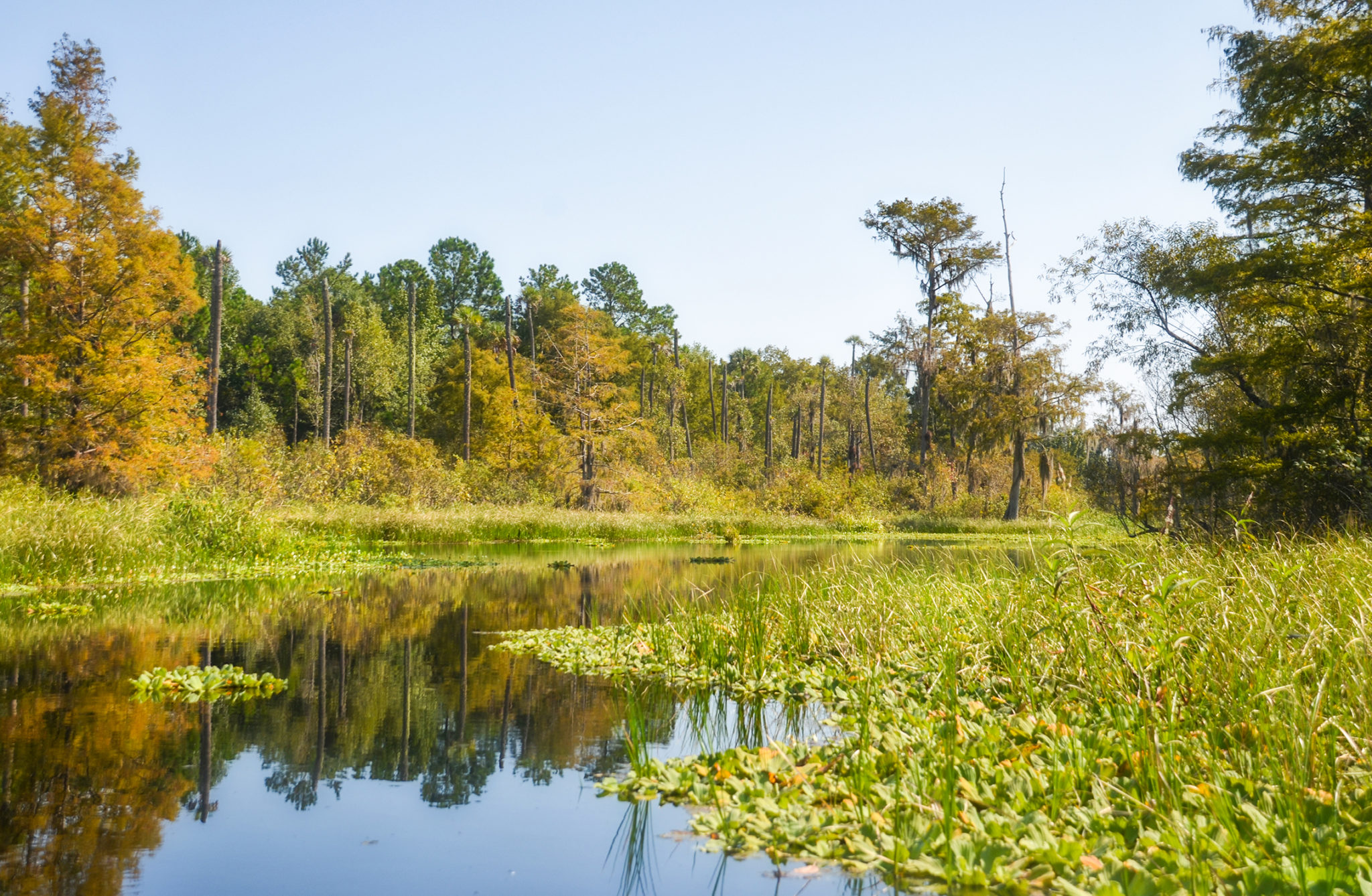
Sweetwater Creek flows basically in a northeast direction, going from North, then East and Northeast. Because the water level was low from the Rodman Dam drawdown, there was a nice, gentle flow to the creek and no problem paddling against this current. We had a partly cloudy day in the higher 70’s, low 80’s with just a slight breeze.
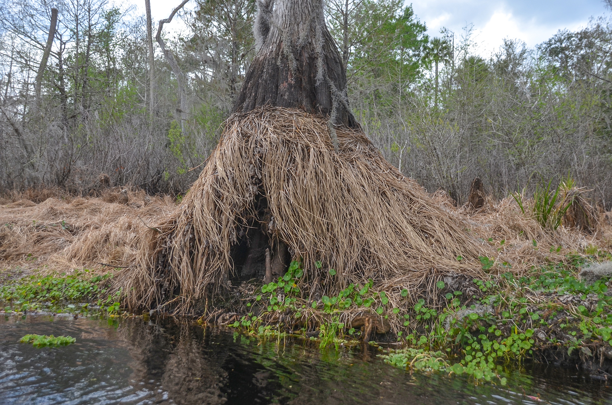
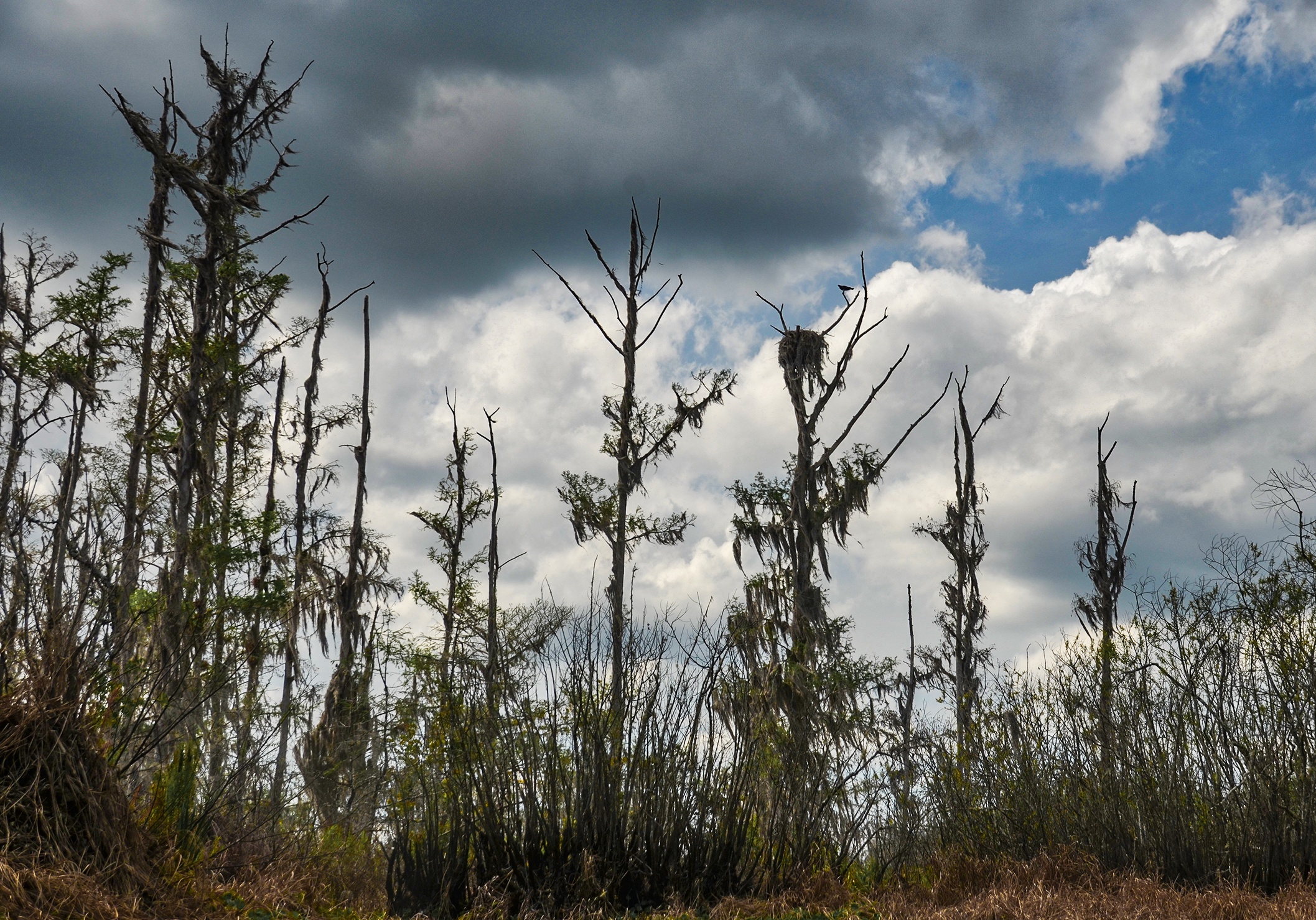
This paddle, as are paddles along the Ocklawaha River in winter during a drawdown, can be disheartening at the least. The deciduous trees are leafless, aquatic vegetation is often browned and dying along the banks, the trunks and stumps from trees drowned by the reservoir water level are exposed. Still standing are many species of trees in flux from either drowning or barely surviving the differing water levels. Today was no different. Along much of the shoreline, dead or dying Lake Sedge and Smartweed cover the banks and existing live vegetation, while tree stumps offer a reminder of a once beautiful habitat, ruined by the reservoir.
Sweetwater Creek During Drawdown

Sweetwater Creek Gallery

Leaping Lizards!
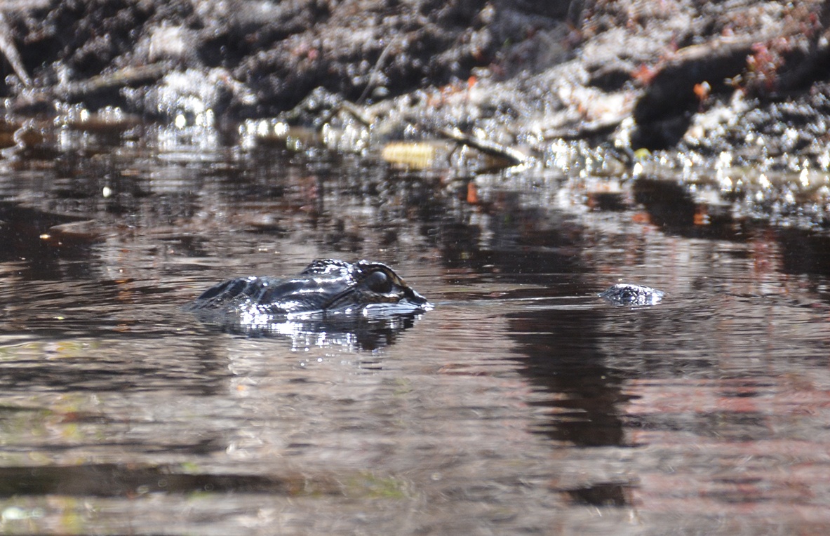
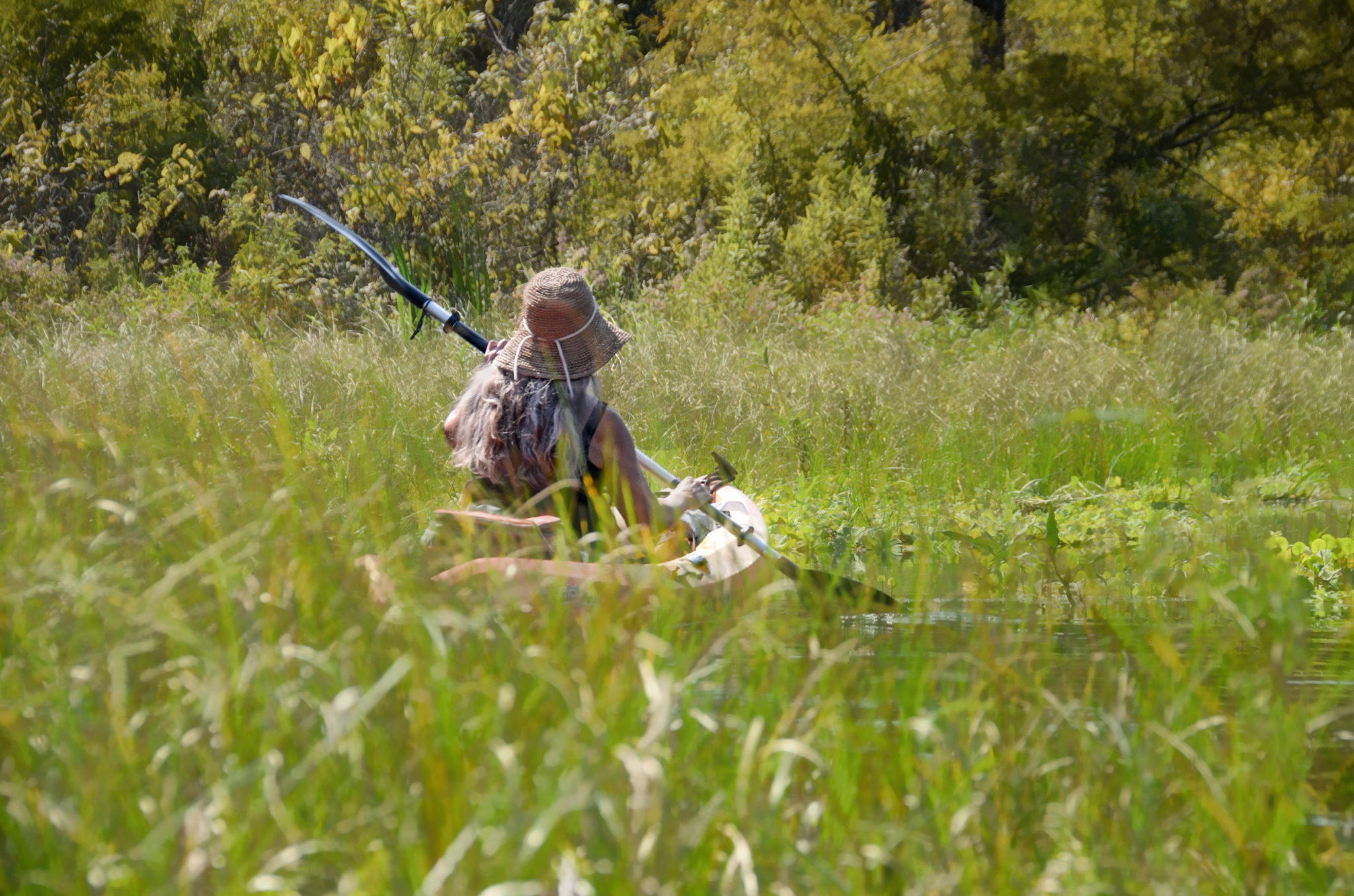
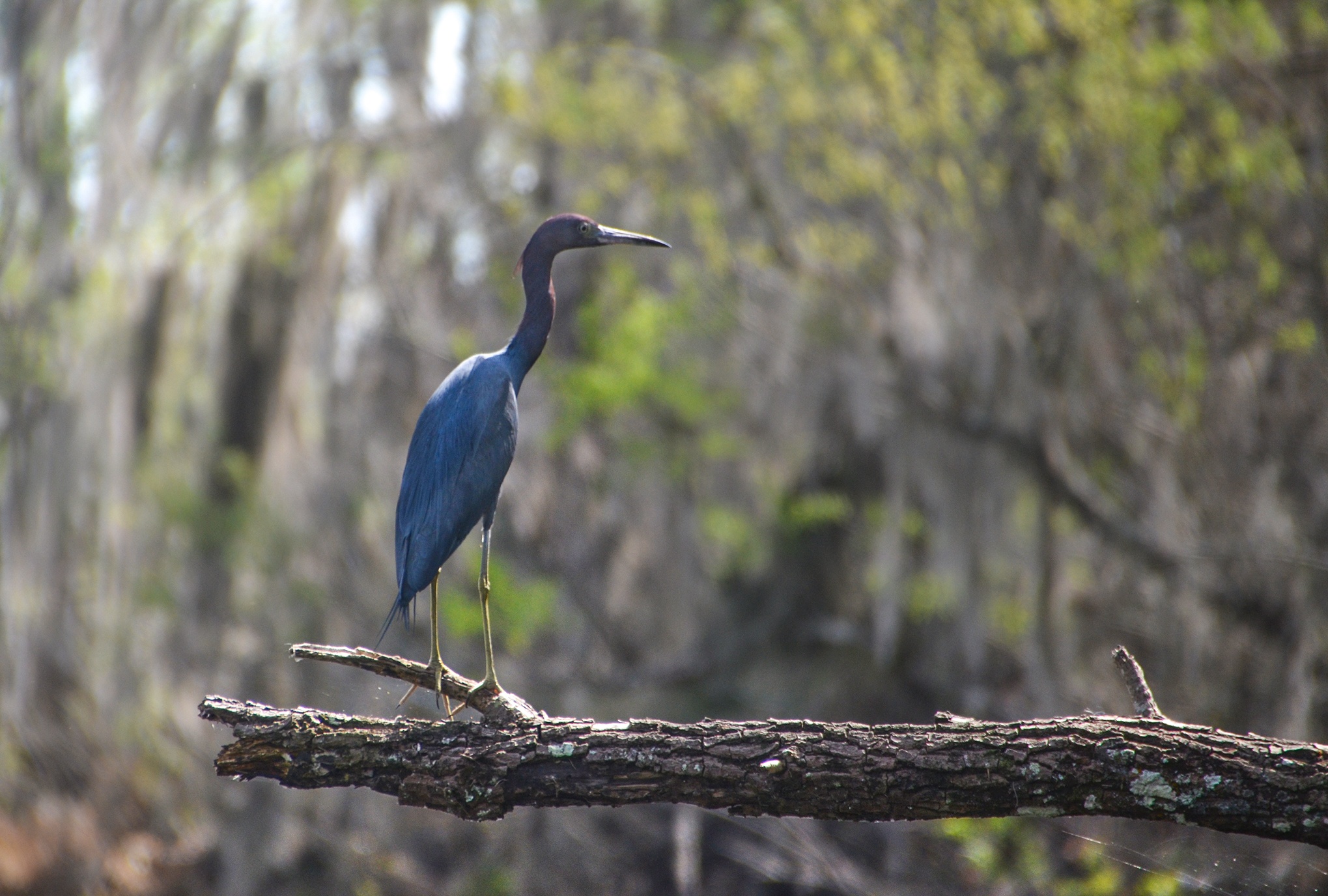
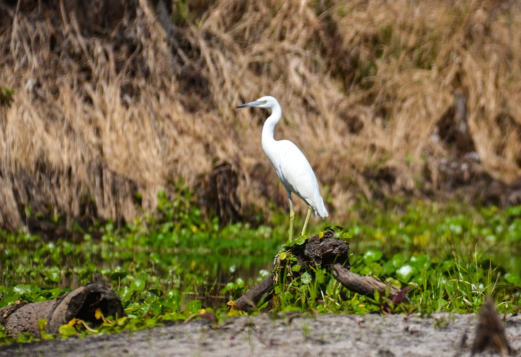
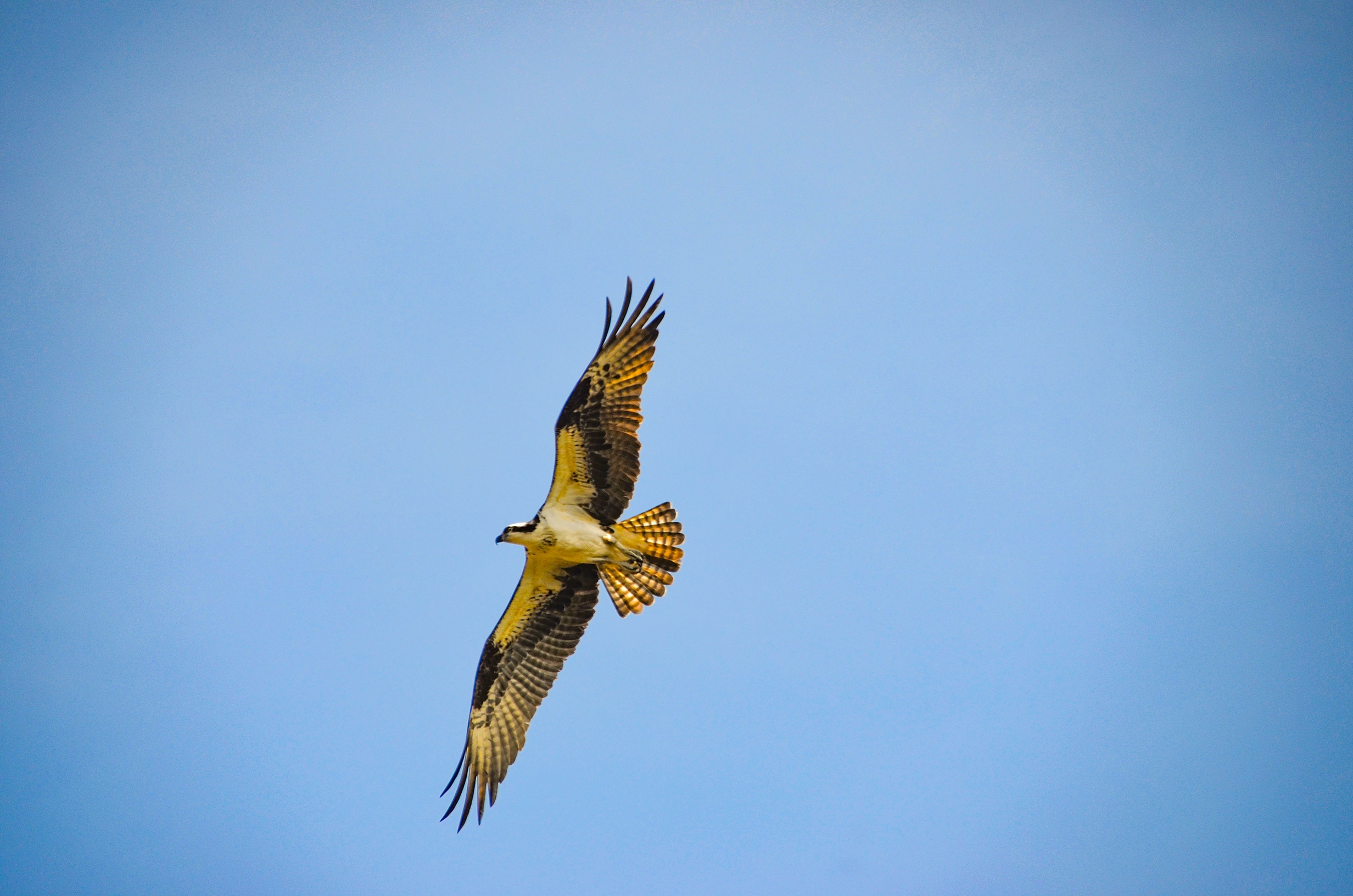
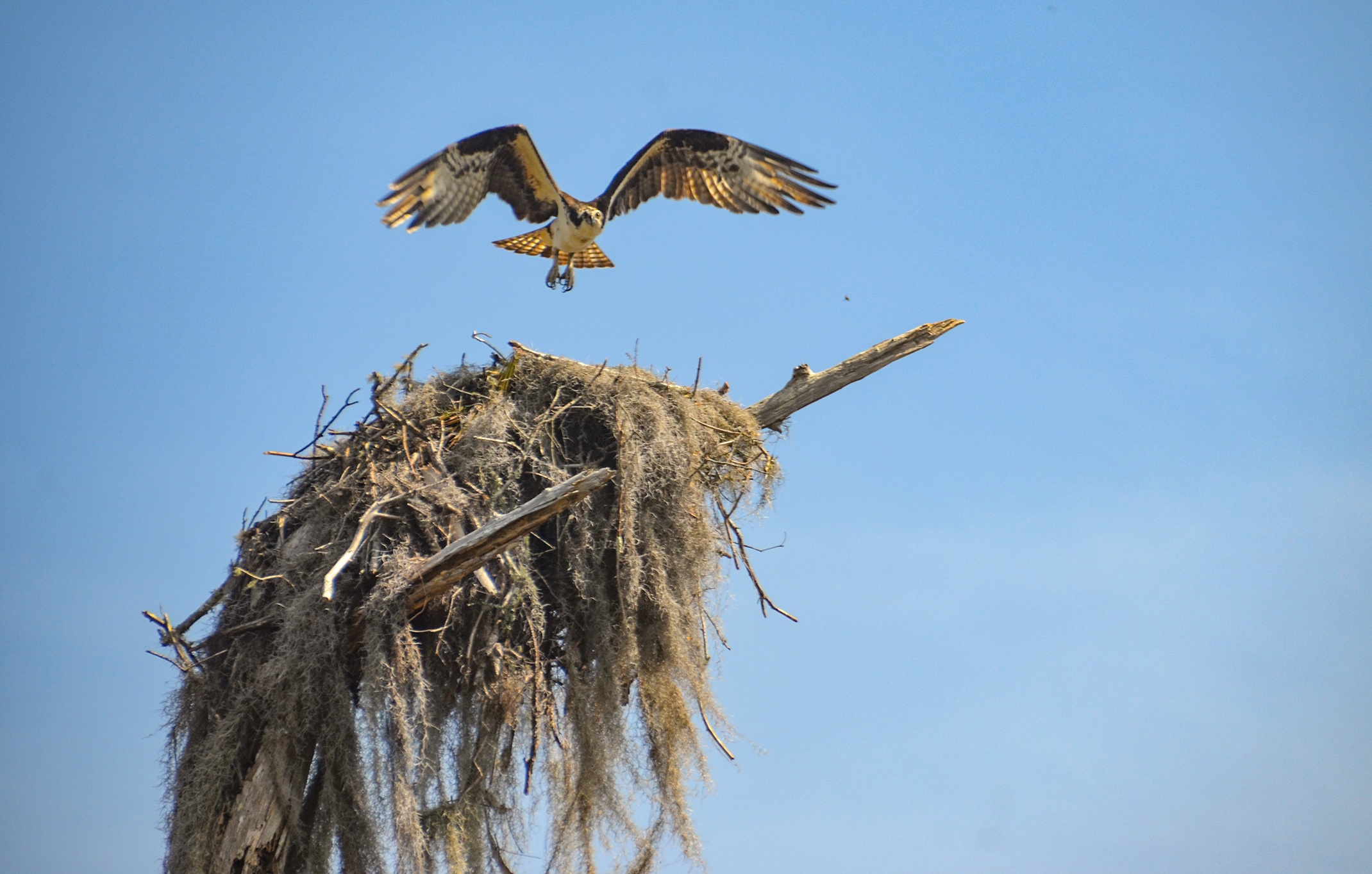
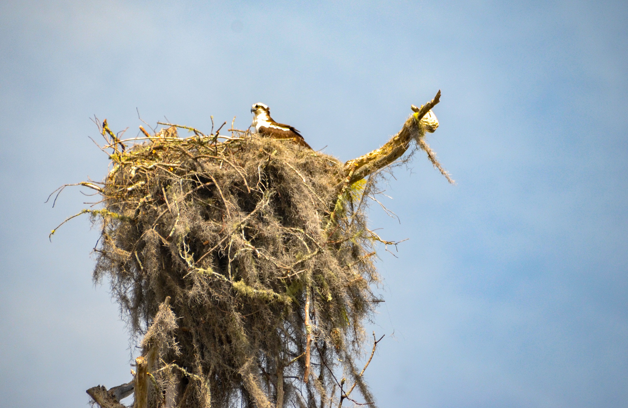
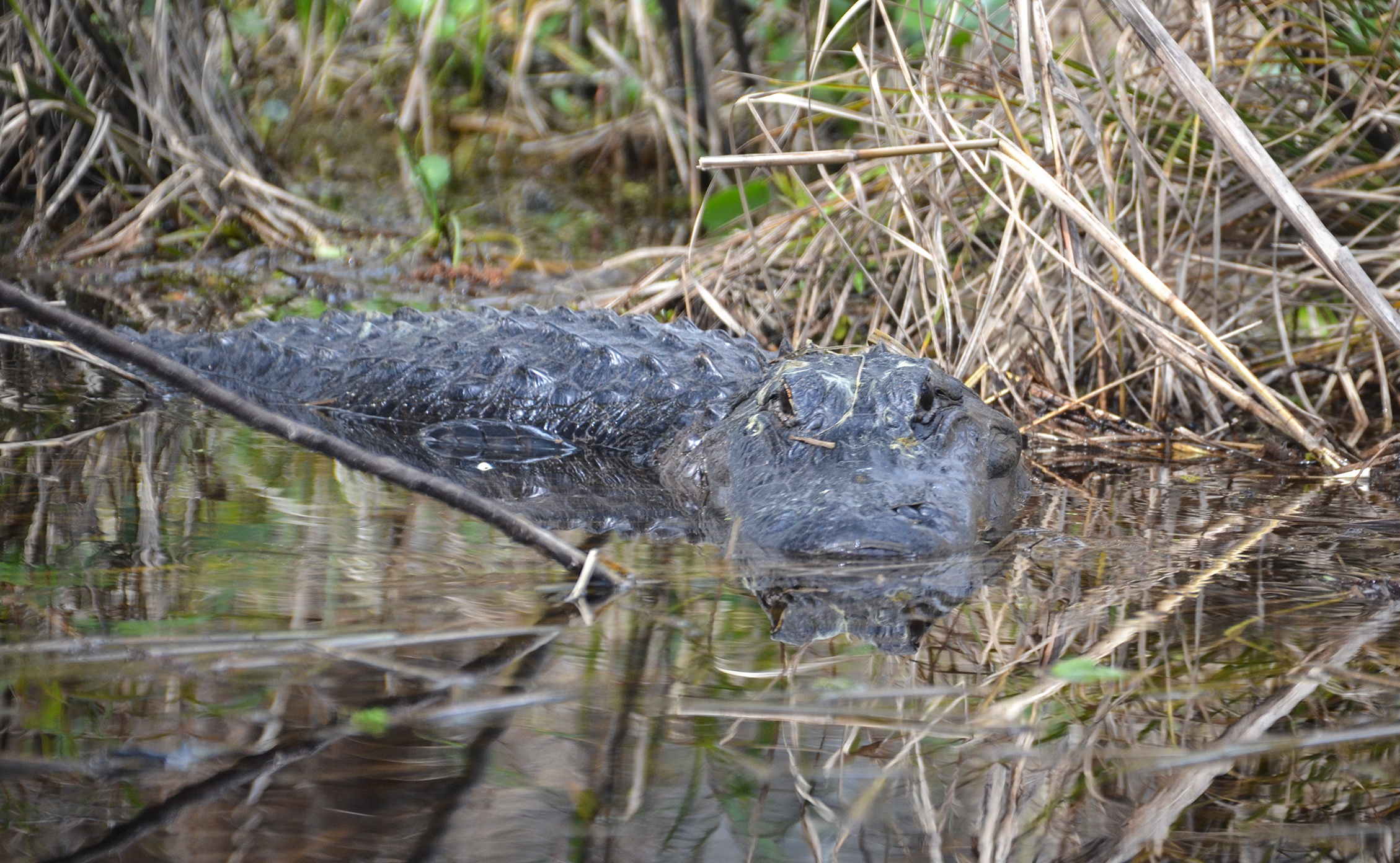
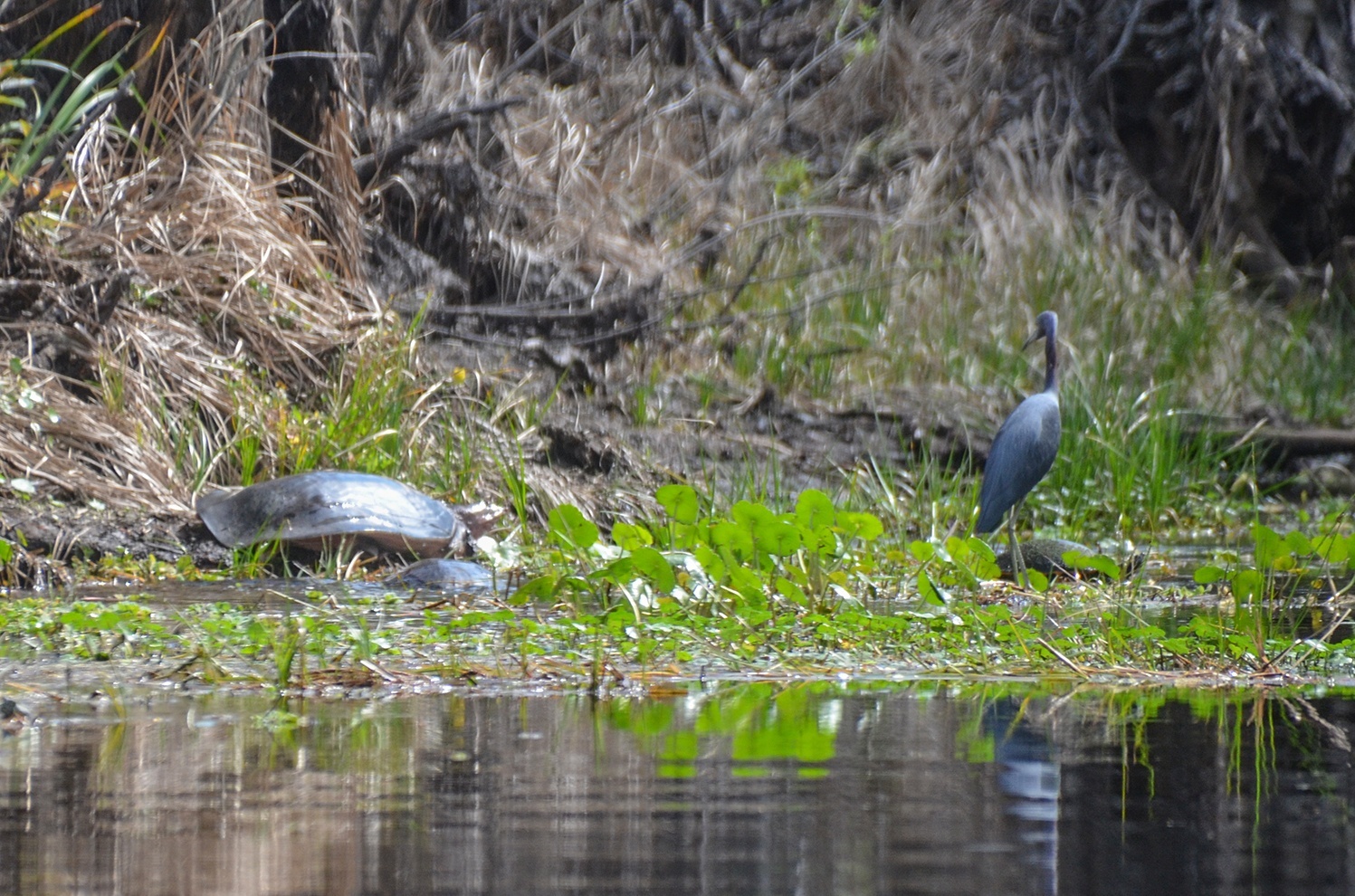
Our last 1.25 mile stretch was very interesting. It was surprisingly quiet, with minimal bird activity except for a Tri-colored Heron that seemed to follow us along the way. Above however, in the tall barren trees, were numerous, occupied, Osprey nests with active Ospreys flying over to check us out. The real ‘hair raisers’ were the gators and turtles. Obviously Sweetwater Creek is not a major paddle trail and both gators and turtles were easily spooked at our slightest paddle motions. Before we could even see many of them, they were splashing in the water ahead of us and disappearing into the dark water. It was eerie, as the creek was quite narrow here and the gators were big…where’d they go? Ahead we saw numerous gators swim across in front of us and many eyes watching just above the surface!
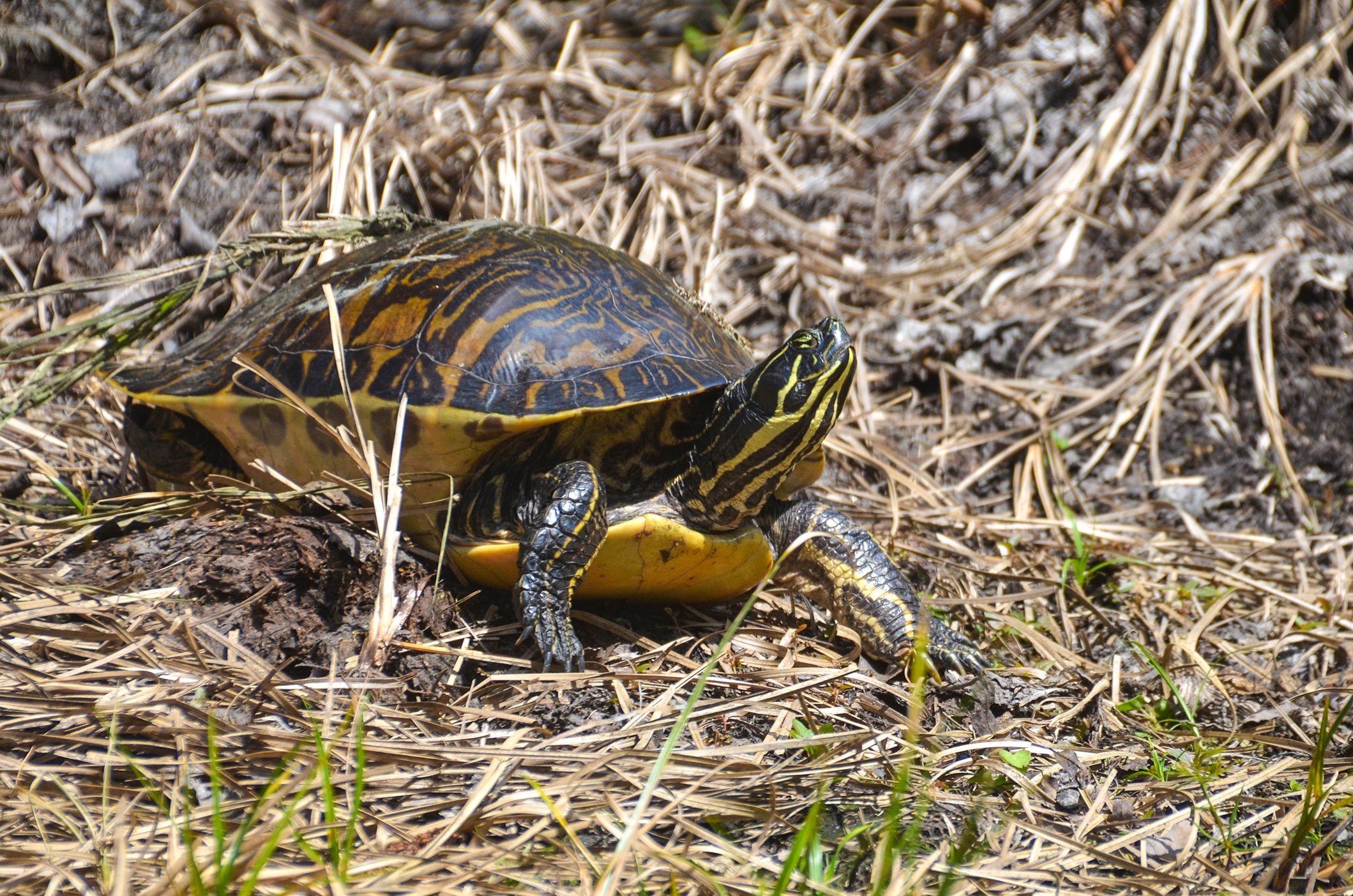
I had to resort to tapping my kayak with the paddle, especially when round a blind corner, to alert the gators. Several of these critters had a running start on the banks and would and leap into the water in front of us…yikes! I did not want one inadvertently jumping onto my kayak! We did see some very large turtles to include Softshell Turtles.


Guides, Maps & Info
- Rodman Topo Map ( Includes Sweetwater and Deep Creek )…
- Water Levels at Rodman Dam…
- Save Rodman Reservoir, Inc…
- St Johns River Keeper,Free the Ocklawaha, Info and Videos…
- Florida Defenders of the Environment – Remembering the Ocklawaha…
- Ocklawaha River – Remembered-Imagined…
![]()