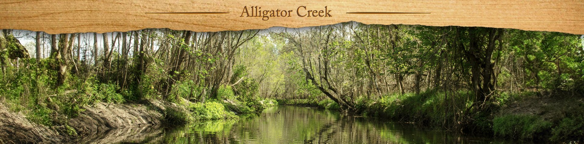
This is basically a drainage ditch that flows into Lake Rowell, however, Alligator Creek was a very interesting and surprising scenic treat to paddle! Between the cypress trees along Lake Rowell and the sandbars and foliage along the creek, it made for a very pleasant and unexpected enjoyment!…James
![]()
The original Alligator Creek ( North ) is a 6 1/2 mile long body of water, with its source about 4 miles East of Starke. The Creek flows in a southwesterly direction toward Lake Rowell, southwest of Starke, in Bradford County.
Five miles southeast of Starke is the location of an area known as OMA, Old Mining Area, where DuPont mined heavily for Titanium. At this location, the Civilian Conservation Corps, around 1939, excavated a drainage canal from the mining site North to connect with the existing Alligator Creek. The creek provides necessary drainage for this entire area.
From the mining site, Alligator Creek ( South ) finds its way south of the Trail Ridge area, connecting Blue Pond, Lowry Lake, and Magnolia Lake before diffusing into the Keystone Recharge area around Keystone Heights * ( Some information is from the document Upper Floridan Aquifer Recharge: A Clay-Bradford County Solution to Northeast Florida’s Future Drinking Water Crises, Presented by Dr. Pat Welsh 2015 )
Alligator Creek Paddle Map…
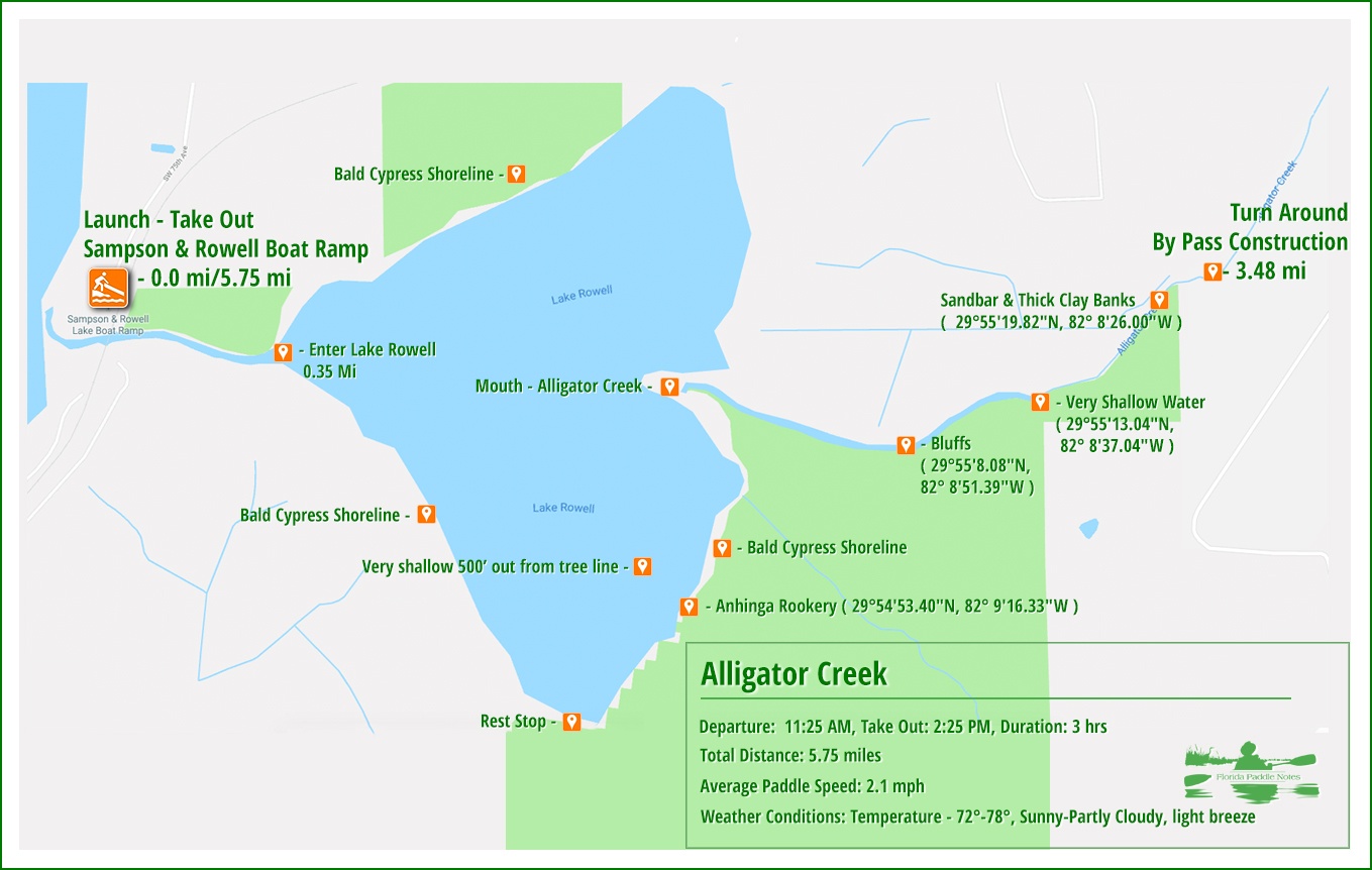
Alligator Creek Details:
![]() Location: Alligator Creek is located in Bradford County. The 1.25-mile creek flows 3+ miles southeast of Starke
Location: Alligator Creek is located in Bradford County. The 1.25-mile creek flows 3+ miles southeast of Starke
![]() Launch and Take Out Point: The launch and take out point is the Sampson and Rowell Lake Boat Ramp, 14300 SW 75th Avenue, Starke, Fl 32091.
Launch and Take Out Point: The launch and take out point is the Sampson and Rowell Lake Boat Ramp, 14300 SW 75th Avenue, Starke, Fl 32091.
![]() Paddle Distance: The distance for this paddle can vary. It is a little over 1/4 mile from the launch to Lake Rowell and a little over 3/4 mile to Alligator Creek if paddling straight across the lake. Lake Rowell is quite pretty, surrounded by numerous Bald Cypress. Choosing to follow either the southern shoreline or the northern shoreline to get to Alligator Creek can add up to an additional 1.5 miles. The actual creek itself is 1.2 miles long, stopping at the Starke by-pass construction. Our paddle was a combination of all of this and totaled 5.75 miles round trip.
Paddle Distance: The distance for this paddle can vary. It is a little over 1/4 mile from the launch to Lake Rowell and a little over 3/4 mile to Alligator Creek if paddling straight across the lake. Lake Rowell is quite pretty, surrounded by numerous Bald Cypress. Choosing to follow either the southern shoreline or the northern shoreline to get to Alligator Creek can add up to an additional 1.5 miles. The actual creek itself is 1.2 miles long, stopping at the Starke by-pass construction. Our paddle was a combination of all of this and totaled 5.75 miles round trip.
![]() Difficulty: Easy to difficult. Paddling on Lake Rowell is quite open and easy. Gaining entrance to Alligator Creek requires an easy portage over sandy shallow water. The difficulty comes about 3/4 of the way into the creek. Very shallow water and sandbars make it difficult to paddle against a weak current. On the return, going through this same area with the flow, was easy and required little paddling going over the shallow sandbars.
Difficulty: Easy to difficult. Paddling on Lake Rowell is quite open and easy. Gaining entrance to Alligator Creek requires an easy portage over sandy shallow water. The difficulty comes about 3/4 of the way into the creek. Very shallow water and sandbars make it difficult to paddle against a weak current. On the return, going through this same area with the flow, was easy and required little paddling going over the shallow sandbars.
 Average Paddle Speed: 2.1 mph. The slowest part of the paddle is paddling the very shallow areas of the creek.
![]() Width and Depth: This winding creek averaged about 20′ across. It is quite shallow from 6″ to 18″
Width and Depth: This winding creek averaged about 20′ across. It is quite shallow from 6″ to 18″
![]() Current – Tidal: The creek flows in a southwesterly direction, the flow is slow, picking up over the shallower areas..
Current – Tidal: The creek flows in a southwesterly direction, the flow is slow, picking up over the shallower areas..
![]() Side Paddles: Not Applicable.
Side Paddles: Not Applicable.
![]() Rest Areas: Porta-Potties at the launch. Several attractive sandy areas along the creek to rest and/or exit if needed.
Rest Areas: Porta-Potties at the launch. Several attractive sandy areas along the creek to rest and/or exit if needed.
![]() Important Information: Lake Rowell is open and can be hot in the Summer. The entrance to Alligator Creek requires a short portage and several places along the creek are very shallow making paddling difficult.
Important Information: Lake Rowell is open and can be hot in the Summer. The entrance to Alligator Creek requires a short portage and several places along the creek are very shallow making paddling difficult.
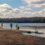
Sampson and Rowell Lake Boat Ramp …
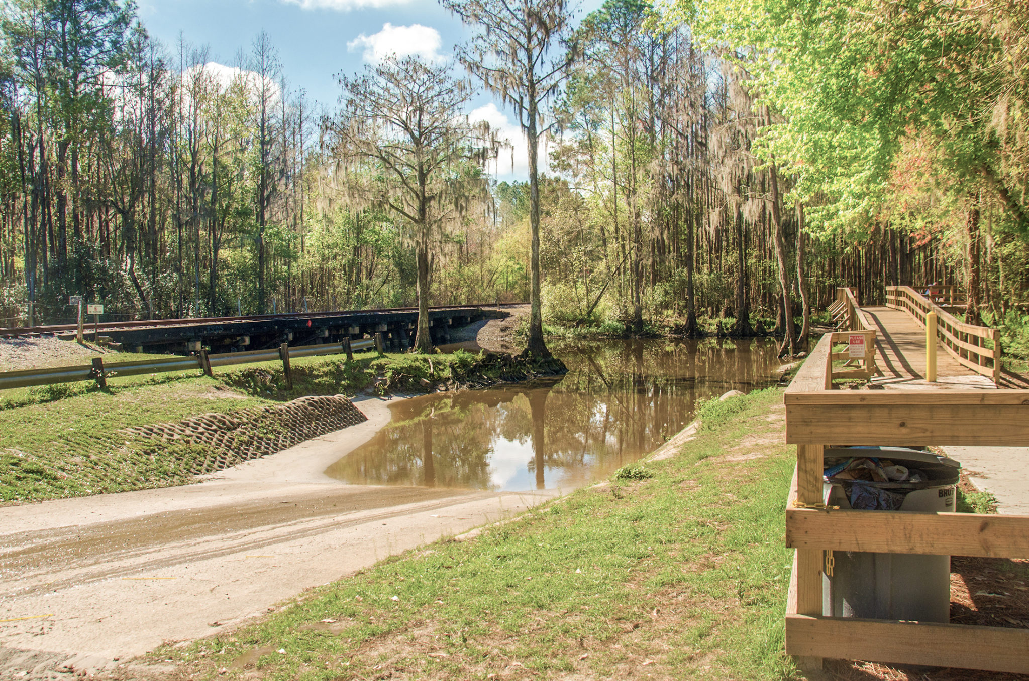
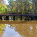
The Sampson and Rowell Lake Boat Ramp is our launching point for today’s paddle to Alligator Creek. The boat ramp is well maintained with ample parking, concrete ramp, observation/fishing walkway, and porta-potties. The ramp is on a connecting canal between Lake Sampson to the West and Lake Rowell to the East. The connecting canal is about 1/2 mile long, averages approximately 50′ wide and is only several feet deep. Sadly, there is a lot of litter along the northern banks from fishermen. It is a warm 72° at launch, mostly sunny and a slight breeze.
Lake Rowell…
Launching and heading East on the canal, we travel under a low railroad trestle, pass several folks fishing in boats, and make our way to Lake Rowell. It is a short paddle, just over 1/4 mile.
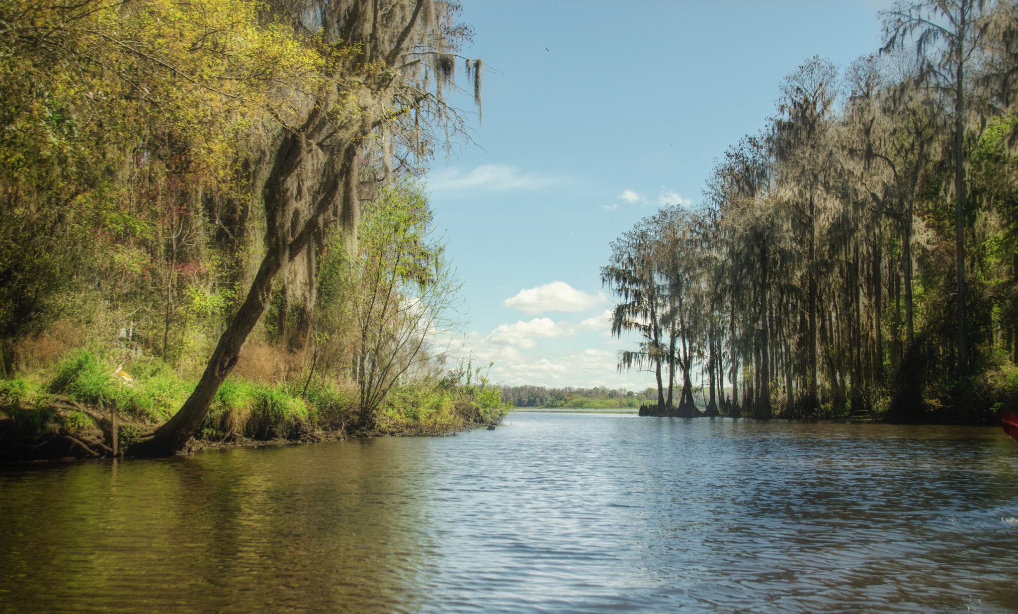
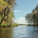
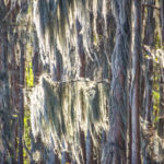
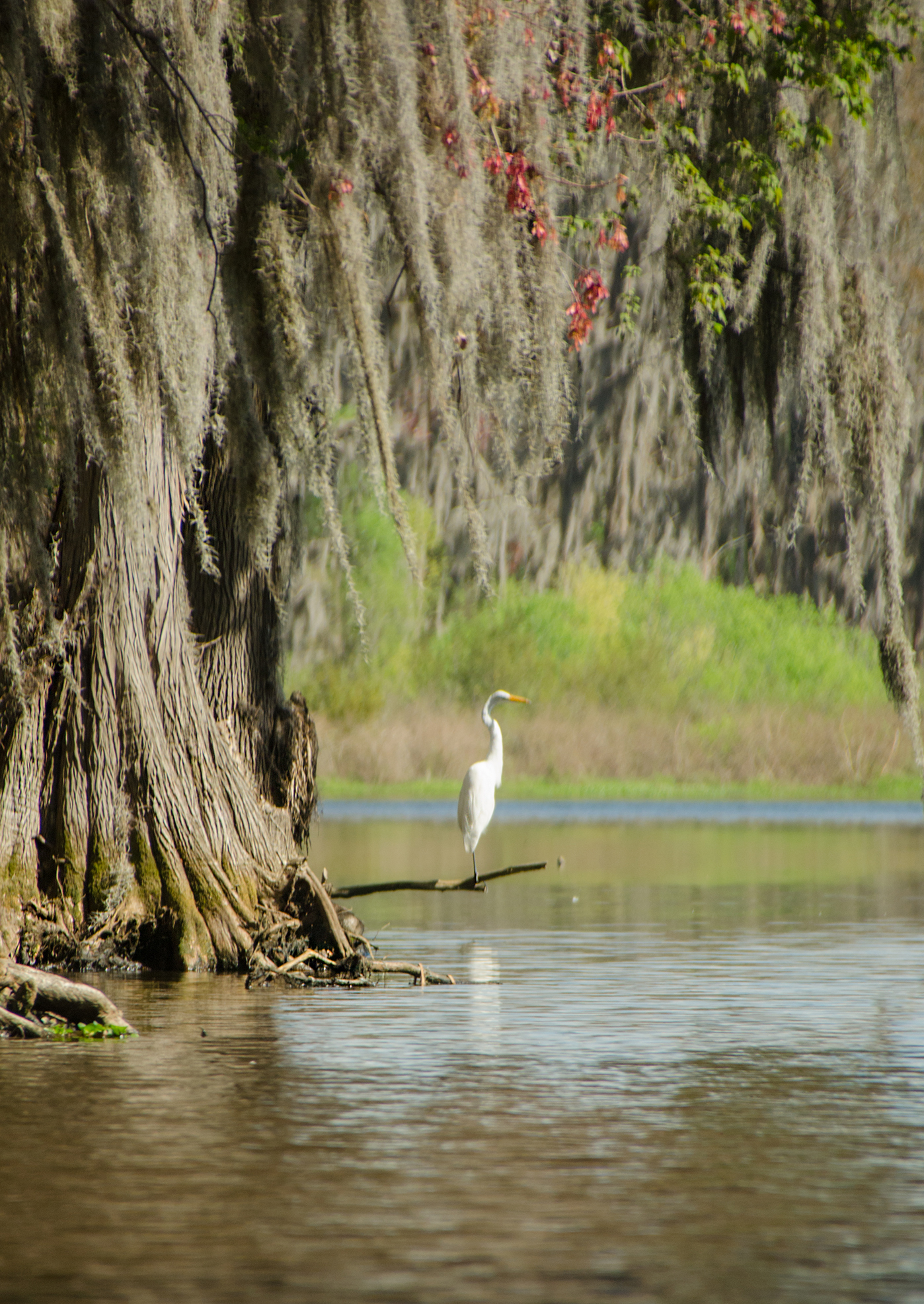
Lake Rowell is a beautiful 340-acre lake, shaped like a Sting Ray ( See the Paddle Map above ). Alligator Creek flows into Lake Rowell on the eastern shoreline which is easily spotted looking straight across. It is one of the few areas of green that stands out amidst a shoreline bordered with endless Bald Cypress. I doubt that I have ever seen this amount of cypress surrounding so much of a lake…it is beautiful!

We paddle along the West shoreline to the southern tip of the lake, about 0.80 miles, continue along the southeasterly portion of the lake before heading north straight for the tip where Alligator Creek flows in. Unlike the western side of the lake, this side is very shallow and filled with hydrilla, keeping us 500′ from the treeline. As we make our turn to the creek there is a large Anhinga Rookery to our right! The cypress trees are full of Anhingas, nests and at the top is perched a lone heron…quite awesome!
Alligator Creek…
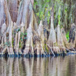
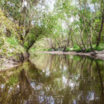
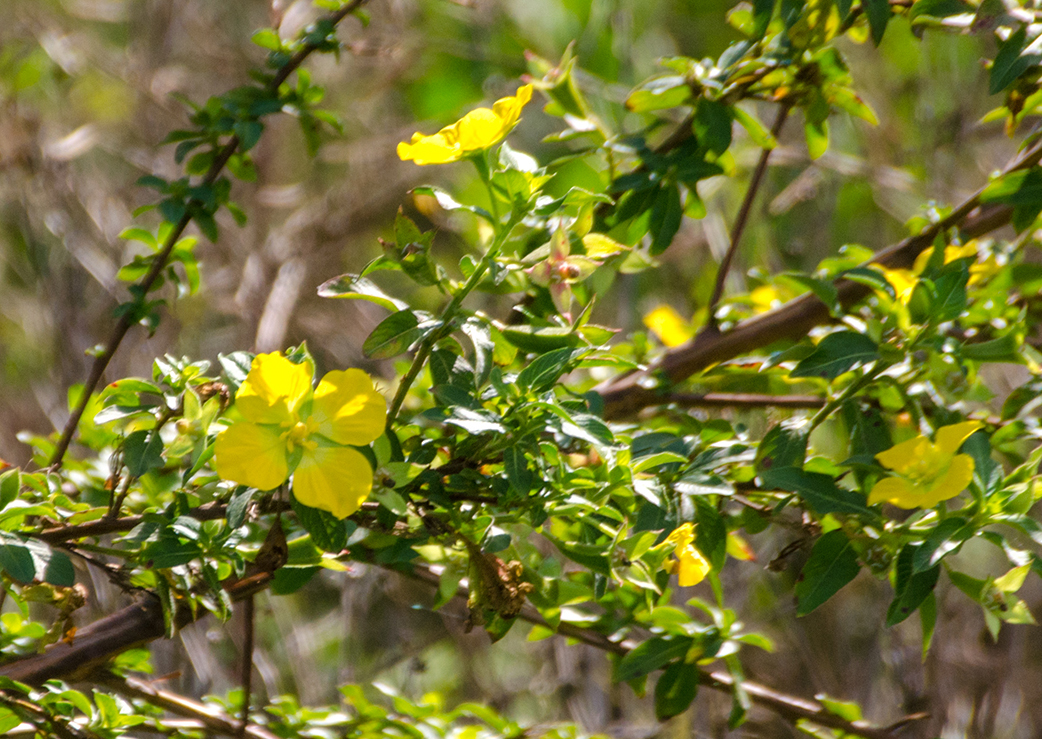
Alligator Creek is easily located in the point that divides the two ‘wings’ of Lake Rowell. The point is devoid of the characteristic Bald Cypress bordering 99% of the lake. Instead, there is a sandbar jutting out into the water and the land is covered with a combination of Water Primrose and several species of willow, including the Coastal Plains Willow.
Because the entrance to the creek was not typically obvious, we paddled around the short point to see if it was accessible from the other side and it was not…back to the sandbar! With a short portage over the shallow water sandbar and a paddle around a fallen Red Maple, an adventure on a hidden treasure awaited us!
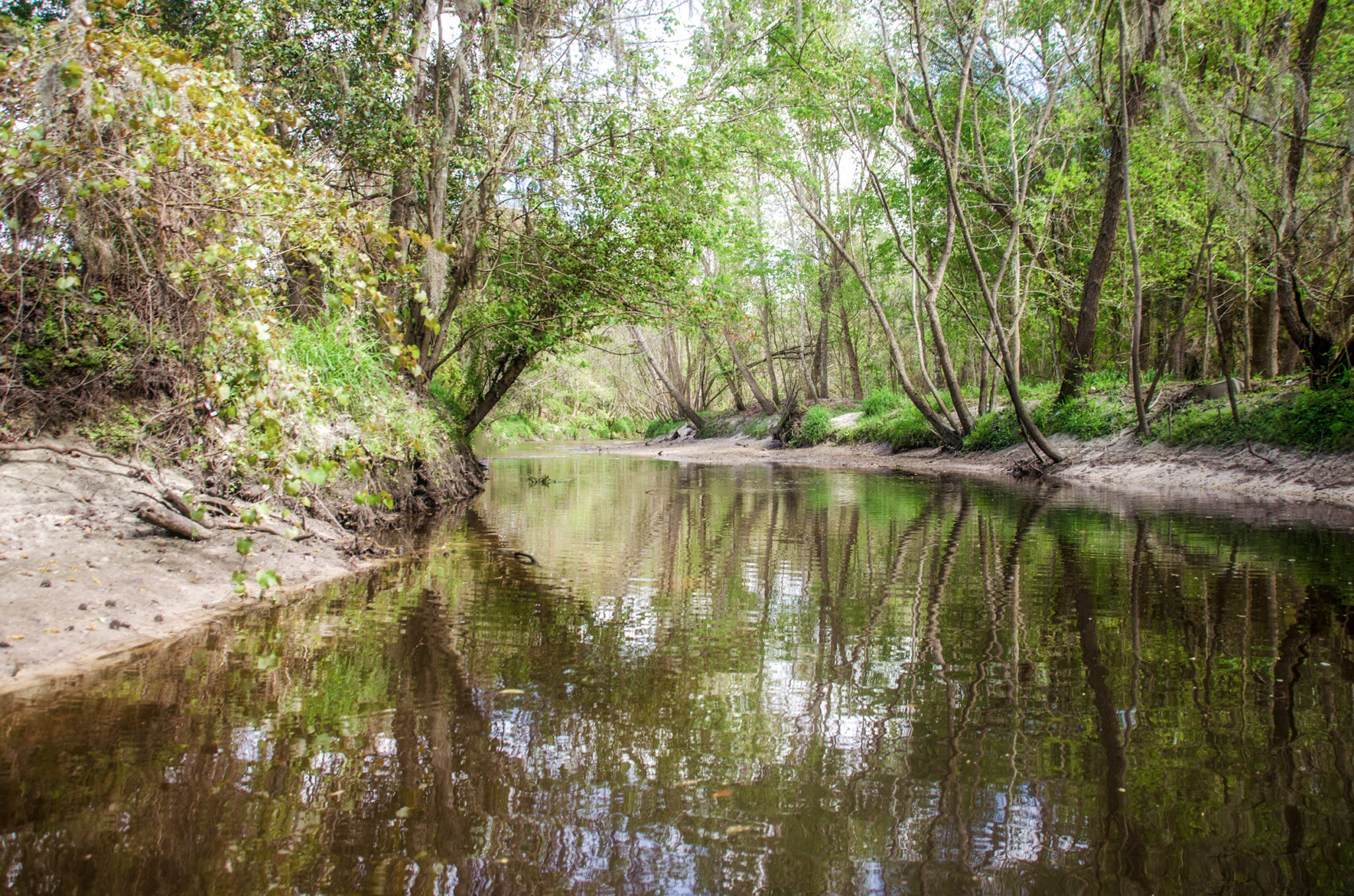
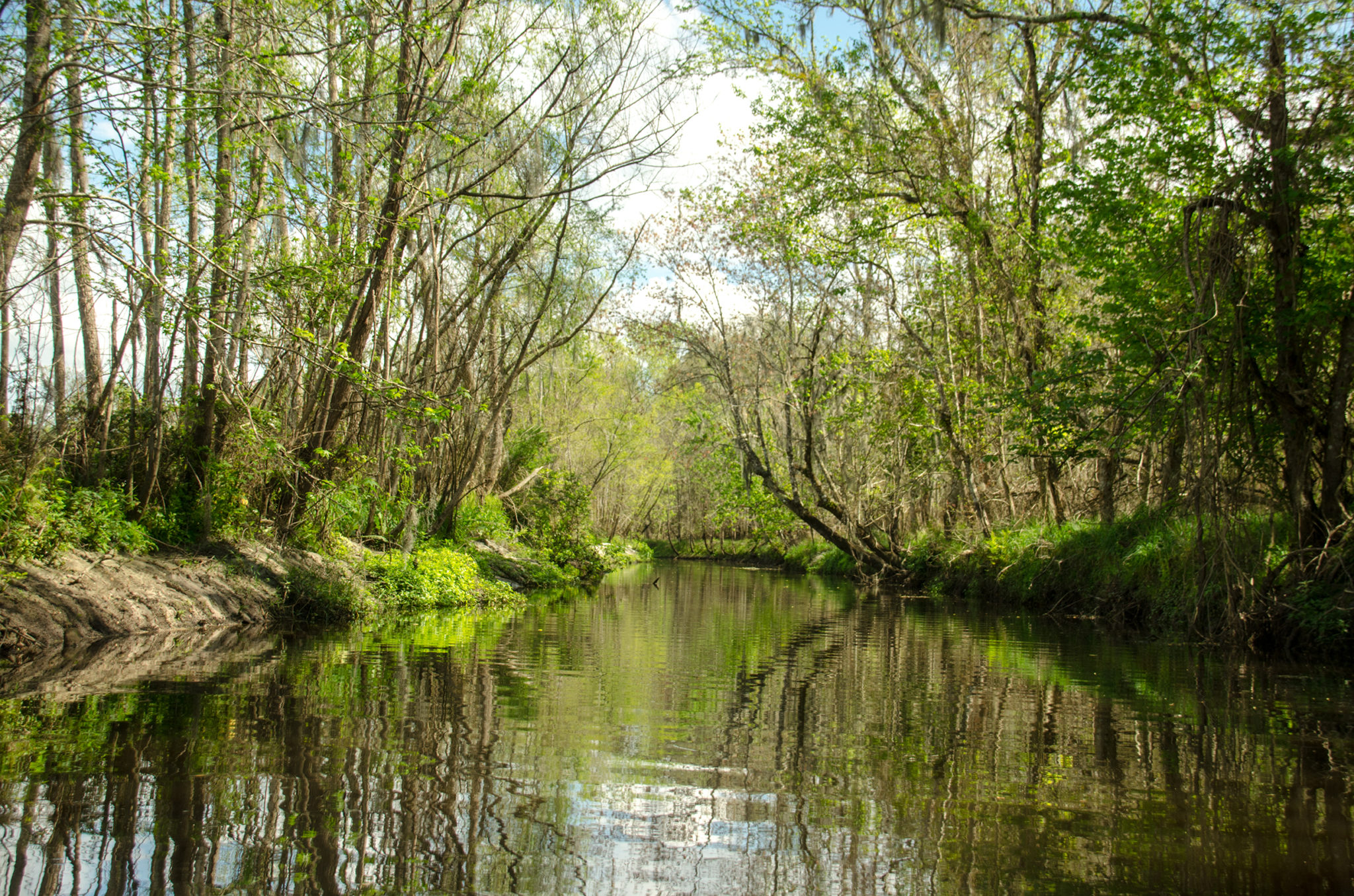
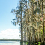
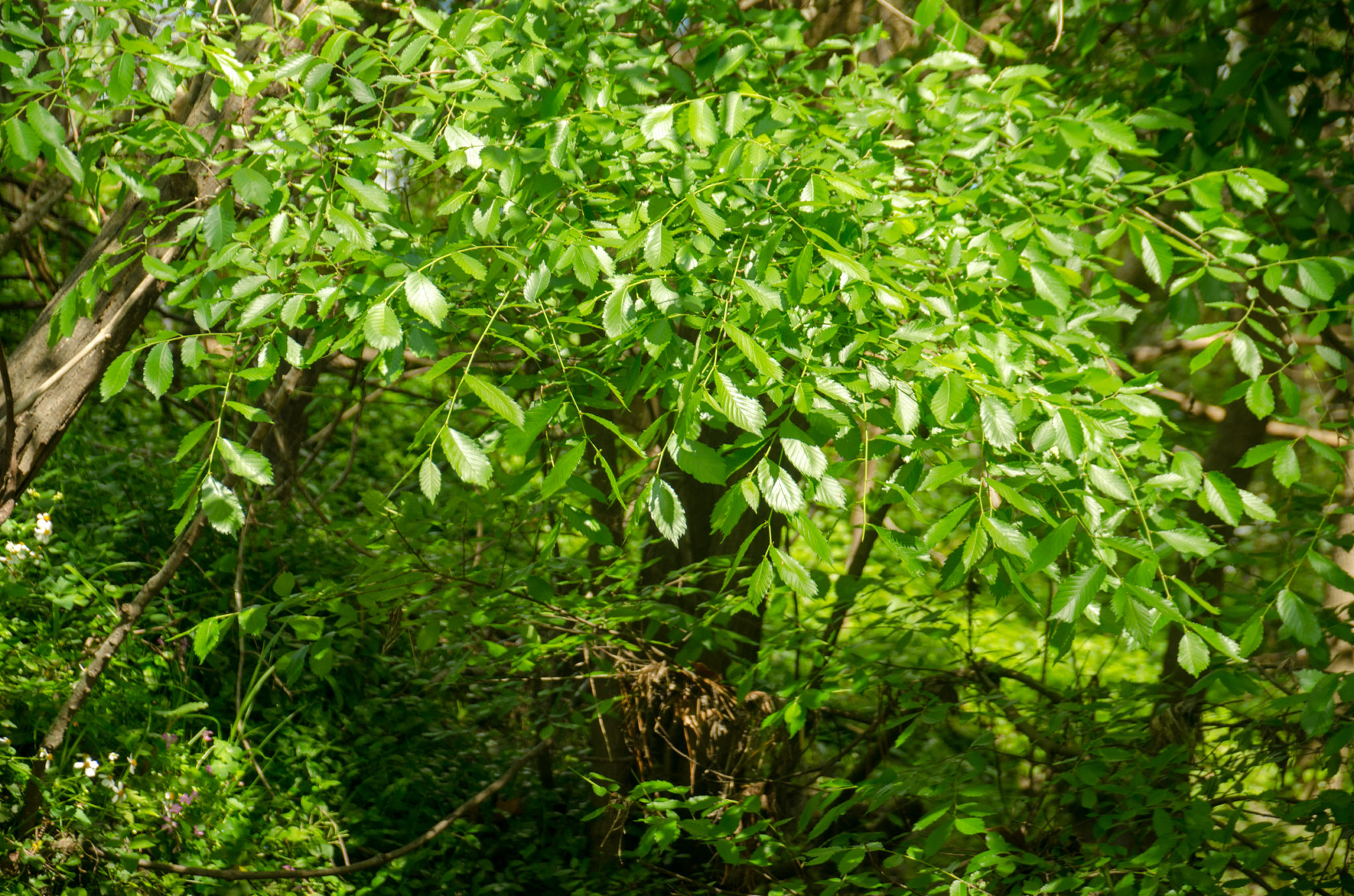
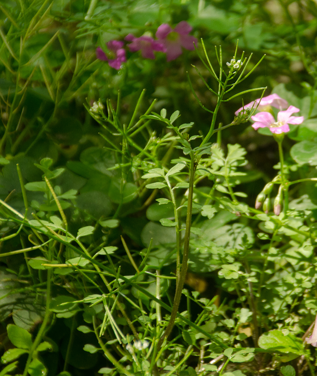
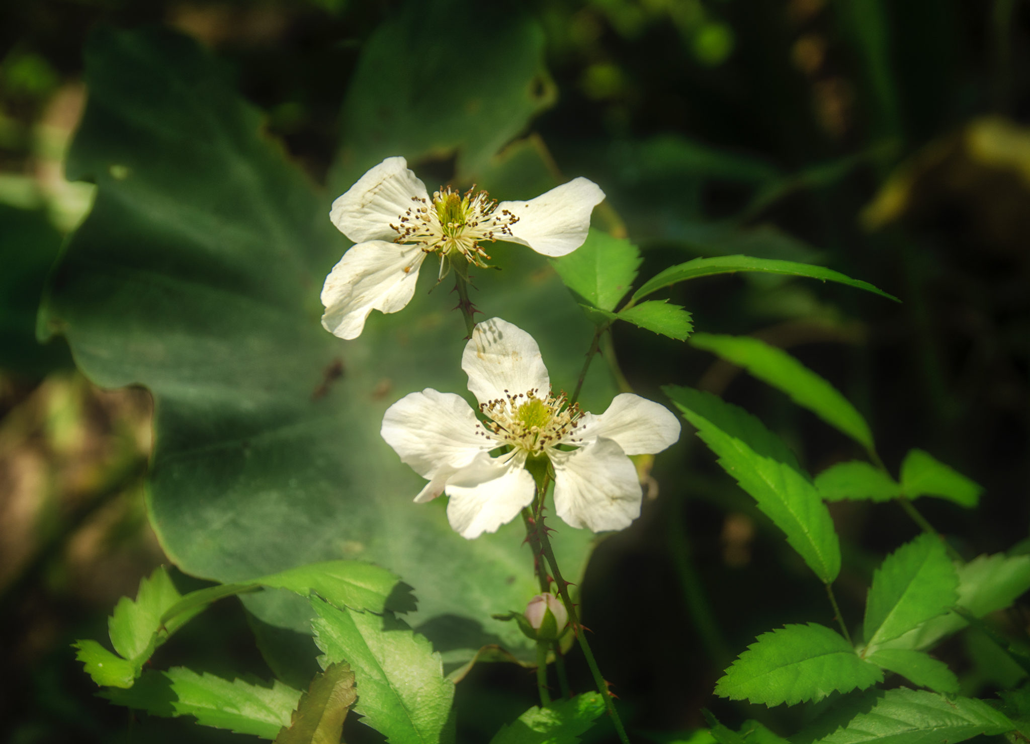
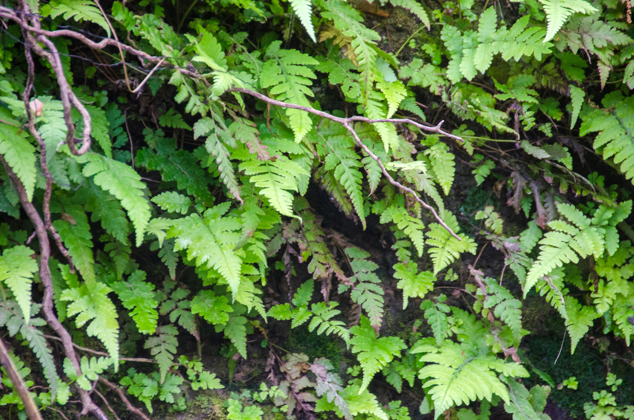
From Lake Rowell, Alligator Creek separates farmland on the North and wetland forest on the South. The 20′-25′ creek is a mixture of tannin and silt and varies in depth from inches to maybe 2′. The flow is slow as we paddle against it heading ‘upstream’. The banks provide a contrast in vegetation. On the farmland bank side is a mixture of common field weeds and shrubs that include Water Primrose, Trailing Blackberry, Wood Sorrel, and Hairy Cowpea among others. The forested side presents us with several species of ferns, grasses, dollarweed, and Colocasia. Both banks have an assortment of Gum, Maple, Willows, Oaks, and Elm, many leaning overhead creating a nice shady canopy.
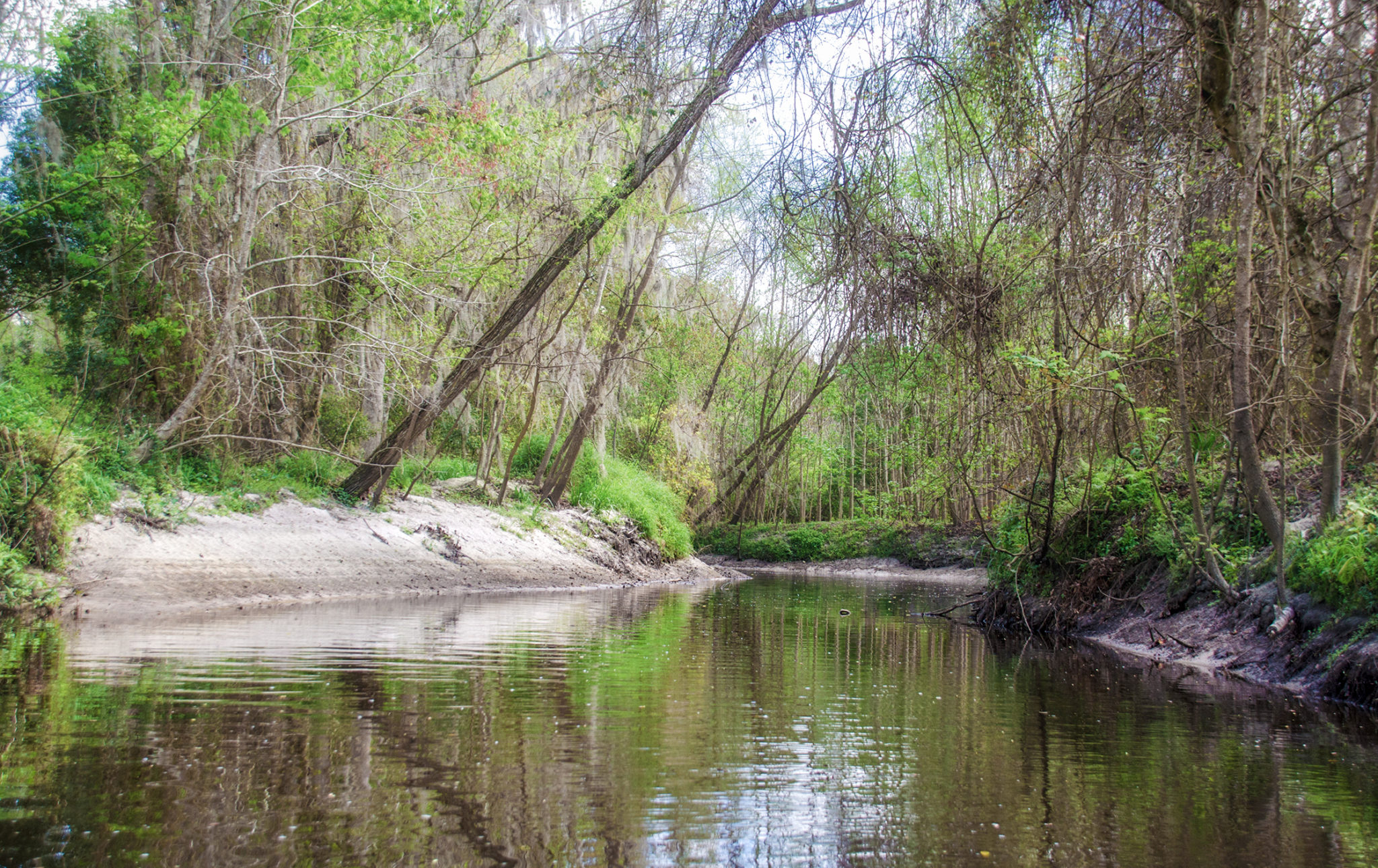
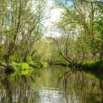
The paddle is pleasant, new spring growth presents a freshness to the scenery as we paddle by sandy, 3′ high, banks. At the 3/4 mile mark, the creek is very shallow and paddling is difficult. I keep a keen eye on the leaves floating on the surface to give me an idea of where the deeper water and flow was. The current was not a factor, and almost unnoticeable until we reached the shallows and had to paddle against it. Also in this area, the banks change from sand to heavy, gray clay that looked like rocks in some areas. Finally, at 1.2 miles, we arrive at the construction of the Starke by-pass. Despite a flexible barrier, easily paddled over, paddling further up the creek is possible, however our goal was the by-pass and we turned around.
A brief break and we returned back down the creek, this time much easier over the shallows with the flow on our side. Reaching Lake Rowell, we paddled a beeline across the lake. The weather now was mostly cloudy with a slight coolness in the air. We paddled into the wind and returned to the launch. It was an unexpected treat today, both the beauty of Lake Rowell and the hidden adventure of Alligator Creek, thus ending another chapter in Florida Paddle Notes.
Alligator Creek Gallery:

Alligator Creek Flora & Fauna:


Guides, Maps & Info…
![]()