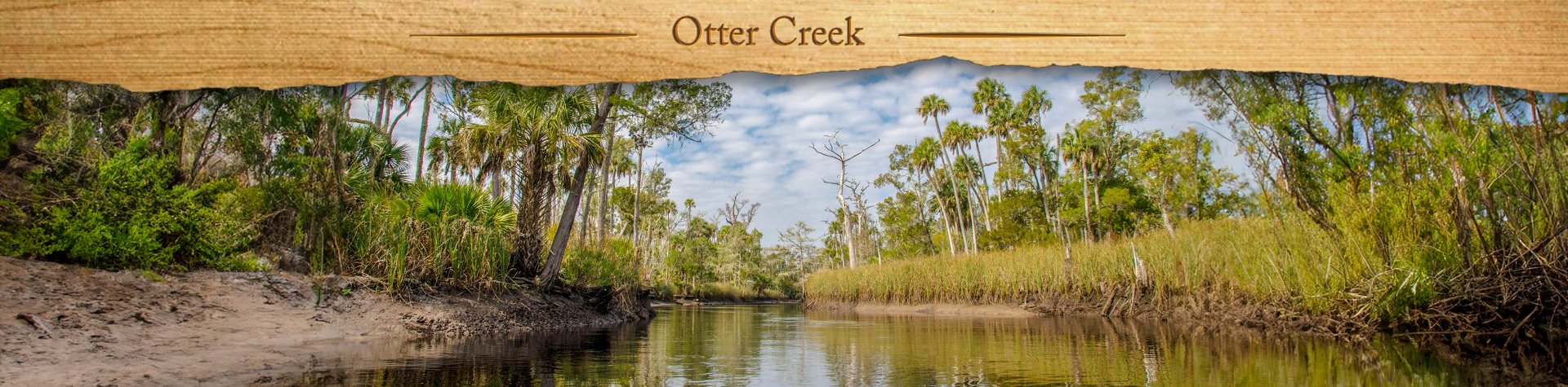
Brief Overview…
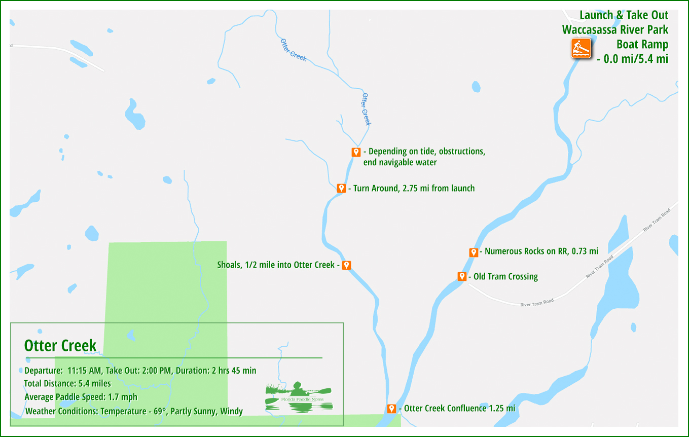
Otter Creek is an approximately 11-mile long creek, located in Levy County, 3 miles West of Gulf Hammock. Only the last 2 – 3 miles of the creek are navigable, toward the confluence with the Waccasassa River. The creek source is in the area of the town Otter Creek near Hwy 24 and Hwy 19. Otter Creek flows South until it merges with the Waccasassa River, which flows into the Gulf of Mexico just over 4 miles southeast, downriver.
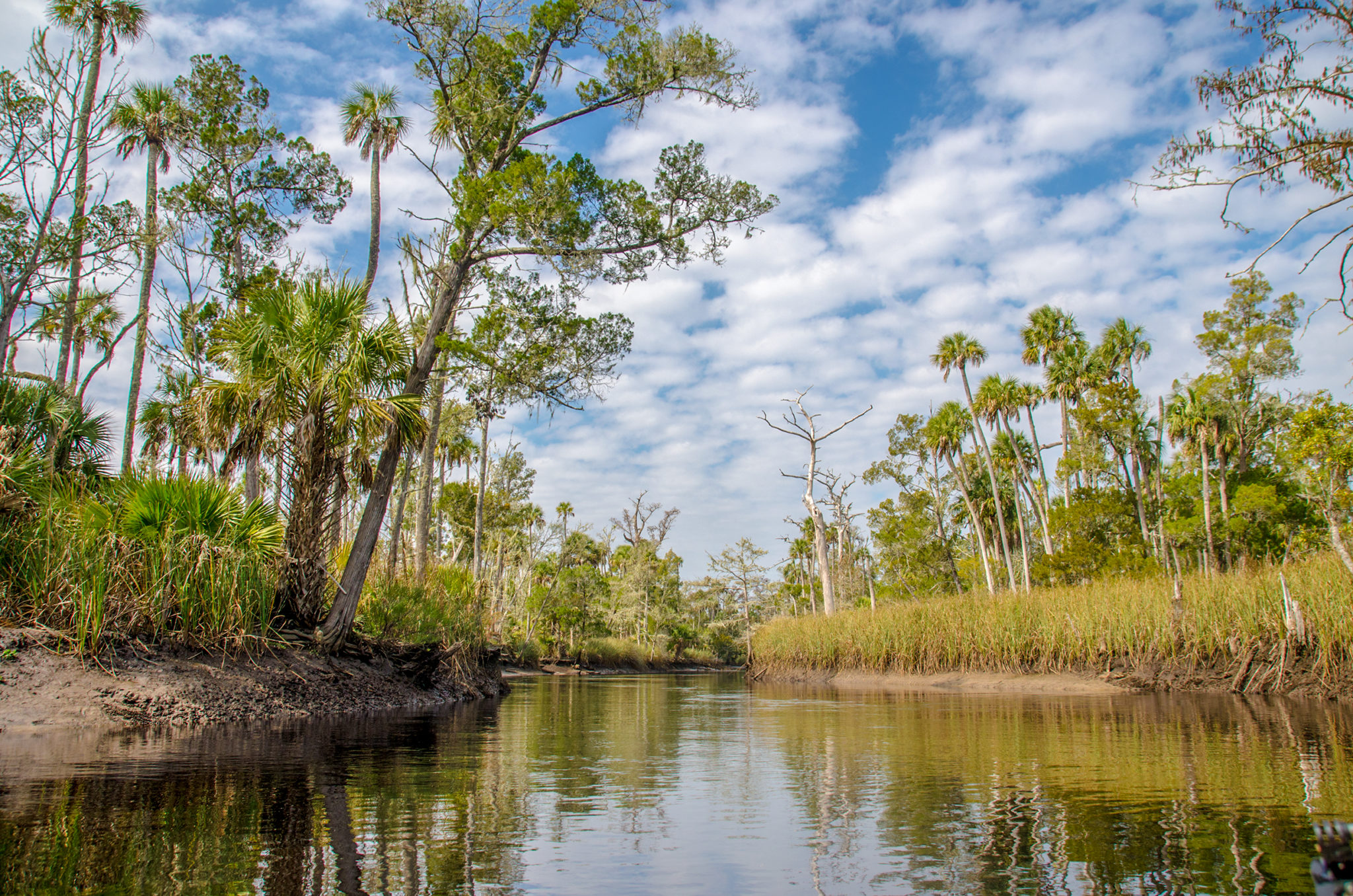
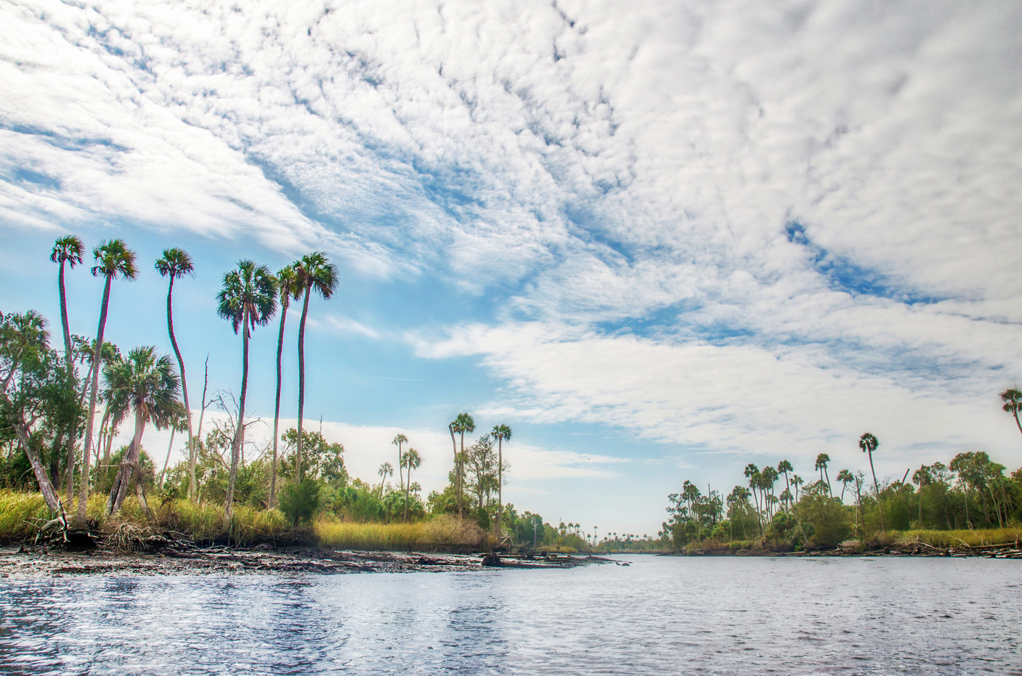
The Waccasassa is one of the most undeveloped rivers in Florida, with Otter Creek one of the principal tributaries to the river. Otter Creek transitions from forested swamp to salt marshes and the upper reaches are tannin-stained and acidic.
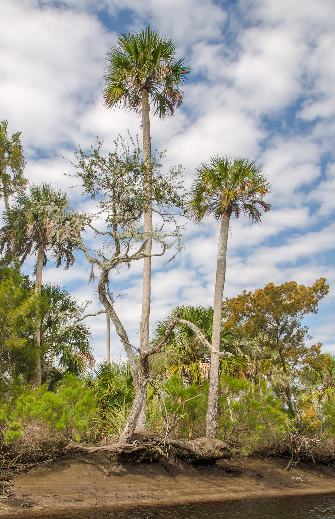
The Waccasassa River, and Otter Creek present a very scenic paddle with a variety of trees consisting of Sweet Gum, Ash, Bays, Cabbage Palms, Red Cedar as well as some huge old Bald Cypress still hanging in there. Many are majestic remnants of a previous time. Hernando de Soto crossed Otter Creek during his explorations of Florida in 1539.

Otter Creek Details:
![]() Location: Levy County, 3 miles West of Gulf Hammock.
Location: Levy County, 3 miles West of Gulf Hammock.
![]() Launch/Take Out point: Only one launch point! Waccasassa River Park boat ramp, Waccasassa River Boat Ramp 29.214050, -82.763564, (352) 543-5567, Gulf Hammock, FL 34449
Launch/Take Out point: Only one launch point! Waccasassa River Park boat ramp, Waccasassa River Boat Ramp 29.214050, -82.763564, (352) 543-5567, Gulf Hammock, FL 34449
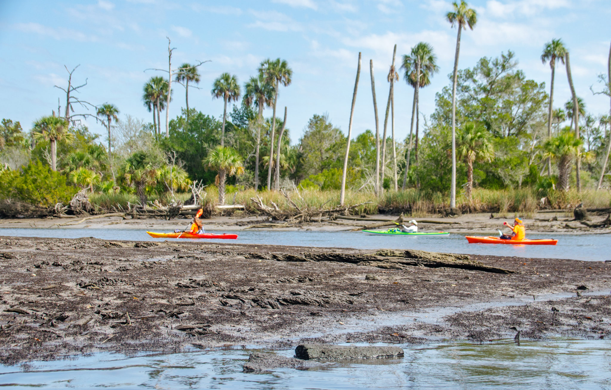
![]() Paddle Distance: The entire paddle was 5.45 miles. It is 1.25 miles down the Wacasassa River to the emergence of Otter Creek. We paddled 1.5 miles up Otter Creek and turned around, headed back to the launch.
Paddle Distance: The entire paddle was 5.45 miles. It is 1.25 miles down the Wacasassa River to the emergence of Otter Creek. We paddled 1.5 miles up Otter Creek and turned around, headed back to the launch.
![]() Difficulty: Easy to Difficult. There is a nice flow at the tide change and even an area of shoals, which are easy. The current may be too strong for beginners, especially heading back on the Waccasassa, where we paddled into a strong wind, 15-20 mph.
Difficulty: Easy to Difficult. There is a nice flow at the tide change and even an area of shoals, which are easy. The current may be too strong for beginners, especially heading back on the Waccasassa, where we paddled into a strong wind, 15-20 mph.
![]() Paddle Speed: Average paddle speed 1.75 mph. This is slower than normal due to the winds.
Paddle Speed: Average paddle speed 1.75 mph. This is slower than normal due to the winds.
![]() Width and Depth: At the launch the river is about 100′ wide and the width of Otter Creek at the Waccasassa was around 70′. Tides play a big role on the width of the river. One mile into Otter Creek it was, at times, only 30 feet wide. Checking the depth on the creek at low tide, was from 1′ – 3.5′ deep.
Width and Depth: At the launch the river is about 100′ wide and the width of Otter Creek at the Waccasassa was around 70′. Tides play a big role on the width of the river. One mile into Otter Creek it was, at times, only 30 feet wide. Checking the depth on the creek at low tide, was from 1′ – 3.5′ deep.
![]() Current – Tidal: Both the Waccasassa and Otter Creek are affected by tides, with the mean tide difference being 3.25′
Current – Tidal: Both the Waccasassa and Otter Creek are affected by tides, with the mean tide difference being 3.25′
![]() Side Paddles: There are several narrow, snaking side creeks that at High tide may be worth exploring, but not accessible during low tide.
Side Paddles: There are several narrow, snaking side creeks that at High tide may be worth exploring, but not accessible during low tide.
![]() Rest Areas: There are no rest facilities during this paddle. During a higher tide it would probably be possible to get out of the kayak onto shore, however, during low tide, there is too much mud that would be hazardous.
Rest Areas: There are no rest facilities during this paddle. During a higher tide it would probably be possible to get out of the kayak onto shore, however, during low tide, there is too much mud that would be hazardous.
![]() Important Information: Most of this paddle is in the open on the Waccasassa. We encountered strong winds on our way back…even had some periods of strong wind on Otter Creek. Be mindful of boat traffic along the Waccasassa River.
Important Information: Most of this paddle is in the open on the Waccasassa. We encountered strong winds on our way back…even had some periods of strong wind on Otter Creek. Be mindful of boat traffic along the Waccasassa River.
Otter Creek Paddle Map…
Waccasassa Launch…
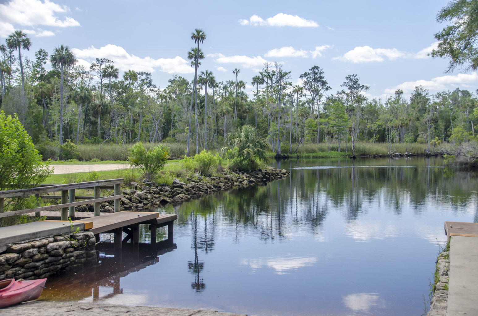
The Waccasassa River Boat Ramp is at the end of the line in this ‘wilderness’ area East of Gulf Hammock. Hwy 326 literally dead ends at the site of the ramp. There are restroom facilities here and make sure to have enough snacks and beverages with you as there are not many places to get them once you get away from town.
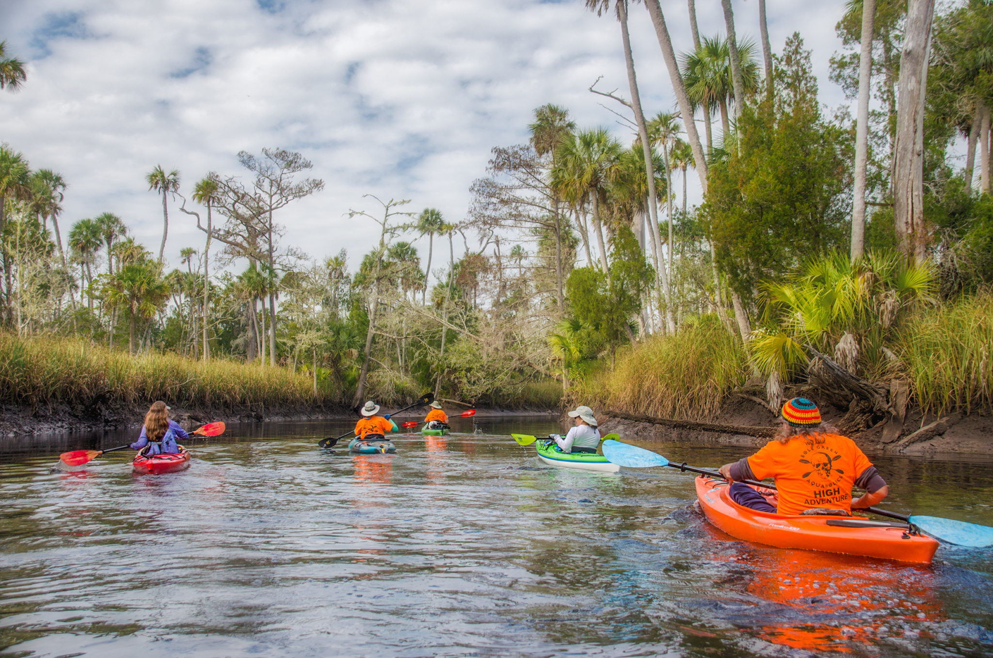
It was a cool morning in the upper 60°s but by launch time, just after 11 am, it was beginning to warm under mostly cloudy skies. The breeze, at this point, was light but steadily increaseing paddling toward Otter Creek. The Waccasassa is affected by the tides from the Gulf of Mexico and we launched at low tide. The tide exposed considerable old tree trunks, rocks and the muddy banks as we paddled with the out-going current and a light breeze at our backs…usually it’s always the other way around! The skies were overcast which contributed to the eeriness of the weather-beaten landscape before us.
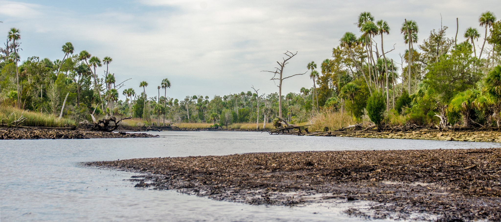
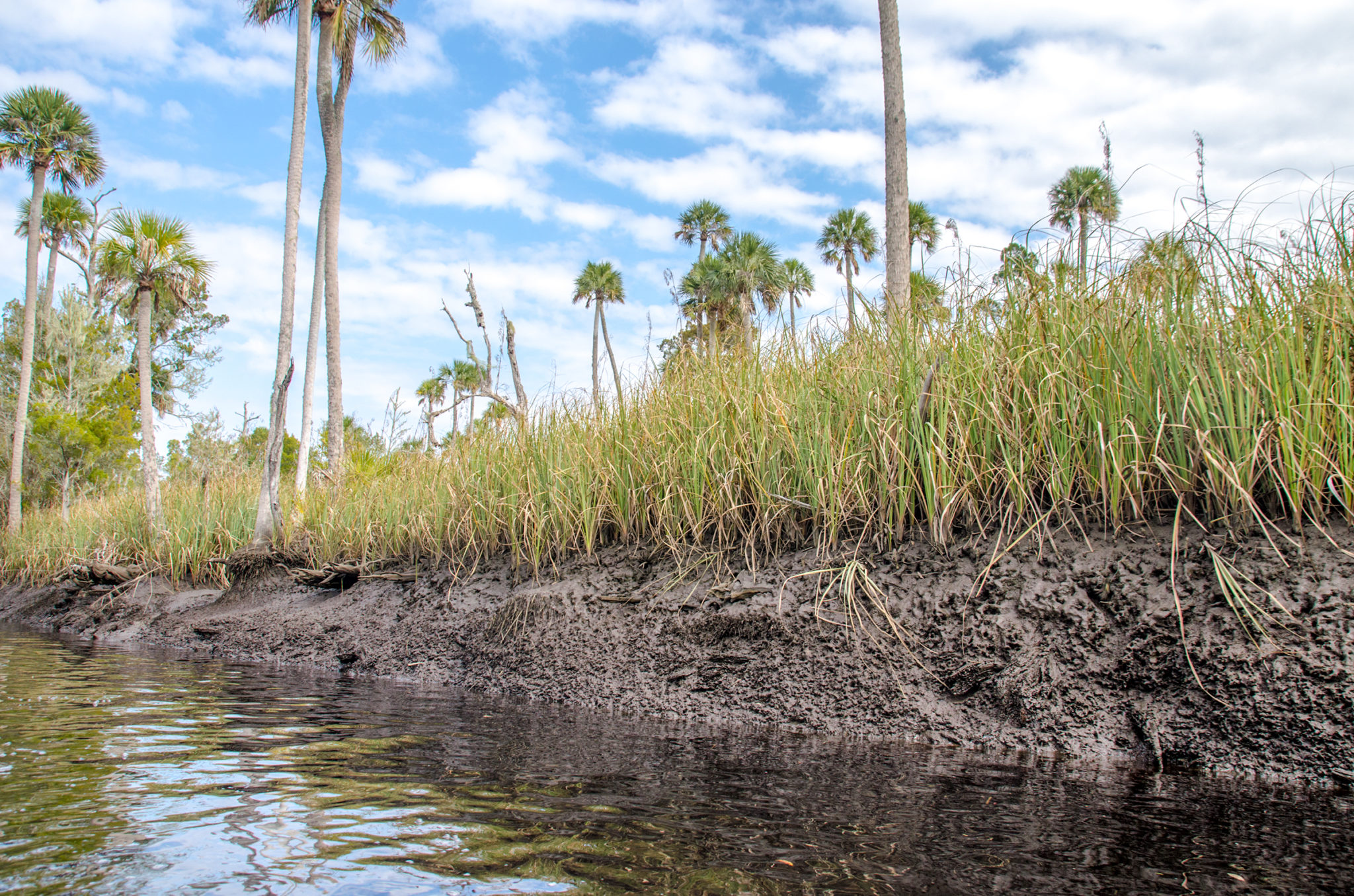
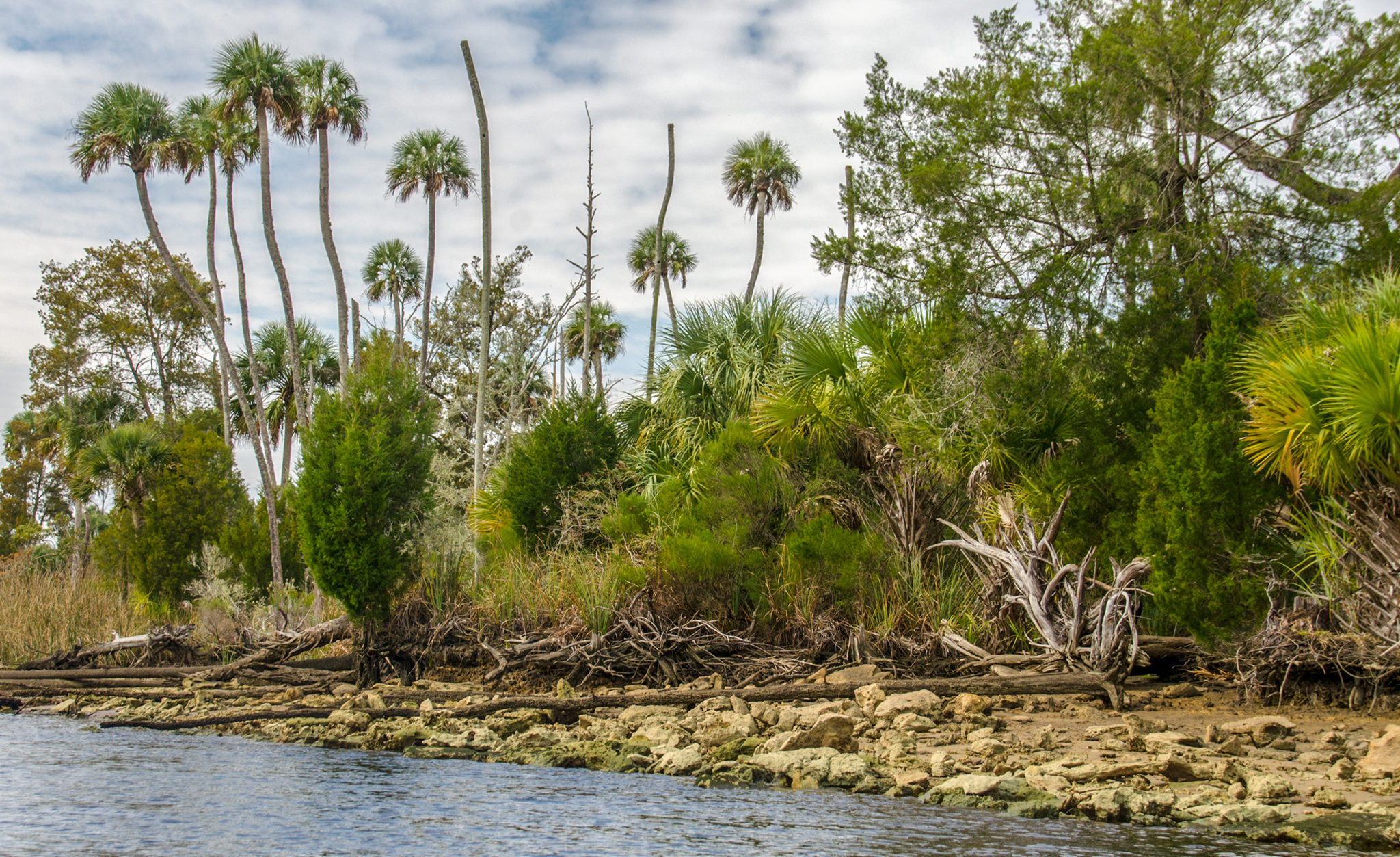
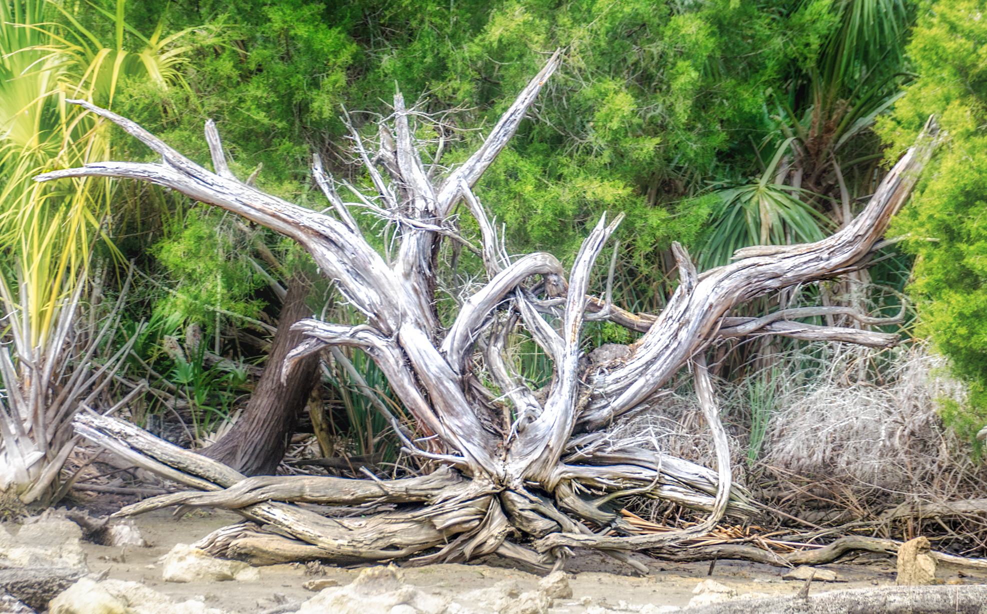
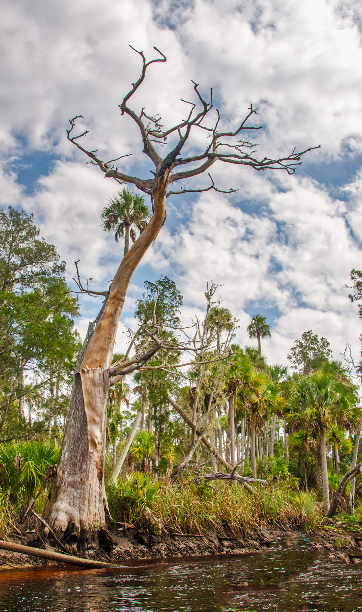
This area took a beating from several hurricanes over the past two years. Numerous trees were downed and tops blown off the tall Sabal Palmettos due to high winds. Erosion along the banks and the numerous dead and dying Bald Cypress were evidence of higher waters, stronger currents and the increased salinization of the water. Still, we were paddling through a true wilderness landscape, where the Waccasassa transitions from forested swamp to slat marshes. It has it’s own unique beauty and story.
Otter Creek…
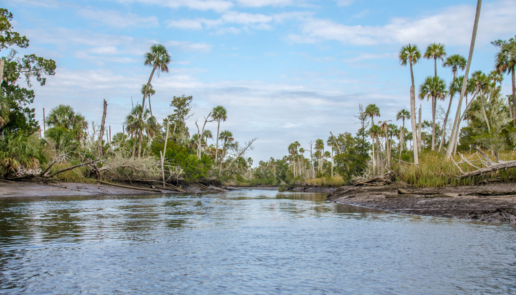
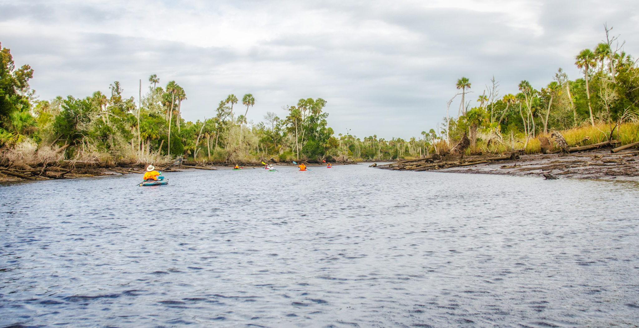
1.25 miles down from the launch is the confluence of Otter Creek and the Waccasassa River. Otter Creek is one of the four tributaries to the Waccassasa, along with Magee Branch, Wekiva River and Cow Creek. The creek’s source is 11 miles north from where it enters the Waccasassa.
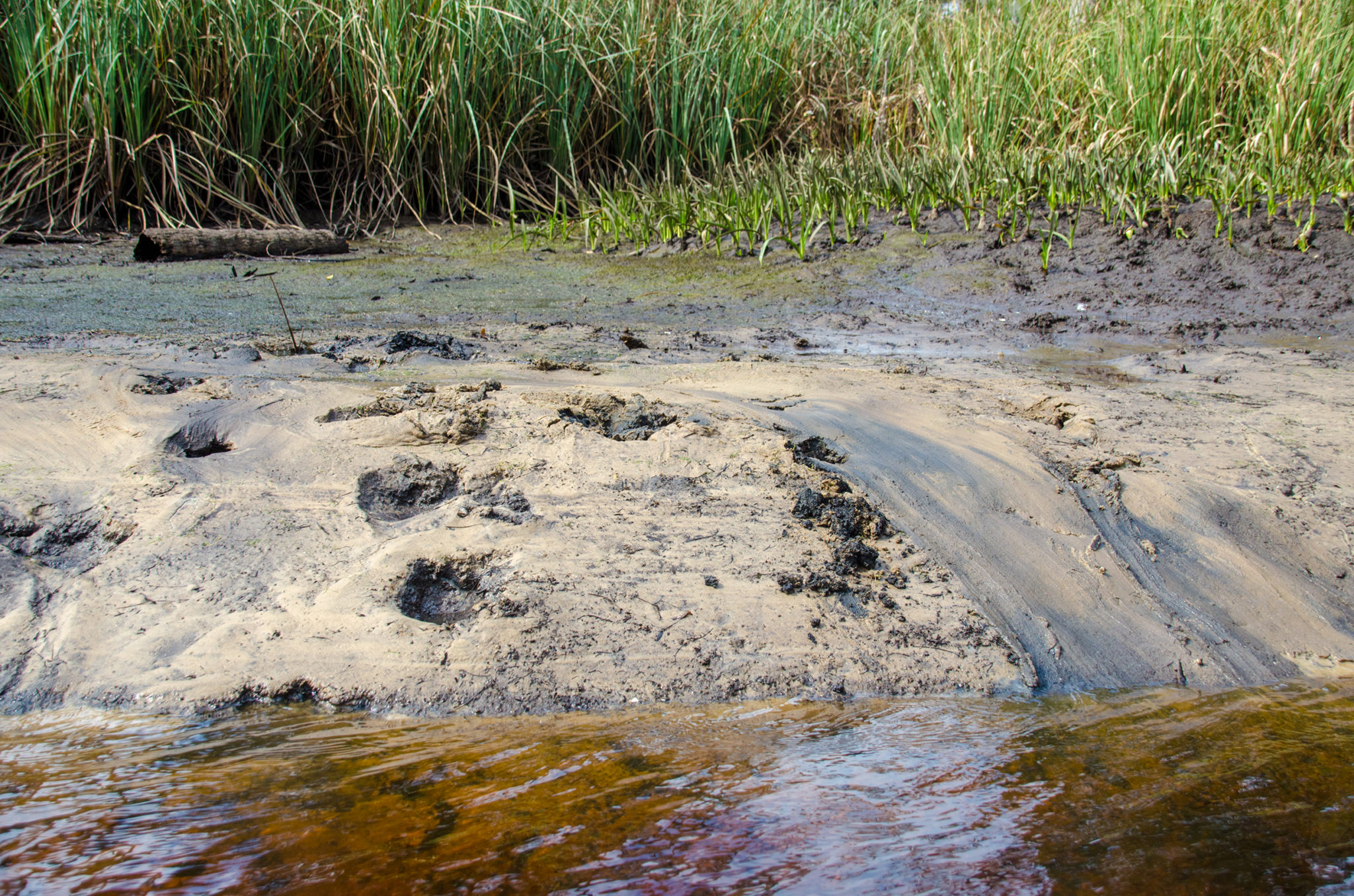
Being low tide, we paddled against a medium current and at times a strong current, depending on the bends in the river. The banks confirmed the tide difference in the creek, being 3.25′. The shoreline was exposed and muddy. At points it was a sharp vertical drop from land to water and at other points it was a gradual slope of exposed mud.
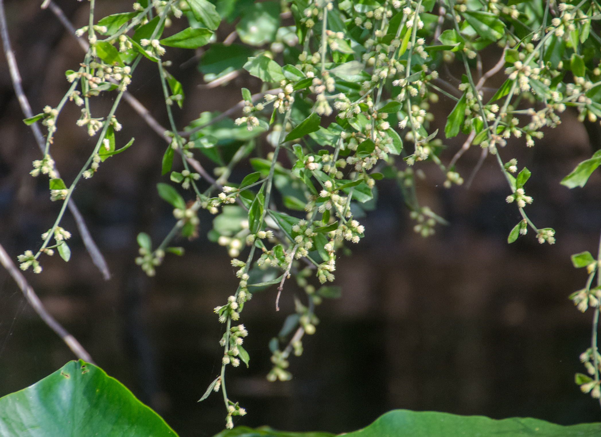
Flora and Fauna…
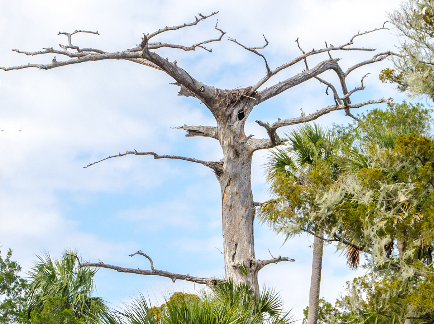
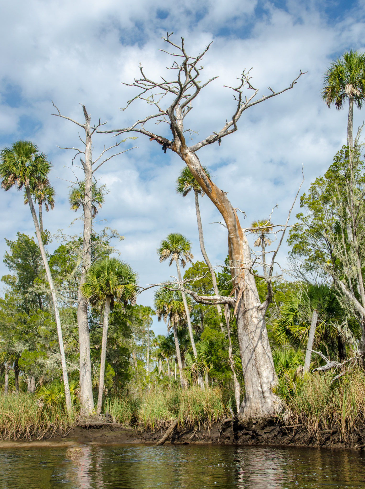
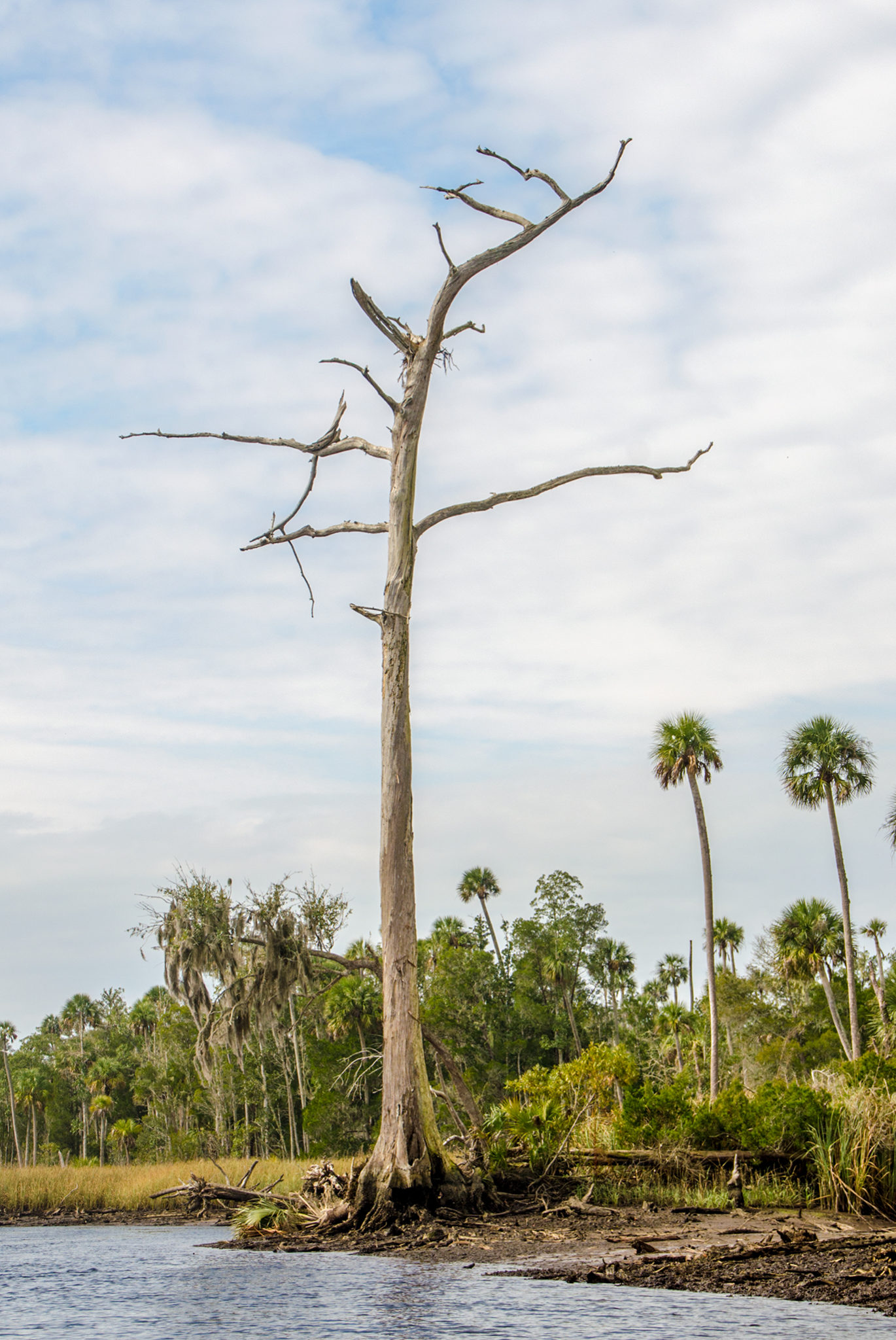
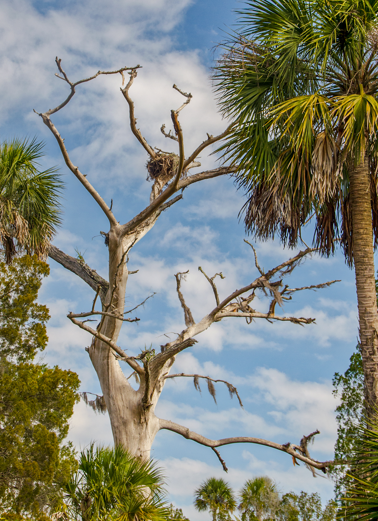
Otter Creek ranged in width from 80′ down to 40′ for this particular paddle. Along the banks, a solid growth of Sawgrass accented the Red Cedar, Sea Myrtle, False Willow, not yet dead Cypress and Sabal Palmettos. Towering among the tall palms were the decaying trunks of old, tall Bald Cypress trees, now skeletons among the landscape and home to numerous Osprey nests.
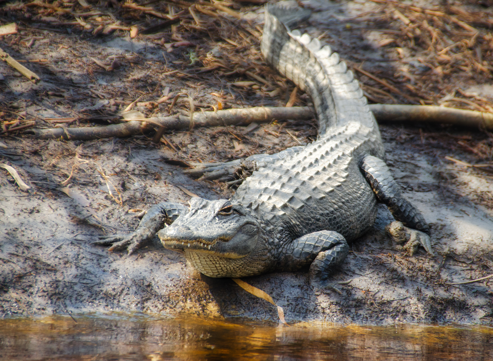
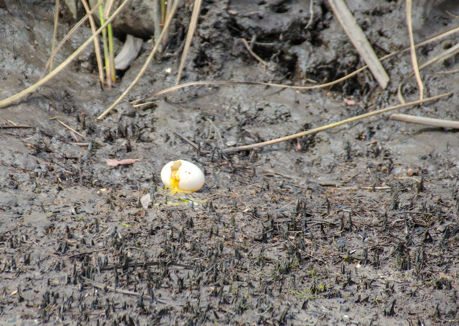
Paddling by several of the tall Cypress trees with nests, Ospreys called out flying overhead. Along the shore a raccoon was noticed scurrying in the brush. Several eggs were seen in one area along the bank, broken with yolk still noticeable…perhaps our sounds scared some culprit away. Two alligators were spotted, one slipping into the water and the other smaller one, standing his ground as I paddled close for a photo.
Shoals and Return…
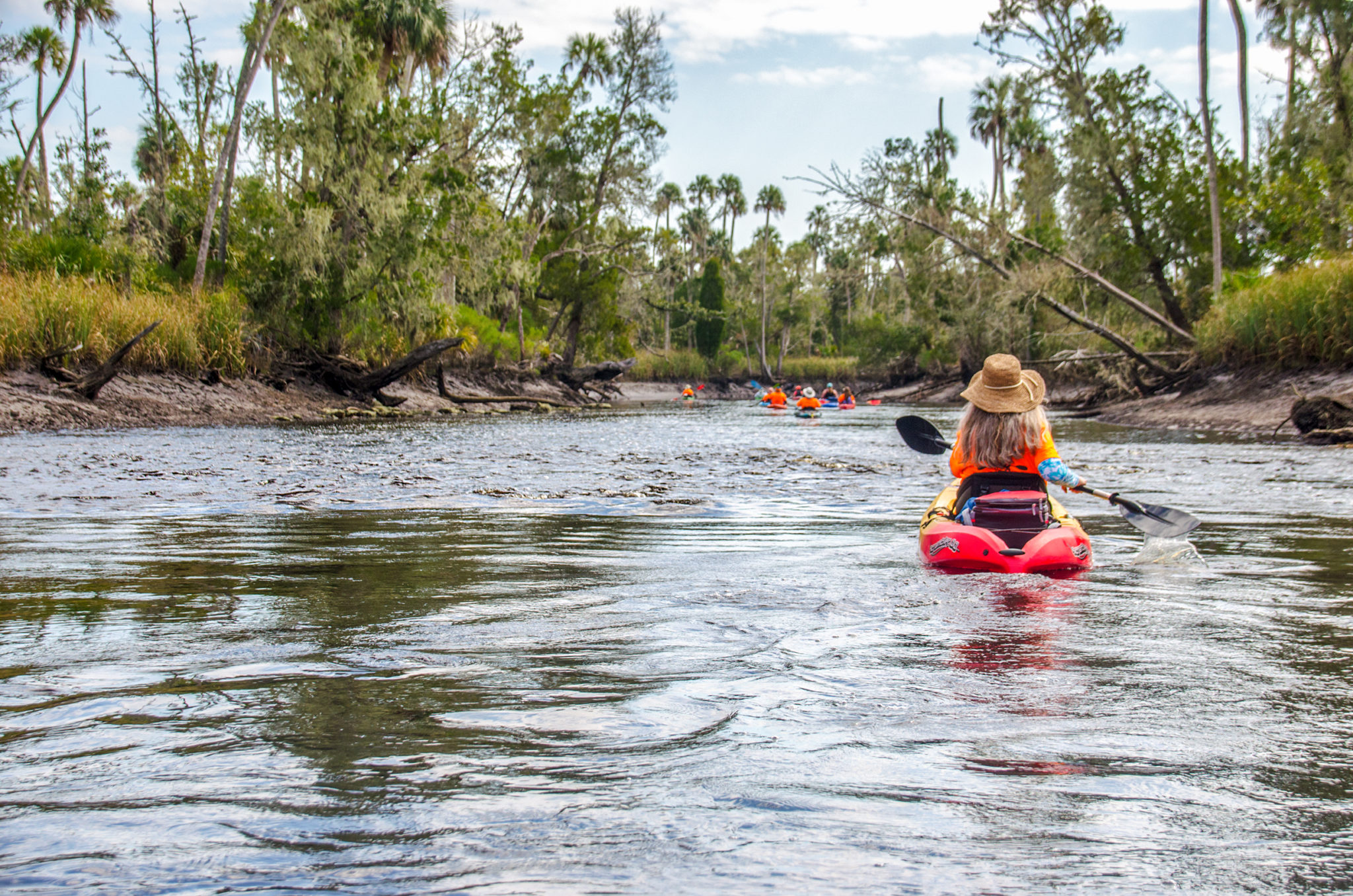
An unexpected treat was 1/2 mile up Otter Creek. The water was moving fast and choppy and as we immediately realized we were paddling on a shoal! Not a foot below the surface were numerous rocks and, being low tide, created a shoal that was challenging to get through while paddling against the current…definitely more fun on our return trip back when going with the flow!
We paddled up Otter Creek 1 1/2 miles and decided to turn around and head back. To keep going we most likely would have gotten only a half mile further due to the creek narrowing and it being low tide. It was pleasant and relaxing, paddling back and running the shoals with the current…reaching the Waccasassa River though was a rude awakening!
Turning the corner from Otter Creek onto the Waccasassa was an exercise in stamina! The now increased wind, gusting to 20 mph+, was coming directly down river and that final 1.25 miles had everyone giving their all against the wind. After a couple of brief rest stops, the boat ramp ahead was a site for sore eyes!
Thanks to the Boll Green Aquaholics for another interesting day of Florida’s waterways, thus ending another chapter in Florida Paddle Notes!
Otter Creek Photo Gallery:

![]()