
Brief Overview…
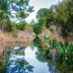
Halfmoon Lake is an approximately 500 acre lake, located in the Ocala National Forest, East of Silver Springs, in a protected Federal Forest. The lake is open, with minimal access to the shoreline except in a few areas. There is a thick growth of blackberry brambles throughout the shoreline, along with assorted reeds, rush and Sawgrass. Wax Myrtle, Dahoon Holly, Sandweed, Saltbush and Red Maples also line portions of the shoreline. Once on higher ground, Pines, Palms and Oaks are the dominant trees.
Halfmoon Lake displays evidence of variable water levels over the years. Vegetation extends out anywhere from a 1/4 mile to a 1/2 mile from the original shoreline along the southeasterly, southern, western and northwestern banks as evidence of prolonged low water levels. Once shaped like a halfmoon, the lake is now actually two lakes, the larger lake in the southern portion is approximately 330 acres, while the northern portion is a small 30 acre pond in the area called Bear Hole. Locals talk of a 400 lb bear that roams the area. What now is left of the halfmoon, are two bodies of water connected by a narrow 12′ ‘canal’ that cuts through what is now a shallow prairie wetland. Compare the difference of a non-satellite view of the lake to a satellite view…quite a difference!

Outlet River Details:
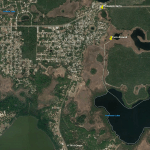
![]() Location: Halfmoon Lake is approximately 15 miles East of Silver Springs South of Highway 40 in Marion County.
Location: Halfmoon Lake is approximately 15 miles East of Silver Springs South of Highway 40 in Marion County.
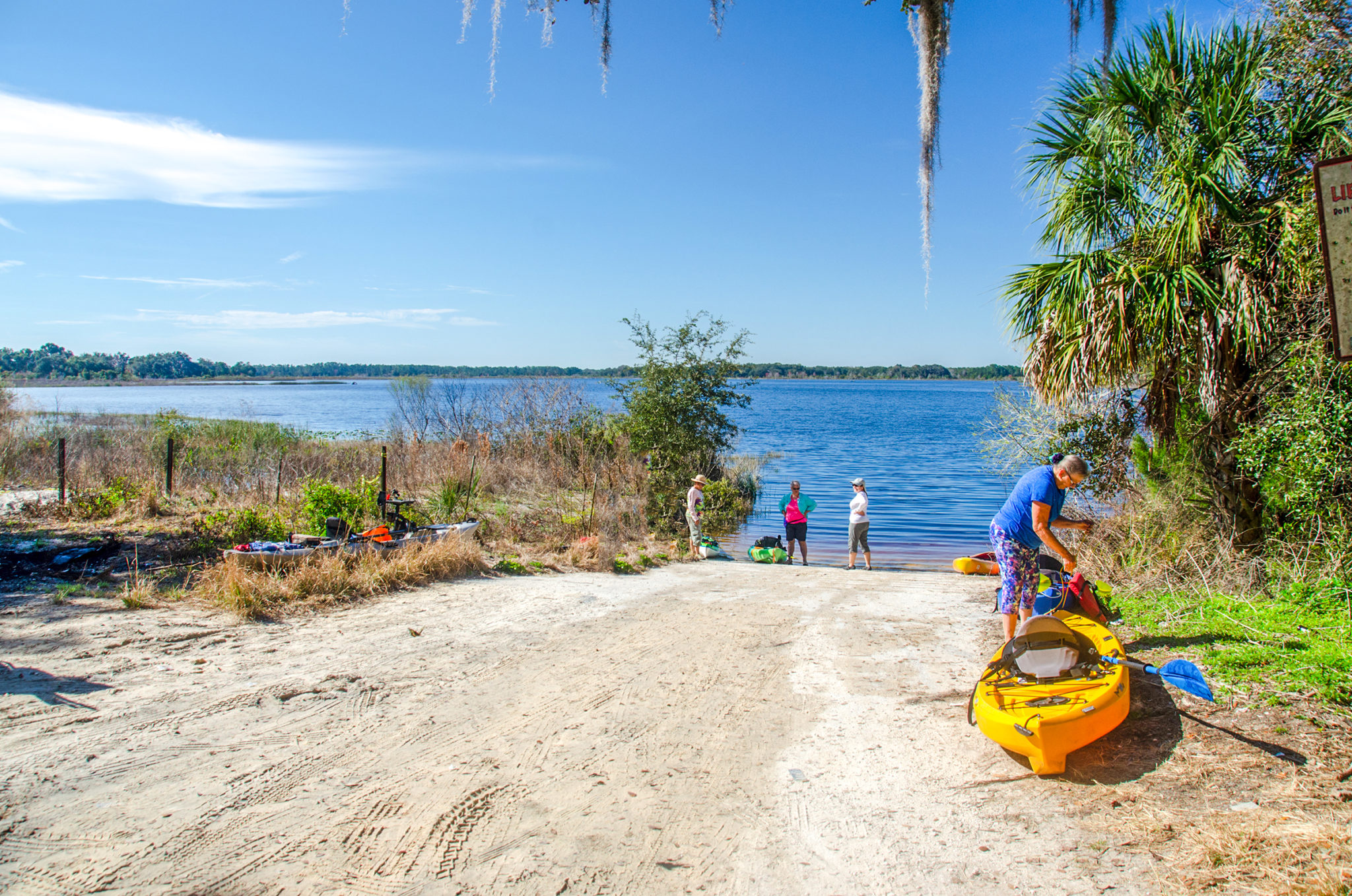
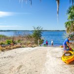
![]() Launch/Take Out point: The launch is located at Forest Road 79-2, Marion County, Ocklawaha, 32179 Latitude 29° 9.5448′ Longitude 81° 49.2714′
Launch/Take Out point: The launch is located at Forest Road 79-2, Marion County, Ocklawaha, 32179 Latitude 29° 9.5448′ Longitude 81° 49.2714′
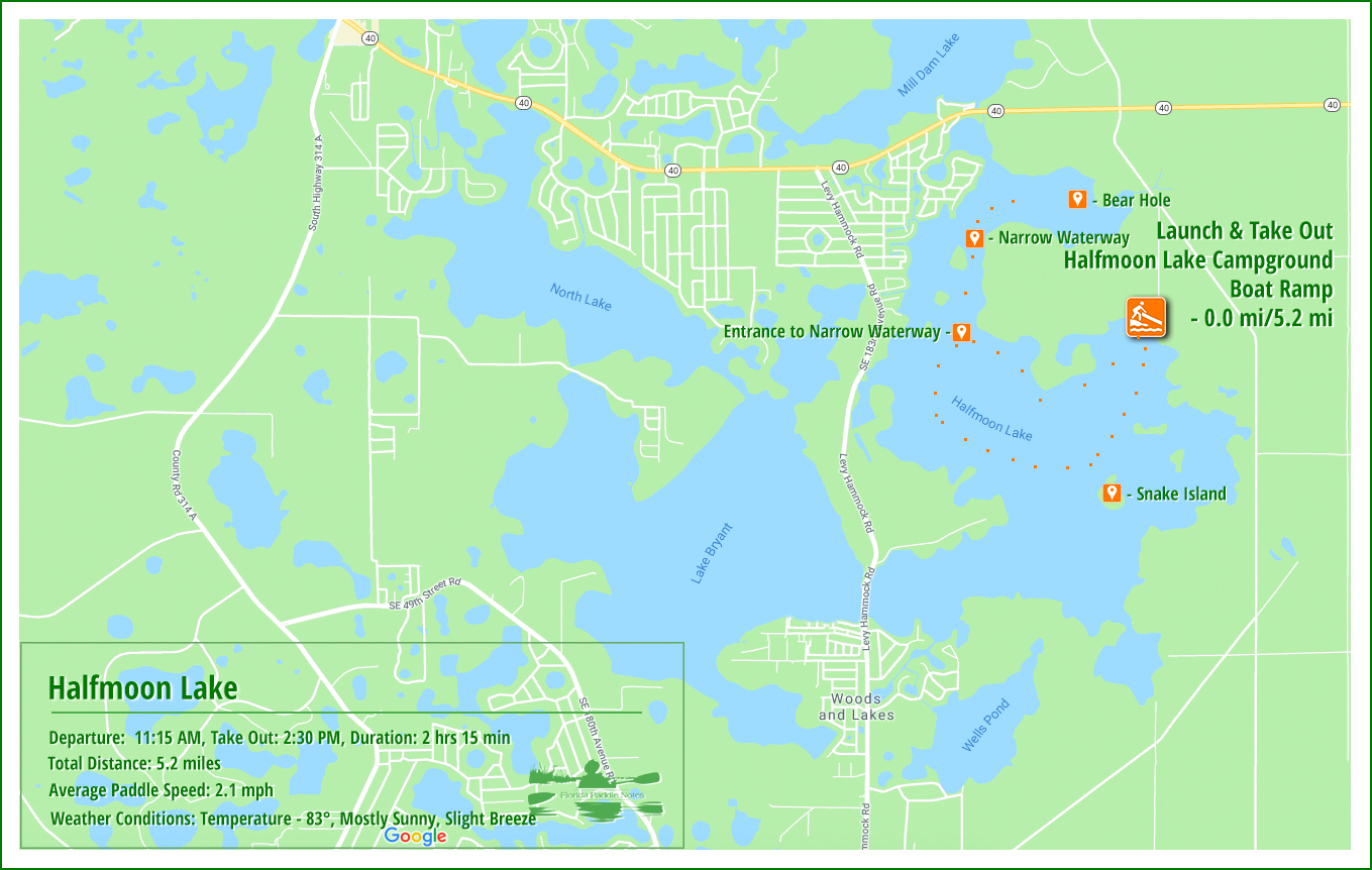
![]() Paddle Distance: Paddling the perimeter of the lake and exploring to the north section and back was 5.2 miles.
Paddle Distance: Paddling the perimeter of the lake and exploring to the north section and back was 5.2 miles.
![]() Difficulty: Easy.
Difficulty: Easy.
![]() Paddle Speed: Average paddle speed 2.1 mph.
Paddle Speed: Average paddle speed 2.1 mph.
![]() Width and Depth: Average depth, according to fishing information is 10-15′ in the middle and 3′ – 4′ along the shoreline. In the small canal-like waterway the depth was 3′ and the width was about 12′
Width and Depth: Average depth, according to fishing information is 10-15′ in the middle and 3′ – 4′ along the shoreline. In the small canal-like waterway the depth was 3′ and the width was about 12′
![]() Current – Tidal: Not tidal, no flow.
Current – Tidal: Not tidal, no flow.
![]() Side Paddles: The main side paddle is along the Northwest side of the lower lake, 29° 9’29.52″N, 81°50’9.99″W. Paddling into this canal leads up into a prairie-like wetland known as Bear Hole.
Side Paddles: The main side paddle is along the Northwest side of the lower lake, 29° 9’29.52″N, 81°50’9.99″W. Paddling into this canal leads up into a prairie-like wetland known as Bear Hole.
![]() Rest Areas: There are no rest facilities except on the southern shoreline where there is a dock and an RV Resort. Also, if necessary, it is possible to exit a kayak on the narrow passageway paddling north to Bear Hole.
Rest Areas: There are no rest facilities except on the southern shoreline where there is a dock and an RV Resort. Also, if necessary, it is possible to exit a kayak on the narrow passageway paddling north to Bear Hole.
![]() Important Information: Most of this paddle is in the open. Depending on the time of year, be prepared for strong breezes, exposure to sun and insects.
Important Information: Most of this paddle is in the open. Depending on the time of year, be prepared for strong breezes, exposure to sun and insects.
Halfmoon Lake Paddle Map…
Halfmoon Lake…
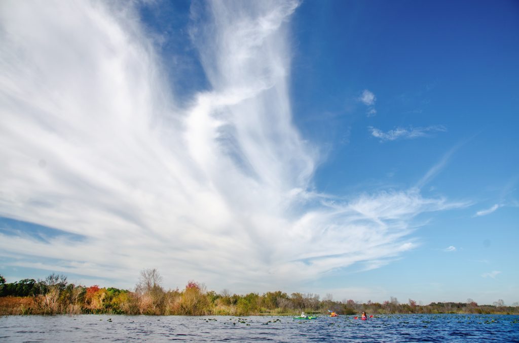
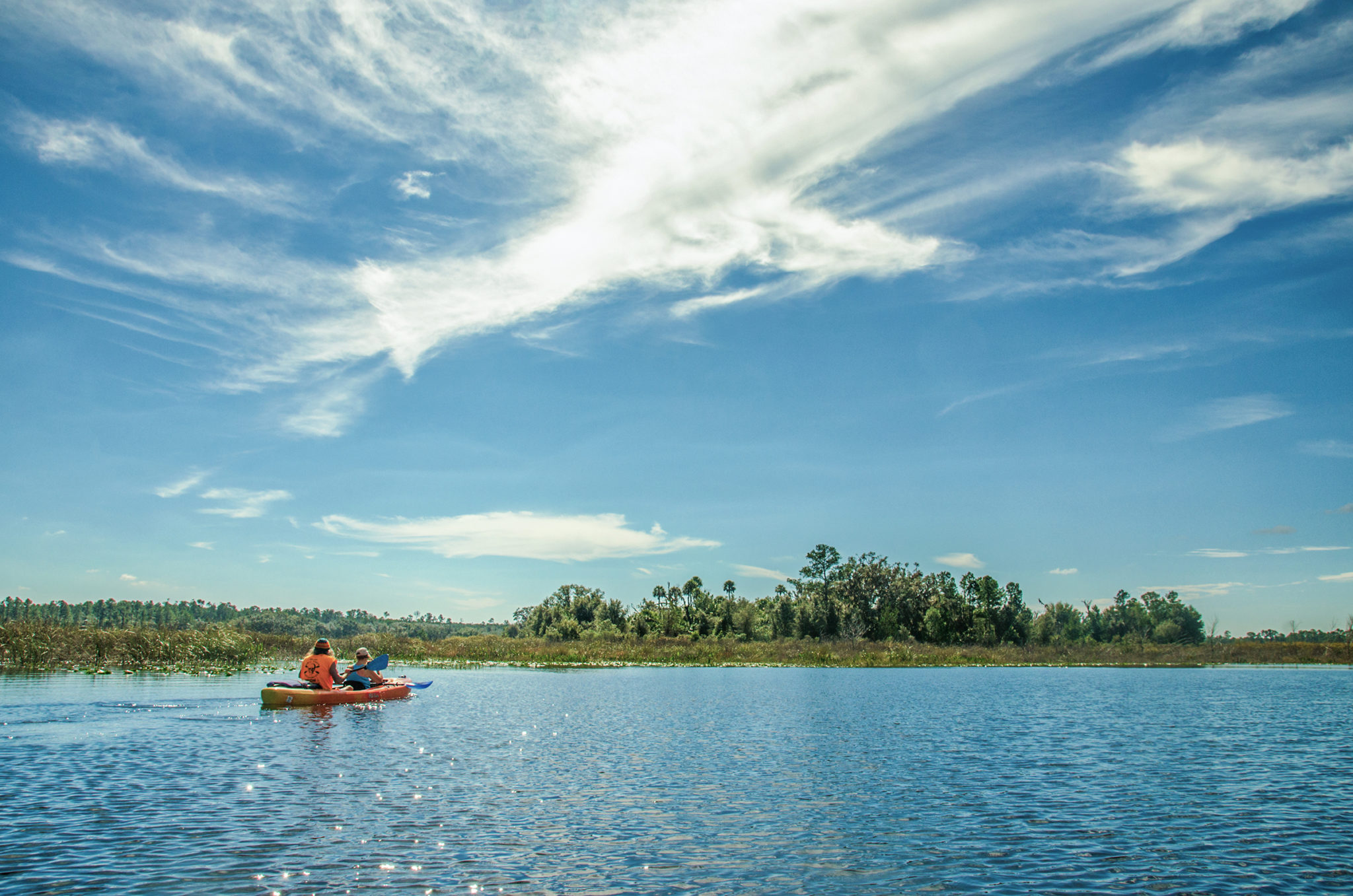
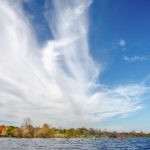
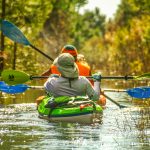
 I must admit, when I got to the ramp and looked out onto Halfmoon Lake for the first time, there wasn’t a lot to peak my enthusiasm for this paddle. It was very open without many trees along the shoreline, but it was a beautiful February day with a high at 83° and my first time back on the water in 4 weeks!
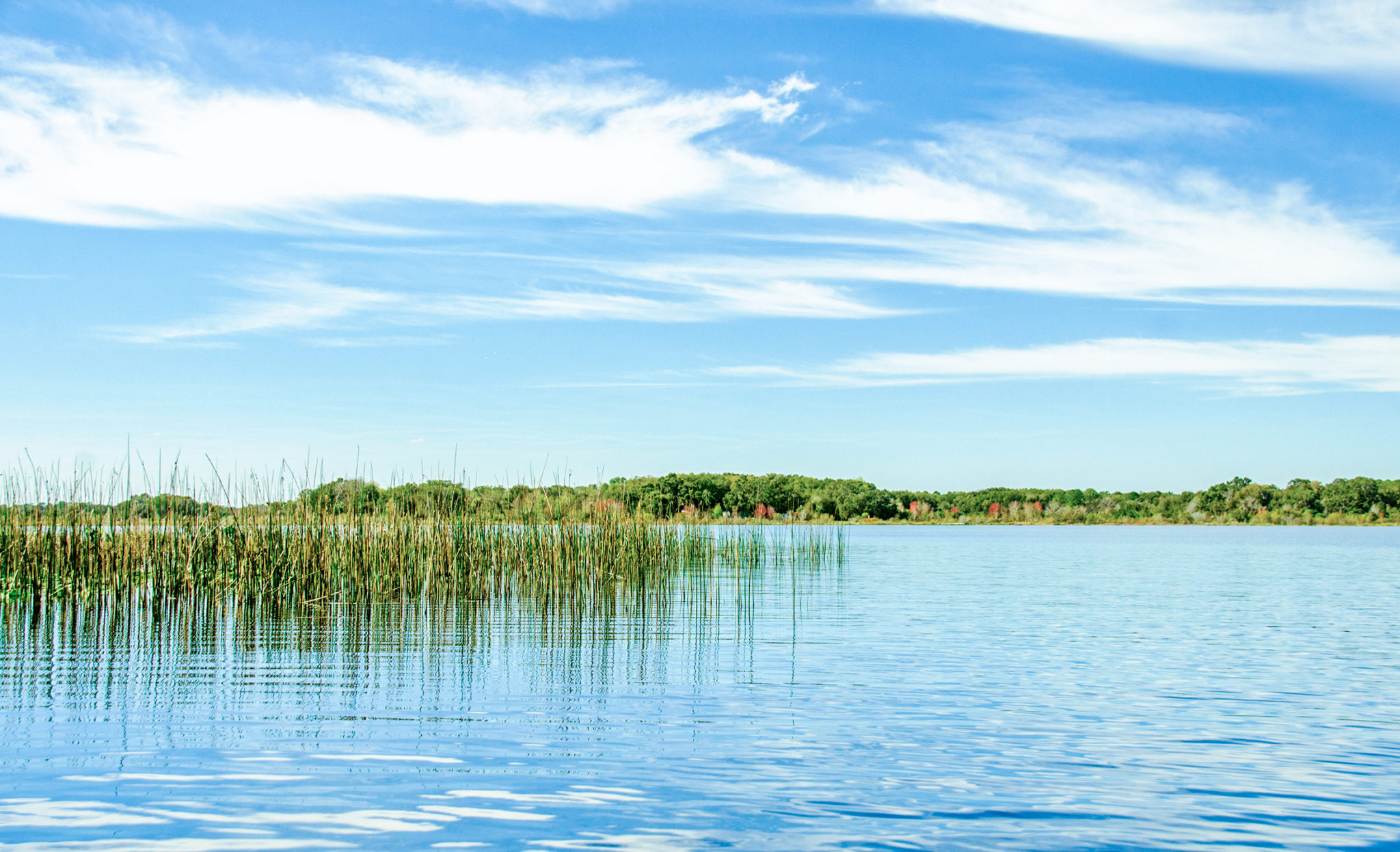
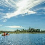
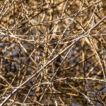
We paddled to the left to begin circumnavigating the shoreline…if you could call it a shoreline. Due to many seasons of low water levels the vegetation extended well over a 1/4 mile or more out from the true shoreline to the East. We paddled alongside the Rush that buffered large expanses of blackberry brambles which were like barbed wired! We ventured into a side opening thinking it would lead us closer to Snake Island which was ahead to our left, but it led only into a formidable barrier of briars!
Snake Island was no longer and island but a land mass buffered by Wax Myrtle, Saltbush and very sharp blackberry bushes, dead and devoid of leaves due to the water level being a few feet higher than normal. We passed Snake Island, with its palms and trees towering high and with it’s protective barrier keeping us away.
The Unexpected…
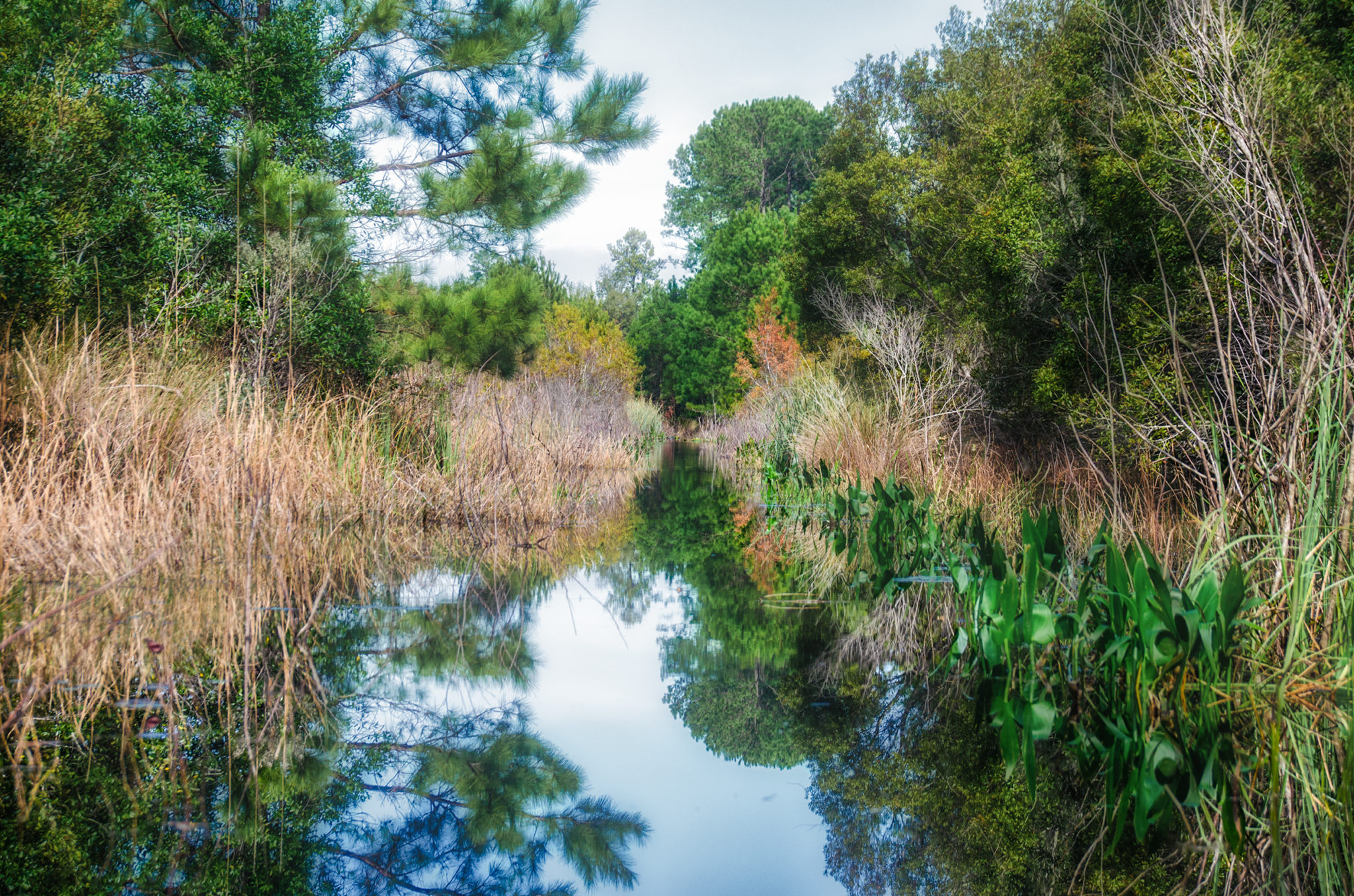
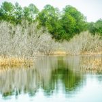
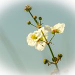
While uneventful, paddling along the southern end of the lake was relaxing. The February clouds were dramatic and wistful in a rich blue sky. Along the shore Duck Potatoes were in full bloom and the bright samaras on the Red Maples stood out against the deep blue backdrop. After rounding the western side of the lake, there was a small narrow waterway leading North. Time to check it out. Lined with blackberries, Pines, Hollies and Wax Myrtle we paddled up into this waterway for 3/4 mile.
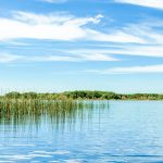
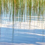
This narrow waterway, barely 3′ deep and 12 – 14′ wide, was the only remaining passage that connects the north portion of Halfmoon Lake with the southern part. To the West, where the lake used to be, was now just a wetland prairie. Paddling up the waterway led to the entrance of the area known as Bear Hole. Ahead was a landscape of wetland reeds and grasses, and the skeletal remains of trees now bare for the winter, some dead due to water levels. It had a unique attractiveness to it though and offered incentive for a future exploration.
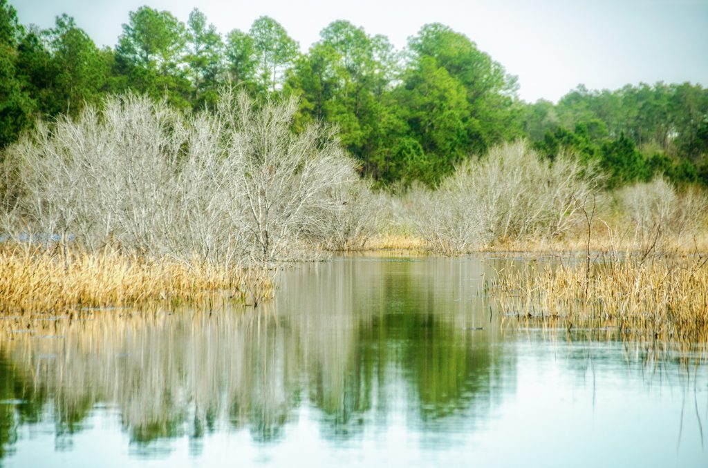
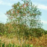
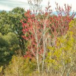
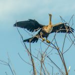
Wildlife was scarce except Anhingas drying their feathers in trees and Blackbirds along the shore. The Duck Potato blooms and Red Maple samaras provided the color and the bare trees, brown grasses and green Rush gave texture and color. We enjoyed the paddle and will return…perhaps in Blackberry season! This ends another chapter in Florida Paddle Notes!
Halfmoon Lake Photo Gallery:

![]()