Brief Overview…
The Outlet River was at one time a canal, dug in the 1800’s to connect citrus growers and cattle ranchers along the Withlacoochee River to the rail head located in the town Lake Panasoffkee. Lake Panasoffkee, which is Indian for “Valley of Water” is the third largest lake in Florida with a surface area of approximately 4100 sq ft. and a mean depth of 3′. The lake is designated an Outstanding Florida Waterway.
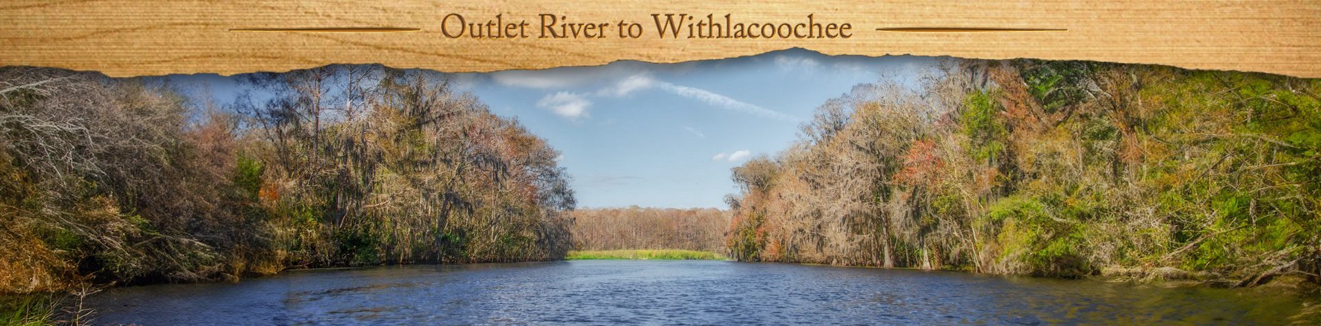
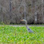
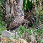
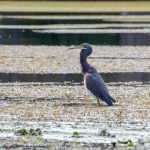
The 2 mile long Outlet River varies from 115′ to 180′ wide as it meanders WSW from Lake Panasoffkee to the Withlacoochee River. The Withlacoochee River starts in the Green Swamp in west Central Florida, flowing North. At mile 42, the Outlet River meets the Withlacoochee in Princess Lake. Princess Lake is a wide area in the Withlacoochee River that has several floating islands of vegetation known as tussocks. These large masses of grass and shrubs host a wide variety of water birds to include Herons, Egrets, Kites and Limpkins, which are known for their distinctive call.
Coogler/Wysong Dam
The Wysong-Coogler Water Conservation Structure (originally constructed in 1965) is located at Wysong Park in Lake Panasoffkee. The structure spans the Withlacoochee River in Citrus and Sumter counties 2.5 miles north of the Lake Panasoffkee Outlet River. The structure’s inflatable dam can be remotely operated to help maintain water levels in Lake Panasoffkee and the Tsala Apopka chain of lakes. This structure also has a boat lock and an airboat slide to allow navigation of the Withlacoochee River
In 1981, water levels in Lake Panasoffkee dropped to levels that had not been seen since 1965, the year the Wysong Dam was built. Southwest Florida Water Management District officials discussed the construction of a temporary dam to elevate water levels. Lake Panasoffkee residents believed that the Wysong Dam contributed to the destruction of the Withlacoochee River. The dam remained in use for 22 years, however in 1988 the SWFWMD determined that it was having little to no effect on water levels and removed it. The dam was reconstructed in 2002 after the DEP determined it was needed to maintain Lake Tsala Apopka and Lake Panasoffkee water levels as well as to help groundwater recharge in the area. (TetraTech, Inc., 2004).

Outlet River Details:
![]() Location: Outlet River flows between Lake Panasoffkee and the Withlacoochee River in Sumter County.
Location: Outlet River flows between Lake Panasoffkee and the Withlacoochee River in Sumter County.
![]() Launch/Take Out point: The launch is located at Marsh Bend Outlet Park, 3101 N County Rd 470, Lake Panasoffkee, FL 33538.
Launch/Take Out point: The launch is located at Marsh Bend Outlet Park, 3101 N County Rd 470, Lake Panasoffkee, FL 33538.
![]() Paddle Distance: Paddling West on Outlet River and North on the Withlacoochee and back is approximately 6.5 miles.
Paddle Distance: Paddling West on Outlet River and North on the Withlacoochee and back is approximately 6.5 miles.
![]() Difficulty: Easy to moderate, based on the wind and sun exposure.
Difficulty: Easy to moderate, based on the wind and sun exposure.
![]() Average Paddle Time & Paddle Speed: 1 hr 10 min going and 1 hr 45 min return ( which included a stop ). Average paddle speed 2.6 mph.
Average Paddle Time & Paddle Speed: 1 hr 10 min going and 1 hr 45 min return ( which included a stop ). Average paddle speed 2.6 mph.
![]() Width and Depth: Average width of outlet River was 150′, Average width of the Withlacoochee River was 400′. The Withlacoochee water level is considered ideal for paddling at 38′. Today our level was 39.22
Width and Depth: Average width of outlet River was 150′, Average width of the Withlacoochee River was 400′. The Withlacoochee water level is considered ideal for paddling at 38′. Today our level was 39.22
![]() Current – Tidal: Not tidal, flow was very slow.
Current – Tidal: Not tidal, flow was very slow.
![]() Side Paddles: Other than exploring around the islands in Princess Lake or venturing South on the Withlacoochee there are no side paddles to speak of.
Side Paddles: Other than exploring around the islands in Princess Lake or venturing South on the Withlacoochee there are no side paddles to speak of.
![]() Rest Areas: Restroom facilities at the launch, there is a nice stopping point at 28°48’7.76″N, 82°10’37.79″W, along the North bank. Nice oaks and an old hollow Cypress. Numerous shells indicate usage at one time by perhaps native Indians. There are facilities at The Dam Pub as well.
Rest Areas: Restroom facilities at the launch, there is a nice stopping point at 28°48’7.76″N, 82°10’37.79″W, along the North bank. Nice oaks and an old hollow Cypress. Numerous shells indicate usage at one time by perhaps native Indians. There are facilities at The Dam Pub as well.
![]() Important Information: Most of this paddle is in the open. Depending on the time of year, be prepared for strong breezes, exposure to sun and insects.
Important Information: Most of this paddle is in the open. Depending on the time of year, be prepared for strong breezes, exposure to sun and insects.
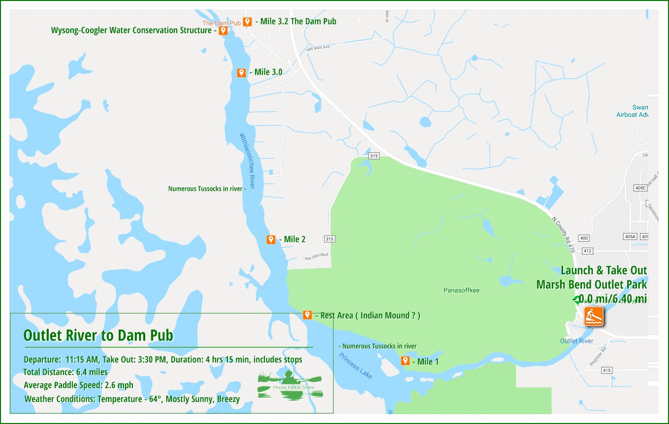
Outlet River Paddle Map…
The Launch at Marsh Bend Outlet Park…
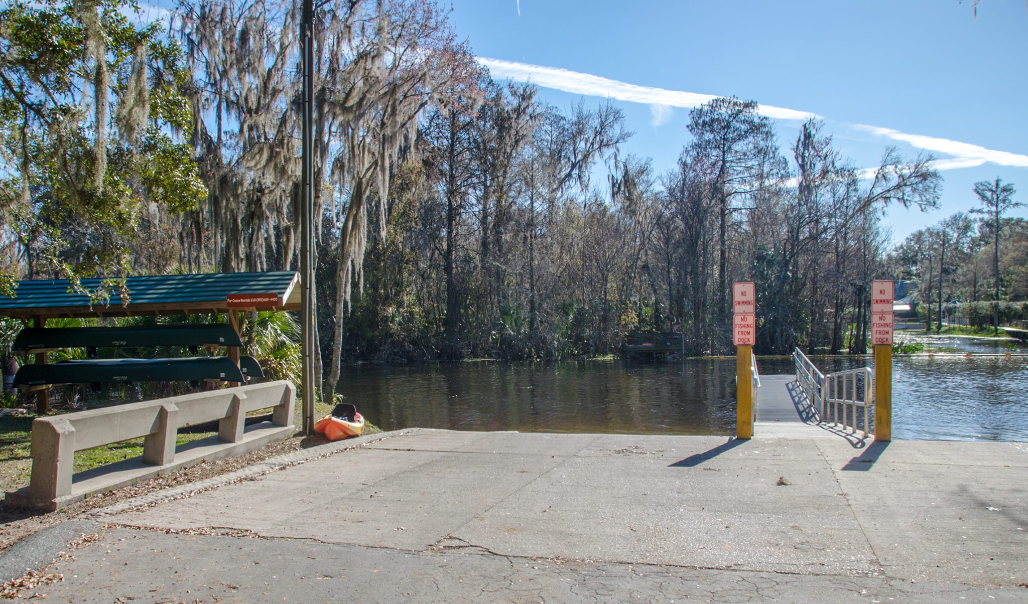
It was a chilly morning when we arrived and a bit breezy, mid-50’s but sunny! The launch at Marsh Bend Outlet park is nice and there is ample parking, no fees charged. The launch is on the Outlet River about halfway between Lake Panasoffkee and the Withlacoochee River. Be prepared for airboats! This is definitely their territory and they will come cruising by, breaking the peaceful ambience the ear splitting airplane engines.
Outlet/Withlacoochee Rivers…
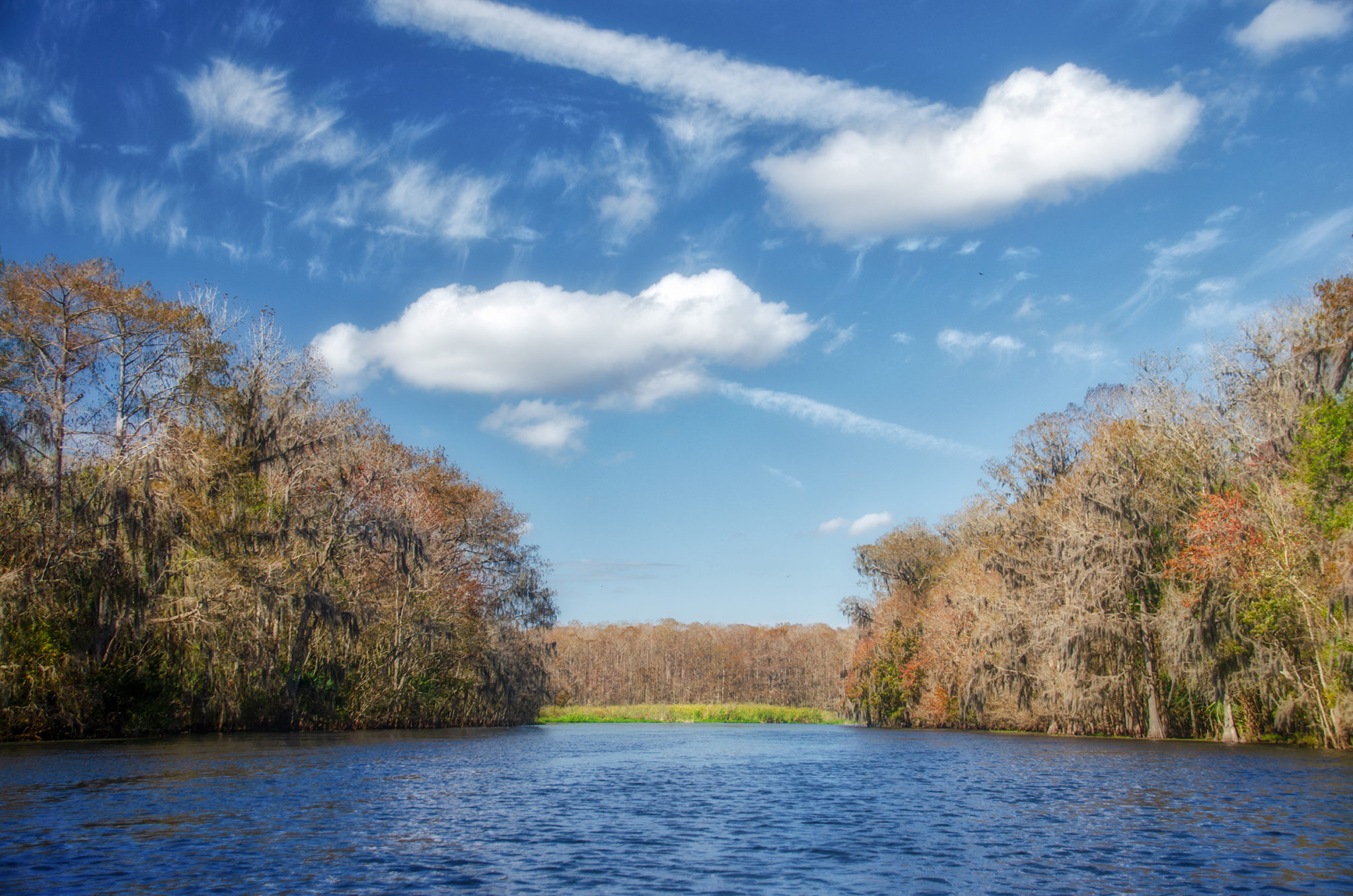
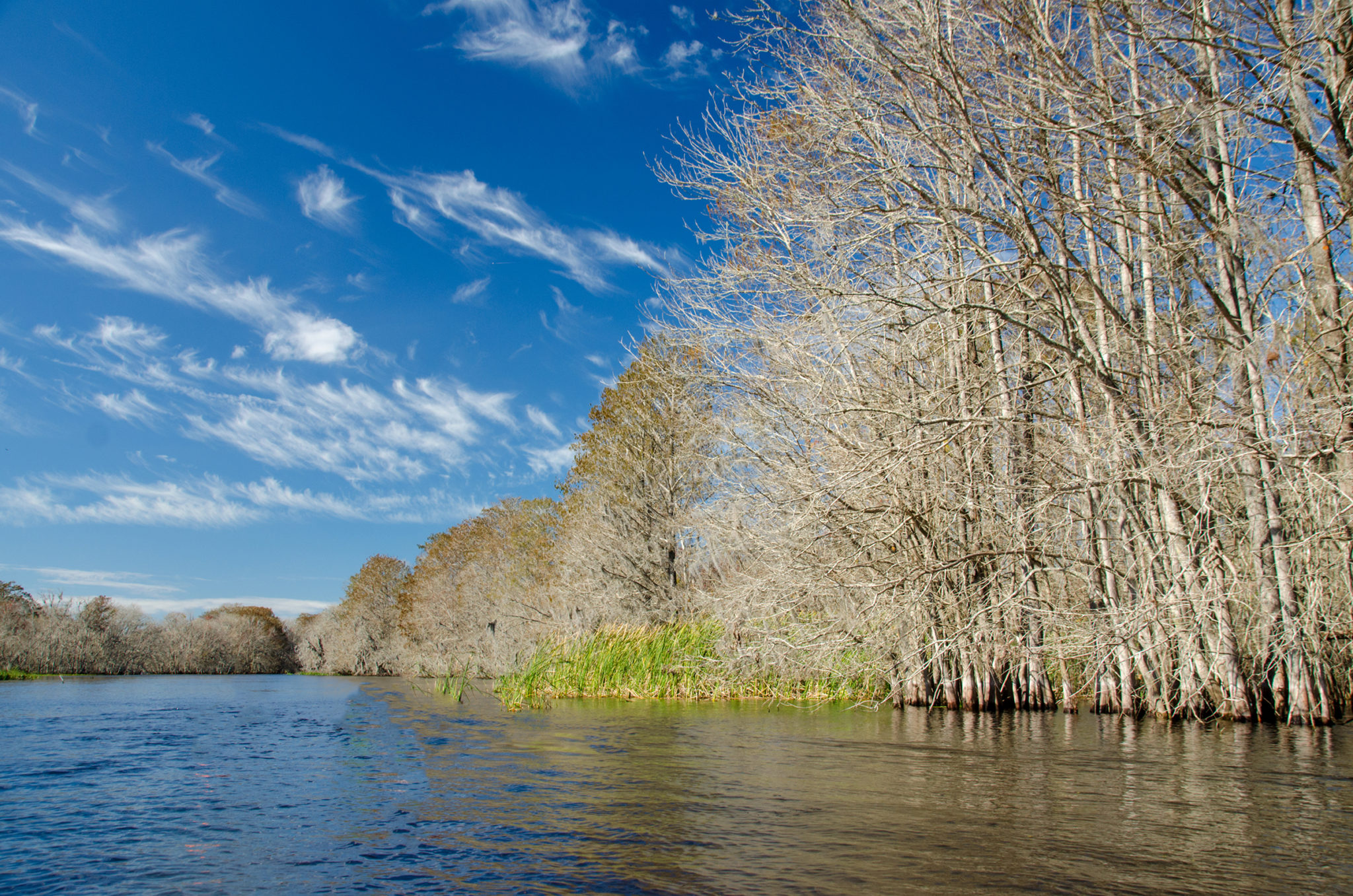
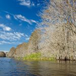
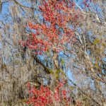
The Outlet River is wide and we kept to the side for the most part, so airboats were not that bothersome except for the noise. At the half mile mark there are obvious small islands that can be paddled around. These are mostly deciduous Bald Cypress, Bays and Tupelo. Red Maples still had their bright red winged samaras on many of the branches and the pale orange cypress leaves still cling on gave a nice contrast to the very blue sky. The flow along the river was minimal however we had a nice breeze to our backs as we ventured out.
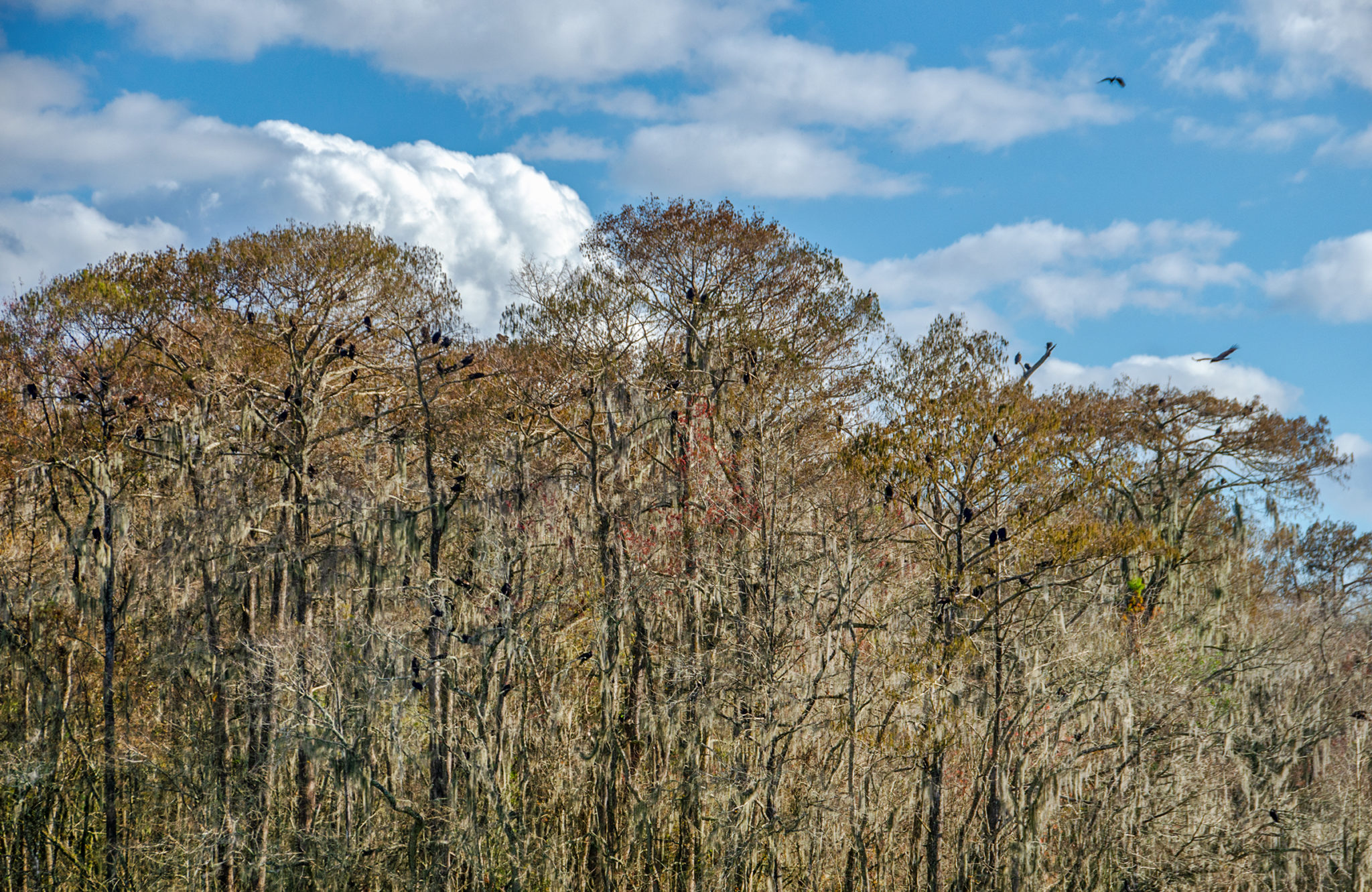
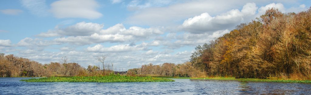
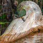
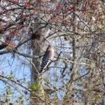
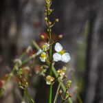
The borders of each side of the Outlet River was a combination of underwater hydrilla, scattered eel grass and above the surface Sawgrass, Smart Weed, Dollar Weed and patches of Pickerel Weed were prevalent. The river is open and by 3/4 mile into the paddle there are small islands of trees as mentioned above and the aquatic weeds were minimal. Here we enter Princess Lake, a widened section of the Withloochee River,42 miles from it’s source in the Green Swamp, flowing north to the Gulf of Mexico. Princess Lake is approximately 1500′ wide by 3000′ long, characterized by the numerous tussocks throughout. These floating masses of weeds and shrubs and flowering plants host numerous water birds and today there was no shortage. Herons, Egrets and Limpkins were busy feeding, while numerous buzzards flew overhead and roosted in trees.
We kept to the right and paddled the eastern shoreline while the occasional airboats keep well to the West of us, with tussocks as a buffer.
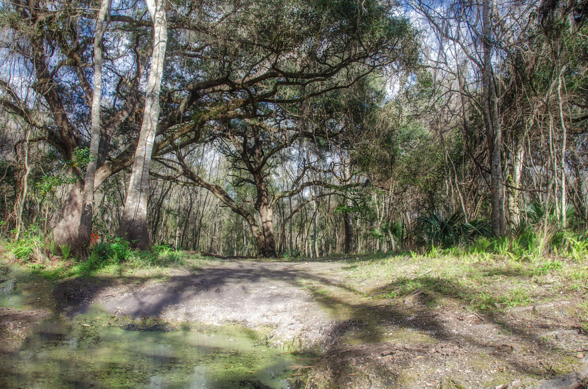
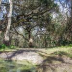
There is a pleasant rest stop after leaving Princess Lake on RR at about 1.46 miles, 28°48’7.76″N, 82°10’37.79″W. Some beautiful oaks, on high ground and the trunk of a large hollow Cypress tree. There are numerous shells here and we wondered if perhaps it could have been used by the local Indians at one time.
From here we continue our paddle to the destination, passing several canals on our right, giving river access to the local residents. The Dam Pub is just off the river, several hundred feet. We portaged our kayaks from the river up to the entrance gate to the pub property, visible from inside.
Bloody Marys, Cold Beer,light sandwich food and wings await us and we enjoy a nice break before hauling the kayaks back to the ramp and face a breezy 3.2 mile paddle back. By the time I reached the launch/take out I was tired, but enjoyed another adventure on Florida’s waterways and thus ending another chapter in Florida Paddle Notes.
Outlet River Photo Gallery:


![]()