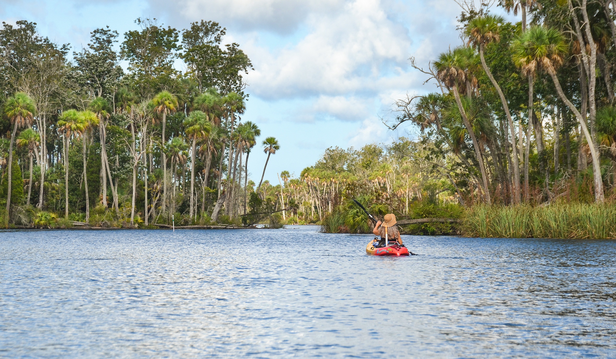
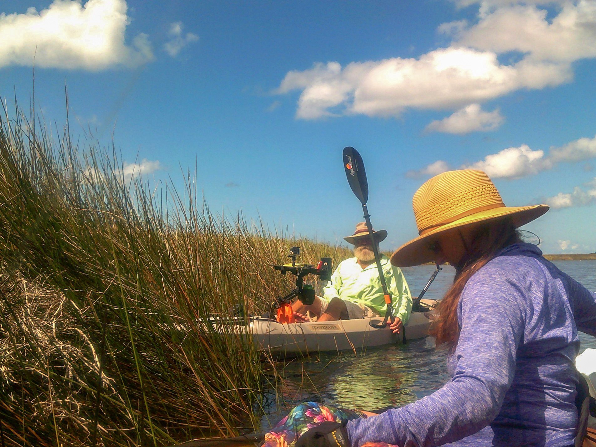
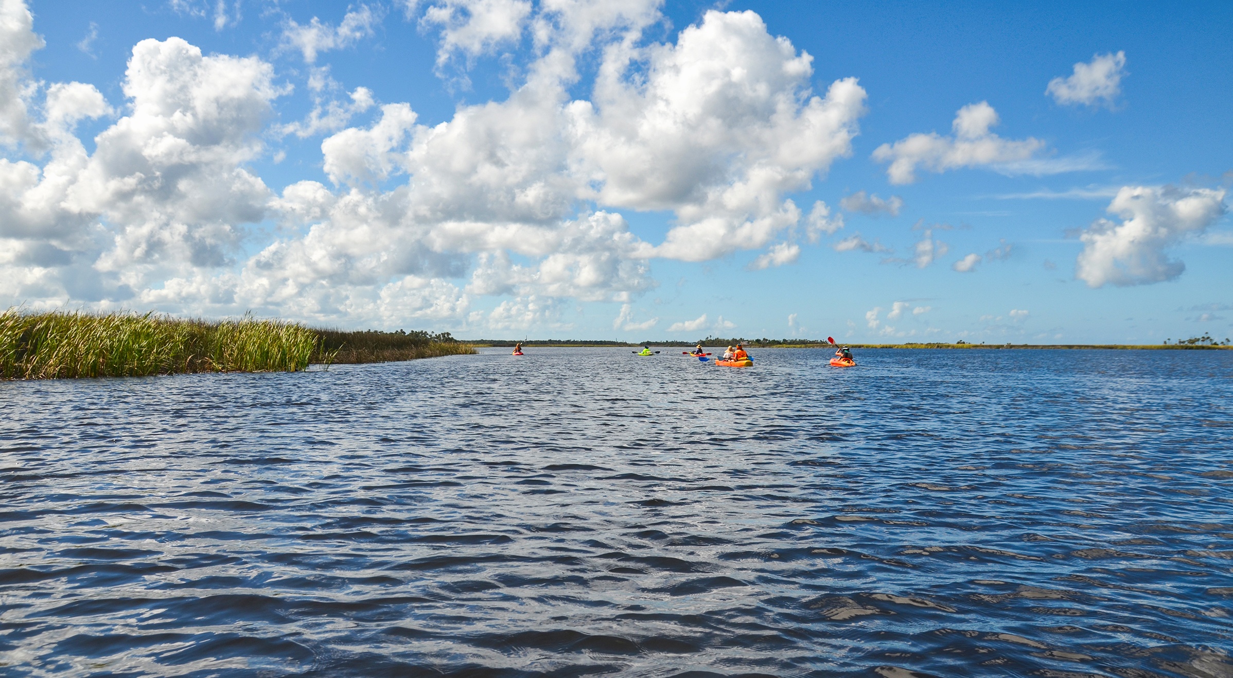
A beautiful Saturday afternoon in October and Florida Paddle Notes is on the Chassahowitzka River with the destination Beteejay Spring in Crawford Creek. It is a first time to paddle Crawford Creek as well as Beteejay Spring, the weather is perfect and we headed out looking forward to a new adventure! …James
![]()
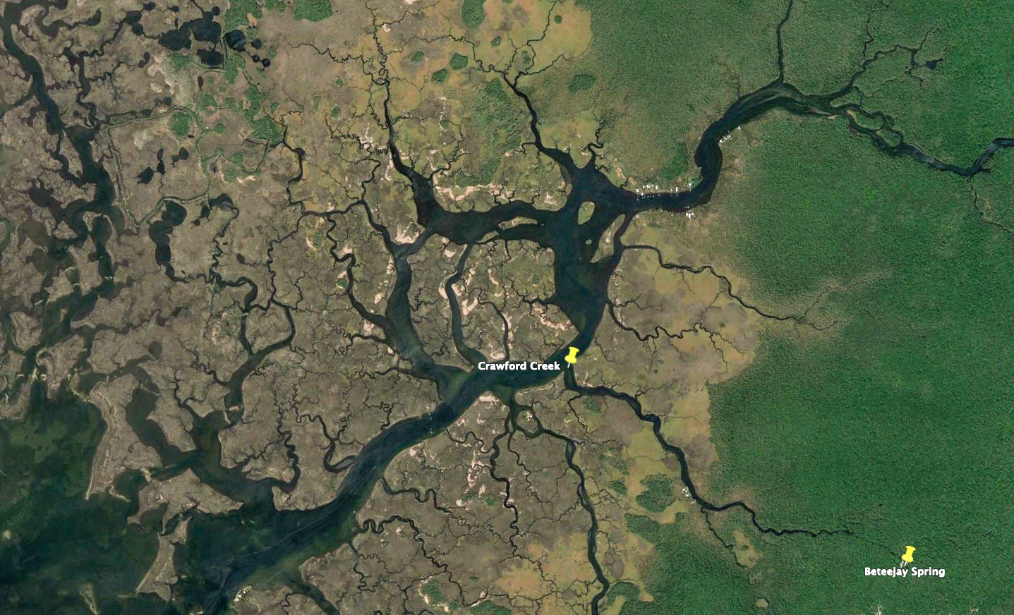
The ‘Chaz’ – Crawford Creek Overview:
The Chassahowitzka River (pronounced “Chaz-wits’-kuh”) is a spring-fed river located in southwestern Citrus County, Fl. south of Homosassa Springs. The river is 5.6 miles long from source to the gulf, flowing through the Chassahowitzka National Wildlife Refuge. Chassahowitzka was named after a wild variety of vining, hanging pumpkin that grew along the shoreline and translates as “hanging pumpkin”.
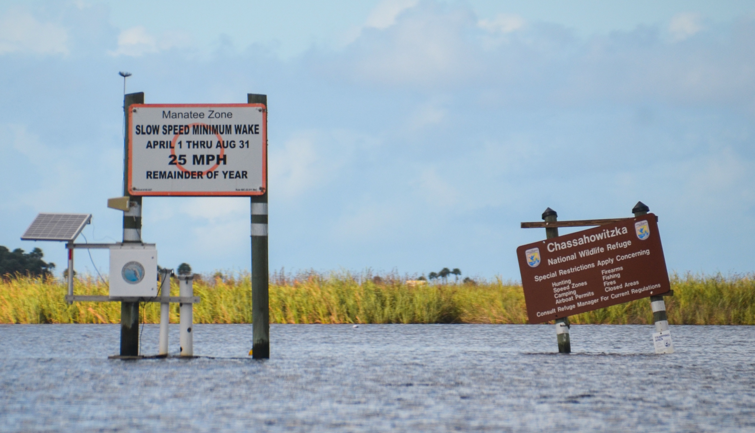
The spring-fed Chassahowitzka River was named an Outstanding Florida Waterway for its pristine, natural condition and receives protection to maintain the water quality. The main river is wide, shallow and slow moving. It is an easy paddle, though some of the spring runs may present challenges due to downed trees and shallow water. The Chaz has an abundance of wildlife to include Otters, Feral Pigs, Raccoons, Egrets, Herons, Eagles and Ospreys among others. Fishing is excellent. The shoreline forests are a beautiful jungle-like mix of Palms, Cedars, Red Maples, Hickories and Bay.
Crawford Creek is a tributary to the Chassahowitzka River. It enters the river just over 3 miles downstream from Chassahowitzka Main Spring. The two mile creek is fed by four springs…Rita Marie, Beteejay, Beteejay Lower and Blue Run and begins as a very small stream less than 10′ wide reaching 270′ wide by the time it flows into the Chaz.
![]() For more in depth details and photos on the Chassahowitzka River please see the previous Chassahowitzka River post from Florida Paddle Notes ..
For more in depth details and photos on the Chassahowitzka River please see the previous Chassahowitzka River post from Florida Paddle Notes ..

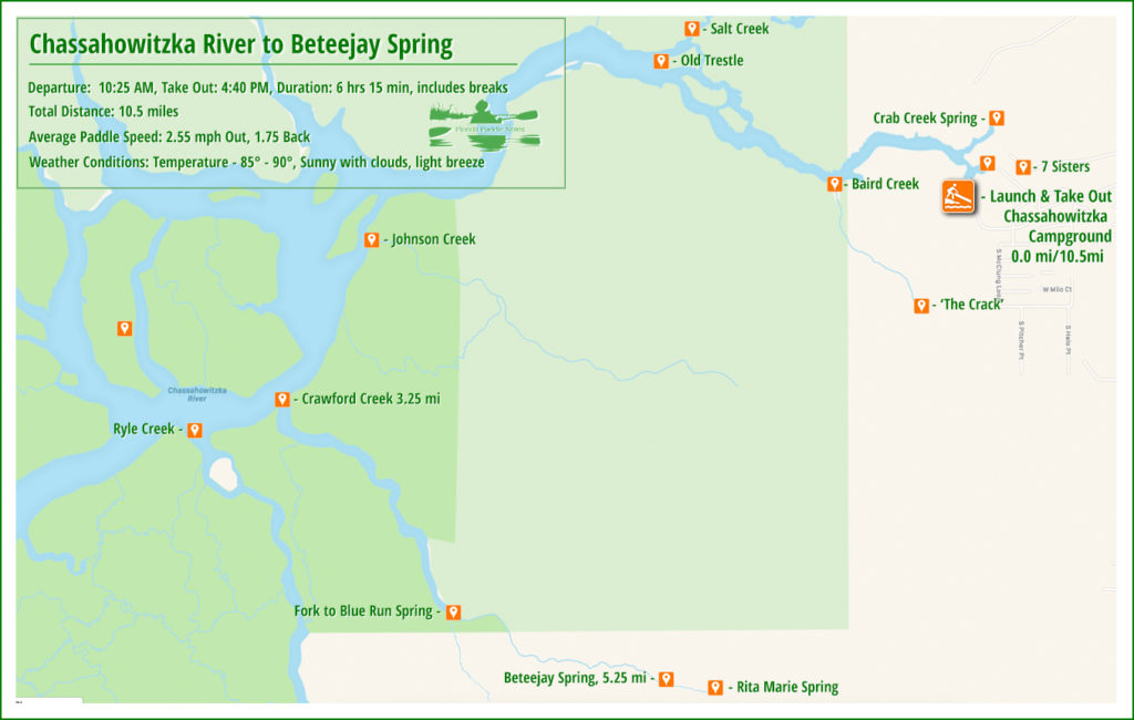
The Paddle Route…
Crawford Creek Details:
![]() Location: Crawford Creek’s source is in Hernando, County, while it’s mouth is in southwest Citrus, County, 6.5 miles west of Sugarmill Woods.
Location: Crawford Creek’s source is in Hernando, County, while it’s mouth is in southwest Citrus, County, 6.5 miles west of Sugarmill Woods.
![]() Launch Point and Take Out: Chassahowitzka River Campground – 8600 W Miss Maggie Drive Chassahowitzka, Fl 34448 Phone 1-352-382-220. There is a $5.00 parking fee, Restrooms and small store. The launch has a ramp, a sandy beach launch and a handicap launch.
Launch Point and Take Out: Chassahowitzka River Campground – 8600 W Miss Maggie Drive Chassahowitzka, Fl 34448 Phone 1-352-382-220. There is a $5.00 parking fee, Restrooms and small store. The launch has a ramp, a sandy beach launch and a handicap launch.
![]() Paddle Distance: 10.5 miles round trip
Paddle Distance: 10.5 miles round trip
![]() Difficulty: Easy to moderate depending on the wind.
Difficulty: Easy to moderate depending on the wind.
 Average Paddle Speed: 2.55 mph to Beteejay Spring, 1.75 mph returning against the wind.
![]() Width and Depth: Crawford Creek was 270′ wide at it’s mouth and about 10′ wide at the source. Depth averaged 4′ – 5′ at it’s deepest.
Width and Depth: Crawford Creek was 270′ wide at it’s mouth and about 10′ wide at the source. Depth averaged 4′ – 5′ at it’s deepest.
![]() Current – Tidal: Tidal and spring fed. Paddling against the current wasn’t too bad.
Current – Tidal: Tidal and spring fed. Paddling against the current wasn’t too bad.
![]() Side Paddles: There is a small, shallow creek, 0.9 miles into Crawford Creek, on the right, that flows from Blue Run Spring. It is about 0.75 miles to the spring…we did not paddle this.
Side Paddles: There is a small, shallow creek, 0.9 miles into Crawford Creek, on the right, that flows from Blue Run Spring. It is about 0.75 miles to the spring…we did not paddle this.
![]() Rest Areas: Only in your kayak. There is minimal shade as well until you get 1.6 miles up the creek. We exited our kayaks in the middle of the creek about 400′ downstream from Beteejay Spring. The water in the middle of the run was about 3′ deep.
Rest Areas: Only in your kayak. There is minimal shade as well until you get 1.6 miles up the creek. We exited our kayaks in the middle of the creek about 400′ downstream from Beteejay Spring. The water in the middle of the run was about 3′ deep.
![]() Important Information: Tides, sun exposure and winds may be a big influence on this paddle.
Important Information: Tides, sun exposure and winds may be a big influence on this paddle.
Launch on ‘The Chaz’…
As mentioned above, the launch from Chassahowitzka River Campground is nice. The folks are friendly and the actual launch is a nice sandy beach. On busy days, the parking lot can get quite full so I suggest an early start.
From this launch the Chaasahowitzka Main Spring is just to right, as are the Seven Sisters Springs…these are beautiful and unique, however today we are heading down river to Crawford Creek and Beteejay Sping
On to Crawford Creek…
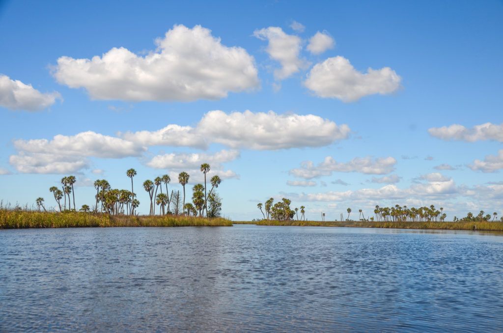
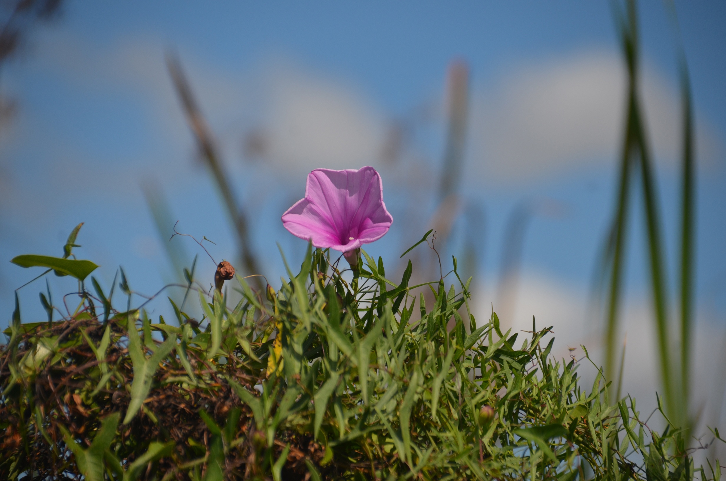
The Chassahowitzka River is beautiful. There is an abundance of wildlife to view and of course the numerous Palms that make this a breathtaking journey on this ‘Old Florida’ River. The sky is blue with awesome white clouds, we have both the tide and a slight breeze at our back as we head out.
There are several side paddles to enjoy on this river to include Crab Spring Creek, Baird Creek, Salt Creek and Potter Creek, however today our destination, Crawford Creek, is a bit further out. I have details and photos on these creeks posted on my original Chassahowitzka River post. It’s worth checking out!
Paddling further down river, the ‘Chaz’ opens up into a series of twisted and winding tributaries as it flows to the Gulf of Mexico just a couple miles further from where we turn in to Crawford Creek.
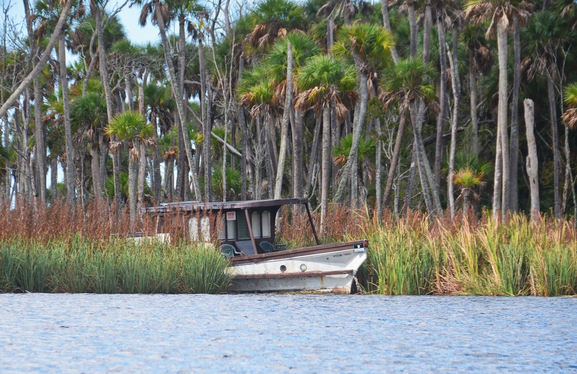
Along the way are numerous abandoned homes, broken docks, collapsed buildings and an old boat or two. It is a sign of a harsh environment, yet there are the those that continue to live there, rebuild and thrive living off the grid. We stay to our left, follow the shoreline of marsh rush and at mile 3.25 from our launch is the mouth of Crawford Creek.
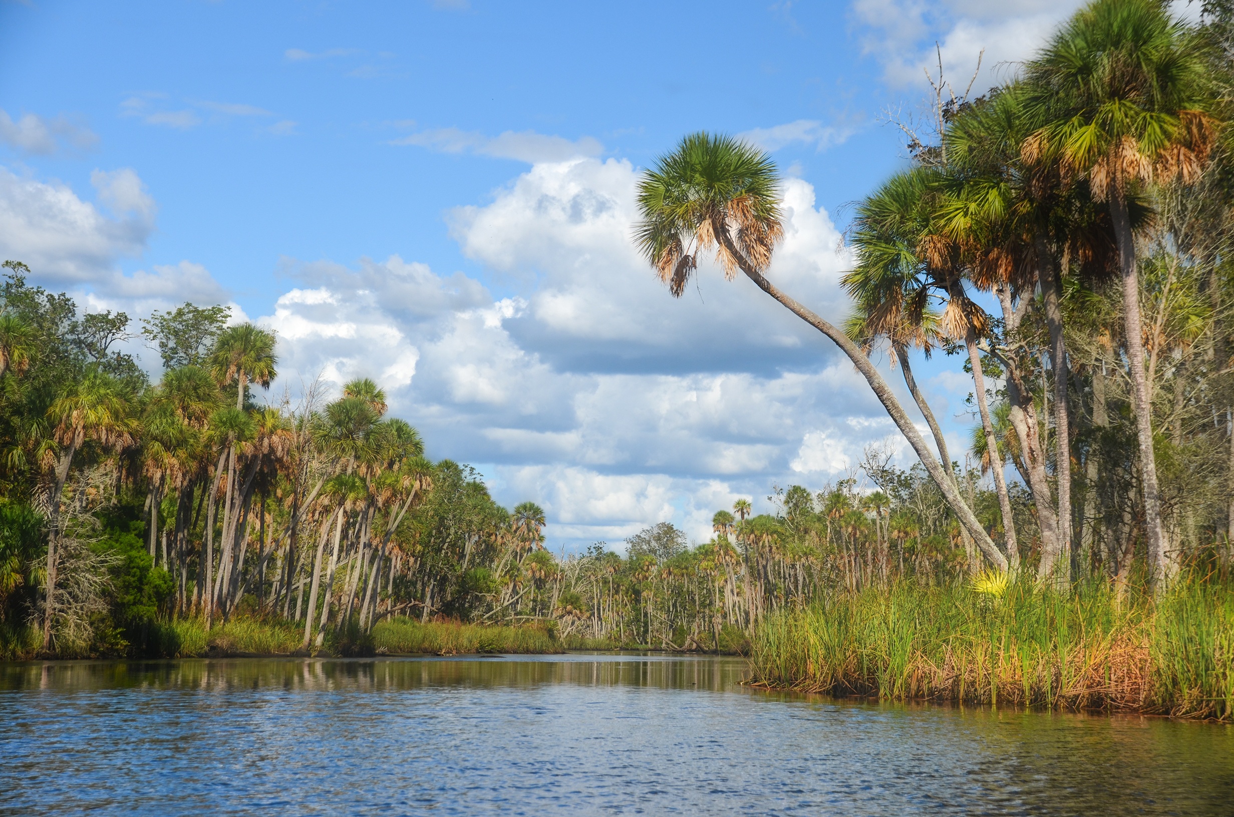
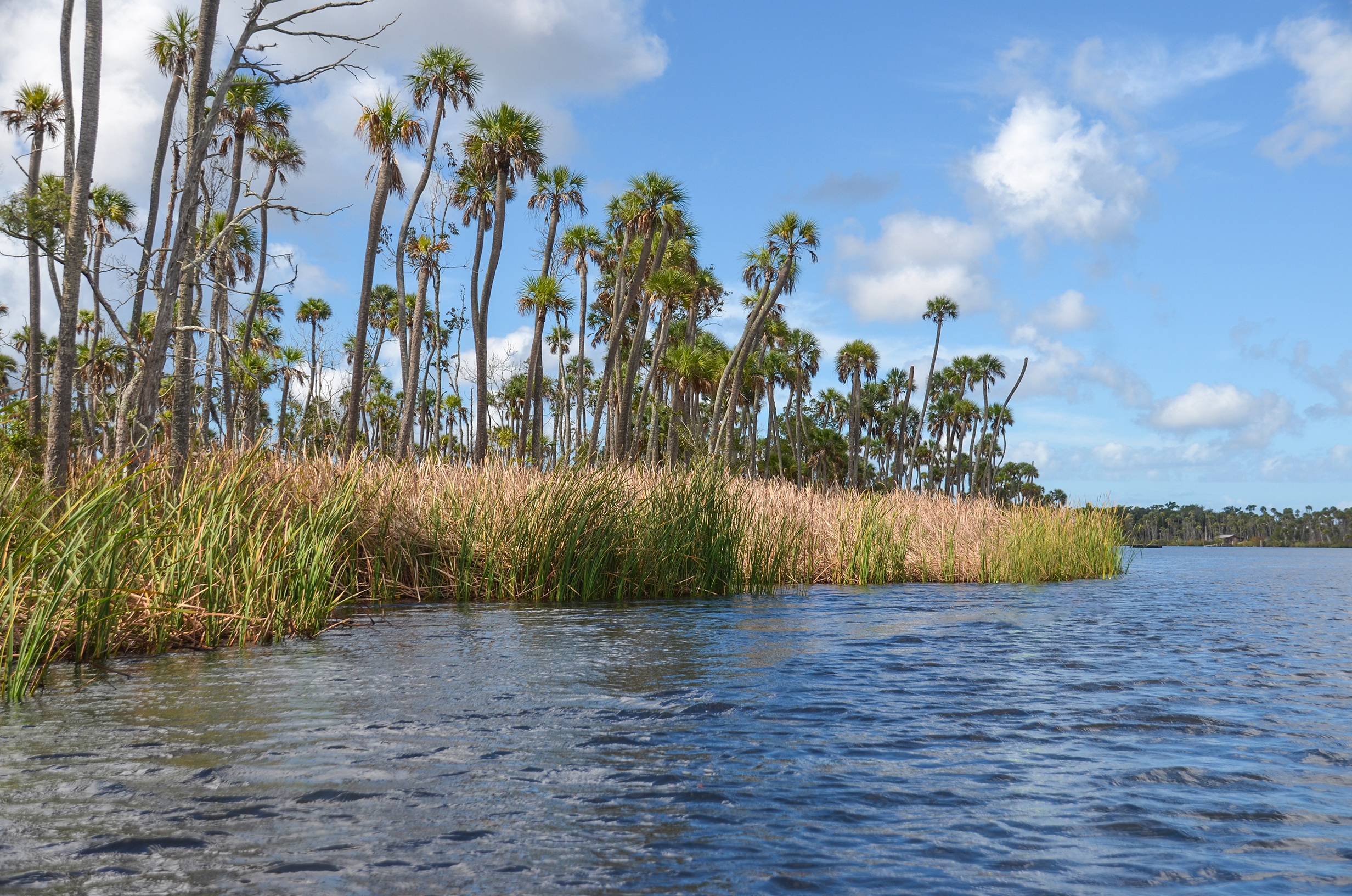
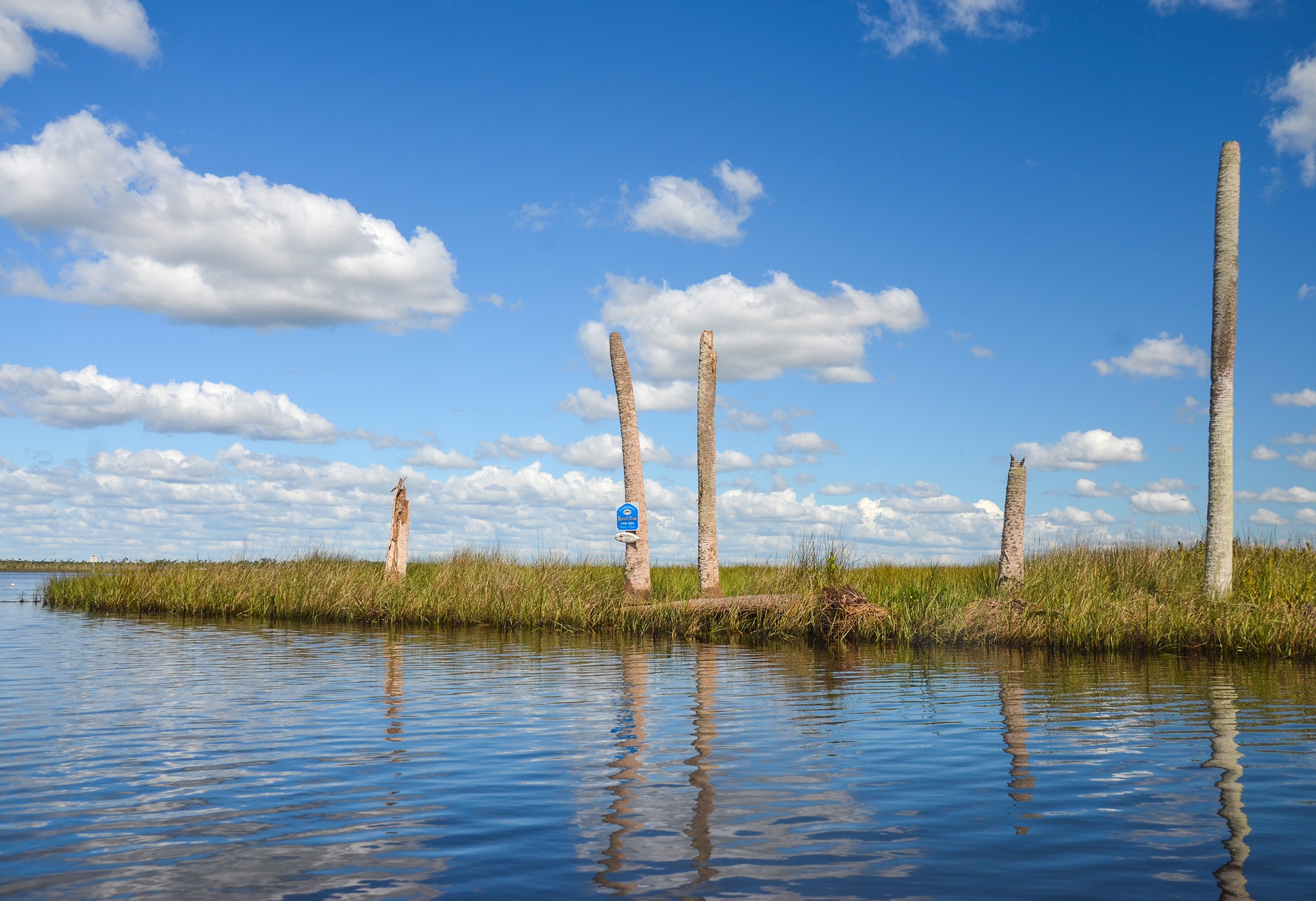
The creek is about 275′ wide and only a few feet deep. There is a landmark to use for future paddles, several dead palms with only the trunks exposed, one with a memorial plaque. The sun is warm and there is no shade here, however we paddled into the rush to steady our kayaks for a short break. The shade from a stand of trees on this island hammock did not quite reach us. Under a beautiful sky we paddle against a slight wind and gentle current toward Beteejay Spring.
Crawford Creek:
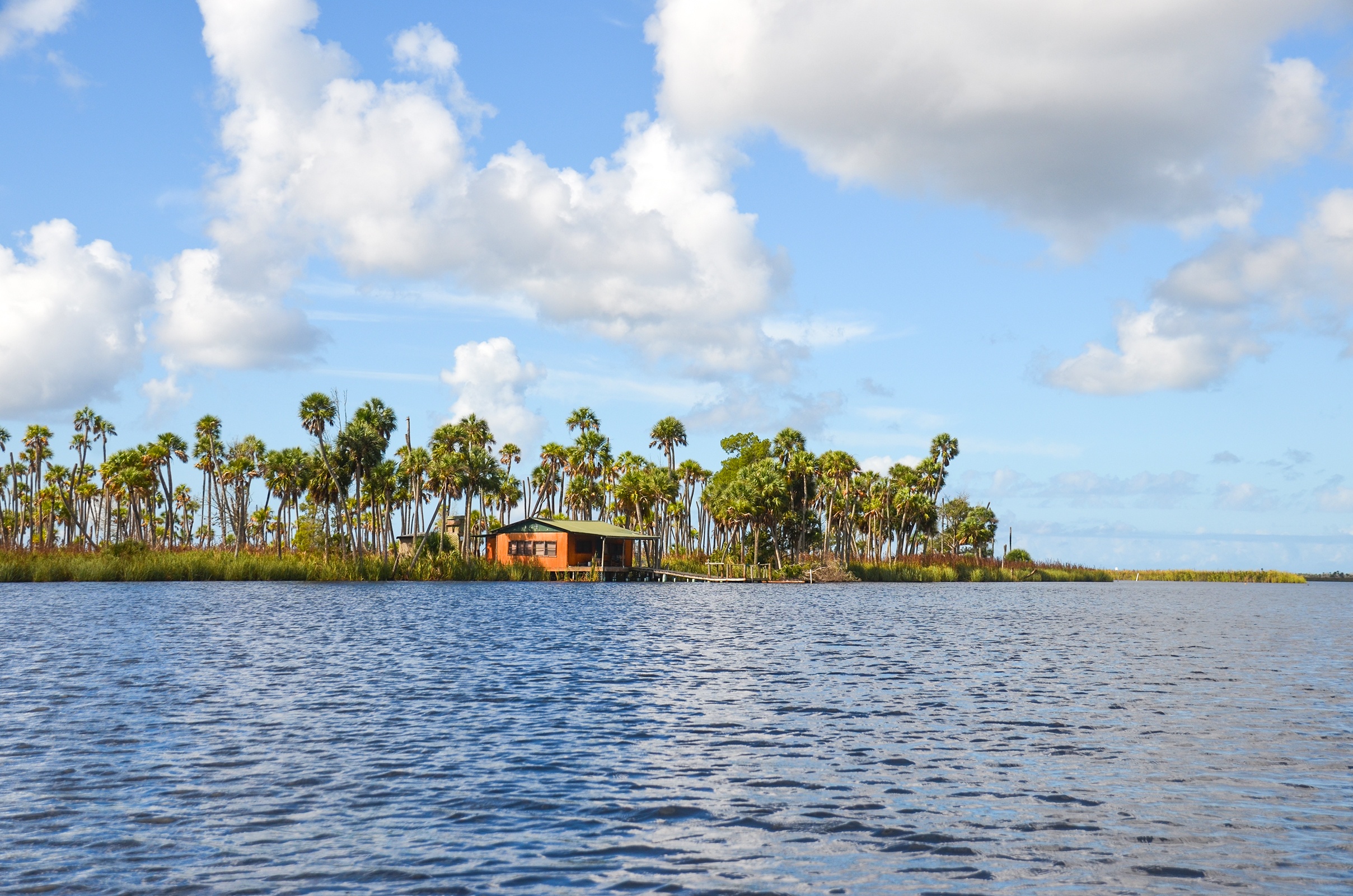
Paddling up Crawford Creek is like paddling into remote wilderness. A mile into the creek, is the Chassahowitzka Island Lodge. From this website the description states…
“The island operates on generator power. Cell phones usually work, but we hope you don’t need it. There is no WIFI . It is time to relax. Each bedroom downstairs in the lodge has a screened in porch. You can open the sliding doors and listen to the Whippoorwills sing you to sleep each night. You will be awakened by the smell of coffee and bacon in the upstairs kitchen. After a great breakfast it is down the stairs and out to the dock to meet your guides and enjoy a day fishing inshore. No long boat ride. The guides know the best places to go and you will enjoy their personality and knowledge. Tight Lines everyone! “
It looks like an old movie set in the middle of nowhere…then again we are in the middle of nowhere! At this mile mark there is a narrow creek that leads to Blue Run Spring. It is only 0.75 miles to the spring however we had our destination in mind.
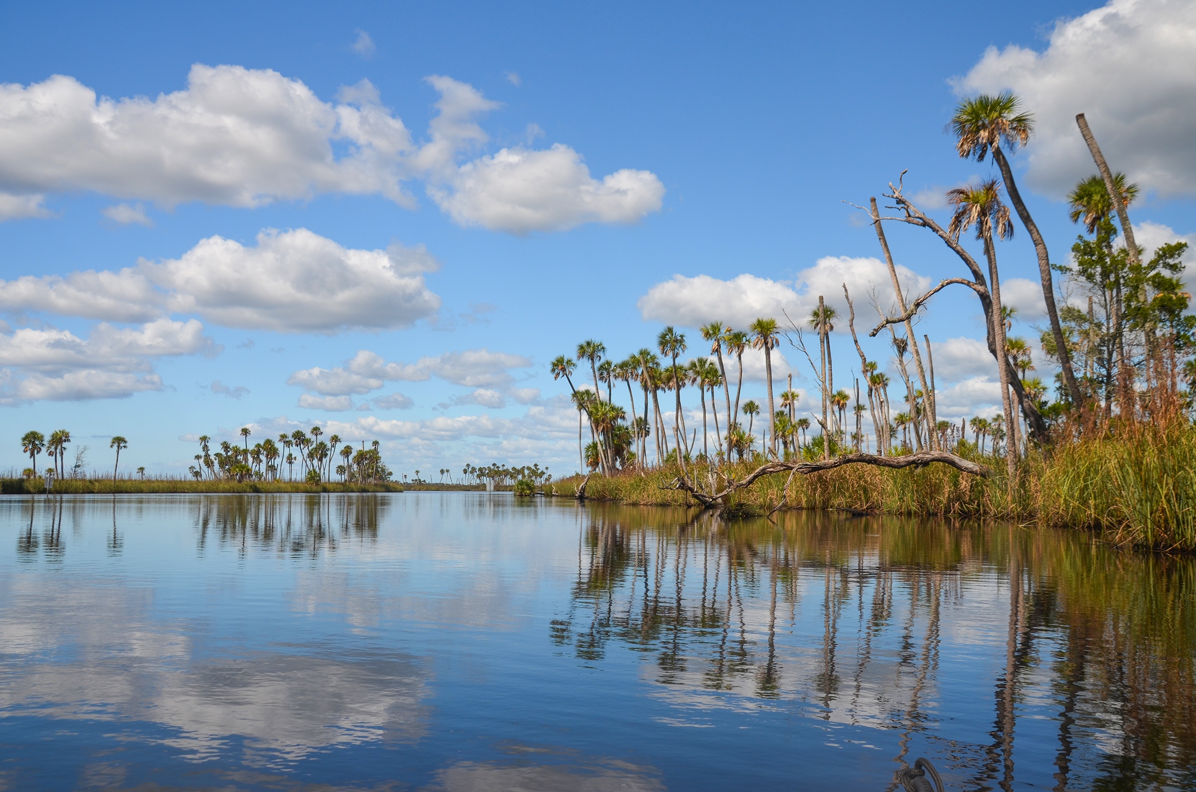
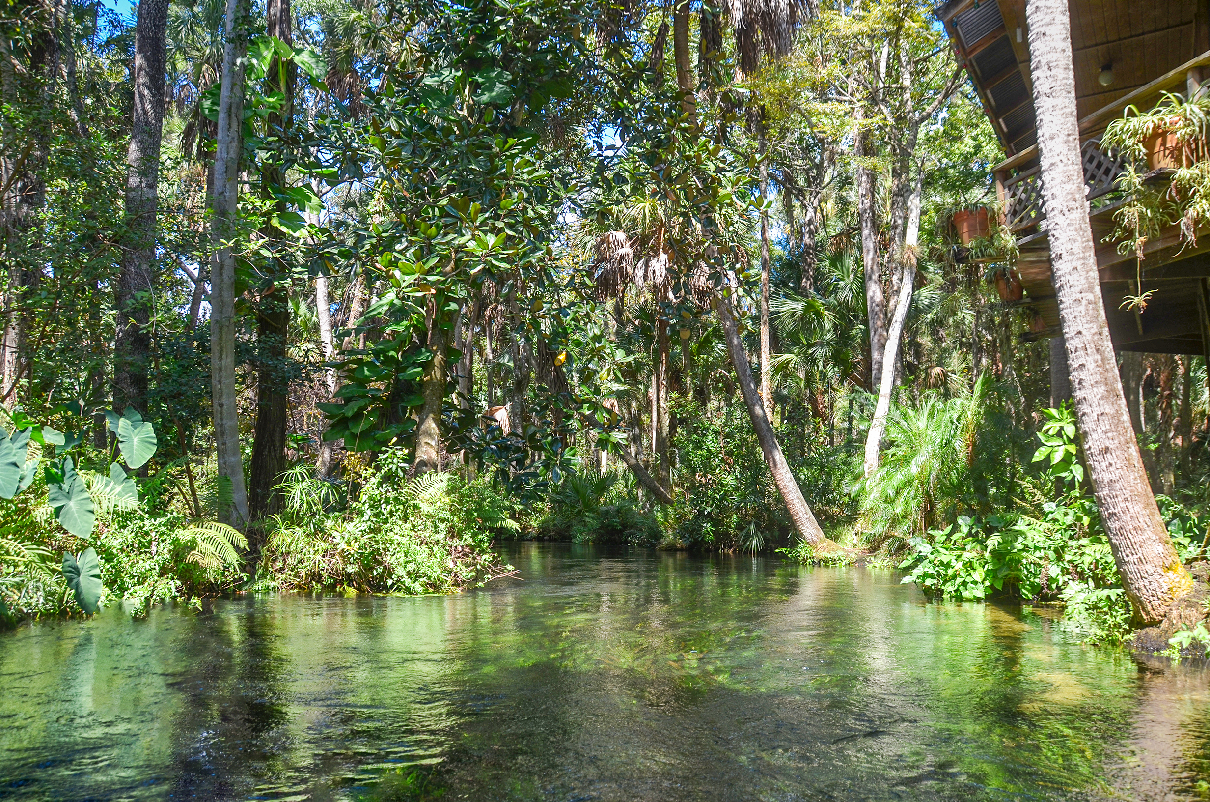
We continued to paddle among the palms, the rush and numerous Tillandsia and Bromeliads when at mile 1.7 things changed. Through a small portal of vegetation we paddle into a lush, shaded, canopied Beteejay Spring Run. Beautiful Bay trees, Magnolias, Hollies and Palms provided the cooling canopy and offered relief from the sun for the final 1/4 mile. Paddling this cooling jungle leads us to Beteejay Spring.
Beteejay Spring:
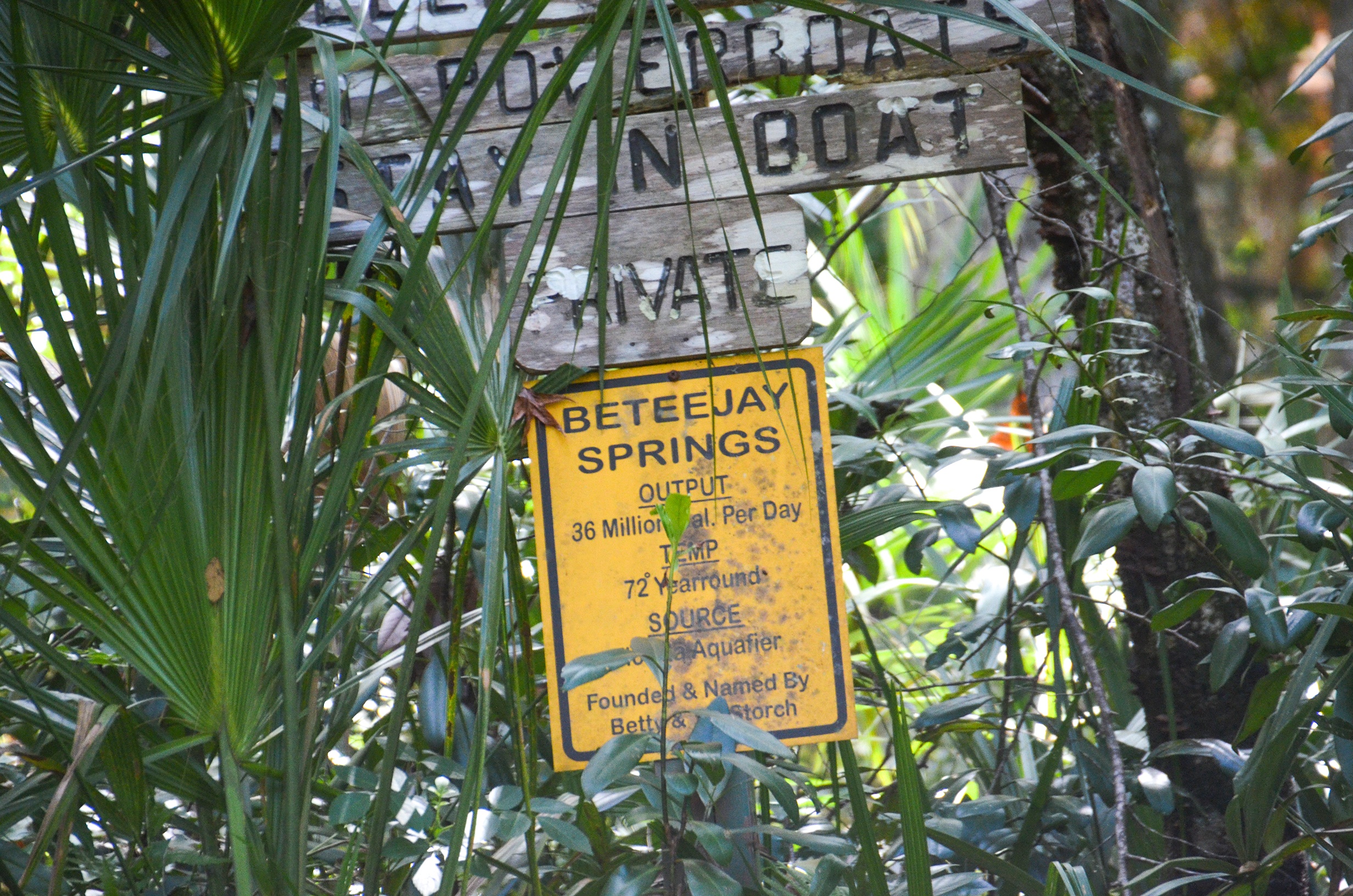
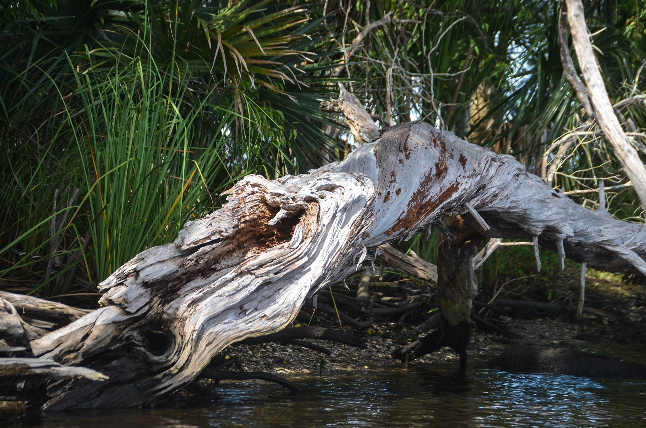
Before actually reaching the spring a very large Bay tree had fallen completely across the run! Fortunately a paddler was able to saw enough branches off to allow passage under the trunk. What greets us next is a secluded dock surrounded with tropical vegetation and a sign with details about Beteejay Springs and also a ‘request’ for us to stay in our boats as the property is private. The spring was named after Betty and Jay Storch who found it.
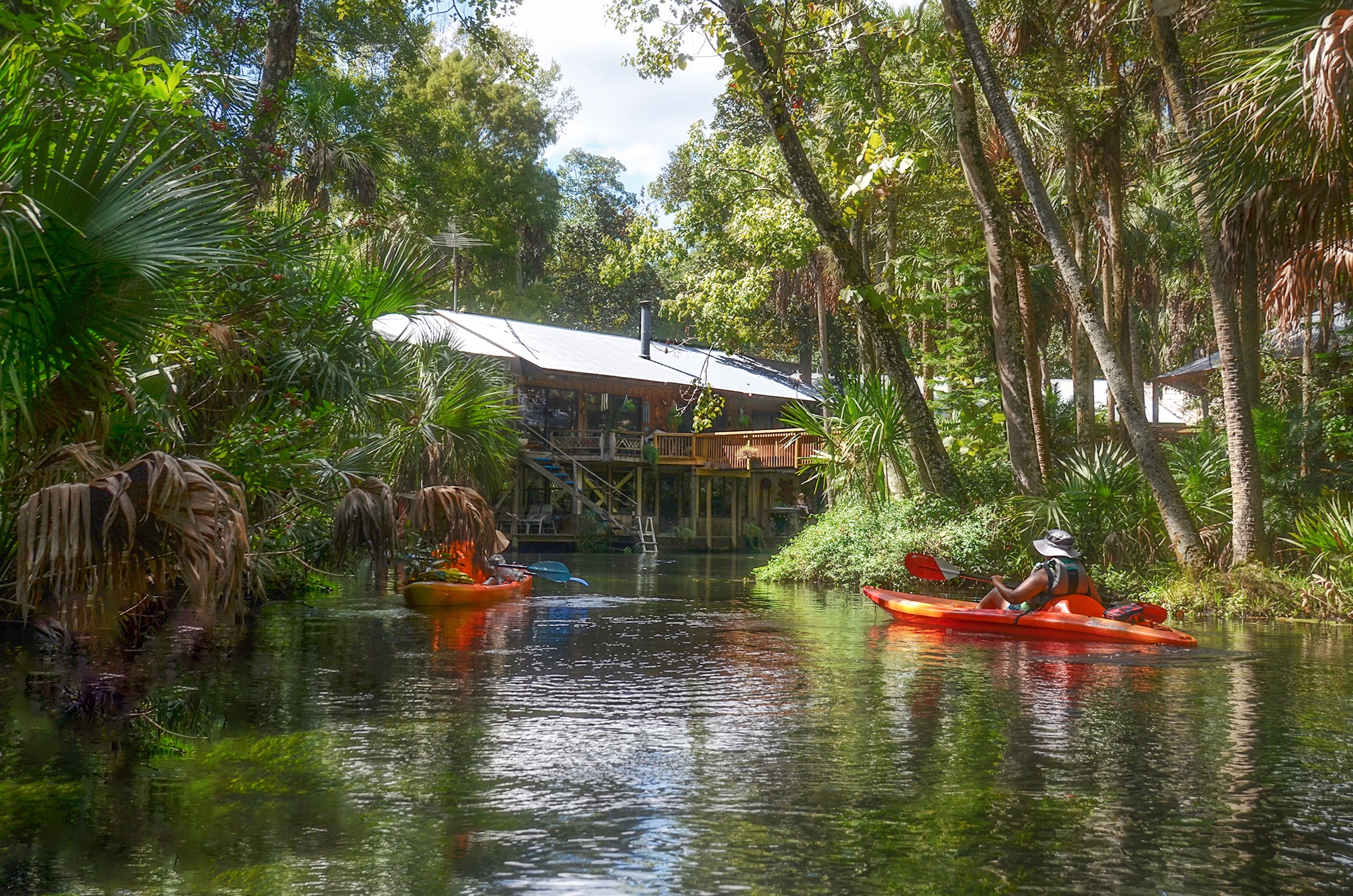
Upon reading the sign we continue around the corner and there on each side of the run is a beautiful residence with an overhead walkway connecting the two buildings. It is absolutely beautiful and well ‘landscaped’ with tropical plantings. What was not beautiful was the fact that the spring was ‘obstructed’ by a twin boat house with boats. 125′ to the rear of those boats was Beteejay Spring! No access. I will not give an opinion on the legality of obstructing access to the spring, but it was what it was. A 1/4 mile further down the creek is Rita Marie Spring however due to downfall we were not able to reach it.
Having talked to the caretakers of the home at the spring, we stopped for a refreshing rest, exiting our kayaks in the middle of the spring run where the water was about 3′ deep. Back on board, we paddle with the current out of Crawford Creek, right into the wind for our remaining 3 miles back. The scenery was beautiful, the paddle back was a nice workout and all things considered it was a great chapter in Florida Paddle Notes!
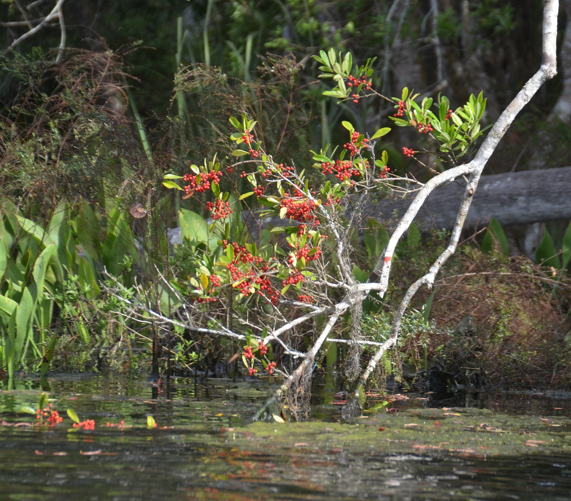
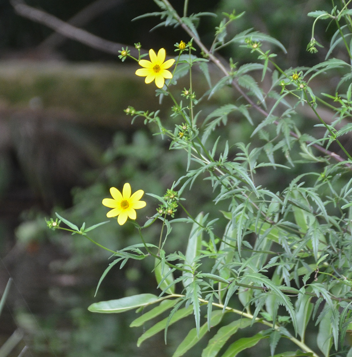
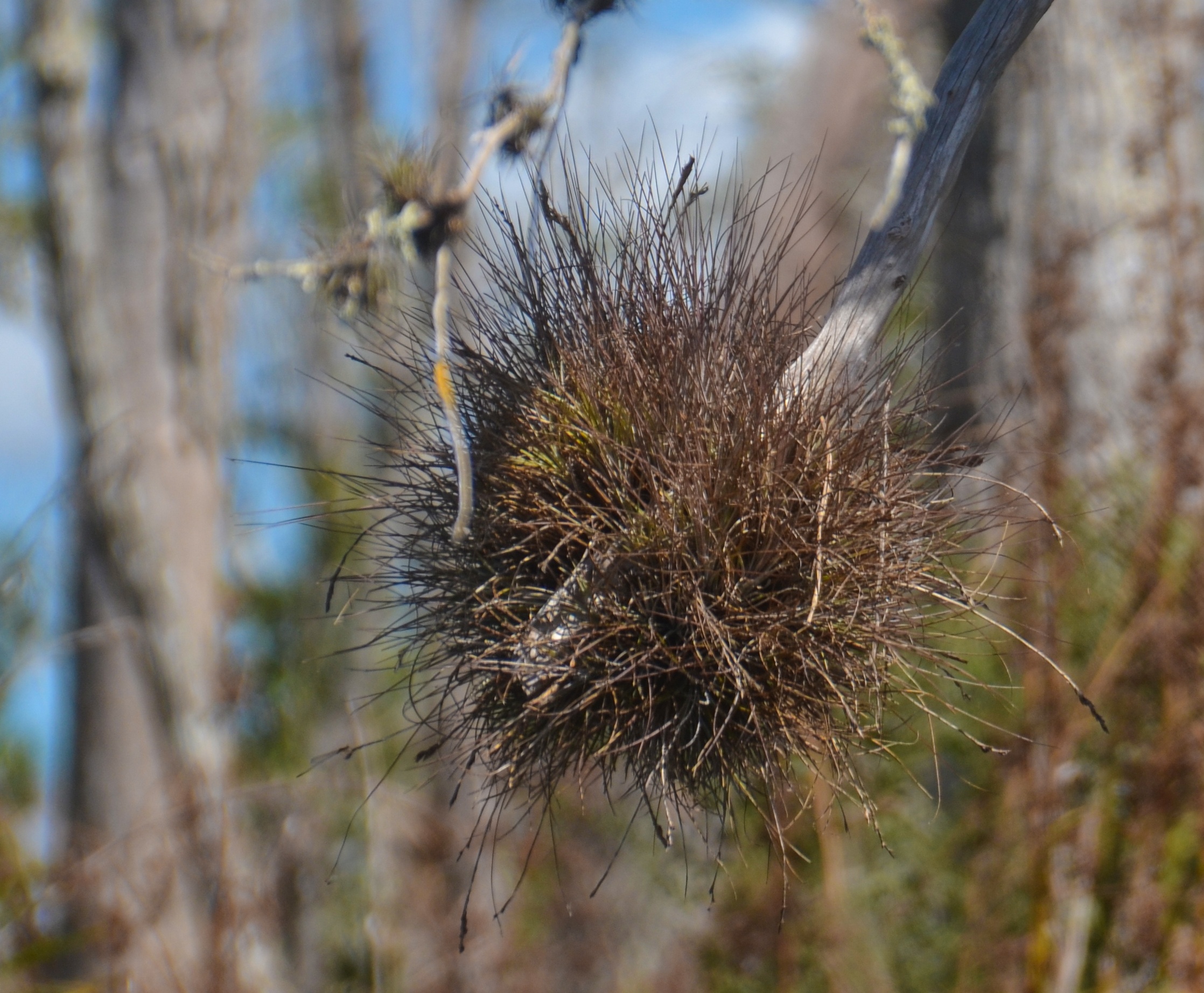
Photo Gallery:


Guides, Maps & Info…
- Chassahowitzka Wilderness at Wilderness Connect…
- Crawford Creek Topo Map…
- Beteejay Spring Water Data…
- US Fish and Wildlife Service – Chassahowitzka National Wildlife Refuge…
- Chassahowitzka River Campground…
- Florida Nature Coast – Chassahowitzka National Wildlife Refuge…
- Springs Fever also has excellent information on some of the springs along the Chaz…
- A great interactive map for Florida Springs. This opens in Google Earth for me…
- AllTrail Paddle Info…
- Dave’s Yak Tales – Chassahowitzka…
- Beludas Musings…
- Paddle Florida – Chassahowitzka…
![]()