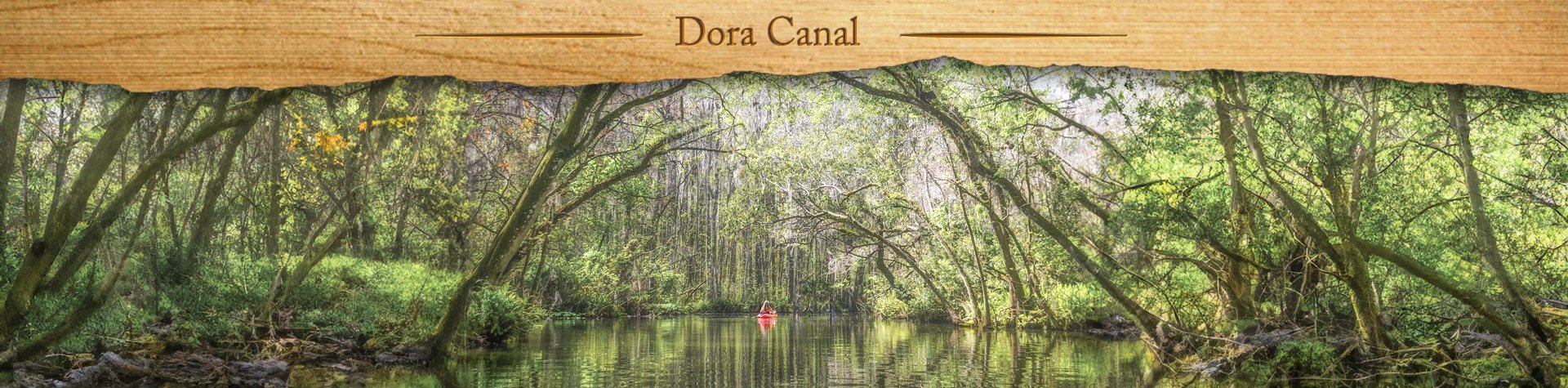
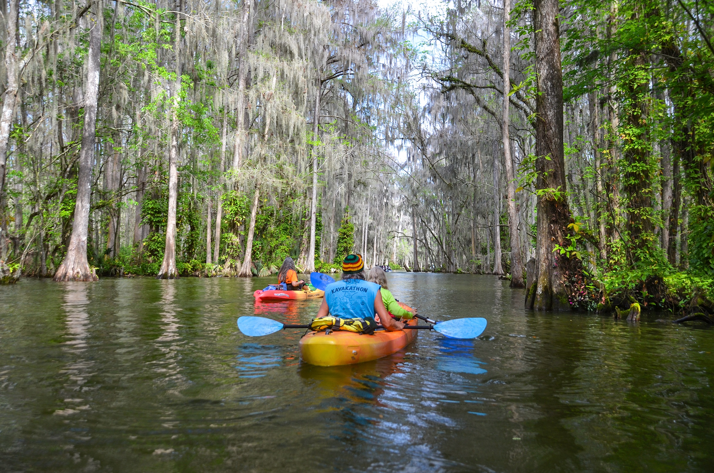
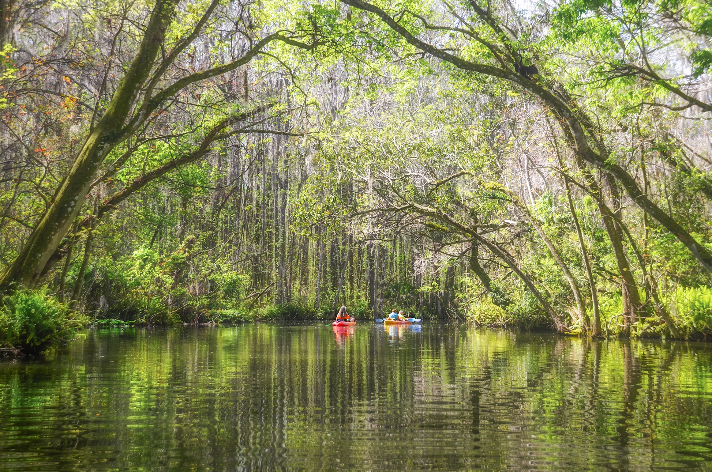
We spent President’s Day on the Dora Canal down in Tavares. It was my first time on the canal and I found it to be a quite pretty place to paddle, though very busy with tour boats, fishing boats and pleasure craft. I would highly recommend doing this on a day other than the weekend or on a holiday…James
![]()
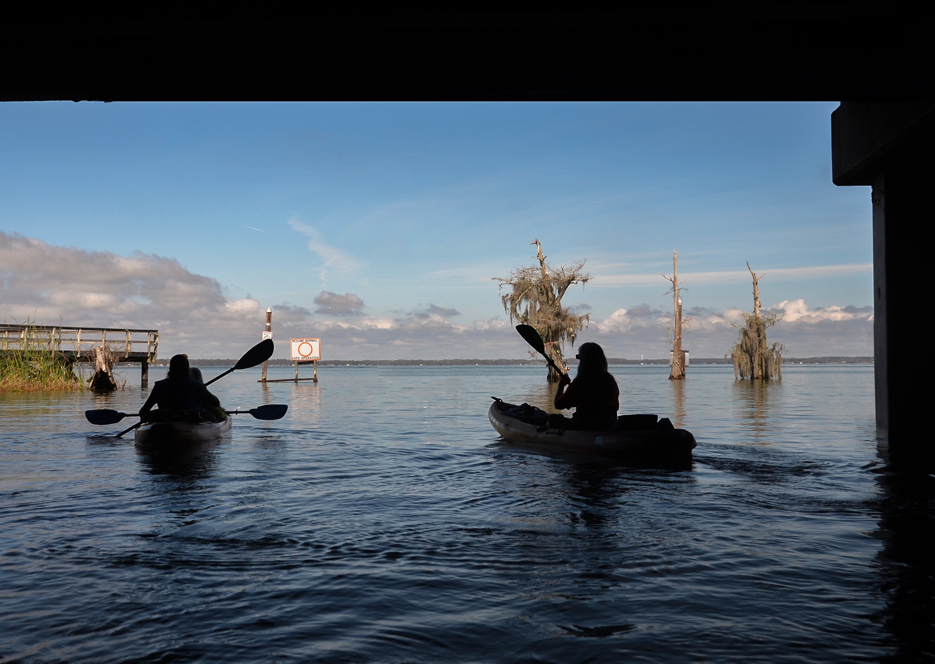
The Dora Canal is a 1.2-mile waterway that connects Lake Dora with Lake Eustis in Lake County. Originally called the Elfin River, once home to the Timucuan Indians. In the 1800’s it was dredged to accommodate steamboats that were important to the commerce of the local towns. The river became more known as the Dora Canal. The canal is part of the Harris Chain of Lakes, a series of canals and streams connecting 8 lakes forming the Florida Ocklawaha Basin which drains Central Florida to the north through the St Johns River entering the Atlantic Ocean at Jacksonville.
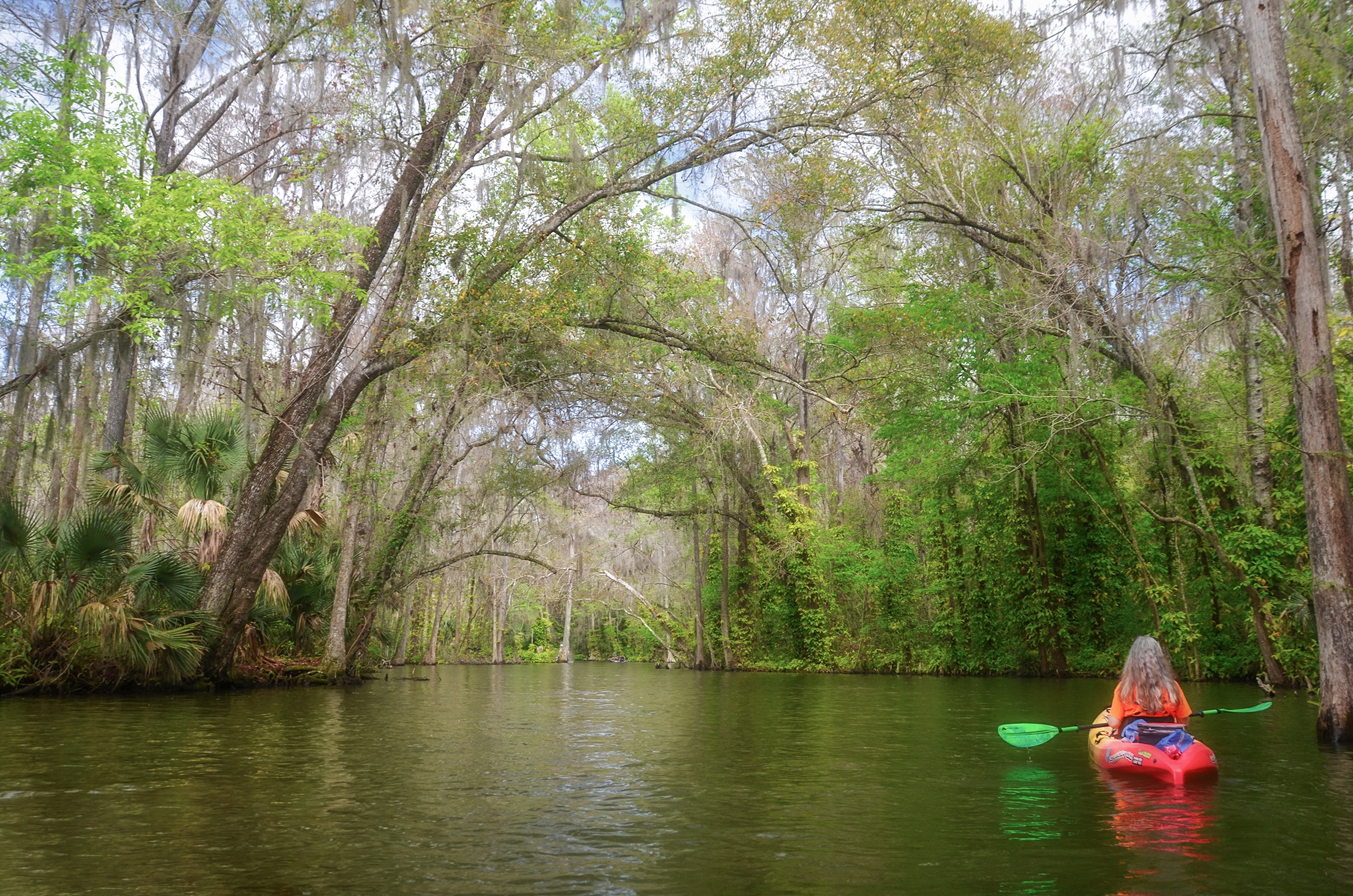
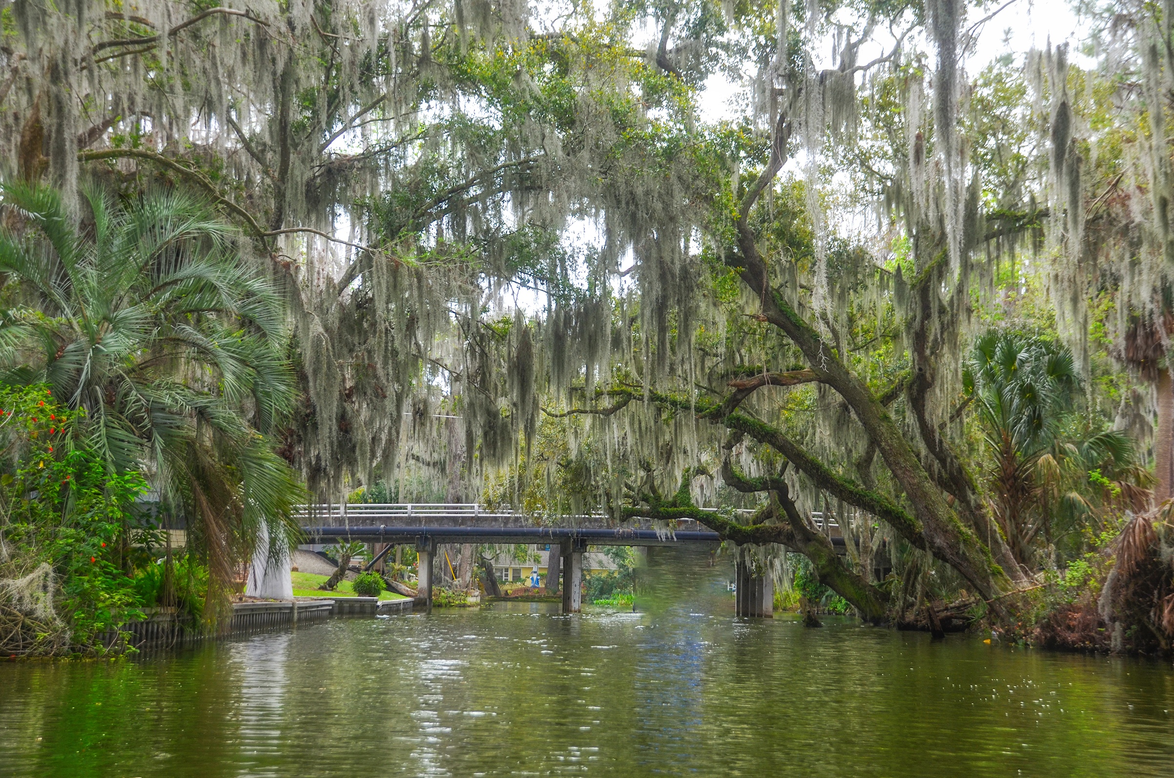
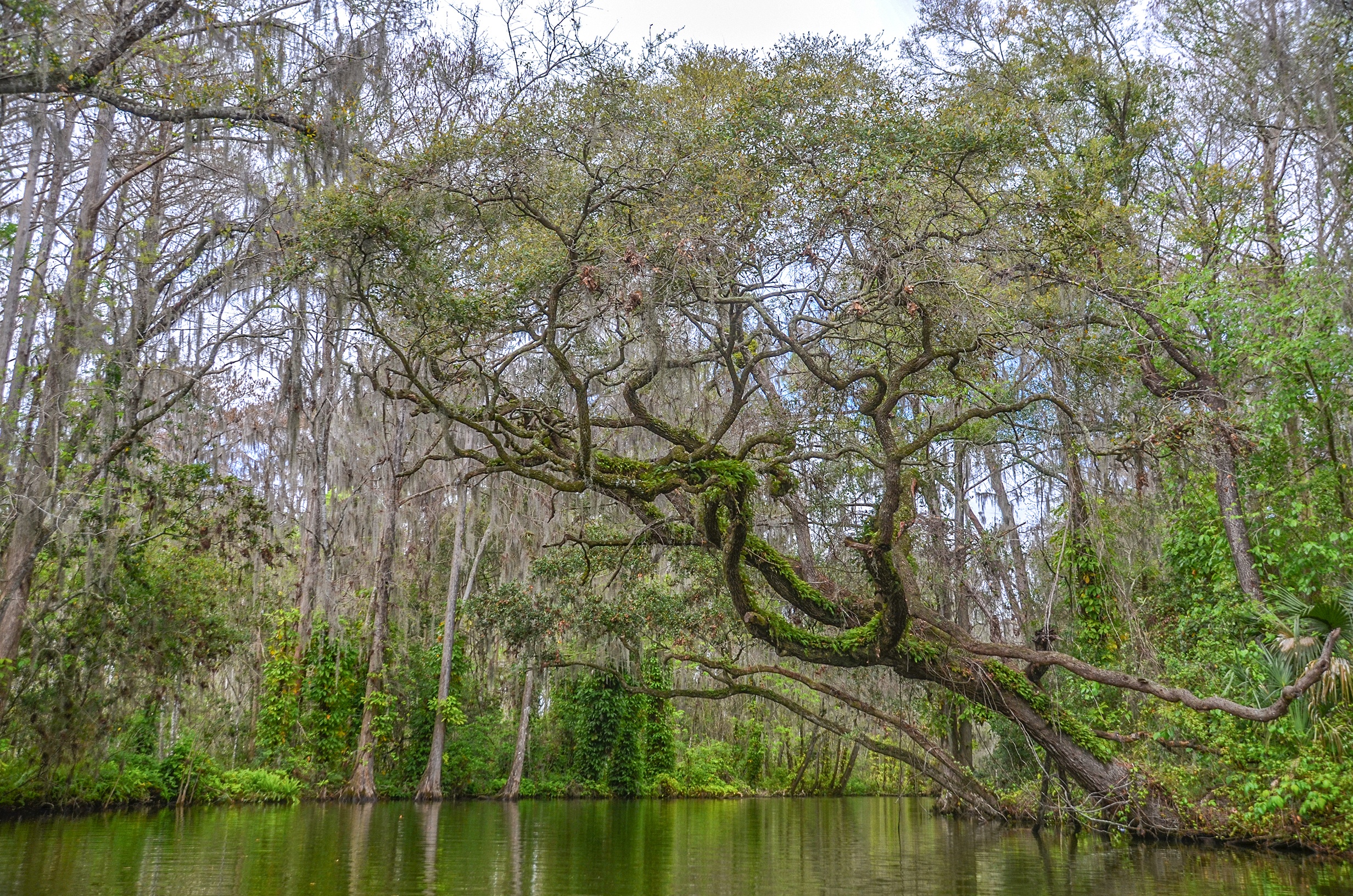
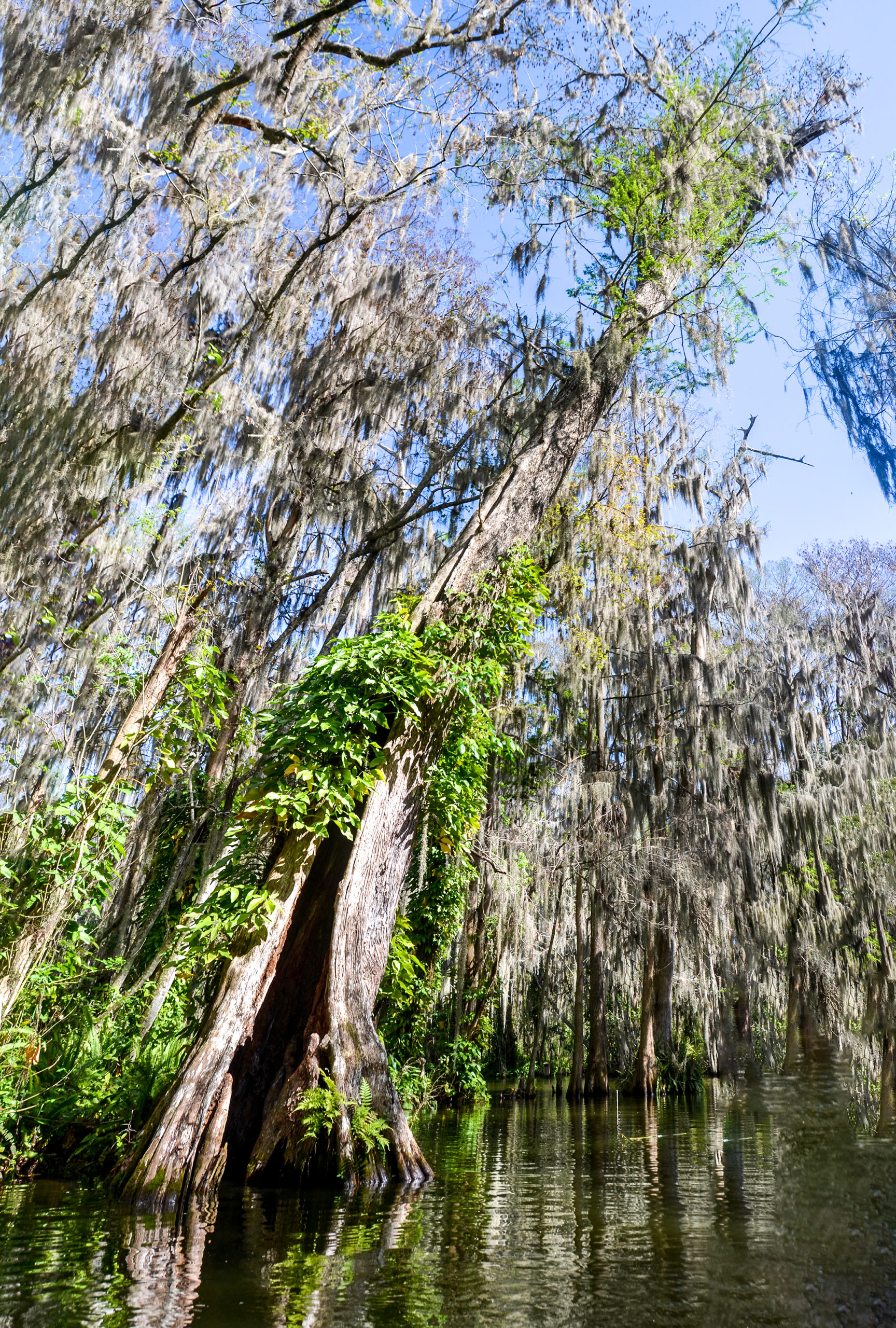
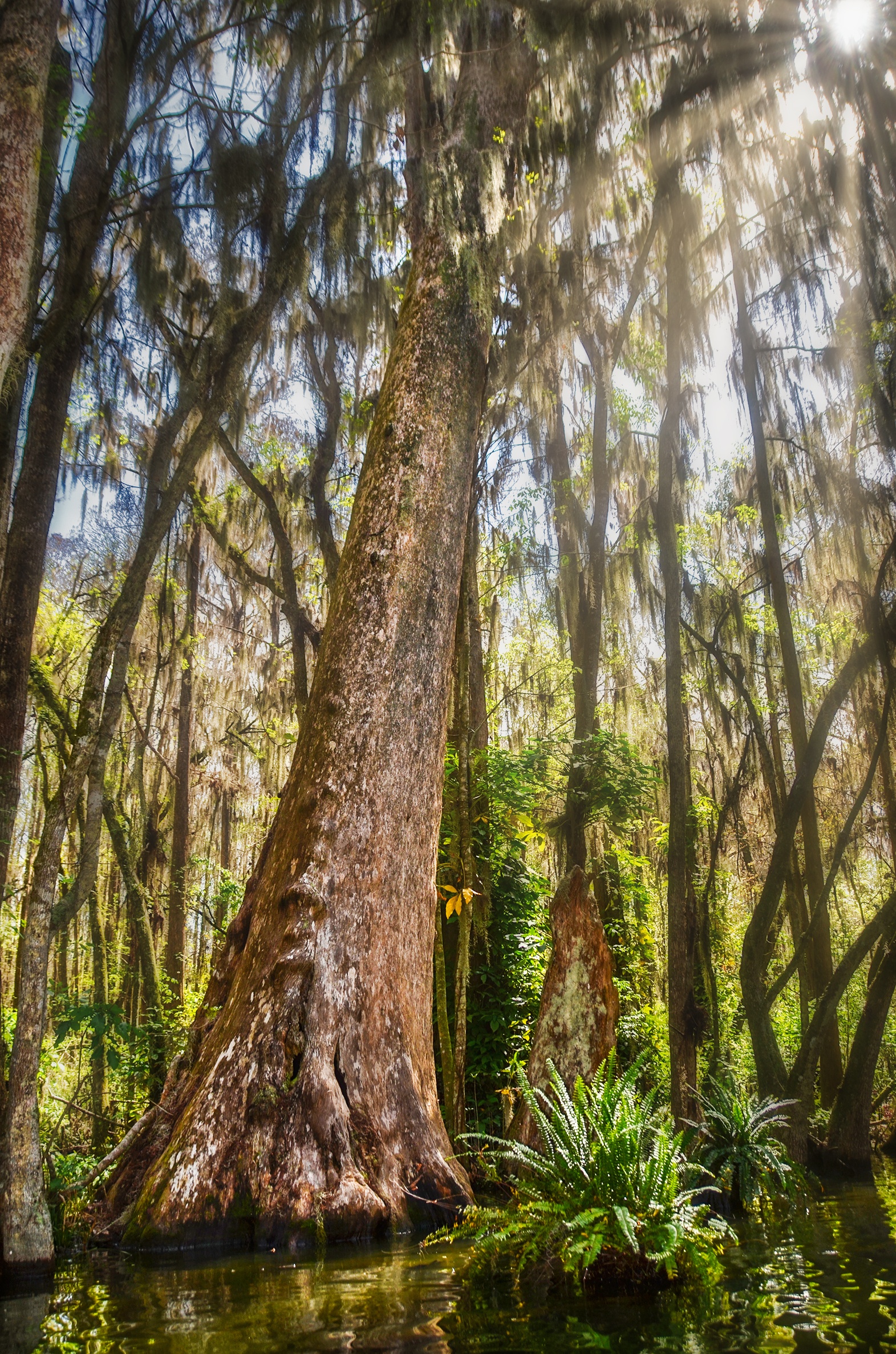
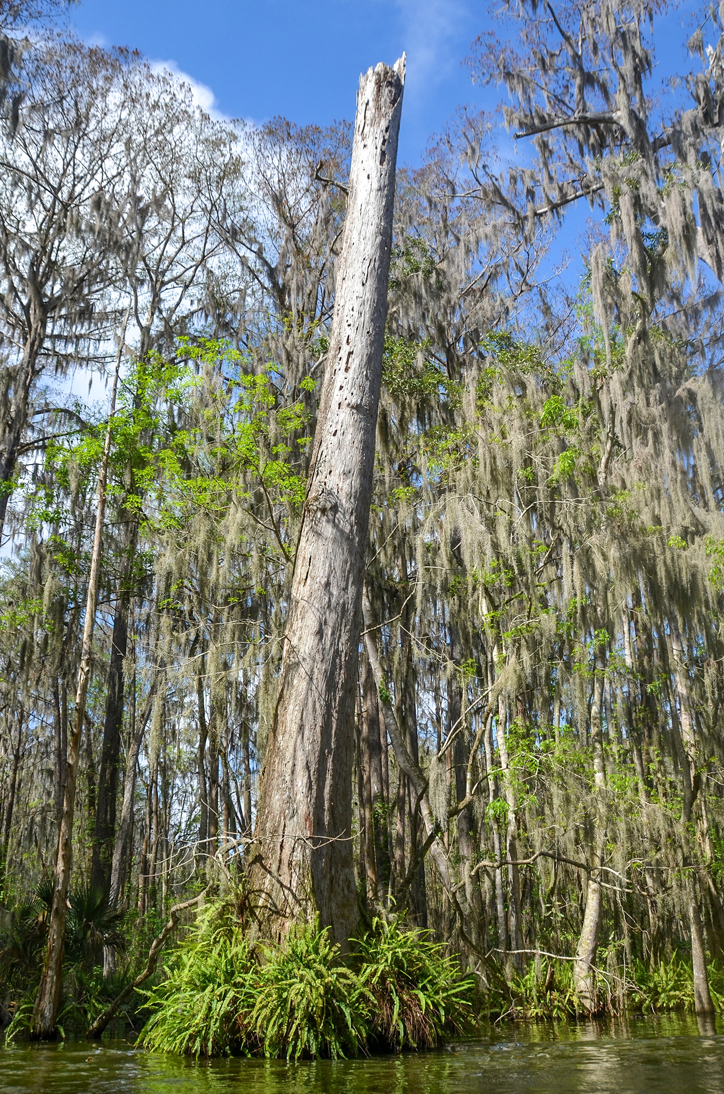
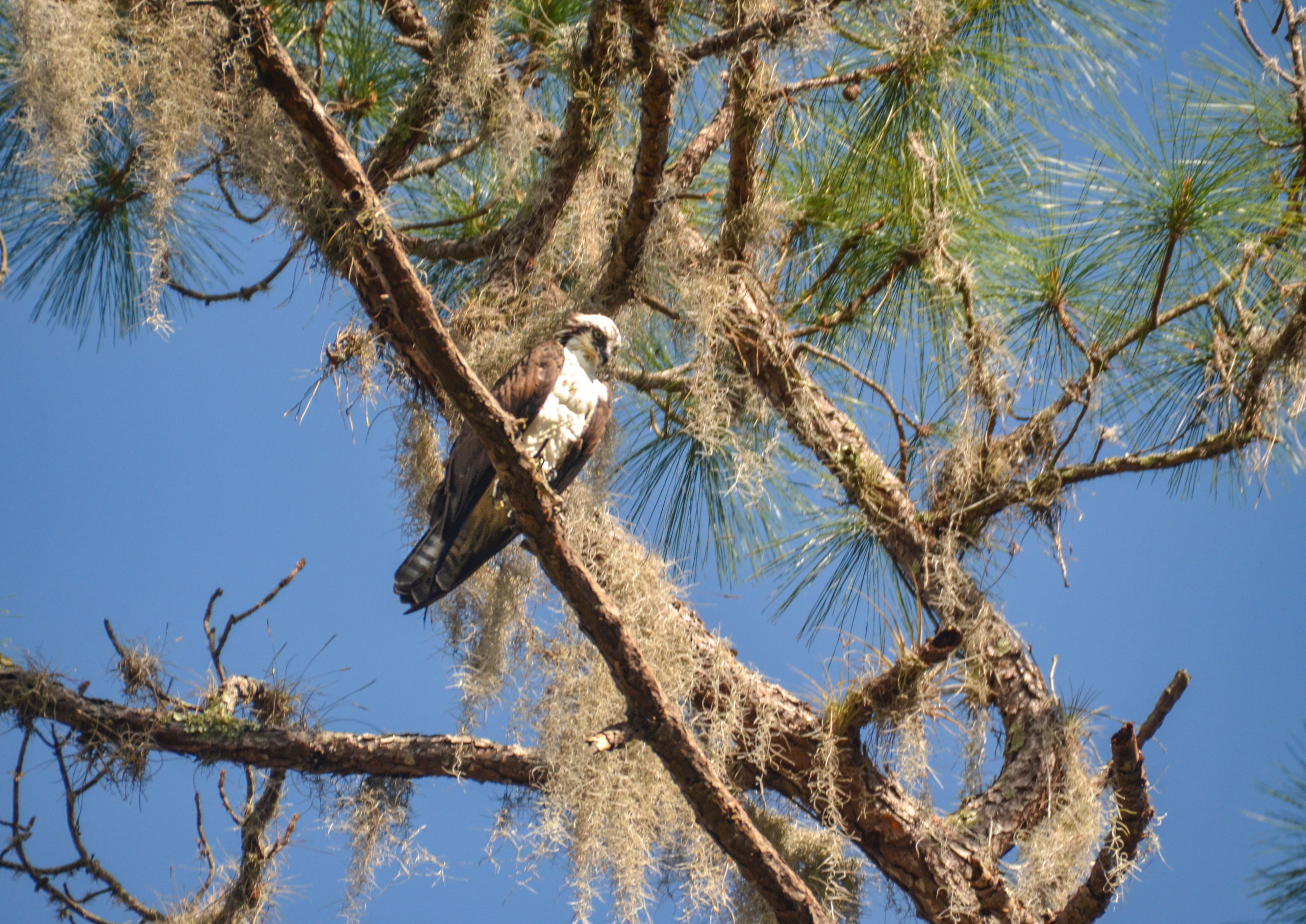
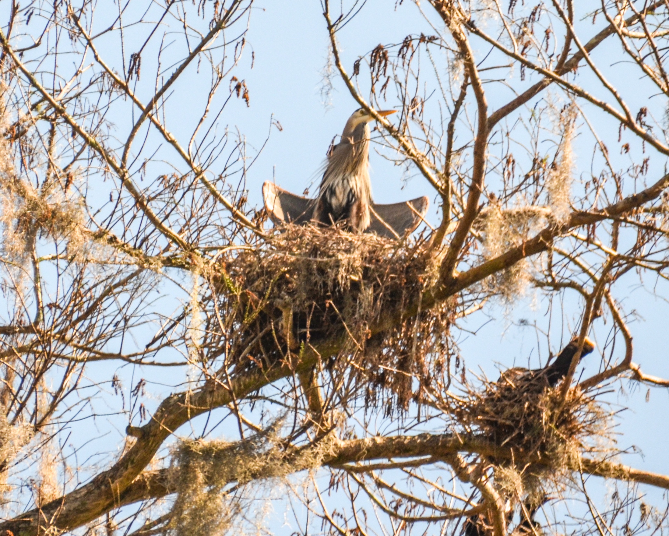
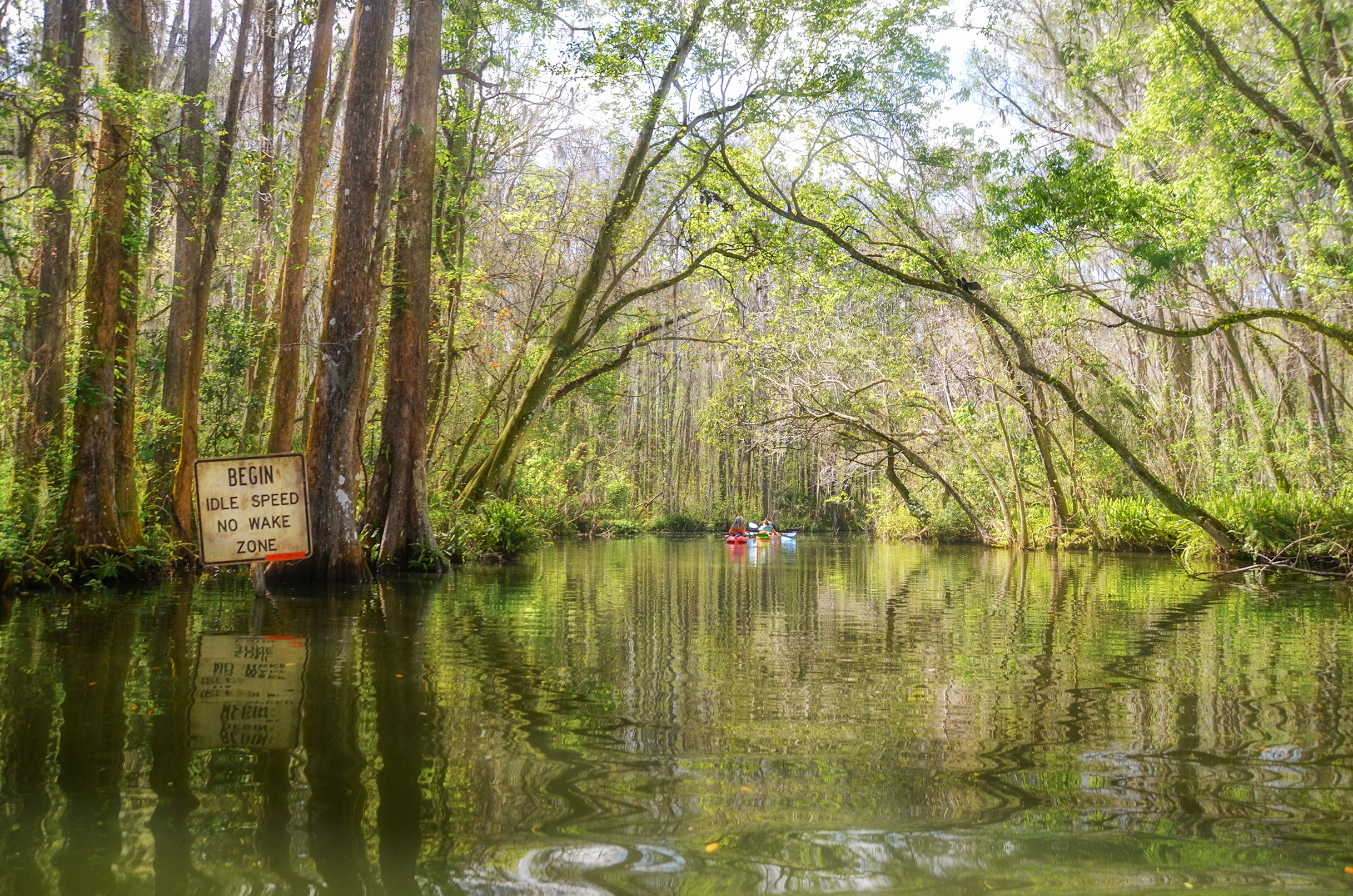
The canal is a short but beautiful stretch through a large wetland swamp, characterized by tall, aged, Bald Cypress trees and Bay. There is a thick canopy overhead abounding with wildlife to include nesting Ospreys, Ibis, Egrets and Herons. In 1951, this beautiful, jungle-like setting was the perfect place to shoot several re-takes of the famous classic movie African Queen, originally filmed in Africa starring Humphrey Bogart and Katherine Hepburn.
Dora Canal Paddle Map…
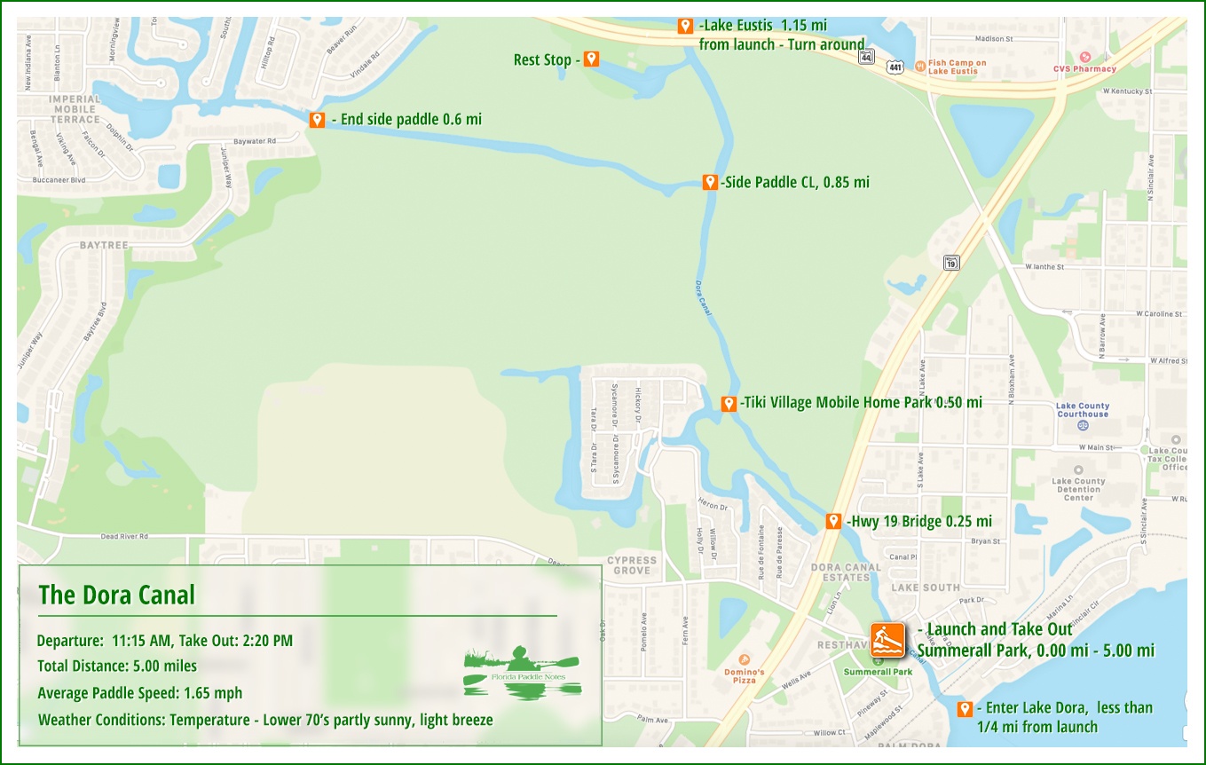
Dora Canal Details:
![]() Location: The Dora Canal is located in Lake County, near the city of Tavares and connects Lake Dora with Lake Eustis.
Location: The Dora Canal is located in Lake County, near the city of Tavares and connects Lake Dora with Lake Eustis.
![]() Launch point and Take out: The launch for this paddle is Summerall Park Boat Launch ( for small boats, kayaks and canoes ) 1001 Wells Avenue, Tavares, Fl, 32778.
Launch point and Take out: The launch for this paddle is Summerall Park Boat Launch ( for small boats, kayaks and canoes ) 1001 Wells Avenue, Tavares, Fl, 32778.
![]() Paddle Distance: 5.0 miles, includes two short side paddles
Paddle Distance: 5.0 miles, includes two short side paddles
![]() Difficulty: Easy…however boat traffic can be quite busy!
Difficulty: Easy…however boat traffic can be quite busy!
 Average Paddle Speed: 1.65 mph.
![]() Width and Depth: The canal averages around 50′ wide, give or take 10′ in some areas.
Width and Depth: The canal averages around 50′ wide, give or take 10′ in some areas.
![]() Current – Tidal: Not affected by either
Current – Tidal: Not affected by either
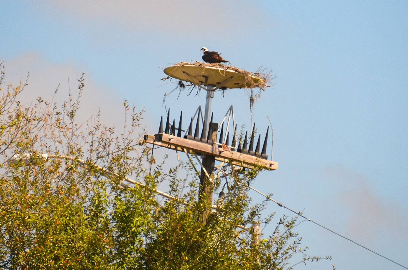
![]() Side Paddles: At mile 0.85 on CL ( Golden Triangle Run Marker #4 ) is a side canal leading to a subdivision. We paddled the wooded canal for just over a 1/2 mile before reaching the subdivision. It was a pleasant paddle. Just before the HWY 441 bridge at Lake Eustis, there is a small lagoon to the left which we paddled in to have a short break. This used to be a business/home with remnants of some diverse landscaping, as well as a freaky looking Osprey nest up on a power pole.
Side Paddles: At mile 0.85 on CL ( Golden Triangle Run Marker #4 ) is a side canal leading to a subdivision. We paddled the wooded canal for just over a 1/2 mile before reaching the subdivision. It was a pleasant paddle. Just before the HWY 441 bridge at Lake Eustis, there is a small lagoon to the left which we paddled in to have a short break. This used to be a business/home with remnants of some diverse landscaping, as well as a freaky looking Osprey nest up on a power pole.
![]() Rest Areas: There are bathroom facilities at the launch and a chance to exit your kayak in the above mentioned lagoon.
Rest Areas: There are bathroom facilities at the launch and a chance to exit your kayak in the above mentioned lagoon.
Summerall Park Launch:
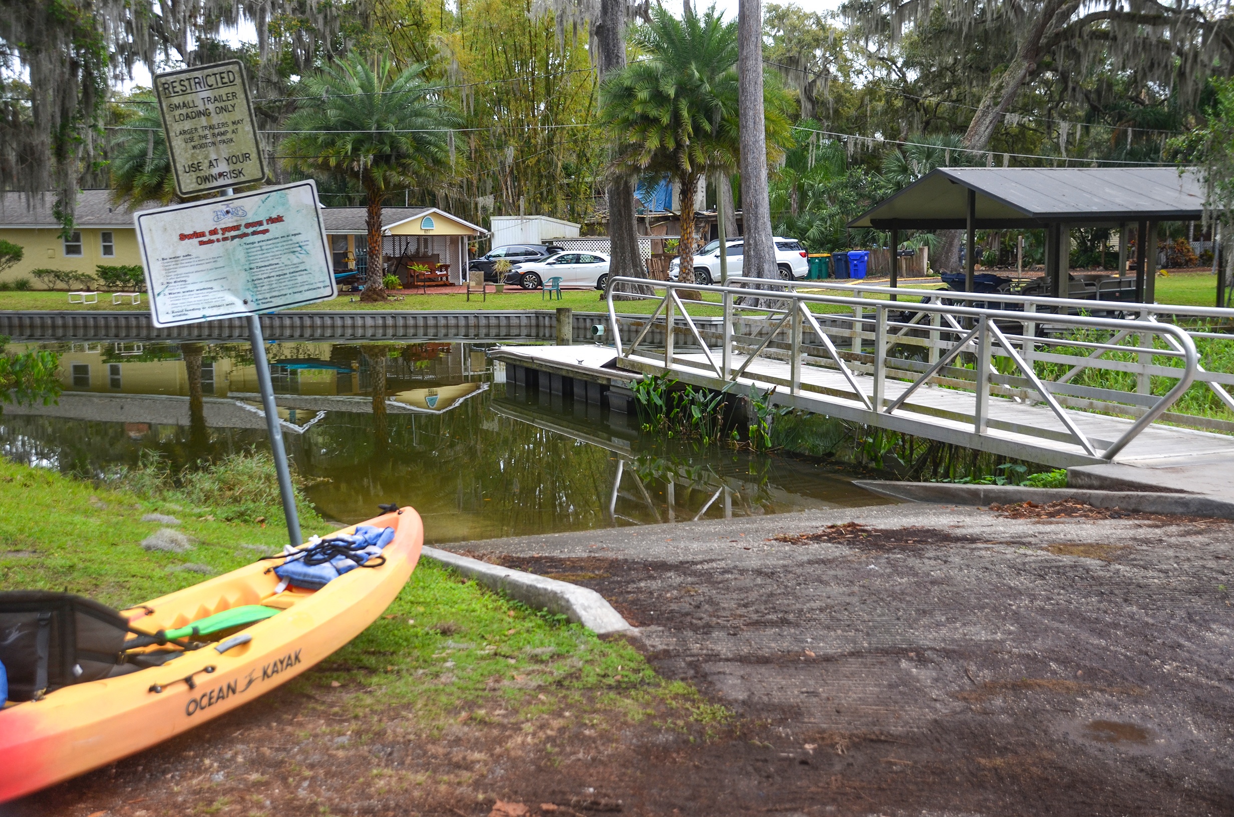
Summerall Park is located at 1001 Wells Avenue, Tavares, Fl 32778. The road approaching the park is a bit tricky and can be missed…keep to the right. The ramp is a very good concrete ramp with a small floating dock. There are no fees to park or launch and there are bathroom facilites.
Launching from the park has us on the canal within 250′ and thus having to avoid any lake paddling, whether on Lake Dora or Lake Eustis. We paddled to our right just under 1/4 mile to view Lake Dora, then turned around to begin the entire Dora Canal paddle.
The Dora Canal:
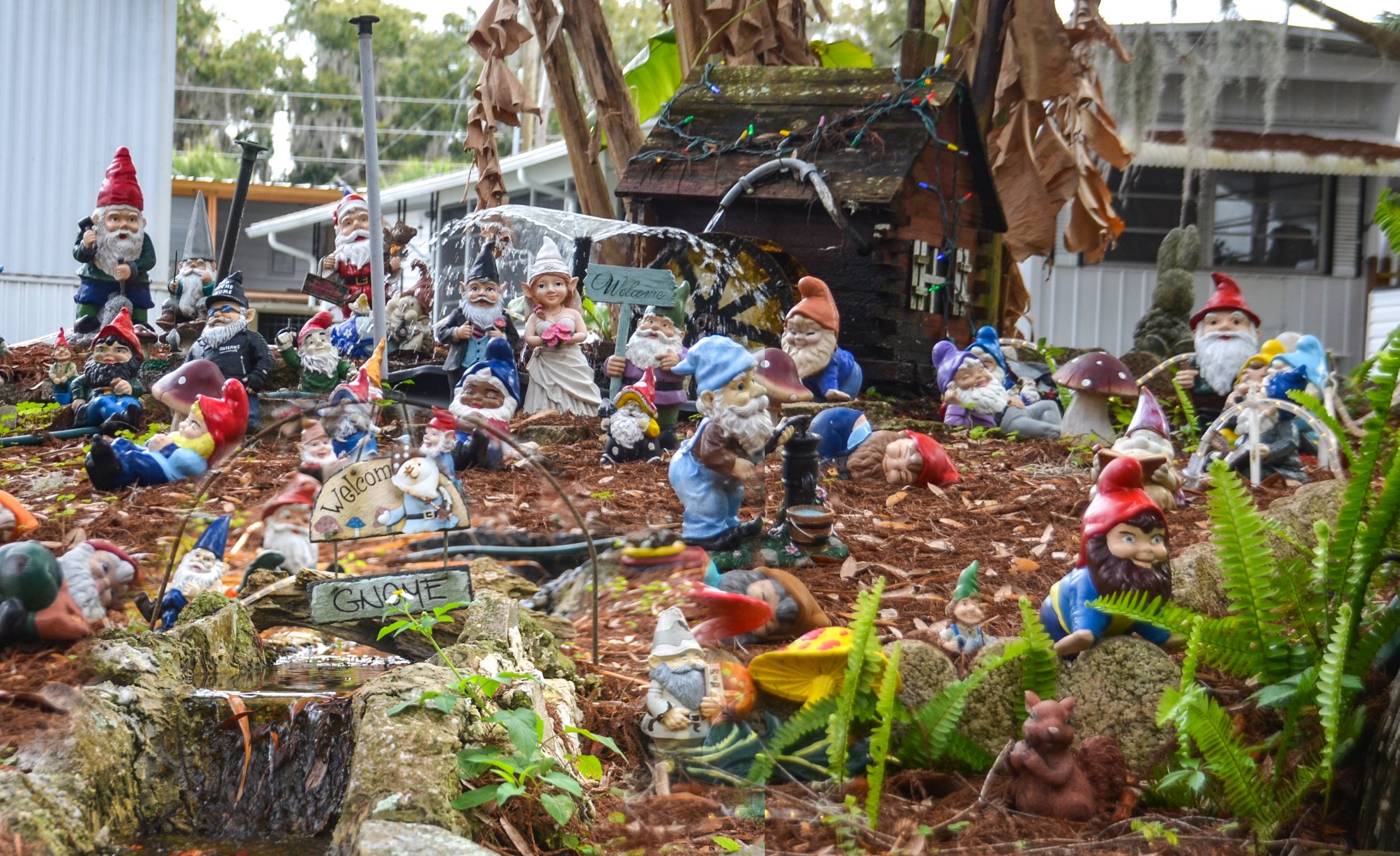
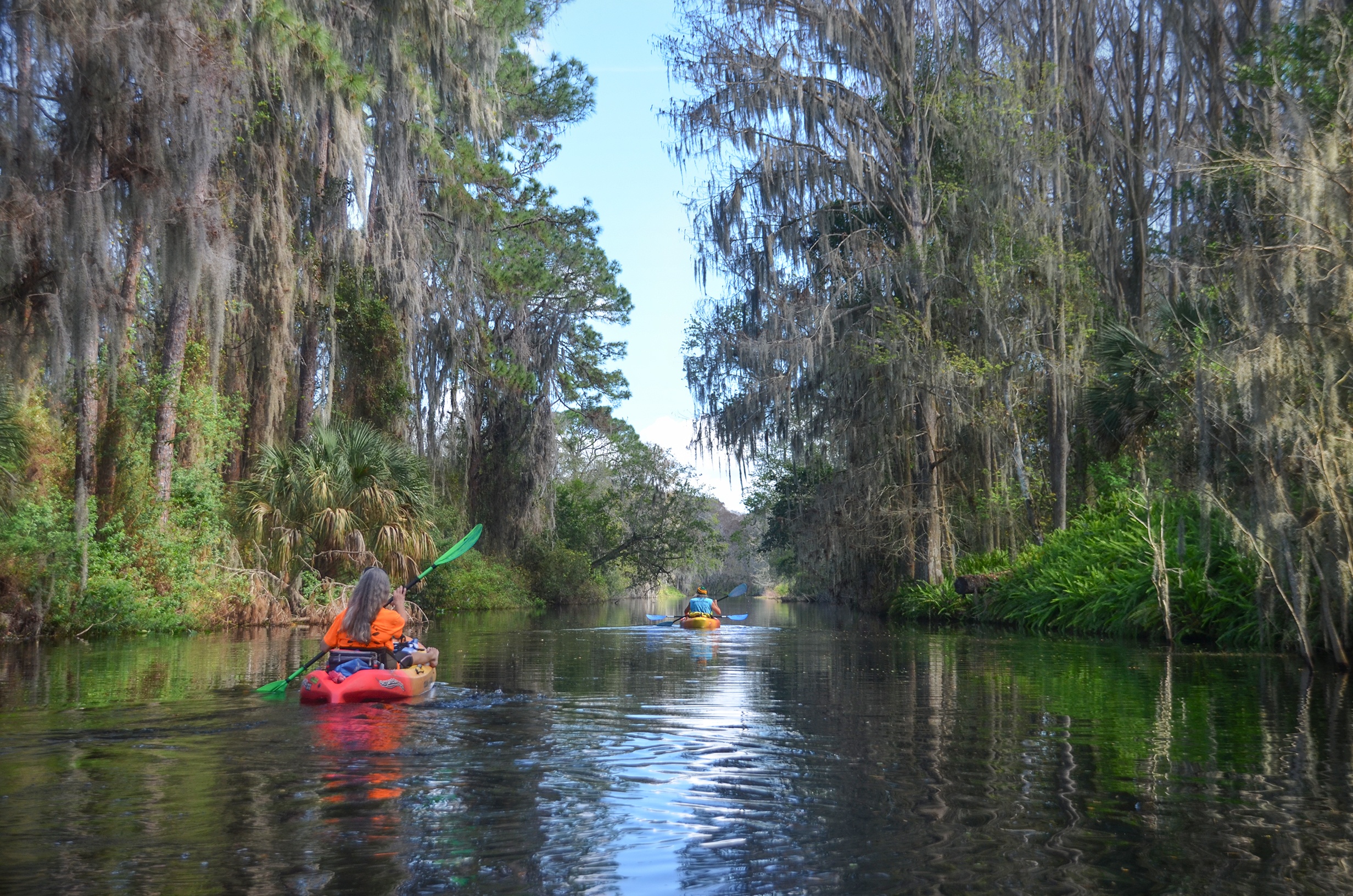
Just getting onto the Dora Canal was pleasant. A wonderful shady, canopied waterway of Oaks, Palms and Spanish Moss, winding through old river homes and mobile home parks…at least for the first 1/4 mile. Within that first 1/4 mile, be sure to see the Gnome City display on canal right…cute and creative!
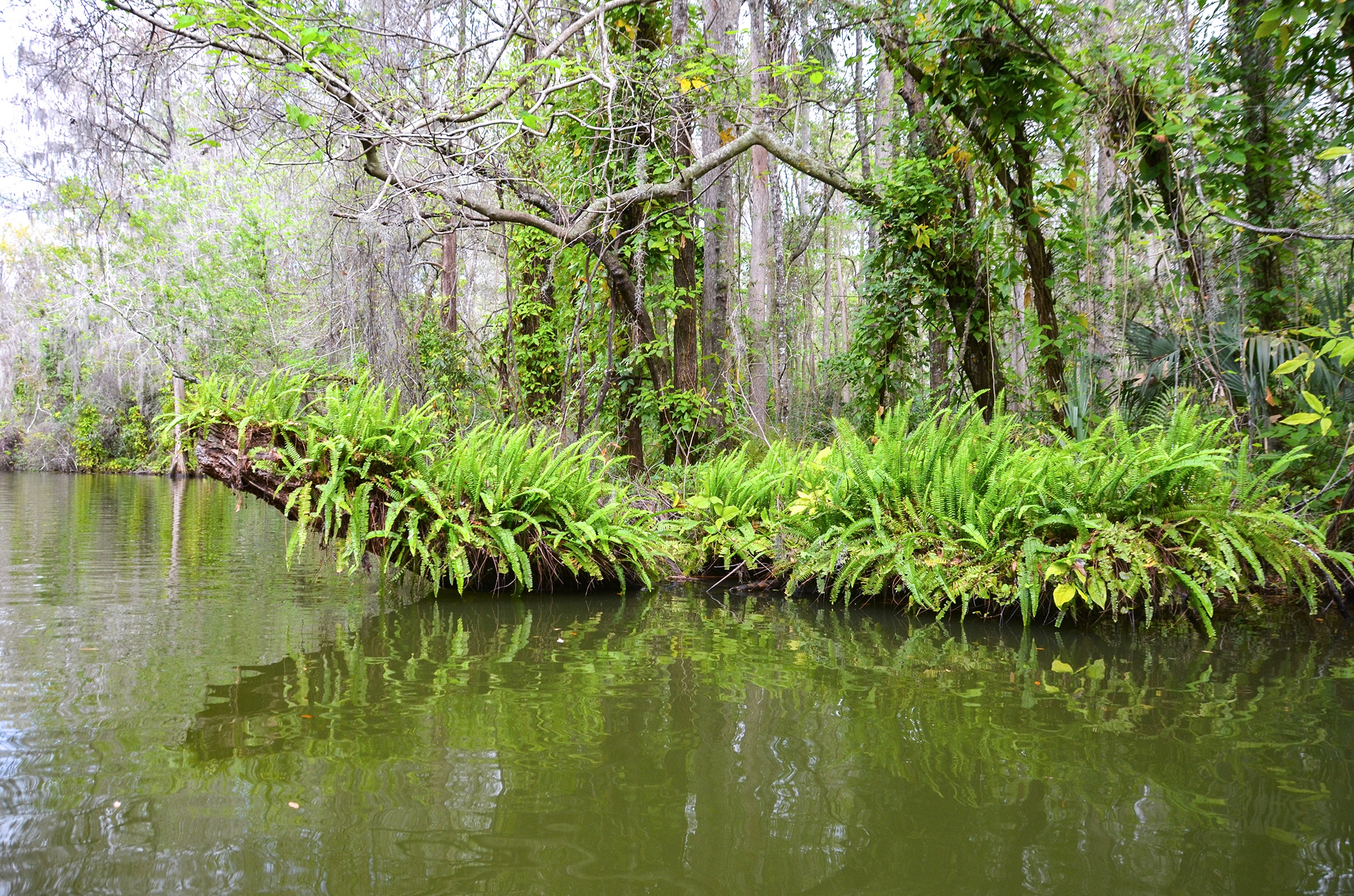
Once under the HWY 19th Bridge ( S. Duncan Dr. ) the remaining paddle is through a beautiful woodland swamp, with Bald Cypress, Palms and Tupelo covered in Spanish Moss. The temperature is pleasant and the canopied waterway is cool. Quite noticeable are the numerous vines climbing up many of the stately tree trunks. Overhearing a tour guide on a passing boat, I learned these vines are Arrowhead Vine – Syngonium podophyllum. Often sold and grown as tropical plants, this particular species has become an aggressive invasive and well populates the Dora Canal, adding to it’s jungle-like characteristics. Boston Fern is abundant all along the paddle, growing on trunks and fallen logs. Wandering Jew, normally a house/landscape vine, can be seen along the paddle as well offering splashes of purple and red.
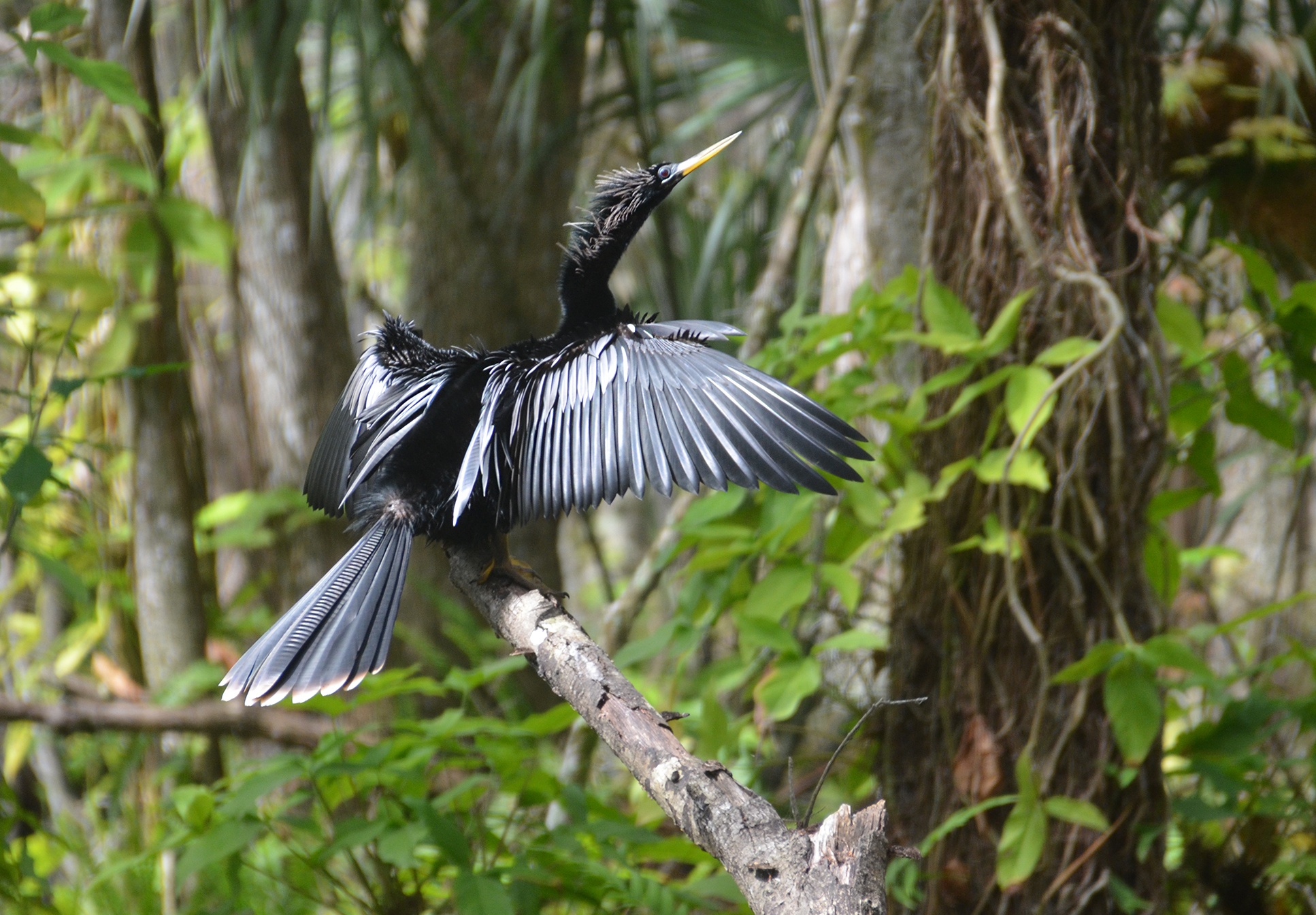
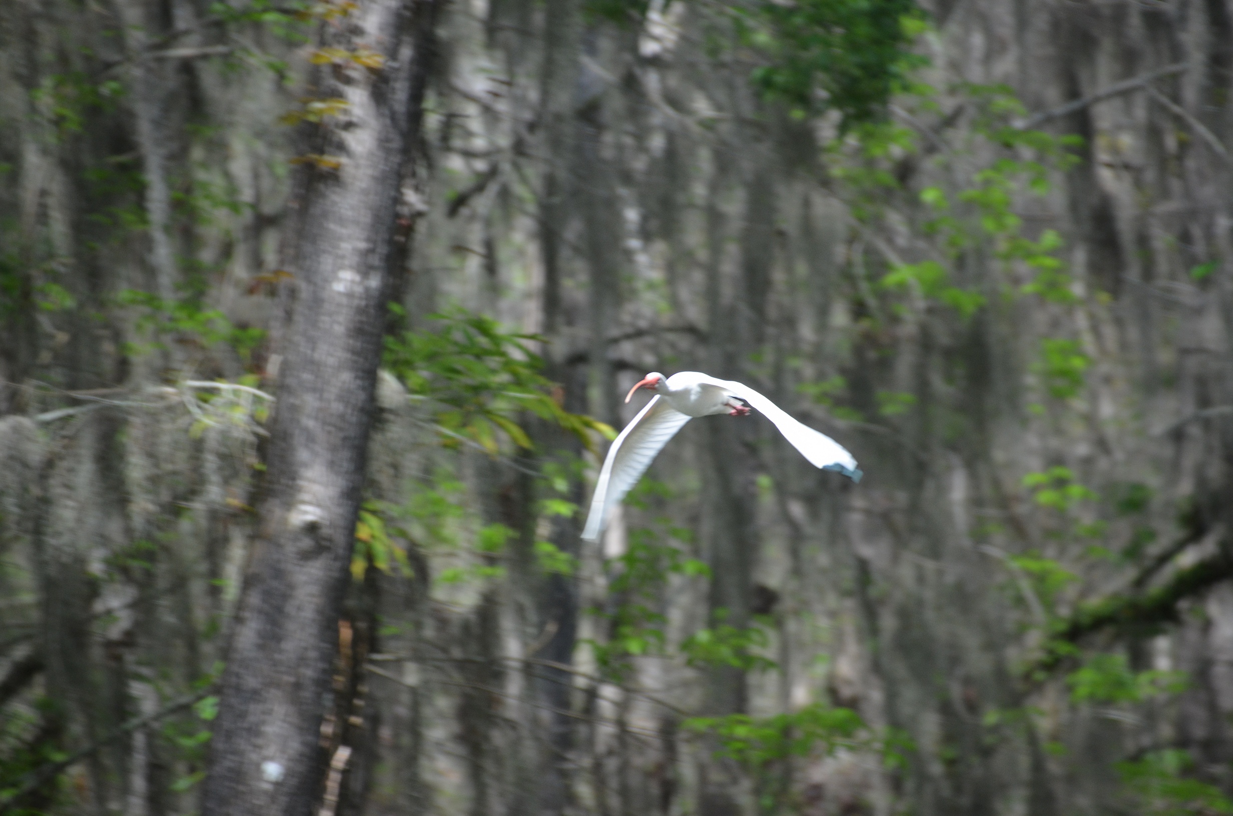
The Dora Canal hosts several species of birds and on this trip we saw numerous Ibis, Anhingas, Herons and Ospreys…several were nesting high above in the Bald Cypress trees.
The Side Paddles:
At canal mile 0.84 on the left, is a side canal that leads West to a subdivision, however the 1/2 mile+ paddle to that subdivision is through swamp wetland and was pleasant. The first 1/4 mile of this 75′ wide canal, is bordered with tall Cypress, Bay, Palms and Pines, creating a nice canopy. The shoreline is covered in Boston Fern. The remaining section is more open but still nice to paddle, adding a little more distance to an otherwise short adventure.
Another side paddle can be taken at mile 1.0 just before the US 441 bridge. On canal left, there is a small lagoon, which was once a small marina and launch. After paddling a couple of hundred feet through a nice shaded canopy, the lagoon opens up approximately 600′ long by 100′ wide. Remnants of old docks remain and the shoreline hosts several landscape plants and trees to include a Rubber Tree, Bananas, Azaleas and others.
The Golden Triangle Run:

The Dora Canal ends into Lake Eustis, just past the HWY 441 bridge. This is part of the Golden Triangle Run. The towns of Mount Dora, Tavares, and Eustis form what is known as The Golden Triangle. The Golden Triangle Run is a 7 stop boating run beginning in Lake Harris and ending at Mt. Dora. The Dora Canal is on this run as it is considered the most famous waterway in Lake County. The first side paddle mentioned above is at Marker #4 of the Golden Triangle Run.

Guides, Maps & Info…
- Tavares, Dora Canal Topo Map…
- Dora Canal Water Information…
- Lake County Blueways – Golden Triangle Run…
![]()