
Brief Overview…
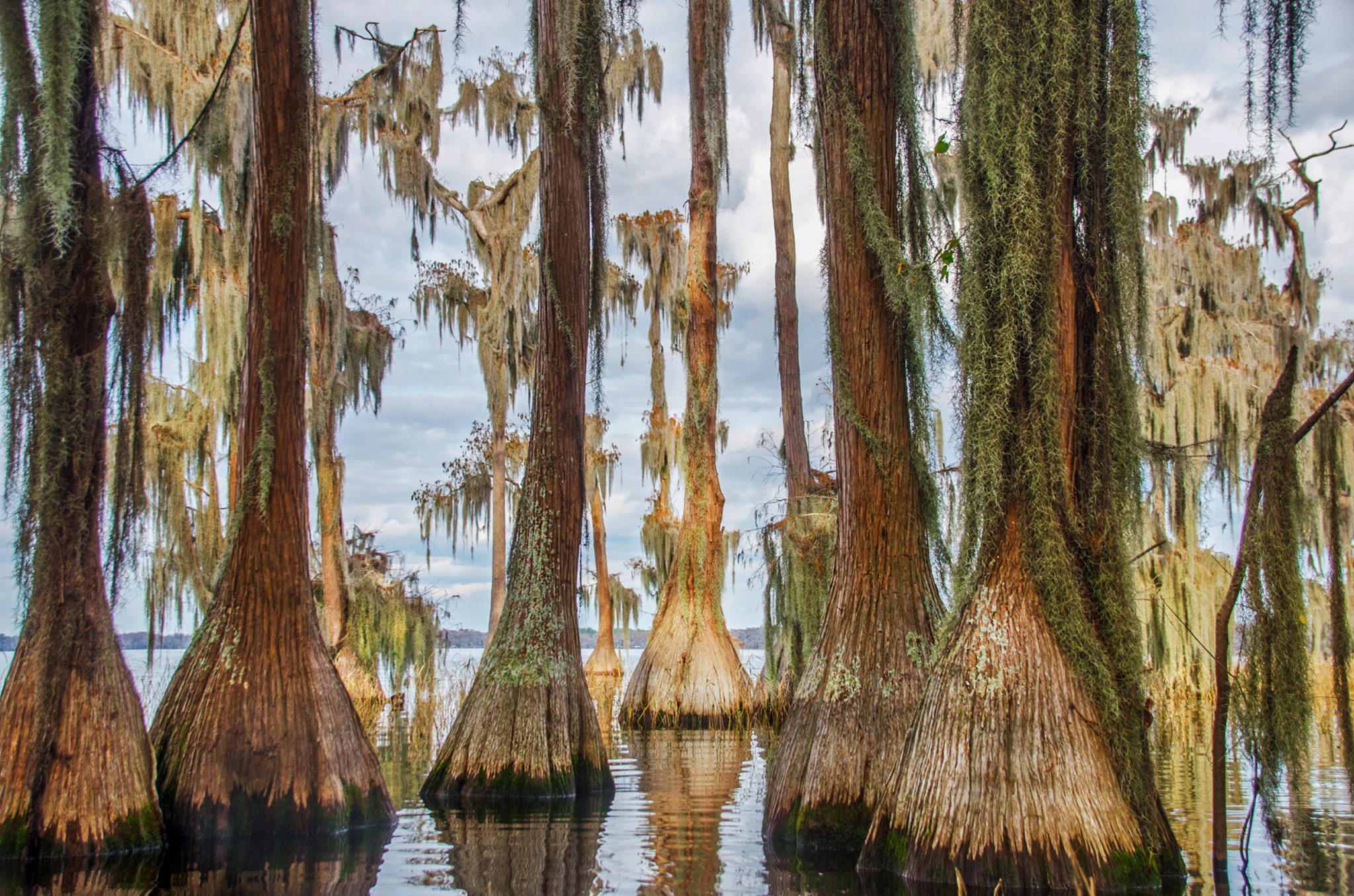
Santa Fe Lake is a 5,850-acre lake in northeastern Alachua County. It forms the headwaters of the Santa Fe River, exiting from Little Santa fe Lake and which flows into the Suwannee River. Santa Fe Lake offers abundant wildlife, excellent fishing and recreational boating. The lake is the third most stable of 120 lakes studied in Florida, as well as one of the clearest. The ordinary high water line (normally the shoreline), is 141 feet above mean sea level. Santa fe Lake is considered a deep lake, with some spots reaching 30’ deep. It is designated by the State of Florida as an Outstanding Florida Water, characterized by the numerous Bald Cypress that grow along the shoreline.
It is supported by water flowing in at the southern extremity of the intermediate aquifer that outcrops in the lake bottom. It is also replenished from rainfall and run-off from the Santa Fe Swamp, north of the lake, which is mostly a wildlife and environmental conservation area managed by the Suwannee River Water Management District.
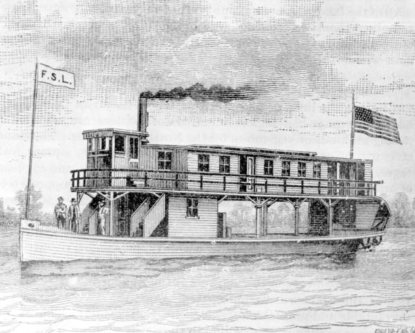
Santa Fe Lake was the largest of a series of lakes, connected by canals dug in the 1870s and 1880s. These canals allowed boats to travel between Melrose (at the time the center of a thriving citrus and tourist industry) and Waldo, the railroad terminal. The canal was dredged from Little Lake Santa Fe into Lake Alto. Improved roads and the automobile doomed the era of steamships in Alachua County and the canals fell into disuse. The canal is still visible today and navigable by small boats, kayaks and canoes. More information about the Santa Fe Canal can be seen here from a previous Florida Paddle Notes post.
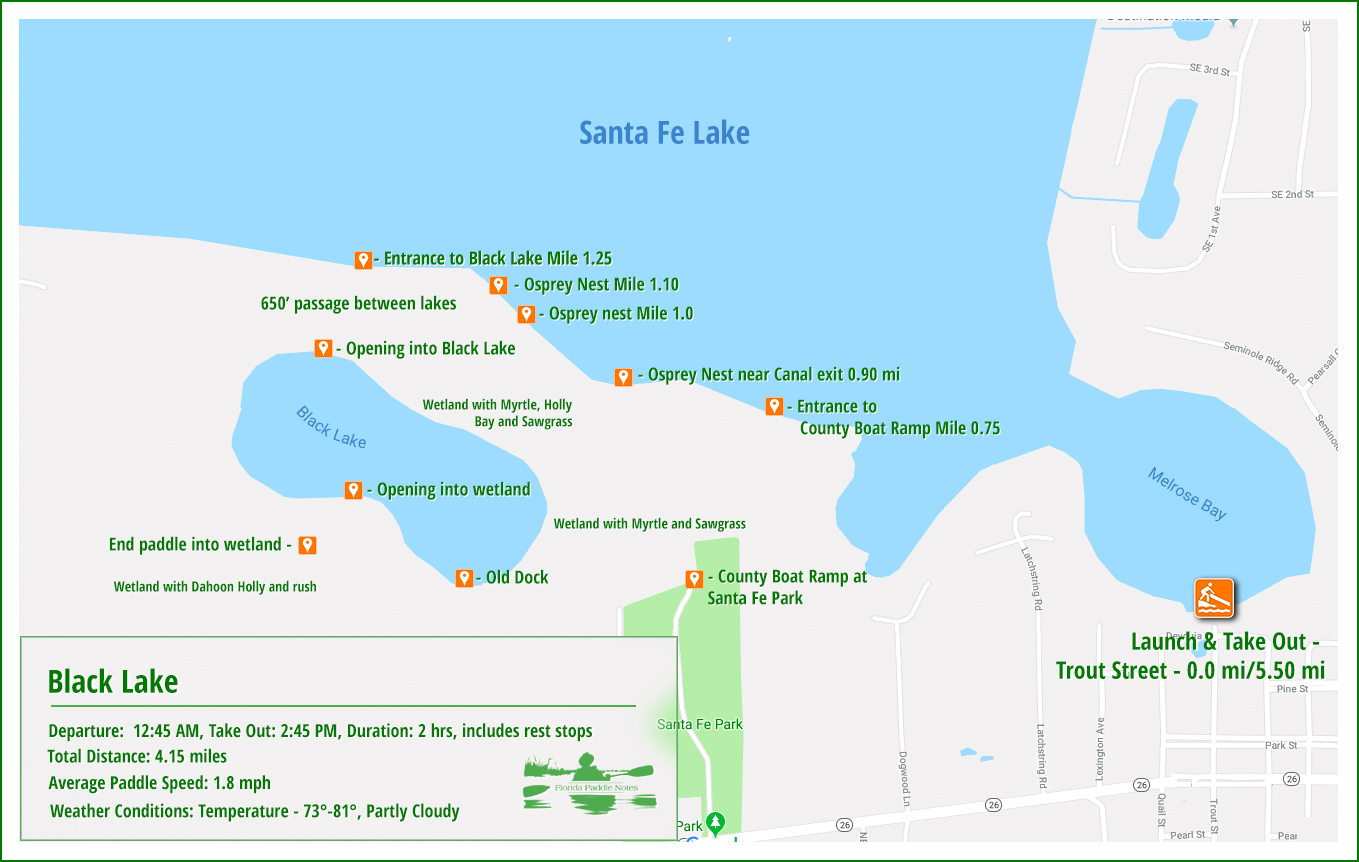
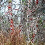
Black Lake is located inside the southern shoreline of Santa Fe Lake, surrounded by a 360 acre wetland. The Lake is a 40 acre, shallow lake, with the depth fluctuating from a couple of feet to 6′. The wetland surrounding Black Lake has numerous Dahoon Hollies, Wax Myrtle and old bays. Many of these trees are weathered and struggling due to the fluctuating water level. The entire boundary of the shoreline is buffered by maidencane, in various stages of growth, 25′-30′ wide.
There is a short 650′ ‘run’ from Santa Fe Lake to Black Lake, no more than 1-2′ deep and 12′ wide. The entrance to the run is located at 29°43’9.55″N, 82° 4’13.08″W.

Santa Fe/Black Lake Details:
![]() Location: Santa Fe Lake and Black Lake are located North of Melrose on Hwy 26.
Location: Santa Fe Lake and Black Lake are located North of Melrose on Hwy 26.
![]() Launch/Take Out point: The launch is located at Melrose Boat Ramp on Trout Street in Melrose. This launch is for boats with 12hp motors or less. Larger boats, to include jet skies and Wave Runners are to use the ramp 0.7 miles to the West at Santa Fe Lake Park.
Launch/Take Out point: The launch is located at Melrose Boat Ramp on Trout Street in Melrose. This launch is for boats with 12hp motors or less. Larger boats, to include jet skies and Wave Runners are to use the ramp 0.7 miles to the West at Santa Fe Lake Park.
![]() Paddle Distance: Paddling from the launch at Melrose Bay, out to Black Lake and exploring Black Lake, is just over 4 miles, round trip. It is 1.25 miles to the entrance of Black Lake.
Paddle Distance: Paddling from the launch at Melrose Bay, out to Black Lake and exploring Black Lake, is just over 4 miles, round trip. It is 1.25 miles to the entrance of Black Lake.
![]() Difficulty: Easy. Wind could present a problem out on Santa Fe Lake.
Difficulty: Easy. Wind could present a problem out on Santa Fe Lake.
![]() Average Paddle Time & Paddle Speed: 2 hours with stops, paddle speed 1.8 mph.
Average Paddle Time & Paddle Speed: 2 hours with stops, paddle speed 1.8 mph.
![]() Width and Depth: Lake Santa Fe averages around 6′ along the southern shoreline and Black Lake is shallow at 3 – 5′. Width is not applicable, although the width of the run connecting the two lakes is around 12′ and very shallow 1′-2′.
Width and Depth: Lake Santa Fe averages around 6′ along the southern shoreline and Black Lake is shallow at 3 – 5′. Width is not applicable, although the width of the run connecting the two lakes is around 12′ and very shallow 1′-2′.
![]() Current – Tidal: Currents and tides do not affect the lakes, however water levels can be an issue for entering Black Lake in severe drought.
Current – Tidal: Currents and tides do not affect the lakes, however water levels can be an issue for entering Black Lake in severe drought.
![]() Side Paddles: If you are adventurous, it is possible, during high water, to paddle from the south shore of Black Lake, south into the wetland. Even at high water the level is 1′ to 1 1/2′ deep at best. The location of this entrance is 29°42’54.47″N, 82° 4’14.40″W.
Side Paddles: If you are adventurous, it is possible, during high water, to paddle from the south shore of Black Lake, south into the wetland. Even at high water the level is 1′ to 1 1/2′ deep at best. The location of this entrance is 29°42’54.47″N, 82° 4’14.40″W.
![]() Rest Areas: No facilities at the Melrose Boat Ramp. There is some iffy spots in the run between the lakes for emergencies. These can be precarious.
Rest Areas: No facilities at the Melrose Boat Ramp. There is some iffy spots in the run between the lakes for emergencies. These can be precarious.
![]() Important Information: Watch for power boats on Santa Fe Lake and be mindful of the wind. Santa Fe Lake is large and can host some strong winds as well as small waves.
Important Information: Watch for power boats on Santa Fe Lake and be mindful of the wind. Santa Fe Lake is large and can host some strong winds as well as small waves.
Santa Fe Lake – Black Lake Paddle Map…
Melrose Bay…
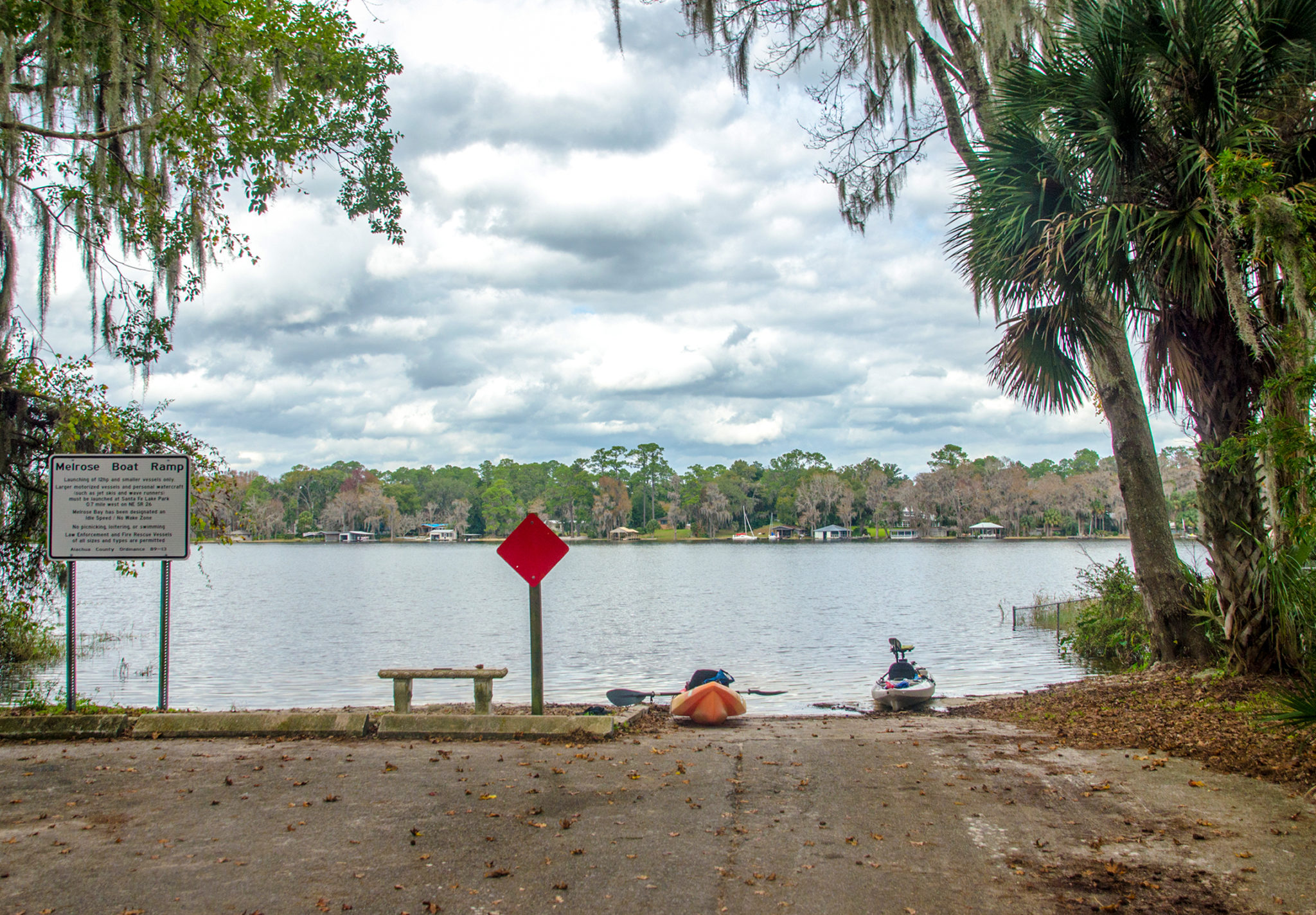
Melrose Bay offers a great place to launch our kayaks. It is a small concrete ramp, and there is a sandy, shallow shoreline as well. There is enough parking for several vehicles, though it is important to leave room for others to launch using trailers.
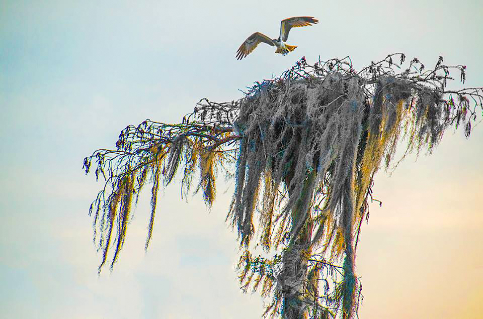
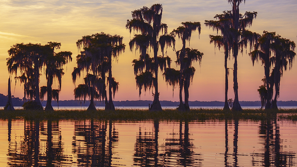
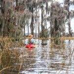
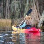
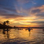
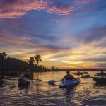
The Bay is completely surround by houses, both large and small and it is a straight shot Northwest to paddle into the pass that connects the bay with Santa Fe Lake. This pass is just over 400′ wide and on the north side ( right ), there is an opportunity to explore a small area of Cypress trees and scattered Maidencane. There are usually several Ospreys in nests overhead and this little strip of Cypress presents a wonderful opportunity for photographers to photograph sunsets. See the gallery at the bottom of this post. From this location in the pass, the southern shoreline of Santa Fe Lake can be seen, just a little over 1/4 mile ahead.
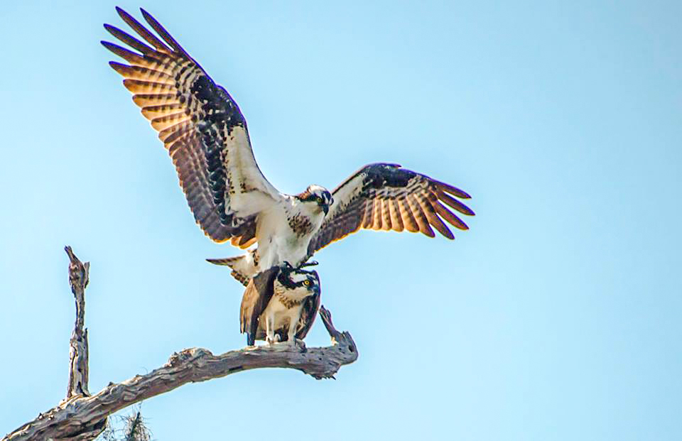
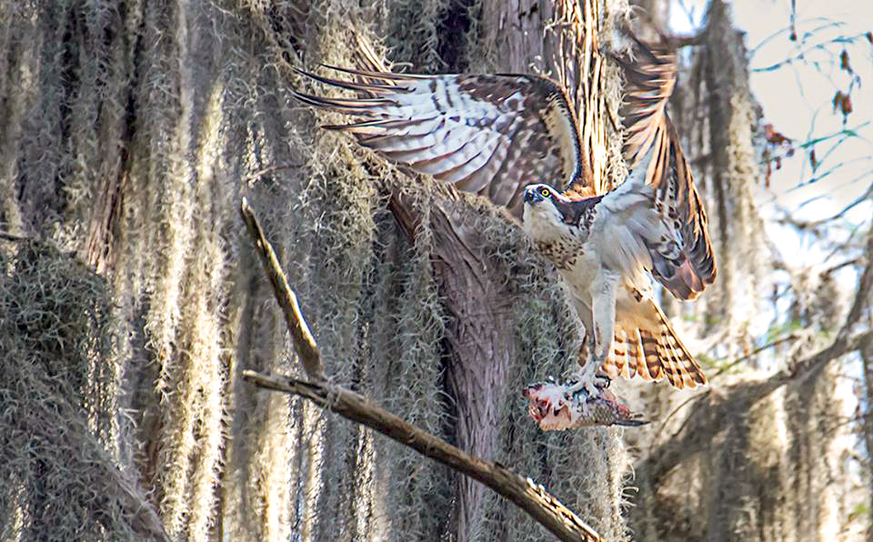
The Ospreys…
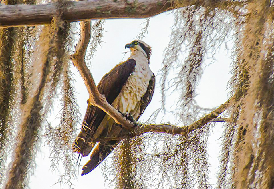
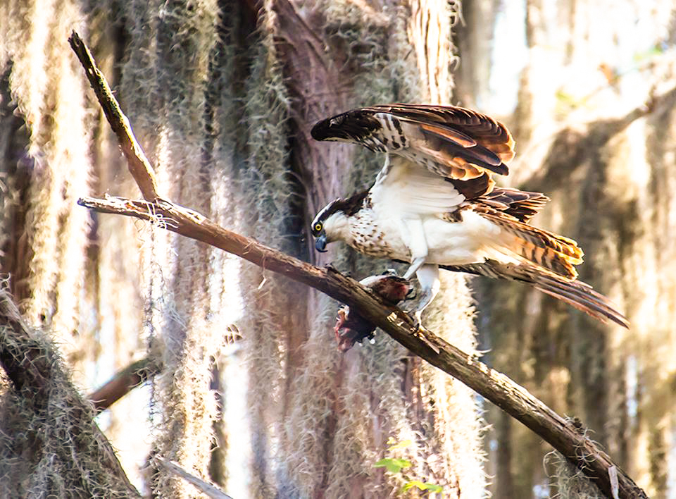
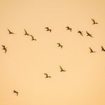
Santa Fe Lake is an ideal habitat to observe Ospreys. They can be seen just about everywhere on the lake, however I usually encounter the most along the eastern and southern shorelines. Here, where there are plenty of tall Bald Cypress trees for nesting and of course plenty of fish to be had, Ospreys are not in short supply.
Ospreys usually nest from December through February and they will make their familiar high-pitched, whistling calls, given as a slow succession of chirps during flight or as an alarm call. I was fortunate to capture the following shots…
Santa Fe Lake …
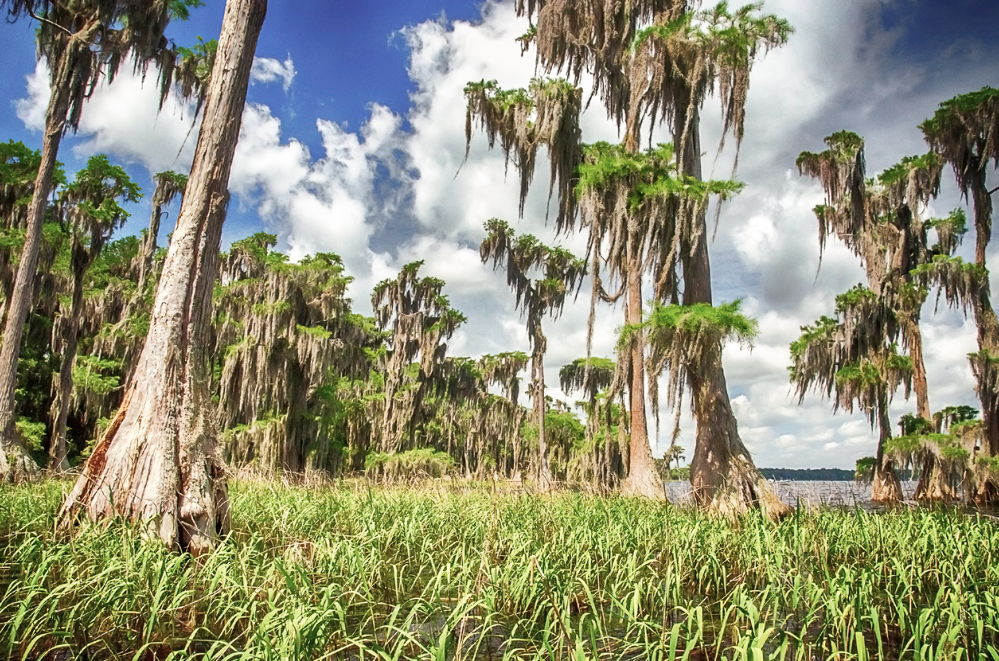
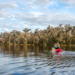
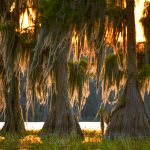
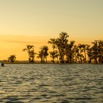
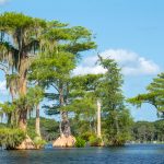
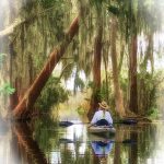
It is a short paddle from the pass to the southern shoreline of Santa Fe Lake. This is a beautiful area, filled with all manner of Cypress Trees, tall and majestic, short and weathered. There is a choice to paddle along the outside edge of the trees or be a bit more adventurous and paddle through them, weaving in, out and around these beautiful trees. Here, as in the pass, are several Osprey nests and they do not hesitate to sound their alarm as we paddle below. This is a serene area and paddling through the trees certainly fills a sense of awe.
At the 3/4 mile mark ( from the launch ) is the first canal that leads to the County Boat Ramp in Lake Santa Fe Park. This is where larger boats come in and out of the lake, so be aware of their presence. Just before Mile 1 is the second canal leading up to residences and also the first of several Osprey nests. Paddling through the Cypress offers a buffer from the wind and waves from larger boats. Also in here, an occasional fishing boat will be tucked among the trees hoping for success in the protected water that fish love.
A little over 1.25 miles, paddling along the shoreline, through the trees is the entrance to Black Lake. It may be hard to pick out for first timers as it is a narrow passage, however the ‘light at the end of the tunnel’ is Black Lake.
Black Lake…
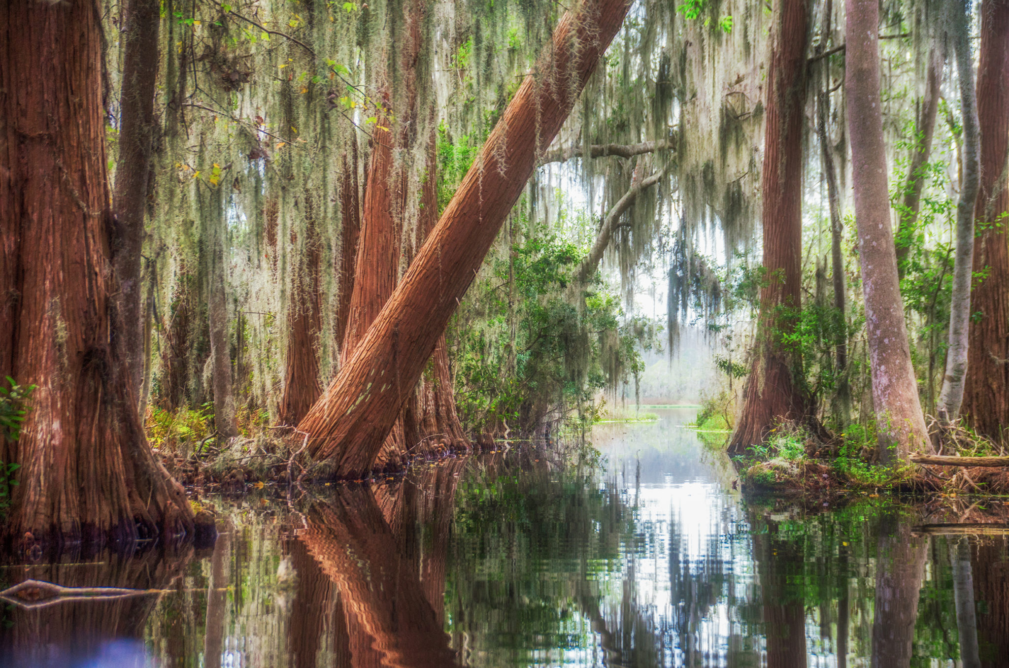
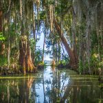
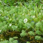
Entering the passage to Black Lake is exciting. It may be just a narrow 650′ waterway, but it is through thick Cypress trees, ferns, Hydrilla, cypress knees and flowers that line the wet shoreline. Ahead is the light that promises something new. Black Lake awaits.
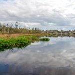
Upon entering Black Lake there is a noticeable difference in the environment and habitat. This 40 acre lake, stretching East and West, is open, secluded and quiet. The lake is in the middle of a 360+ acre wetland and the trees ( or lack of ), shrubs and plants are characteristic of a wetland.
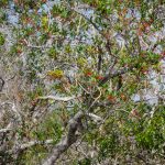
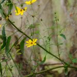
Along the entire perimeter of the lake is a 20′-25′ buffer of new growth Maidencane, while behind it is the larger, dying growth of the older cane. Behind this buffer are scattered Dahoon Hollies, Wax Myrtle and decaying trunks of Bay Trees. An occasional patch of Sawgrass is seen along the eastern and southern shoreline. As we paddle to the east end of the lake, behind this wetland flora, are the Pines, Oaks and Palms of higher ground.
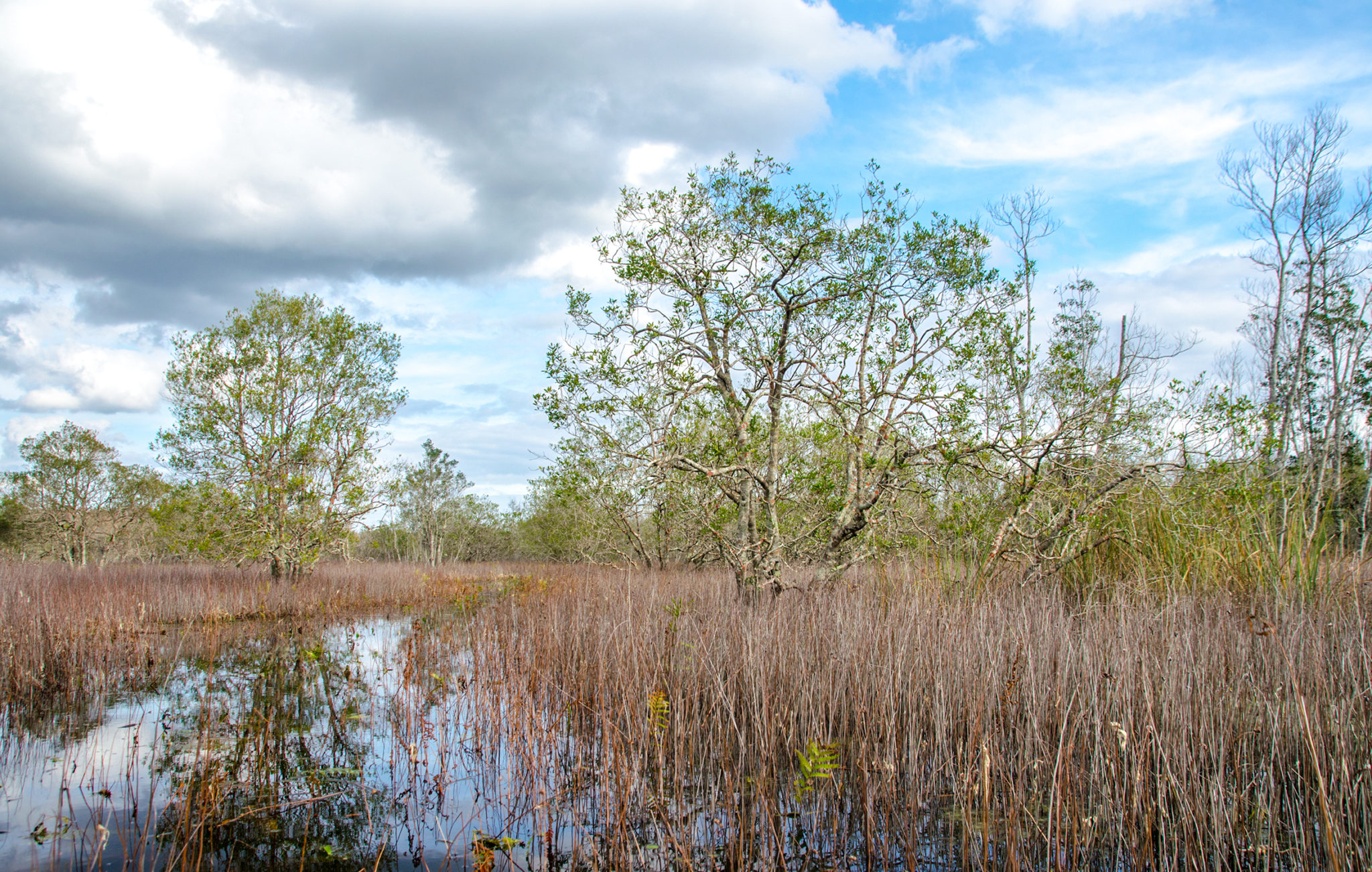
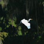
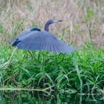
Small Gators, an Otter, Herons and Egrets are seen, as well as fish breaking the still water. Along the southern shore, marked by two clumps of Sawgrass, we venture through and paddle out of Black Lake into the wetland to explore. With only a foot of water below us, we follow what was probably an animal trail in drier times, and venture through the vast expanse of rush. It is obvious that the water level has fluctuated often over the years in this area. The only trees, Dahoon Hollies, are twisted, gnarled with sparse leaves, and red lichens patch their trunks. This is a sign of a struggling tree, and the wetland is full of them. We only venture in about 500′ and returned to Black Lake.
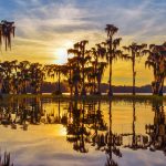
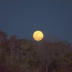
Black Lake is a favorite to paddle to for a full moon. The openness and stillness present an inspiring canvas as the full moon slowly rises above the distant tree line. Day or evening, it is well worth the visit and is an easy paddle to enjoy. I certainly do and will conclude this chapter of Florida Paddle Notes.
Santa Fe Lake – Black Lake Photo Gallery:


Guides, Maps & Info…
- Melrose Bay at Santa Fe Lake Topo Map…
- Black Lake Topo Map…
- Santa Fe Water Level Data…
- Lake Santa Fe Information…
- Santa Fe Lake Park…
![]()