
Overview:
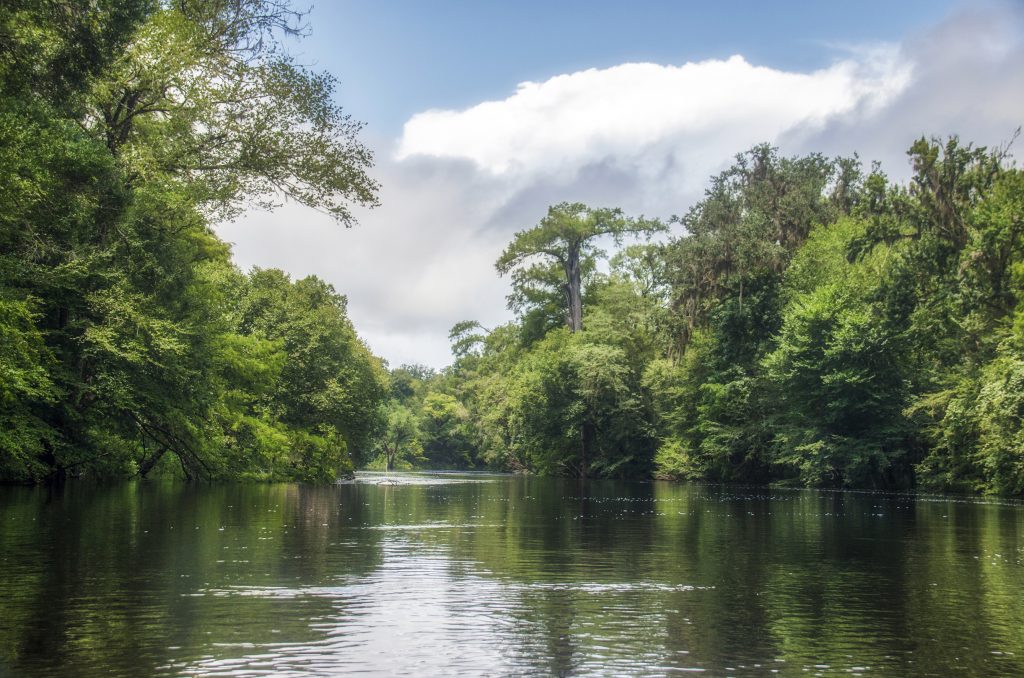
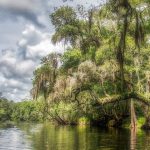
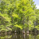
The Santa Fe River is a 75-mile river in north central Florida and derives its name from a Franciscan mission named Santa Fé de Toloca once located near the river. It’s source is Lake Santa Fe – Little Lake Santa Fe located north of Melrose and East of Waldo. The upper half of The Santa Fe is a small, winding creek that often dries in low water periods and the river is usually a slow-flowing river.
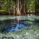
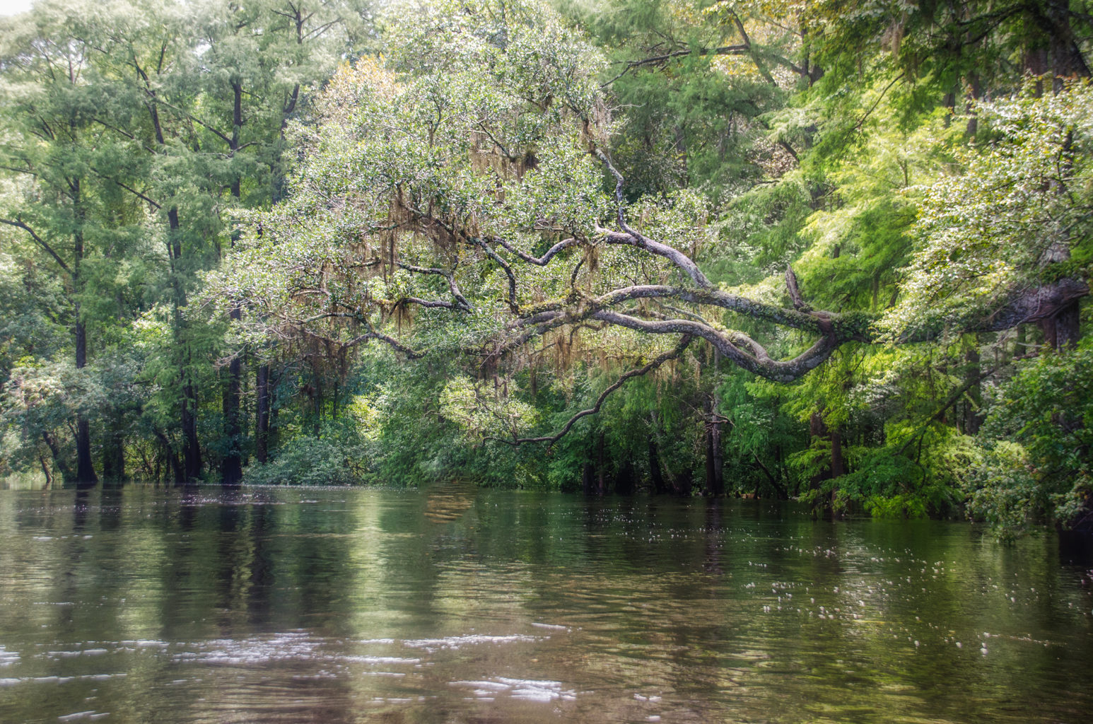
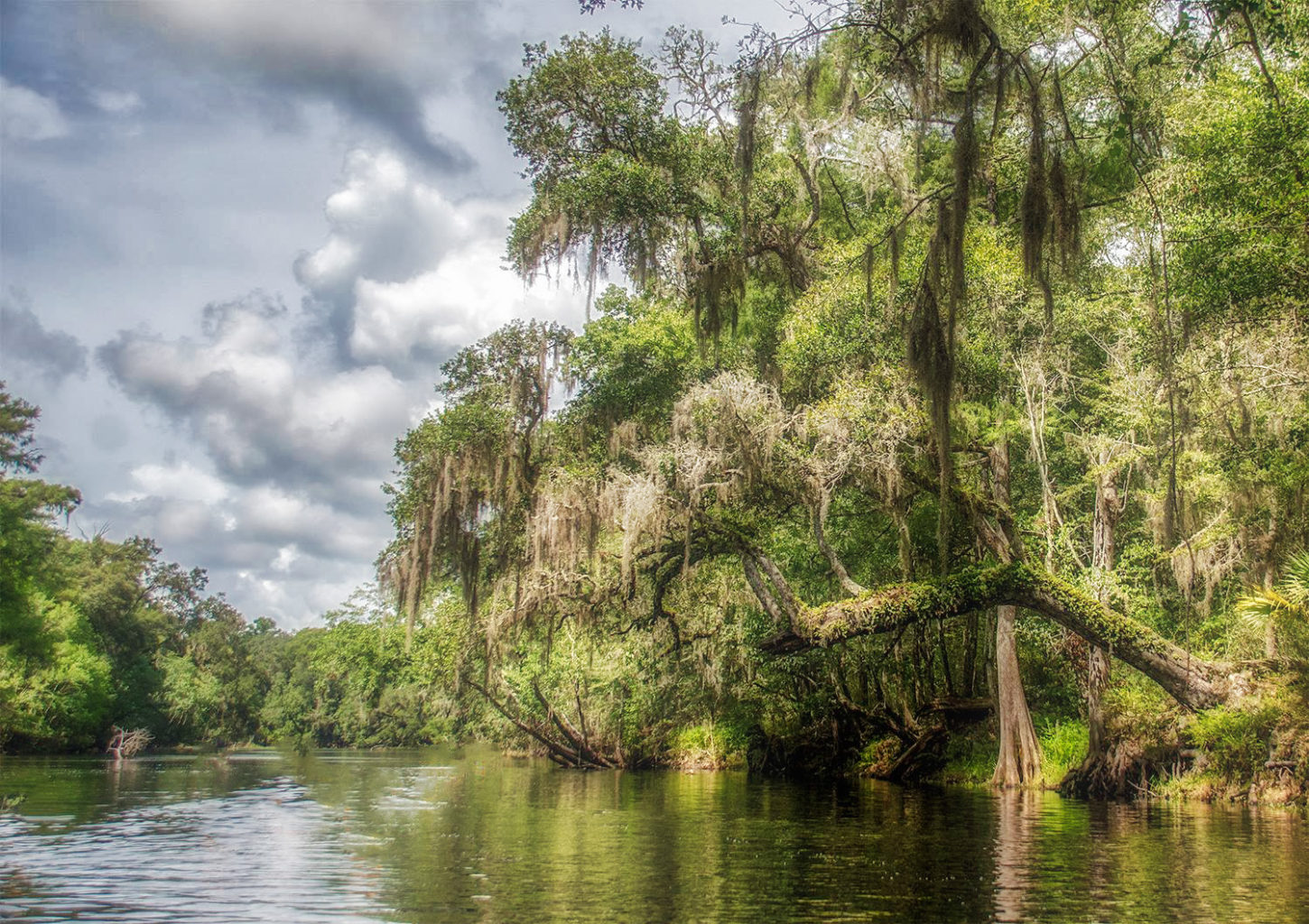
Tannic acid, released from the roots of the cypress trees, leaves and organic matter, give the Santa Fe River a dark, tea-colored appearance.
The tributaries of the Santa Fe include the New River, Olustee Creek, and the Ichetucknee River. The Santa Fe flows into the Suwannee River near Branford, Florida.
An interesting aspect of the river is that in it’s upper section, the river flows into a sinkhole at O’Leno State Park, flows underground for 3 miles then surfaces in River Rise Preserve State Park near High Springs.
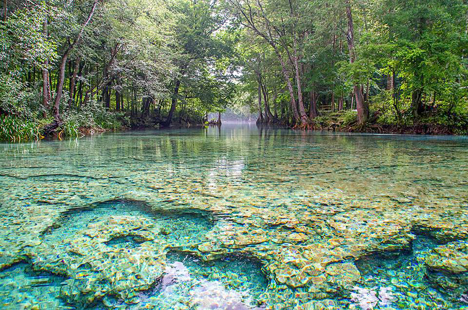
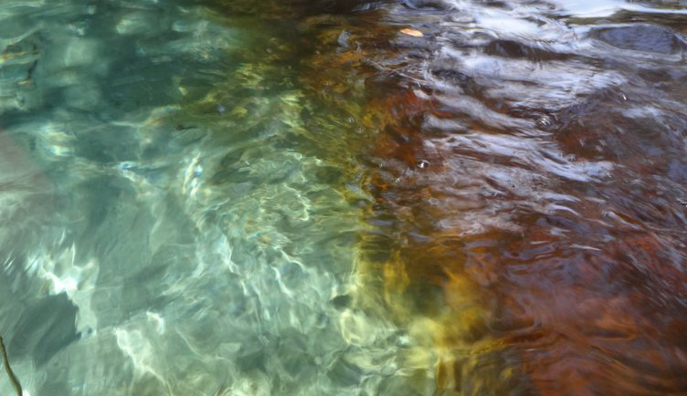
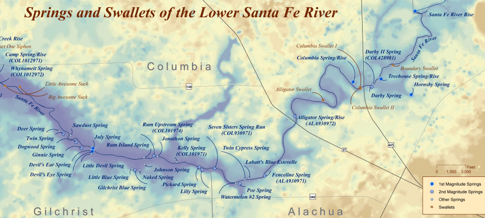
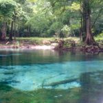
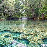
Dozens of springs feed into the Santa Fe river many of which are located in what is called the Lower Santa Fe River. Some springs are small and have interesting stories as does Lily Spring once occupied by ’Naked Ed’ and the neighboring Packard Spring, whose tenants enjoy skinny dipping. Some of the most popular springs include Poe Springs, Rum Island Spring, Gilchrist Blue, Ginnie, Devils Eye and Devils Ear.
Due to the numerous springs the water temperature is usually around 72 °F, especially close to the springs.
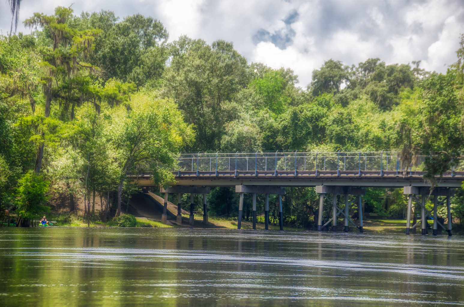
A 26 mile Designated Paddling Trail runs from High Springs to Branford at the Suwannee River. The upper portion of this stretch has the abundance of popular springs and after the Ichetucknee River flows into the Santa Fe the river widens. In this section there is more development and there are numerous powerboats as it flows into the Suwannee River.
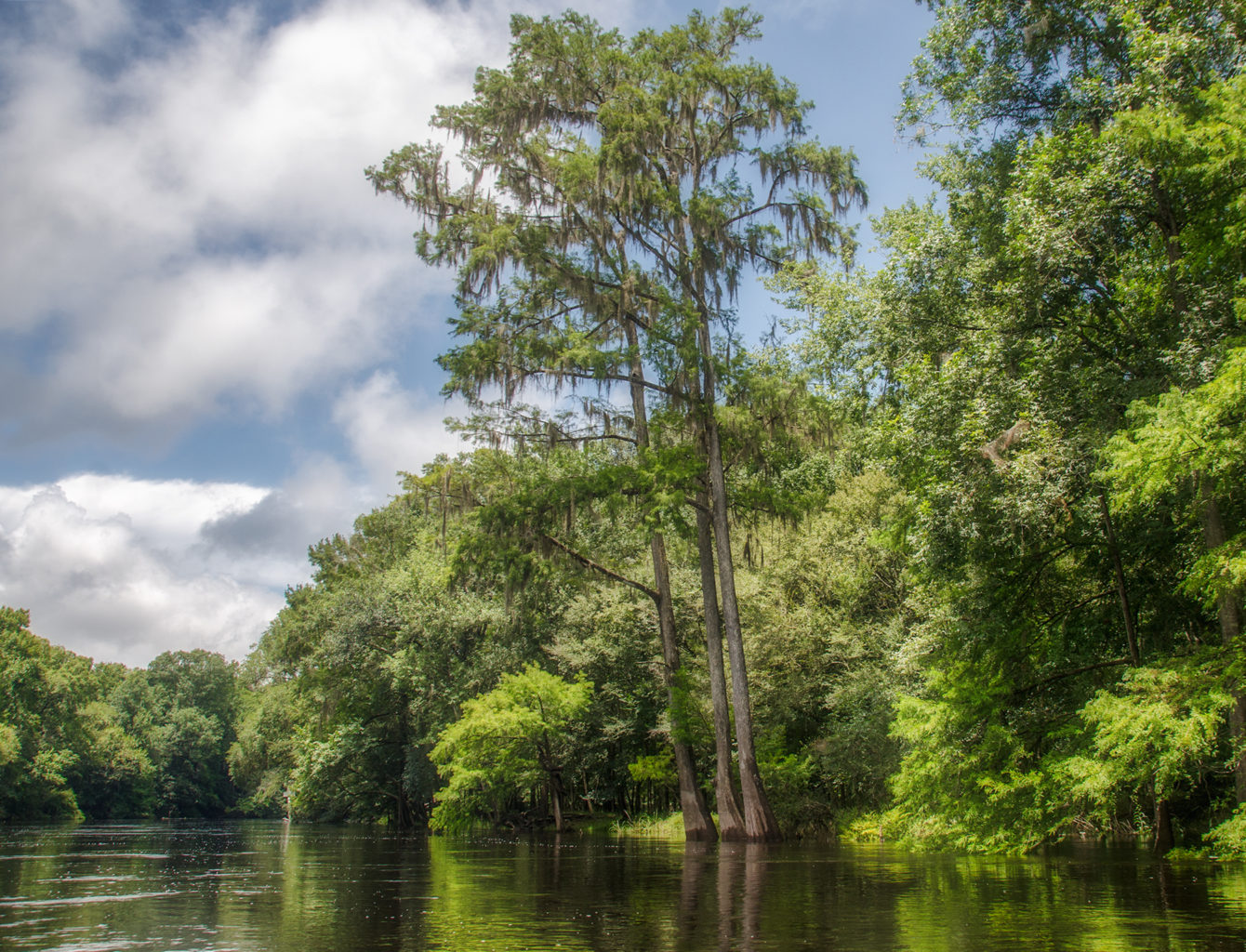
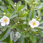
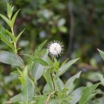
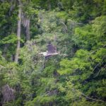
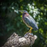
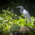
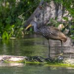
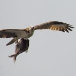
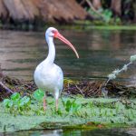
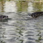
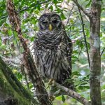
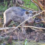
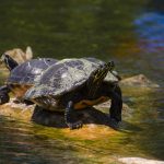
The Santa Fe River has an abundance of wildlife to include several species of Turtles, Otters, Deer, Snakes, Herons, Egrets, Limpkins, Owls and Ospreys among others. Along the shoreline is an assortment of hardwood trees and in the lower-lying areas there are a variety of shrubs to include Spider Lilies, Atamasco Lilies, Buttonbush, Red Cardinal Flower, Yellow Burr Marigolds and Purple Asters. See the Flora and Fauna galleries below…
Guides, Maps & Info…
- oursantaferiver.org has a few nice maps and guides for this river…
- Florida Springs Database by Greg Johnson…
- A great interactive map for Florida Springs. This opens in Google Earth for me…
- floridaspringlife.com has a good interactive map of Santa Fe River Springs…
- Florida Designated Paddling Trails – Santa Fe River Guide (pdf)…
- 5-Star Yak Pak.org has a great detailed Santa Fe Fact Sheet Mileage Chart…
- Suwannee River Water Management District has an excellent (pdf ) covering Springs on the Santa Fe River…
- Springs Fever also has excellent information on the Santa Fe River and each spring (pdf )…
River Details ~ Paddle Notes ~ Flora ~ Fauna
Santa Fe River Details:
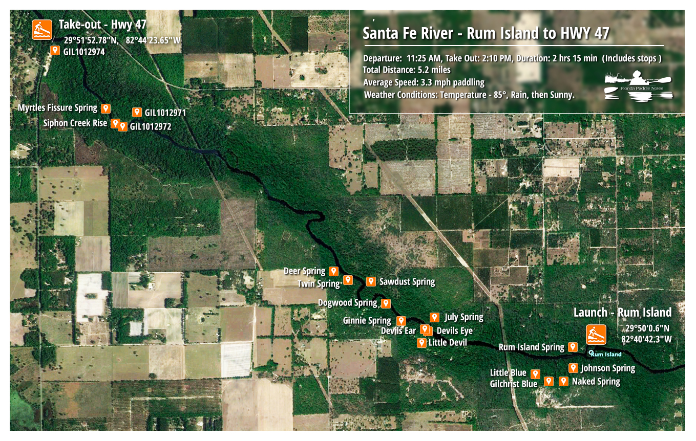
![]() Location: The Santa Fe River ‘s source is Lake Santa Fe – Little Lake Santa Fe located north of Melrose and East of Waldo in Alachua County. It flows in a westerly direction, meeting the Suwannee River in the northwest corner of Gilchrist county.
Location: The Santa Fe River ‘s source is Lake Santa Fe – Little Lake Santa Fe located north of Melrose and East of Waldo in Alachua County. It flows in a westerly direction, meeting the Suwannee River in the northwest corner of Gilchrist county.
![]() Launch point: The launch point for this paddle is at Rum Island County Park. Take US 27 NW out of High Springs for 3.3 miles from downtown. Turn left on CR 138 and travel 2 miles. Turn left on Rum Island Road and travel 1.5 miles to the park and launch.
Launch point: The launch point for this paddle is at Rum Island County Park. Take US 27 NW out of High Springs for 3.3 miles from downtown. Turn left on CR 138 and travel 2 miles. Turn left on Rum Island Road and travel 1.5 miles to the park and launch.
![]() Paddle Distance: This paddle is 5.2 miles, taking into account some side paddles to Gilchrist Blue and Ginnie Springs.
Paddle Distance: This paddle is 5.2 miles, taking into account some side paddles to Gilchrist Blue and Ginnie Springs.
![]() Difficulty: Easy to moderate. The river is open with a nice easy flow. I say moderate only if water levels are low as there may be shoals and rocks. Today’s paddle was with a swift flow which added some fun corners to go around.
Difficulty: Easy to moderate. The river is open with a nice easy flow. I say moderate only if water levels are low as there may be shoals and rocks. Today’s paddle was with a swift flow which added some fun corners to go around.
 Average Paddle Time: Today’s paddle, which included stops at Gilchrist Blue, side paddles to Naked Spring, Little Devil and Ginnie added some extra time. Out total paddle today took 2 hours 40 minutes.
![]() Width and Depth: The water level was high and the average width of the navigable river is about 170′ wide.
Width and Depth: The water level was high and the average width of the navigable river is about 170′ wide.
![]() Current – Tidal: The flow was swift due to the amount of rainfall this summer and made for a fun, easy paddle.
Current – Tidal: The flow was swift due to the amount of rainfall this summer and made for a fun, easy paddle.
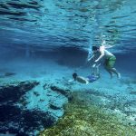
![]() Side Paddles: There are numerous side paddles on this section of the river. The side paddles are short as they lead to the many springs along the route. Neither of the side paddles are of any great distance. These include Gilchrist Blue run, Naked Spring, Little Devil Spring and Ginnie Spring. Due to the high water levels, several of the spring runs were completely covered.
Side Paddles: There are numerous side paddles on this section of the river. The side paddles are short as they lead to the many springs along the route. Neither of the side paddles are of any great distance. These include Gilchrist Blue run, Naked Spring, Little Devil Spring and Ginnie Spring. Due to the high water levels, several of the spring runs were completely covered.
![]() Rest Areas: There are numerous areas to stop and rest along this section of the river. Many of the larger springs have public restrooms available. Due to high water levels some familiar rest stops were submerged.
Rest Areas: There are numerous areas to stop and rest along this section of the river. Many of the larger springs have public restrooms available. Due to high water levels some familiar rest stops were submerged.
Paddle Notes:
The sky is crying…
As I mentioned in my initial post on the Santa Fe River, this river has always been special to me. Having lived on 5 acres, walking distance up the then dirt road from the river, I spent many days exploring the springs and boating the river. Each time I return I recall fond memories, and though it’s been over 45 years ago that I first moved here from Miami, it’s almost like coming home!
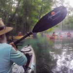
Today’s paddle with the Boll Green Aquaholics was one not to be missed! I’ve done several previous paddles covering sections from HWY 27 bridge outside of High Springs, to Sawdust Springs and today we’re going up further to the take-out on Hwy 47. It has been so long since I’ve been on the section covering Hwy 47 and I was looking forward to visiting Siphon Creek and Myrtle’s Fissure! Despite a sketchy weather report, we met at 11:00 am, unloaded our boats and gear and proceeded to set up our shuttle needs, driving some vehicles to the take out on Hwy 47. By 11:30 we were launching under a brief drizzle but nothing too bad, although the sky was threatening more!
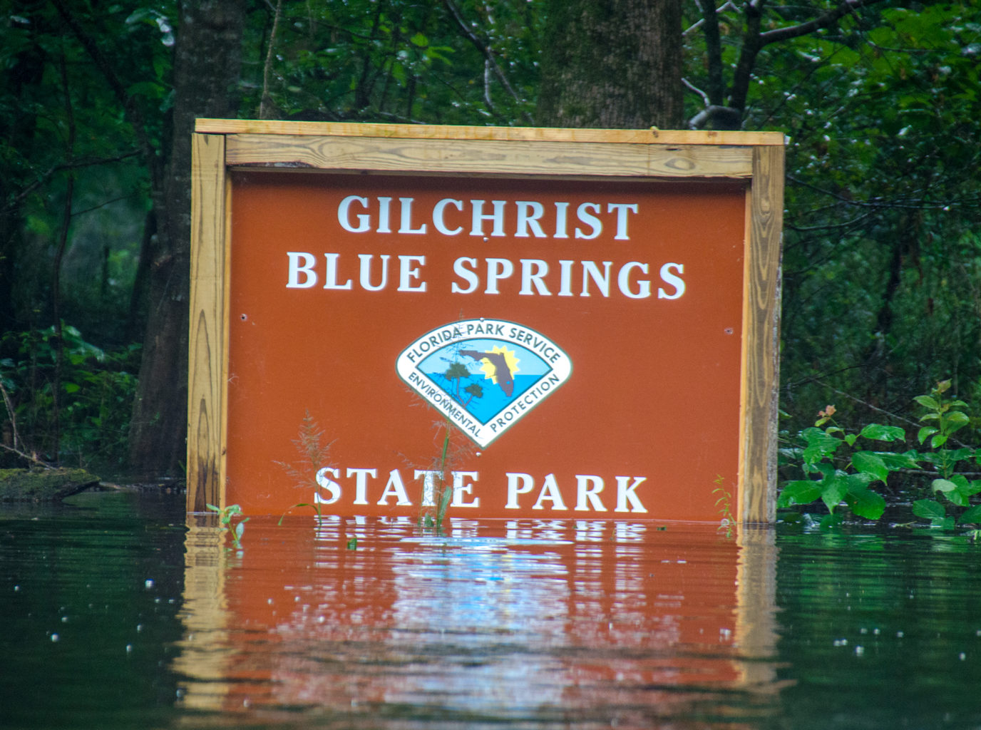
It was obvious when we arrived that the water level was high and the current was swift. Having had an abundance of rain over the Spring and Summer, most of the rivers of recent paddles have also been high and fast. We launched and proceeded about a tenth of a mile down river to the Gilchrist Blue Springs run. The state park sign was a definite indicator on the water level height.
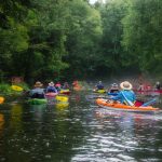
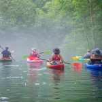
This run, which as about 1200′ long, leads into Gilchrist Blue Springs State Park. When the water levels are lower this particular run is quite swift as it flows into the Santa Fe River. Today with the higher water level, it was quite manageable. Upon entering the run we paddled ‘Into the Mystic’. As a result of the brief rain, the water temperature and the air temperature, there was a mist covering the surface. It was very cool!

When it rains it pours…
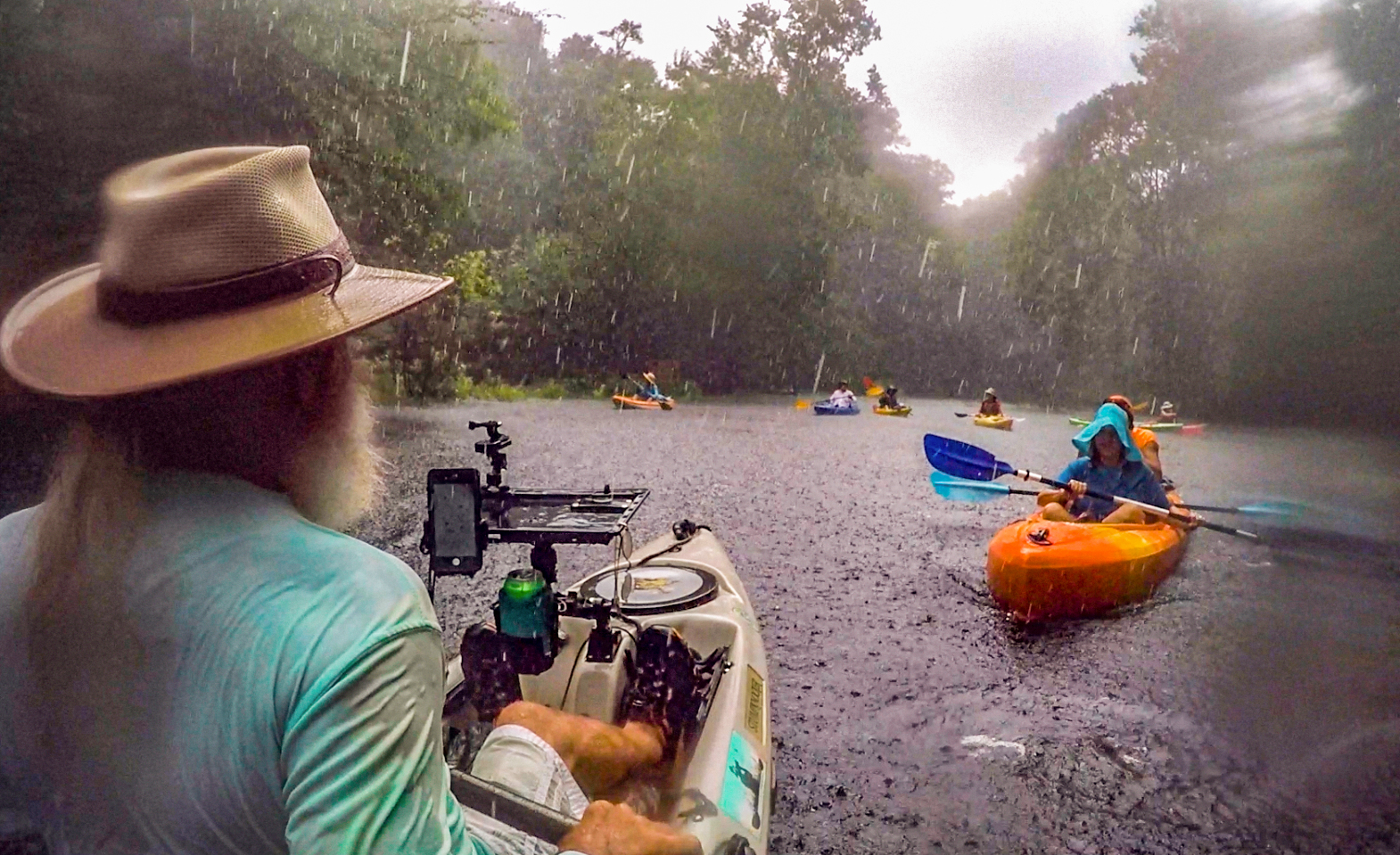
As we exited Blue Springs run, the sky opened up, the wind blew and we were paddling in a good old Florida Palmetto Pounder. It was raining so hard in fact that we decided to take refuge under the dense canopy of Bald Cypress, Carolina Ash and Black Gum. It was amazing how this dense canopy provided such good relief from the rain. With the water level high we were able to paddle among many Cypress Knees and secure our boats well.
The rain didn’t last long, perhaps 20 minutes thereabouts and we proceeded to venture out from our hidden sanctuary along the riverside. I didn’t say shoreline because there was no visible shoreline at this point due to the high water. We still had several other springs to visit and thus continued on our journey with clear blue skies ahead of us and threatening skies and thunder slowly following us.
The Springs…
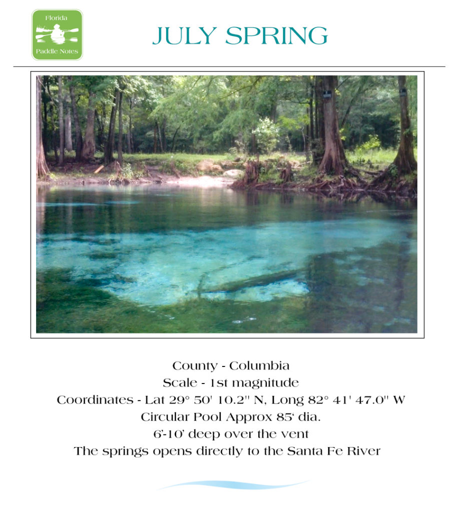
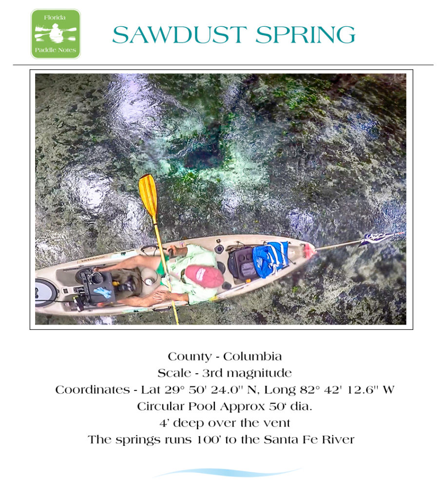
The next group of springs were to be the last we saw. Due to the high water levels, the springs and fissure I was hoping to see further down the line were covered and unnoticeable. Even the few on our next part, listed below, were visible but the water was very clouded from the limestone run-off from all the rain. July spring seemed to catch all the plant debris floating down river and was not visible. Sawdust spring as well, browned out. For a more in depth look at location and descriptions, open the interactive springs map or look over several of the Maps and Guides listed above…
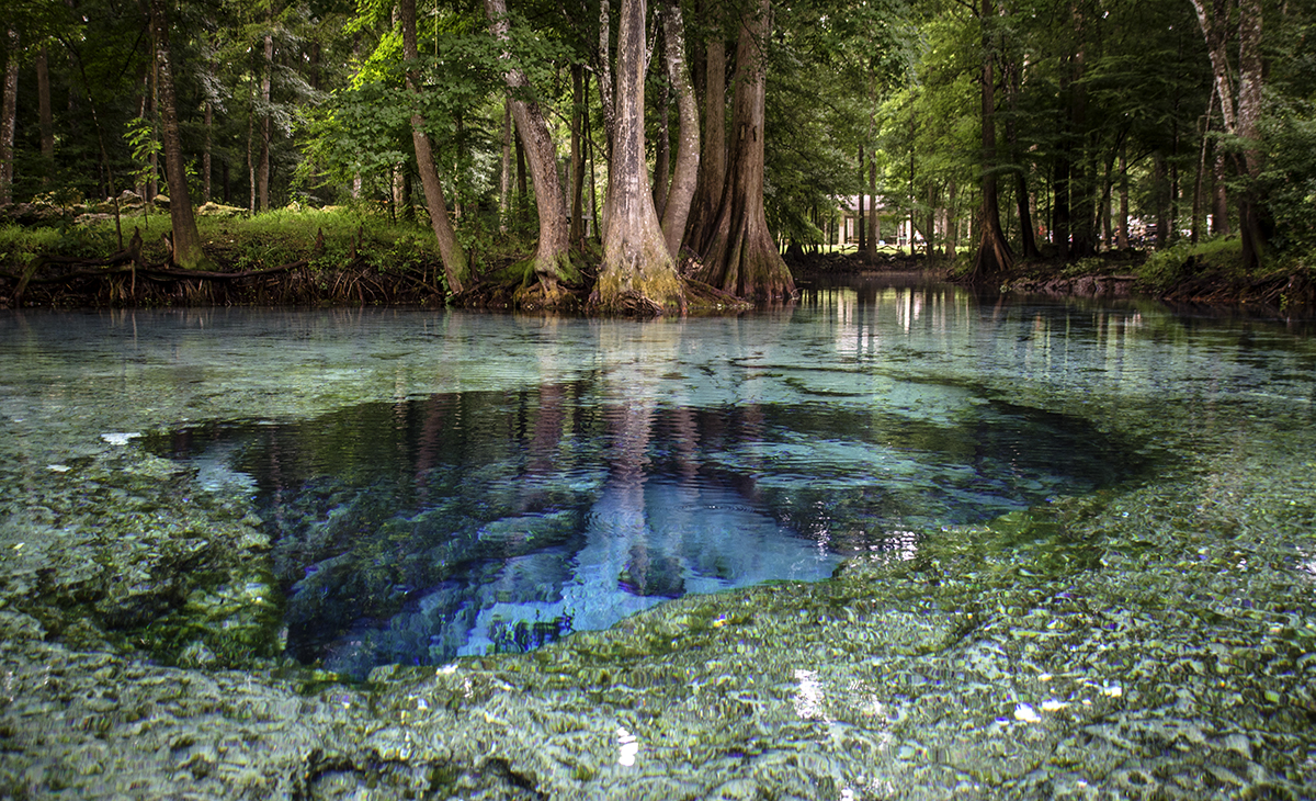
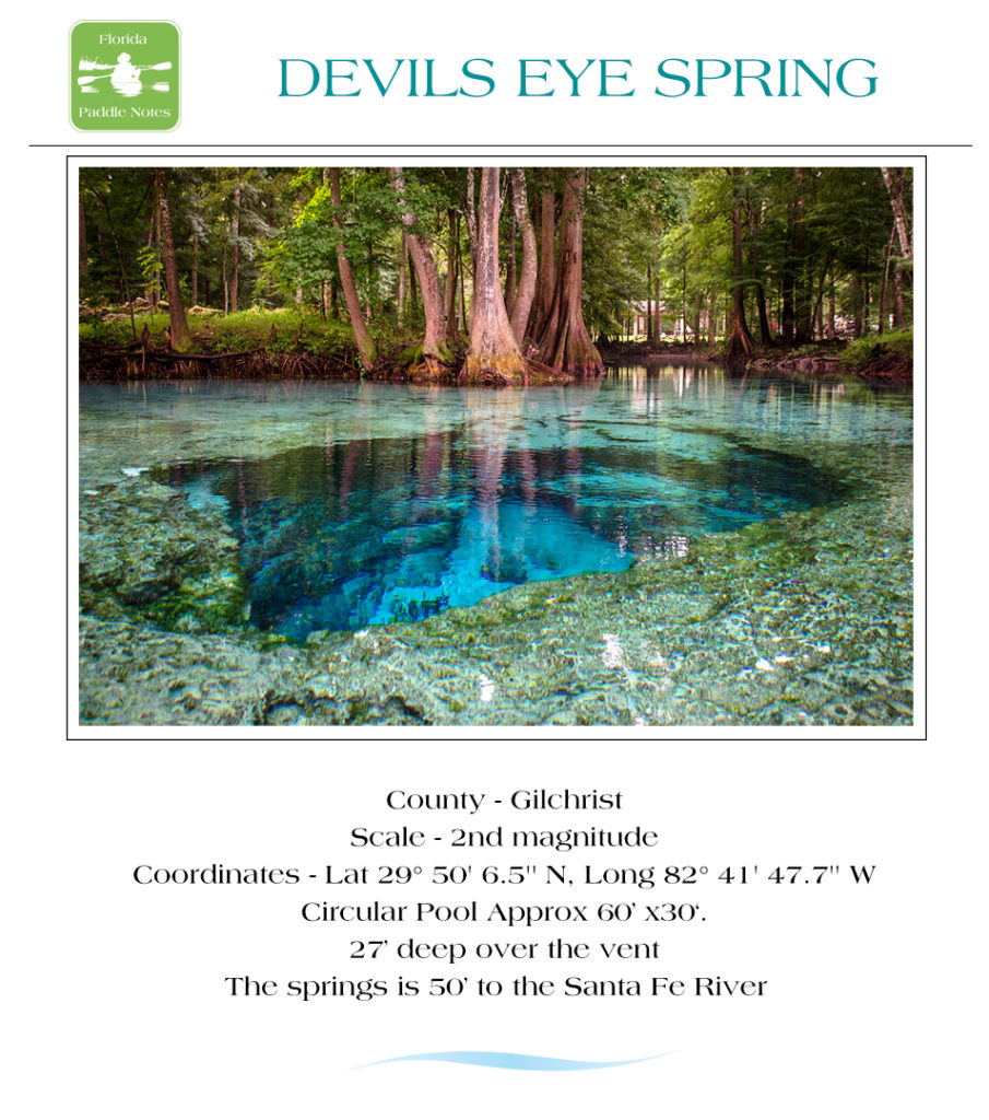
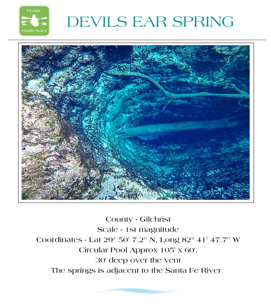
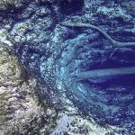
- Devils Eye, Devils Ear and Little Devil are just under a mile downstream from Gilchrist Blue ( 5 mi from launch ). These are popular diving springs and they are so awesome! If you are short on time do not miss these springs. See photos below…
- July Spring is a nice spring right across the river from the Devil system. It is surrounded by private property so enjoy the water but keep off the land.
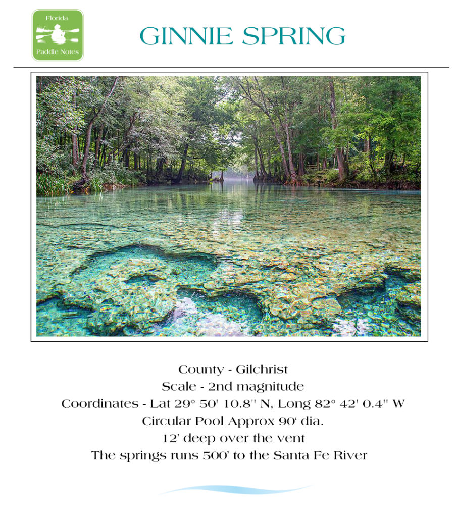
- Ginnie Spring is up next very quickly on the left. A large gorgeous spring to explore with plenty of lime rock support to stand on and observe.
- Sawdust Spring is the final spring on this paddle at 5.7 miles from launch. Another spring on private property but the underwater scenes here are beautiful!
Santa Fe River Springs Photo Gallery:
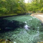
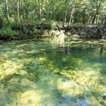
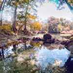
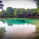
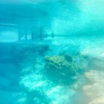
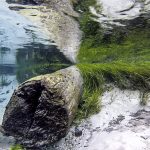
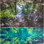
I took the above photos on much clearer days.
Let the Sunshine:
As we proceeded down river we paddled over several eddys, that, along with the swift current, provided short thrills. By this time the sun was out, the sky was blue, though it was still cloudy and thundering behind us. The beauty of the river was really exposed as the sun created contrast on the different species of trees. The current made this paddle so relaxing as well as quick. Before we knew it, our destination was ahead and so ended another great day of paddling Florida waterways and another chapter in Florida Paddle Notes.
Flora:
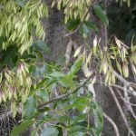
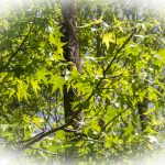
Trees: There is a wide variety of hardwood trees along The Santa Fe – Bald Cypress -Taxodium distichum, Live Oak – Quercus virginiana, Tupelo – Nyssa sylvatica, Cabbage Palm – Sabal Palmetto, Loblolly Bay – Gordonia lasianthus, Dahoon Holly – Ilex cassine, American Sweetgum – Liquidambar styraciflua, Red Maple – Acer rubrum, Carolina Ash – Fraxinus caroliniana, Swamp Dogwood – Cornus racemosa, Virginia Willow – Itea virginica
and others.
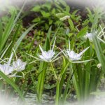
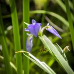
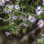
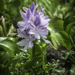
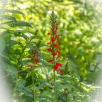
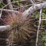
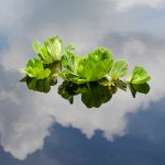
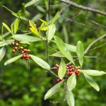
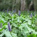
Shrubs, Grasses, Aquatic and Flowering Plants: The under growth was rich with Bartram’s Airplant – Tillandsia bartramii , Pickerelweed – Pontedaria cordata , Elliott’s Aster – Symphyotrichum elliottii, Blue Flag Iris– Iris viginica, Cardinal Flower – Lobelia cardinalis , American Eelgrass – Vallisneria americana, Hydrilla – Hydrilla verticillata, Water Hyacinth – Eichhornia crassipes, Spider Lily – Hymenocallis latifolia, Atamasco Lily – Zephyranthes atamasco, Buttonbush – Cephalanthus occidentalis, Saw Palmetto – Serenoa Repens, Bur Marigold – Bidens aristosa
Trees, Shrubs, Grasses, Aquatic and Flowering Plants – Gallery:
Fauna:
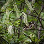
The Santa Fe River is abundant with wildlife. On a good day you’ll get to see an assortment of river birds to include Herons, Egrets, Limpkins, Ibis, Owls and Ospreys, plenty of turtles, an occasional otter or wild hog and deer. Alligators are few and far between on the Santa Fe, in fact I’ve never seen a gator on the Santa Fe!
Wildlife Gallery:
![]()