
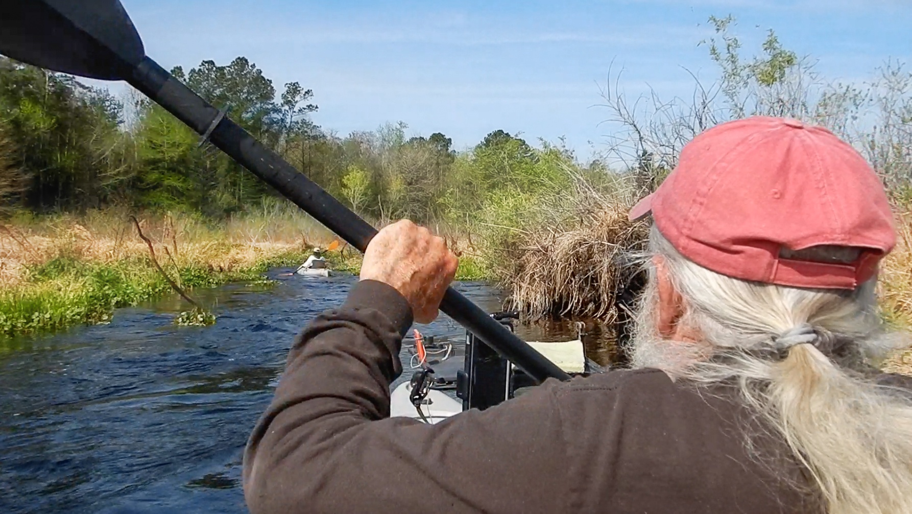
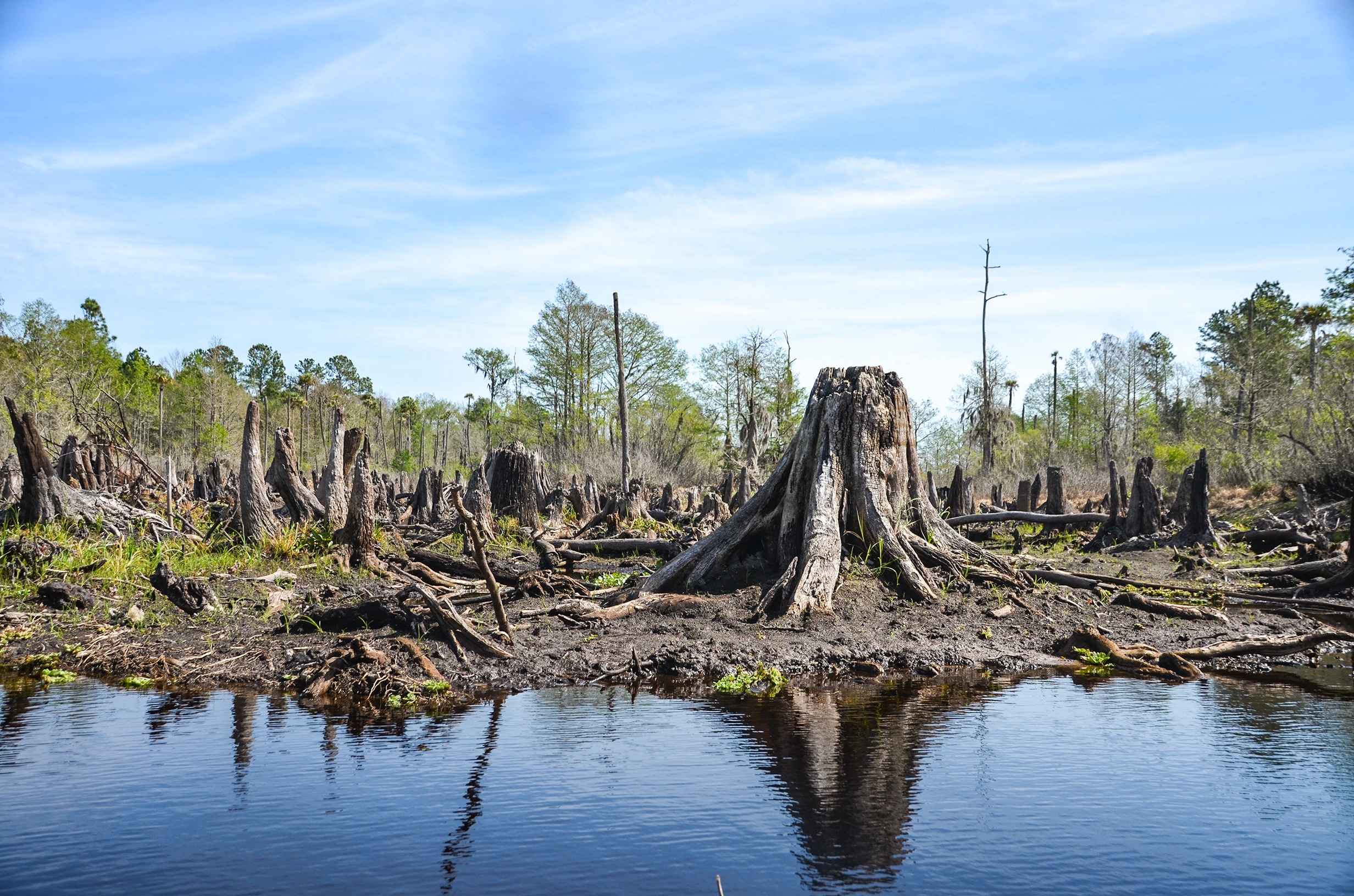
With the Rodman Reservoir drawdown ending, it was time to revisit Sweetwater Creek and Deep Creek while the water was at a low level. On a previous paddle in September 2019, the water level was quite a bit higher and much of the paddle was over the hundreds of tree stumps killed by the reservoir waters. The flow of the creek was minimal in September and much of it was clogged with aquatic vegetation, allowing us to paddle up only 1 mile. With the drawdown, the water level exposed an entirely different landscape! Today I joined Capt. Karen Chadwick from North Star Charters and we were able to paddle up 2.65 miles before several tree trunks blocked our path…James
![]()
 Sweetwater Creek Details:
![]() Location: Sweetwater Creek is located in Putnam County, Fl, 6.5 miles southeast of Interlachen, Fl.
Location: Sweetwater Creek is located in Putnam County, Fl, 6.5 miles southeast of Interlachen, Fl.
![]() Launch Point for this Paddle: A small bridge on HWY 310. Launch area is on the SE corner of the bridge.
Launch Point for this Paddle: A small bridge on HWY 310. Launch area is on the SE corner of the bridge.
![]() Paddle Distance: Potentially 3 miles…this day, due to fallen tree trunks we were able to reach 2.64 miles
Paddle Distance: Potentially 3 miles…this day, due to fallen tree trunks we were able to reach 2.64 miles
![]() Difficulty: Easy to moderate. It is an easy gentle paddle, however there are several obstacle to encounter, either vegetative clogs or tree trunks across the creek with mud. It takes some arm strength to inchworm over and through several of these.
Difficulty: Easy to moderate. It is an easy gentle paddle, however there are several obstacle to encounter, either vegetative clogs or tree trunks across the creek with mud. It takes some arm strength to inchworm over and through several of these.
![]() Average Paddle Speed: 1.6 mph
Average Paddle Speed: 1.6 mph
![]() Width and Depth: The navigable width averaged around 25′ to 30′. The further up it is only around 15′ wide. The depth ranged from 8″ to almost 3.5 feet
Width and Depth: The navigable width averaged around 25′ to 30′. The further up it is only around 15′ wide. The depth ranged from 8″ to almost 3.5 feet
![]() Current – Tidal: Due to the Rodman Dam draw down. there was a light current and in some locations a strong current over obstacles. Runoff from the surround wetland was evident flowing into the creek.
Current – Tidal: Due to the Rodman Dam draw down. there was a light current and in some locations a strong current over obstacles. Runoff from the surround wetland was evident flowing into the creek.
![]() Side Paddles: Deep Creek enters Sweetwater Creek about a 1/4 mile up from the launch. Today, Deep Creek was navigable but only for a 1/4 mile before hitting a log jam of several tree trunks.
Side Paddles: Deep Creek enters Sweetwater Creek about a 1/4 mile up from the launch. Today, Deep Creek was navigable but only for a 1/4 mile before hitting a log jam of several tree trunks.
![]() Rest Areas: There are several areas or banks along the way to stop and rest.
Rest Areas: There are several areas or banks along the way to stop and rest.
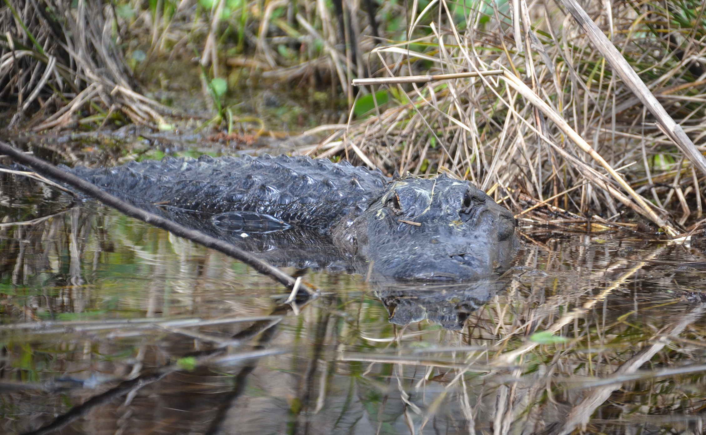
![]() Important Information: Be prepared for several obstacles to maneuver as well as keeping an eye out for numerous, large gators.
Important Information: Be prepared for several obstacles to maneuver as well as keeping an eye out for numerous, large gators.
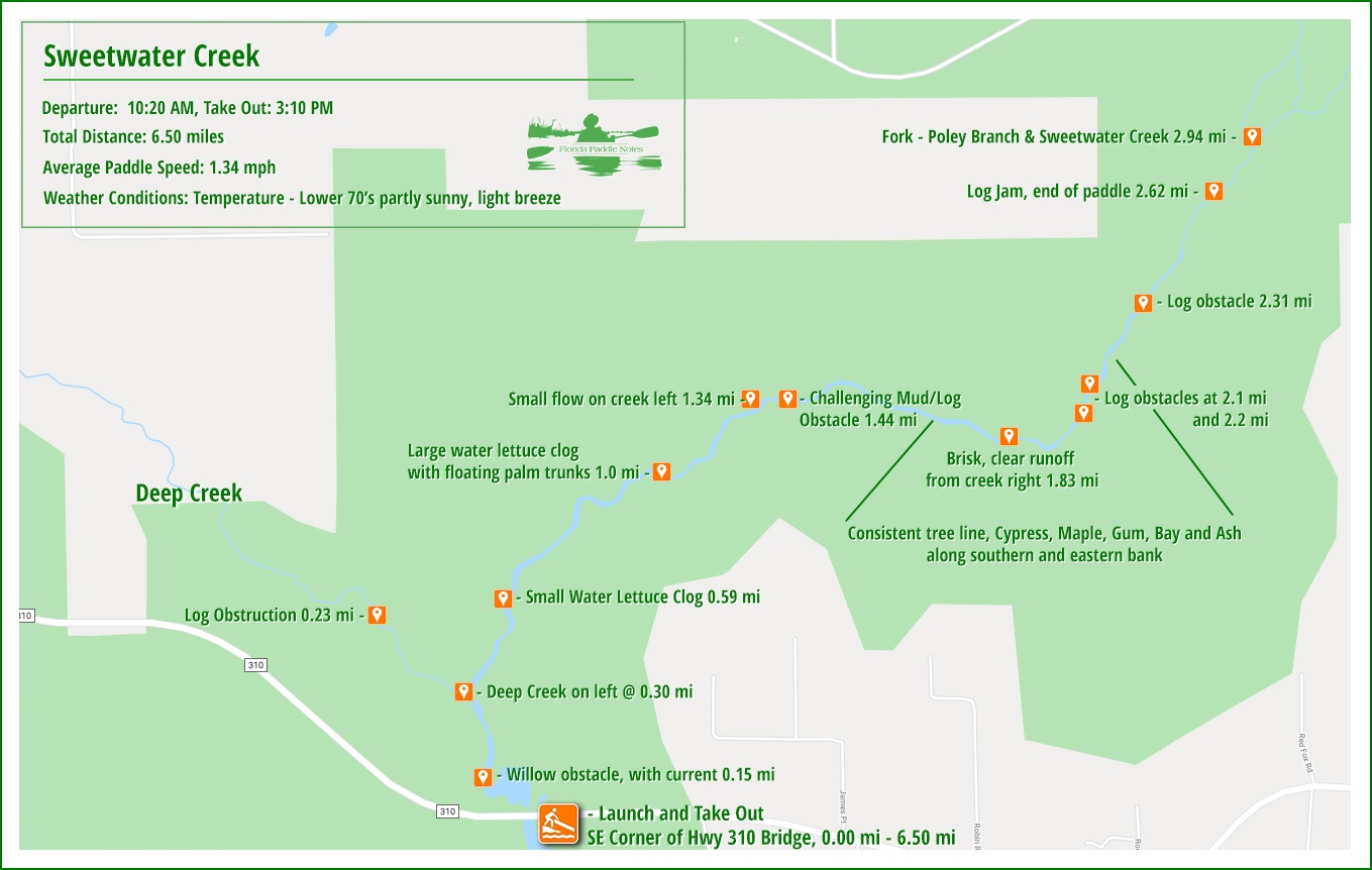
The Sweetwater Creek Paddle Map…
The Launch…
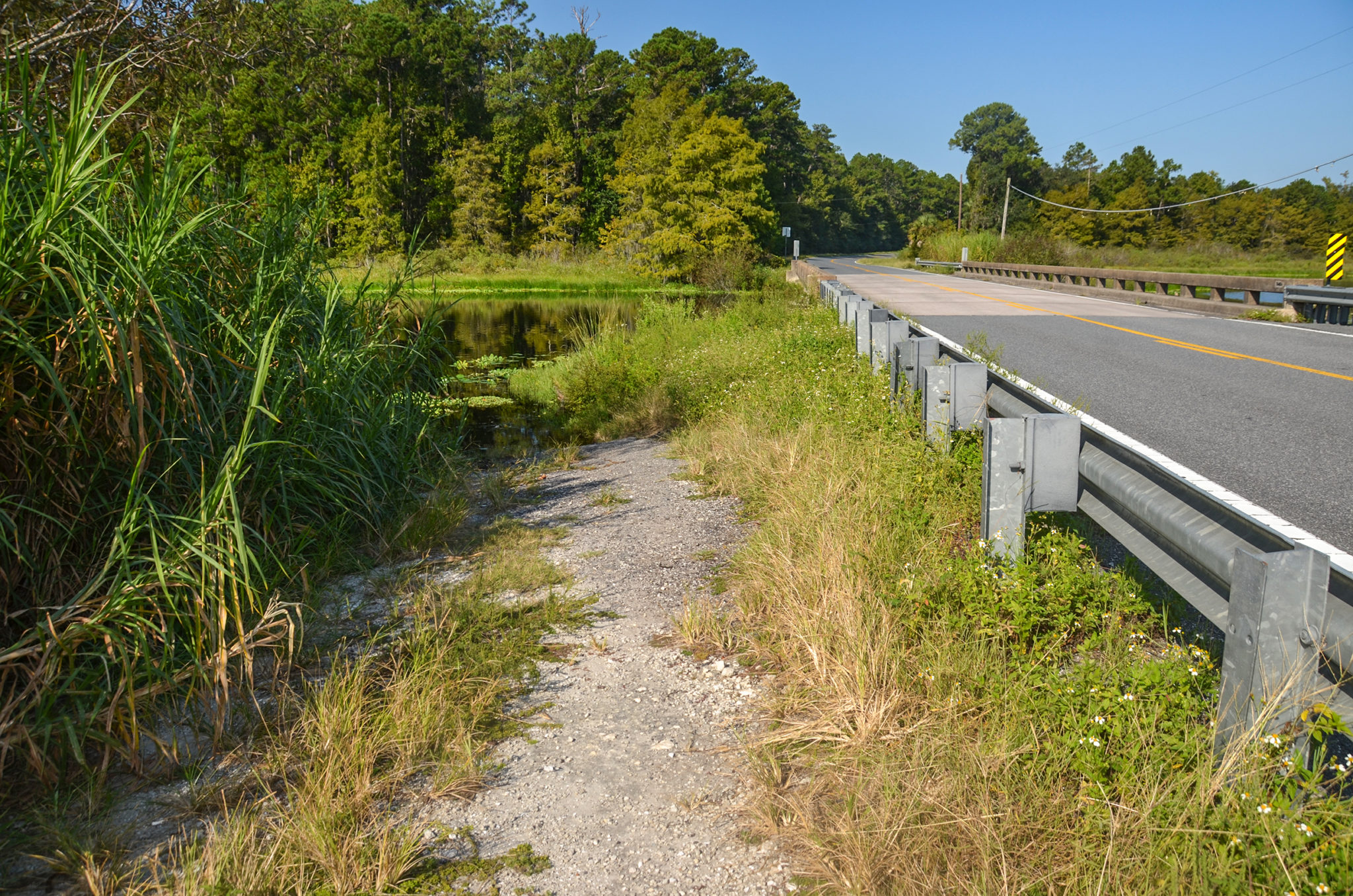
The launch is rural. Just a narrow path of gravel and grass on the southeast corner of the Highway 310 bridge. The low water level exposed a larger section of the creek bank and made for an easy launch…it also made it much easier to paddle under the bridge.
Be careful of the passing traffic on highway 310! There are no restroom facilities here except for some scattered vegetation.
Sweetwater Creek…
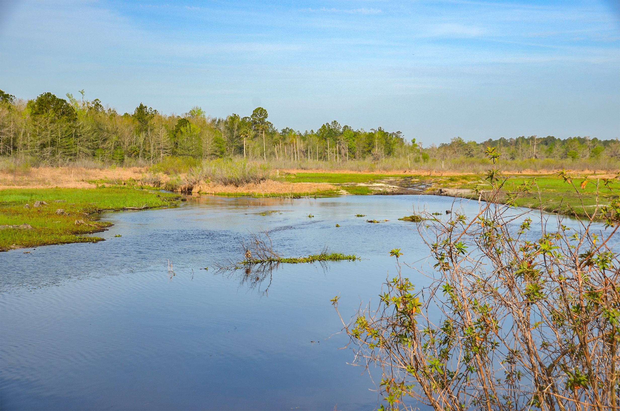
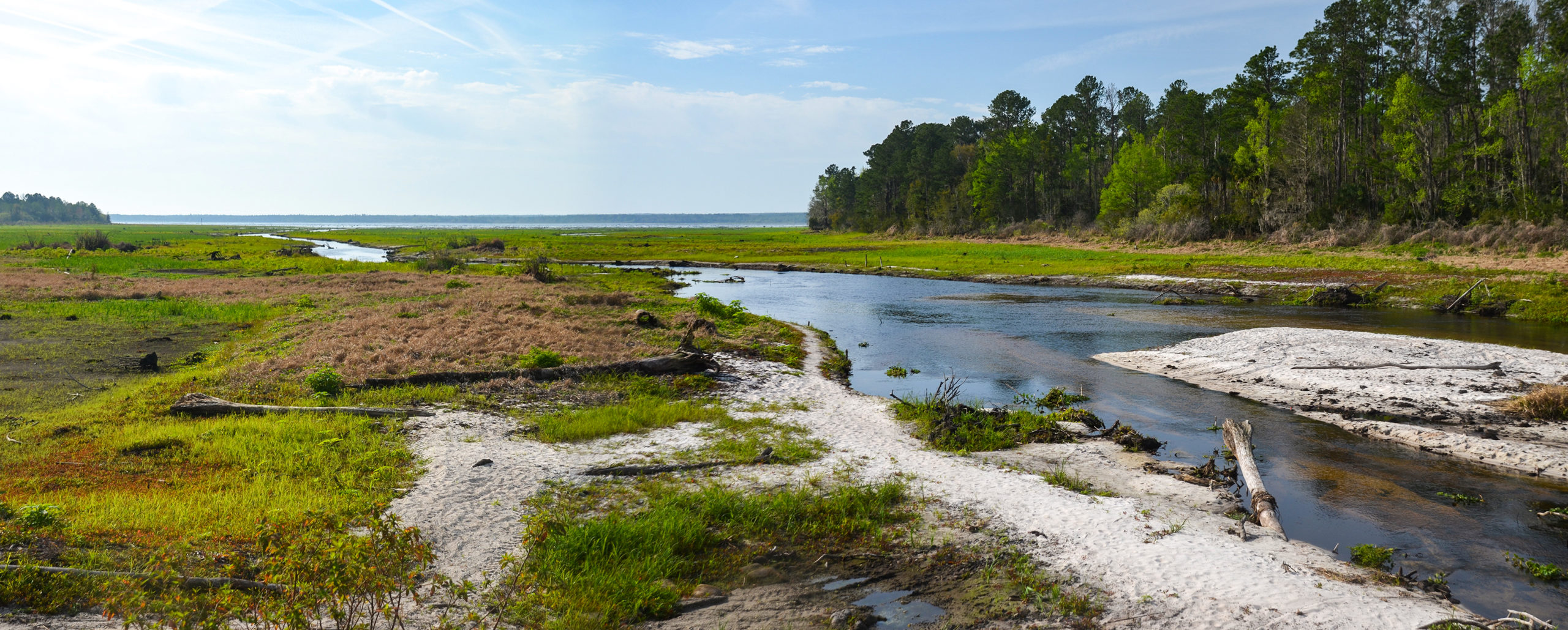
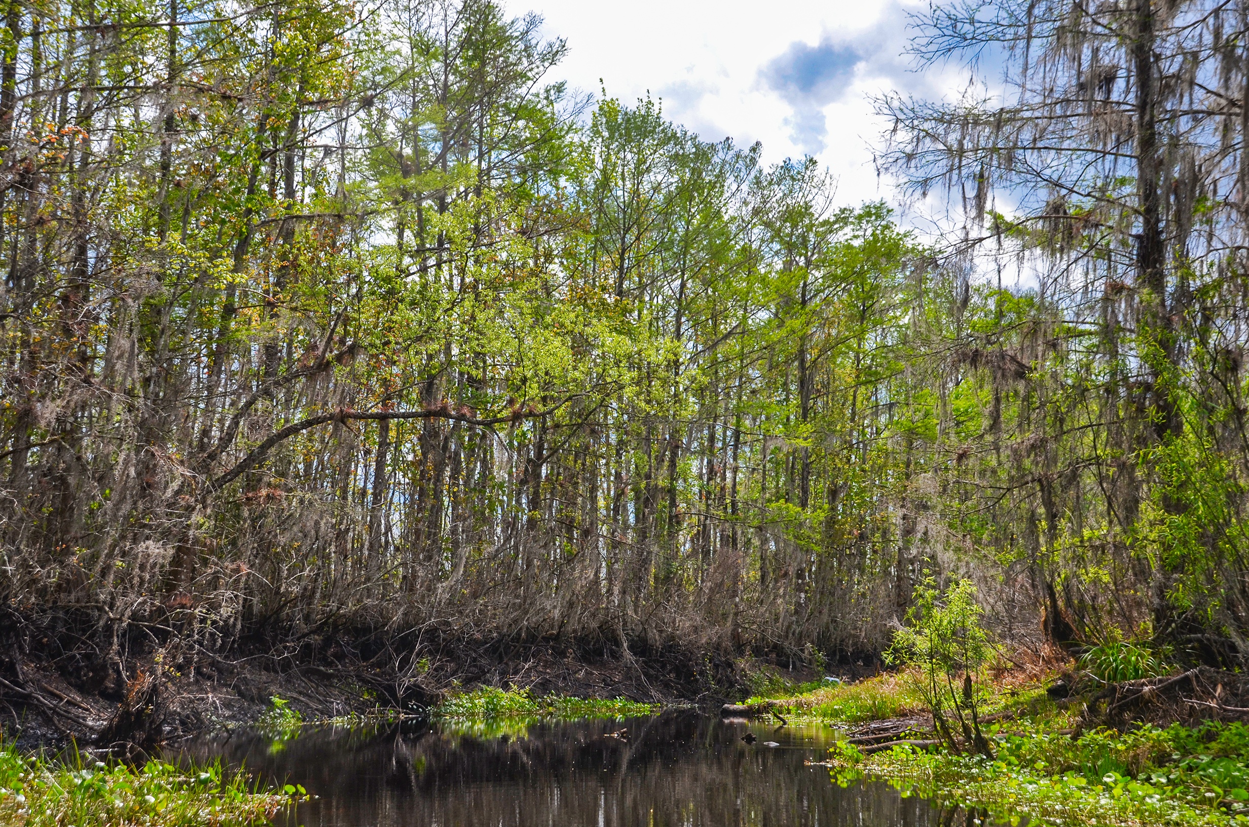
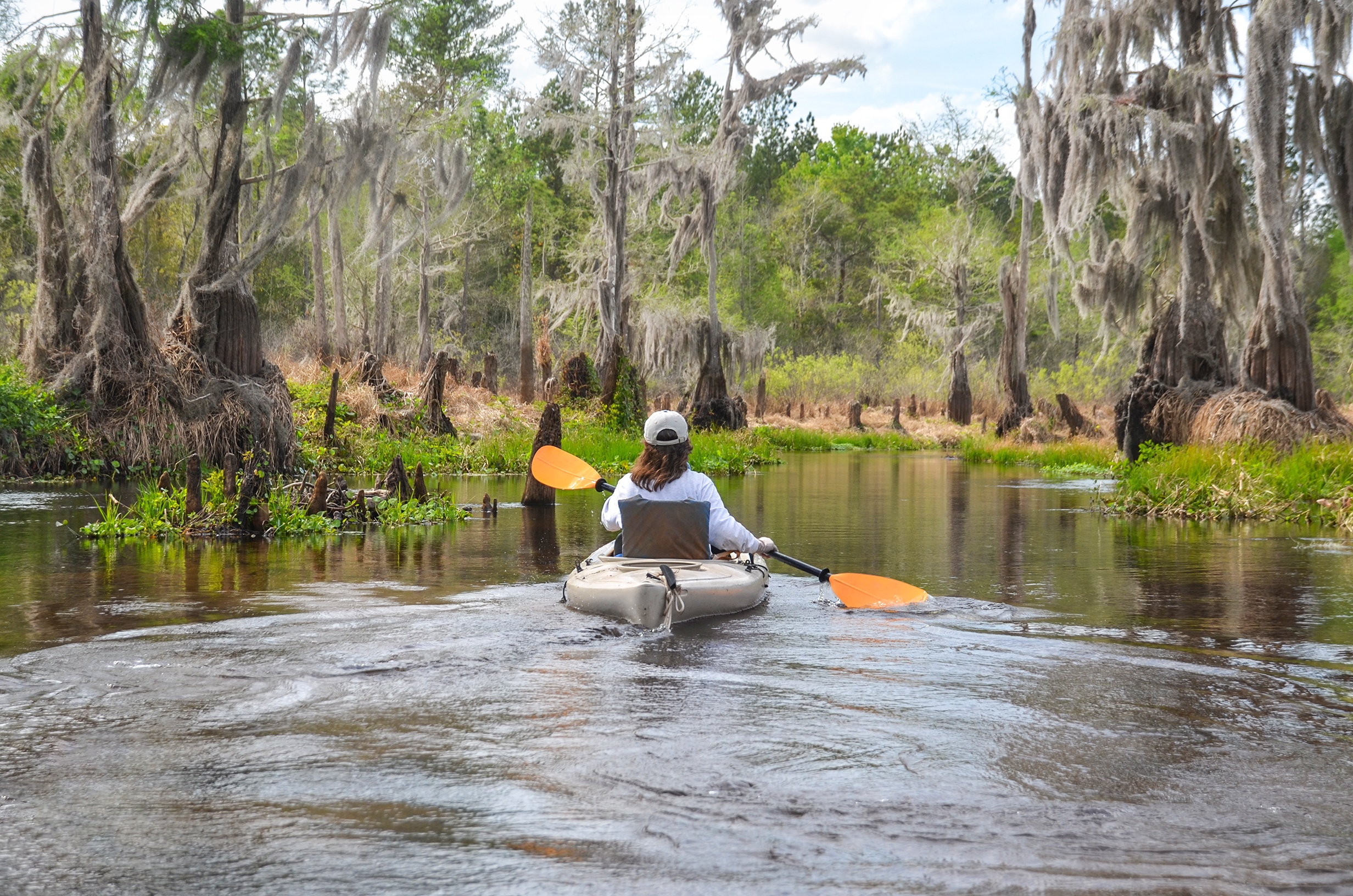
Sweetwater Creek flows basically in a northeast direction, going from North, then East and Northeast. Because the water level was low from the Rodman Dam drawdown, there was a nice, gentle flow to the creek and no problem paddling against this current. We had a partly cloudy day in the higher 70’s, low 80’s with just a slight breeze.
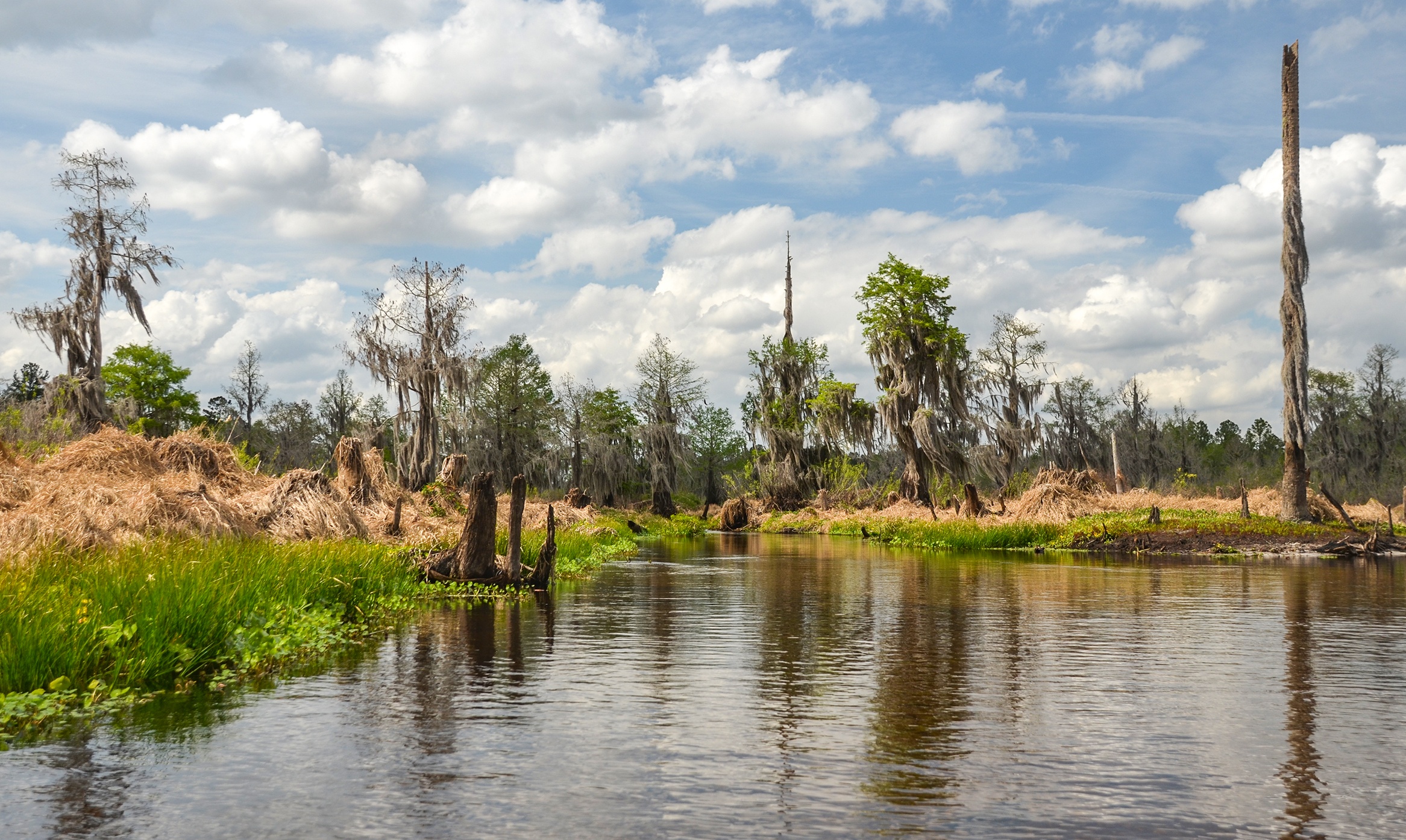
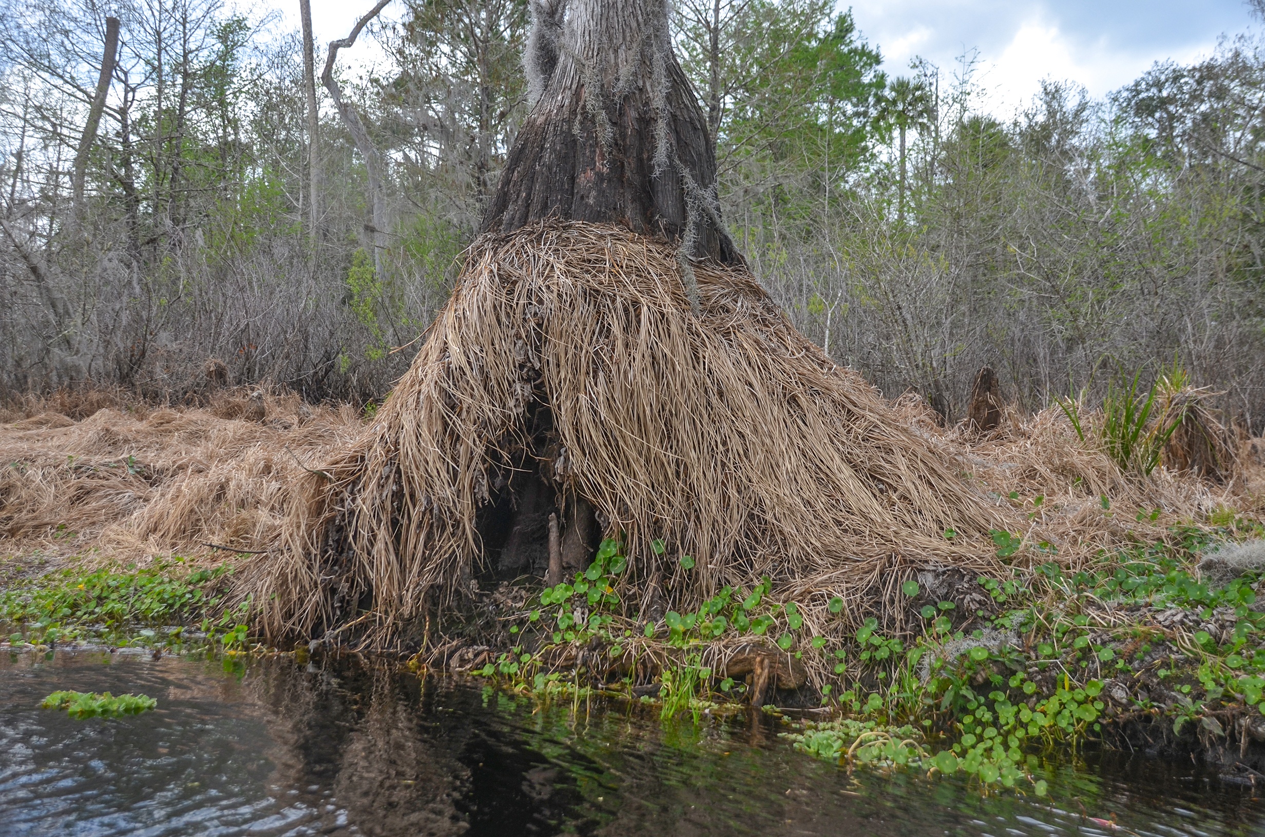
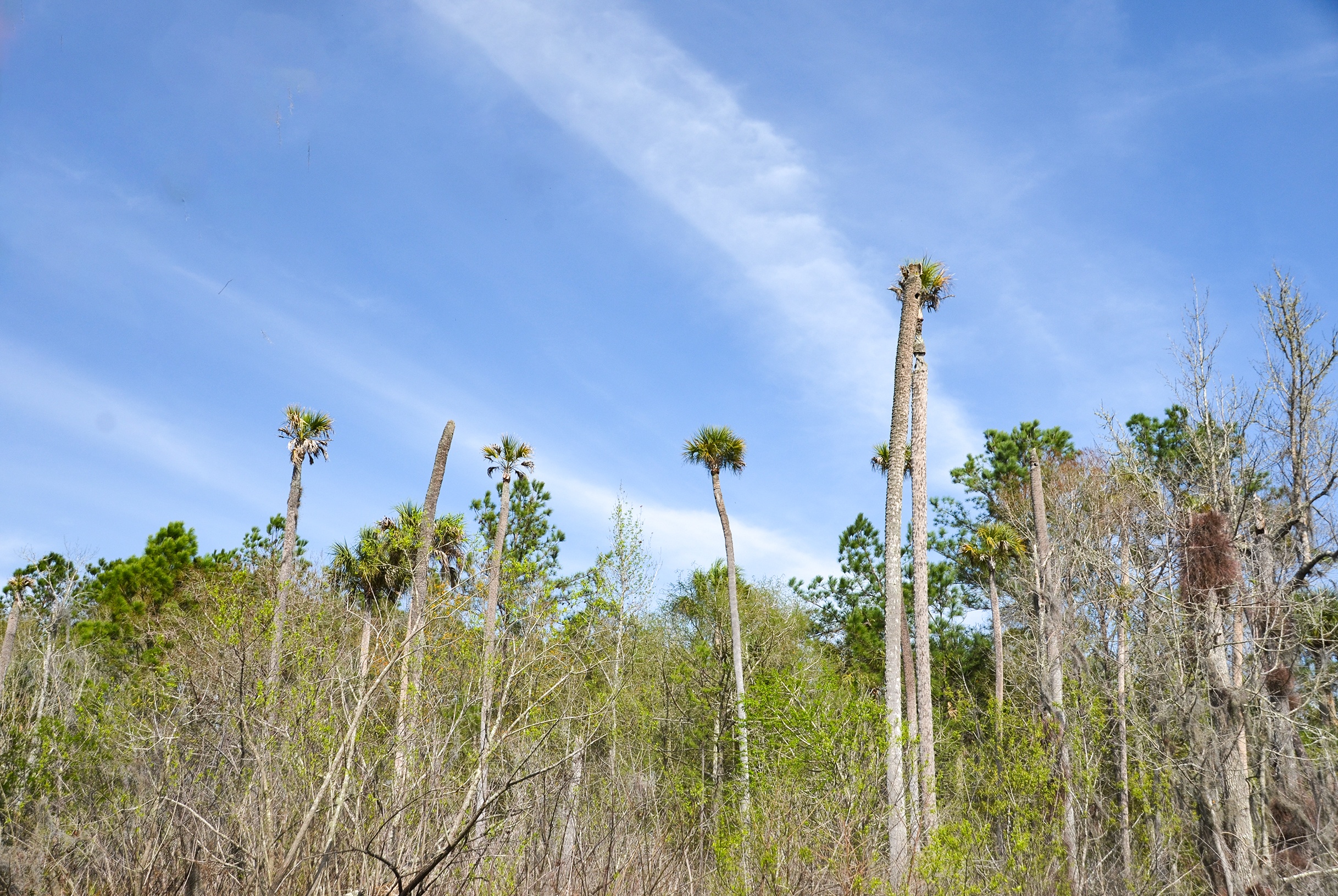
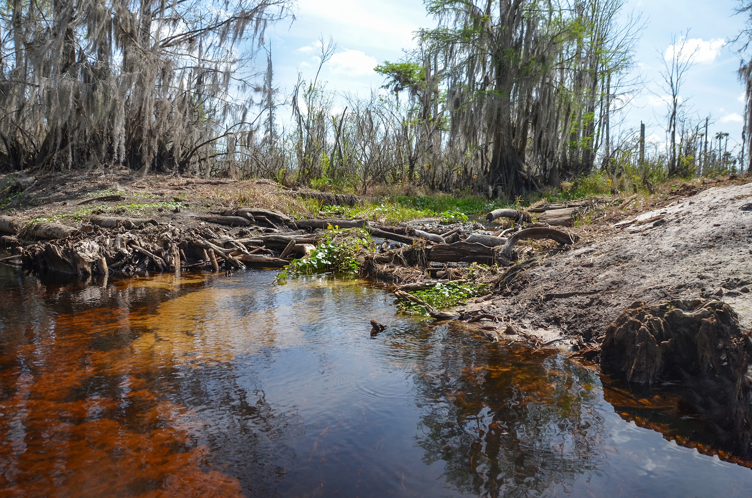
This paddle, as are paddles along the Ocklawaha River in winter during a drawdown, can be disheartening at the least. The deciduous trees are leafless, aquatic vegetation is often browned and dying along the banks, the trunks and stumps from trees drowned by the reservoir water level are exposed. Still standing are many species of trees in flux from either drowning or barely surviving the differing water levels. Today was no different. Along much of the shoreline, dead or dying Lake Sedge and Smartweed cover the banks and existing live vegetation, while tree stumps offer a reminder of a once beautiful habitat, ruined by the reservoir.
On our way…
Paddling North from under the Hwy 310 bridge, the normal channel is straight ahead but still too shallow to navigate. It is necessary to veer to the right and paddle through a brief Willow clog with a strong current, which we do and circle around onto the main creek. Here it is open, the sandy banks exposed and tall dead or dying trees dot the landscape. The banks are covered in the golden brown color of dead Lake Sedge and Smartweed. At mile 0.30 Deep Creek enters Sweetwater Creek with a nice consistent flow and it is open. We plan to explore on our way back.
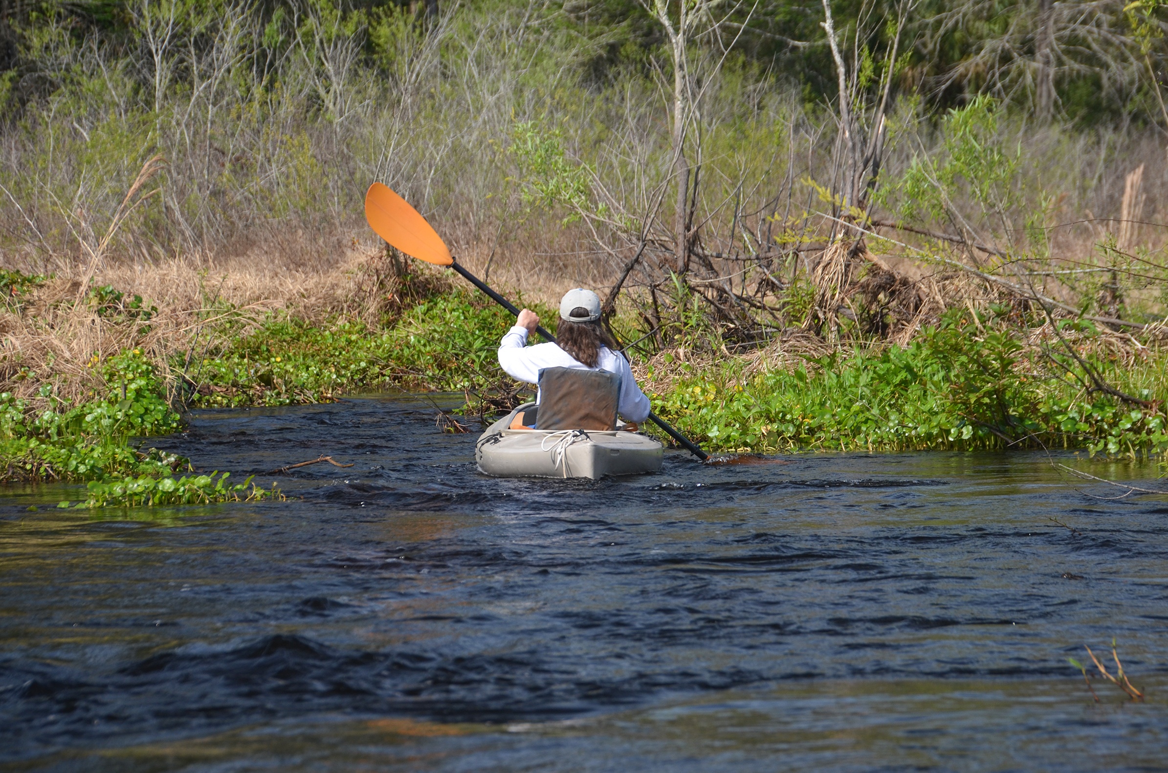
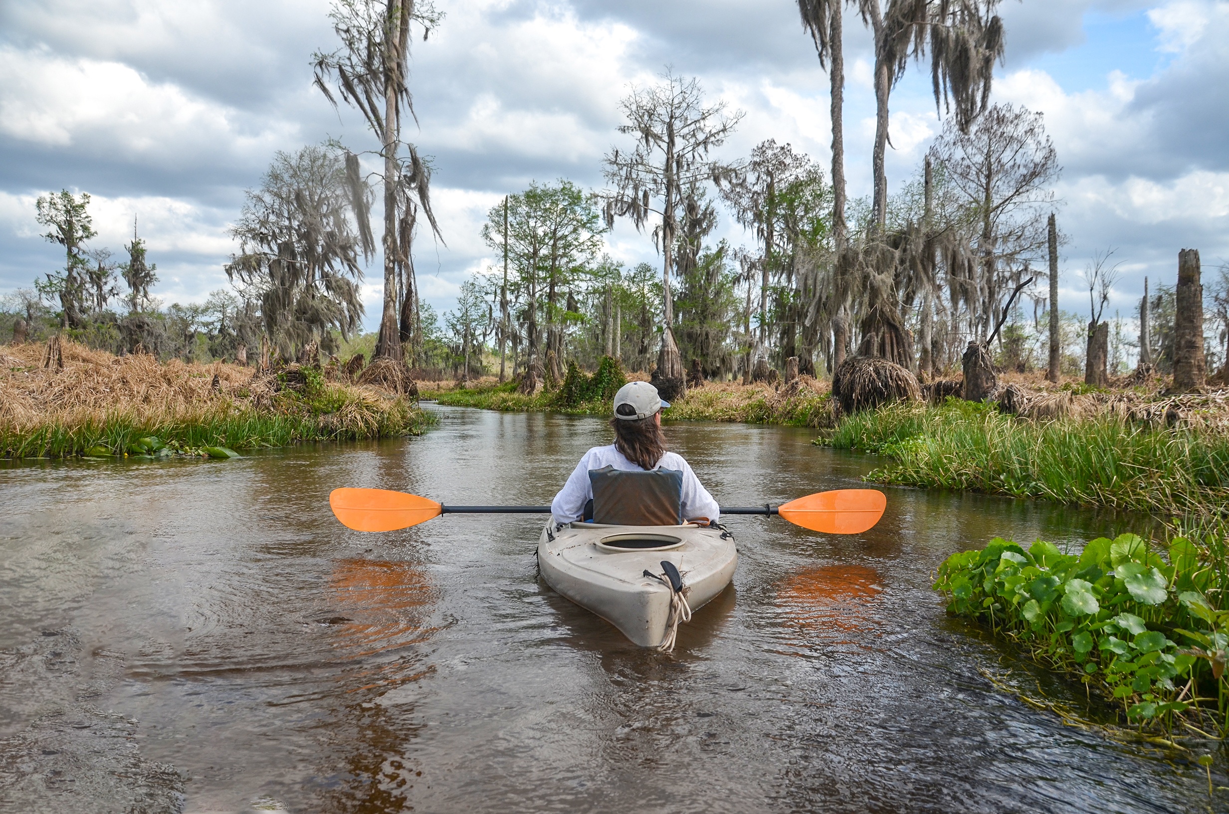
A small vegetative clog of Water Lettuce, Dollarweed and Duckweed is encountered at 0.6 miles and easily maneuvered. Mile 1.0 brought another vegetative clog accompanied with numerous floating palm trunks which made this one a little harder to get through. Mile 1.34 had a small runoff entering the creek on our left and then at 1.44 we hit a challenging obstruction. A small log crossed the creek, secured with vegetation and mud. It took a while to get over the log and squeeze through the vegetation, and required some effort and ‘inchworming’.
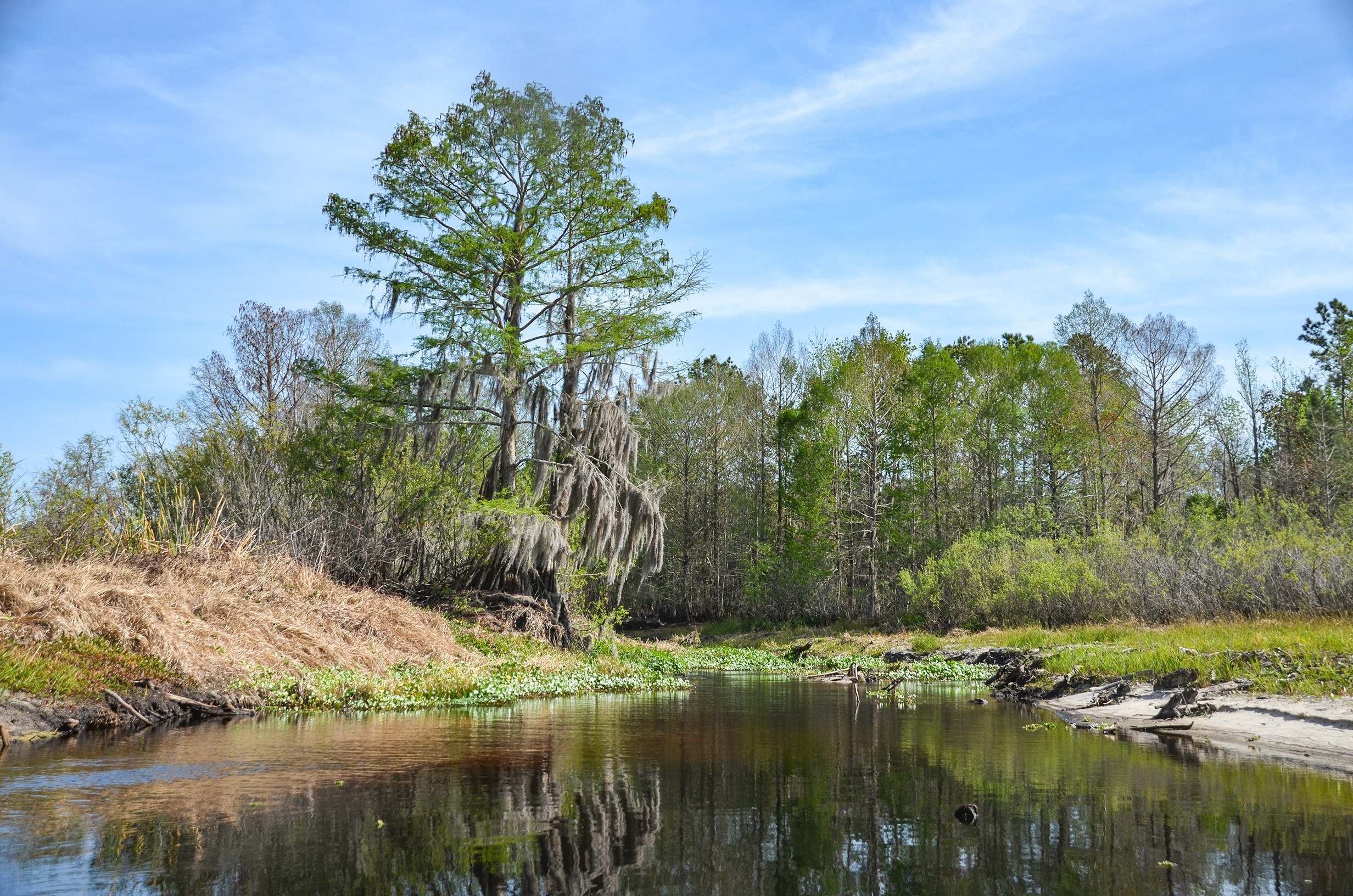
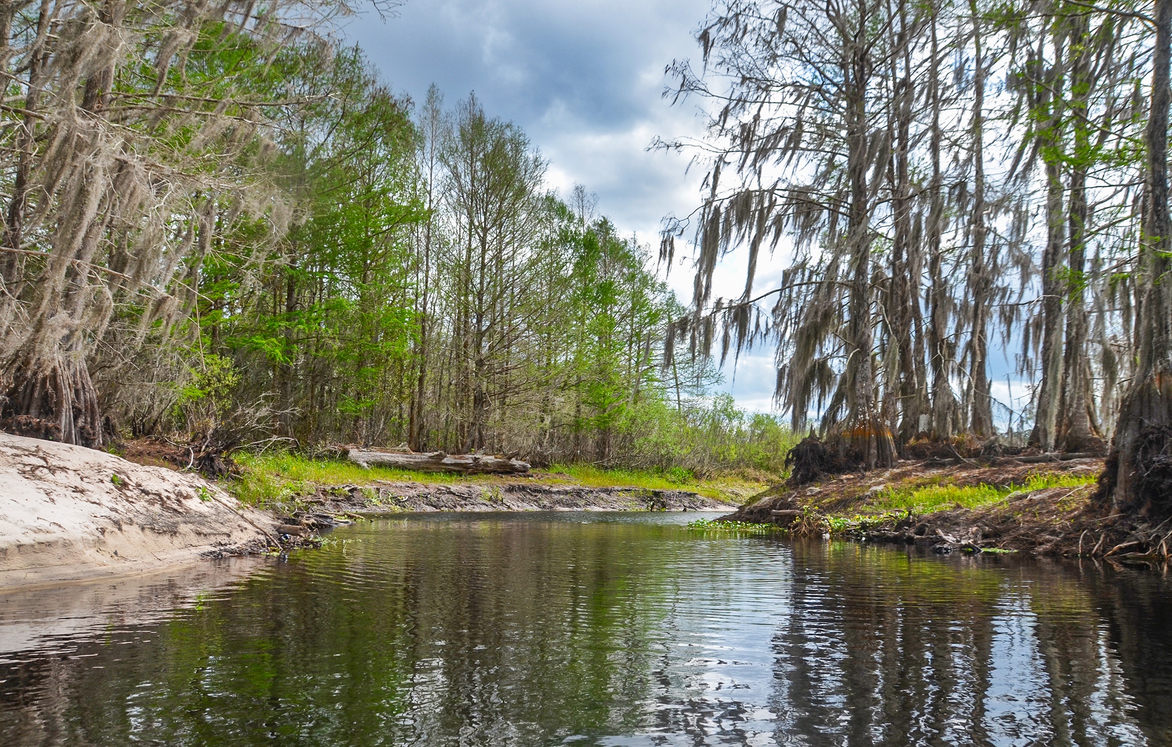
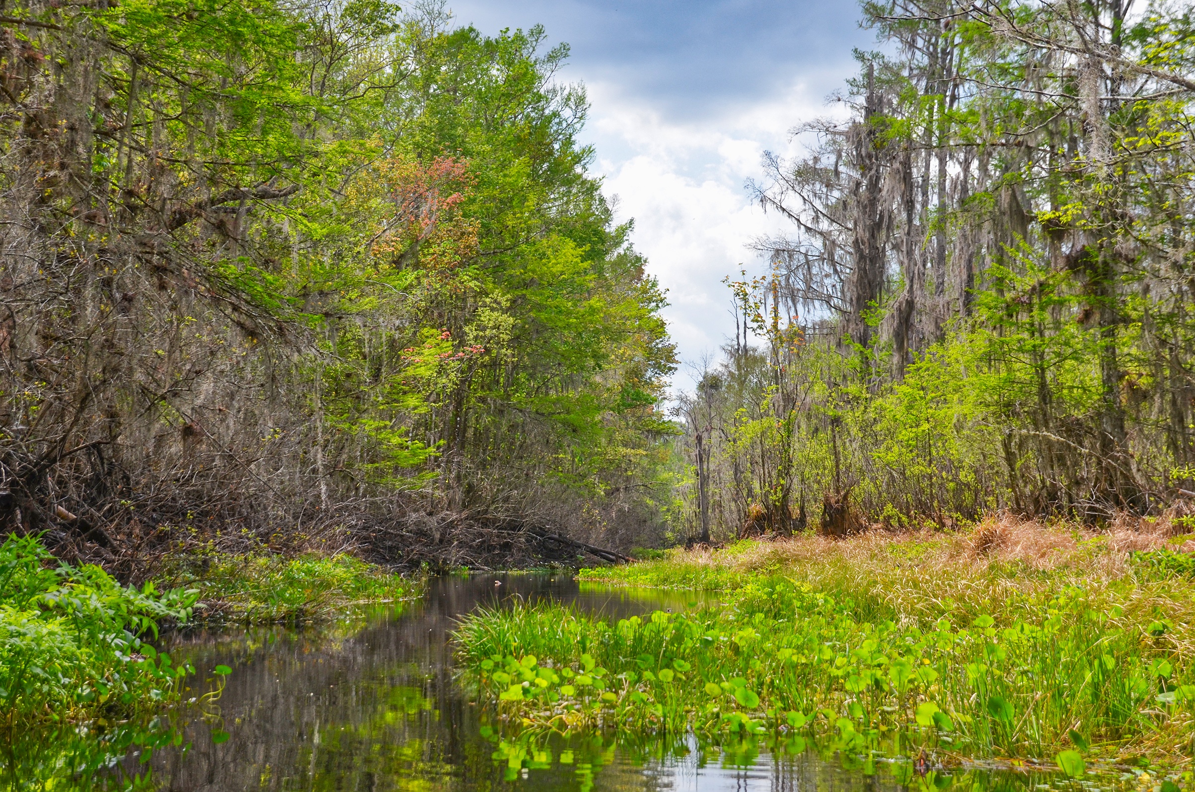
At this point in the paddle, around Mile 1.25, there is a consistent tree line along the southern and eastern bank on our right. A wide variety of trees consisting of Maple, Gum, Ash, Bay and Cypress formed a dense tree line, New Spring leaves were just emerging adding a hint of color in contrast to the first mile we paddled. Here also the bak is higher to our right and actually appears that it may have been dredged at one point in time. Willows were in bloom along the creek as were Burr Marigolds. The next section would prove to be quite interesting!

Leaping Lizards!…
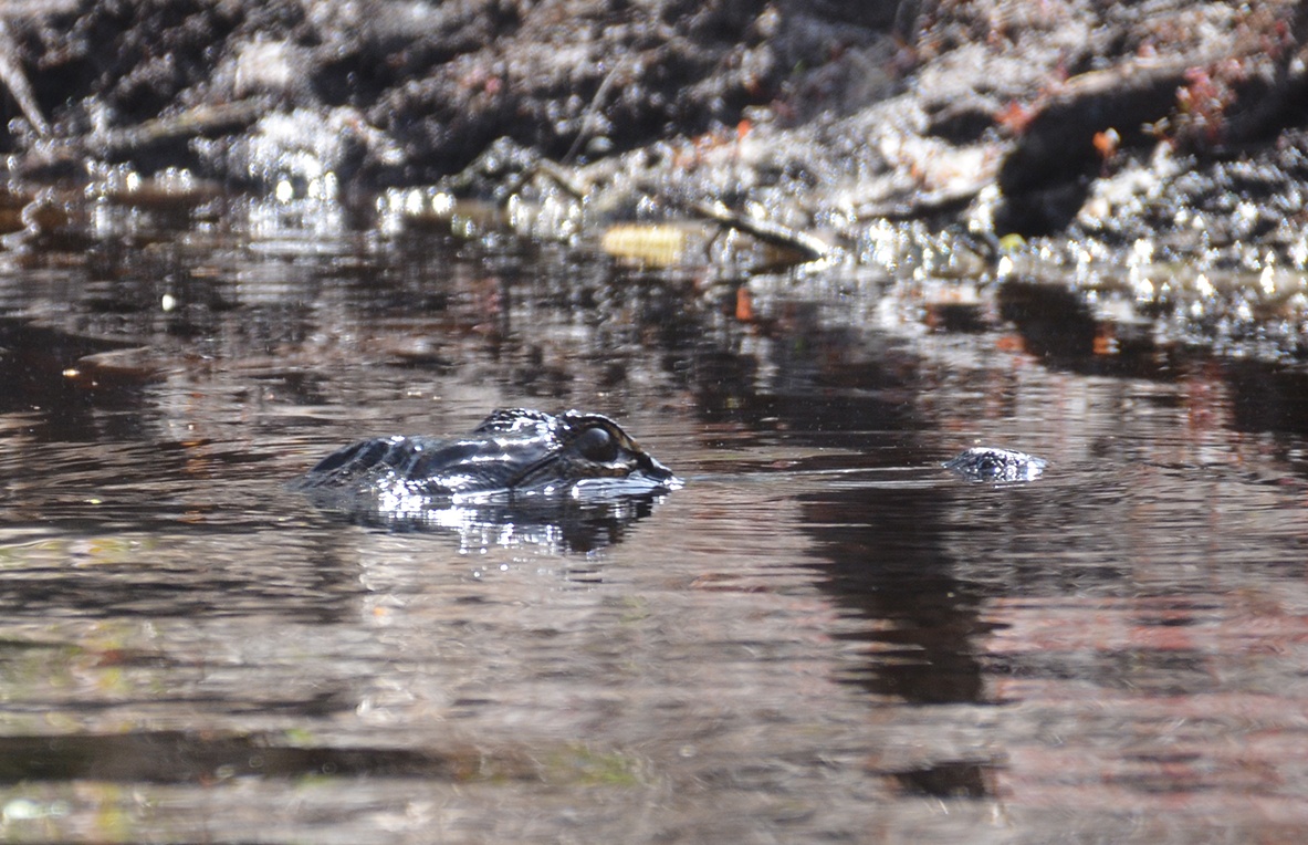
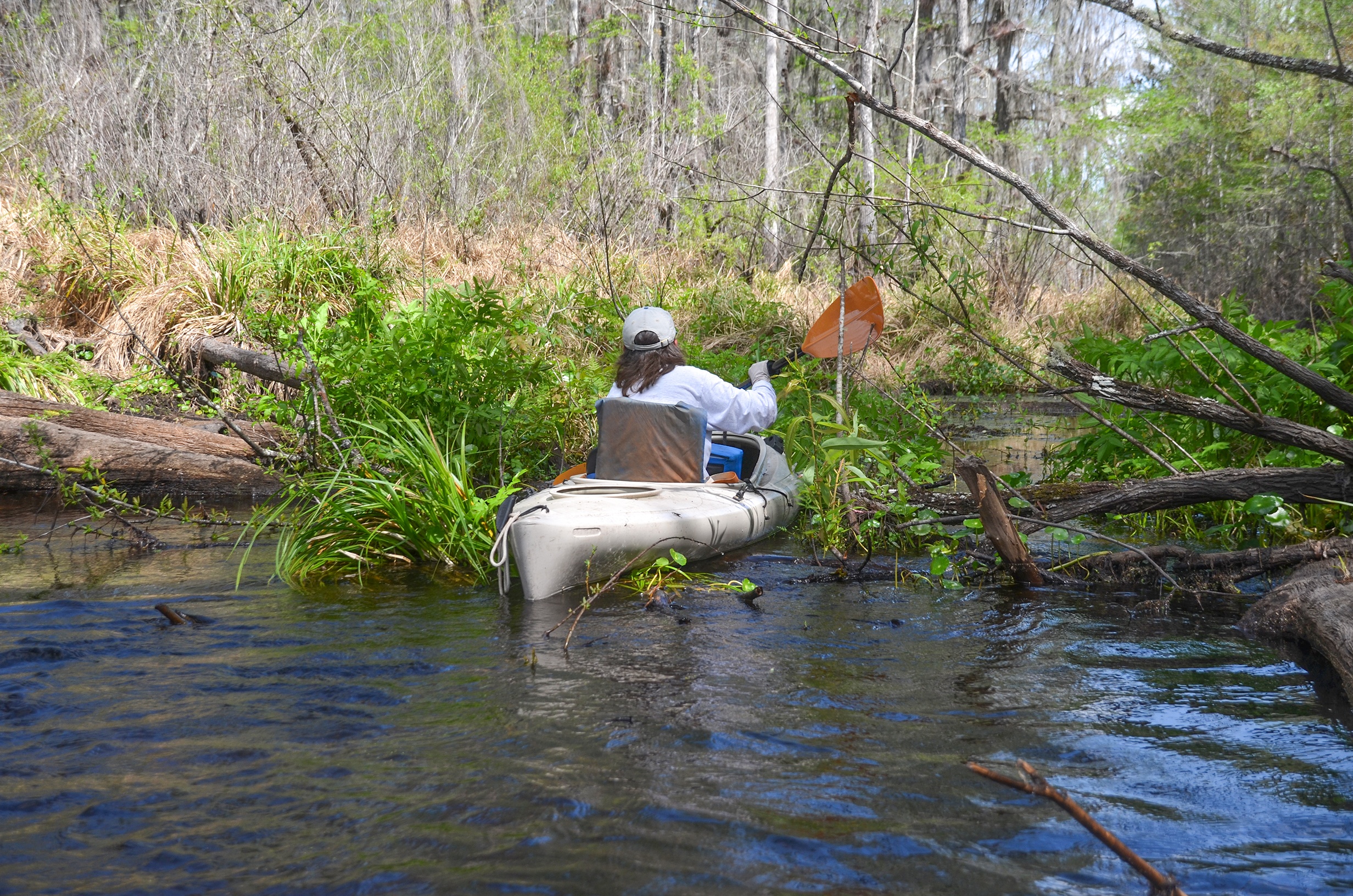
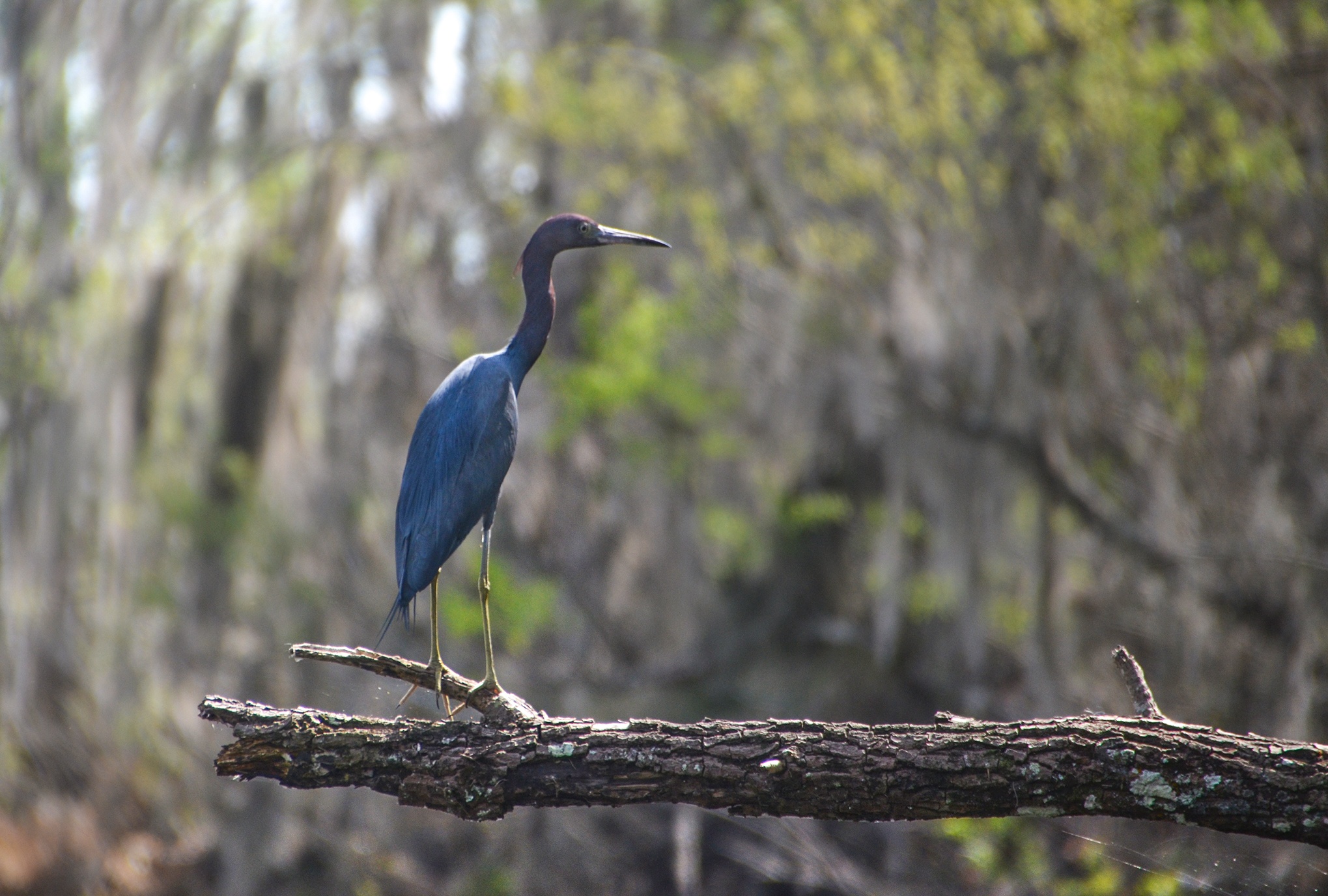
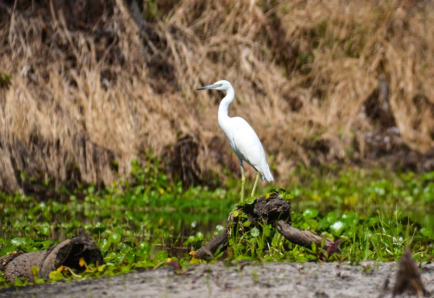
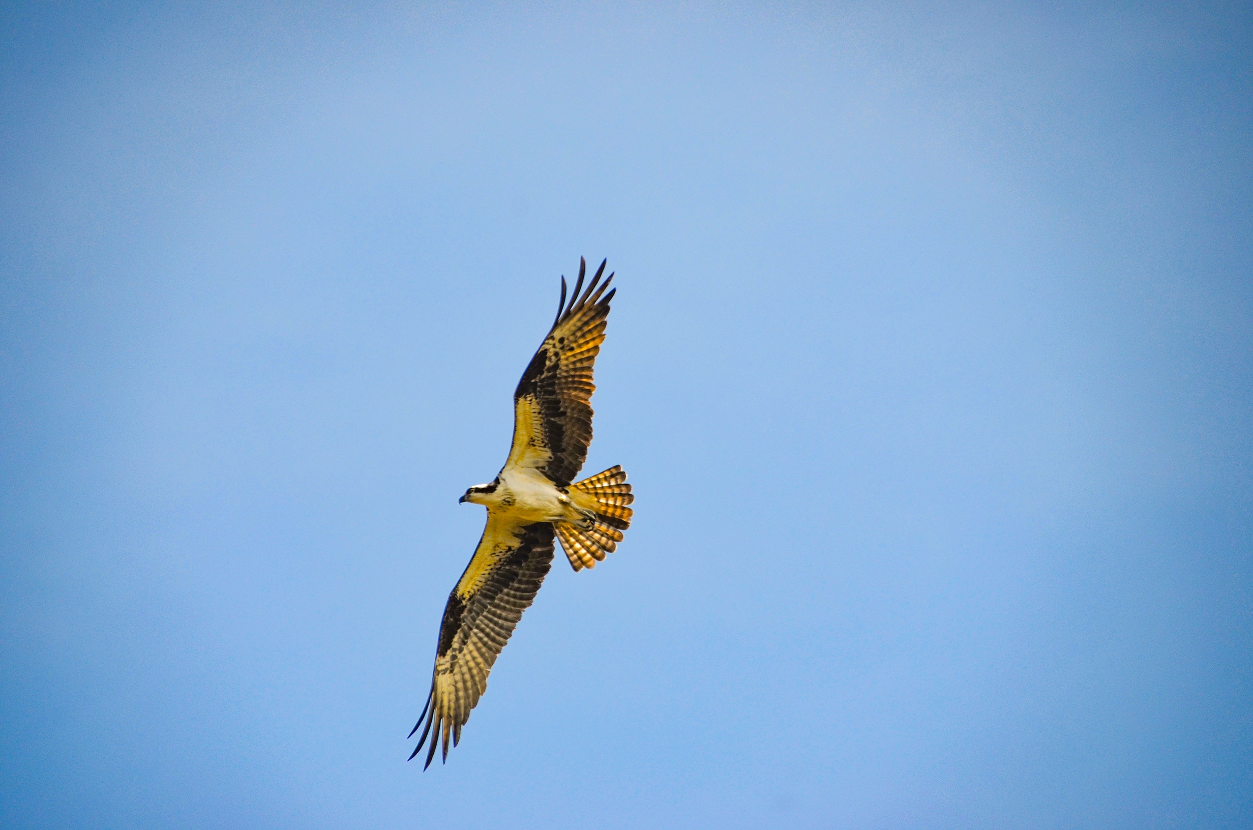
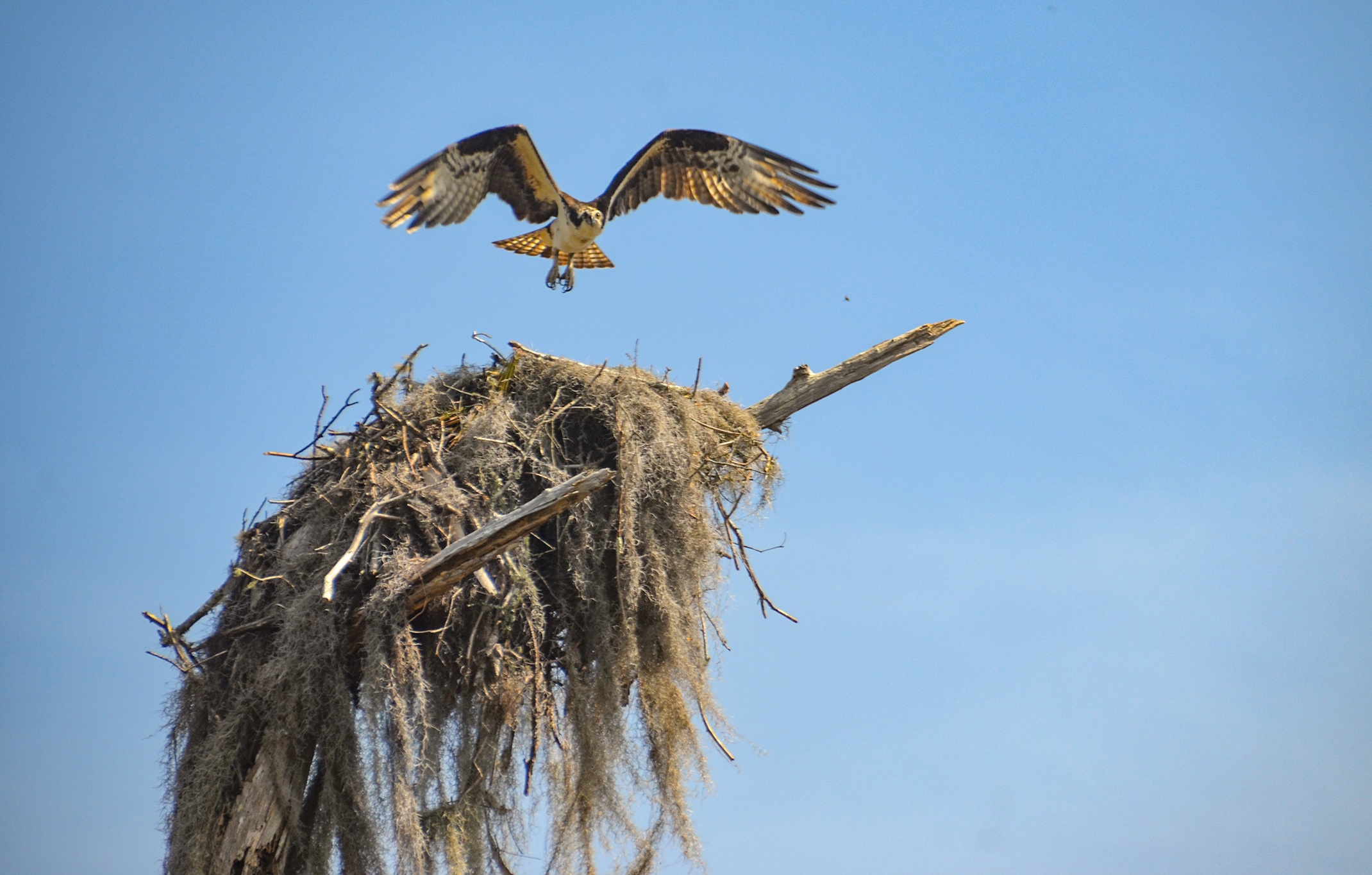
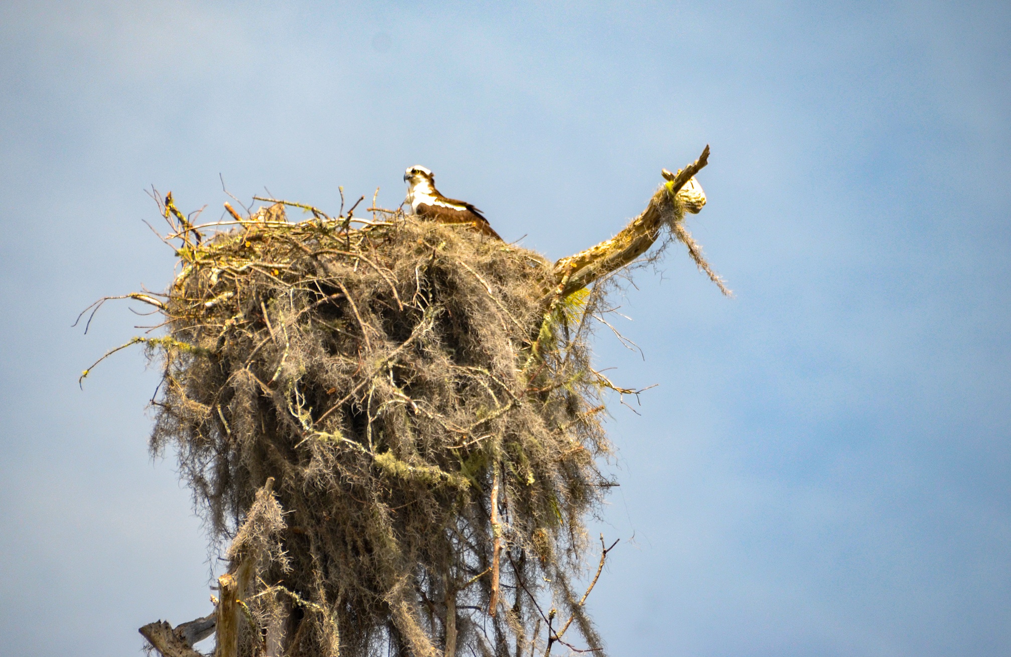
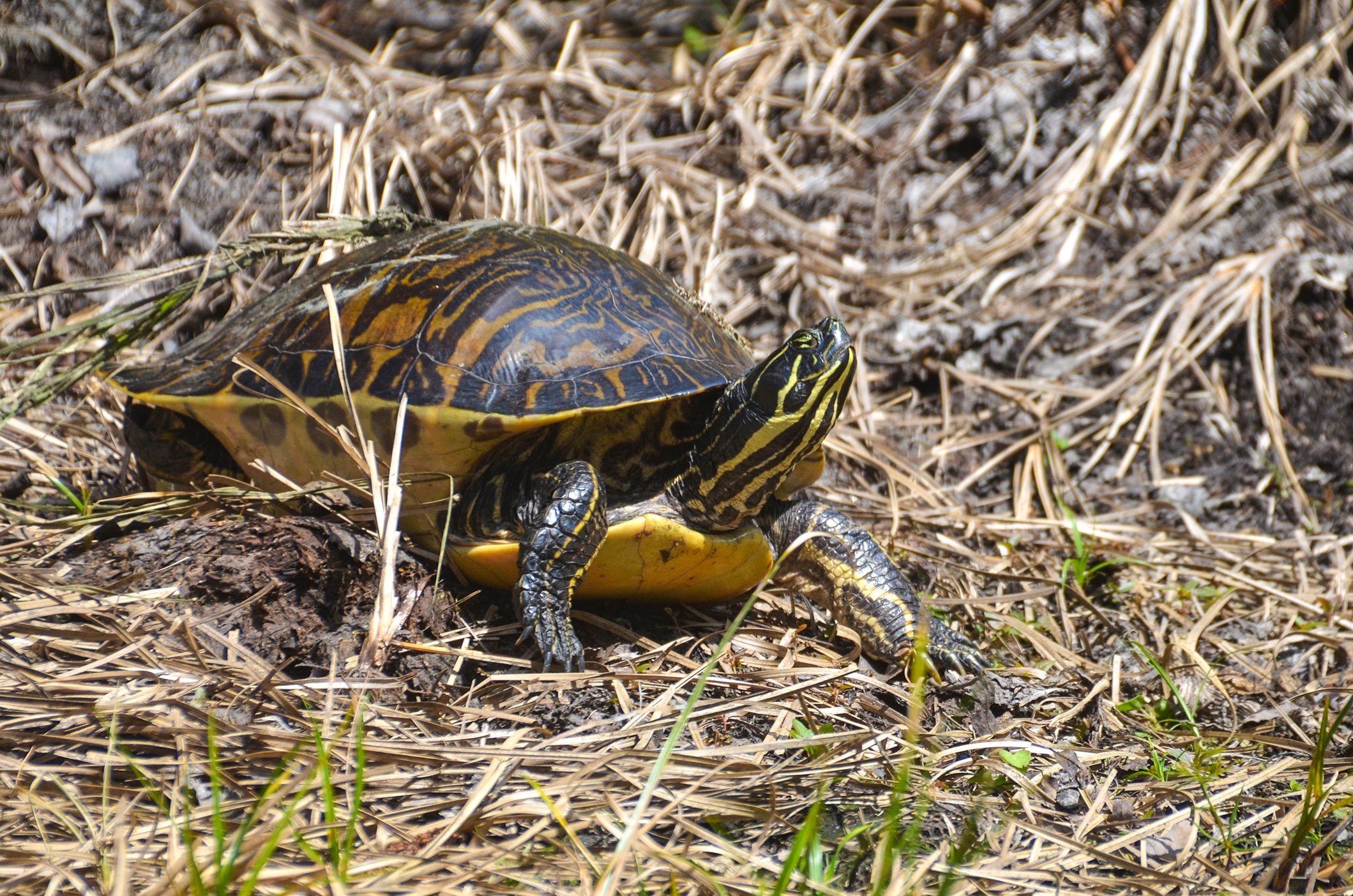
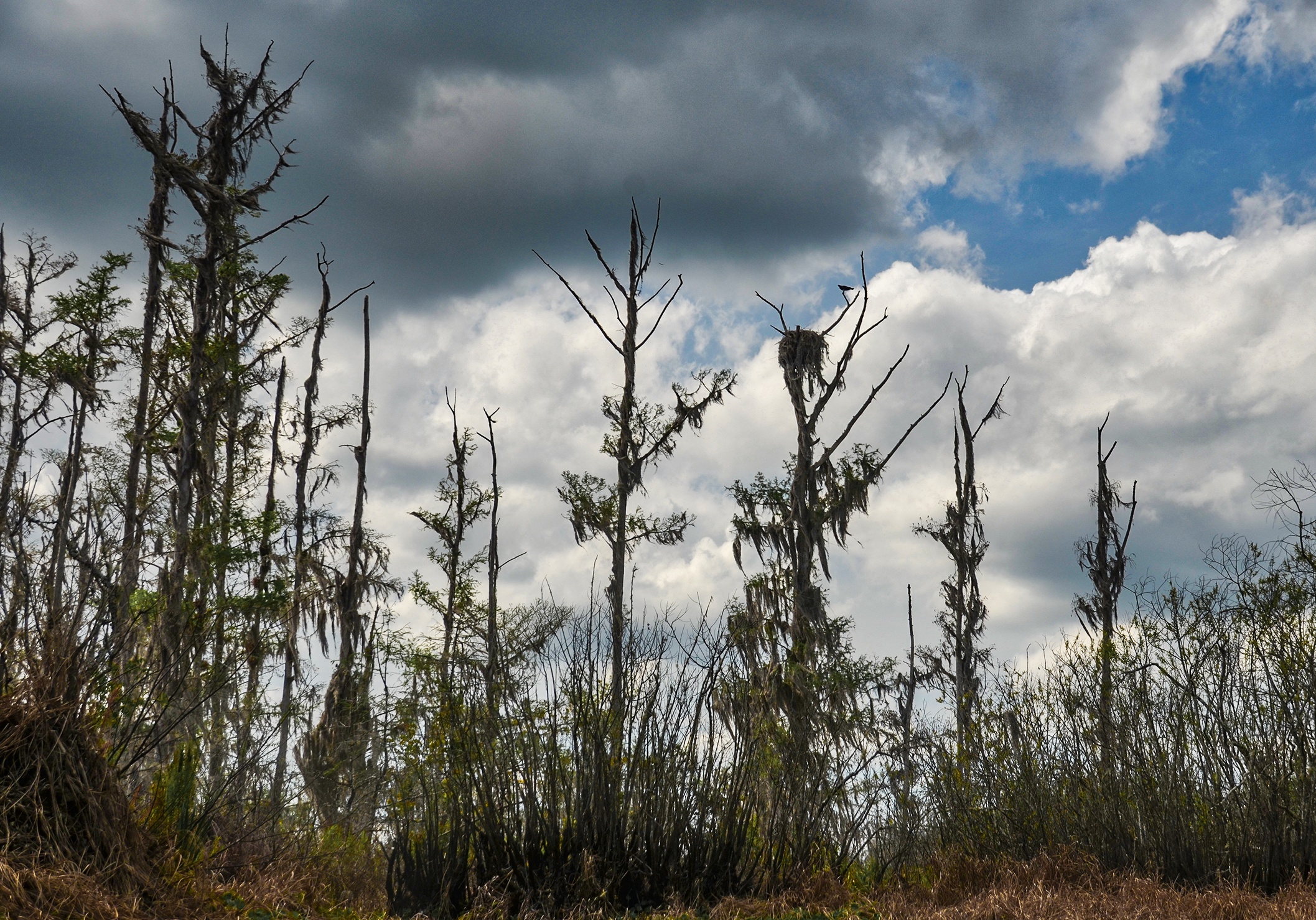
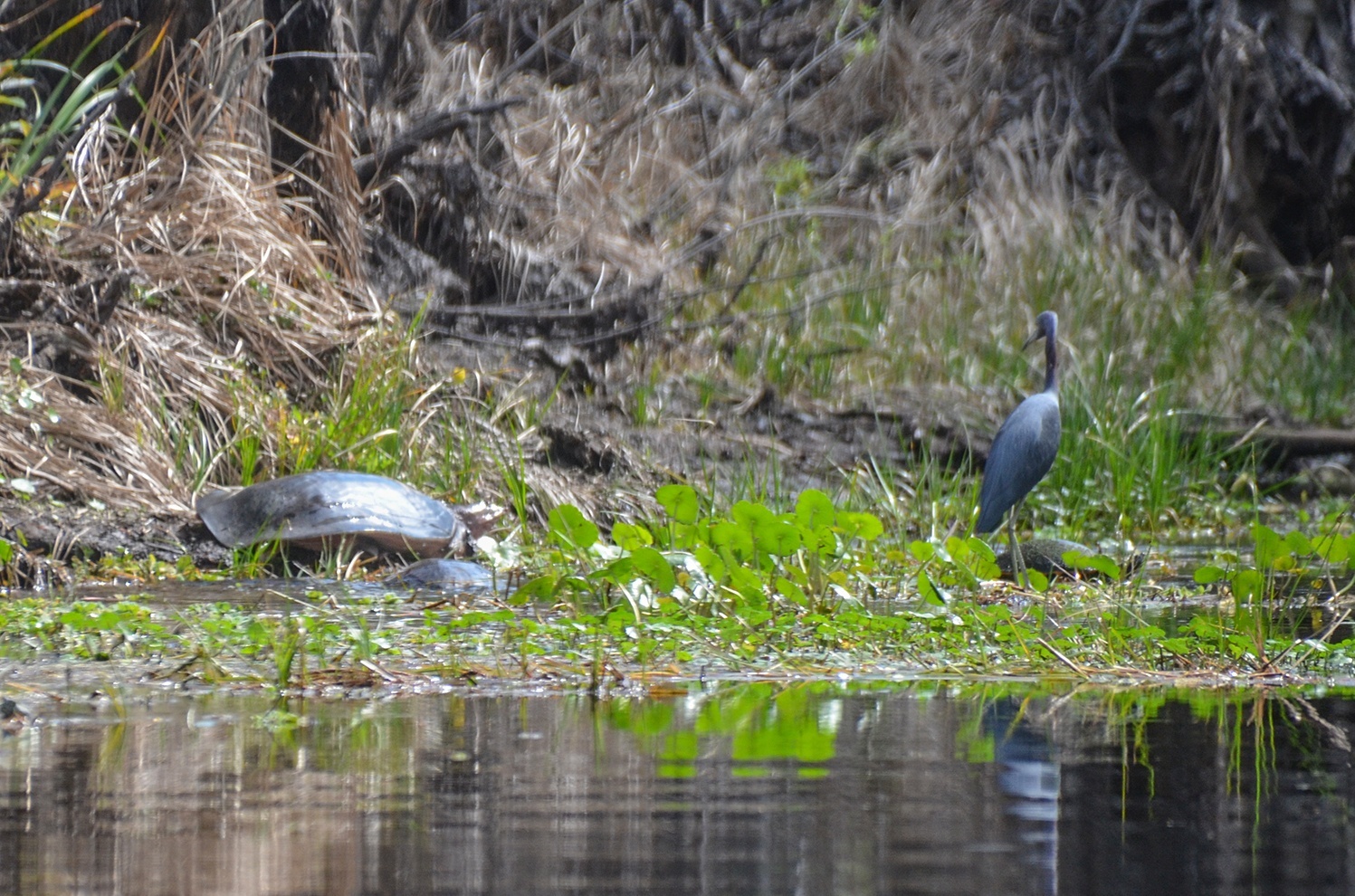
Our last 1.25 mile stretch was very interesting. It was surprisingly quiet, with minimal bird activity except for a Tri-colored Heron that seemed to follow us along the way. Above however, in the tall barren trees, were numerous, occupied, Osprey nests with active Ospreys flying over to check us out. The real ‘hair raisers’ were the gators and turtles. Obviously Sweetwater Creek is not a major paddle trail and both gators and turtles were easily spooked at our slightest paddle motions. Before we could even see many of them, they were splashing in the water ahead of us and disappearing into the dark water. It was eerie, as the creek was quite narrow here and the gators were big…where’d they go? Ahead we saw numerous gators swim across in front of us and many eyes watching just above the surface!
I had to resort to tapping my kayak with the paddle, especially when round a blind corner, to alert the gators. Several of these critters had a running start on the banks and would and leap into the water in front of us…yikes! I did not want one inadvertently jumping onto my kayak! We did see some very large turtles to include Softshell Turtles.


End of the Line…
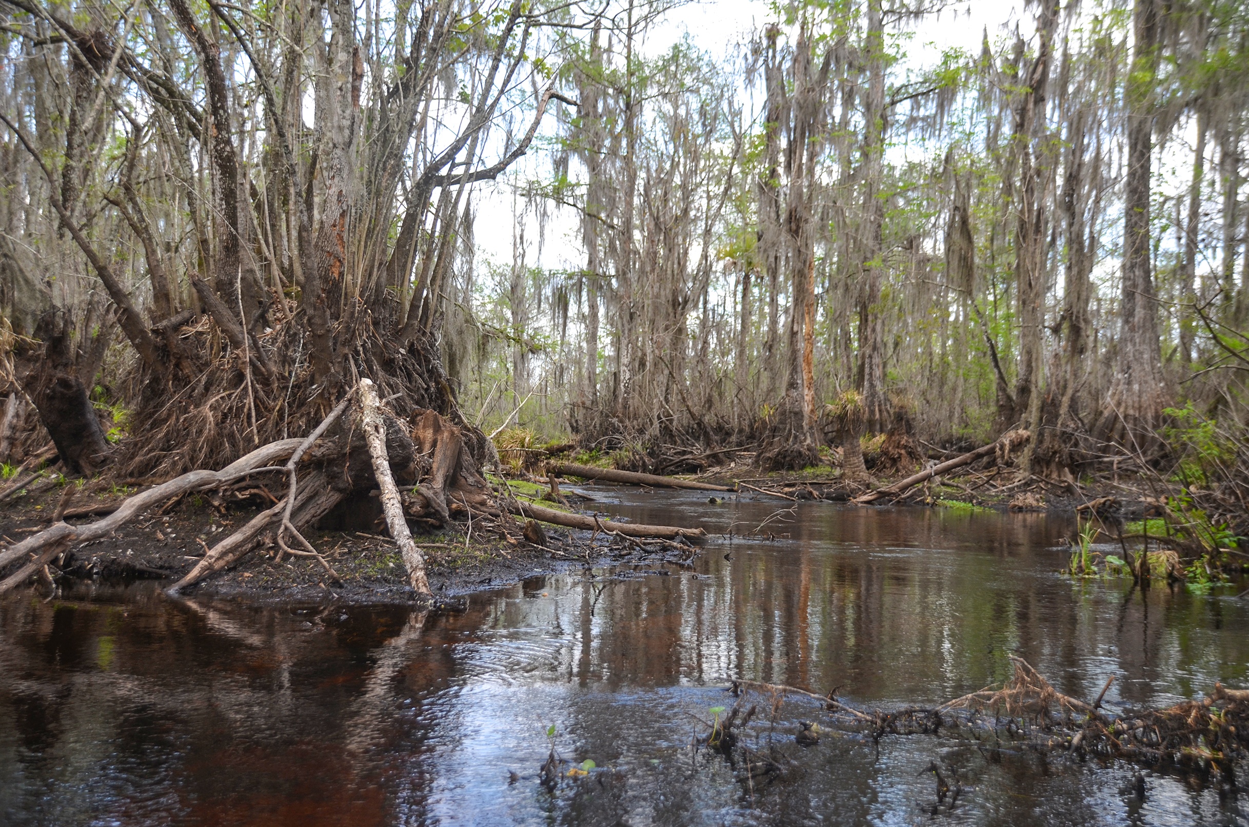

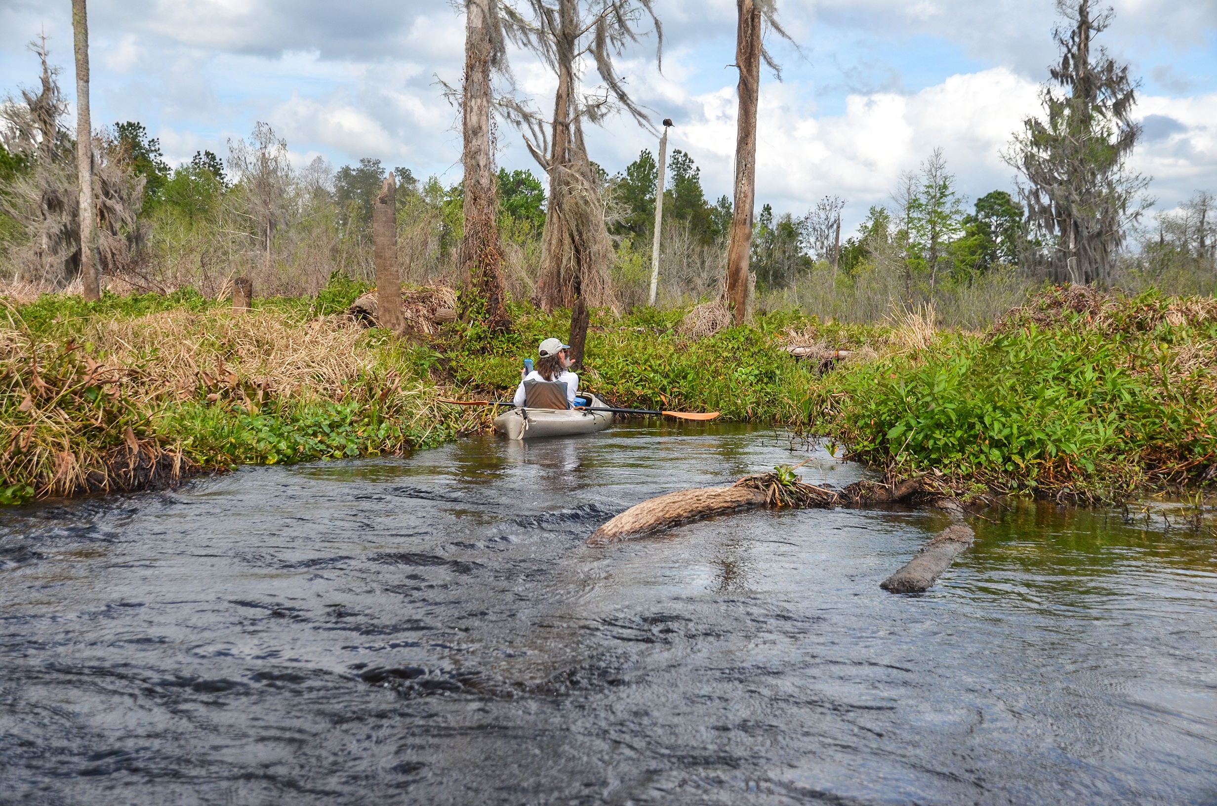
In this last stretch we also encountered three more log obstacles, requiring some effort as we see-sawed over them. We soon hit a fork in the creek with the flow coming from our right, however 100′ up the muddy fork, several downed palms created a blockage that ended our paddle at 2.65 miles. The water rushed over the trees with a nice flow, but it was the end and we headed back…
Deep Creek…
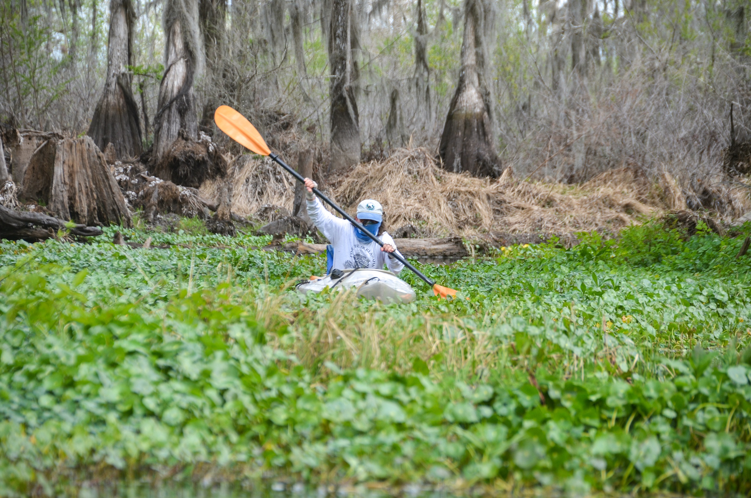
Arriving back where Deep Creek enter Sweetwater Creek, we decided to venture in. The water flowed well, had a nice sandy bottom, slightly tinted with tannin. The shoreline was colored golden as matted, dead Lake Sedge covered the exposed tree trunks. The water was quite shallow and the creek was about 15′ wide here, however 1/4 mile in, we hit a blockage of several tree trunks that prevented further exploration on this day. It looks promising for the adventurous however…those who would want to portage over some of these obstacles to see further up the creek. The clear water, sandy bottom and strong flow suggested there might be a spring feeding portions of this creek.
Read our previous post on Sweetwater Creek, before the drawdown.
Guides, Maps & Info…
- Rodman Topo Map ( Includes Sweetwater and Deep Creek )…
- Water Levels at Rodman Dam…
- North Star Charters…Capt. Karen Chadwick…
- Save Rodman Reservoir, Inc…
- St Johns River Keeper,Free the Ocklawaha, Info and Videos…
- Florida Defenders of the Environment – Remembering the Ocklawaha…
- Ocklawaha River – Remembered-Imagined…
![]() Keep up with new paddles here to receive an email notification when a new adventure is posted…sign me up! Check out past paddles here and follow Florida Paddle Notes on Facebook !
Keep up with new paddles here to receive an email notification when a new adventure is posted…sign me up! Check out past paddles here and follow Florida Paddle Notes on Facebook !
![]()