
Withlacoochee River (S) Hwy 200 to Hwy 41
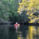 We could not pass up the predicted excellent weather and so ventured out on a 12-mile section of the Withlacoochee River (S), launching just north of Hwy 40 at Spruce Public Boat Launch and paddling to Dunnellon to enjoy our reward at The Blue Gator Tiki Bar and Restaurant. Along this Florida Paddle Trail, we enjoyed temperatures in the 70s, sunny skies, an awesome breeze at our back, and a swift current! Couldn’t have been better…James
 Another first for Florida Paddle Notes, Durbin Creek. In an effort to fill in some
  The Ocklawaha River is the principal tributary of the St. Johns River. Its main source is Lake Griffin, part of the Harris chain of lakes in Lake County, Florida. The Ocklawaha River watershed includes parts of the Green Swamp, most of Lake County, and portions of Marion, Alachua, and Putnam counties. The key tributary to the Ocklawaha is the Silver River, which originates in Silver Springs, Fl…James
 This week, we decided to paddle downstream from our launch at Bible Camp Road and head toward the
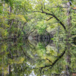
 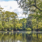 The last time I paddled the Upper Santa Fe River and Olustee Creek was back in February ( You can read about that paddle here ). The trees were still bare but it was a great first visit to this section of the river. Today Florida Paddle Notes revisited the same route on what started out a beautiful sunny summer day and finished with a typical Florida thunderstorm. A very enjoyable paddle! …James
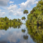
 Deep Creek is a 12-mile creek, originating in the low, agricultural land
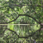
  Today we paddled close to home. One of the last remaining sections of the Ocklawaha River, that I have paddled but have yet to document. The entire Ocklawaha River – Bear Creek Loop, which begins at the Hwy 19 Bridge, goes East to the St Johns River, then back up Bear Creek, is about a 10-mile paddle. Today, however, we paddled a 6.5-mile loop, entering Bear Creek 3.5 miles down the Ocklawaha.
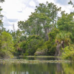 On the north shore of the Salt Springs basin is a wetland area known as Bear Swamp. Today’s side paddle takes us a 1/2 mile east of the launch at Salt Springs Marina and Landing. Here an unnamed tributary flows into Salt Springs Run…James
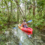 Today, despite a threat of rain, Donna and I headed on over to the