
Overview:
The Santa Fe River is a 75-mile river in north central Florida and derives its name from a Franciscan mission named Santa Fé de Toloca once located near the river. It’s source is Lake Santa Fe – Little Lake Santa Fe located north of Melrose and East of Waldo. The upper half of The Santa Fe is a small, winding creek that often dries in low water periods and the river is usually a slow-flowing river.
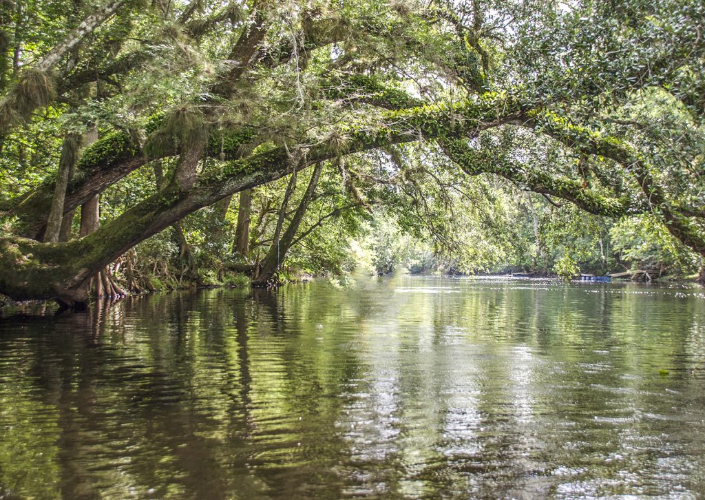
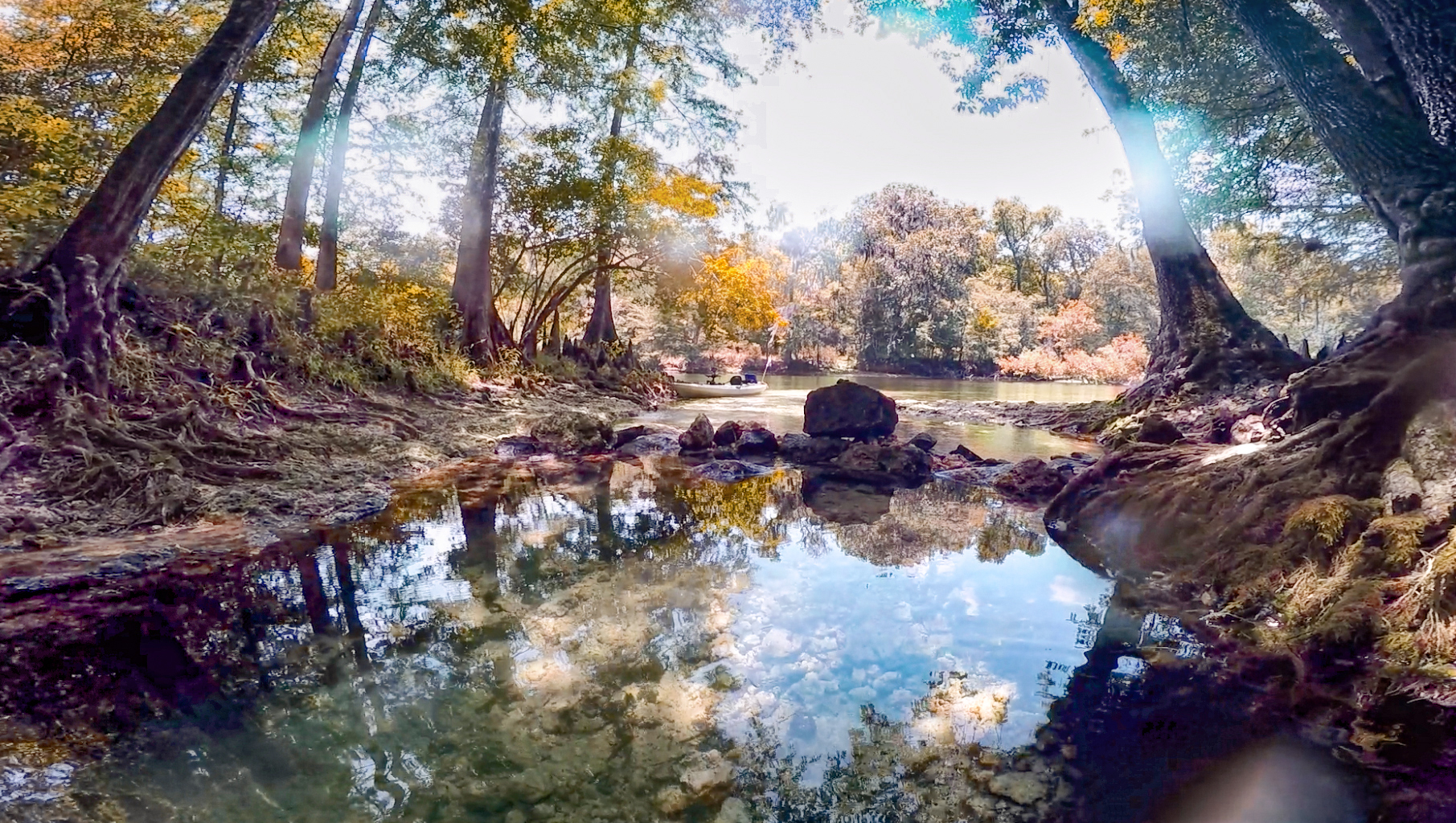
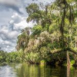
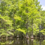
Tannic acid, released from the roots of the cypress trees, leaves and organic matter, give the Santa Fe River a dark, tea-colored appearance.
The tributaries of the Santa Fe include the New River, Olustee Creek, and the Ichetucknee River. The Santa Fe flows into the Suwannee River near Branford, Florida.
An interesting aspect of the river is that in it’s upper section, the river flows into a sinkhole at O’Leno State Park, flows underground for 3 miles then surfaces in River Rise Preserve State Park near High Springs.
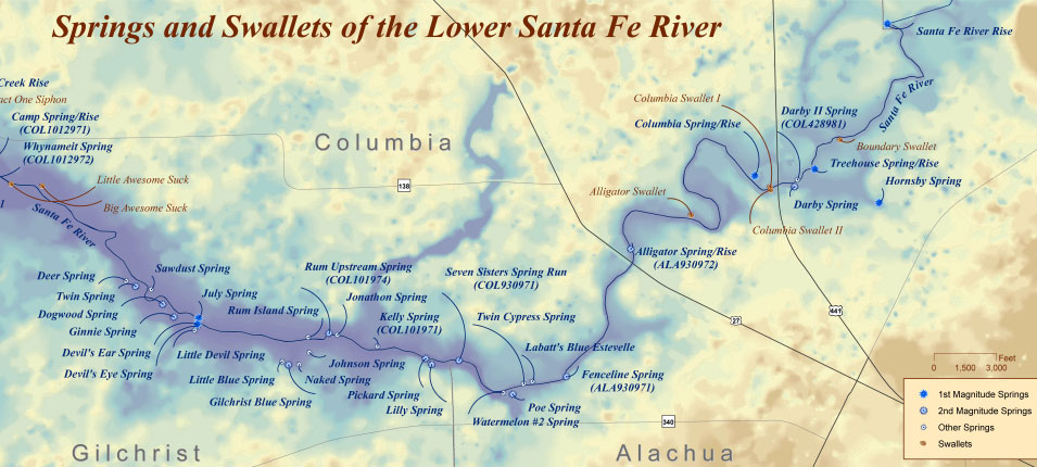
Dozens of springs feed into the Santa Fe river many of which are located in what is called the Lower Santa Fe River. Some springs are small and have interesting stories as does Lily Spring once occupied by ’Naked Ed’ and the neighboring Packard Spring, whose tenants enjoy skinny dipping. Some of the most popular springs include Poe Springs, Rum Island Spring, Gilchrist Blue, Ginnie, Devils Eye and Devils Ear.
Due to the numerous springs the water temperature is usually around 72 °F, especially close to the springs.
A 26 mile Designated Paddling Trail runs from High Springs to Branford at the Suwannee River. The upper portion of this stretch has the abundance of popular springs and after the Ichetucknee River flows into the Santa Fe the river widens. In this section there is more development and there are numerous powerboats as it flows into the Suwannee River.
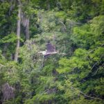
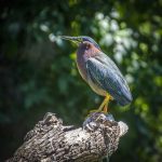
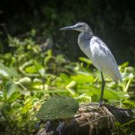
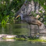
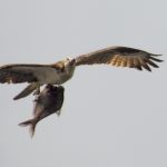
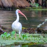
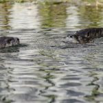
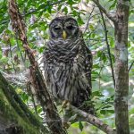
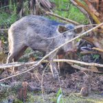
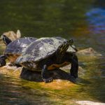
The Santa Fe River has an abundance of wildlife to include several species of Turtles, Otters, Deer, Snakes, Herons, Egrets, Limpkins, Owls and Ospreys among others. Along the shoreline is an assortment of hardwood trees and in the lower-lying areas there are a variety of shrubs to include Spider Lilies, Atamasco Lilies, Buttonbush, Red Cardinal Flower, Yellow Burr Marigolds and Purple Asters. See the Flora and Fauna galleries below…
Guides, Maps & Info…
- oursantaferiver.org has a few nice maps and guides for this river…
- Florida Springs Database by Greg Johnson…
- A great interactive map for Florida Springs. This opens in Google Earth for me…
- floridaspringlife.com has a good interactive map of Santa Fe River Springs…
- Florida Designated Paddling Trails – Santa Fe River Guide (pdf)…
- 5-Star Yak Pak.org has a great detailed Santa Fe Fact Sheet Mileage Chart…
- Suwannee River Water Management District has an excellent (pdf ) covering Springs on the Santa Fe River…
- Springs Fever also has excellent information on the Santa Fe River and each spring (pdf )…
River Details ~ Paddle Notes ~ Flora ~ Fauna
River Details:
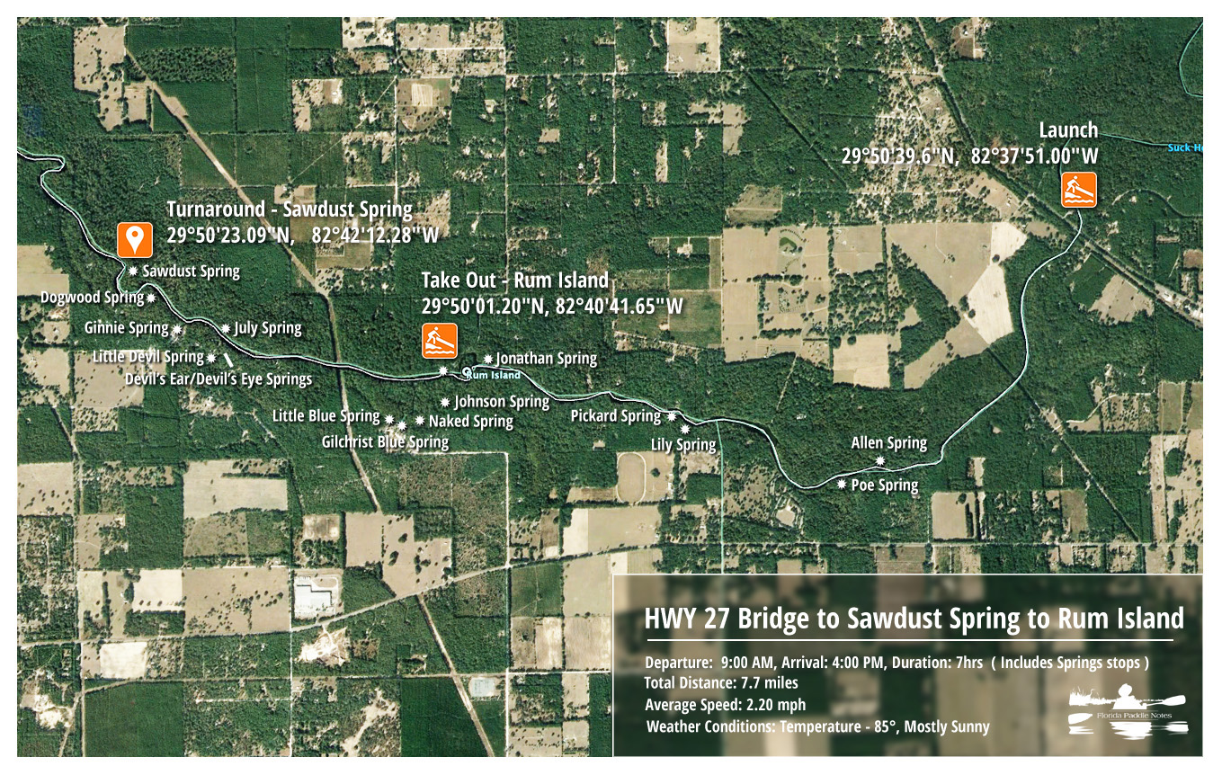
![]() Location: This paddle starts on HWY 27, 2.4 miles NW of High Springs, over the bridge and the launch is on the North side of the highway. There is plenty of parking.
Location: This paddle starts on HWY 27, 2.4 miles NW of High Springs, over the bridge and the launch is on the North side of the highway. There is plenty of parking.
![]() Launch points: The launch is 2.4 miles NW of downtown High Springs, over the bridge on the North side of Highway 27. There is plenty of parking.
Launch points: The launch is 2.4 miles NW of downtown High Springs, over the bridge on the North side of Highway 27. There is plenty of parking.
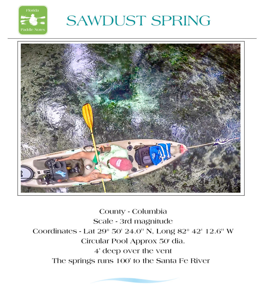
![]() Paddle Distance: This paddle is 7.7 miles. It is 5.8 miles from Hwy 27 to Sawdust Spring, then, heading back upstream it is another 1.9 miles to the take out at Rum Island County Park.
Paddle Distance: This paddle is 7.7 miles. It is 5.8 miles from Hwy 27 to Sawdust Spring, then, heading back upstream it is another 1.9 miles to the take out at Rum Island County Park.
![]() Difficulty: Easy to moderate. The river is open with a nice easy flow. I say moderate only if water levels are low as there may be shoals and rocks.
Difficulty: Easy to moderate. The river is open with a nice easy flow. I say moderate only if water levels are low as there may be shoals and rocks.
 Average Paddle Time: On this particular trip the paddle speed was about 2.3 mph. On a straight paddle with no stops it should take around 3.5 hours, however this trip is made for stopping and exploring the many springs, which could add several more hours to the trip.
![]() Width and Depth: The river is about 120′ wide at the start on Hwy 27 and gradually widens. At the turn around, Sawdust Springs, it is about 160′ wide. Average depth could vary depending on the water levels, from 2-3′ to 20′.
Width and Depth: The river is about 120′ wide at the start on Hwy 27 and gradually widens. At the turn around, Sawdust Springs, it is about 160′ wide. Average depth could vary depending on the water levels, from 2-3′ to 20′.
![]() Current – Tidal: The flow is approximately 1.5 – 2.+ mph. Not tidal. Just passed Ginnie Springs, depending on the water level, are some quick, fun shoals.
Current – Tidal: The flow is approximately 1.5 – 2.+ mph. Not tidal. Just passed Ginnie Springs, depending on the water level, are some quick, fun shoals.
![]() Side Paddles: There are numerous side paddles on this section of the river. The side paddles are short as they lead to the many springs along the route.
Side Paddles: There are numerous side paddles on this section of the river. The side paddles are short as they lead to the many springs along the route.
![]() Rest Areas: There are numerous areas to stop and rest along this section of the river. Many of the larger springs have public restrooms available.
Rest Areas: There are numerous areas to stop and rest along this section of the river. Many of the larger springs have public restrooms available.
Paddle Notes:
Fond Memories…
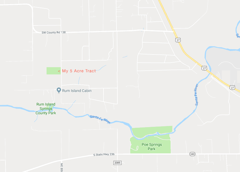
Paddling the Santa Fe River is very special to me. I first saw the Santa Fe back in 1972 after purchasing 5 acres of land just up the road from Rum Island Spring. I spent many days on the Santa Fe exploring it’s numerous springs and each time I return there are fond memories. Back then, Rum Island Spring was not a county park and it was rarely used. On many days there were only a handful of locals there. Whenever my electricity would go out I walked down to the spring to cool off and just upstream a few hundred feet was Jonathan Spring, which I considered my private bathtub and spent many a hot summer day sitting in the small hidden spring!
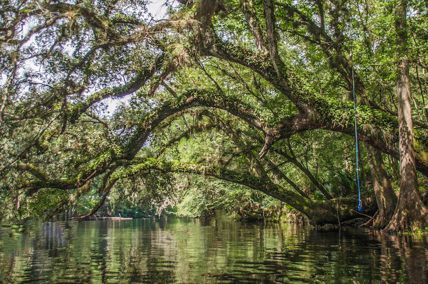
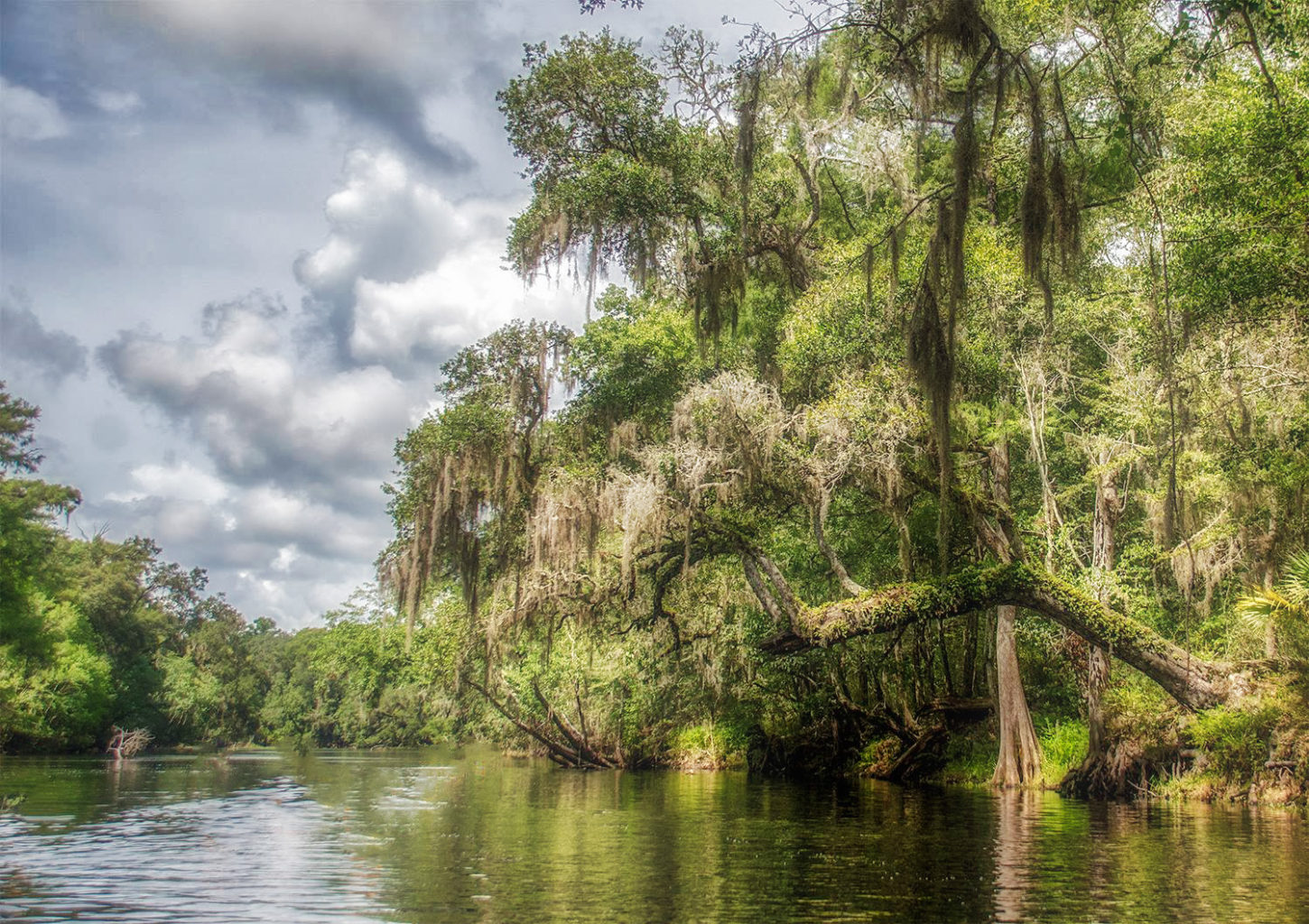
Leaving the launch and heading downstream under the old railroad trestle, the banks of the Santa Fe reach 10′-15′ high and gradually diminish in height by the time I reach Poe Springs, just under 2 miles downstream. Spotted houses line the banks and the shoreline is heavily wooded with Cypress and other assorted hardwoods. There was very little aquatic vegetation in this section on this particular paddle. The river had a slow gentle flow. Having stopped for a quick swim in Poe Springs, I paddled under the large live oak stretching over the water as I exit the spring head. I remember back, tying my canoe to the shoreline roots and climbing the oak just to sit and watch the river flow beneath me.
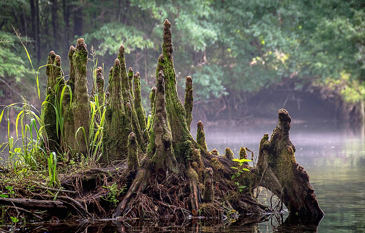
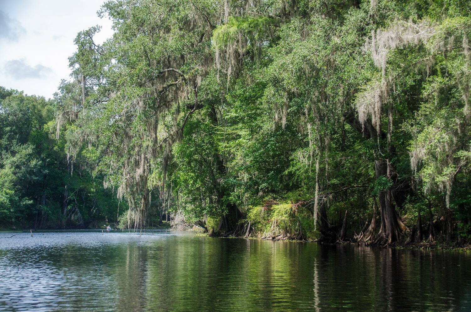
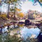
I refer to the Santa Fe River as a ‘lazy’ river. The slow moving current helps create a ‘no rush’ attitude while paddling or drifting along. The banks are full of hardwoods, shrubs and palmettos with many of the trees leaning over the shoreline offering a canopy of shade. When the water level is up and the flow is a bit more brisk, as on this trip, there is minimal aquatic vegetation along the shoreline until venturing into the spring runs. The banks are lined with numerous cypress knees acting like sentinels of the shoreline.
Naked Ed…
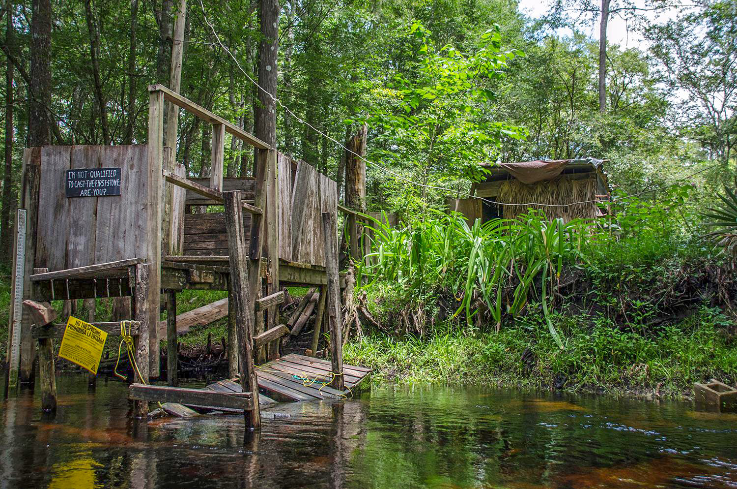
If you’ve paddled the Santa Fe you’ve probably saw or at least heard of Naked Ed. John Edward “Naked Ed” Watts has been the local Lily Springs caretaker for over 24 years and retired in 2017 due to illness and a need to care for his mother. Ed lived in a grass hut at the spring and as you guessed liked to be naked. A pleasant person, Ed liked greeting paddlers to Lily Spring from his deck over the water. Out of respect to visitors Ed would sometimes where a loin cloth or pants when he expected a crowd. Ed’s worst enemies were people who littered the springs and he kept Lilly Spring pristine. He’s been a legend over the years and doubtful he will return to the spring.
The Springs…
This stretch of the river is famous for it’s many springs. Though I have been to almost all of the springs on this section, this paddle only focuses on a select few… Individual spring details are noted in the highlighted spring links list below. For a more in depth look at location and descriptions, open the interactive springs map or look over several of the Maps and Guides listed above…
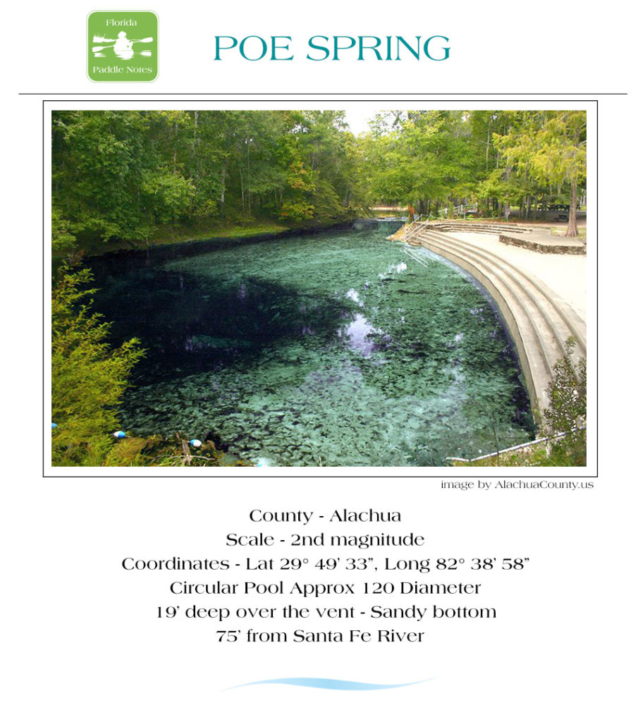
- Poe Spring ( 1.9 mi ) is usually my first stop and is always good for a refreshing swim, stretch and using the restroom. Poe Spring can get quite crowded on weekends. Depending on the water Levels, the shoals just downstream from Poe can be a quick fun run.
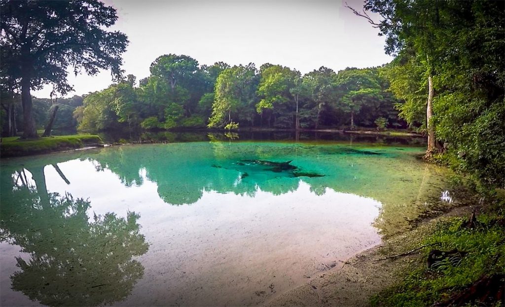
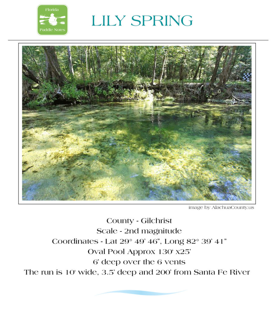
- Lily Spring is just under a mile downstream from Poe and was the home of ’Naked Ed’ . With a high water level, the water is swift up the short run.
- Packard Spring is just past Lily on the left and is on private property with the entrance to the spring usually blocked.
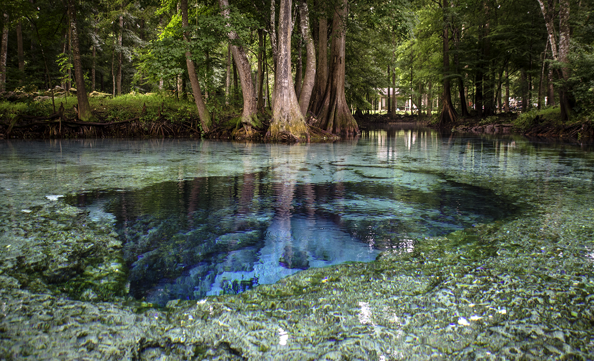
- Jonathan Spring 1 mile past Lily Spring ( 2.8 mi from the launch ) is an old favorite from my time living at Rum Island. A small, intimate spring with a lot of natural beauty. Great on a hot summer day to take a break and just sit in the shallow cool water tucked just into the hardwoods.
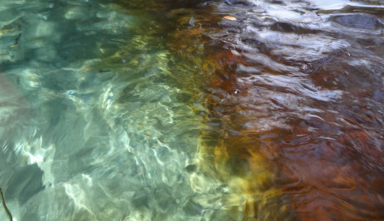
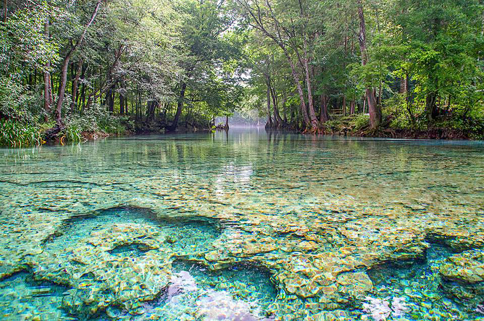
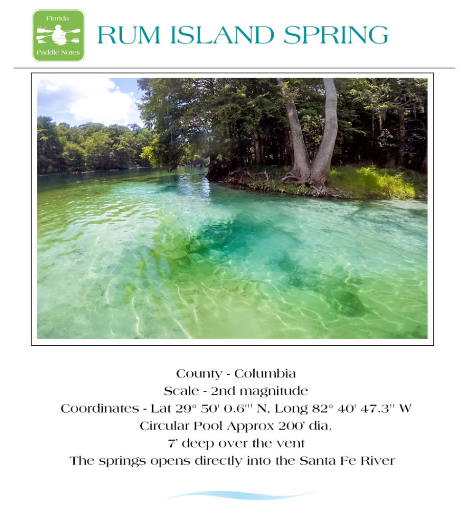
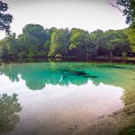
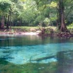
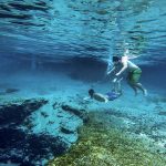
- Rum Island Spring is just past Jonathan. The river flows around the small Rum Island and to Rum Island Park with the spring on the West side of the park. There is a nice shallow area for hanging out and the springs shows off the stark difference in water color as the clear spring water mixes with the tannin colored Santa Fe.
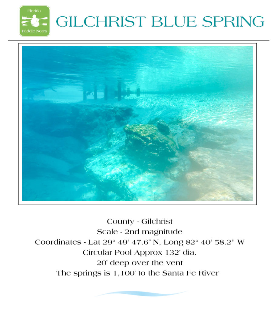
- Gilchrist Blue Spring, Naked Spring and Little Blue Spring are right across the river from Rum Island. Gilchrist Blue is now a Florida State Park. There is a nice run with a strong current that leads to the main spring as well as to Naked Springs. Exiting your boat is subject to Florida State Park fees.
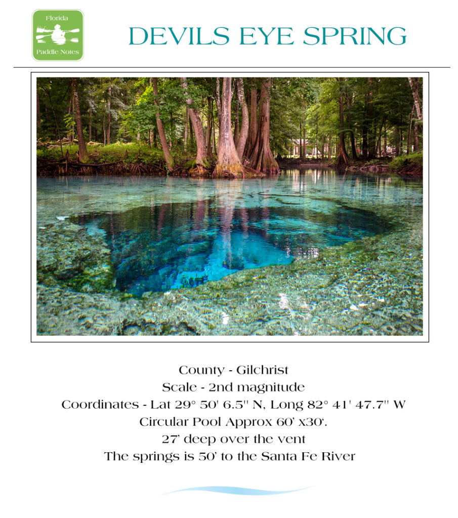
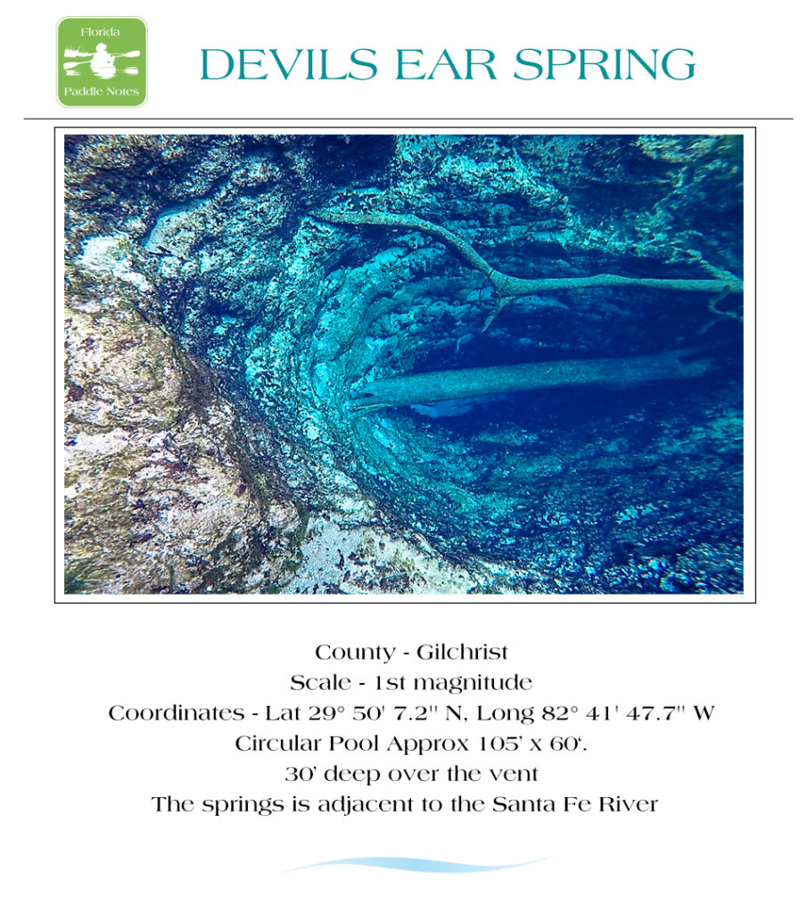
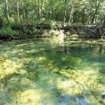
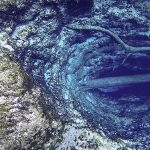
- Devils Eye, Devils Ear and Little Devil are just under a mile downstream from Gilchrist Blue ( 5 mi from launch ). These are popular diving springs and they are so awesome! If you are short on time do not miss these springs. See photos below…
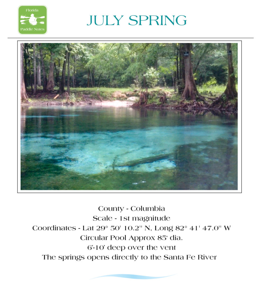
- July Spring is a nice spring right across the river from the Devil system. It is surrounded by private property so enjoy the water but keep off the land.
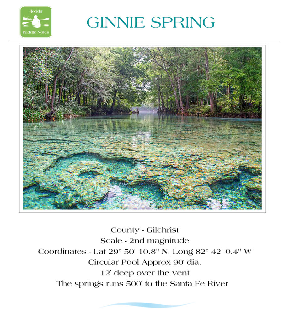
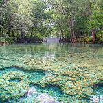
- Ginnie Spring is up next very quickly on the left. A large gorgeous spring to explore with plenty of lime rock support to stand on and observe.
- Sawdust Spring is the final spring on this paddle at 5.7 miles from launch. Another spring on private property but the underwater scenes here are beautiful!
Springs Photo Gallery:
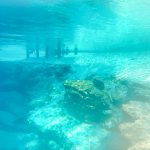
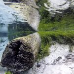
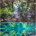
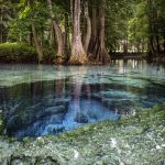
Below the surface, the eel grass waves with the current as my kayak drifts over patches of vegetation through the tannin colored waters.
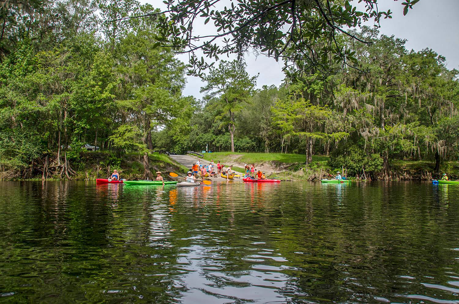
This is a great paddle with so much to see! Get an early start and plan to spend most of the day. Brings beverages and snacks and remember to keep the river clean. This section of the Santa Fe is quite popular and during the summer months as well as weekends, expect it to be crowded. Memorial Day, Fourth of July and Labor Day expect huge crowds of students floating on tubes, rafts and boats. I find getting here early on weekdays is my best bet. I love this river and this paddle ends another chapter of Florida Paddle Notes
Flora:
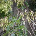
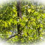
Trees: There is a wide variety of hardwood trees along The Santa Fe – Bald Cypress -Taxodium distichum, Live Oak – Quercus virginiana, Tupelo – Nyssa sylvatica, Cabbage Palm – Sabal Palmetto, Loblolly Bay – Gordonia lasianthus, Dahoon Holly – Ilex cassine, American Sweetgum – Liquidambar styraciflua, Red Maple – Acer rubrum, Carolina Ash – Fraxinus caroliniana, Swamp Dogwood – Cornus racemosa, Virginia Willow – Itea virginica
and others.
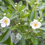
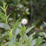
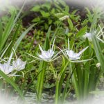
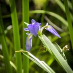
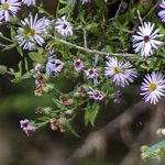
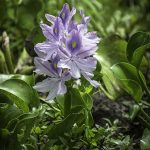
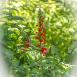
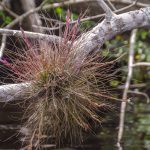
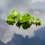
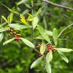
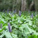
Shrubs, Grasses, Aquatic and Flowering Plants: The under growth was rich with Bartram’s Airplant – Tillandsia bartramii , Pickerelweed – Pontedaria cordata , Elliott’s Aster – Symphyotrichum elliottii, Blue Flag Iris– Iris viginica, Cardinal Flower – Lobelia cardinalis , American Eelgrass – Vallisneria americana, Hydrilla – Hydrilla verticillata, Water Hyacinth – Eichhornia crassipes, Spider Lily – Hymenocallis latifolia, Atamasco Lily – Zephyranthes atamasco, Buttonbush – Cephalanthus occidentalis, Saw Palmetto – Serenoa Repens, Bur Marigold – Bidens aristosa
Trees, Shrubs, Grasses, Aquatic and Flowering Plants – Gallery:
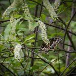
Fauna:
The Santa Fe River is abundant with wildlife. On a good day you’ll get to see an assortment of river birds to include Herons, Egrets, Limpkins, Ibis, Owls and Ospreys, plenty of turtles, an occasional otter or wild hog and deer. Alligators are few and far between on the Santa Fe, in fact I’ve never seen a gator on the Santa Fe!
Wildlife Gallery:
![]()