
Brief Overview:
The Santa Fe River is a 75-mile long river in north-central Florida and derives its name from a Franciscan mission named Santa Fé de Toloca once located near the river. Its source is Lake Santa Fe – Little Lake Santa Fe located north of Melrose and East of Waldo. The upper half of The Santa Fe is a small, winding creek that often dries in periods of low water and the river is usually a slow-flowing river.
37 miles West of this source, the Santa Fe River disappears into a large sinkhole located in O’Leno State Park. The river continues to flow, underground, until it emerges 3 miles SSW of O’Leno in what is now River Rise Preserve State Park.
The Santa Fe River continues its flow for over 30 more miles until it meets the Suwannee River near Branford, Fl. Along the way, numerous springs feed into the river as do New River, Olustee Creek, and the Ichetucknee River. Due to the numerous springs, the water temperature is usually around 72 ° F, especially close to the springs.
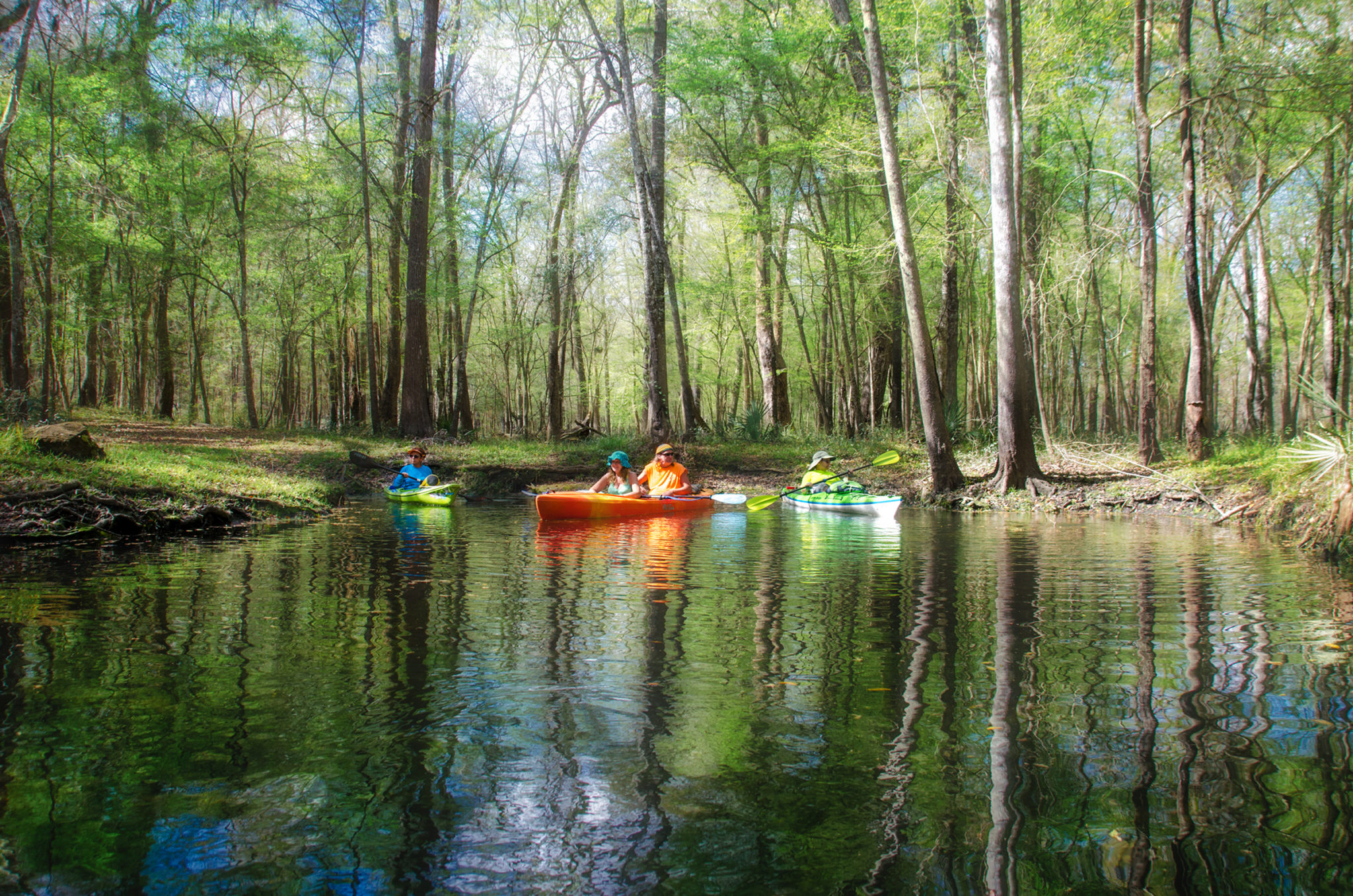
A 26 mile Designated Paddling Trail runs from High Springs to Branford at the Suwannee River. The upper portion of this stretch has the abundance of popular springs and after the Ichetucknee flows into the Santa Fe, the river widens. In this section there is more development and numerous powerboats as it flows into the Suwannee River.
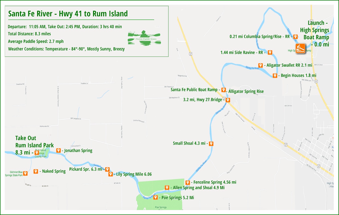
 Hwy 41 to Rum Island Details:
![]() Location: The ‘River Rise’ is located in Alachua County in the River Rise Preserve State Park.
Location: The ‘River Rise’ is located in Alachua County in the River Rise Preserve State Park.
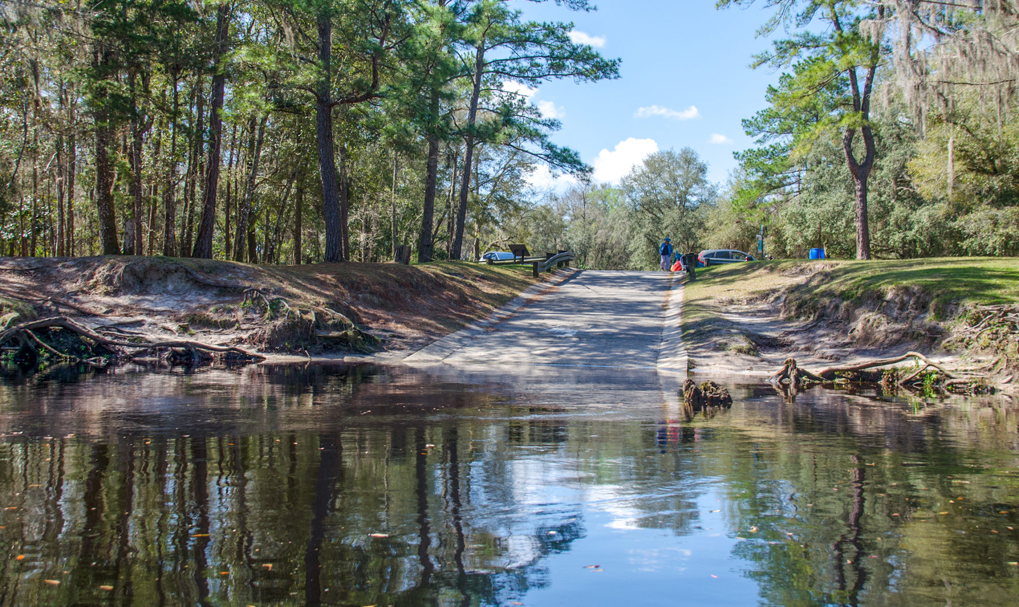
![]() Launch Point for this paddle: The launch is located at the High Springs Boat Ramp, 25227 Boat ramp Rd, High Springs, FL 32643. Rentals are available at Santa Fe Canoe Outpost High Springs, just up the road/river from the launch and Adventure Outpost in downtown High Springs.
Launch Point for this paddle: The launch is located at the High Springs Boat Ramp, 25227 Boat ramp Rd, High Springs, FL 32643. Rentals are available at Santa Fe Canoe Outpost High Springs, just up the road/river from the launch and Adventure Outpost in downtown High Springs.
Take Out: The take-out point for this paddle is at Rum Island County Park. Take US 27 NW out of High Springs for 3.3 miles from downtown. Turn left on CR 138 and travel 2 miles. Turn left on Rum Island Road and travel 1.5 miles to the park and launch.
![]() Paddle Distance: Approximately 8.3 miles.
Paddle Distance: Approximately 8.3 miles.
![]() Difficulty: Easy. Today there was a nice current allowing for an easy, relaxing paddle.
Difficulty: Easy. Today there was a nice current allowing for an easy, relaxing paddle.
 Average Paddle Speed: 2.7mph.
![]() Width and Depth: The width of the Santa Fe was 170′ at the launch. In between there were minimum widths of 40′ and 90′. The water level at the launch was 32′. Flood stage for this area is 35′.
Width and Depth: The width of the Santa Fe was 170′ at the launch. In between there were minimum widths of 40′ and 90′. The water level at the launch was 32′. Flood stage for this area is 35′.
![]() Current – Tidal: The current was steady flow, 2+ mph.
Current – Tidal: The current was steady flow, 2+ mph.
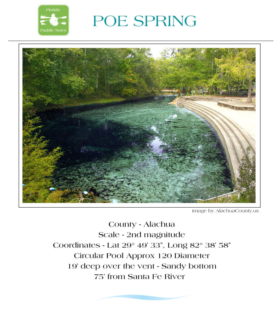
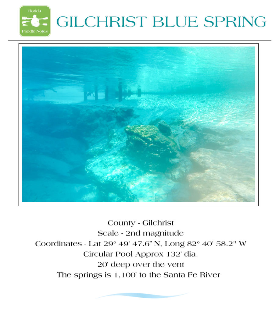
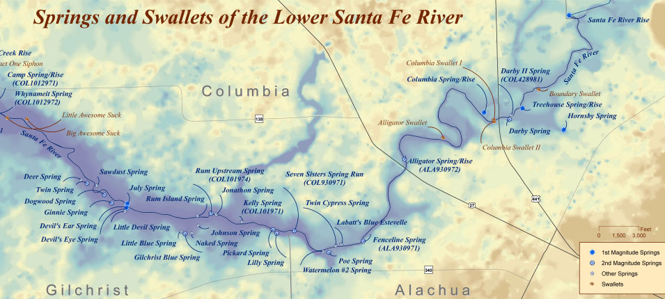
![]() Side Paddles: Side paddles were taken at Poe Springs, Pickard Springs and Gilchrist Blue Springs ( see Paddle Map ).
Side Paddles: Side paddles were taken at Poe Springs, Pickard Springs and Gilchrist Blue Springs ( see Paddle Map ).
![]() Rest Areas: Rest areas could be found along this paddle if exiting the boat was necessary. Actual facilities can be found at Poe Springs, Gilchrist Blue and Rum Island Park.
Rest Areas: Rest areas could be found along this paddle if exiting the boat was necessary. Actual facilities can be found at Poe Springs, Gilchrist Blue and Rum Island Park.
![]() Important Information: This is an easy going paddle, no warnings necessary. There are three small , short shoal areas with rocks and at a lower water levels may be tricky for some folks to paddle over the rocks.
Important Information: This is an easy going paddle, no warnings necessary. There are three small , short shoal areas with rocks and at a lower water levels may be tricky for some folks to paddle over the rocks.
The Paddle Route…
High Springs Boat Ramp…
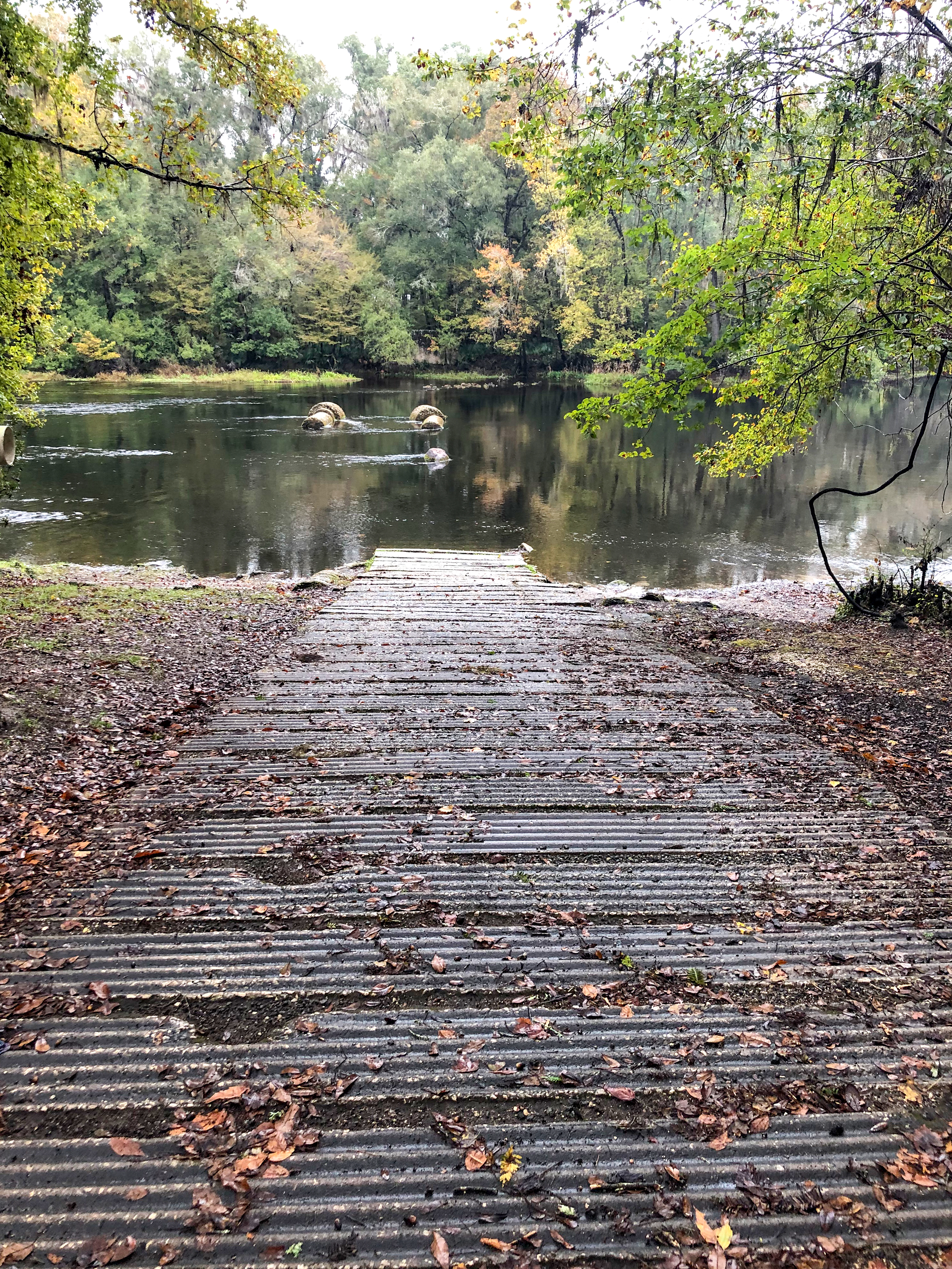
The High Springs Boat Ramp is located at 25227 Boat ramp Rd, High Springs, FL 32643. The High Springs Boat Ramp (and surrounding property) was purchased in 1958 from the State of Florida to provide recreational access to the Santa Fe River.
It is a bit of a slope for hauling kayaks but a good concrete ramp. Boats can be staged on either side of the ramp in the shallow, limerock and sand bottom water.The ramp is on the southern side of a large bend in the river creating a swift current coming from upstream to downstream.
Launching from the High Springs Boat Ramp, the temperature at 11:05 am was 82°, relatively warm for this time of year. It was mostly sunny, the river had a nice flow and the wind was at our backs. The initial shoal at launch is quick, over a shallow, rocky stretch for about 100′. At a lower water lever, there would definitely be exposed rocks. Currently the water level was at 32′ with flood stage being 35′ for this section. The water marks on the cypress along the shore bore evidence to this. Also, a 1/4 mile from the launch, on RR is Columbia Spring/Rise.
Hwy 41 to Hwy 27…
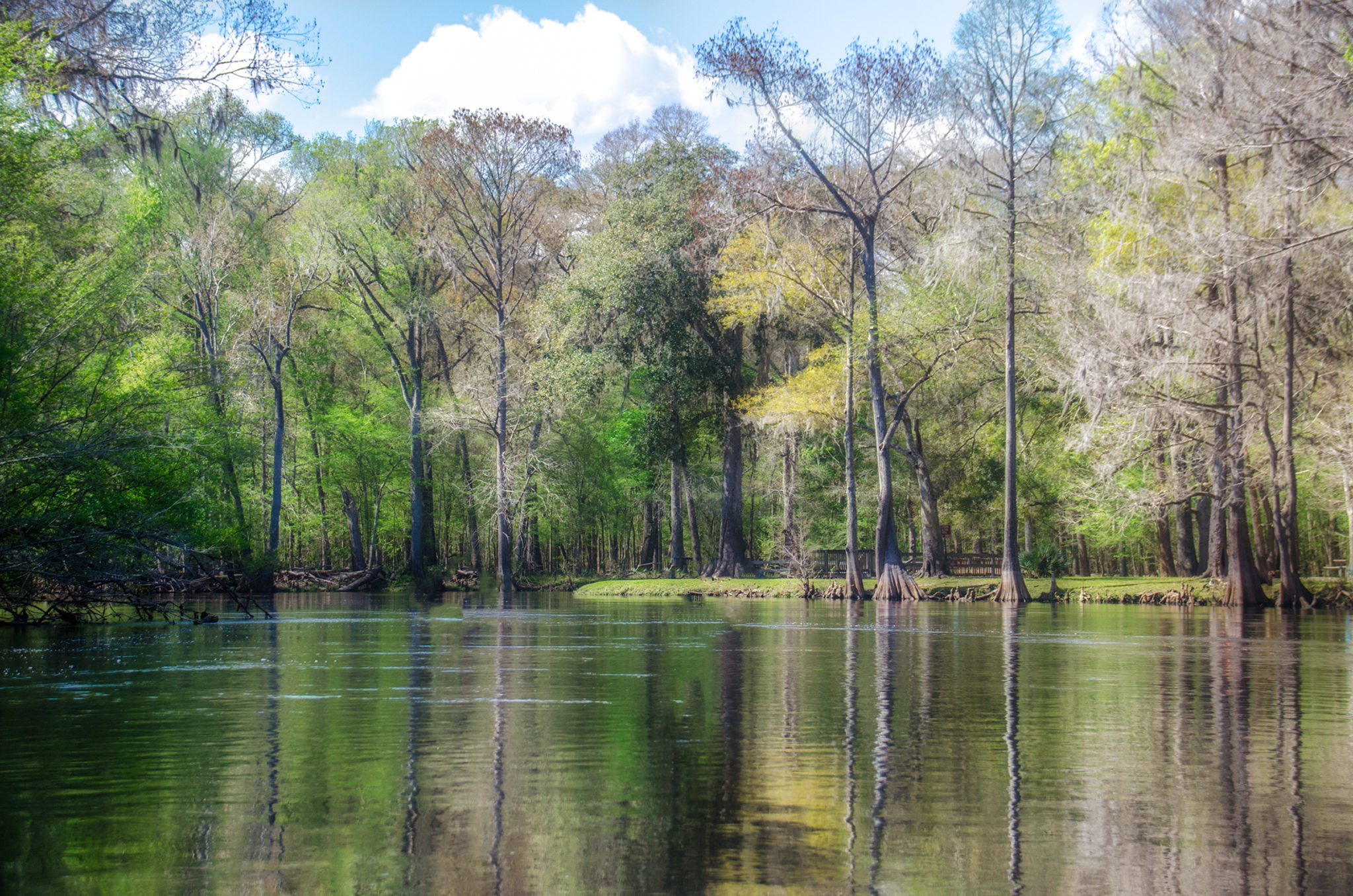
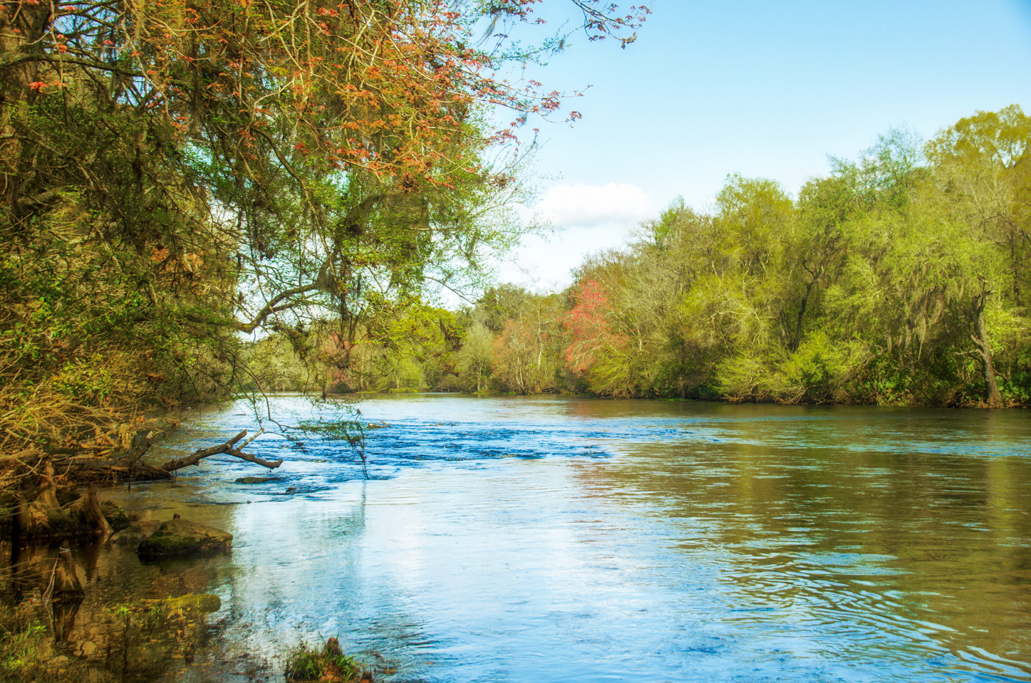
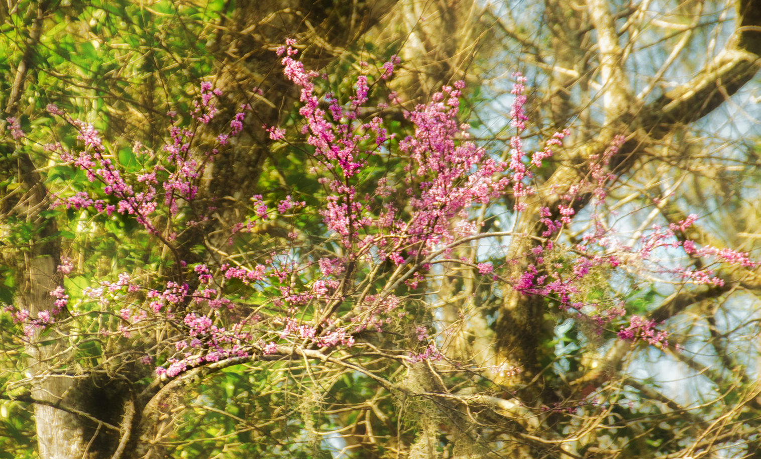
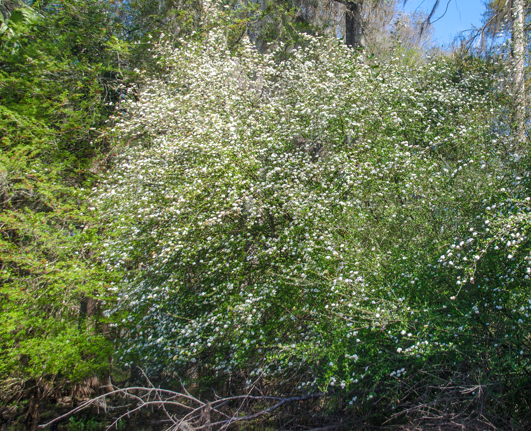
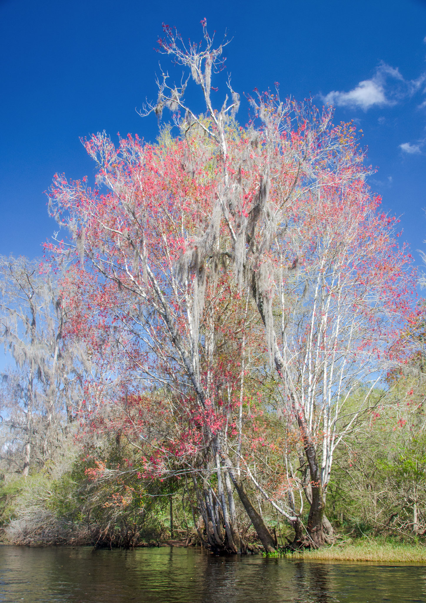
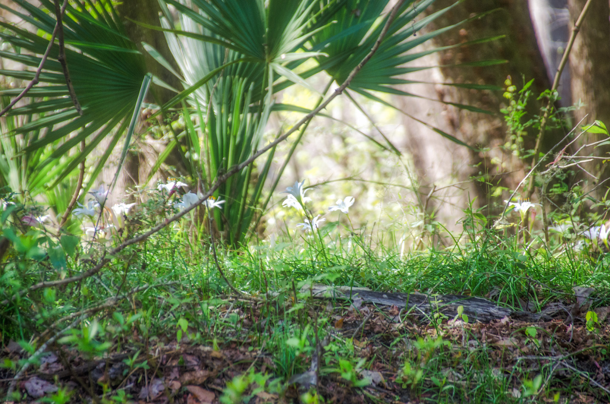
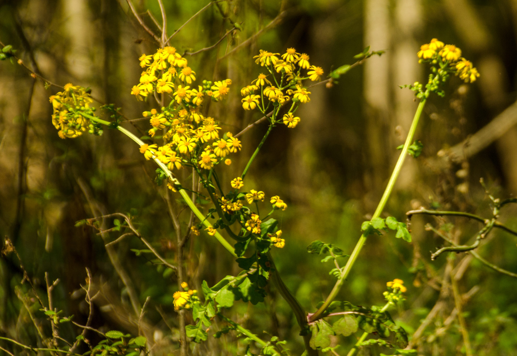
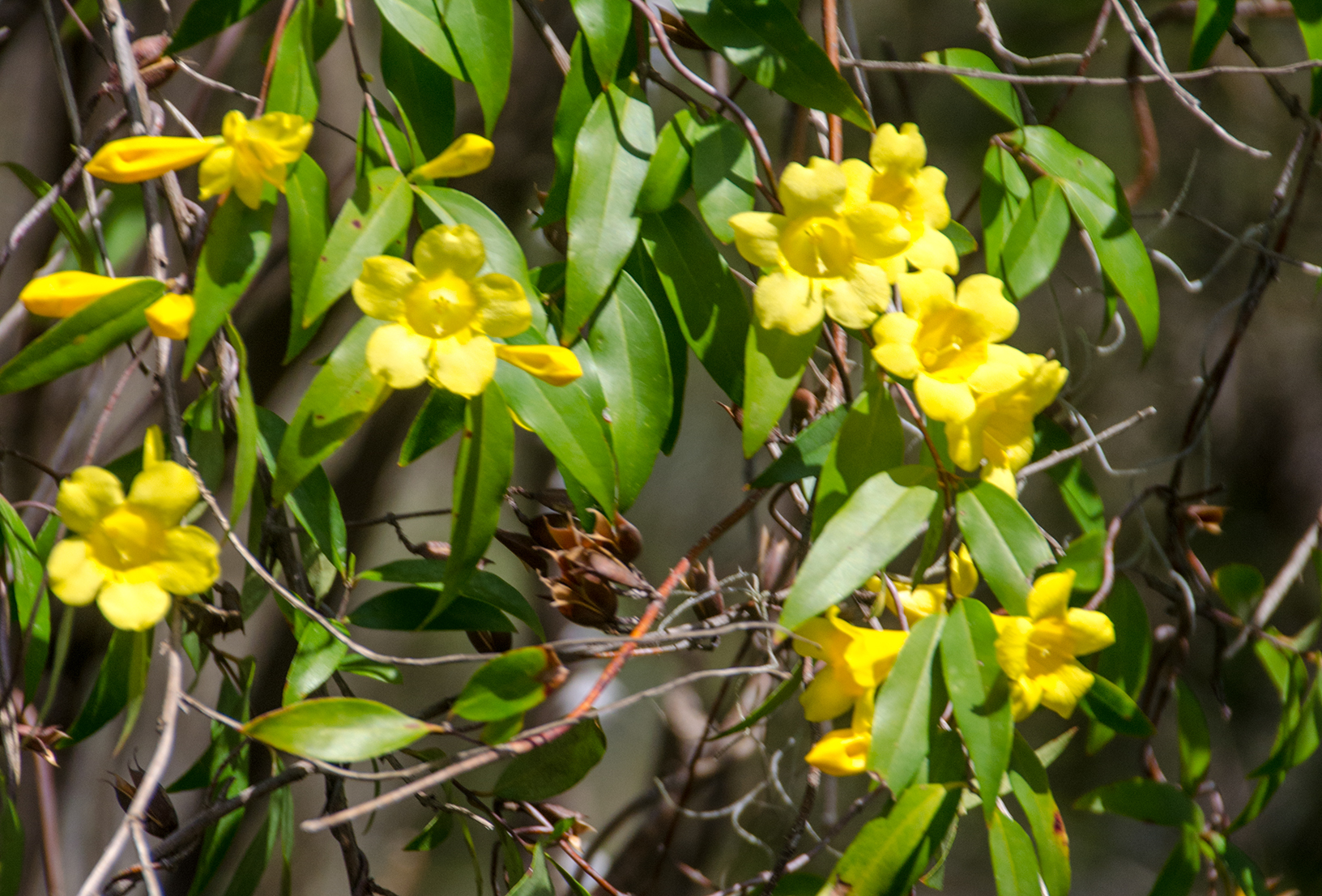
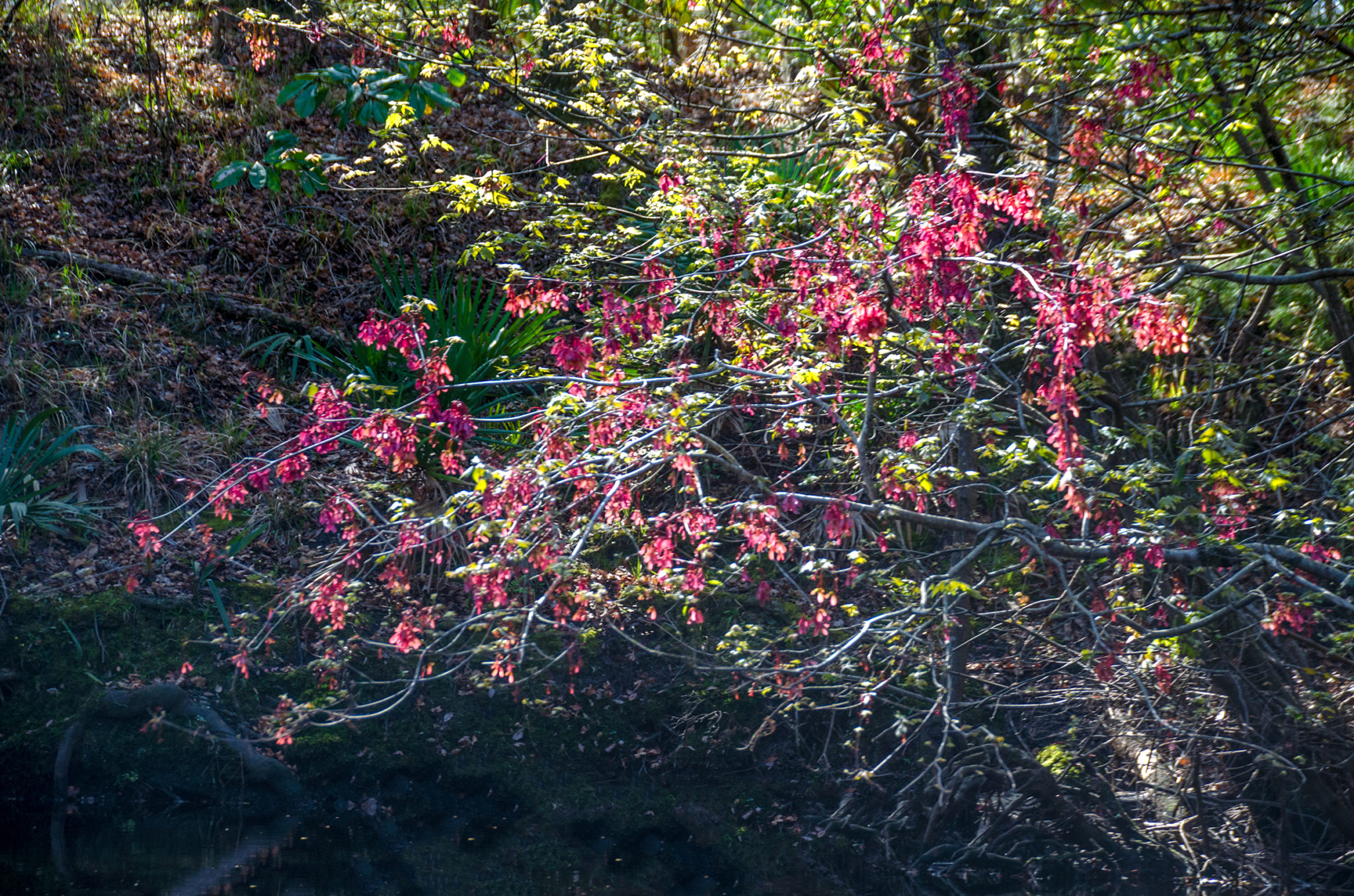
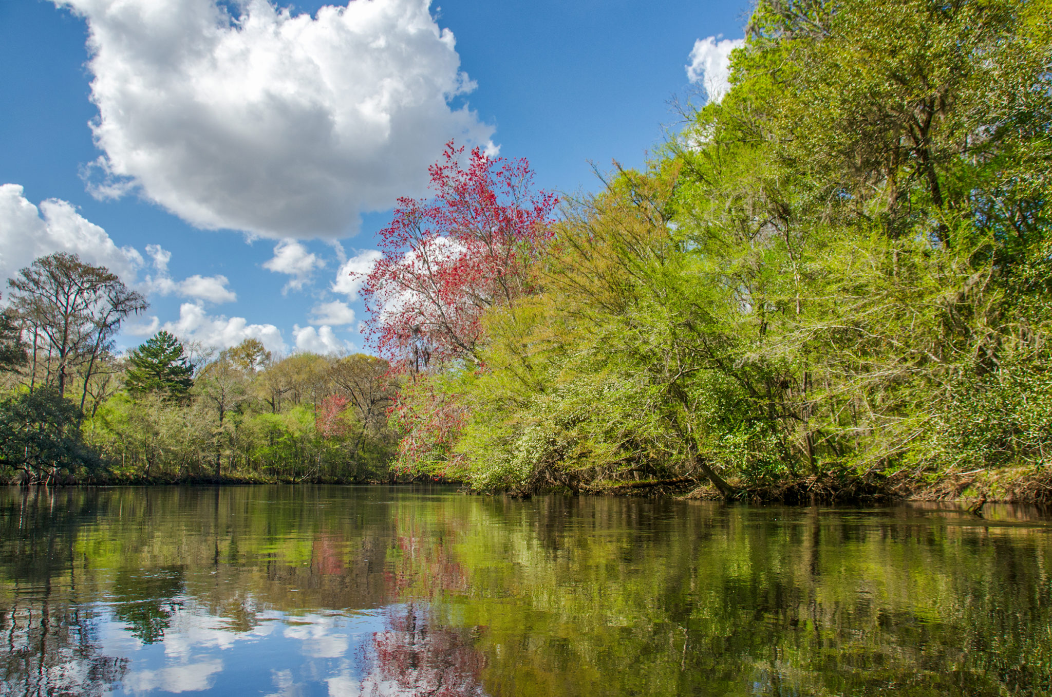 This section of the Santa Fe is one that should not be missed. Although it was near mid-February, this area has experienced only a few cold snaps. Along the river, trees and shrubs were displaying signs of an early Spring, with new flushes of light green foliage and showy blossoms. In bloom were Redbuds, Carolina Yellow Jasmine, Flatwoods/Chickasaw Plum and Walter’s Viburnum. Red Maples displayed their showy ‘Winged Samaras’, Elms were flushing with new growth. Many of the oaks, overhanging the river, displayed signs of a fresh new leafing out.
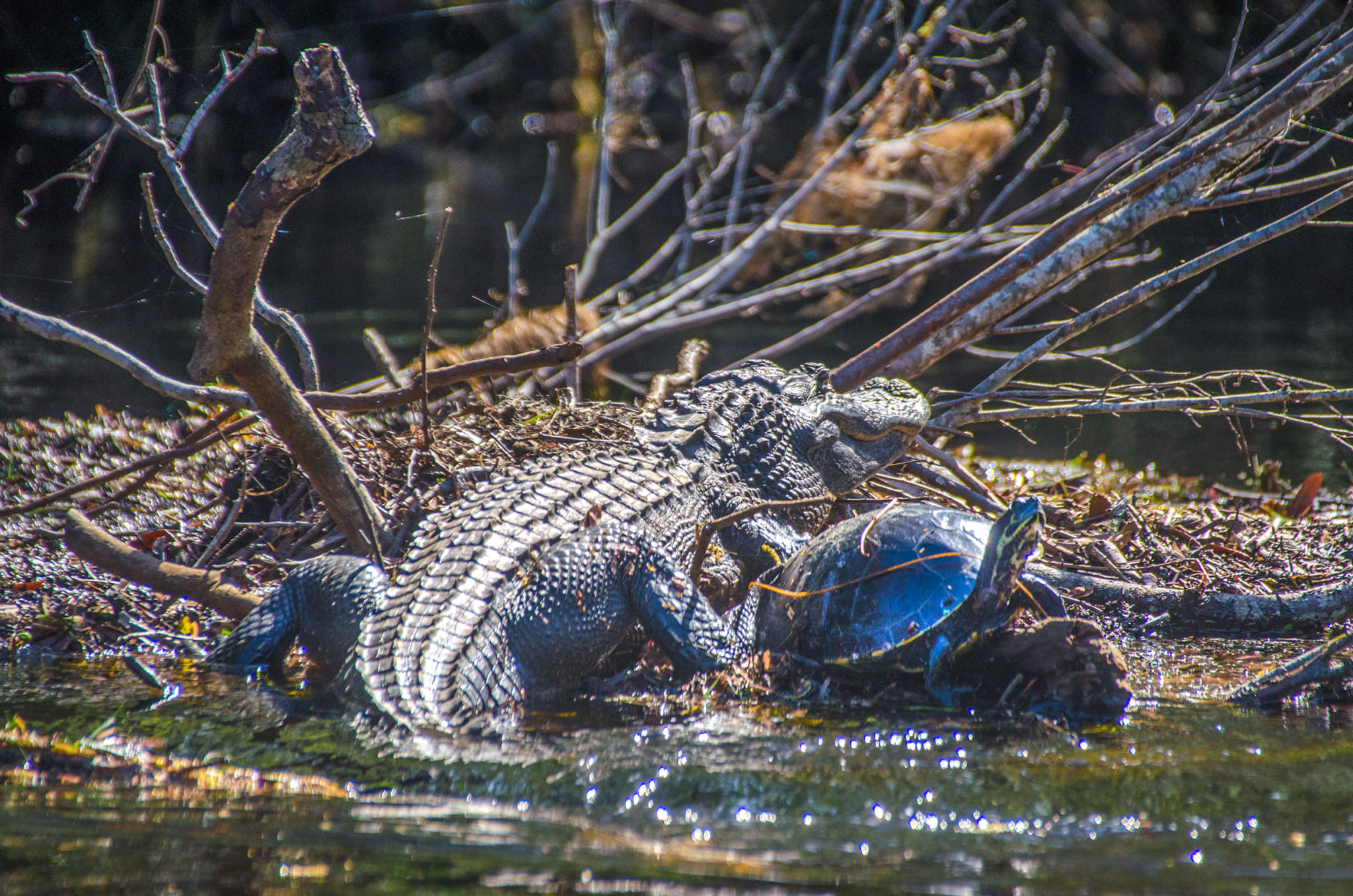
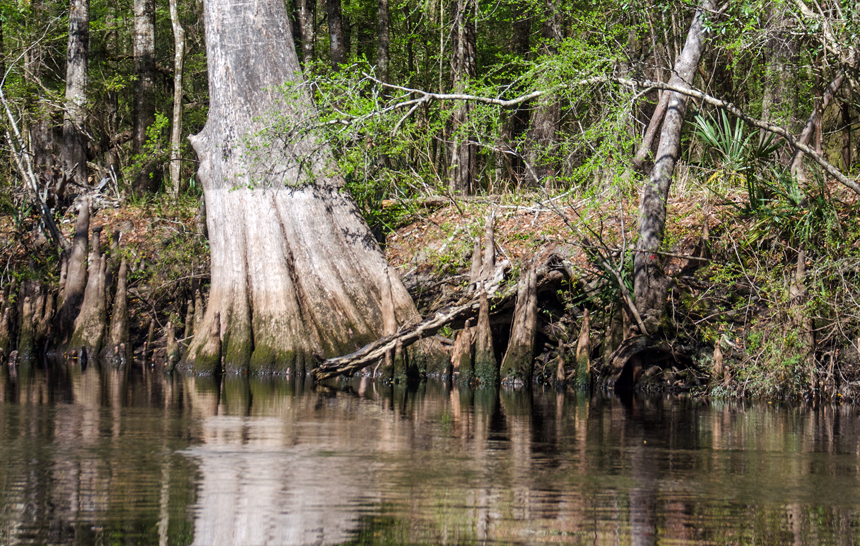
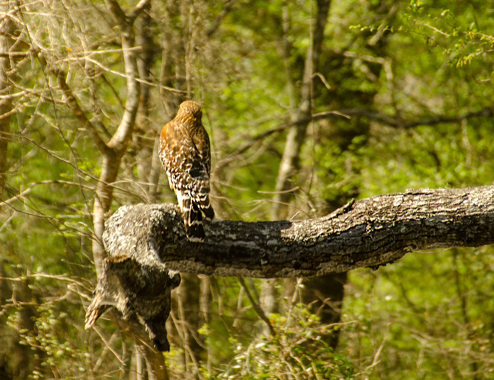
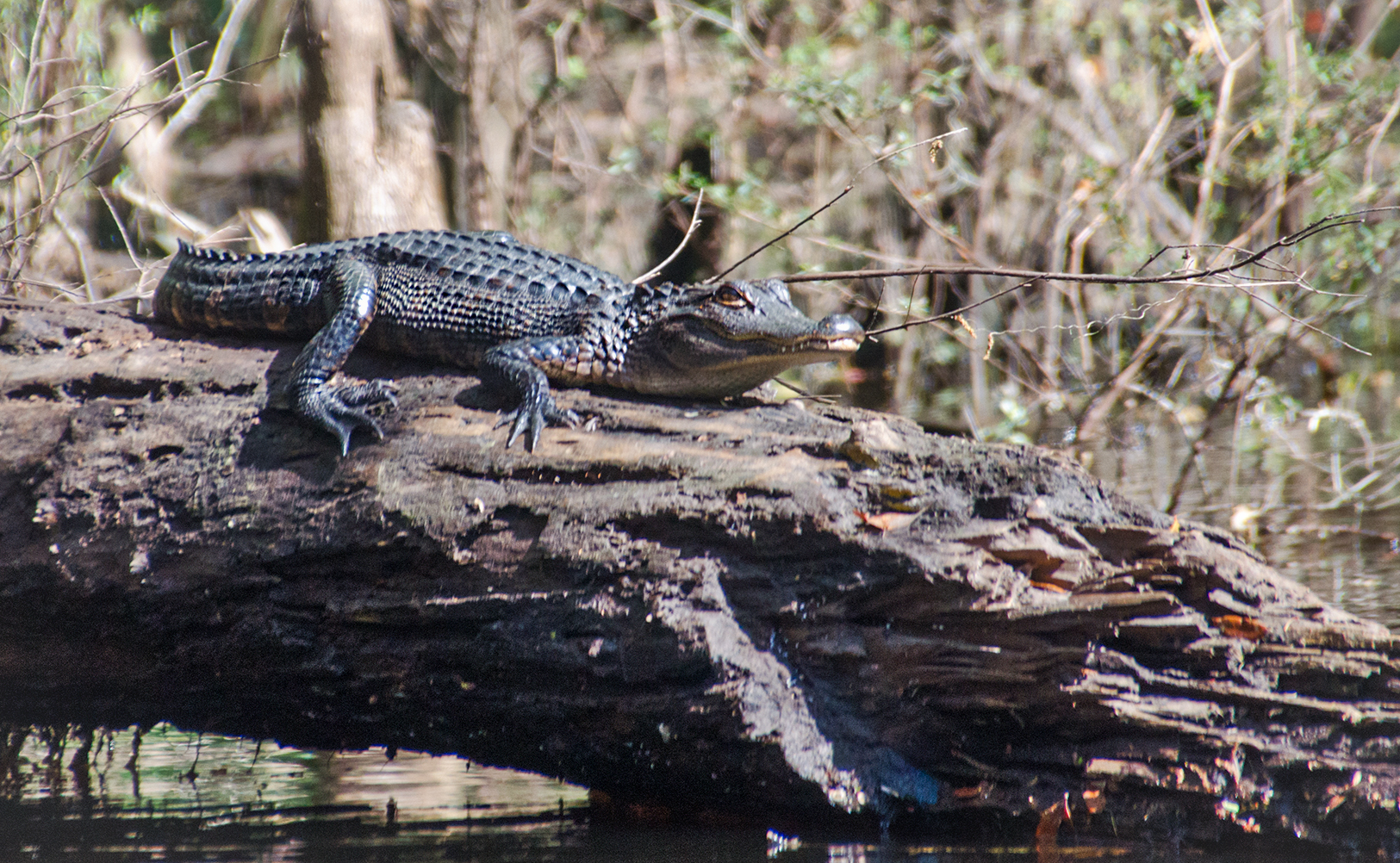
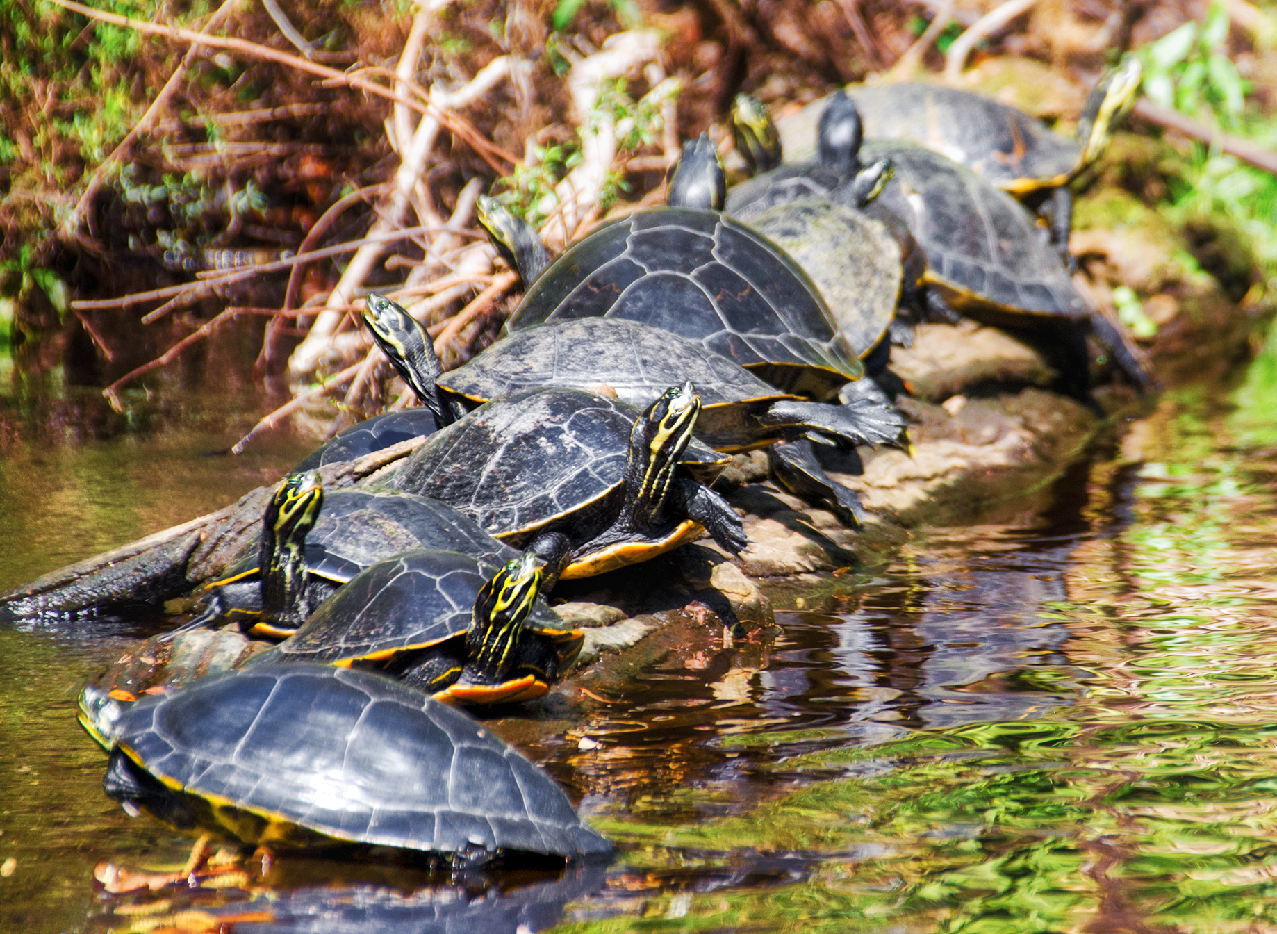
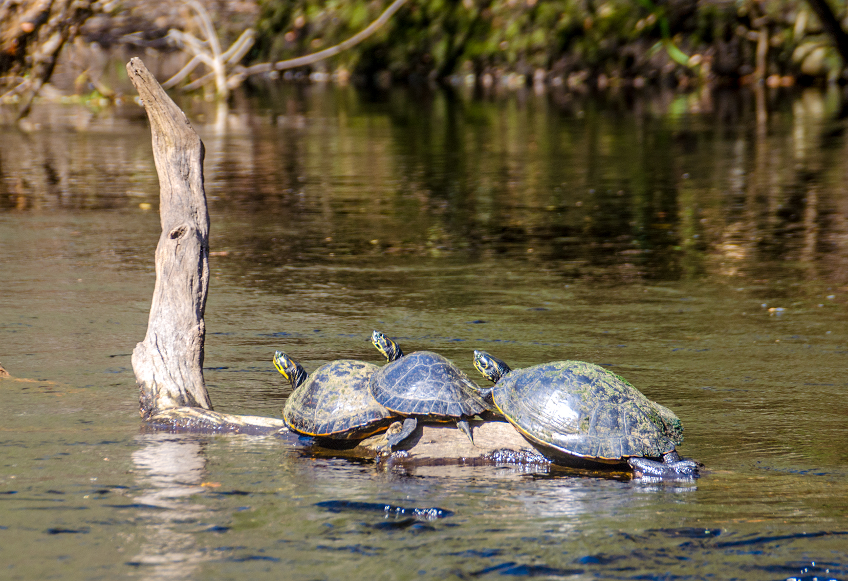
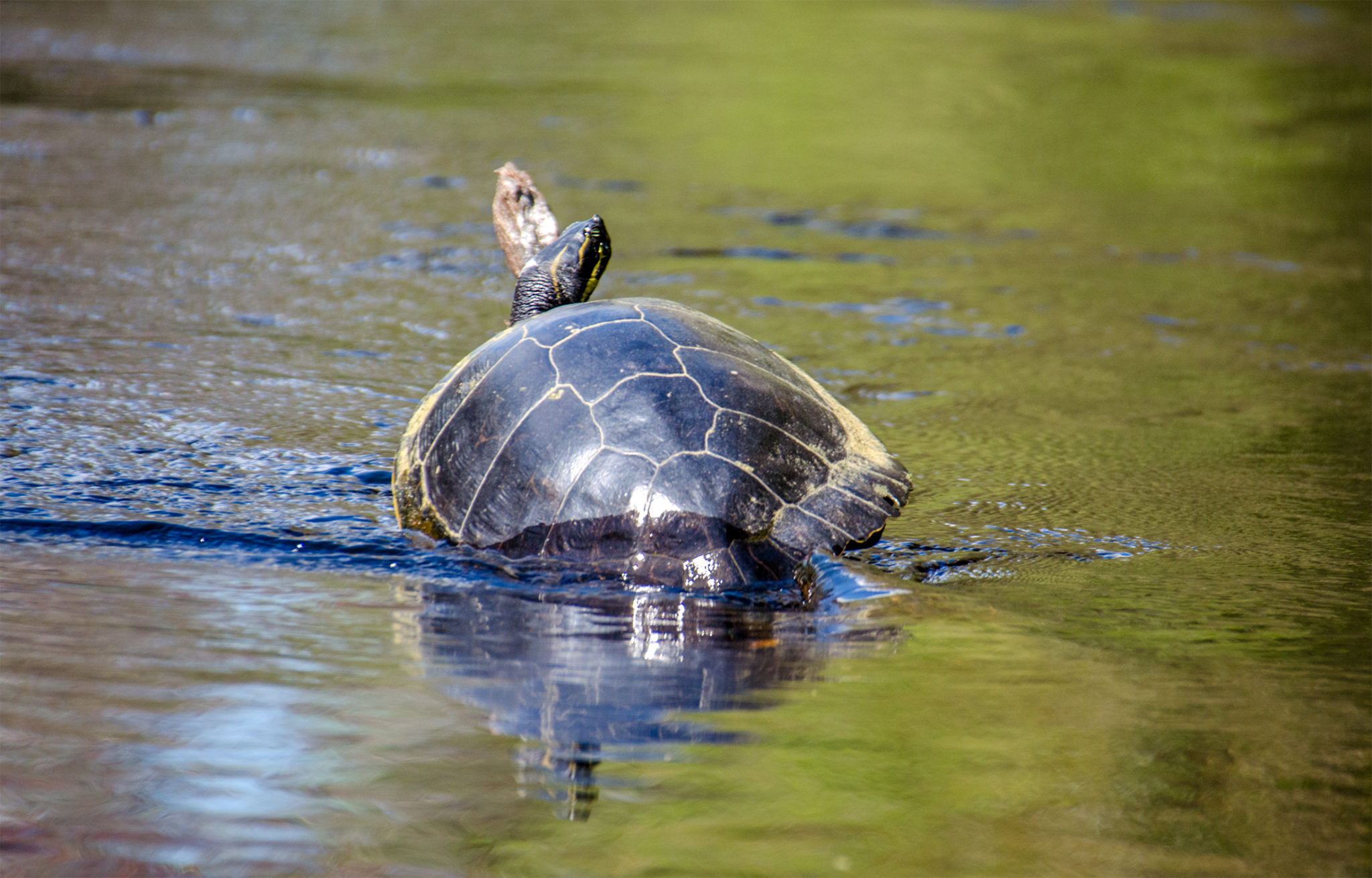
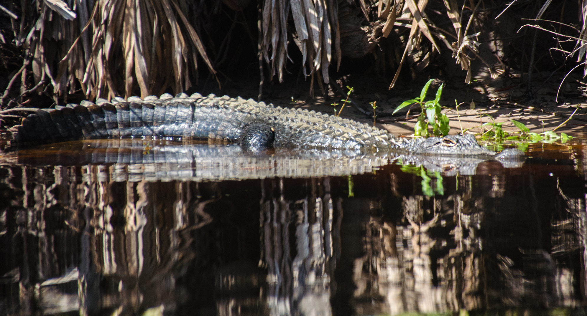
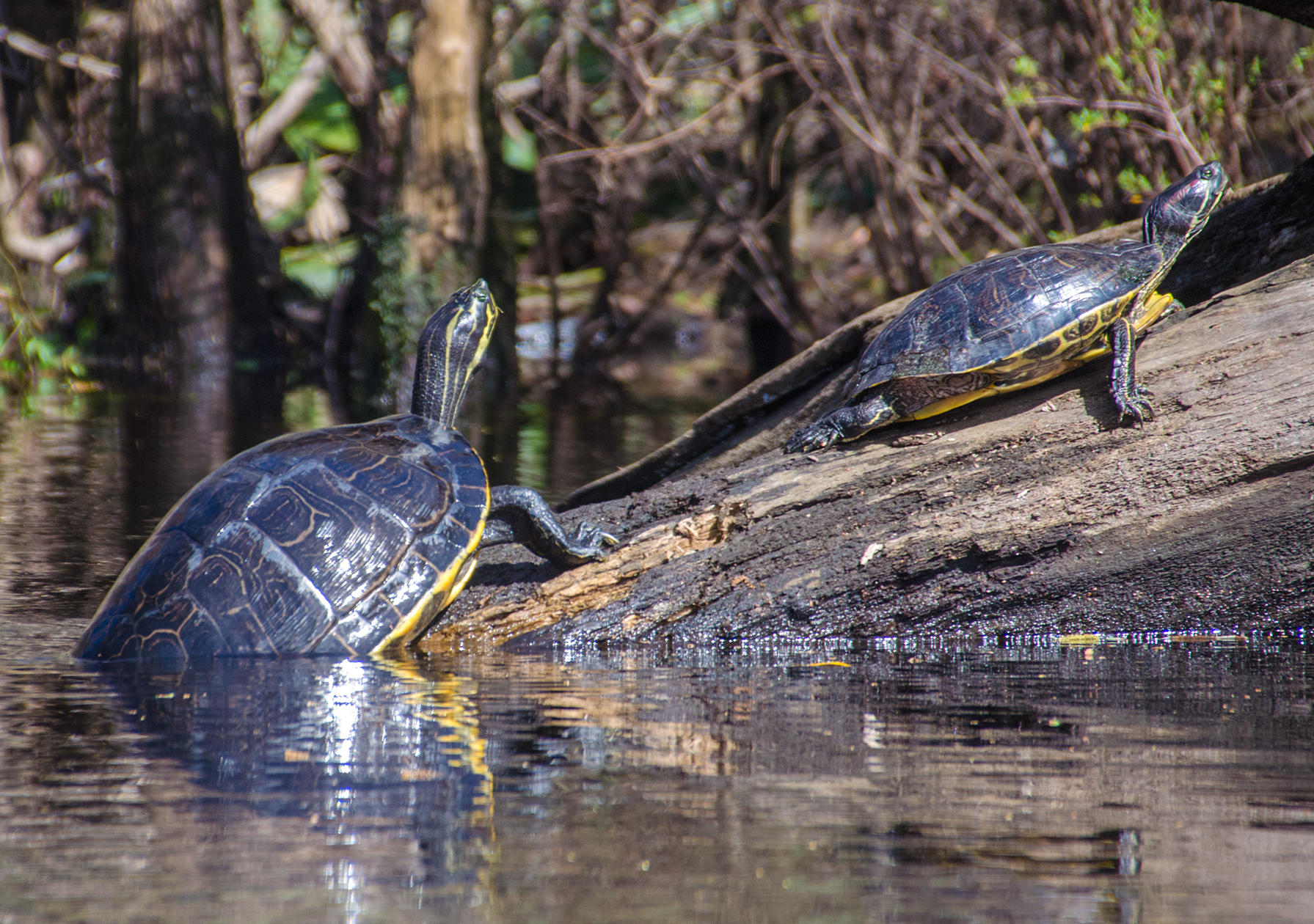
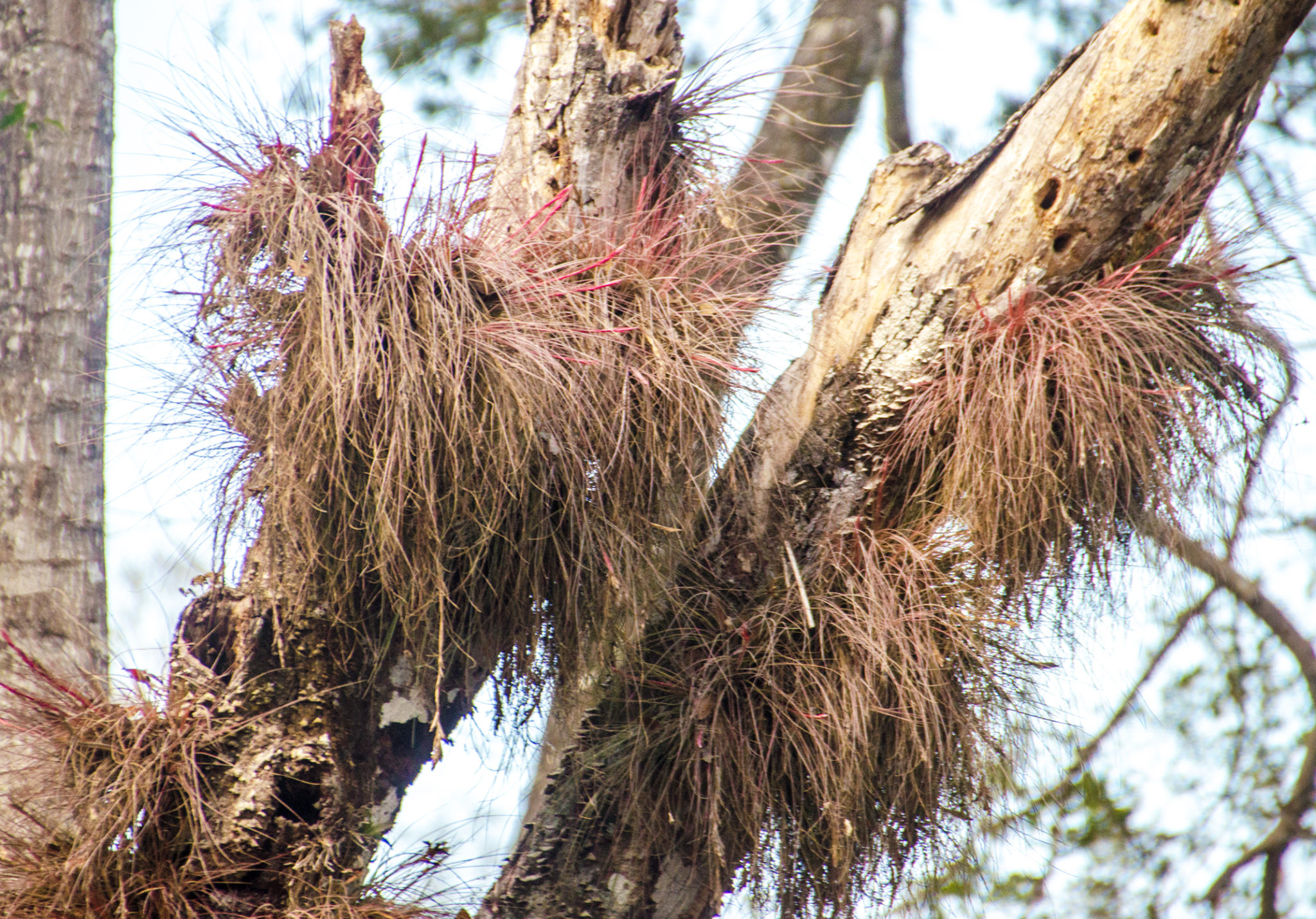
I have never seen Alligators on the Santa Fe River ( though I obviously know they are there ), however in this section, I photographed three gators and numerous turtles. The turtles were on every available perch or trunk above the high water and on one shot a gator and a turtle shared the same small island of debris.
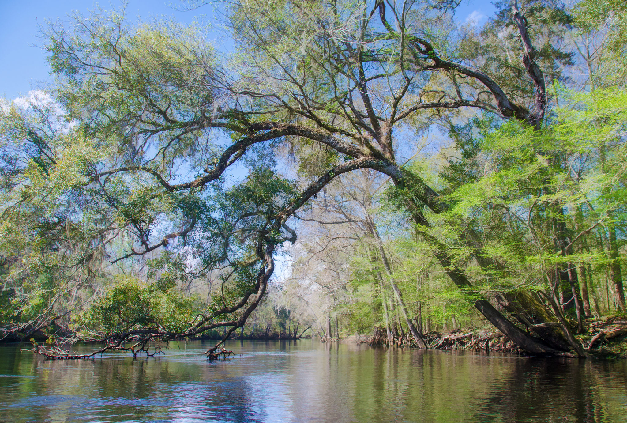
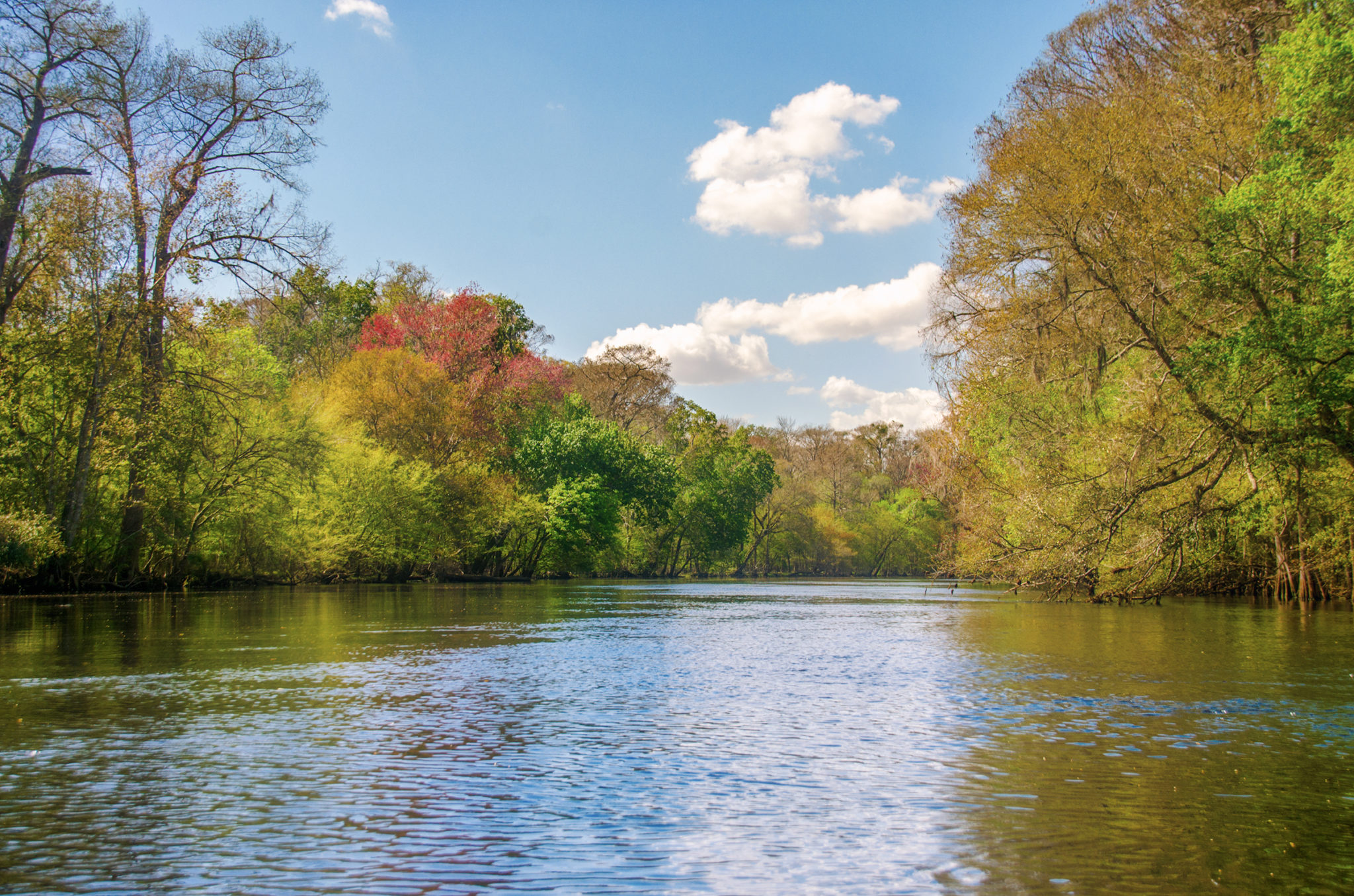
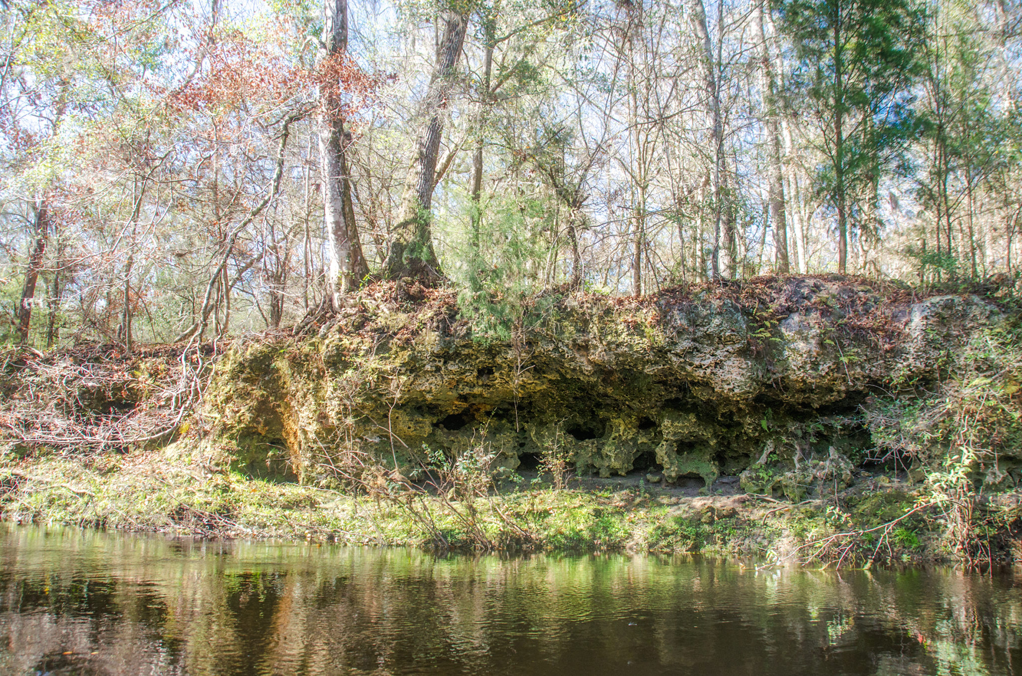
This is a pleasant, easy beginning to the journey. The first 3 miles, which is the stretch between Hwy 41 and Hwy 27, forms a large “S” shape as it winds its way through the quiet, unpopulated landscape, a combination of flatwoods on one side and low swampland on the other. Deep ravines can be seen, mainly on RR along this section. At 2.1 miles, is Alligator Swallet, where water from the river goes underground and resurfaces several hundred feet down river. Approaching the 3 mile mark, just prior to the Bridge over HWY 27, is Alligator Spring/Rise on RR. All along this last section before the bridge, on RR, more deep ravines can be seen but are blocked by numerous cypress knees.
Hwy 27 to Poe Springs…
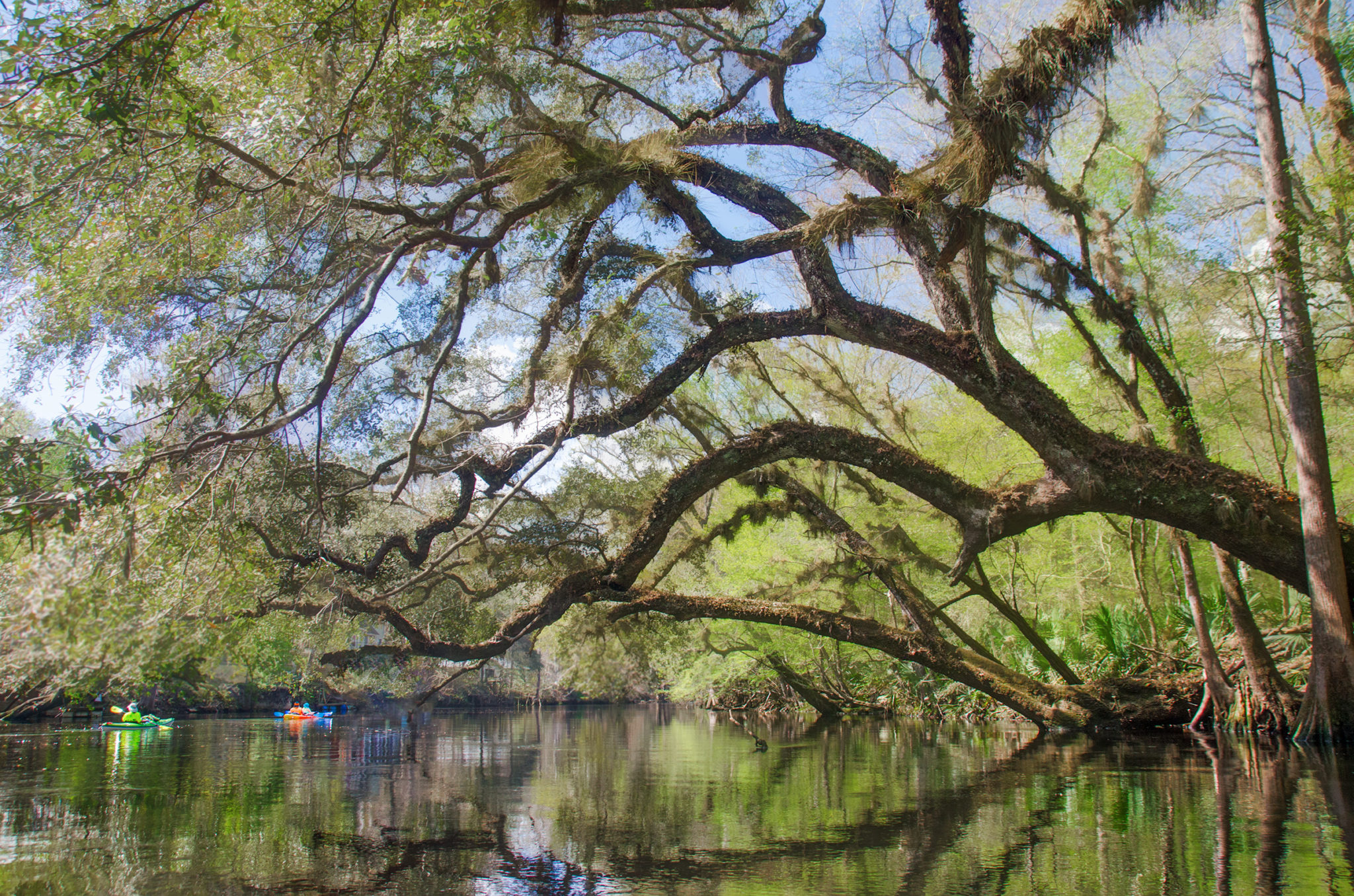
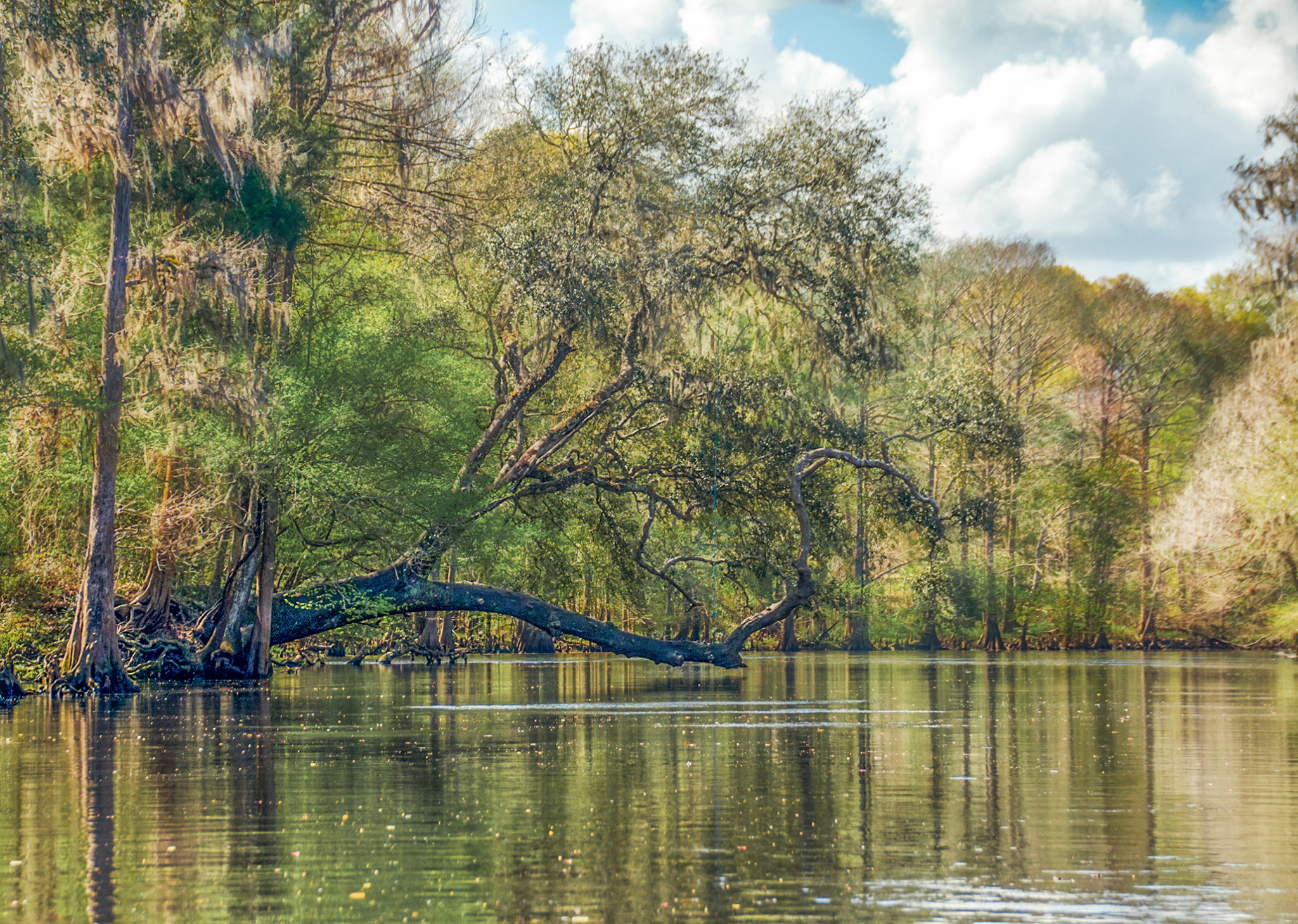
 This next 1.8 mile stretch takes us through three small shoals and a couple of smaller springs often not seen. Many of the trees that were blooming on the first stretch were not as noticeable on this section. What was eye catching where the numerous oaks that leaned over the river from the banks creating scenic arches to paddle beneath.
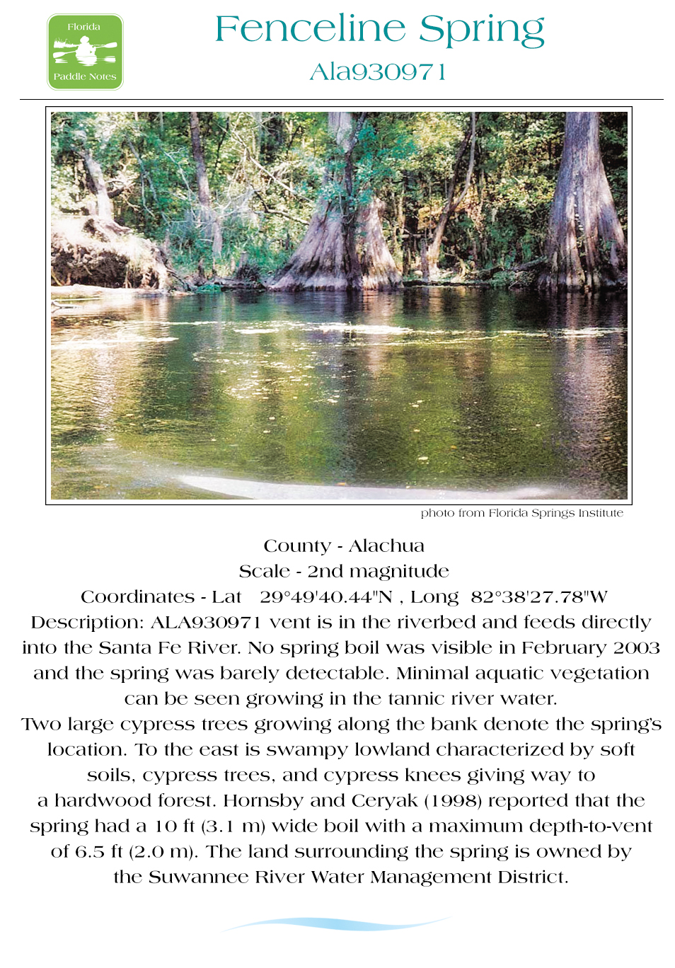
Just after reaching the 4 mile mark of the trip, we paddle under a power line that also has a minimal shoal. Continuing on a straight course, another shoal appears 1/4 mile down river. Around mile marker 4.57 is a small island and on RL is what is known as Fenceline Spring ( ALA903971). This spring is actually in the river bed and at our water level today goes unnoticed.
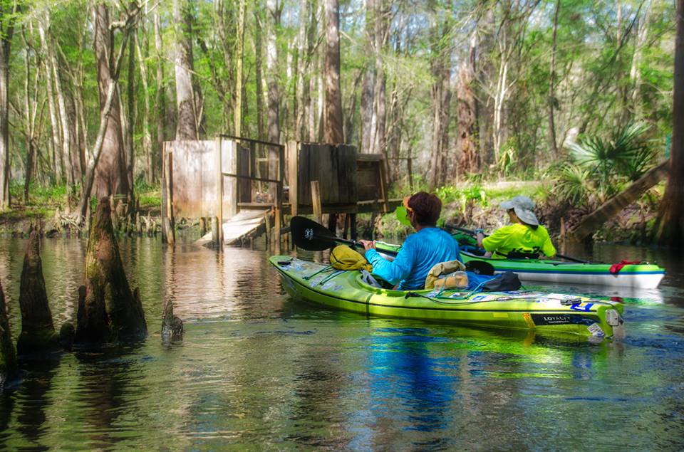
Under a half mile further there is an island, with small shoals and on RR, at the island is Allen Spring, small and unnoticed at high water levels. Ahead, just after 5 miles, is the familiar Poe Springs tree, that reaches out from RL marking the entrance to Poe Springs. The springs was not quite clear, a few visible sandy spots below, but a good chance to rest before moving on to Lily and Pickard Spring.
The Final Stretch…
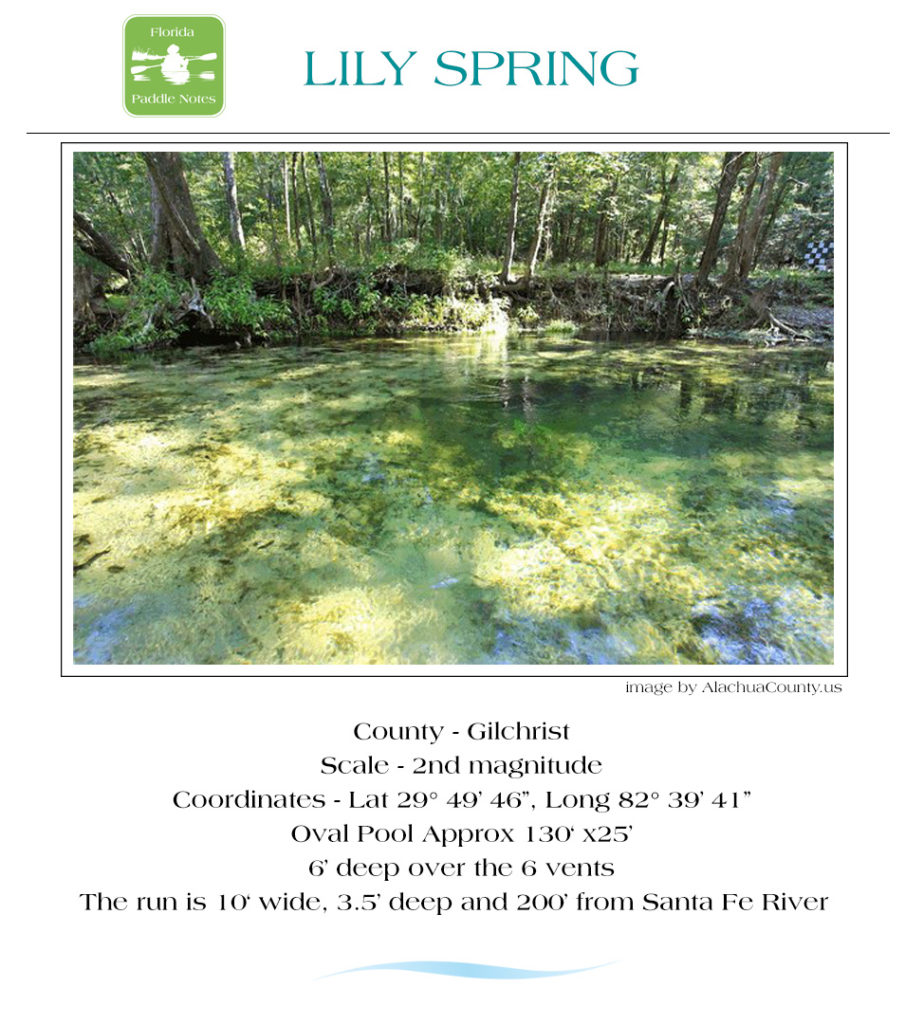
There was 2 1/4 miles to go, the day was still beautiful but actually getting close to 90° by now. Lily Springs, with bygone memories of the days of Naked Ed, is now a remnant of the structure he once greeted folks from. Pickard Spring, just around the corner from Lily was actually accessible but nothing exciting at this water level. From there we headed down river to Gilchrist Blue Spring.
On the way to Blue Spring, Jonathan Spring is on RR and had several occupants. This is a pleasant small spring to relax in on hot afternoon!

Gilchrist Blue Spring is just past Rum Island Spring, (which was browned out). Being a 2nd magnitude spring, pumping 44 million gallons of water a day, it was clear and blue. On the run up to the Springs, we normally take a side paddle into Naked Spring, however trees block the run into the spring. A brief rest and snorkeling in Blue, then ending our paddle at Rum Island County Park, just across the river and ending another chapter of Florida Paddle Notes.
NOTE: See other Florida Paddle Notes entries for The Santa Fe River: US Hwy 27 to Rum Island ( Springs Paddle ), Rum Island to Hwy 47, River Rise
Santa Fe River Gallery 2-21-19:

Additional Resources…Guides, Maps & Info…
- oursantaferiver.org has a few nice maps and guides for this river…
- Florida Springs Database by Greg Johnson…
- A great interactive map for Florida Springs. This opens in Google Earth for me…
- floridaspringlife.com has a good interactive map of Santa Fe River Springs…
- Florida Designated Paddling Trails – Santa Fe River Guide (pdf)…
- 5-Star Yak Pak.org has a great detailed Santa Fe Fact Sheet Mileage Chart…
- Suwannee River Water Management District has an excellent (pdf ) covering Springs on the Santa Fe River…
- Springs Fever also has excellent information on the Santa Fe River and each spring (pdf )…
![]() Keep up with new paddles here to receive an email notification when a new adventure is posted…sign me up! Check out past paddles here and follow Florida Paddle Notes on Facebook !
Keep up with new paddles here to receive an email notification when a new adventure is posted…sign me up! Check out past paddles here and follow Florida Paddle Notes on Facebook !
![]()